
Mori Atlas logo
Nature reserveHolzbachdurchbruch

Mapping the geological heritage and protected stream valley corridors of Rheinland-Pfalz.

Holzbachdurchbruch Nature Reserve: A Protected Basalt Gorge in the Westerwald Highlands of Germany

(Naturschutzgebiet Holzbachdurchbruch)

Holzbachdurchbruch represents a significant protected nature reserve where the Holzbach stream has incised a deep, narrow breakthrough valley into the basalt bedrock of the Westerwald. This compact 21-hectare landscape showcases a distinct volcanic geological signature that contrasts sharply with the broader, more open plateaus of the surrounding region. As one of the oldest designated protected areas in the district, the reserve preserves a continuous strip of near-natural woodland, rocky slopes, and shaded stream habitats that illustrate the complex hydrology and terrain of Rheinland-Pfalz.

Westerwaldbasalt gorgebreakthrough valleystream valleynature reserveRhineland-Palatinate
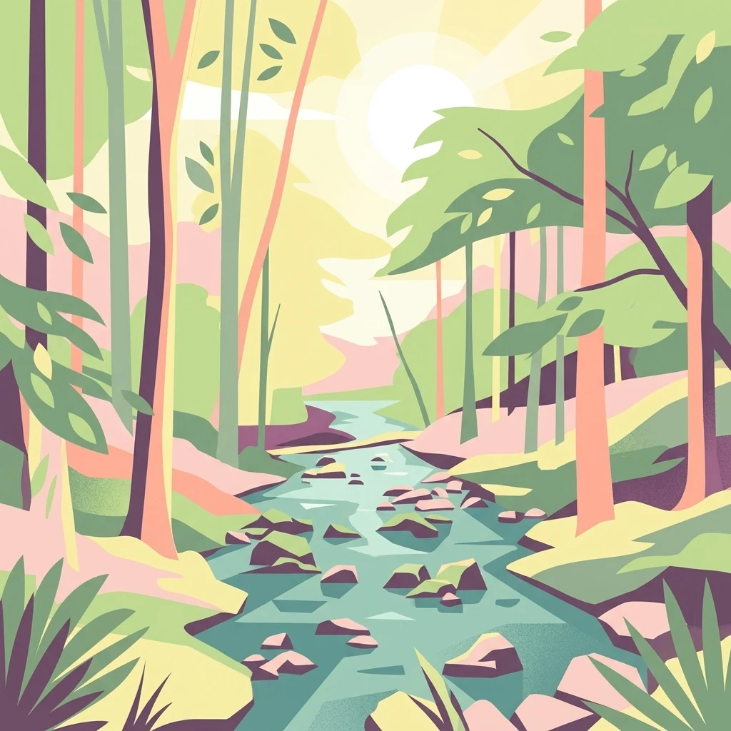
A vector-style illustration of a rocky stream flowing through a lush forest with soft sunlight filtering through the trees.

Holzbachdurchbruch

Nature reserve

Park overview

Structured park overview, official facts, and landscape profile for Holzbachdurchbruch

Holzbachdurchbruch park facts, protected area profile, and essential visitor context

Review the core facts for Holzbachdurchbruch, including designation, size, terrain, visitor scale, habitats, and operating context in one park-focused overview.

About Holzbachdurchbruch

Holzbachdurchbruch is a compact nature reserve in the Westerwald region of Rhineland-Palatinate, in west-central Germany. The protected area follows the course of the Holzbach where the stream breaks through the basalt bedrock of the Westerwald plateau, creating the narrow, steep-sided valley that gives the site its name. The reserve is situated between the Dappricher Hof hamlet, part of the municipality of Seck, and the village of Gemünden, in the wider vicinity of Westerburg.

At about 21 hectares, the protected area is modest in size, but its ecological significance is concentrated rather than extensive. The reserve extends roughly 100 meters to either side of the Holzbach, forming a continuous strip of valley habitat that includes the stream itself, the rocky slopes, and the adjacent woodland. The surrounding Westerwald plateau is largely shaped by softer sediments and agricultural or coniferous forest land, so the basalt gorge stands out as a distinct landscape element, both visually and ecologically.

In geological terms, the Holzbachdurchbruch is a Durchbruchstal, a breakthrough valley: a stream valley carved perpendicularly across a resistant geological formation, rather than following the gentler slope of the underlying strata. The presence of basalt, a volcanic rock that occurs widely across the Westerwald from past volcanic activity, makes the Holzbach's work of incision unusually dramatic in this part of the landscape. The result is a sheltered microclimate and a habitat mosaic with features not commonly found in the wider region.

For hikers, the reserve is closely linked to the local circular trail R 29, which begins at Gemünden and passes through or along the gorge. Although small, the Holzbachschlucht has long been recognized as one of the characteristic landscape features of the Westerwald, and it remains a quiet but appreciated destination for those interested in geology, stream valleys, and the volcanic heritage of central-western Germany.

Quick facts and research context for Holzbachdurchbruch

Holzbachdurchbruch is a nature reserve (Naturschutzgebiet) in the Westerwaldkreis district of Rhineland-Palatinate, Germany. It was officially designated on 11 December 1961, replacing an earlier protection order issued in November 1933, making it one of the oldest protected areas in the Westerwald. The reserve covers around 21 hectares and extends roughly 100 meters on either side of the Holzbach stream. It lies between Seck and Gemünden, near Westerburg, and is accessed locally via the circular hiking trail R 29 starting at Gemünden.

Protection and recognition

Documented terrestrial protection scope and verified recognition records

Holzbachdurchbruch Protection Status and International Recognition Data

Holzbachdurchbruch maintains a documented terrestrial protection scope cataloged within official global databases. Verified designation metrics outline the administrative status, management framework, and recognized conservation boundaries.

Protection details

Protection scope
Terrestrial
Transboundary protection
No
WDPA ID
81925
Park context

Deeper park guide and search-rich context for Holzbachdurchbruch

Holzbachdurchbruch history, landscape, wildlife, and travel context

Explore Holzbachdurchbruch through its history, landscape character, ecosystems, wildlife, conservation priorities, cultural context, and seasonal travel timing in a structured park guide built for atlas discovery and search intent.

Why Holzbachdurchbruch stands out

The reserve is best known for the Holzbach breakthrough valley itself: a narrow, geologically striking gorge where the Holzbach has incised into the basalt of the Westerwald. The combination of vertical basalt walls, a shaded stream corridor, and near-natural mixed forest gives the small protected area a much more dramatic and intimate character than the surrounding agricultural and forested highlands. It is also known as a representative example of how volcanic geology shapes the hydrology of the Westerwald. The basalt bedrock resists erosion while the stream has, over time, cut a focused and pronounced valley through it, producing the kind of small, enclosed habitat mosaic that is scarce in the broader region.
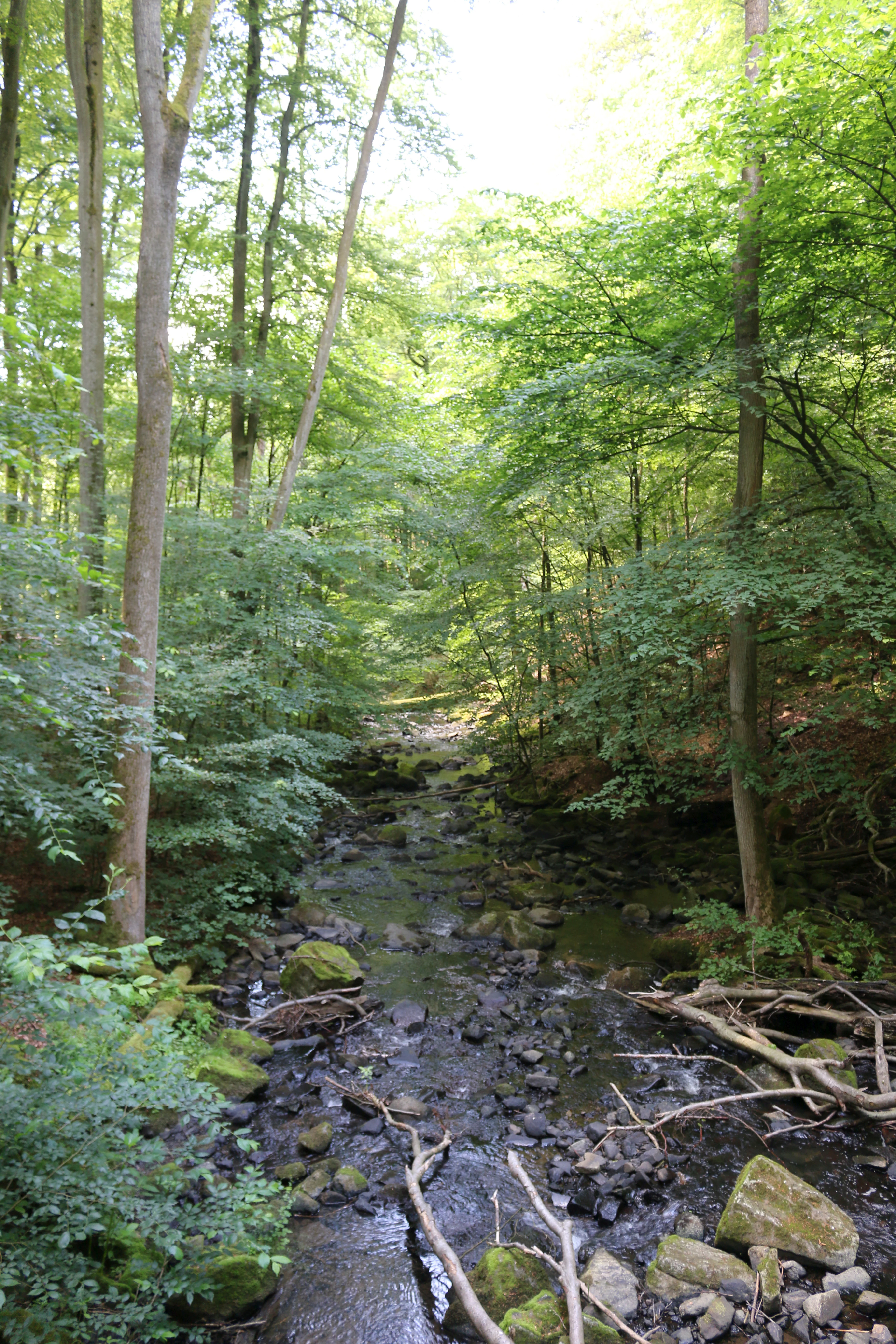
A small rocky stream flows through a lush, dense deciduous forest at Holzbachdurchbruch.
A shaded stream winding through the dense forest of the Holzbachdurchbruch nature reserve.

Holzbachdurchbruch history and protected-area timeline

The Holzbachdurchbruch has a protection history that stretches back well into the first half of the twentieth century. In November 1933, the former Bezirksregierung Wiesbaden, the regional administrative authority responsible at the time, issued an initial ordinance providing protection for the area. That early designation laid the groundwork for later, more durable conservation measures.

On 11 December 1961, the Bezirksregierung Montabaur, the successor regional authority, formally designated the Holzbachdurchbruch as a Naturschutzgebiet. This 1961 designation replaced the 1933 ordinance and established the modern legal framework for the reserve. Because the area had been recognized as worthy of protection for nearly three decades before its formal 1961 designation, Holzbachdurchbruch counts among the oldest nature reserves in the Westerwald region.

Since its post-war redesignation, the area has continued to function primarily as a small valley reserve managed for habitat conservation rather than as a heavily developed visitor attraction. Local trails, including the circular route R 29 beginning at Gemünden, provide low-impact public access while keeping the core gorge habitat intact.

Holzbachdurchbruch landscape and geographic character

The defining landscape feature of Holzbachdurchbruch is its narrow, steep-sided basalt gorge. The Holzbach has incised a focused valley through the basalt bedrock of the Westerwald, producing a classic breakthrough valley, or Durchbruchstal, where a stream cuts across a resistant geological barrier rather than running parallel to it. The result is a compact valley that feels enclosed and sheltered compared to the broader, more open Westerwald plateau around it.

Within the protected area, the valley includes the active stream channel, rocky basalt slopes, and the wooded margins that climb toward the plateau edge. The reserve is approximately 100 meters wide on each side of the stream, which gives the protected strip a clear, corridor-like shape on the landscape. Outside the reserve, the surrounding Westerwald continues as a rolling, mostly forested and agricultural highland shaped by older volcanic geology and softer sedimentary cover.

The contrast between the sheltered, deeply incised gorge and the open plateau above is the most immediate visual signature of the area. For a small site, the Holzbachdurchbruch delivers an unusually concentrated sense of vertical relief and geological structure, which is part of why it has long been recognized as a notable Westerwald landscape feature.

Holzbachdurchbruch ecosystems, habitats, and plant life

Because the reserve follows a single stream corridor through the basalt of the Westerwald, the ecological character of Holzbachdurchbruch is defined by the relationship between water, rock, and forest in a narrow valley setting. The combination of permanent flowing water, cool and shaded slopes, and basaltic substrate produces habitats that differ from the broader regional matrix of forests, fields, and meadows on the surrounding Westerwald plateau.

The forest along the Holzbach is shaped by the valley's microclimate: more humid, more shaded, and in places steeper than the woodland on the plateau above. Such streamside woodland corridors in a region dominated by conifer plantations and agricultural land are important refuges for native broadleaf species and for the associated ground flora. The basalt rock outcrops along the slopes add a structural element: exposed rock faces, crevices, and thin soils that host their own specialized vegetation and invertebrate communities.

The protected area thus functions less as a broad ecosystem reserve than as a focused habitat corridor: a long, narrow strip linking stream, gorge, and slope forest. In a regional context, this kind of near-natural valley habitat is relatively rare and ecologically valuable for species that depend on cool, shaded, structurally complex environments close to running water.

Holzbachdurchbruch wildlife and species highlights

The wildlife of Holzbachdurchbruch is shaped primarily by the nature of the habitat: a permanently flowing stream in a steep, shaded basalt gorge. Species typical of such near-natural stream valleys in the Westerwald are likely to include stream-associated invertebrates, amphibians that depend on cool flowing water, and forest-floor fauna adapted to the humid, sheltered conditions of the valley.

The birdlife reflects the wooded gorge setting, with species typical of mature deciduous and mixed forest along small watercourses. Rock outcrops and exposed basalt along the slopes add nesting and shelter opportunities not commonly found in the surrounding plateau forests. Although the reserve is small, its structural complexity, with water, rock, and old woodland in close combination, supports a richer local wildlife assemblage than the more uniform forest stands that dominate much of the surrounding Westerwald.

Mammals in the area would primarily be small forest species typical of central German woodland, while larger fauna uses the corridor as part of a broader movement network through the Westerwald landscape. The reserve's long-standing protected status helps maintain the relative quiet and habitat continuity that allow these communities to persist in a region where land use elsewhere is more intensive.

Holzbachdurchbruch conservation status and protection priorities

The conservation significance of Holzbachdurchbruch lies in what it preserves rather than how large it is. The reserve protects a representative example of a basalt breakthrough valley: a rare landscape type at the regional scale, where the interaction of resistant volcanic bedrock and an incising stream has produced a habitat mosaic that cannot easily be recreated once lost. In a Westerwald landscape dominated by plantation forestry, agriculture, and small settlements, such a near-natural valley corridor is an important element of the regional ecological network.

Because the protected strip extends about 100 meters on either side of the stream, the reserve links aquatic habitat, rocky slope, and forest in a single continuous unit. This continuity matters: isolated patches of habitat are more vulnerable, while a connected valley corridor helps maintain microclimate, water quality, and species movement along the Holzbach.

The reserve's long protection history, from an initial 1933 ordinance to its formal 1961 designation, also gives it institutional weight. Holzbachdurchbruch is one of the oldest Naturschutzgebiete in the Westerwaldkreis, which reinforces its role as a recognized reference site for the region's volcanic and stream-valley heritage rather than just a small local patch of protected land.

Holzbachdurchbruch cultural meaning and human context

The cultural context of Holzbachdurchbruch is closely tied to the rural character of the inner Westerwald. The reserve sits between small Westerwald communities: the Dappricher Hof hamlet in the municipality of Seck and the village of Gemünden, with the town of Westerburg nearby. Like many Westerwald valleys, it has historically been a modest, locally known feature of the landscape rather than a high-profile destination.

Protection of the gorge in the twentieth century reflects a broader German tradition of recognizing and formally safeguarding distinctive small-scale natural features, especially in regions shaped by older volcanic geology. The presence of a dedicated circular hiking trail, R 29, beginning at Gemünden, shows how the area is woven into local recreation culture: a place residents walk through, rather than a heavily promoted tourist attraction.

The Holzbachschlucht is also part of how the Westerwald region defines itself regionally. Local nature conservation literature, including the Westerwaldverein's _Großer Westerwaldführer_, treats the gorge as a recognized element of the area's natural heritage. In that sense, the reserve carries both ecological and regional identity value for the surrounding communities.

Top sights and standout views in Holzbachdurchbruch

Holzbachdurchbruch's strongest highlight is the basalt breakthrough valley itself: a narrow, dramatic gorge that contrasts sharply with the gentler Westerwald plateau around it. The reserve's compact size, roughly 21 hectares, is offset by the visual and ecological intensity of the habitat it protects, with the stream, rocky slopes, and shaded valley forest all packed into a tight strip along the Holzbach.

A second highlight is the area's standing as one of the oldest nature reserves in the Westerwald. Originally protected in 1933 and formally designated in 1961, it has a longer continuous protection history than most protected sites in the district, giving it both legal durability and cultural recognition as a regional landmark.

Finally, the reserve is notable for how easily it can be experienced via the local circular hiking trail R 29 from Gemünden, making it a quietly accessible showcase of the Westerwald's volcanic geology and stream-valley ecology within a short, low-key outing.

Best time to visit Holzbachdurchbruch

The character of the Holzbachdurchbruch varies with the seasons in ways typical of sheltered stream valleys in the Westerwald. Spring is often a particularly rewarding time to visit, when the valley woodland leafs out, the stream runs well, and the gorge feels lush and enclosed. The cool, shaded microclimate of the basalt gorge makes even warmer days feel calmer inside the valley than on the open plateau above.

Summer visits highlight the contrast between the sheltered gorge and the surrounding landscape; the deep shade, the sound of running water, and the cool air below the basalt slopes make the walk through the reserve feel distinctly different from the broader Westerwald. Autumn brings late-season color to the mixed forest along the valley, sharpening the visual contrast between the gorge and the surrounding plateau.

In winter, when leaves are off the trees, the structure of the basalt valley becomes more visible, including the steep slopes and rocky outcrops that are partly hidden in summer. Conditions underfoot can be wet and slippery at any time of year, particularly along the stream and rocky sections, so sturdy footwear is advisable. As with many small German nature reserves, the area is best approached as a short, unhurried walk rather than a full-day outing.

Monthly climate preview

Long-term representative temperature and precipitation rhythm across twelve months

Holzbachdurchbruch Climate Normals and Monthly Weather Patterns

Holzbachdurchbruch records measured baseline temperature and precipitation normals derived from a representative coordinate at 317 meters elevation. Examining the full monthly climate profile reveals detailed thermal shifts and precipitation distributions across the protected landscape.
Annual mean9 °C
0 °C19 °C
Jan
Feb
Mar
Apr
May12°
Jun16°
Jul19°
Aug18°
Sep14°
Oct
Nov
Dec
Warmest month
July

18.5 °C

Coolest month
January

-0.4 °C

Wettest month
December

2.5 mm/day

Driest month
April

1.6 mm/day

Park location guide

Geography guide, regional context, and park location map for Holzbachdurchbruch

Holzbachdurchbruch park geography, regions, and map view in Germany

Understand where Holzbachdurchbruch sits in Germany through a broader geographic reading of the surrounding landscape, nearby location context, and its mapped position within the national park landscape.

How Holzbachdurchbruch fits into Germany

Germany is a federal republic in Western and Central Europe with a population of over 83 million across sixteen constituent states. It is Europe's largest economy by nominal GDP and a major global exporter and importer. The capital is Berlin, and the country borders Denmark, Poland, Czech Republic, Austria, Switzerland, France, Luxembourg, Belgium, and the Netherlands.

Wider geography shaping Holzbachdurchbruch in Germany

Germany is located in Western and Central Europe, spanning 357,022 km². It borders Denmark to the north, Poland and the Czech Republic to the east, Austria and Switzerland to the south, and France, Luxembourg, Belgium, and the Netherlands to the west. The country has coastlines on the Baltic Sea and North Sea to the north, with the Alps located in the southern region.

Map view of Holzbachdurchbruch

Use this park location map to pinpoint Holzbachdurchbruch in Germany, understand its exact geographic position, and read its mapped placement within the surrounding landscape more clearly.

Pigeon | © OpenStreetMap contributors

Location context for Holzbachdurchbruch

Rheinland-Pfalz

Explore protected basalt gorge scenery, stream valleys, and vertical rock formations.

Holzbachdurchbruch Photos and Visual Landscape Guide

Visual documentation captures the steep basalt walls, shaded stream corridors, and mixed forest habitats defining the protected reserve. Examining detailed terrain imagery helps interpret the volcanic geological heritage and enclosed microclimate shaping the valley environment.

A small rocky stream flows through a lush, dense deciduous forest at Holzbachdurchbruch.

Park atlas

Compare surrounding regional geography and connected basalt landscapes in the Westerwald highlands.

Other Parks and Protected Areas Near Holzbachdurchbruch

Browse protected areas near Holzbachdurchbruch to examine similar geological formations and stream valleys across the surrounding region. Expanding the regional park comparison reveals how volcanic terrain shapes local habitats beyond a single reserve.
Nature reserveRheinland-Pfalz
About 7.6 km away#1 closest

Northeast

Wacholderheide bei Westernohe Nature Reserve Protected Area Atlas and Geographic Map Context

Juniper heathland mosaic in the German Westerwald region

Spanning 14 hectares, Wacholderheide bei Westernohe acts as a vital protected pocket of open heathland framed by dense spruce forests. The reserve supports a specialized community of arnica, common heather, and juniper, sustained by decades of consistent grazing and mechanical mowing that define its unique regional character.

Area
0.14 km²
Established
1967
IUCN
IV
Watercolor painting of a soft, hazy landscape featuring rolling green hills, distant mountains, and water in the foreground.
Nature reserveWesterwaldkreis
About 9.1 km away#2 closest

Northeast

Breitenbachtalsperre Nature Reserve: Geography and Protected Habitat Mapping in Westerwaldkreis

Managed wetland and reservoir landscape in western Germany

Breitenbachtalsperre protects an important reservoir ecosystem, including shallow margins and wet meadows near Waigandshain. This nature reserve provides a focused look at habitat management in the Westerwald, where stream-fed waters sustain diverse plant societies and wildlife in a compact, protected basin.

Area
0.47 km²
Established
1988
IUCN
IV
A horizontal watercolor painting depicting a soft, scenic landscape of a park with rolling hills, a central body of water, and surrounding trees.
Nature reserveWesterwaldkreis
About 11 km away#3 closest

North

Bacher Lay Nature Reserve: Basalt Quarry Landscapes in Westerwaldkreis, Germany

Protected landscape with significant geological geotope features

Bacher Lay provides an informative look at a compact nature reserve formed within a former basalt quarry. Featuring the striking Pfaffenmal columnar basalt formation and a mosaic of river valley habitats, the site serves as a vital protected area in the Westerwaldkreis region for studying habitat succession and geological formations.

Area
0.447 km²
Established
1996
IUCN
IV
Relief
Upland
Nature reserveWesterwaldkreis
About 11 km away#4 closest

West

Wölferlinger Weiher Nature Reserve: Geography and Protected Wetland Boundaries

Historic Westerwaldkreis pond and protected aquatic landscape

Wölferlinger Weiher represents a critical protected wetland within the Westerwaldkreis region of Germany. This detailed record highlights the pond's geographic role within the Westerwälder Seenplatte, covering its marshy fringes, shallow water zones, and surrounding moist meadows that define its protected area status.

Area
0.9 km²
Established
1979
Relief
Lowland
Climate
Temperate
A horizontal watercolor painting depicting a soft, green landscape with a winding stream through a flowery meadow and forested hills in the background.
Nature reserveHessen
About 12 km away#5 closest

Northeast

Die Heck bei Hohenroth Nature Reserve: Hessen Protected Forest and Geography

High-elevation woodland habitats in the Hoher Westerwald

Located in the Lahn-Dill district, Die Heck bei Hohenroth provides a specialized look at Mittelgebirge ecology. The reserve functions as a node within European conservation networks, protecting a mosaic of wet and dry forest patches that support rare lichens, fungi, and native bird populations across its rolling upland terrain.

Area
0.204 km²
Established
1998
IUCN
IV
A soft watercolor painting showing green rolling hills in the foreground and faded purple and yellow mountain silhouettes against a white background.
Nature reserveRhineland-Palatinate
About 12 km away#6 closest

Northeast

Fuchskaute Nature Reserve: Topographic Atlas and Protected Landscape Overview

Highland basalt summit of the Westerwald range in Rhineland-Palatinate

Fuchskaute represents a primary geographic landmark and nature reserve in the Hoher Westerwald. The site features an ancient, erosion-resistant basalt cap that supports rare upland heaths and species-rich meadows, distinct from the surrounding Devonian sediments. Our atlas data tracks its complex overlapping conservation status and provides a clear view of its summit plateau and surrounding hydrographic networks.

Area
0.402 km²
Established
1984
Relief
Mountain
Climate
Temperate
Watercolor painting of a soft, hazy landscape featuring gentle green hills, clusters of trees, and open fields against a white background.
Nature reserveHessen
About 13 km away#7 closest

Northeast

Bermershube bei Heisterberg Protected Area: Geography and Landscape Atlas

Nature reserve in the Hoher Westerwald region of Hessen

Located in the Lahn-Dill district, Bermershube bei Heisterberg represents a concentrated mosaic of upland natural features. The protected landscape combines deciduous slope forests with spring-fed wetlands and meadows, creating an essential ecological corridor within the Hoher Westerwald plateau. Detailed geographic insights reveal the interplay between the Amdorf brook drainage and the surrounding undisturbed forest ecosystems.

Area
0.449 km²
Established
1984
IUCN
IV
Relief
Upland
A horizontal watercolor painting depicting a soft, impressionistic landscape with rolling hills in the background and a line of green trees and meadow in the foreground.
Nature reserveHessen
About 13 km away#8 closest

Northeast

Feuerheck bei Waldaubach Nature Reserve: Upland Forest and Habitat Geography in Hessen

Protected broadleaf woodland landscapes and high-elevation habitat patterns.

Located in the German central highlands of Hessen, Feuerheck bei Waldaubach stands as a meticulously protected 24-hectare nature reserve. The site features a sophisticated interplay of deciduous woodland and moist meadow clearings, driven by high annual rainfall and varied soil conditions. This atlas entry provides essential data on the reserve's topography, forest management status, and its role as a key habitat for specialized invertebrates and woodland birds.

Area
0.244 km²
Established
1984
IUCN
IV

Common questions about visiting, size, designation, and location context for Holzbachdurchbruch

Holzbachdurchbruch FAQs for park facts, access, geography, and protected area context

Find quick answers about Holzbachdurchbruch, including protected-area facts, park geography, trail and visitor context, and how the park fits into its surrounding country and regional landscape.
MoriAtlas Explorer

Continue Your Protected Areas Search Across the Global Atlas

Deepen your exploration by continuing the structured search for national parks and protected areas worldwide. Utilize the comprehensive filtering capabilities to compare different conservation landscapes and refine your understanding of global park geography. Discover more about the distribution and characteristics of protected natural areas.

Global natural geography