Mori Atlas logo
State or regional parkHorne Lake Caves Provincial Park

Tracing the geological boundaries and riparian terrain within this Vancouver Island provincial park

Horne Lake Caves Provincial Park: A Comprehensive Look at Protected Karst and Forest Landscapes

Horne Lake Caves Provincial Park preserves a significant cluster of limestone cave systems tucked into the forested hills of Vancouver Island. The protected area features a striking contrast between its subterranean chambers and the lush river corridors of the Qualicum River watershed. This geographic overview examines the karst formations, cave passage networks, and the surrounding woodland terrain that define this protected landscape in British Columbia.

cave parklimestone cavesshow cavesadventure cavingspeleothemsVancouver Island

Horne Lake Caves Provincial Park

State or regional park

Park overview

Structured park overview, official facts, and landscape profile for Horne Lake Caves Provincial Park

Horne Lake Caves Provincial Park park facts, protected area profile, and essential visitor context

Review the core facts for Horne Lake Caves Provincial Park, including designation, size, terrain, visitor scale, habitats, and operating context in one park-focused overview.

About Horne Lake Caves Provincial Park

Horne Lake Caves Provincial Park is a small but distinctive provincial park on Vancouver Island, established primarily to safeguard a cluster of caves that have drawn visitors and explorers for more than a century. Positioned inland in the central-eastern portion of the island, the park sits within a forested landscape traversed by the Qualicum River, and its compact footprint concentrates a surprising variety of experiences above and below ground.

The defining feature of the park is the Horne Lake Caves system, a set of limestone caves whose passages range from gentle, walk-in chambers suited to casual visitors to narrow, vertical drops favored by experienced cavers. This diversity within a single reserve makes the park simultaneously a beginner-friendly caving destination and a serious site for recreational cave exploration. Public show caves such as Main Cave and Lower Main Cave provide an accessible introduction to the underground environment, where visitors can observe speleothems, learn about cave formation, and experience the cool, sheltered atmosphere of the passages.

Above ground, the park's 158 hectares include forest and a stretch of the Qualicum River, extending its appeal beyond pure cave tourism. Trails weave through the surrounding woodland, while the river itself offers a setting for fishing and canoeing. The combination of underground cave systems, mature forest, and a freshwater river corridor means that the park functions as a multi-use protected area, where nature observation, hiking, water-based recreation, and interpretive cave tours coexist within the same management framework.

The park's broader significance lies in its role as a preserved example of Vancouver Island karst and forest landscape, and as a place where the conservation of fragile cave formations has been matched by efforts to provide structured public access. Managed by BC Parks, the reserve continues to balance strict cave protection measures, including gating of sensitive passages, with the recreational and educational opportunities that have drawn visitors to the Horne Lake area since the early twentieth century.

Quick facts and research context for Horne Lake Caves Provincial Park

Horne Lake Caves Provincial Park is a 158 hectare provincial park situated on Vancouver Island in British Columbia, within the Alberni Land District, and managed by BC Parks, the provincial agency responsible for protected areas in the province. It lies roughly 60 kilometres north of Nanaimo, about 26 kilometres west of Qualicum, and is reached via the Horne Lake exit off Highway 19, with Port Alberni serving as the nearest city.

The park was established on January 29, 1971, and is classified as an IUCN Category II protected area, equivalent in management intent to a national park. Its principal purpose is the protection, management, and recreational use of the Horne Lake Caves, a group of caves that includes both publicly accessible show caves and more demanding passages visited through guided adventure tours.

Protection and recognition

Documented terrestrial protection metrics and official conservation status for Horne Lake Caves

Horne Lake Caves Provincial Park Protection Status and Management Scope

Terrestrial protection status for Horne Lake Caves Provincial Park outlines the documented conservation framework and official management scope. Structured records provide baseline geographic data and verified designation details for regional conservation analysis.

Protection details

Protection scope
Terrestrial
Park context

Deeper park guide and search-rich context for Horne Lake Caves Provincial Park

Horne Lake Caves Provincial Park history, landscape, wildlife, and travel context

Explore Horne Lake Caves Provincial Park through its history, landscape character, ecosystems, wildlife, conservation priorities, cultural context, and seasonal travel timing in a structured park guide built for atlas discovery and search intent.

Why Horne Lake Caves Provincial Park stands out

Horne Lake Caves Provincial Park is best known for the Horne Lake Caves themselves, a group of limestone caves that include Main Cave, Lower Main Cave, Riverbend Cave, and Euclataws Cave, all of which collectively form the core reason the park was created and continues to be managed. Among these, Riverbend Cave is particularly recognized for its vertical drops and adventurous guided caving tours, while Main and Lower Main have served as the most accessible introductory caves for general visitors. The park is also notable within British Columbia's caving community for its long history of cave exploration and cave conservation, including early logging-era visits, mid-twentieth-century discoveries such as Riverbend Cave in 1941 and Euclataws Cave in 1963, and ongoing documentation of newer passages such as Cougar Cave, Eggshell Cave, Andre's Annex, and Riverbend Trail Slot Cave.
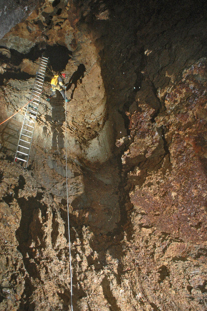
A person wearing a helmet and backpack descends a vertical cave wall inside a cavern, using a metal ladder and a safety rope against dark, rugged rock formations.
A spelunker descends into Riverbend Cave at Horne Lake Caves Provincial Park using a ladder and safety rope.

Horne Lake Caves Provincial Park history and protected-area timeline

The caves at Horne Lake were certainly known to the Qualicum First Nation long before any written record, but the first documented reference to them appeared in a geological report published in 1912. In the years that followed, two caves known as Main and Lower Main became familiar to loggers working in the surrounding forest, and public interest grew after the caves were publicized in 1939.

A major turning point came in 1941, when the larger Riverbend Cave was discovered. By 1945 it had developed into a popular tourist site. As visitation increased, the caves began to lose many of their formations to souvenir-taking and damage, prompting the Province of British Columbia to place a 29 hectare reserve around the Horne Lake caves in 1957 in an effort to protect what remained.

The modern history of the park effectively began with the discovery of Euclataws Cave in 1963 by Jim and Delores Johnson of Nanaimo. Concerned about the vulnerability of this newly revealed cave system, local cavers approached the provincial government for stronger protection. Their efforts led to the formal establishment of Horne Lake Caves Provincial Park on January 29, 1971. Both Euclataws and Riverbend Cave were gated, and guided tours commenced in Main, Lower Main, and Riverbend caves.

Despite these measures, vandalism and gate-breaching continued into the 1970s and early 1980s. The situation escalated in 1984, when a serious incident of vandalism inside Riverbend Cave drew increased attention to the park's management needs. This event prompted the development of a formal management plan in 1985, followed by improved visitor facilities and the introduction of privately managed cave tours designed to better balance protection with public access.

In more recent years, exploration has continued. Four additional caves, Cougar Cave, Eggshell Cave, Andre's Annex, and Riverbend Trail Slot Cave, have been documented within the park, expanding the known underground resource and reinforcing the park's role as an important site for British Columbia's caving community.

Horne Lake Caves Provincial Park landscape and geographic character

The landscape of Horne Lake Caves Provincial Park is defined by the contrast between its dark, sheltered underground environment and its green, forested surface terrain above. Beneath the surface, the park protects a network of limestone caves whose passage walls, chambers, and formations reflect the slow action of water on soluble rock over long periods of geological time.

Some passages, such as parts of Main Cave and Lower Main Cave, are relatively accessible and allow visitors to experience typical cave features including stalactites, stalagmites, and other speleothems. Other sections, especially in Riverbend Cave, contain pronounced vertical drops and more confined spaces that give the underground landscape a distinctly adventurous character. Euclataws Cave, kept hidden for several years after its discovery, contributed additional complexity to the overall cave system.

Above ground, the park covers a compact 158 hectares of Vancouver Island forest, much of it typical of the island's central-eastern woodland. The Qualicum River flows through the park, adding a dramatic freshwater element to the setting, with stretches of moving water, riverbanks, and riparian vegetation. The combination of forest, river corridor, and the entrances to multiple caves creates a landscape where visitors move easily between dense woodland, open riverside views, and the cool, still environment of the cave interiors.

Horne Lake Caves Provincial Park ecosystems, habitats, and plant life

Ecologically, Horne Lake Caves Provincial Park preserves a sample of the central Vancouver Island forest and river environment that surrounds the cave systems, while the caves themselves represent a specialized underground habitat. The forests on the surface support typical Vancouver Island vegetation associations, providing shade, ground cover, and habitat continuity around the cave entrances and riverbanks.

The park's ecological character is shaped by the proximity of karst terrain, forest, and the Qualicum River corridor. This combination produces a mosaic of microhabitats, from damp, sheltered entrance zones where cave and forest environments meet, to the cooler, stable conditions deeper inside the caves, to riparian zones along the Qualicum River. These transitions support a range of species and ecological processes, and they reinforce the value of treating the park as a single integrated landscape rather than just a collection of caves.

From a habitat perspective, the park's most distinctive ecological features are the cave passages themselves, which function as a unique underground environment sensitive to disturbance. Their conservation is tied directly to careful visitor management, gated access, and guided tours designed to limit damage to formations and the cave ecosystem.

Horne Lake Caves Provincial Park wildlife and species highlights

The wildlife profile of Horne Lake Caves Provincial Park reflects the broader forest and river ecosystems of central Vancouver Island rather than a single charismatic species. The mixed forest surrounding the caves and along the Qualicum River supports the usual range of small mammals, birds, and forest-dwelling species typical of the region, while the river provides aquatic habitat supporting fish populations.

Cave-dwelling fauna, where present, reflects the specialized underground environment, and the careful management of the park over several decades has been partly motivated by the need to protect both the physical formations and these more delicate cave ecosystems. Outside the caves, the Qualicum River corridor offers opportunities for fishing, indicating the presence of freshwater fish species, and the surrounding forest provides habitat for birds and other wildlife characteristic of Vancouver Island woodlands.

Horne Lake Caves Provincial Park conservation status and protection priorities

Horne Lake Caves Provincial Park exists principally to protect a group of caves that, by the late twentieth century, had already suffered significant losses of their formations through souvenir-taking and vandalism. The park's protected status provides a formal framework for limiting further damage, controlling access to sensitive passages, and supporting guided rather than free-access visitation in the more vulnerable caves.

Conservation management at the park has evolved over time. Early efforts focused on gating Euclataws and Riverbend Cave and introducing guided tours in Main, Lower Main, and Riverbend caves. Continued problems with gate-breaching and vandalism culminated in a serious 1984 incident in Riverbend Cave, which led directly to a formal management plan in 1985, improved visitor facilities, and the establishment of privately managed cave tours that combined revenue generation with stronger protection.

On a broader scale, the park also conserves forest habitat and part of the Qualicum River, contributing to the protection of a representative segment of central Vancouver Island's natural landscape. Its IUCN Category II designation reflects a high level of protection, and its ongoing role as both a conservation site and a public recreational destination makes it an important example of how cave protection can be balanced with public education and access.

Horne Lake Caves Provincial Park cultural meaning and human context

The cave systems that the park protects were certainly known to the Qualicum First Nation long before any written archaeological or geological record. This long-standing awareness by Indigenous peoples forms part of the deeper cultural context of the site, even where specific details of traditional use are not detailed in current public sources.

In the modern era, the caves also play an important role in the recreational and community culture of British Columbia's caving enthusiasts. Local cavers were instrumental in lobbying the provincial government for stronger protection, and their involvement helped shape both the establishment of the park in 1971 and its ongoing management approach. The growth of guided show-cave tours and adventure caving from the mid-twentieth century onward has added a layer of tourism and outdoor recreation culture tied directly to the park.

Top sights and standout views in Horne Lake Caves Provincial Park

Horne Lake Caves Provincial Park's most distinctive highlights include its cluster of named caves (Main, Lower Main, Riverbend, Euclataws, and the more recently documented Cougar, Eggshell, Andre's Annex, and Riverbend Trail Slot caves), its accessible show-cave experiences alongside true adventure caving opportunities, and its combination of forest and Qualicum River recreation within a single compact protected area.

The park's history of evolving conservation responses, from the 1957 provincial reserve through the 1971 park establishment to the 1985 management plan and the introduction of privately managed tours, is itself a highlight for visitors interested in how cave protection has developed in British Columbia. Equally notable is the park's role as an accessible entry point into the Vancouver Island caving experience, where visitors of different skill levels can engage with underground environments under careful supervision.

Best time to visit Horne Lake Caves Provincial Park

Because the caves maintain a relatively constant cool temperature year round, visiting Horne Lake Caves Provincial Park is in many ways a year round activity, with the underground experience remaining broadly similar across seasons. However, the surface portion of the park, including the forest trails and the Qualicum River, has a more seasonally variable character, with the river likely to be most lively during wetter months and the forest taking on a green, lush appearance in the wet season typical of coastal British Columbia.

Summers on Vancouver Island tend to be the busiest season for outdoor recreation in general, with longer daylight hours, drier trail conditions, and easier road access. Spring and fall can offer quieter conditions and a more reflective atmosphere in the forest and along the river, while still providing comfortable access to the caves. Planning a visit in any season is largely a matter of choosing between trail and river recreation versus cave visits, since the caves themselves are not strongly seasonal in character.

Monthly climate preview

Measured annual temperature ranges and precipitation patterns across representative park coordinates

Horne Lake Caves Provincial Park Climate Normals and Weather by Month

Representative coordinate records show average monthly temperatures ranging from 1.12 degrees Celsius in winter to 16.12 degrees Celsius in mid-year alongside variable daily precipitation rates. Examining the full twelve-month profile provides complete historical averages for temperature minimums and maximums across the protected landscape.
Annual mean8 °C
1 °C16 °C
Jan
Feb
Mar
Apr
May11°
Jun13°
Jul16°
Aug16°
Sep13°
Oct
Nov
Dec
Warmest month
July

16.1 °C

Coolest month
December

1.1 °C

Wettest month
November

5.7 mm/day

Driest month
July

1.2 mm/day

Park location guide

Geography guide, regional context, and park location map for Horne Lake Caves Provincial Park

Horne Lake Caves Provincial Park park geography, regions, and map view in Canada

Understand where Horne Lake Caves Provincial Park sits in Canada through a broader geographic reading of the surrounding landscape, nearby location context, and its mapped position within the national park landscape.

How Horne Lake Caves Provincial Park fits into Canada

Canada is a federal parliamentary constitutional monarchy spanning North America from the Atlantic to the Pacific and Arctic Oceans. With a population of over 41 million, it is officially bilingual in English and French at the federal level. The country gained independence from the United Kingdom through a gradual process culminating in 1982.

Wider geography shaping Horne Lake Caves Provincial Park in Canada

Canada occupies the northern portion of North America, sharing its longest international border with the United States. The country extends from the Atlantic Ocean to the Pacific Ocean and northward into the Arctic Ocean, giving it the longest coastline of any nation.

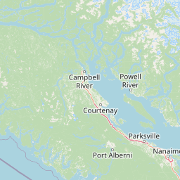
Map view of Horne Lake Caves Provincial Park

Use this park location map to pinpoint Horne Lake Caves Provincial Park in Canada, understand its exact geographic position, and read its mapped placement within the surrounding landscape more clearly.

Pigeon | © OpenStreetMap contributors

Location context for Horne Lake Caves Provincial Park

British Columbia

Visual reference for limestone formations, forest terrain, and subterranean habitats

Horne Lake Caves Provincial Park Photos, Limestone Scenery, and Underground Landscapes

Photographic documentation reveals the distinct contrast between dense Vancouver Island forest canopies and subterranean limestone chambers. Visualizing these protected environments clarifies regional topography, geological formations, and river corridors without relying on verbal descriptions.

A person wearing a helmet and backpack descends a vertical cave wall inside a cavern, using a metal ladder and a safety rope against dark, rugged rock formations.

A person wearing a caving suit and helmet explores a limestone cave with flowing rock formations.

Park atlas

Compare regional Vancouver Island reserves and connected forest landscapes.

Explore Parks Near Horne Lake Caves Provincial Park and Surrounding Protected Areas

Continue exploring protected areas near Horne Lake Caves Provincial Park by comparing adjacent forest reserves, river valleys, and regional natural habitats. Examining nearby provincial parks provides broader geographic context for the unique limestone cave ecosystems across Vancouver Island.
A horizontal watercolor illustration featuring a wooden boardwalk winding through a calm, light-filled landscape with soft green trees, grassy foreground, and rolling hills in the distance.
State or regional parkBritish Columbia
About 9.1 km away#1 closest

Southeast

MacMillan Provincial Park: Mapped Geography and Protected Forest Landscapes

Vancouver Island, British Columbia

Examine the mapped footprint of MacMillan Provincial Park, home to iconic old-growth Douglas fir trees and the Cameron River delta. This protected area serves as a biogeoclimatic transition zone, showcasing the rich, moisture-retentive coastal forest environment that defines this specific section of Vancouver Island.

Area
3.01 km²
Established
1947
IUCN
III
Visitors
543.7K annual
A soft watercolor illustration depicting a winding river flowing through a lush green valley with coniferous forests on the hillsides and mountains in the background.
State or regional parkBritish Columbia
About 9.3 km away#2 closest

Southeast

Little Qualicum Falls Provincial Park: Regional Protected Landscape and Atlas Geography

River canyon and mountain lake habitat in British Columbia

Explore the structured geography of Little Qualicum Falls Provincial Park, a protected area characterized by its sequence of dramatic river cascades and old-growth Douglas Fir stands. This entry maps the park's key natural features, including the Cameron Lake shoreline and the rugged canyon terrain of the Little Qualicum River.

Area
4.4 km²
Established
1940
IUCN
II
Relief
Mountain
Watercolor painting of a waterfall surrounded by lush green trees and forest.
State or regional parkBritish Columbia
About 31 km away#3 closest

East

Englishman River Falls Provincial Park: Regional Geography and Protected Area Overview

Vancouver Island river canyon and coastal forest terrain

Englishman River Falls Provincial Park protects a concentrated area of canyon scenery and old-growth forest on the eastern side of Vancouver Island. The landscape is characterized by the dramatic steps of the Englishman River, deep plunge pools, and mature cedar and hemlock stands. This geography provides an essential look at the coastal rainforest ecosystems and river-fed topography that define the recreational corridors of British Columbia.

Area
0.97 km²
IUCN
II
Relief
Upland
Access
Easy access
A pale, minimalist watercolor painting depicting a wide, sandy beach shoreline with a line of evergreen trees in the distance.
State or regional parkBritish Columbia
About 35 km away#4 closest

East

Rathtrevor Beach Provincial Park: Coastal Geography and Protected Land Overview

Vancouver Island coastal terrain and forested landscapes

Spanning over 300 hectares, Rathtrevor Beach Provincial Park protects a rare combination of fine sandy beaches and ancient Douglas fir groves along the Strait of Georgia. This coastal sanctuary on Vancouver Island serves as a critical habitat for migrating birds and represents a preserved segment of regional geography amidst the surrounding developed shoreline.

Area
3.47 km²
Established
1967
IUCN
II
Visitors
836.2K annual
Watercolor painting of a tranquil body of water with gentle hills in the background and a cluster of trees on the right shore.
State or regional parkBritish Columbia
About 42 km away#5 closest

Northeast

Jedediah Island Marine Provincial Park: Coastal Terrain and Regional Protected Area Map

Mapping island boundaries and sheltered maritime ecosystems

Jedediah Island Marine Provincial Park offers a unique study in coastal geography, featuring a complex shoreline of pebble beaches and indented bays. Located within the Strait of Georgia, the park serves as a protected landmass that blends maritime forest ecosystems with open water corridors. Its boat-only access ensures the landscape remains a quiet, preserved example of Gulf Islands terrain.

Area
6.03 km²
Established
1995
IUCN
II
Relief
Lowland
National parkBritish Columbia
About 57 km away#6 closest

South

Pacific Rim National Park Reserve: National Park Protected Landscape & Map Atlas

Mapped boundaries and regional geographic context in British Columbia.

Pacific Rim National Park Reserve stands as a distinct protected natural landscape, serving as a critical component of Canada's national park inventory. This page facilitates an atlas-style exploration of its mapped boundaries and its position within the broader geography of British Columbia. Understanding the park's protected status and its integration with the surrounding natural terrain offers valuable insight into conservation landscapes.

Area
511 km²
Established
1970
IUCN
VI
Visitors
1.2M annual
A minimalist watercolor illustration showing rolling hills in the background and soft foliage in the foreground on a white background.
State or regional parkBritish Columbia
About 64 km away#7 closest

East

Petroglyph Provincial Park: Protected Indigenous Heritage and Coastal Geography

Cultural landscape and bedrock carvings in British Columbia

Petroglyph Provincial Park preserves a remarkable concentration of ancient carvings etched into the sandstone bedrock of the Nanaimo River estuary. This protected area on Vancouver Island provides a rare look at how Indigenous traditions integrated with powerful natural features, offering a unique geographic context for studying historical rock art in the Pacific Northwest.

Area
0.02 km²
Established
1948
IUCN
III
Relief
Lowland
State or regional parkBritish Columbia
About 70 km away#8 closest

North

Mitlenatch Island Nature Provincial Park: Protected Coastal Geography and Marine Sanctuary Atlas

Coastal landscapes and protected seabird habitats in British Columbia

Mitlenatch Island Nature Provincial Park represents a specialized coastal refuge defined by grass-topped rocky outcrops and sheltered intertidal zones. This protected area in the Strait of Georgia functions as an important sanctuary for nesting seabird colonies and seasonal marine mammal populations, demonstrating how compact island geography provides high-density habitat within the broader British Columbia ecosystem.

Area
1.55 km²
Established
1961
IUCN
Ia
Relief
Lowland

Common questions about visiting, size, designation, and location context for Horne Lake Caves Provincial Park

Horne Lake Caves Provincial Park FAQs for park facts, access, geography, and protected area context

Find quick answers about Horne Lake Caves Provincial Park, including protected-area facts, park geography, trail and visitor context, and how the park fits into its surrounding country and regional landscape.
MoriAtlas Explorer

Continue Your Protected Areas Search Across the Global Atlas

Deepen your exploration by continuing the structured search for national parks and protected areas worldwide. Utilize the comprehensive filtering capabilities to compare different conservation landscapes and refine your understanding of global park geography. Discover more about the distribution and characteristics of protected natural areas.

Global natural geography