
Mori Atlas logo
Nature reserveHundekehlefenn

A preserved glacial meltwater channel characterized by mesotrophic moor pond flora and alder swamp remnants.

Hundekehlefenn Nature Reserve: Mapping the Glacial Wetland Landscapes of Berlin Grunewald

(Naturschutzgebiet Hundekehlefenn)

Hundekehlefenn stands as a critical nature reserve within the Berlin Grunewald, occupying a distinct marshy depression formed by ancient glacial meltwater channels. This protected area connects the Grunewaldsee to the Hundekehlesee, serving as a vital fragment of original wetland vegetation in the region. The landscape features a mix of drained boggy terrain, open meadows dotted with birch stands, and an integrated canal system that preserves the ecological continuity of the Grunewaldseenkette.

wetlandmoorlandglacial channelnature reserveBerlin Grunewaldmesotrophic bog
A flat-style digital illustration showing a bright, peaceful landscape with a winding river flowing through a green meadow, bordered by a dark forest, birch trees, and distant rocky peaks under a soft yellow sun.

Hundekehlefenn

Nature reserve

Park overview

Structured park overview, official facts, and landscape profile for Hundekehlefenn

Hundekehlefenn park facts, protected area profile, and essential visitor context

Review the core facts for Hundekehlefenn, including designation, size, terrain, visitor scale, habitats, and operating context in one park-focused overview.

About Hundekehlefenn

Hundekehlefenn is a protected nature reserve in the heart of Berlin's Grunewald forest, embedded in the landscape created by the Grunewaldseenkette, the chain of lakes and wetlands shaped by glacial meltwater channels at the end of the last ice age. The reserve occupies a marshy depression along this ancient channel terrain, and serves both as an ecological refuge and as a connecting link between the larger Hundekehlesee to the north and the Grunewaldsee to the south. The Hundekehlekanal runs along the eastern side of the area, ensuring a continuous hydrological connection that preserves the moist character of the basin.

The site's ecological importance lies in what remains of Berlin's original vegetation. Together with the nearby Riemeisterfenn, Hundekehlefenn represents one of the last surviving examples of the natural landscape that once characterized the Grunewald region before extensive development, drainage, and urbanization altered it. The reserve protects mesotrophic moor pond communities, fragments of alder swamp woodland, and a zone of natural overgrowth vegetation where plant succession is allowed to proceed undisturbed. The layered structure of the bog substrate is also explicitly preserved as part of the conservation goal, recognizing the scientific and ecological value of the peat profile itself.

Beyond the biological character, the reserve also reflects a layered human history. The western side of the Fenn is overlooked by the Forsthaus Hundekehle, a building that began in 1907 as a police mounted station with living quarters, stables, and a small coachman's house. After 1923 it became part of the Grunewald forestry administration and has since served continuously as a forester's seat, embedding the protected wetland within an older, continuing tradition of forest management in the Grunewald.

Quick facts and research context for Hundekehlefenn

Hundekehlefenn is a nature reserve in the Berlin district of Charlottenburg-Wilmersdorf, set within the forested Grunewald. It lies in the glacial channel of the Grunewaldseenkette and connects the Grunewaldsee with the Hundekehlesee through the Hundekehlekanal. Designated in 1987, the reserve is classified as a moorland protection area and is intended to preserve mesotrophic moor pond flora, alder swamp remnants, and natural overgrowth vegetation.

Protection and recognition

Documented protection scope and international recognition details

Hundekehlefenn Protection Status and Terrestrial Conservation Data

Terrestrial protection status for Hundekehlefenn outlines documented conservation frameworks and recognized management parameters. Official designation records provide structured insight into the environmental administration governing natural terrain.

Protection details

Protection scope
Terrestrial
Transboundary protection
No
Park context

Deeper park guide and search-rich context for Hundekehlefenn

Hundekehlefenn history, landscape, wildlife, and travel context

Explore Hundekehlefenn through its history, landscape character, ecosystems, wildlife, conservation priorities, cultural context, and seasonal travel timing in a structured park guide built for atlas discovery and search intent.

Why Hundekehlefenn stands out

Hundekehlefenn is known for preserving one of the last fragments of original, undisturbed wetland vegetation within the Berlin city boundary, including rare mesotrophic moor pond flora and remnants of alder swamp forest. Its location within the glacial channel of the Grunewaldseenkette gives the reserve a distinctive elongated, hollow profile that visibly continues the character of nearby protected sites such as Rehwiese and Riemeisterfenn. The combination of drained boggy ground, open meadows, light birch stands, and a connecting canal makes it a compact but recognizable example of Berlin's glacial terrain.
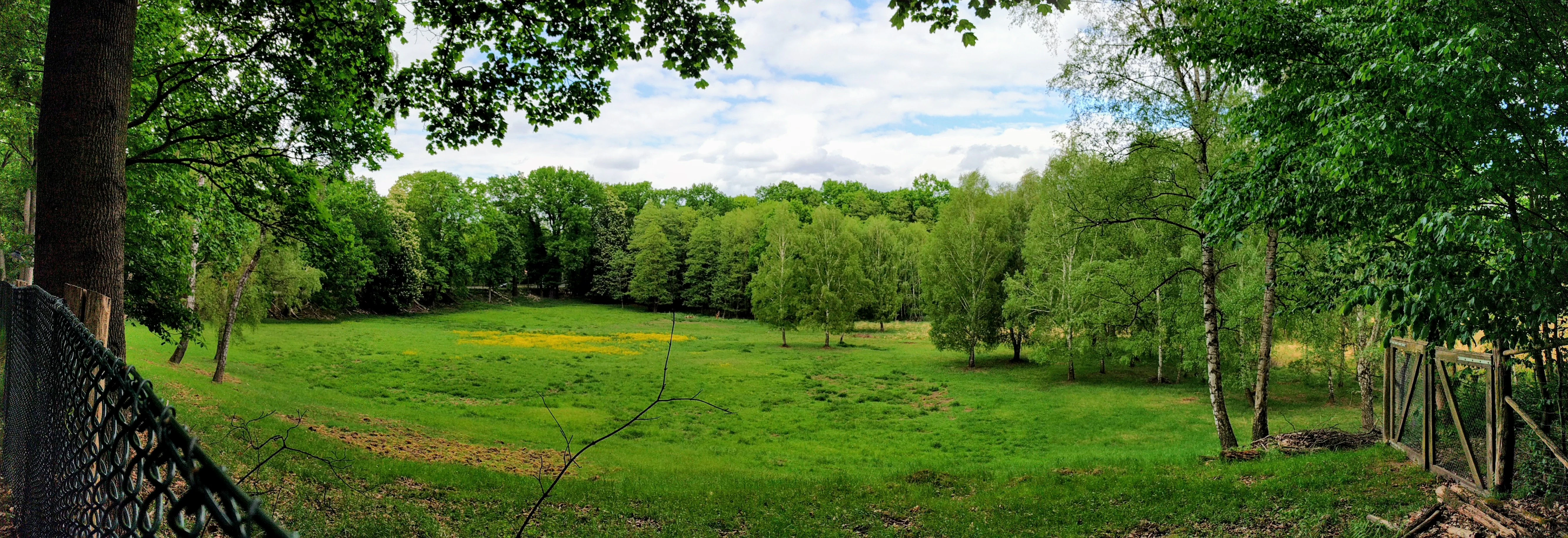
A panoramic view of a lush green meadow surrounded by a dense deciduous forest, with a chain link fence in the foreground.
The meadow at Hundekehlefenn, a marshy depression located within the Grunewald forest in Berlin.

Hundekehlefenn history and protected-area timeline

Hundekehlefenn has been formally protected as a nature reserve since 1987, but its broader context reaches back much further. The name itself reflects deep historical roots: the term 'Hundekehle' has been linked either to an older word for a gathering point of hunting hounds during drive hunts near the nearby Jagdschloss Grunewald, or, according to name researcher Gerhard Schlimpert, to the older terms 'hunt' meaning a field measure and 'kele' meaning ravine. The word 'Fenn' is a Low German term for a swampy inland lake, introduced into the Mark Brandenburg region through the settlement by Flemings in the 12th century during the development of what is now the Fläming.

The landscape itself was formed by glacial processes, with the bog-rich depression sitting in a glacial meltwater channel that once shaped the entire Grunewaldseenkette. By the late 20th century, much of the original wetland had been drained or altered, making the surviving Hundekehlefenn and its neighbor Riemeisterfenn especially important as fragments of the original vegetation. The 1987 designation formalized the protection of this residual wetland character, including its flora, fauna, alder swamp remnants, and layered bog structure.

The surrounding cultural layer is older, but tied into the reserve through the Forsthaus Hundekehle. This building was constructed in 1907 as a police mounted station, complete with detention and residential areas, stables, and a coachman's house. Since 1923 it has functioned as the Forsterei Hundekehle within the Grunewald forestry administration. The Forsthaus was used as a filming location in 1963 for 'Scotland Yard jagt Dr. Mabuse' and served as the setting for the 1966 television series 'Förster Horn', giving the area a small but distinctive cinematic memory alongside its natural significance.

Hundekehlefenn landscape and geographic character

Hundekehlefenn lies within a glacial meltwater channel, part of the broader Grunewaldseenkette that threads through the southwestern part of Berlin. The reserve occupies a marshy, morass-like depression whose elongated form clearly expresses the underlying ice-age channel geology, a character also seen in the nearby Rehwiese and Riemeisterfenn. The glacial origin of the site gives it a recognizable elongated hollow profile within the otherwise forested terrain of the Grunewald.

The surface character of the area combines two main landscape types: a formerly boggy, much-drained central section that still preserves a sense of marshy ground, and a series of open meadow areas with light birch cover that extend along the channel axis. The canal on the eastern side continues the glacial channel's hydrological function, linking the southern Grunewaldsee basin with the northern Hundekehlesee basin and keeping the corridor visibly integrated into the wider lake chain.

Above the western edge of the reserve sits the Forstamt Grunewald and the historic Forsthaus Hundekehle, anchoring the wetland within a clearly framed forested setting. The combination of marshy hollow, birch-dotted meadows, connecting canal, surrounding forest, and historic forester's buildings gives Hundekehlefenn a layered yet coherent landscape identity.
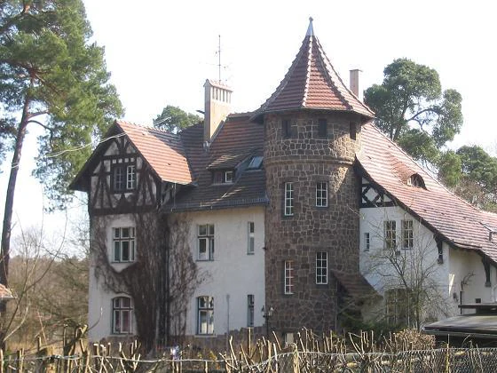
A historic, multi-story forest house with a stone tower and timber-framed elements, situated within a wooded area.
The historic forest house at the Hundekehlefenn nature reserve.

Hundekehlefenn ecosystems, habitats, and plant life

Hundekehlefenn's ecological value rests on its preservation of a transitional wetland system within an urban forest. The reserve belongs to the category of Berlin nature reserves classified as moorland, and its primary objective is to maintain the surviving mesotrophic moor pond flora and the characteristic bog substrate structure. The combination of moist depressions and drier, partially drained sections supports a mosaic of plant communities rather than a single uniform habitat.

The open meadow sections are characterized by grassy vegetation and clusters of birch, allowing light to reach the soil and sustaining herbaceous meadow flora typical of nutrient-poor, formerly bog-influenced ground. In the central, more boggy section, the surviving vegetation includes plants associated with mesotrophic moor ponds as well as fragments of alder swamp woodland, marking the site as an ecological transition between open water, marsh, and wet woodland.

The reserve is intentionally managed with minimal disturbance, allowing overgrowth vegetation to develop naturally and preserving the vertical layering of the bog profile. This approach supports ecological processes typical of slowly evolving wetland systems and maintains the site's value as a small-scale refugium within a heavily urbanized region.
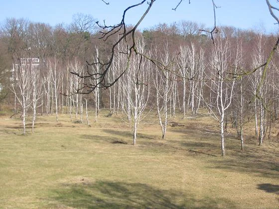
A wide, eye-level shot of a clearing in the Hundekehlefenn nature reserve, featuring many leafless white-barked trees in a grassy field under a bright sky, with a forest in the distance.
A view of the marshy depression at the Hundekehlefenn nature reserve in Berlin.

Hundekehlefenn wildlife and species highlights

The protected status of Hundekehlefenn is centered on the conservation of characteristic wetland flora and the broader bog habitat, which in turn supports the fauna associated with such environments. The mosaic of boggy ground, open meadows, birch stands, and the connecting Hundekehlekanal creates habitats for invertebrates, amphibians, and bird species adapted to mesotrophic wetland conditions and wet woodland edges.

Because the reserve sits within the larger forested Grunewald and connects directly to the Grunewaldsee and Hundekehlesee via the canal, animal movement between the wetland and surrounding forest and lake habitats is largely unobstructed. This continuity is part of what gives the small reserve its ecological function within the wider Grunewaldseenkette system, even though the source material does not provide a detailed species inventory.

Hundekehlefenn conservation status and protection priorities

Hundekehlefenn has been a designated nature reserve since 1987, classified as a moorland protection area. The conservation purpose explicitly targets the preservation of mesotrophic moor pond flora and fauna, the remnants of alder swamp forest, and the layered geological structure of the bog substrate. The reserve is also managed to allow natural overgrowth succession to proceed without disturbance, supporting the slow ecological dynamics of a true wetland system.

In the broader Berlin context, Hundekehlefenn and the neighboring Riemeisterfenn together represent some of the last surviving fragments of original vegetation left within the city. This makes the reserve ecologically significant not only for what it contains locally but also as a remaining example of a once much more extensive natural landscape now reduced by urban development, drainage, and forest use.

Hundekehlefenn cultural meaning and human context

Hundekehlefenn is named through a layered linguistic history. The element 'Hundekehle' may refer to a traditional gathering point for hunting hounds during drive hunts, an interpretation tied to the nearby Jagdschloss Grunewald, though the place-name researcher Schlimpert instead links it to older terms for a field measure and a ravine. The word 'Fenn' is a Low German term for a swampy inland lake, introduced into the Mark Brandenburg region through the medieval settlement by Flemings whose influence gave the Fläming its name.

The Forsthaus Hundekehle above the western edge of the reserve adds another cultural layer, having begun in 1907 as a police mounted station before becoming a forestry office in 1923. The building's use as a filming location for 'Scotland Yard jagt Dr. Mabuse' in 1963 and as the setting for the 'Förster Horn' television series in 1966 gives the surrounding landscape a small place in Berlin's mid-20th century visual memory.

Top sights and standout views in Hundekehlefenn

Hundekehlefenn offers a compact but ecologically meaningful glimpse of the wetland character that once dominated Berlin's Grunewald glacial channel. Its protected moor status, surviving mesotrophic bog vegetation, alder swamp remnants, and undisturbed overgrowth succession combine to make it one of the last refuge sites of original Berlin vegetation alongside Riemeisterfenn. The visible glacial channel profile, the Hundekehlekanal linking two lakes, and the historic Forsthaus Hundekehle together give the reserve both ecological and cultural identity within the Grunewaldseenkette.

Best time to visit Hundekehlefenn

Hundekehlefenn can be experienced throughout the year as a quiet nature site within the Grunewald. Spring and early summer tend to bring out the most active vegetation and birdlife in the open meadows and along the canal, when the birch stands and wetland flora are at their most visible. Late summer and autumn highlight the layered bog profile and the natural overgrowth succession that is central to the reserve's conservation purpose. Because the reserve sits within a forested urban landscape, visits benefit from softer light in the morning as the marshy ground and birch meadow character come clearly into view.

Monthly climate preview

Track monthly temperature variations and precipitation averages across the protected terrain

Hundekehlefenn Climate Normals, Long-Term Temperature and Precipitation Patterns

Historical climate records for Hundekehlefenn document measured long-term temperature ranges alongside consistent monthly precipitation patterns across the representative coordinate. Exploring the complete meteorological profile reveals detailed monthly fluctuations in average maximums, minimums, and daily precipitation volumes.
Annual mean9 °C
-1 °C20 °C
Jan-1°
Feb
Mar
Apr
May14°
Jun18°
Jul20°
Aug20°
Sep15°
Oct
Nov
Dec
Warmest month
July

20.3 °C

Coolest month
January

-0.7 °C

Wettest month
July

2.4 mm/day

Driest month
April

1 mm/day

Park location guide

Geography guide, regional context, and park location map for Hundekehlefenn

Hundekehlefenn park geography, regions, and map view in Germany

Understand where Hundekehlefenn sits in Germany through a broader geographic reading of the surrounding landscape, nearby location context, and its mapped position within the national park landscape.

How Hundekehlefenn fits into Germany

Germany is a federal republic in Western and Central Europe with a population of over 83 million across sixteen constituent states. It is Europe's largest economy by nominal GDP and a major global exporter and importer. The capital is Berlin, and the country borders Denmark, Poland, Czech Republic, Austria, Switzerland, France, Luxembourg, Belgium, and the Netherlands.

Wider geography shaping Hundekehlefenn in Germany

Germany is located in Western and Central Europe, spanning 357,022 km². It borders Denmark to the north, Poland and the Czech Republic to the east, Austria and Switzerland to the south, and France, Luxembourg, Belgium, and the Netherlands to the west. The country has coastlines on the Baltic Sea and North Sea to the north, with the Alps located in the southern region.

Map view of Hundekehlefenn

Use this park location map to pinpoint Hundekehlefenn in Germany, understand its exact geographic position, and read its mapped placement within the surrounding landscape more clearly.

Pigeon | © OpenStreetMap contributors

Location context for Hundekehlefenn

Berlin

Explore photographic records of moorland vegetation, alder swamps, and glacial channel scenery.

Hundekehlefenn Photos and Protected Landscapes: Visualising Berlin Glacial Terrain

Visual documentation reveals the distinct glacial meltwater depression and boggy terrain that define Hundekehlefenn within the surrounding forest reserve. Examining these protected habitats provides direct insight into surviving wetland ecology and ice-age channel topography.

A panoramic view of a lush green meadow surrounded by a dense deciduous forest, with a chain link fence in the foreground.

A narrow water channel flowing through a deciduous forest with a fallen tree trunk in the foreground.

A historic, multi-story forest house with a stone tower and timber-framed elements, situated within a wooded area.

A wide, eye-level shot of a clearing in the Hundekehlefenn nature reserve, featuring many leafless white-barked trees in a grassy field under a bright sky, with a forest in the distance.

Park atlas

Discover related wetland reserves and glacial channel landscapes across the region

Exploring Other Parks and Protected Areas Near Hundekehlefenn

Browsing other protected areas near Hundekehlefenn reveals connected glacial meltwater channels and regional wetland reserves across the surrounding landscape. Comparing adjacent park geography provides broader context for understanding urban forest ecosystems and surviving moorland habitats.
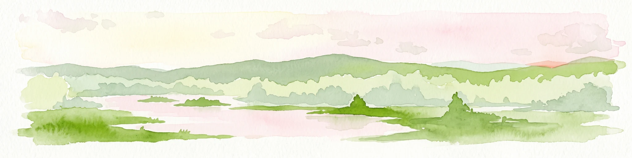
A horizontal watercolor painting showing a wetland landscape with calm water, marshy vegetation, and a background of soft rolling hills and mixed forest trees.
Nature reserveBerlin
About 2 km away#1 closest

Southwest

Langes Luch / Dachsheide: Nature Reserve and Glacial Wetland Geography in Berlin

Protected mosaic of bog, forest, and inland dune habitats

Langes Luch / Dachsheide encompasses a rare urban protected area in Berlin, defined by the interplay between low-lying swampy depressions and elevated sandy heath. The site features complex glacial meltwater channels, open transitional mires, and historical terrain modifications, forming an essential study area for local conservation and regional landscape ecology.

Area
0.324 km²
Established
1960
IUCN
IV
Relief
Lowland
Watercolor illustration of a serene wetland scene with soft green hills and a light pink sky.
Nature reserveBerlin
About 2.2 km away#2 closest

Northwest

Sandgrube im Jagen 86 Nature Reserve: Mapped Geography and Protected Area Context

A unique habitat mosaic within the Berlin forest region

Sandgrube im Jagen 86 functions as a protected nature reserve in Berlin, characterized by a bowl-shaped terrain of glacial sands. The area provides a critical habitat for specialized wildlife by balancing nutrient-poor grasslands with open water bodies and sun-exposed slopes, illustrating an effective example of managed conservation within an urban forest.

Area
0.135 km²
Established
1992
IUCN
IV
Relief
Lowland
Nature reserveBerlin
About 2.8 km away#3 closest

Southwest

Riemeisterfenn Nature Reserve and Protected Peatland Landscape in Berlin

A rare bog ecosystem within the city glacial lake chain

Riemeisterfenn is a distinct nature reserve in Berlin, characterized by its marshy lowlands, reed beds, and alder carr vegetation. This site offers an essential look at a preserved peatland habitat and the Fennkanal hydrology that connects these protected areas to the wider Grunewald forest ecosystem.

Area
0.072 km²
Established
1987
Relief
Lowland
Climate
Temperate
Nature reserveBerlin
About 5 km away#4 closest

North

Fließwiese Ruhleben: A Glacial Nature Reserve and Wetland Mosaic in Berlin

Mapping a unique urban protected area and its peat marsh topography

Fließwiese Ruhleben is a protected nature reserve in western Berlin that preserves a distinct relic of Weichselian glaciation. The site features a narrow, basin-like depression carved by glacial meltwater, supporting a rich diversity of peat-forming marshland and alder swamp forests. This protected area remains a vital node for regional biodiversity, contrasting sharply with the surrounding urban landscape of the Teltow plateau.

Area
0.118 km²
Established
1959
Relief
Lowland
Climate
Temperate
Protected landscapeBerlin
About 5.8 km away#5 closest

Northwest

Tiefwerder-Wiesen Protected Landscape: Berlin Riverine Geography and Floodplain Map

Mapping the historic Havel river floodplains and wetland habitats.

Tiefwerder-Wiesen serves as an important ecological corridor in Berlin, safeguarding the last functional pike spawning grounds within the city. This protected landscape contains a dense network of river arms, ditches, and sedge meadows that illustrate the historical and ongoing geomorphological processes of the Havel river valley.

Area
0.667 km²
Established
1960
Relief
Lowland
Climate
Temperate
Nature reserveBerlin
About 6 km away#6 closest

West

Windmühlenberg Nature Reserve: Glacial Terrain and Steppe Flora in Berlin

Protected sand-dry grasslands on the Nauen Plateau edge

Windmühlenberg preserves a rare ecological landscape in western Berlin. This glacial hill and nature reserve functions as a protected habitat for steppe-relict flora and specialized insects, serving as a critical point of interest for understanding the geomorphology and sand-based grassland environments of the Havel river valley.

Area
0.051 km²
Established
2002
Relief
Upland
Climate
Temperate
Watercolor painting of a green wetland area with soft, blurred rolling hills in the background.
Nature reserveBerlin
About 11 km away#7 closest

Southwest

Großes Fenn Nature Reserve: Protected Peatland and Kettle Bog Geography in Berlin

A study of post-glacial landforms and mire environments.

Großes Fenn represents a rare urban kettle bog formed during the last glacial period, now protected within the Berlin region. This reserve showcases the historical peat-forming processes and the fragile ecological balance of small depressions in the Düppeler Forest, offering a compact site for understanding glacial landscape legacies.

Area
0.064 km²
Established
1986
IUCN
IV
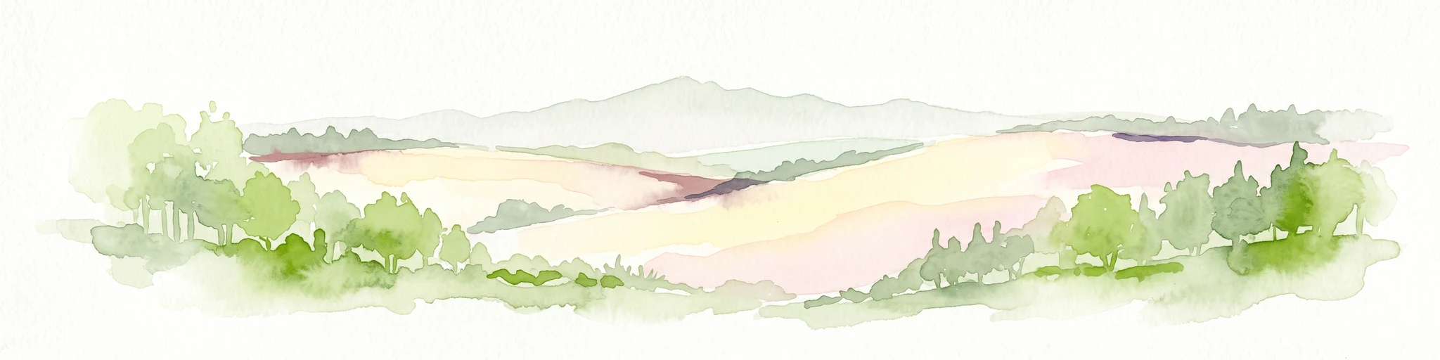
A soft watercolor painting showing rolling green hills, patches of open land, and trees against a pale sky background.
Nature reserveHavelland
About 11 km away#8 closest

West

Döberitzer Heide Nature Reserve: Geographic Atlas and Protected Landscape Mapping

Glacial sand flats and heathlands in the Havelland region

Döberitzer Heide occupies a unique position on the southeastern Nauener Platte, providing a study of dry heath, grassland, and wetland habitats. Once a restricted military training ground, the area now functions as a vital protected landscape where European bison and wild horses maintain open terrains. This atlas entry focuses on the regional geography and the structural components of this nature reserve situated near the urban centers of Berlin and Potsdam.

Area
34.15 km²
Established
1997
Relief
Upland
Climate
Temperate

Common questions about visiting, size, designation, and location context for Hundekehlefenn

Hundekehlefenn FAQs for park facts, access, geography, and protected area context

Find quick answers about Hundekehlefenn, including protected-area facts, park geography, trail and visitor context, and how the park fits into its surrounding country and regional landscape.
MoriAtlas Explorer

Continue Your Protected Areas Search Across the Global Atlas

Deepen your exploration by continuing the structured search for national parks and protected areas worldwide. Utilize the comprehensive filtering capabilities to compare different conservation landscapes and refine your understanding of global park geography. Discover more about the distribution and characteristics of protected natural areas.

Global natural geography