

Mori Atlas logo
Protected landscapeHuron–Manistee National Forests

Tracing the glacial terrain, river basins, and lakeshore dunes of a vast Midwest ecosystem.

Huron–Manistee National Forests: Mapped Geography and Protected Landscapes in Northern Michigan

(Huron-Manistee National Forests)

The Huron–Manistee National Forests encompass nearly one million acres of public land across Michigan, defined by a complex mosaic of glacial outwash plains, sandy moraines, and extensive inland water systems. This administrative unit preserves vital northern ecosystems, including fire-adapted jack pine barrens and rare Great Lakes coastal dunes. Mapped boundaries reveal a landscape shaped by hydrology and forest succession, providing a unique look at the interaction between protected wilderness and working forest management in the heart of the Great Lakes region.

national forestGreat LakesLake Michigan shorelinepine barrensjack pineriver systems
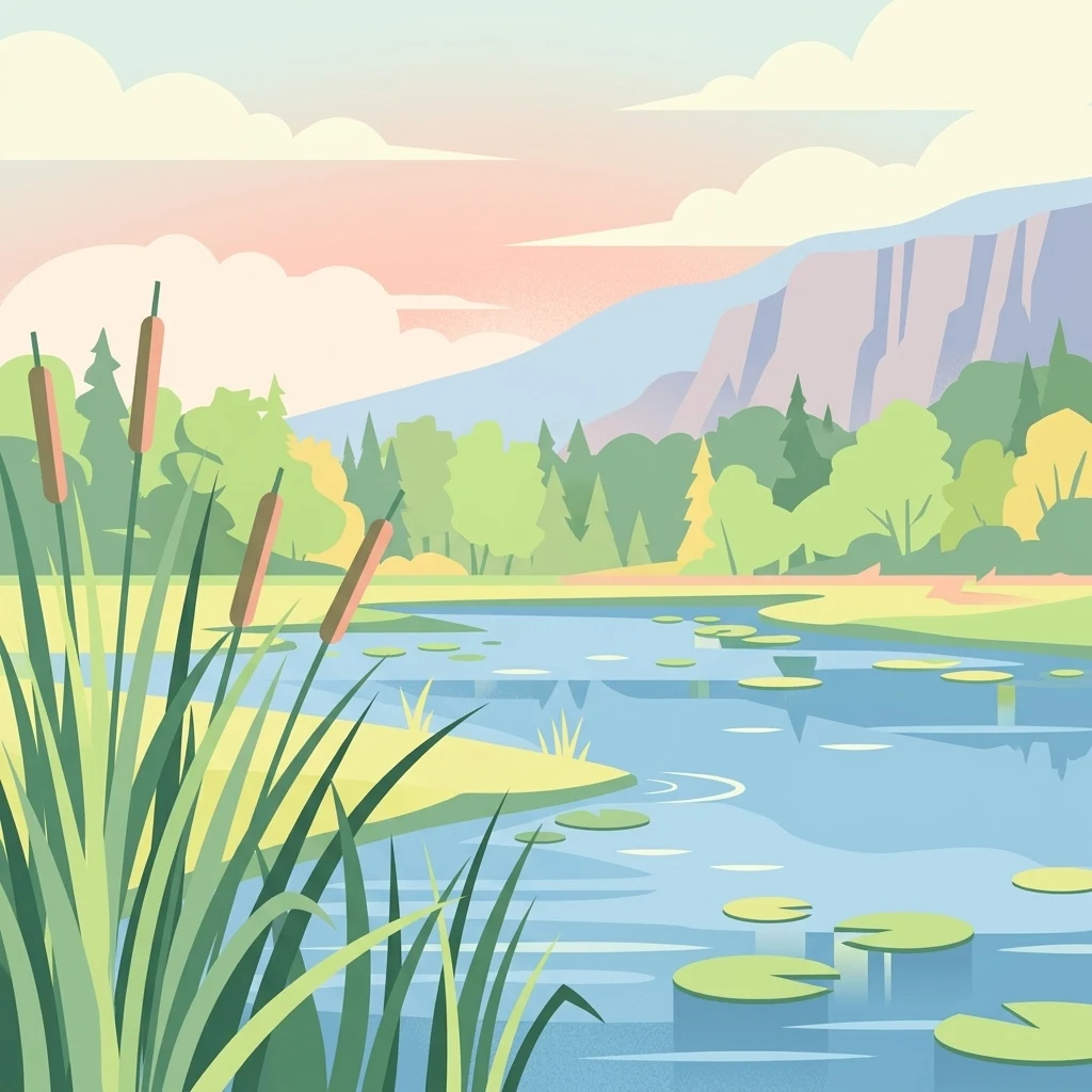
A flat vector illustration showing a calm river or wetland with cattails in the foreground, water lilies floating on the surface, and a forested shoreline with distant cliffs under a soft sunset sky.

Huron–Manistee National Forests

Protected landscape

Park overview

Structured park overview, official facts, and landscape profile for Huron-Manistee National Forests

Huron-Manistee National Forests park facts, protected area profile, and essential visitor context

Review the core facts for Huron-Manistee National Forests, including designation, size, terrain, visitor scale, habitats, and operating context in one park-focused overview.

About Huron-Manistee National Forests

The Huron-Manistee National Forests together form one of the largest expanses of public land in Michigan's Lower Peninsula, stretching across much of the state's northern reaches. Although the Huron and Manistee units are not connected, they have been managed jointly since 1945 and together represent nearly a million acres of forested landscape, rivers, lakes, wetlands, and Lake Michigan shoreline.

The Manistee National Forest occupies the northwestern Lower Peninsula, extending across parts of Lake, Newaygo, Wexford, Manistee, Mason, Oceana, Muskegon, Mecosta, and Montcalm counties. Its terrain is largely sandy in character, the legacy of glacial outwash plains, and supports a mix of pine and hardwood forest, numerous inland lakes, and frontage on Lake Michigan. The Huron National Forest lies further northeast, in parts of Oscoda, Alcona, Iosco, Crawford, and Ogemaw counties, and shares many of the same ecological traits while remaining its own distinct domain.

These forests are deepl... [truncated]

Protection and recognition

Examine documented conservation scope and international recognition records

Huron–Manistee National Forests Protection Status and Terrestrial Designation

Terrestrial protected area records outline the formal conservation status and administrative framework established for Huron–Manistee National Forests. Documented management parameters provide a clear baseline for evaluating official recognition and geographic boundaries.

Protection details

Protection scope
Terrestrial
Transboundary protection
No
Park context

Deeper park guide and search-rich context for Huron-Manistee National Forests

Huron-Manistee National Forests history, landscape, wildlife, and travel context

Explore Huron-Manistee National Forests through its history, landscape character, ecosystems, wildlife, conservation priorities, cultural context, and seasonal travel timing in a structured park guide built for atlas discovery and search intent.

Why Huron-Manistee National Forests stands out

The Huron-Manistee National Forests are best known for the Pere Marquette and Au Sable rivers, which draw canoeists and anglers from across the Midwest. They are a destination for river-based recreation and trout fishing. The forests are equally associated with Great Lakes coastal dunes, jack pine barrens shaped by wildfire, and key habitat for the Kirtland's warbler. Nordhouse Dunes Wilderness, in particular, stands out as one of the few federally designated wilderness areas in the United States with an extensive lakeshore dune ecosystem.
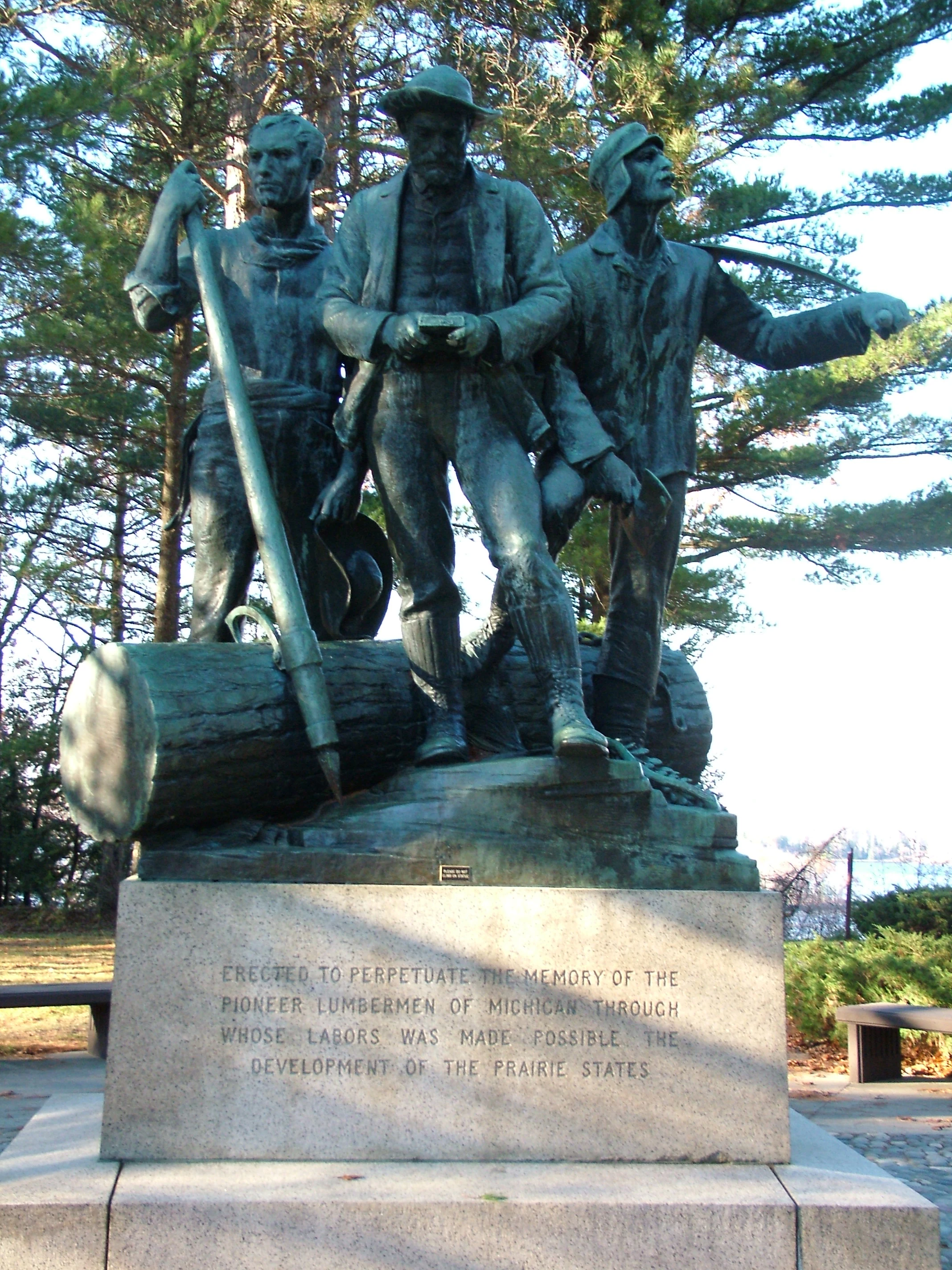
A bronze statue featuring three lumberjacks standing around a log, set on a stone pedestal with an engraved inscription, surrounded by pine trees.
The Lumbermens Monument in Huron-Manistee National Forests, a bronze tribute to the region's historic logging industry.

Huron-Manistee National Forests history and protected-area timeline

The Huron National Forest was established in 1909, and the Manistee National Forest followed in 1938. In 1945, the two forests were administratively combined for management purposes, even though their boundaries remain separate on the landscape. The Manistee unit accounts for roughly 55 percent of the combined area, while Huron makes up the remaining 45 percent.

Much of the land in both forests had been logged heavily in earlier decades before being abandoned by timber companies. The national forest designation reflected an effort to stabilize watersheds, restore forest cover, and put the land back into long-term public use. Ecological management for the Kirtland's warbler, which depends on dense young jack pine stands for nesting, has shaped fire-prone sections of the Huron unit for decades.

Wildfire has been a recurring force in the forests' history. The sandy soils, the dominance of jack pine in some areas, and the deliberate creation of dense young jack pine stands for warbler habitat all contribute to high fire risk. In 2010, the Meridian Boundary Fire burned over 8,500 acres in and near the Huron District, destroying homes, outbuildings, and large areas of forest, underscoring the ongoing... [truncated]

Huron-Manistee National Forests landscape and geographic character

The Huron-Manistee National Forests occupy a landscape profoundly shaped by glaciation. Sandy outwash plains, glacial lake beds, and moraines combine to produce rolling forested terrain interspersed with lakes, rivers, and marshes. The Manistee unit is dominated by these sandy, largely forested conditions and includes frontage on Lake Michigan, while the Huron unit shares this character in the northeast.

Along the Lake Michigan shoreline, the Nordhouse Dunes Wilderness preserves a rare Great Lakes dune ecosystem. Most of these dunes are roughly three to four thousand years old, and some rise about 140 feet above the lake surface. They are interspersed with woody vegetation such as juniper, jack pine, and hemlock, with dune grass covering many slopes and small water holes and marshes scattered through the system. Between the lake and the inland forests, the landscape transitions from open beach and dune to denser mixed forest.

Inland, the forests host more than 1,800 miles of rivers and about 17,000 acres of lakes. Eight major river basins define the regional hydrology, in... [truncated]
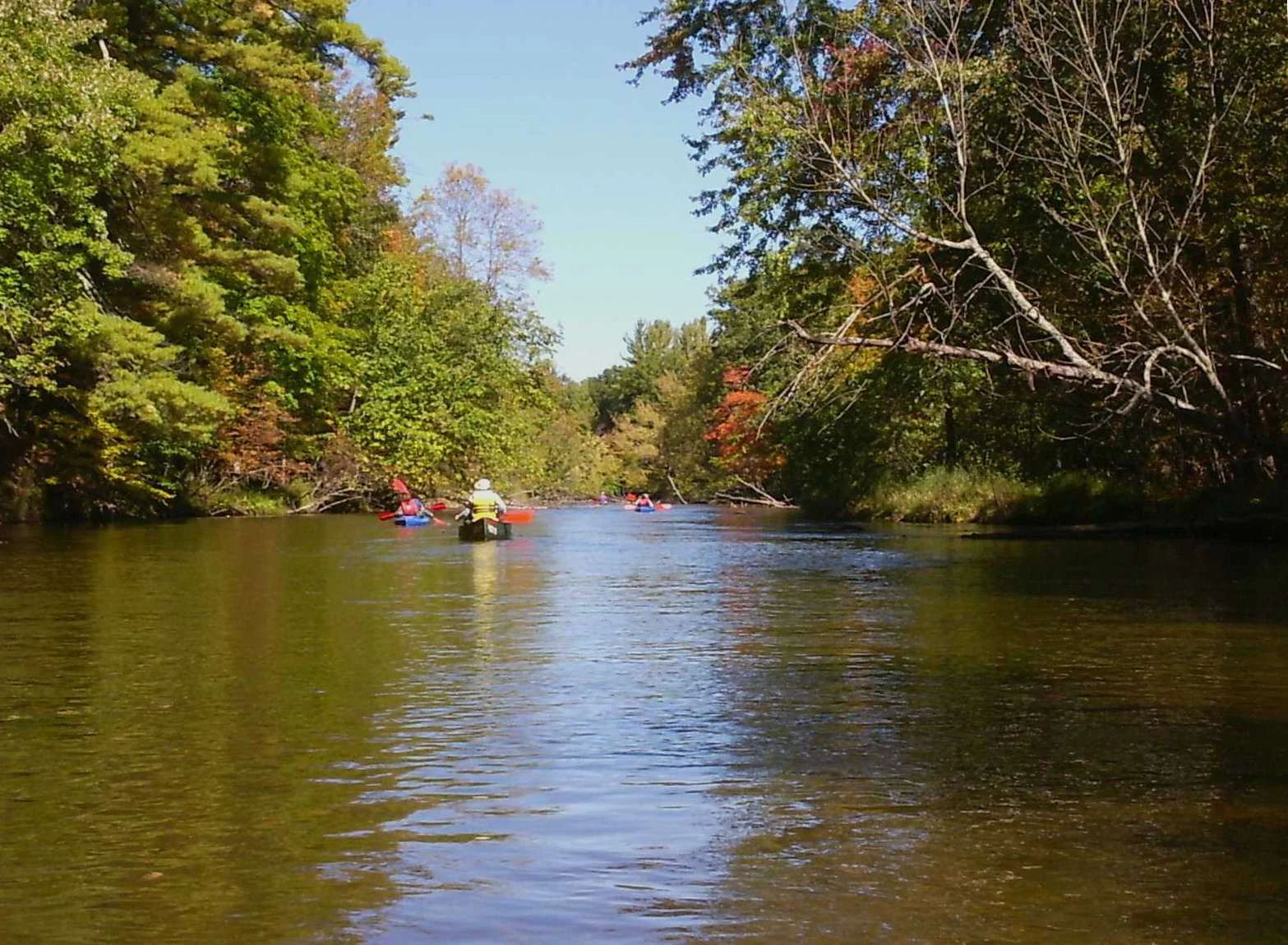
A view from the water level of a river flowing through a lush forest, with several people paddling in kayaks and canoes in the distance.
Kayakers paddling down the Pere Marquette River during the autumn season.

Huron-Manistee National Forests ecosystems, habitats, and plant life

Ecologically, the Huron-Manistee National Forests are defined by the interplay between pine-dominated and mixed hardwood-conifer communities. Sandy soils support extensive jack pine forests, particularly in the Huron unit, where jack barrens are intentionally maintained as nesting habitat for the Kirtland's warbler. Other sections feature oak-pine forest, dense hemlock stands, and transitional northern hardwood communities typical of the Great Lakes region.

The forests also include a significant wetland component. Across the nearly one-million-acre combined area, a few thousand acres of wetlands are formally recognized, but the broader network of marshes, small water holes, bogs, and riparian zones along the extensive river systems contributes substantially to the region's hydrological and ecological character. The Au Sable and Pere Marquette watersheds, in particular, support coldwater conditions important for trout and other sensitive aquatic species.

The dune ecosystem at Nordhouse Dunes forms another distinct ecological zone. There, juniper, jack pine, hemlock, dune grass, and small interdunal wetlands and pools combine into a habitat type that is rare in... [truncated]

Huron-Manistee National Forests wildlife and species highlights

The forests support a varied fauna typical of Michigan's northern Lower Peninsula, with both resident and migratory species using the rivers, lakes, wetlands, and forest types available across the landscape. Among the most notable species is the Kirtland's warbler, a threatened songbird whose nesting cycle is closely tied to dense young jack pine, a habitat condition that has shaped management of parts of the Huron National Forest for decades.

Federally listed species also include the bald eagle, Indiana bat, Karner blue butterfly, and Pitcher's thistle, the latter associated with open dune environments along the Great Lakes shoreline. The combination of mature forest, regenerating jack pine, wetlands, and dune habitat creates the structural diversity needed to support these species alongside more common woodland wildlife.

The extensive river network provides habitat for fish and other aquatic life, with the Pere Marquette and Au Sable recognized regionally for their fishing quality. Coldwater species drawn to these rivers, along with warmwater fish in the inland lakes, form a recurring focus of the forests... [truncated]

Huron-Manistee National Forests conservation status and protection priorities

The conservation significance of the Huron-Manistee National Forests lies in their role as one of the largest blocks of publicly protected forest in the northern Lower Peninsula of Michigan. Their combined extent, watershed coverage, and ecological diversity allow for the protection of multiple habitat types, from jack pine barrens and northern hardwood forest to Great Lakes dune ecosystems and coldwater rivers.

A defining element of their conservation profile is active management for the Kirtland's warbler. Maintaining dense, young jack pine stands as nesting habitat has influenced both forestry practice and fire ecology in the Huron unit, even as those same conditions are associated with elevated risk of crown fires and wildfire events that have periodically affected the forest, as illustrated by the 2010 Meridian Boundary Fire.

Inclusion of the Nordhouse Dunes Wilderness strengthens the forests' conservation standing by formally protecting one of the few wilderness areas in the United States with an extensive Lake Michigan dune ecosystem. Together with protections for federally listed species such as the... [truncated]

Huron-Manistee National Forests cultural meaning and human context

The cultural context of the Huron-Manistee National Forests is deeply rooted in the Great Lakes logging era. Large swaths of the forests were heavily logged in the nineteenth and early twentieth centuries and then abandoned as timber companies moved on, leaving behind cutover landscapes that were eventually reconstituted as national forests. The Lumberman's Monument, located near Oscoda in the eastern part of the forest, honors the workers of this early logging industry and remains a tangible reminder of the region's working-forest heritage.

Today, the forests support a continuing tradition of outdoor recreation in northern Michigan. Communities around Baldwin, Wellston, Cadillac, Mio, and Oscoda serve as gateways, and local ranger districts and visitor centers connect residents and visitors to the landscape. Events such as the Lumberjack 100, a 100-mile ultra-endurance mountain bike race held within the Manistee portion, reflect how the forests have evolved from an industrial timber base into a venue for endurance sport and backcountry recreation, while still supplying timber, minerals, and energy resources... [truncated]

Top sights and standout views in Huron-Manistee National Forests

Among the strongest standalone features of the Huron-Manistee National Forests are the Pere Marquette and Au Sable rivers, both nationally known for canoeing and trout fishing, and the more than 1,800 miles of rivers and 17,000 acres of lakes that together sustain one of the Midwest's most extensive inland paddling networks.

Equally distinctive are the Nordhouse Dunes Wilderness on the Lake Michigan shore, one of the few U.S. wilderness areas with an extensive lakeshore dune ecosystem, and the jack pine barrens of the Huron unit, where management for the Kirtland's warbler has shaped a unique fire-adapted forest landscape.

Best time to visit Huron-Manistee National Forests

Spring and early summer bring high water on rivers such as the Pere Marquette and Au Sable, making them well suited to canoeing and fishing, while warming temperatures open up inland lakes for boating and camping. Early mornings and evenings during this period are also good times to experience active wildlife along forest edges and waterways.

Late summer and early fall typically offer drier forest roads, comfortable hiking temperatures, and the beginning of color in hardwood stands. Winter transforms the forests into a snowmobile and cross-country skiing landscape, with frozen rivers, snow-covered dunes, and access to trail systems unavailable in other seasons.

Monthly climate preview

Long-term monthly temperature and precipitation data measured at a representative coordinate

Huron–Manistee National Forests Climate Normals and Temperature Rhythm

Representative coordinate records show average monthly temperatures ranging from sub-zero winter minimums to warm summer maximums alongside consistent annual precipitation distribution. Examining the complete twelve-month climatology profile provides detailed insight into long-term meteorological patterns across the landscape.
Annual mean7 °C
-7 °C20 °C
Jan-7°
Feb-6°
Mar-1°
Apr
May11°
Jun17°
Jul20°
Aug20°
Sep16°
Oct
Nov
Dec-3°
Warmest month
July

20.1 °C

Coolest month
January

-6.9 °C

Wettest month
June

2.8 mm/day

Driest month
February

1.4 mm/day

Park location guide

Geography guide, regional context, and park location map for Huron-Manistee National Forests

Huron-Manistee National Forests park geography, regions, and map view in United States of America

Understand where Huron-Manistee National Forests sits in United States of America through a broader geographic reading of the surrounding landscape, nearby location context, and its mapped position within the national park landscape.

How Huron-Manistee National Forests fits into United States of America

The United States of America is a federal presidential republic and one of the world's largest countries by area and population. It consists of 50 states across a vast territory spanning multiple time zones, with its capital in Washington, D.C. and largest city in New York City. The nation has a diverse economy, influential political system, and significant cultural and military presence globally.

Wider geography shaping Huron-Manistee National Forests in United States of America

The United States occupies a vast territory in North America, bordered by Canada to the north and Mexico to the south. The 48 contiguous states stretch from the Atlantic to the Pacific Ocean, while Alaska occupies the northwestern region and Hawaii is an archipelago in the Pacific. The country encompasses diverse terrain including the Rocky Mountains, Appalachian Mountains, Great Plains, and extensive river systems.

Map view of Huron-Manistee National Forests

Use this park location map to pinpoint Huron-Manistee National Forests in United States of America, understand its exact geographic position, and read its mapped placement within the surrounding landscape more clearly.

Pigeon | © OpenStreetMap contributors

Location context for Huron-Manistee National Forests

Michigan

Visual reference guide for terrain, river networks, and coastal dunes

Huron–Manistee National Forests Photos and Landscape Scenery

Visual documentation captures the diverse terrain, river networks, and Great Lakes coastal dunes defining Huron–Manistee National Forests. Examining protected area imagery provides deeper insight into pine barrens, forested moraines, and regional wildlife habitats.

A bronze statue featuring three lumberjacks standing around a log, set on a stone pedestal with an engraved inscription, surrounded by pine trees.

A peaceful lake view with tall reeds and grasses in the foreground, calm blue water in the midground, and a dense forest tree line against a partly cloudy sky in the background.

A view from the water level of a river flowing through a lush forest, with several people paddling in kayaks and canoes in the distance.

Park atlas

Compare regional geography, glacial terrain, and connected protected landscapes

Explore Parks Near Huron–Manistee National Forests and Surrounding Protected Lands

Continue geographic discovery by comparing Huron–Manistee National Forests with other protected natural areas across the surrounding region. Regional park comparisons reveal shared glacial topography, river networks, and diverse forest ecosystems.
Marine protected areaMichigan
About 54 km away#1 closest

Northeast

Thunder Bay National Marine Sanctuary: Geography and Protected Maritime Landscape Context

Mapping underwater heritage in the Michigan Great Lakes region

Spanning 4,300 square miles of Lake Huron, Thunder Bay National Marine Sanctuary preserves a significant collection of shipwrecks within a glacially shaped freshwater terrain. This marine protected area offers a look at submerged geography ranging from shallow coastal bays to deep lake basins. It serves as a vital anchor for understanding maritime history and freshwater ecosystem stability across the Michigan shoreline.

Area
11,000 km²
Established
2000
Relief
Lowland
Climate
Temperate
Marine protected areaMichigan
About 76 km away#2 closest

Northeast

Thunder Bay National Marine Sanctuary and Underwater Preserve: Geography and Protected Area Atlas

Maritime heritage sites and glacial freshwater geography in Lake Huron, Michigan.

Situated along the rugged northeastern coast of Lake Huron, Thunder Bay National Marine Sanctuary and Underwater Preserve protects over two hundred shipwreck sites spanning nearly two centuries of maritime history. This marine protected area offers a unique intersection of submerged archaeological resources, shallow shoals, coastal marshes, and limestone bedrock, forming a vital freshwater ecosystem in the Great Lakes region of Michigan.

Area
11,000 km²
Established
2000
Relief
Lowland
Climate
Temperate
A watercolor painting of a rolling, soft-toned landscape with a foreground of green forest and layers of hills receding into the distance.
Protected landscapeUpper Peninsula of Michigan
About 147 km away#3 closest

Northwest

Hiawatha National Forest: Geographic Overview and Protected Area Map of the Upper Peninsula

Coastal forest landscape and wilderness river corridors.

Hiawatha National Forest spans significant portions of the Upper Peninsula of Michigan, bridging the gap between northern hardwood forests and the boreal environments of the Great Lakes. This protected landscape encompasses extensive shorelines along Lake Superior, Lake Michigan, and Lake Huron, alongside six wilderness areas and five designated wild and scenic rivers.

Area
3,621.27 km²
Established
1931
IUCN
VI
Relief
Lowland
A watercolor painting showing a winding river flowing through a lush, green valley with rolling mountains in the distance.
Wildlife reserveUnited States of America
About 148 km away#4 closest

North

Round Island Wilderness: Geographic Overview of the Straits of Mackinac Wildlife Reserve

Coastal marsh, conifer forest, and hardwood interior terrain

Round Island Wilderness encompasses nearly all of a 378-acre island sanctuary, distinguished by its mature beech-maple hardwood interior and boreal-leaning conifer forests. This protected land remains an essential study of Great Lakes island ecology, standing as a quiet, undisturbed wilderness edge along the transit routes of the Michigan straits.

Area
1.53 km²
Relief
Lowland
Climate
Temperate
Access
Remote access
A soft watercolor painting showing green rolling hills, a calm body of water, and small clusters of pink flowers against a light, hazy background.
National parkMichigan
About 149 km away#5 closest

West

Sleeping Bear Dunes National Lakeshore: Atlas, Maps, and Protected Landscape Geography

Great Lakes freshwater coast and glacial dune systems

Sleeping Bear Dunes National Lakeshore showcases the unique intersection of glacial geology and freshwater ecology. This protected area features massive dunes resting on ancient glacial deposits, backed by beech and maple forests. The geographic scope includes the vast shoreline of Lake Michigan, inland waters such as Glen Lake, and the distinct maritime history found across the remote North and South Manitou Islands.

Area
288.13 km²
Established
1970
IUCN
III
Visitors
1.5M annual
Wildlife reserveMichigan
About 162 km away#6 closest

North

Horseshoe Bay Wilderness: A Detailed Geographic Overview of Michigan Protected Lands

Protected wetland habitat and Lake Huron coastal geography

Horseshoe Bay Wilderness represents a pristine 3,787-acre protected area located along the northwestern corner of Lake Huron in Michigan. Administered as part of the Hiawatha National Forest, this wilderness features an intricate post-glacial landscape of riparian wetlands, dense northern whitecedar stands, and quiet shallow waters that serve as vital spawning ground for local aquatic life.

Area
15.33 km²
Established
1987
IUCN
Ib
Relief
Lowland
Wildlife reserveMichigan
About 175 km away#7 closest

North

Mackinac Wilderness Protected Area: Glacial Terrain and River Geography in Upper Michigan

A roadless wilderness reserve within Hiawatha National Forest

Uncover the geographic significance of Mackinac Wilderness, an IUCN Category Ib protected area in Michigan. The unit provides a distinct look at northern forest recovery through a terrain of sandy ridges, aspen and birch cover, and aquatic corridors. This study examines the interplay between postglacial landforms and the ongoing natural succession occurring along the Carp River drainage basin.

Area
49.5 km²
IUCN
Ib
Relief
Lowland
Climate
Temperate
National parkOntario
About 199 km away#8 closest

East

Bruce Peninsula National Park: National Park Protected Landscape and Geographic Context in Ontario

Discover its mapped boundaries and regional landscape identity.

Bruce Peninsula National Park stands as a protected national park entity within Ontario, offering a distinct geographic profile. Its mapped boundaries and position within the regional atlas are crucial for understanding its landscape character. MoriAtlas facilitates exploration of the park's protected status and its contribution to the conservation landscape of Ontario.

Area
154 km²
Established
1987
IUCN
II
Visitors
460.4K annual

Common questions about visiting, size, designation, and location context for Huron-Manistee National Forests

Huron-Manistee National Forests FAQs for park facts, access, geography, and protected area context

Find quick answers about Huron-Manistee National Forests, including protected-area facts, park geography, trail and visitor context, and how the park fits into its surrounding country and regional landscape.
MoriAtlas Explorer

Continue Your Protected Areas Search Across the Global Atlas

Deepen your exploration by continuing the structured search for national parks and protected areas worldwide. Utilize the comprehensive filtering capabilities to compare different conservation landscapes and refine your understanding of global park geography. Discover more about the distribution and characteristics of protected natural areas.

Global natural geography


