Mori Atlas logo
Protected areaHuston Park Wilderness

Mapping the geographic character, coniferous forest, and rugged alpine terrain of this protected wilderness area.

Huston Park Wilderness: A Defined Protected Mountain Landscape in the Wyoming Rocky Mountains

Huston Park Wilderness encompasses 30,000 acres of untouched central Rocky Mountain terrain within Wyoming. This protected area preserves a vital stretch of high elevation coniferous forest and alpine ridges, remaining free from modern infrastructure or road development. The geography features a continuous, intact natural system that showcases the subalpine characteristics and mountainous character typical of the southern Medicine Bow region.

Wilderness areaRocky MountainsMountain forestConiferous forestSubalpine environmentMedicine Bow National Forest

Huston Park Wilderness

Protected area

Park overview

Structured park overview, official facts, and landscape profile for Huston Park Wilderness

Huston Park Wilderness park facts, protected area profile, and essential visitor context

Review the core facts for Huston Park Wilderness, including designation, size, terrain, visitor scale, habitats, and operating context in one park-focused overview.

About Huston Park Wilderness

Huston Park Wilderness occupies a substantial block of mountainous country in south central Wyoming, fully enclosed within the Medicine Bow National Forest. It sits in Carbon County, the same broad region that frames the southern Rocky Mountains' transition into Wyoming's high country. Laramie, the nearest significant city, gives visitors a familiar access point to the wilderness's southern front, while the surrounding national forest provides a vast buffer of similarly protected terrain.

The wilderness preserves what is in many ways a textbook version of a Rocky Mountain wilderness. High peaks, forested ridges, and conifer-dominated slopes define the area. Coniferous forest stretches across much of the landscape, punctuated by the typical clearings, alpine meadows, and natural openings that come with elevation changes characteristic of the central Rockies. The character of the land is shaped by snow, cold winters, and a remote, lightly populated setting, which together make the area feel notably distant from the more visited landscapes of the American West.

Designated in 1984, Huston Park is one of several wilderness areas that emerged from a broader push to formally protect America's most ecologically intact wildlands during the 1980s. Management of the area falls to the U.S. Forest Service, following the strict, non-motorized, non-mechanized principles of the Wilderness Act of 1964. These rules govern every aspect of visitor use: no roads are built, no structures erected, and no resource extraction such as logging or mining is permitted. Activities like camping, fishing, and seasonal hunting remain allowed under permit, in keeping with standard Forest Service wilderness policy.

What distinguishes Huston Park from many other wilderness areas is its role in anchoring the wildlife and scenic value of the southern Medicine Bow landscape. Within the wider context of Wyoming's national forest system, it functions as a preserved core area, ensuring that a meaningful slice of central Rocky Mountain terrain remains in its natural state for future generations.

Quick facts and research context for Huston Park Wilderness

Huston Park Wilderness lies in Carbon County, Wyoming, near the city of Laramie. It is entirely contained within the Medicine Bow National Forest and is administered by the U.S. Forest Service. The area was officially designated as wilderness in 1984 under the framework of the 1964 Wilderness Act.

The wilderness covers about 30,588 acres. It is classified as an IUCN Category Ib protected area, reflecting its status as a strictly preserved wilderness. No motorized or mechanized use, roads, permanent structures, logging, or mining are permitted within its boundaries, preserving the landscape in its predominantly natural state.

Protection and recognition

Documented terrestrial protection scope, 1984 designation year, and management context

Huston Park Wilderness Protection Status And International Recognition Records

Exploration of Huston Park Wilderness protection status brings together official terrestrial designation records established in 1984. Structured facts outline the recorded management scope without importing external conservation assumptions or unverified international programs.

Protection details

Protection scope
Terrestrial
Designated year
1984
Transboundary protection
No
Park context

Deeper park guide and search-rich context for Huston Park Wilderness

Huston Park Wilderness history, landscape, wildlife, and travel context

Explore Huston Park Wilderness through its history, landscape character, ecosystems, wildlife, conservation priorities, cultural context, and seasonal travel timing in a structured park guide built for atlas discovery and search intent.

Why Huston Park Wilderness stands out

Huston Park Wilderness is known for protecting a northern segment of the central Rocky Mountains within the Medicine Bow National Forest. Its defining qualities are high elevation coniferous forest, alpine ridges, and an absence of modern infrastructure, making it an example of classic American mountain wilderness. The wilderness draws recognition from those interested in the conservation of Rocky Mountain ecosystems, particularly the coniferous and subalpine environments that characterize southern Wyoming's high country. Its proximity to the greater Medicine Bow landscape connects it to a broader network of forested and mountainous protected terrain.

Huston Park Wilderness history and protected-area timeline

Huston Park Wilderness has its administrative origins in the broader history of the Medicine Bow National Forest, which has long served as one of southern Wyoming's principal federal forest reserves. The land that now forms the wilderness was, for decades prior to formal designation, managed by the U.S. Forest Service under conventional national forest rules that permitted varying degrees of resource use and development.

The pivotal moment in the wilderness's history came with enactment of the 1964 Wilderness Act, which established the legal framework under which areas of national forest land could be preserved in a strictly natural state. Although Huston Park itself would not be designated as wilderness for another two decades, this act laid the conceptual and legal foundation that made such protections possible.

Huston Park Wilderness was officially designated in 1984, joining a wave of wilderness areas created across the American West during that era. The designation formalized protection for roughly 30,000 acres of high country within the Medicine Bow National Forest, removing the land from the pool of areas open to road building, logging, and mechanized use. Since that time, the wilderness has been managed under the standard provisions applicable to U.S. wilderness areas within national forests: motorized and mechanized vehicles including bicycles are prohibited, camping and fishing are permitted with appropriate permits, and seasonal hunting is allowed in accordance with state and federal regulations.

Huston Park Wilderness landscape and geographic character

The landscape of Huston Park Wilderness is unmistakably that of the central Rocky Mountains in their northern Wyoming expression. High mountain peaks and ridges anchor the wilderness, with elevation sufficient to shape the vegetation, climate, and overall character of the terrain. Coniferous forest dominates much of the area, cloaking slopes and valleys in the dense green texture typical of montane and subalpine Rocky Mountain environments.

The terrain is shaped by the same forces that have defined the Medicine Bow Mountains more broadly: long winters, deep snowpack, and the slow erosional work of weather on exposed ridgelines. Openings and natural gaps in the forest canopy where elevation or slope change relieves tree growth give the landscape a layered structure, alternating between dense woodland and more exposed ground. The result is a wilderness that visually combines the enclosed feel of the forest with the openness associated with mountain country.

Without roads, permanent structures, or mechanical modifications, the landscape retains its raw form. Drainage lines, rocky ridges, and forested valleys read as continuous natural systems, undisturbed by the visible signatures of modern development. This intactness is one of the defining landscape features of the wilderness and reinforces its character as a preserved stretch of Rocky Mountain wilderness.

Huston Park Wilderness ecosystems, habitats, and plant life

Huston Park Wilderness protects a representative section of the Rocky Mountain ecological zone that characterizes south central Wyoming. The dominant ecosystem is montane to subalpine coniferous forest, with tree species and vegetation patterns typical of the Medicine Bow Mountains at these elevations. The forest setting is shaped by cold winters, deep snowpack, and a relatively short growing season, conditions that govern the types of vegetation able to thrive at higher elevations.

Because the wilderness lies fully within the Medicine Bow National Forest, it functions as a preserved ecological core within a much larger forested landscape. This positioning is ecologically meaningful, as core wilderness areas like Huston Park help maintain habitat continuity, watershed function, and natural disturbances regimes across the broader forested region.

Wilderness designation in this setting ensures that ecological processes, including tree regeneration following natural events like fire or windthrow, proceed largely without human intervention. The result is an ecological environment that reflects the historical ecological character of southern Wyoming's high country rather than a managed or modified version of it.

Huston Park Wilderness wildlife and species highlights

Wildlife in Huston Park Wilderness reflects the broader fauna of the Medicine Bow Mountains and south central Wyoming's montane forests. The combination of dense coniferous forest cover, alpine openings, and elevation-driven habitat diversity supports animal communities typical of central Rocky Mountain wilderness areas. Habitat conditions favor species adapted to forested mountainous terrain, with cold winters and seasonal snowpack influencing seasonal behavior and distribution.

Although the wilderness has no motorized access and no permanent human infrastructure, it remains ecologically connected to the surrounding Medicine Bow landscape. This connectivity allows wildlife to move between the wilderness core and the broader national forest, supporting population viability and natural ecological processes typical of large, intact western wilderness areas.

Huston Park Wilderness conservation status and protection priorities

The conservation significance of Huston Park Wilderness rests on its role in formally preserving an ecologically intact and representative segment of the central Rocky Mountains in southern Wyoming. By placing roughly 30,000 acres under the strict protections of the 1964 Wilderness Act, the 1984 designation ensured that this mountain landscape would remain free of roads, permanent structures, logging, mining, and motorized or mechanized access.

As a Category Ib protected area, Huston Park embodies the highest level of wilderness preservation applied within the U.S. National Forest System. Its location entirely within the Medicine Bow National Forest positions it as a key conservation anchor within a much larger network of federally managed lands, helping to maintain ecological continuity across south central Wyoming.

Beyond the protection of habitat and scenery, the wilderness contributes to watershed function, air quality, and the long-term resilience of southern Wyoming's mountain ecosystems. Its preservation supports the broader conservation goal of maintaining ecologically functional wildlands in a region where much of the surrounding territory continues to experience active land use.

Huston Park Wilderness cultural meaning and human context

Huston Park Wilderness does not have a widely documented built heritage or settlement history within its boundaries. The area is remote and high elevation, and there are no permanent structures associated with the wilderness itself. Its cultural context is therefore largely tied to the broader identity of the Medicine Bow National Forest and the long-running tradition of federal wilderness stewardship in the American West.

The naming of the wilderness reflects local geographic identity, a common practice in the western United States where natural areas often carry names derived from regional landmarks, historical figures, or longstanding local usage. Beyond this naming connection, the wilderness serves as a place of recreation and quiet enjoyment for those who visit the southern Medicine Bow landscape, particularly hikers, anglers, and hunters operating within the regulatory framework established for U.S. wilderness areas.

Top sights and standout views in Huston Park Wilderness

Huston Park Wilderness offers a compact but genuinely representative slice of the central Rocky Mountains in their northern Wyoming setting. High peaks and forested ridges define the wilderness's character, and the unbroken coniferous forest cover gives it a strong sense of ecological continuity.

Its strict wilderness protections distinguish it from the surrounding national forest land, where some forms of development and resource use may occur. As a result, Huston Park offers an experience of the Medicine Bow landscape in a form that closely matches its historical ecological character, free of roads and mechanical disturbance.

Best time to visit Huston Park Wilderness

The character of a visit to Huston Park Wilderness varies meaningfully across seasons, in keeping with the high country climate of southern Wyoming. Summer and early autumn are typically the most accessible and most rewarding periods for non-motorized travel in the wilderness, when snow has melted from lower elevations, trails are at their most passable, and weather is generally more stable. These months also bring out the green character of the coniferous forest and the openness of alpine terrain.

Winter and early spring visit conditions differ substantially. Heavy snowpack, cold temperatures, and limited daylight make travel through the wilderness considerably more demanding, and access to higher terrain is typically limited to those equipped and experienced for winter mountain travel. Seasonal hunting periods in autumn can bring additional users into the area, in keeping with the hunting opportunities provided within national forest wilderness areas.
Monthly climate preview

Trace long-term representative temperature ranges and monthly precipitation patterns across Wyoming terrain

Huston Park Wilderness Climate Normals, Annual Temperature, and Monthly Precipitation

Representative coordinate records for Huston Park Wilderness outline a measured annual progression of average temperatures and monthly precipitation values from NASA climatology data. Reviewing the complete twelve-month statistical profile clarifies long-term thermal rhythms and moisture distribution patterns for this protected area.
Annual mean2 °C
-11 °C17 °C
Jan-11°
Feb-10°
Mar-5°
Apr
May
Jun12°
Jul17°
Aug15°
Sep10°
Oct
Nov-5°
Dec-10°
Warmest month
July

16.7 °C

Coolest month
January

-10.7 °C

Wettest month
April

2.4 mm/day

Driest month
July

1.1 mm/day

Park location guide

Geography guide, regional context, and park location map for Huston Park Wilderness

Huston Park Wilderness park geography, regions, and map view in United States of America

Understand where Huston Park Wilderness sits in United States of America through a broader geographic reading of the surrounding landscape, nearby location context, and its mapped position within the national park landscape.

How Huston Park Wilderness fits into United States of America

The United States of America is a federal presidential republic and one of the world's largest countries by area and population. It consists of 50 states across a vast territory spanning multiple time zones, with its capital in Washington, D.C. and largest city in New York City. The nation has a diverse economy, influential political system, and significant cultural and military presence globally.

Wider geography shaping Huston Park Wilderness in United States of America

The United States occupies a vast territory in North America, bordered by Canada to the north and Mexico to the south. The 48 contiguous states stretch from the Atlantic to the Pacific Ocean, while Alaska occupies the northwestern region and Hawaii is an archipelago in the Pacific. The country encompasses diverse terrain including the Rocky Mountains, Appalachian Mountains, Great Plains, and extensive river systems.

Map view of Huston Park Wilderness

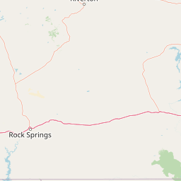
Use this park location map to pinpoint Huston Park Wilderness in United States of America, understand its exact geographic position, and read its mapped placement within the surrounding landscape more clearly.

Pigeon | © OpenStreetMap contributors

Location context for Huston Park Wilderness

Wyoming
Recorded earthquake history

Explore the Historical Earthquake Catalogue for Huston Park Wilderness

Investigate the recorded seismic history associated with the high mountain terrain of Huston Park Wilderness. MoriAtlas provides a clear, data-driven view of past geological events in the Medicine Bow National Forest to support your geographic and landscape research.

Huston Park Wilderness Earthquake History

Catalogued events

15 events

Strongest magnitude

Magnitude 3.8

Most recent event

Sep 14, 2024

This history includes earthquakes recorded inside the park or within 50 km of its borders

Park atlas

Compare surrounding mountain terrain and connected regional conservation areas

Explore Parks Near Huston Park Wilderness and Related Protected Landscapes

Browse other parks near Huston Park Wilderness to examine similar coniferous forests, high elevation ridges, and unbroken subalpine environments across the region. Extending the geographic comparison reveals broader patterns within the central Rocky Mountain ecosystem and adjacent protected lands.
Wildlife reserveWyoming
2.2 km away#1 closest

East

Encampment River Wilderness: Protected River Canyon Geography and Mapped Terrain

A focused wilderness landscape in the Medicine Bow National Forest

The Encampment River Wilderness preserves a unique, roadless canyon corridor in south central Wyoming. By protecting the river drainage, it maintains a critical forest ecosystem defined by steep slopes and riparian habitats within the broader Medicine Bow National Forest mountain range.

Area
40.97 km²
Established
1984
IUCN
Ib
Relief
Mountain
A watercolor illustration of a mountain range with soft, pastel-colored peaks in the background and a green treeline in the foreground.
Wildlife reserveColorado
8.6 km away#2 closest

Southeast

Mount Zirkel Wilderness: Protected Mountain Geography and Forested Landscape Overview

A study of high elevation terrain in the Colorado Rocky Mountains.

Mount Zirkel Wilderness stands as a primary protected area within the Colorado Rocky Mountains. The landscape is defined by the Encampment River headwaters, glaciated alpine basins, and the characteristic ribbon forests formed by extreme snowfall. This analysis explores the metamorphic bedrock and forest composition across the high ridges near the Continental Divide, providing a clear view of the park boundaries and regional environmental features.

Area
647.23 km²
Established
1980
IUCN
Ib
Relief
Mountain
A horizontal watercolor painting depicting a winding river flowing through a green valley with purple-tinted mountain ranges in the background.
Wildlife reserveWyoming
35 km away#3 closest

East

Platte River Wilderness: Geography and Protected Landscape Atlas

Mapping wild river corridors and mountain forest terrain across Wyoming and Colorado.

Platte River Wilderness preserves a vital stretch of the North Platte River, carving through mountain ranges with steep canyon walls and rocky gorges. The terrain offers a distinct profile of conifer forests and shifting river landscapes. This protected area stands as a primary example of wilderness administration, managing complex river-based topography and regenerating mountain habitat for regional wildlife populations.

Area
95.07 km²
Established
1984
IUCN
Ib
Relief
Mountain
A horizontal watercolor painting showing a range of purple and reddish-toned mountains in the distance, behind rolling green fields and a pale pinkish waterway in the foreground.
Protected landscapeColorado
56 km away#4 closest

East

Roosevelt National Forest: Mapping Wilderness and Protected Landscapes in Northern Colorado

Regional geography, river corridors, and alpine mountain terrain

Roosevelt National Forest encompasses a significant protected landscape across Larimer, Boulder, Gilpin, and Jefferson counties. The forest features a complex terrain of deep canyons, forested plateaus, and protected wilderness areas that form a scenic buffer along the eastern side of the Continental Divide and Rocky Mountain National Park.

Area
3,293.33 km²
Established
1902
Relief
Mountain
Climate
Subpolar
A horizontal watercolor painting showing a soft mountain range in the distance, a midground forest, and a foreground area suggesting marshy ground or a meadow.
Wildlife reserveColorado
101 km away#5 closest

Southeast

Never Summer Wilderness: Protected Mountain Geography and Alpine Terrain in Colorado

High-altitude wilderness along the Continental Divide

Spanning over 21,000 acres, the Never Summer Wilderness defines a critical segment of the Colorado Rockies. This protected area features a jagged skyline of 12,000-foot summits, extensive alpine tundra, and the remarkable old-growth spruce and fir forests of Bowen Gulch. Use these maps to understand its role as a vital headwater landscape and its position as a sanctuary for alpine wildlife and ecosystems.

Area
85.3 km²
Established
1980
IUCN
Ib
Relief
Mountain
National parkColorado
104 km away#6 closest

Southeast

Rocky Mountain National Park: National Park Protected Landscape in Colorado

Explore its mapped boundaries and regional geographic context.

Rocky Mountain National Park is a designated National Park within Colorado, crucial for understanding the distribution and geographic context of protected areas in the United States. This detail page provides an atlas-oriented perspective, emphasizing the park's mapped boundaries and its place within the natural landscape of the region. It is designed to facilitate a clear understanding of the park's protected status and its contribution to the atlas of natural landscapes, offering factual insights for geographic discovery.

Area
1,074.28 km²
Established
1915
IUCN
II
Visitors
4.2M annual
Protected landscapeGrand County
121 km away#7 closest

Southeast

Arapaho National Recreation Area: Geographic Profile and Protected Landscape Context

High-country mountain reservoirs and forested mountain terrain

The Arapaho National Recreation Area defines a unique intersection of montane forest and water-based geography in Grand County, Colorado. As the home to the Great Lakes of Colorado, this protected landscape provides a critical connection point between the Colorado River headwaters and the Continental Divide. Examine the park's terrain, reservoir distribution, and its role as a forested gateway to the neighboring mountain regions.

Area
124.2 km²
Established
1978
Relief
Mountain
Climate
Alpine
A soft watercolor illustration featuring rolling, flat-topped mountains in the background and a dense line of coniferous trees across the foreground.
Protected areaUnited States of America
About 125 km away#8 closest

South

Flat Tops Wilderness: Protected Geographic Landscapes of the Colorado Rockies

High-altitude volcanic plateaus and glaciated terrain

Spanning 235,000 acres, Flat Tops Wilderness stands out as a foundational protected area in Colorado. Its unique basalt cap, carved by glacial activity into an array of high-country lakes and distinctive ridges like the Devils Causeway, creates a rare geographic profile. This overview details the structural features and regional terrain that distinguish this wilderness from the surrounding Rocky Mountain summits.

Area
951.88 km²
Established
1975
Relief
Mountain
Climate
Alpine

Common questions about visiting, size, designation, and location context for Huston Park Wilderness

Huston Park Wilderness FAQs for park facts, access, geography, and protected area context

Find quick answers about Huston Park Wilderness, including protected-area facts, park geography, trail and visitor context, and how the park fits into its surrounding country and regional landscape.
MoriAtlas Explorer

Continue Your Protected Areas Search Across the Global Atlas

Deepen your exploration by continuing the structured search for national parks and protected areas worldwide. Utilize the comprehensive filtering capabilities to compare different conservation landscapes and refine your understanding of global park geography. Discover more about the distribution and characteristics of protected natural areas.

Global natural geography