Mori Atlas logo
Wildlife reserveIndian Pass Wilderness

Tracing the dramatic transition from the Chocolate Mountains to the Colorado River Valley

Indian Pass Wilderness: A Protected Sonoran Desert Landscape in Southern California

Indian Pass Wilderness protects a rugged stretch of Sonoran Desert terrain within the southern Chocolate Mountains of California. This protected area features a complex landscape of steep, bouldery slopes, gravelly washes like Julian Wash, and a critical ecological transition zone descending toward the Lower Colorado River Valley. Users can examine the park boundaries and the geographic relationship between these arid mountain uplands and the river-edge riparian habitat that anchors this expansive wilderness.

wilderness areaSonoran DesertChocolate MountainsColorado River corridorBLM landarid mountain landscape

Indian Pass Wilderness

Wildlife reserve

Park overview

Structured park overview, official facts, and landscape profile for Indian Pass Wilderness

Indian Pass Wilderness park facts, protected area profile, and essential visitor context

Review the core facts for Indian Pass Wilderness, including designation, size, terrain, visitor scale, habitats, and operating context in one park-focused overview.

About Indian Pass Wilderness

Indian Pass Wilderness occupies a remote and rugged corner of southeastern California, where the Chocolate Mountains descend toward the Colorado River in the far southeast of the state. The area lies in Imperial County, near the Arizona border and just across the river from Yuma, giving it a distinctly cross-border, river-canyon character. Established in 1994 and managed by the Bureau of Land Management, the wilderness ranks as a Category Ib protected area under the IUCN system, which signals its status as a landscape maintained in a wild state rather than a more intensively managed recreational or multiple-use reserve.

The terrain of the wilderness is defined by the southern Chocolate Mountains, a long arid range that runs north along the California side of the Colorado River. Within Indian Pass, elevations climb to Quartz Peak at 2,126 feet, the highest point in the area, while the broader landscape slopes east through broad washes and steep drainages toward the Colorado River. Julian Wash, which runs roughly east through the center of the wilderness, gives its name to the so-called Julian Wash Country, a region recognized for its deeply cut desert drainage systems and its interplay between mountain ridges and river-edge flats.

Beyond its physical geography, the wilderness is significant for its location within a larger network of protected desert landscapes. It borders the Imperial National Wildlife Refuge to the east, a refuge designed around the river and its backwaters, and connects to the Picacho Peak Wilderness on its southern edge. Together, these areas form a continuous stretch of protected Sonoran Desert and river-edge habitat that preserves wildlife movement, hydrological functions, and a sense of solitude that is increasingly rare in the lower Colorado region.

Quick facts and research context for Indian Pass Wilderness

Indian Pass Wilderness is a 32,418-acre BLM wilderness in Imperial County, California, established in 1994 and rated IUCN Category Ib (wilderness area). It lies within the southern Chocolate Mountains, near the Colorado River and across the border from Yuma, Arizona. Quartz Peak, the area's high point, reaches 2,126 feet, and Julian Wash cuts through the center of the wilderness. The wilderness connects ecologically with the adjacent Imperial National Wildlife Refuge and Picacho Peak Wilderness, forming part of a larger desert and river corridor in southeastern California.

Protection and recognition

Documented terrestrial conservation scope and official designation records

Indian Pass Wilderness Protection Status and International Recognition

Indian Pass Wilderness maintains a documented terrestrial protection scope within the federal protected area network. Official records organize administrative boundaries and conservation classifications for structured geographic analysis.

Protection details

Protection scope
Terrestrial
Transboundary protection
No
Park context

Deeper park guide and search-rich context for Indian Pass Wilderness

Indian Pass Wilderness history, landscape, wildlife, and travel context

Explore Indian Pass Wilderness through its history, landscape character, ecosystems, wildlife, conservation priorities, cultural context, and seasonal travel timing in a structured park guide built for atlas discovery and search intent.

Why Indian Pass Wilderness stands out

The wilderness is best known for its position along the Colorado River corridor, where the rugged southern Chocolate Mountains drop down toward one of the most important desert river systems in North America. It protects a steep transition between desert mountain habitat and the riparian edge of the Lower Colorado River Valley through washes such as Julian Wash and the rugged slopes around Quartz Peak. The area is also recognized as habitat for desert bighorn sheep, Colorado River toads, and free-roaming wild burros, three species strongly tied to Sonoran Desert and river-edge environments.

Indian Pass Wilderness history and protected-area timeline

Indian Pass Wilderness is a comparatively modern designation within the U.S. federal wilderness system, established in 1994 after years of broader legislative effort to set aside large blocks of BLM-managed desert land in southeastern California. Its creation placed the southern Chocolate Mountains, already surrounded by other protected landscapes, into a more formal framework of long-term wilderness protection.

The wilderness has historically functioned as part of a broader working landscape that included grazing, mining, and limited off-road activity, much of which was wound down or restricted as the wilderness designation took hold. With its 1994 establishment came the protections typical of BLM wilderness: restrictions on mechanized travel, new limits on development, and stronger recognition of its value for wildlife habitat and ecological connectivity. Its later inclusion in landscape-scale conservation planning reflects an ongoing shift from treating this stretch of the Colorado River corridor as simply undeveloped public land to viewing it as an integral part of one of the most ecologically important desert regions in the American Southwest.

Indian Pass Wilderness landscape and geographic character

The landscape of Indian Pass Wilderness is shaped by the southern segment of the Chocolate Mountains and the long, gradual descent from those mountains toward the Colorado River. The terrain is classic Basin and Range desert country: long ridges separated by broad washes, with steep, bouldery slopes climbing toward local summits and gentler terrain opening eastward into the Lower Colorado River Valley.

Quartz Peak, at 2,126 feet, anchors the western side of the wilderness and gives a sense of the relative relief of the area; even though the elevations are modest by mountain standards, they rise sharply from the surrounding desert flats and produce dramatic views, rugged climbs, and sheltered canyon microhabitats. Julian Wash runs through the heart of the wilderness, draining east toward the Colorado River; the broad, gravelly character of this and adjacent washes defines much of the visually dominant scenery of the area, and it is the wash country that gives the central portion of the wilderness its identity.

Toward the east, the mountains step down toward the river's edge, where bluffs, terraces, and canyon mouths create a transitional zone between upland desert and the riparian corridor. This juxtaposition of steep, sun-baked mountain slopes and the deeply carved drainage of Julian Wash produces the distinctive sense of place that defines the wilderness: a working desert landscape of stone, sand, and sparse vegetation, edged by the quiet ecological influence of the Colorado River.

Indian Pass Wilderness ecosystems, habitats, and plant life

Ecologically, Indian Pass Wilderness sits in the lower western reaches of the Sonoran Desert, with vegetation and habitat patterns typical of hot, arid mountain-and-river terrain. The slopes and ridges support creosote bush and other drought-adapted desert scrub, while the washes, with their deeper soils and occasional water flow, host denser belts of desert wash vegetation. The proximity of the Colorado River introduces a strong riparian influence even into the drier uplands, especially along the eastern edge of the wilderness.

This combination of arid uplands, broad desert washes, and river-edge slopes gives the wilderness a layered ecological structure. Higher rocky slopes and ridges provide cover for climbing and escaping species, while the broader washes serve as natural travel corridors for both wildlife and, historically, water flow during desert storms. The river itself adds a critical third layer, a permanent source of water and dense vegetation that stands in sharp contrast to the open desert above.

Because the wilderness borders the Imperial National Wildlife Refuge and connects ecologically with Picacho Peak Wilderness, its ecological value extends well beyond its own boundaries. It contributes to a long, protected ribbon of desert and river-edge habitat along the lower Colorado, helping maintain ecological functions such as wildlife movement, seed dispersal, and watershed connectivity in an otherwise heavily altered regional landscape.

Indian Pass Wilderness wildlife and species highlights

The wildlife profile of Indian Pass Wilderness reflects the overlap of Sonoran Desert uplands with the Colorado River corridor. Desert bighorn sheep use the rugged slopes of the Chocolate Mountains, where cliffs, ridges, and bouldery terrain offer both escape terrain and the visibility they need to thrive. Their presence is a strong indicator of the wilderness's value as a refuge for wide-ranging native desert species that depend on large, relatively undisturbed terrain.

The Colorado River toad, one of the more iconic amphibians of the Southwest, is associated with the area because of its broader range along the lower Colorado and adjacent uplands; the species depends on seasonal rainfall and water availability that the washes and river-edge habitats within and around the wilderness can provide. Wild burros, descended from animals with a long history in the region, roam the area as well, adding to the visible large-mammal character of the wilderness.

Beyond these headline species, the combination of mountain, wash, and river-edge habitats supports typical desert fauna including mule deer, coyotes, bobcats, javelina, a wide variety of reptiles, and raptor species such as hawks and eagles that hunt the open desert terrain. The eastern edge of the wilderness, closest to the river, is particularly rich for birds, as the riparian habitat of the Colorado and the Imperial National Wildlife Refuge draws migratory and resident birdlife that ranges into adjacent desert environments.

Indian Pass Wilderness conservation status and protection priorities

Indian Pass Wilderness plays an important conservation role as one of a chain of protected landscapes that line the lower Colorado River. By placing the southern Chocolate Mountains under formal wilderness protections, the BLM has helped ensure that a sizeable stretch of Sonoran Desert mountain habitat remains free from large-scale development, mining expansion, and mechanical disturbance. The wilderness designation also limits road building and vehicle use, which over time reduces habitat fragmentation and protects sensitive desert surfaces.

Its alignment with the Imperial National Wildlife Refuge to the east and with Picacho Peak Wilderness to the south gives the area an outsized conservation value relative to its size. Together, these designations help maintain a continuous corridor of desert and river habitat along one of the most heavily altered river systems in the western United States. This corridor provides space for large-ranging species such as desert bighorn sheep and supports the ecological processes, including seasonal wildlife movement and watershed function, that link uplands to the river itself.

The wilderness also holds conservation significance because it preserves habitat for native Sonoran Desert flora and fauna in a region where human pressures, including agricultural development, energy infrastructure, and rapid urbanization in adjacent parts of California, Arizona, and Mexico, have dramatically reshaped the surrounding landscape. By keeping this stretch of the Chocolate Mountains and its washes in a wild state, the wilderness helps safeguard one of the last relatively intact desert ecosystems along the California side of the lower Colorado.

Top sights and standout views in Indian Pass Wilderness

Standout features of Indian Pass Wilderness include Quartz Peak, the area's high point at 2,126 feet, and the dramatic descent from the Chocolate Mountains down through Julian Wash to the Colorado River. The wilderness is notable for its direct ecological connection to the Imperial National Wildlife Refuge along the river and to Picacho Peak Wilderness to the south, anchoring a continuous stretch of protected Sonoran Desert landscape. Wildlife sightings of desert bighorn sheep, Colorado River toads, and wild burros, along with a strong raptor presence along the cliffs and washes, give the wilderness a recognizable and distinctive wilderness character within California's protected-area system.

Best time to visit Indian Pass Wilderness

The cooler months from late fall through early spring are generally the most comfortable season to experience Indian Pass Wilderness, when daytime desert temperatures are milder and wildlife activity around water sources tends to be more concentrated and visible. Winter and early spring also highlight the structure of the landscape itself, when cooler air makes the layered views from Quartz Peak and along Julian Wash especially clear. Summer brings intense heat characteristic of the lower Colorado Desert and makes strenuous exploration of the rugged mountain terrain significantly more demanding.
Monthly climate preview

Long-term representative temperature and precipitation averages by month

Indian Pass Wilderness Climate Normals and Annual Weather Patterns

Indian Pass Wilderness experiences significant monthly temperature variations alongside consistently low precipitation levels across the representative coordinate. Examining the full twelve-month climate profile reveals precise long-term averages for average minimum and maximum temperatures throughout the year.
Annual mean23 °C
12 °C34 °C
Jan12°
Feb14°
Mar17°
Apr21°
May25°
Jun30°
Jul34°
Aug34°
Sep31°
Oct24°
Nov17°
Dec12°
Warmest month
August

33.9 °C

Coolest month
December

11.7 °C

Wettest month
February

0.5 mm/day

Driest month
June

0 mm/day

Park location guide

Geography guide, regional context, and park location map for Indian Pass Wilderness

Indian Pass Wilderness park geography, regions, and map view in United States of America

Understand where Indian Pass Wilderness sits in United States of America through a broader geographic reading of the surrounding landscape, nearby location context, and its mapped position within the national park landscape.

How Indian Pass Wilderness fits into United States of America

The United States of America is a federal presidential republic and one of the world's largest countries by area and population. It consists of 50 states across a vast territory spanning multiple time zones, with its capital in Washington, D.C. and largest city in New York City. The nation has a diverse economy, influential political system, and significant cultural and military presence globally.

Wider geography shaping Indian Pass Wilderness in United States of America

The United States occupies a vast territory in North America, bordered by Canada to the north and Mexico to the south. The 48 contiguous states stretch from the Atlantic to the Pacific Ocean, while Alaska occupies the northwestern region and Hawaii is an archipelago in the Pacific. The country encompasses diverse terrain including the Rocky Mountains, Appalachian Mountains, Great Plains, and extensive river systems.

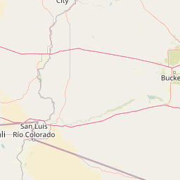
Map view of Indian Pass Wilderness

Use this park location map to pinpoint Indian Pass Wilderness in United States of America, understand its exact geographic position, and read its mapped placement within the surrounding landscape more clearly.

Pigeon | © OpenStreetMap contributors

Location context for Indian Pass Wilderness

California
Park atlas

Compare nearby protected areas and connected Sonoran Desert terrain

Other Parks Near Indian Pass Wilderness and Surrounding Desert Landscapes

Browsing other parks near Indian Pass Wilderness reveals a continuous network of arid mountain ranges and river corridors across the surrounding region. Comparing these protected desert landscapes helps trace broader ecological connections throughout the American Southwest.
Wildlife reserveCalifornia
About 17 km away#1 closest

Southeast

Little Picacho Wilderness: Exploring the Protected Volcanic Terrain and Desert Geography

A rugged wilderness reserve in southeastern California

Little Picacho Wilderness is a protected desert landscape located along the lower Colorado River corridor. The area is defined by dramatic volcanic ridges, Picacho Peak, and extensive arid desert washes. This wildlife reserve serves as an important refuge for desert bighorn sheep, desert tortoises, and free-roaming wild horse herds, offering a clear window into the rugged geography of the Sonoran Desert.

Area
154.65 km²
Established
1994
IUCN
Ib
Relief
Mountain
National parkCalifornia
About 93 km away#2 closest

Northwest

Joshua Tree National Park: Mapped Protected Landscape and Regional Geography in California

Explore unique park boundaries and natural terrain across Southern California.

Joshua Tree National Park is a vital protected area in California, known for its distinctive natural landscape and geographic setting. This entry provides detailed information on the park's mapped boundaries and the unique terrain it encompasses, serving as a key point for atlas exploration of protected lands. Understand the regional geography and the specific character of this significant national park.

Area
3,217.9 km²
Established
1994
IUCN
II
Visitors
3.1M annual
Watercolor painting showing a soft landscape with rolling hills in the background and a grassy plain with sparse trees and water in the foreground.
Wildlife reserveUnited States of America
About 107 km away#3 closest

North

Riverside Mountains Wilderness: Mapping the Desert Peaks and Protected Landscapes of California

A rugged desert wildlife reserve within the Lower Colorado River Valley

Riverside Mountains Wilderness features a tightly woven mosaic of dry drainages, rocky slopes, and sheltered canyon pockets. Situated in Riverside County, California, this protected area showcases a striking transition between steep mountain crags and open desert flats, providing a meaningful look at the Sonoran and Colorado Desert ecosystems along the Colorado River corridor.

Area
97.14 km²
Established
1994
Relief
Mountain
Climate
Arid
Wildlife reserveCalifornia
About 110 km away#4 closest

West

Fish Creek Mountains Wilderness: Mapping the Rugged Colorado Desert Plateau in California

Exploring desert ridges and ancient shoreline remnants

Fish Creek Mountains Wilderness offers a study in desert geomorphology, rising as an abrupt plateau above the surrounding basin. This Bureau of Land Management protected area contains intricate erosional landforms, including twisting canyons and natural rock tanks sustained by limestone outcrops. These features create a critical desert wildlife habitat that maintains moisture long after seasonal storms, offering a quiet, undisturbed perspective on the broader Imperial County landscape.

Area
86.7 km²
Established
1994
IUCN
Ib
Relief
Mountain
A soft watercolor illustration depicting a panoramic desert landscape with prominent rugged purple mountains in the background, rolling green hills in the midground, and saguaro cacti in the foreground.
Wildlife reserveArizona
About 123 km away#5 closest

East

Eagletail Mountains Wilderness: Mapping Arizona Sonoran Desert Protected Areas

Remote ridgelines and desert basin geography in central Arizona.

Analyze the desert mountain terrain of the Eagletail Mountains Wilderness. This protected area features jagged rocky peaks, open desert plains, and a unique position near the Bouse Wash headwaters, making it a key study for Arizona desert geography and arid-land preservation.

Area
407 km²
IUCN
Ib
Relief
Mountain
Climate
Arid
Watercolor painting of a desert scene with rolling hills in the background and saguaro cacti in the foreground.
Wildlife reserveMaricopa County
About 163 km away#6 closest

Northeast

Hummingbird Springs Wilderness: A Protected Sonoran Desert Landscape in Maricopa County

Rugged mountain terrain and desert wash networks

Spanning more than 31,000 acres, Hummingbird Springs Wilderness serves as a core protected area in the Sonoran Desert. The geography encompasses the Belmont Mountains, providing a stark contrast of arid peaks and sandy basins that extend through western Maricopa County. This roadless wilderness represents an essential connection between adjacent protected lands, maintaining a vast and isolated desert environment shaped by centuries of geological forces.

Area
126.26 km²
Established
1990
IUCN
Ib
Relief
Mountain
National parkEnsenada Municipality
About 171 km away#7 closest

Southwest

Constitution 1857 National Park National Park: Mapped Protected Landscape Discovery

Geographic context and park boundaries for Ensenada Municipality.

Delve into the protected landscape of Constitution 1857 National Park, a key national park entity located in the Ensenada Municipality. This resource highlights the park's distinct geographic features and mapped protected area, crucial for atlas exploration and understanding the regional natural terrain. Gain structured insight into the park's identity and its role within the wider geographic context.

Area
50.09 km²
Established
1962
IUCN
II
Relief
Mountain
Watercolor painting of a mountain landscape with rolling green hills and small evergreen trees, with soft purple mountain silhouettes in the distance.
Protected landscapeCalifornia
About 175 km away#8 closest

Northwest

San Bernardino National Forest: Geography and Protected Landscape Atlas

Transverse and Peninsular mountain ranges in California

Spanning over 820,000 acres, San Bernardino National Forest offers a look at one of Southern California's most significant protected landscapes. The forest features seven wilderness areas and a dramatic range of elevation, moving from arid chaparral to old-growth mixed conifer forests. Our geographic mapping traces the unique structure of four intersecting mountain ranges, detailing the terrain from deep canyons to high alpine peaks.

Area
3,333.87 km²
Established
1907
Relief
Mountain
Climate
Mediterranean

Common questions about visiting, size, designation, and location context for Indian Pass Wilderness

Indian Pass Wilderness FAQs for park facts, access, geography, and protected area context

Find quick answers about Indian Pass Wilderness, including protected-area facts, park geography, trail and visitor context, and how the park fits into its surrounding country and regional landscape.
MoriAtlas Explorer

Continue Your Protected Areas Search Across the Global Atlas

Deepen your exploration by continuing the structured search for national parks and protected areas worldwide. Utilize the comprehensive filtering capabilities to compare different conservation landscapes and refine your understanding of global park geography. Discover more about the distribution and characteristics of protected natural areas.

Global natural geography