
Why Indian Peaks Wilderness stands out
Indian Peaks Wilderness is best known for its dense concentration of thirteen-thousand-foot Front Range summits, many named for Native American tribes, and for its numerous high alpine lakes nestled in glacier-carved cirques. The wilderness is also recognized for its surviving glaciers, including the Arapaho and the connected Isabelle and Fair glaciers, which are among the fewer such ice remnants in the southern Rockies. Equally distinctive is the area's accessibility from a major metropolitan region. Few wilderness areas combine such high-alpine scenery with so direct a gateway from a large urban population, and this juxtaposition of wildness and proximity defines much of Indian Peaks' identity.
Indian Peaks Wilderness history and protected-area timeline
The land within Indian Peaks Wilderness holds deep human history. Paleo-Indian peoples used the high passes as travel corridors over the mountains for thousands of years, and the Arapaho tribe hunted and camped in these valleys during summer months, though little physical evidence of their presence survives in the landscape today. The Arapaho were eventually displaced from the area as mining intruded on the high country.
Mining activity in the 1870s reached into the wilderness interior, particularly through the Caribou mining district and over Arapaho Pass and Caribou Pass. A road to Arapaho Pass was begun but never finished; its trace later became the hiking route west from the Fourth of July trailhead. The mines yielded only low-grade ore and were eventually abandoned, but remnants of these operations still line the Arapaho Pass trail.
In the early twentieth century, the glaciers of the Indian Peaks drew scientific and popular attention. Fred A. Fair discovered the Isabelle and Fair glaciers in 1904, and University of Colorado professor Junius Henderson surveyed the glaciers in 1910 at Fair's request, attaching the names that endure today. Fair became a tireless promoter of the area, suggesting both the figure-eight trail networks around Arapaho and Buchanan passes and the 'Glacier Route' branding adopted by the Denver and Interurban Railroad between Boulder and Denver.
The naming of the wilderness's signature peaks has its own layered history. Botany teacher Ellsworth Bethel, inspired by the existing Arapaho Peaks, proposed eleven tribal names for summits along the Divide in 1914. Of those, the United States Board on Geographic Names accepted six, including Apache, Arikaree, Kiowa, Navajo, Ogalalla, and Pawnee. Additional names, such as Shoshoni Peak, Hiamovi Mountain, Satanta Peak, and Watanga Mountain, were added later. Achonee Mountain commemorates Cheyenne Peace Chief Ochinee, who died in the Sand Creek massacre.
The high country also carried moments of tragedy. In January 1948, a Civil Aeronautics Administration aircraft carrying three airmen crashed about five hundred feet below the summit of Navajo Peak in severe turbulence. A five-month expedition by Denver and Boulder mountaineers recovered the remains amid devastation to the mountainside, and the wreckage is still visible in summer.
Indian Peaks had long been envisioned as part of a much larger national park. Enos Mills's original proposal for Rocky Mountain National Park included these mountains, but they were excised to satisfy local and mining interests. Park superintendents repeatedly attempted to annex the area afterward, yet it was not until 1978 that Congress formally designated the Indian Peaks Wilderness Area, securing enduring protection for what had long been one of Colorado's most beloved high-country landscapes.
Indian Peaks Wilderness landscape and geographic character
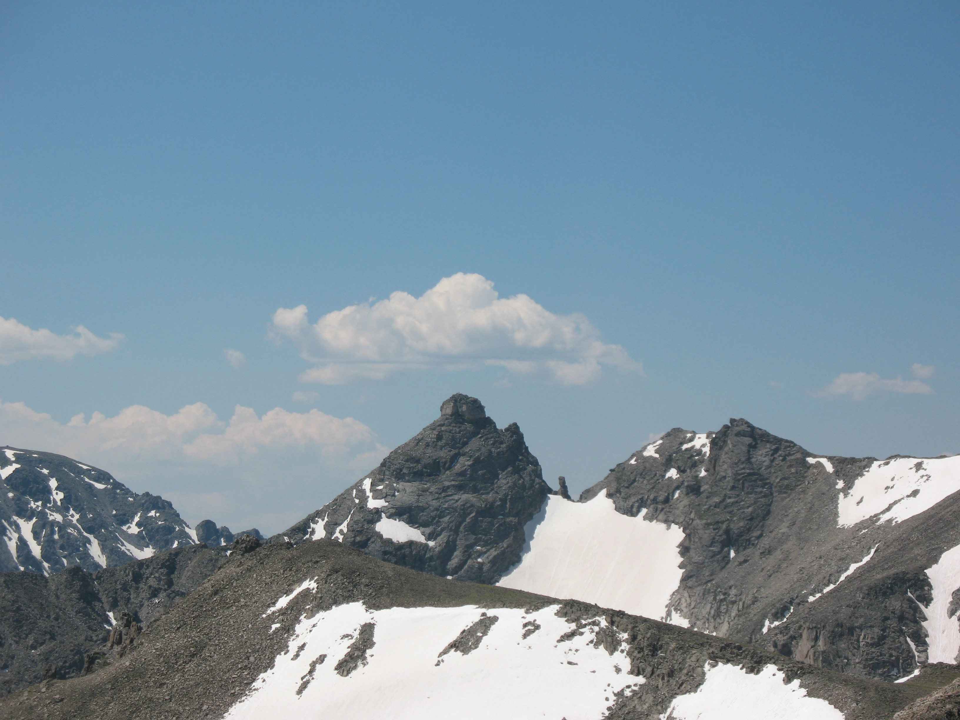
The landscape of Indian Peaks Wilderness is a textbook expression of the Colorado Front Range. Steep, knife-edged ridges rise abruptly from forested valleys, and seven of the area's peaks exceed thirteen thousand feet in elevation. North Arapaho Peak, at thirteen thousand five hundred and two feet, is the highest point, but the distinctive character of the area lies in the way the principal summits cluster together, all within roughly a hundred feet of elevation of each other. Viewed from any vantage along the Continental Divide, the peaks appear as a tightly packed wall of stone.
Glaciation has shaped nearly every surface of the wilderness. Carved cirques cradle the more than fifty alpine lakes scattered across the area, and surviving glaciers, including the Arapaho Glacier, occupy high shaded bowls. The Isabelle and Fair glaciers, connected by a trail that crosses the Continental Divide, are among the most accessible relicts of the Pleistocene ice in this part of the Rockies. Below the alpine zone, broad U-shaped valleys, polished bedrock, meadowed basins, and cascading creeks reveal the slow grinding work of vanished ice.
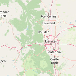
The Continental Divide bisects the wilderness from north to south, dividing waters that ultimately flow east to the South Platte and west to the Colorado River. Some of the most memorable terrain sits along the Divide itself, where windswept saddles connect the dense peak network and offer sweeping panoramas in nearly every direction. To the south, the wilderness connects ecologically and visually with the adjacent James Peak Wilderness, extending the high-country character well beyond Indian Peaks' own boundaries.
Indian Peaks Wilderness ecosystems, habitats, and plant life
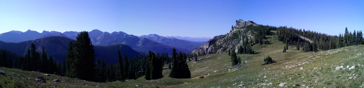
Ecologically, Indian Peaks Wilderness spans the full vertical gradient characteristic of the southern Rockies. Its lower slopes support dense stands of lodgepole pine, ponderosa pine, spruce, and fir, along with aspen groves that brighten the foothills in autumn. Moving upward, the forest thins into subalpine parkland before giving way at the highest elevations to fragile alpine tundra carpeted by low grasses, sedges, and wildflowers adapted to a short growing season.
Wetlands and meadows are a defining feature of the wilderness. Boggy basin floors and lush riparian corridors harbor tremendous botanical diversity and provide essential habitat for numerous species. The more than fifty lakes and countless streams are not only scenic highlights but also ecological anchors, supporting aquatic life and feeding both the City of Boulder watershed and the broader downstream river systems that depend on snowmelt from the high country.
The wilderness sits at a hinge between two great protected landscapes, anchored to Rocky Mountain National Park on its northern edge and surrounded by national forest on its other approaches. This positioning makes Indian Peaks a critical connective tissue in the regional ecosystem, allowing wide-ranging species to move between protected areas and ensuring that the ecological character of the southern Rockies remains continuous rather than fragmented.
Indian Peaks Wilderness wildlife and species highlights
The varied elevations and habitats of Indian Peaks Wilderness support a rich assemblage of Rocky Mountain wildlife. The forests and meadows harbor elk and mule deer, which are commonly seen grazing in open basins during summer months, along with black bears, mountain lions, and the smaller carnivores and rodents typical of Colorado montane forests. Marmots and pikas are conspicuous residents of the high talus slopes, where their calls often punctuate a hiker's ascent toward the alpine zone.
Avian life is abundant. The wilderness lies along important flyways and breeding habitat for many high-country bird species, including white-tailed ptarmigan, which feed and nest in the alpine tundra, along with gray jays, Clark's nutcrackers, mountain bluebirds, and a wide variety of hawks and other raptors that ride the thermals along the Divide. Wet meadows and lake margins attract waterfowl and shorebirds during migration, and the lakes themselves support trout and other cold-water species that draw anglers into the wilderness each summer.
Because the area receives very high visitation, wildlife observation tends to be concentrated near trailheads and around popular lakes such as those accessed from Brainard Lake. Despite this human pressure, the corridor connection to Rocky Mountain National Park offers larger wildlife continued access to extensive habitat, underscoring the wilderness's role as a refuge within an otherwise heavily settled region.
Indian Peaks Wilderness conservation status and protection priorities
Indian Peaks Wilderness was protected by an act of Congress in 1978, ending a long period in which the area was debated as an extension of Rocky Mountain National Park. Its establishment under the National Wilderness Preservation System gives it the highest level of protection available to U.S. federal lands, restricting mechanized recreation, motorized vehicles, and other activities that could compromise its wilderness character.
The conservation significance of the area extends well beyond its scenic value. A portion of the wilderness encompassing the headwaters of North Boulder Creek is closed to public access because it supplies the City of Boulder watershed, illustrating how the mountains function as a critical municipal water source as well as a recreational landscape. Glacier remnants such as the Arapaho Glacier are also part of that protected water system, and access to them is restricted accordingly.
As a connective refuge between Rocky Mountain National Park and the broader Arapaho and Roosevelt National Forests, Indian Peaks plays a vital role in maintaining ecological continuity across the Colorado Front Range. Its protection preserves not only habitats and species but also watershed function, climate resilience, and the heritage of a wilderness landscape that was once nearly lost to mining and development pressures.
Indian Peaks Wilderness cultural meaning and human context
The peaks of the Indian Peaks Wilderness carry a quiet but persistent Native American presence in their very names. Botanist Ellsworth Bethel drew on Western tribal history when, in 1914, he proposed naming unnamed summits along the Continental Divide after Native American peoples. The U.S. Board on Geographic Names accepted six of his proposals, and additional tribal names have been added over time, meaning that hikers crossing these passes are walking through a landscape whose nomenclature consciously honors Indigenous heritage.
At the same time, the area's human story is one of displacement and contested land use. Paleo-Indian peoples used the high country as a seasonal travel route for thousands of years, and the Arapaho hunted and lived here in summer before being pushed out by nineteenth-century mining. Achonee Mountain commemorates Cheyenne Peace Chief Ochinee, killed in the Sand Creek massacre, anchoring the place names to broader histories of Indigenous resistance and loss.
Top sights and standout views in Indian Peaks Wilderness
Indian Peaks Wilderness gathers seven thirteen-thousand-foot summits into one tight cluster, with North Arapaho Peak as the tallest and the Continental Divide threading through their midst. More than fifty alpine lakes and relict glaciers, including the Arapaho, Isabelle, and Fair glaciers, testify to the heavy glaciation that sculpted the cirques and valleys below.
With the Brainard Lake area as its busiest hub, twenty-eight primary trails and a dense network of high passes make the wilderness a premier hiking destination almost year-round, while its proximity to Boulder and Denver guarantees strong stewardship attention alongside heavy visitation.
Best time to visit Indian Peaks Wilderness
Summer, from roughly July through early September, is the most reliable window for experiencing the full range of Indian Peaks Wilderness. Trails through alpine passes and lake basins are typically snow-free, wildflower meadows are at their peak, and the higher lakes and tundra ridges are accessible without specialized gear. This is also when wildlife is easiest to observe in open meadows and along water bodies.
Winter transforms the area into a quieter, snow-covered landscape. Snowshoeing and cross-country skiing become the primary activities, especially around Brainard Lake and the lower trailheads, while the high passes and tundra become technical and are usually left to experienced mountaineers. Shoulder seasons can be spectacular for solitude and aspens in fall but often bring unpredictable weather above treeline.