

Mori Atlas logo
National parkInnes National Park

Explore mapped boundaries and the unique natural terrain of this Australian national park.

Innes National Park: Australia's Protected Landscape and Geographic Context

(Dhilba Guuranda–Innes National Park)

Innes National Park stands as a distinct protected area within Australia's vast geography. This national park offers a unique opportunity to explore its specific landscape character and understand its mapped boundaries. As a key entity in our atlas, it provides valuable context for comprehending the distribution of protected lands across the Australian continent and its surrounding regions.

Coastal parksSouth AustraliaYorke PeninsulaBirdwatchingHeathlandMarine coastline

Innes National Park

National park

Park overview

Structured park overview, official facts, and landscape profile for Innes National Park

Innes National Park park facts, protected area profile, and essential visitor context

Review the core facts for Innes National Park, including designation, size, terrain, visitor scale, habitats, and operating context in one park-focused overview.

About Innes National Park

Innes National Park represents one of South Australia's premier coastal conservation areas, protecting a distinctive peninsula landscape where the waters of the Southern Ocean meet the mainland. The park's location at the southern extremity of Yorke Peninsula creates a unique interface between marine and terrestrial environments, supporting ecosystems found nowhere else in the state. Visitors to the park encounter a landscape of remarkable diversity, from the windswept coastal heaths of the southern tip to the more sheltered valleys and woodland pockets that dot the interior. The park's establishment as a protected area reflects recognition that this coastline supports biological values of state and national significance, while also providing recreational opportunities that draw visitors seeking to experience South Australia's wild coastal places. The park serves as an important corridor for migratory seabirds and protects remnant vegetation communities that have largely been cleared from surrounding farmland.

Quick facts and research context for Innes National Park

Innes National Park occupies the southern reaches of Yorke Peninsula, protecting a chain of coastal headlands, sheltered bays, and heathy woodlands. The park is recognized for its remarkable birdlife, with numerous seabird colonies nesting along the cliff faces, and for populations of endangered species that inhabit the remnant vegetation. The park's landscape transitions from dramatic coastal cliffs to more gentle terrain inland, supporting a variety of plant communities adapted to the region's Mediterranean climate.

Park context

Deeper park guide and search-rich context for Innes National Park

Innes National Park history, landscape, wildlife, and travel context

Explore Innes National Park through its history, landscape character, ecosystems, wildlife, conservation priorities, cultural context, and seasonal travel timing in a structured park guide built for atlas discovery and search intent.

Why Innes National Park stands out

Innes National Park is best known for its spectacular coastal scenery, including towering cliff formations, pristine beaches, and the iconic Cape Spencer lighthouse. The park provides critical habitat for shorebirds and seabirds, with nesting colonies of albatrosses, gannets, and terns. The former designation as Dhilba Guuranda reflects the area's Aboriginal heritage and the deep connection between the landscape and Indigenous communities.

Innes National Park history and protected-area timeline

The land now comprising Innes National Park has a deep Aboriginal heritage, with the name Dhilba Guuranda reflecting the traditional connection of local Indigenous peoples to this coastline. European settlement of Yorke Peninsula in the nineteenth century brought agricultural development that transformed much of the peninsula, leaving the Innes area as one of the few remaining tracts of relatively intact coastal vegetation. The park was formally established to protect these remnants and the significant biodiversity they contain. Over time, the park has evolved from a more limited reserve to encompass additional coastal lands, recognizing the ecological connectivity between different parts of the peninsula's southern tip.

Innes National Park landscape and geographic character

The park's landscape is defined by its position at the southern tip of Yorke Peninsula, where exposure to the Southern Ocean has carved a dramatic coastline of cliffs, headlands, and sandy coves. The terrain rises to modest elevations along the coastal rim, with the most prominent features being the series of headlands that project into the sea. Inland, the land slopes more gently, supporting heathland and woodland communities that contrast with the exposed coastal zone. The park encompasses both the western and eastern faces of the peninsula, giving visitors views across different aspects of the southern ocean.

Innes National Park ecosystems, habitats, and plant life

The vegetation of Innes National Park is dominated by coastal heath and mallee woodlands, communities that are characteristic of southern South Australia's Mediterranean climate region. These plant communities have evolved to withstand the park's exposure to salt-laden winds, periodic drought, and the nutrient-poor soils typical of the region's ancient landscapes. The heathlands support a remarkable diversity of wildflowers, with many species flowering in spring to take advantage of the seasonal moisture. The park's position along a major flyway for migratory seabirds adds an important dimension to its ecological significance.

Innes National Park wildlife and species highlights

Innes National Park provides habitat for a range of wildlife species, with the coastal areas being particularly important for seabirds that nest on the cliff faces and islands. The park supports colonies of several threatened bird species, making it significant for bird conservation in South Australia. The heathland and woodland areas provide shelter for mammals, reptiles, and invertebrates that have adapted to the park's conditions. The surrounding marine environment adds further biodiversity value, with coastal waters supporting seabirds that forage offshore.

Innes National Park conservation status and protection priorities

The protection of Innes National Park addresses several conservation priorities in South Australia, including the preservation of remaining coastal heath communities, the protection of seabird nesting habitat, and the maintenance of landscape connectivity along the peninsula. The park forms part of a network of protected areas that collectively help preserve the state's biodiversity. Recognition of the park's Aboriginal heritage, through the use of the name Dhilba Guuranda, reflects contemporary understanding of the importance of Indigenous cultural values in conservation planning.

Innes National Park cultural meaning and human context

The use of Dhilba Guuranda as an alternate name for the park acknowledges the Aboriginal history of the Yorke Peninsula and the traditional connection of Indigenous peoples to this coastline. The park protects a landscape that was significant to local Aboriginal communities long before European settlement transformed much of the peninsula. This cultural dimension adds depth to the park's identity and reflects broader movements in protected area management to incorporate Indigenous knowledge and perspectives.

Top sights and standout views in Innes National Park

The park's southern tip offers panoramic views across the Southern Ocean, with the Cape Spencer lighthouse standing as a landmark against the often wild coastal sky. The cliff-lined coast provides spectacular viewing opportunities for observing seabirds and, during the right season, whale migrations. The heathland walks offer a different perspective, with spring wildflower displays rewarding visitors who explore the inland tracks. The combination of coastal drama and intimate woodland trails makes the park a destination of lasting appeal.

Best time to visit Innes National Park

The optimal time to experience Innes National Park is during the cooler months of autumn and spring, when temperatures are comfortable for walking and the park's wildflowers are at their best. Spring brings the most spectacular floral displays, with the heathlands transformed by цветущие растения across the park. Summer can be hot and windy, though early morning walks offer a chance to see wildlife active before the heat of the day. Winter brings fewer visitors and a different character to the landscape, with the coast often dramatic under overcast skies.
Monthly climate preview

Measured monthly average temperatures and precipitation rhythms for Innes National Park

Innes National Park Climate Normals and Long-Term Weather Patterns

Representative coordinate records outline the annual temperature range and monthly precipitation variation across the protected landscape. Detailed twelve-month climate normals provide a complete statistical profile of long-term meteorological patterns.
Annual mean17 °C
13 °C20 °C
Jan20°
Feb20°
Mar19°
Apr18°
May16°
Jun14°
Jul13°
Aug13°
Sep14°
Oct15°
Nov17°
Dec18°
Warmest month
February

20.3 °C

Coolest month
August

13.3 °C

Wettest month
June

2.3 mm/day

Driest month
January

0.5 mm/day

Park location guide

Geography guide, regional context, and park location map for Innes National Park

Innes National Park park geography, regions, and map view in Australia

Understand where Innes National Park sits in Australia through a broader geographic reading of the surrounding landscape, nearby location context, and its mapped position within the national park landscape.

How Innes National Park fits into Australia

Australia is a constitutional monarchy and federal parliamentary democracy comprising six states and ten territories. With a population of nearly 28 million, it is one of the world's most urbanised countries, with most people concentrated on the eastern seaboard. The country has a high Human Development Index and is known for its cultural diversity, ancient Aboriginal heritage, and unique wildlife.

Wider geography shaping Innes National Park in Australia

Australia occupies the entire Australian continent, the island of Tasmania, and numerous smaller islands. It is the world's flattest and driest inhabited continent, featuring vast deserts in the interior (the Outback), tropical rainforests along the eastern coast, and a coastline bordering the Indian and Pacific Oceans.

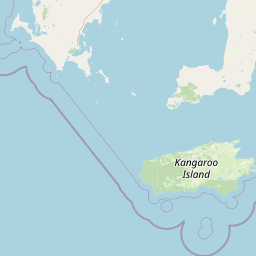
Map view of Innes National Park

Use this park location map to pinpoint Innes National Park in Australia, understand its exact geographic position, and read its mapped placement within the surrounding landscape more clearly.

Pigeon | © OpenStreetMap contributors
Park atlas

Map the regional spread of protected areas, comparing coastal and inland conservation landscapes on Yorke Peninsula and surrounding South Australia.

Discover Other National Parks and Protected Areas Near Innes National Park, South Australia

Browse national parks and protected areas located geographically close to Innes National Park, spanning the diverse coastal and inland landscapes of Yorke Peninsula in South Australia. Compare their unique terrain, conservation focuses, and geographic features to gain a richer understanding of protected-area distribution and regional ecological patterns.
National parkAustralia
Mapped park locations coincide#1 closest

Dhilba Guuranda-Innes National Park: A Detailed Look at Its Australian Protected Landscape

Explore the park's mapped geography and natural terrain.

This section offers a focused atlas exploration of Dhilba Guuranda-Innes National Park, detailing its significance as a protected natural area within Australia. Gain understanding of its unique geographic characteristics, mapped boundaries, and its contribution to the country's diverse natural landscapes. This provides detailed context for anyone interested in Australia's protected land inventory and regional geography.

Area
94.15 km²
Established
1970
Visitors
200K annual
Relief
Mixed relief
Protected areaSouth Australia
About 30 km away#2 closest

Northeast

Carribie Conservation Park: Mapped Geography and Protected Area Overview in South Australia

Ecological terrain and native vegetation remnants on the Yorke Peninsula

Carribie Conservation Park is a 19-hectare protected area situated on the southern Yorke Peninsula of South Australia. The terrain consists of an undulating sandy plain characterized by two contrasting vegetation zones: a northern mallee scrub and a southern sheoak and tea-tree woodland. As a formal conservation site, it provides a vital window into the original botanical character of the region.

Area
0.19 km²
Established
1968
IUCN
III
Relief
Lowland
National parkSouth Australia
About 60 km away#3 closest

South

Flinders Chase National Park: A Detailed National Park Entry for Map Exploration in South Australia

Explore mapped boundaries and regional geographic context.

This dedicated entry for Flinders Chase National Park provides critical geographic and protected-area data, functioning as a key point within the MoriAtlas for understanding Australia's conservation landscapes. Investigate the specific mapped boundaries of this national park, situate it within the regional geography of South Australia, and grasp its identity as a distinct protected land. The information here supports structured exploration for anyone seeking detailed atlas context on natural park entities.

Area
326.61 km²
Established
1972
IUCN
II
Relief
Upland
National parkSouth Australia
About 67 km away#4 closest

Northwest

Lincoln National Park National Park: Mapped Protected Area and Geographic Landscape Identity

South Australia's protected landscape with detailed park boundaries.

Gain a comprehensive atlas perspective on Lincoln National Park, a designated national park in South Australia. This resource details the park's mapped boundaries, offering clear geographic context and highlighting its role as a protected landscape. Understand its place within the regional geography of South Australia, providing essential data for landscape exploration and atlas-based research.

Area
216.38 km²
Established
1941
IUCN
II
Relief
Upland
State or regional parkKangaroo Island
About 80 km away#5 closest

Southeast

Cygnet Estuary Conservation Park: Protected Estuarine Geography and Mapped Wetlands

A focused coastal reserve on the shores of Kangaroo Island

Located on the northern side of Kangaroo Island, Cygnet Estuary Conservation Park provides a protected zone for tidal lagoons and river-mouth mudflats. The park serves as a key example of habitat-focused conservation, preserving the unique transition zone where the Cygnet River meets Nepean Bay. This mapped area highlights the subdued coastal landforms and fringing estuarine vegetation characteristic of South Australia's sheltered shores.

Area
1.39 km²
Established
2014
IUCN
III
Relief
Lowland
Nature reserveSouth Australia
About 81 km away#6 closest

Southeast

Busby Islet Conservation Park: Coastal Protected Area and Nature Reserve Mapping

Geography of a crucial seabird sanctuary in Nepean Bay

Busby Islet Conservation Park is a protected island reserve in South Australia known for its role as a breeding ground for Australian pelicans, cormorants, and various shorebird species. As a strict nature reserve, this low-lying rocky outcrop stands as a vital migratory wader roost along the north coast of Kangaroo Island, preserving essential coastal habitats through its long-standing protected status.

Area
0.17 km²
Established
1967
IUCN
Ia
Relief
Lowland
Marine protected areaSouth Australia
About 81 km away#7 closest

Southwest

Western Kangaroo Island Marine Park: Geographic Profile and Protected Marine Environment

South Australian marine geography and protected seafloor zones.

Western Kangaroo Island Marine Park guards a vital swath of the continental shelf and upper slope in South Australia. The protected area features a unique submerged ancient coastline and deep nutrient-rich waters that support diverse marine ecological processes within the Spencer Gulf Shelf Province.

Area
2,335.31 km²
Established
2012
IUCN
II
Relief
Lowland
Wildlife reserveSouth Australia
About 87 km away#8 closest

Southeast

Cape Gantheaume Conservation Park: Coastal Landscapes and Protected Area Atlas

South Australia wildlife reserve mapping and geography

Discover the geographic layout of Cape Gantheaume Conservation Park in South Australia. This protected area on Kangaroo Island features a distinct transition between the inland Murray Lagoon wetlands, expansive dune systems at D'Estrees Bay, and the offshore environment of Pelorus Islet, offering a comprehensive view of southern coastal terrain.

Area
42.13 km²
Established
1971
IUCN
Ia
Relief
Lowland

Common questions about visiting, size, designation, and location context for Innes National Park

Innes National Park FAQs for park facts, access, geography, and protected area context

Find quick answers about Innes National Park, including protected-area facts, park geography, trail and visitor context, and how the park fits into its surrounding country and regional landscape.
MoriAtlas Explorer

Continue Your Protected Areas Search Across the Global Atlas

Deepen your exploration by continuing the structured search for national parks and protected areas worldwide. Utilize the comprehensive filtering capabilities to compare different conservation landscapes and refine your understanding of global park geography. Discover more about the distribution and characteristics of protected natural areas.

Global natural geography