
Why Irish Wilderness stands out
Irish Wilderness is best known for combining the wilderness qualities of the Missouri Ozarks with a striking human history attached to its name. The area stands out among Missouri's wildernesses because its very identity is tied to a short-lived Irish settlement of the late 1850s, founded by immigrants from St. Louis under the direction of Bishop John Joseph Hogan. That settlement's destruction during the Civil War turned the landscape into an abandoned wilderness that, more than a century later, became federally protected. Ecologically, the area is known for its karst topography, including caves, sinkholes, springs, and scenic hollows carved into the surrounding ridges. The White's Creek Trail, an 18.6-mile route through the area, links many of the wilderness's signature features, from White's Creek Cave to Fiddler and Bliss Springs, and offers long-distance hiking and horseback riding through one of Missouri's quieter protected landscapes.
Irish Wilderness history and protected-area timeline
The history of Irish Wilderness is unusually personal for an area now defined as wild country. Before it became federally protected terrain, the land supported a settlement of Irish Catholic immigrants in southern Missouri. The settlers came from St. Louis, where waves of Irish immigration in the 1840s had produced a community often facing discrimination and largely employed in railroad and mining work. Bishop John Joseph Hogan, an Irish Catholic priest, saw an opportunity for these immigrants to acquire their own farmland and build stable family lives on rural land.
Through the efforts of Hogan and Reverend James Fox, who acquired and donated land in Oregon and Ripley Counties, a settlement was established in the late 1850s. By around 1859, approximately forty families had begun to settle the area, with more on the way. The settlement stretched from the Eleven Point River in Oregon County eastward past the Current River in Ripley County, reaching toward Doniphan. Roads, including the Old Bellevue Road, connected the settlement to the wider region, but that same accessibility made the community vulnerable during the American Civil War.
The settlement existed for only about four years. Between 1859 and 1863, Union and Confederate troops, along with outlaws and opportunists, moved through the area and attacked the isolated community. By the end of 1863, the settlement had been destroyed, and its surviving residents had fled. Union Major James Wilson is associated with the destruction of the community, and later researchers such as Jerry Ponder worked to document what happened there. The abandoned land returned to forest, and over the generations it remained largely unsettled.
In 1984, more than a century after the settlement's collapse, the United States Congress designated the area as a federal wilderness, placing it within the National Wilderness Preservation System and under the management of the U.S. Forest Service through the Mark Twain National Forest. That designation recognized both the natural values that had reasserted themselves on the abandoned land and the historical significance of the site.
Irish Wilderness landscape and geographic character
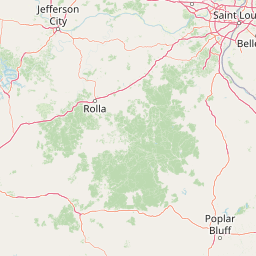
Irish Wilderness occupies a portion of the Missouri Ozarks where karst geology shapes much of what visitors see above and below the surface. The area's topography is built from ridges, hollows, and seasonal drainages typical of the southern Missouri landscape, with the Eleven Point River forming an important hydrological boundary nearby. Across the wilderness, the land rises and falls in forested ridges, narrow valleys, and quiet coves that give the area a sense of seclusion despite its relatively modest size.
The defining geological character of the wilderness is its karst topography. Limestone bedrock, dissolved over time by groundwater, has produced sinkholes, springs, bluffs, and the caves that visitors encounter along trails like the White's Creek Trail. White's Creek Cave, which is temporarily gated for the protection of endangered bats, is one of the most notable underground features in the area, while Fiddler Spring and Bliss Spring add to a network of water features that emerge through the karst system. The combination of caves, springs, and forested slopes gives the wilderness some of its most scenic moments and shapes both the ecology and the visitor experience.
The rivers and corridors surrounding the wilderness, including the Eleven Point River, also contribute to the area's character. Old tramway railroad traces visible along certain routes are a reminder of the region's earlier extractive use, and the surrounding elevations create overlooks where visitors can take in broader sweeps of the Ozark landscape. Together, the terrain, karst features, springs, and river corridors create a landscape that is geographically compact but visually varied.
Irish Wilderness ecosystems, habitats, and plant life
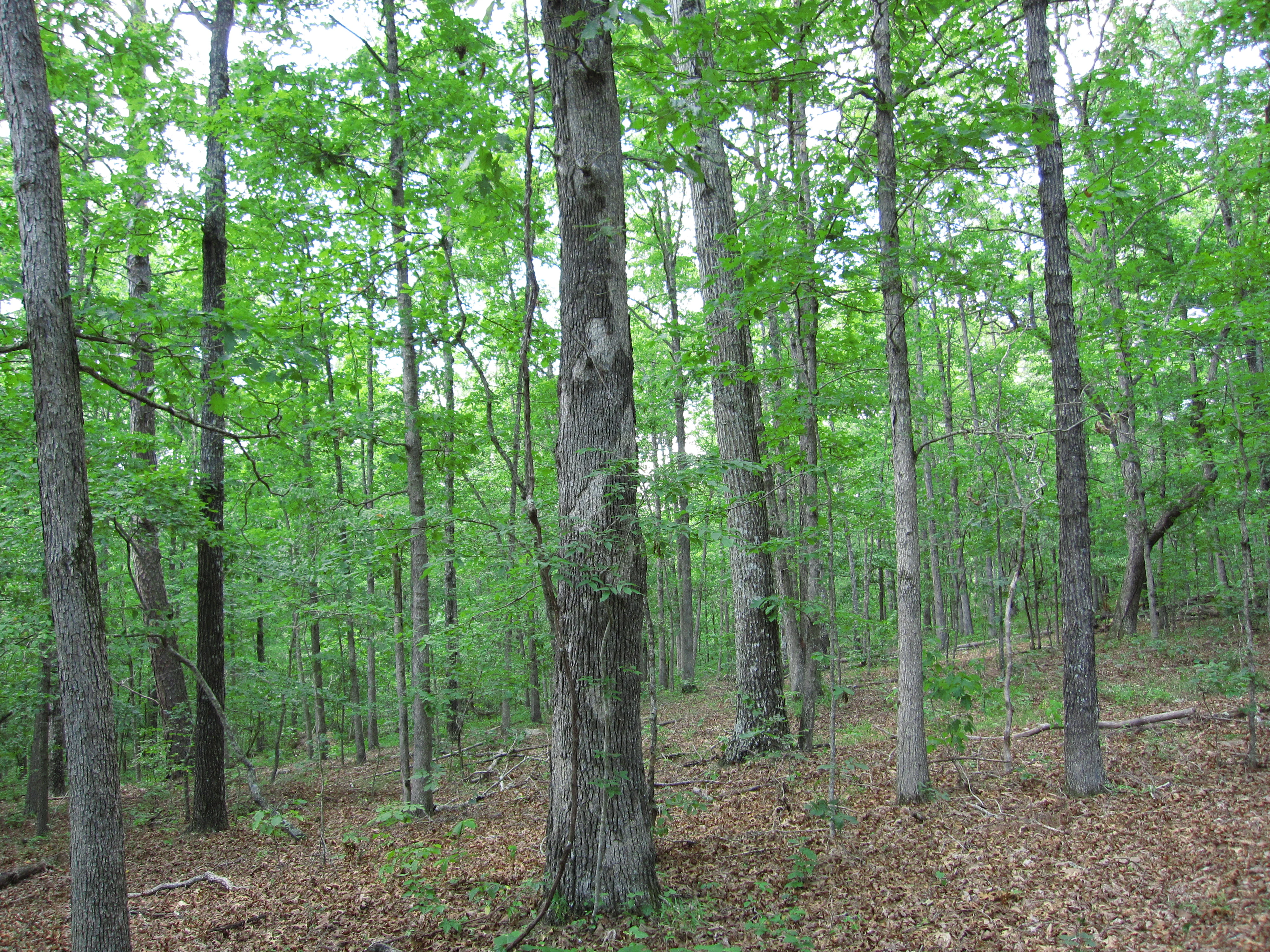
The natural character of Irish Wilderness reflects the broader ecological profile of the Missouri Ozarks, with deep influence from the area's karst geology and its long history of being left relatively undisturbed. Mixed hardwood forests cover most of the area, supporting the species composition typical of southern Missouri's oak-hickory woodlands. The forest canopy gives the wilderness a continuous wooded character, broken only by springs, openings along streams, and the occasional glade or cliff line.
Karst ecology plays a large role in the wilderness's natural systems. Caves and subterranean passages, together with surface springs, form a connected hydrological network that supports both aquatic and terrestrial species. These features are particularly important for cave-dwelling wildlife, including bat populations, which require undisturbed cave environments to survive. As a result, sensitive features such as White's Creek Cave are actively managed to reduce disturbance, and gating is used as a protection tool rather than a restriction of access for its own sake.
Along streams, in the hollows, and on the forested slopes, the wilderness hosts a mosaic of habitats, including riparian zones along tributaries feeding the Eleven Point River, dry ridge woodlands, and mesic hollow communities. These varied habitats contribute to the area's biodiversity and explain why the wilderness can support such a wide range of species within a relatively small footprint. The combination of intact forest, protected hydrology, and minimal modern development gives the wilderness significant ecological value within the regional landscape.
Irish Wilderness wildlife and species highlights
Irish Wilderness supports a typical Ozark wildlife community, with species that reflect the area's mix of hardwood forest, karst features, riparian corridors, and remote terrain. Whitetail deer are common throughout the area, foraging along the forest edges, hollows, and stream corridors. Wild turkey also make their home in the wilderness, using the woodland structure for both food and cover.
Higher-profile predators and rare species have been documented in or near the wilderness, adding to its wildlife significance. Black bears, historically reduced across Missouri, are present in the area, reflecting the recovery and movement of bear populations in suitable Ozark habitat. Mountain lions have also been reported in the broader region, although their presence in the wilderness is not regular. Timber rattlesnakes, a species of conservation concern in many parts of the country, occur within the area and contribute to the broader reptile and amphibian communities supported by the karst landscape.
Birdlife is another important element of the wilderness, with bald eagles documented in association with the Eleven Point River corridor and surrounding forest. The mix of forest interior, stream habitat, and open river systems creates conditions for a diverse bird community, including migratory, resident, and breeding species. Beneath the surface, cave-dependent bat species are among the most ecologically sensitive wildlife in the wilderness and a primary reason why cave access is carefully managed.
Irish Wilderness conservation status and protection priorities
Irish Wilderness has conservation significance that extends well beyond its status as a protected landscape. Its designation within the National Wilderness Preservation System places it at the highest level of federal land protection in the United States, meaning that the area is meant to be preserved in its natural condition and protected from activities that could permanently alter its character. As one of only eight designated wilderness areas in Missouri, it represents a small but meaningful share of the state's permanently protected wild land.
The karst systems within the wilderness are central to its conservation value. Caves, springs, and connected groundwater pathways support sensitive species, including bat populations that have faced serious declines in much of North America. The decision to gate features such as White's Creek Cave reflects a deliberate conservation strategy aimed at minimizing human disturbance to cave-dwelling wildlife, especially during sensitive seasons.
At a broader scale, the wilderness contributes to the ecological connectivity of the Mark Twain National Forest, including habitat continuity for forest-dependent species and a refuge for wildlife that requires relatively undisturbed conditions. Its long history of low-intensity land use, including a century-plus period without permanent human settlement following the destruction of the Irish community in the 1860s, has allowed ecological processes to function with limited modern interruption. That combination of formal protection, historic non-use, and ecologically distinctive karst features gives Irish Wilderness real conservation importance within Missouri's protected-area network.
Irish Wilderness cultural meaning and human context
The cultural identity of Irish Wilderness is inseparable from the nineteenth-century Irish Catholic settlement that briefly occupied the land before the Civil War. Between 1859 and 1863, immigrants from St. Louis, encouraged by Bishop John Joseph Hogan and supported by Reverend James Fox's land donations, attempted to build a farming community in Oregon and Ripley Counties. The community, sometimes remembered as part of Missouri's wider Irish immigrant experience, reflected both the discrimination faced by Irish workers in St. Louis and the aspiration to own land and settle as families.
The collapse of that settlement during the Civil War, marked by the actions of Union Major James Wilson and the broader violence of the period, became a defining episode in the area's history. Later researchers such as Jerry Ponder worked to piece together the story, preserving knowledge of a community that left almost no lasting physical footprint. That shared historical memory connects the wilderness not only to American frontier history but also to the broader Irish diaspora experience in the American Midwest.
Top sights and standout views in Irish Wilderness
Irish Wilderness stands out as one of Missouri's eight officially designated wilderness areas, combining the ecological character of the southern Ozarks with rare karst features such as White's Creek Cave, Fiddler Spring, and Bliss Spring. The 18.6-mile White's Creek Trail crosses many of these features and provides both hiking and horseback riding opportunities through forested ridges, hollows, and overlooks of the Eleven Point River.
Beyond its scenic and recreational qualities, the wilderness carries distinctive historical significance, having been shaped by the rise and fall of an Irish Catholic settlement in the years before and during the Civil War. Its karst-based cave systems also support sensitive wildlife, including endangered bat populations, which is why the area balances accessibility with careful protection in features like White's Creek Cave.
Best time to visit Irish Wilderness
Irish Wilderness, like much of the Missouri Ozarks, is best experienced during the spring and fall seasons, when temperatures are mild and the forest is most visually engaging. Spring brings blooming woodland understory, higher water flows in springs and tributaries, and active wildlife across the area. Fall offers cooler hiking conditions, colorful hardwood foliage, and generally drier trail conditions following the heavier summer growing season.
Summer visits are possible but are typically warmer and more humid, with denser vegetation and stronger insect activity. Winter visits offer quiet conditions and leaf-off views of the karst topography, but require preparation for colder temperatures and variable trail conditions. Because the area is a designated wilderness with limited infrastructure and gated cave features in place to protect bat populations, visitors should generally plan around seasonal trail conditions rather than expecting year-round access to specific sites.