
Trip Timing
When is the best time to visit Iztaccíhuatl–Popocatépetl National Park
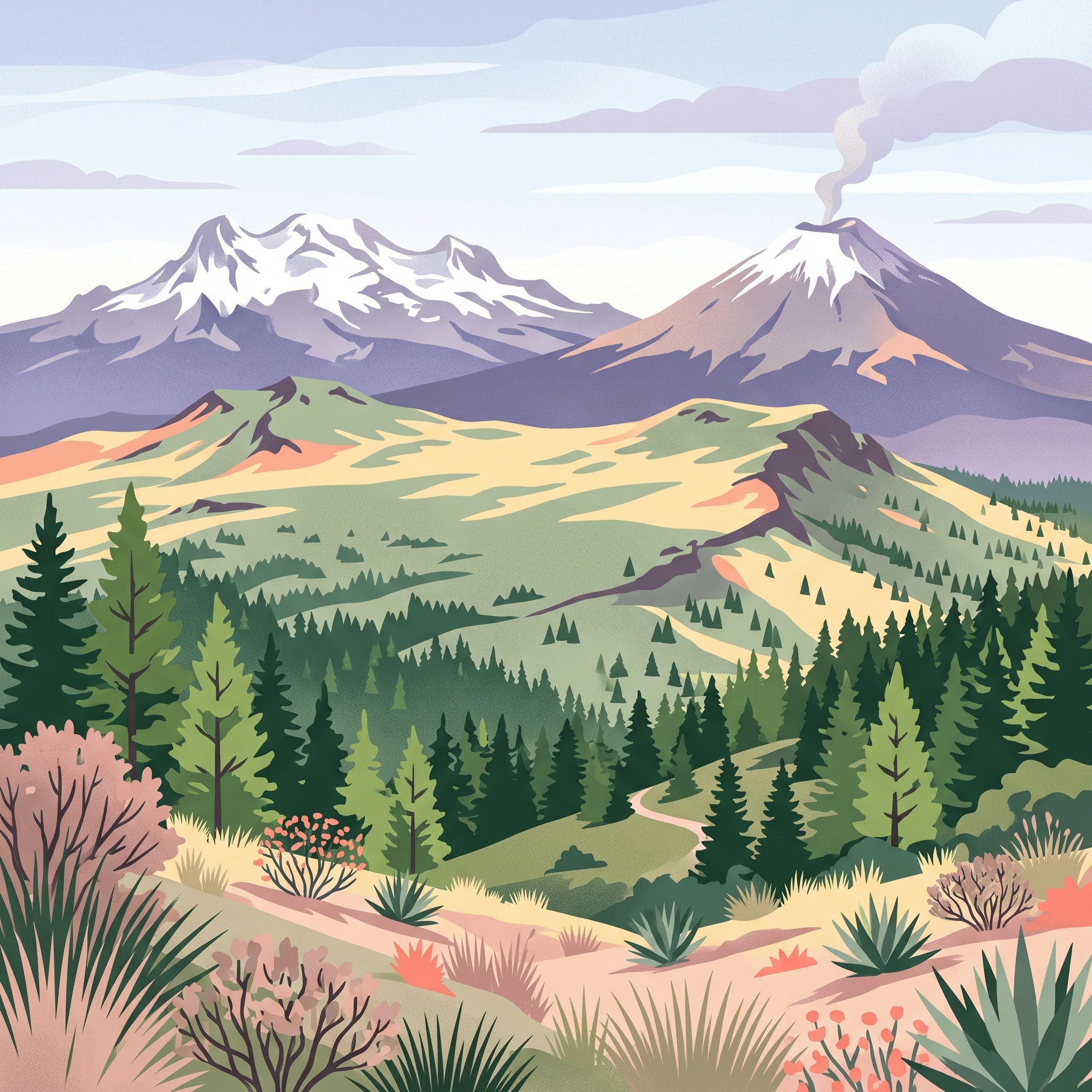
The best time to visit Iztaccíhuatl–Popocatépetl National Park is during the dry season, which typically extends from November through April. During these months, the region experiences significantly lower precipitation, which translates into stable, clear skies and more predictable conditions for high-altitude trekking. Choosing this period allows visitors to capitalize on the mountain vistas and the distinct visual silhouettes of the volcanoes, which are often obscured by cloud cover or seasonal rains during the warmer, wetter months of the year. While these months offer the most reliable window, the park experience remains heavily dependent on your tolerance for cold and the specific altitude you intend to reach.
Navigating the Influence of Elevation and Volcanism
Visitors must recognize that the most impactful factor shaping a trip to this park is the extreme elevation gradient. Even when lower park access points or nearby valleys enjoy mild, pleasant temperatures, the upper slopes near the summits of Iztaccíhuatl and Popocatépetl are subject to alpine conditions year-round. Snow, ice, and rapid temperature fluctuations are common, meaning that the calendar date offers less protection than proper physical preparation. The climate at the base, while useful for planning, does not accurately represent the harsh, high-exposure environment found at higher elevations.
Furthermore, the primary trade-off for visiting during the clearer, drier months is the active geological nature of the park. Popocatépetl remains one of the most active volcanoes in North America. Its continuous fumarolic activity can lead to localized ash fall or temporary restrictions on specific trails and access routes. Because the park authority must prioritize safety, current access to high-altitude sectors is subject to change based on volcanic activity levels rather than just seasonal weather patterns.
Balancing Weather with Park Accessibility
When considering when to travel, you should anticipate a shift in the landscape between the dry months and the wetter summer season. From May through October, increased humidity and frequent afternoon rain showers transform the alpine grasslands and pine-fir forests, though this moisture often brings heavy fog that limits visibility. While the landscape is greener, the combination of restricted visibility and muddier trail conditions can complicate navigation for those unfamiliar with the terrain. Visitors who prioritize long-distance views, photography, or specific trekking goals generally find that the stability of the winter and spring months provides a superior environment, provided they confirm current park status and safety alerts before departure. By focusing your trip during the period of lower precipitation, you align your visit with the most accessible weather conditions while keeping in mind that external factors like volcanic behavior remain the ultimate arbiter of which park areas are open for exploration.
Seasonal Planning
Best Months to Visit Iztaccíhuatl–Popocatépetl National Park at a Glance
Peak Trekking Window: November to April
For most visitors, the period spanning November through April represents the most reliable window for planning a trip. During these months, the park experiences its lowest precipitation, often seeing less than one millimeter of rain per day. These conditions significantly improve visibility and trail traction, which are essential for navigating the high-altitude terrain. The cooler, stable atmosphere during the late autumn and winter months reduces the frequency of afternoon convective storms that can develop rapidly in the valleys and obscure the peaks. While temperatures at base elevations remain comfortable during the day, trekkers should expect cold conditions that intensify as elevation increases, requiring specialized gear even on clear, sunny days.
Transition Phases and Changing Conditions: May and October
May and October act as critical shoulder periods, serving as the bridge between the arid winter season and the height of the summer wet season. May typically brings a gradual increase in humidity and the onset of afternoon precipitation as the region shifts toward the summer months. Travelers choosing this time benefit from slightly longer daylight hours compared to December or January, but they face a higher probability of cloud cover and sudden weather shifts. October provides the inverse, as the heavy moisture of the summer months begins to recede. Visitors in October may encounter lingering dampness on the trails and a more volatile weather pattern, where clear mornings are often followed by increasing clouds or fog by mid-afternoon.
The Summer Wet Season: June through September
From June to September, the park enters its most humid and precipitation-heavy phase. During this time, average daily precipitation levels rise significantly, often exceeding five millimeters per day. While the landscape undergoes a vibrant green transformation, these months present the most substantial logistical challenges for outdoor activity. Dense fog is a common occurrence, which can obscure the dramatic silhouettes of the volcanoes and complicate navigation for those venturing beyond the main viewpoints. The higher relative humidity levels contribute to a sensation of dampness that persists even when rain is not falling, and the potential for severe weather patterns is at its annual peak. Visitors during this season should prioritize flexibility in their itinerary, as local conditions can change rapidly and often without warning, necessitating a reliance on real-time park alerts rather than broad climate expectations.
Annual Climate Overview
Monthly Weather and Temperature Patterns in Iztaccíhuatl–Popocatépetl National Park
Understanding the annual climate of Iztaccíhuatl–Popocatépetl National Park requires a focus on the distinct transition between high-altitude moisture levels and the dry, stable conditions that characterize the cooler months. These long-term climate normals, observed at an elevation of approximately 2120 meters, reflect regional patterns that shift significantly as you move toward the volcanic summits. While these figures represent historical trends rather than a live weather forecast, they provide the essential baseline for interpreting how the park environment changes throughout the year.
The Dry Season Pattern: November to April
During the core of the dry season, the park experiences its most predictable weather. From November through February, precipitation levels are at their lowest, with values often falling well below 1 millimeter per day. This period offers the highest probability of clear skies, which are critical for visitors planning to view the volcanic peaks from the ground or navigate higher-altitude trails. While the air is drier, relative humidity begins at lower levels, typically ranging from 45 percent to 55 percent. Daytime temperatures are generally moderate, but the lack of significant cloud cover and moisture means that heat dissipates rapidly after sunset. Visitors should anticipate cool minimum temperatures during these months, often dipping toward 4 degrees Celsius. The wind, while generally consistent, can become a more significant factor in heat loss at these higher elevations during the clearer winter months.
Warming Trends and the Lead-Up to Summer
As the calendar progresses from March into April and May, the park undergoes a noticeable transition. Average maximum temperatures climb to their annual peaks during this window, occasionally exceeding 31 degrees Celsius at the sample elevation. Daylight hours also extend toward their maximum in June, providing more time for park exploration. However, these warmer months serve as a bridge to the wetter part of the year. Precipitation begins to increase steadily, particularly by May, when daily rainfall figures start to rise significantly compared to the winter months. Humidity levels also begin to creep upward, signaling the shift in regional air mass patterns.
The Summer Wet Season: June to September
From June through September, the climate profile shifts toward higher precipitation and increased cloud cover. Rainfall reaches its annual intensity during these months, with daily averages climbing toward 5 to 6 millimeters. This increased moisture brings higher relative humidity, frequently exceeding 75 percent or even 80 percent by September. While temperatures remain relatively stable, the combination of frequent cloud cover, increased humidity, and persistent precipitation often reduces visibility. The perception of cold during this time is often magnified by damp conditions, even if the absolute temperature readings do not drop as low as they do in the winter months. For those planning a visit, this period demands a higher level of preparedness for rapidly changing conditions, including fog and sudden afternoon showers, which are common across the Sierra Nevada.
Seasonal Daylight and Wind Dynamics
Daylight duration follows a predictable annual arc, peaking near 13 hours in June and shortening to approximately 11 hours by December and January. This variance impacts the amount of usable time available for activities each day. Furthermore, while wind speeds at the 2120-meter elevation sample remain relatively moderate throughout the year, the open, exposed terrain of the volcanic slopes is known to experience stronger gusts. It is important to remember that these climate normals are gathered from a specific mid-elevation sample, and the conditions near the glaciers and summits of Popocatépetl and Iztaccíhuatl will invariably be more extreme. Cold temperatures, high-altitude winds, and sudden shifts in visibility should be anticipated regardless of the month, as mountain weather frequently defies standard lowland expectations.
Seasonal Conditions
Seasonal Weather Patterns and Transitions in Iztaccíhuatl–Popocatépetl National Park
The Rhythm of the Dry Season
The most stable atmospheric conditions occur from November through April, a period defined by minimal precipitation and high sky clarity. During these months, the park experiences its lowest humidity levels, which often drop below 50 percent during the peak of the dry spell in March and April. While valley temperatures remain pleasant during the day, the lack of cloud cover at high elevations means that nighttime temperatures frequently dip toward freezing. Visitors during this window should expect crisp, clear views of the volcanic landscape, as the atmospheric moisture that frequently obscures the peaks during the summer is largely absent. This period is the most predictable in terms of weather, yet it remains subject to the inherent volatility of high-altitude environments where temperatures change rapidly as one ascends from the forested base into the alpine grasslands.
The Transitional Months: April and May
The transition between the dry and wet phases is most perceptible during April and May. As the calendar moves into late spring, temperatures reach their annual peak, with average daytime maximums often exceeding 31 degrees Celsius at lower elevations. This warming trend is accompanied by a noticeable increase in humidity and the arrival of sporadic afternoon rain showers, signaling the shift in regional wind patterns. These two months represent a volatile window where visitors might experience clear, warm mornings followed by rapid cloud development. Because this transition is neither strictly dry nor fully saturated, trail conditions can vary significantly from one week to the next, requiring a flexible approach to timing any planned excursions.
The Summer Wet Phase
Starting in June and extending through September, the park enters a period characterized by significantly higher moisture levels and increased cloud cover. Humidity consistently remains above 70 percent, peaking in September as the influence of seasonal weather systems brings more frequent precipitation to the Sierra Nevada range. Unlike the dry winter months, this season is defined by common afternoon fog and frequent, often heavy, rain showers. While temperatures remain moderate, the high humidity can make the air feel colder during overcast periods or when winds pick up at high altitudes. The landscape, which may appear arid during the winter, becomes noticeably greener as the vegetation responds to the sustained moisture. For those visiting during this phase, the primary atmospheric challenge is the reduced visibility and the higher probability of localized thunderstorms that can impact mountain accessibility and safety, particularly during the afternoon hours when convective activity is most likely to intensify.
Seasonal Experiences
What visiting Iztaccihuatl-Popocatepetl National Park is like throughout the year
Navigating Ecological Transitions Through the Calendar
The experience of visiting this national park is fundamentally defined by the sharp vertical transition from pine-fir forests to high-altitude alpine grasslands, known as the zacatonal. Because this ecological gradient spans thousands of meters, the sensory experience of the landscape changes significantly with the seasonal climate cycle. During the dry winter months, the forest floor and lower alpine trails are often characterized by crisp, stable conditions. Visitors walking from Paso de Cortes toward the base of the mountains find that the lack of humidity during these months emphasizes the volcanic silhouette of the peaks against an often cloudless sky.
As the climate transitions toward the wetter summer period in June, the alpine grasslands undergo a visual shift. The increased precipitation, which peaks in intensity between June and September, fuels the growth of mountain vegetation and influences the local hydrology. Trails that are dry and dusty during the winter can become soft or muddy, altering the pace and effort required for trekking. Hikers should expect these conditions to persist through the height of the summer rainy season, when afternoon cloud cover frequently obscures the upper summits, a contrast to the high visibility typically associated with the dry season.
Wildlife Observation and Timing
Wildlife viewing in the park is closely tied to these seasonal shifts, particularly for those seeking a glimpse of the rare volcano rabbit, or zacatuche. This species inhabits the high-elevation forest edges and the transition zones into the zacatonal. During the drier winter period, visibility within these brushy habitats can be slightly better due to the dormancy of some lower vegetation, though the animals are more active in seeking shelter during the coldest nights.
Bird watchers find the park particularly active year-round, with resident species like red-tailed hawks and peregrine falcons utilizing thermal currents that rise over the slopes. These thermal patterns are most consistent during the sunnier, drier months, when the ground heats effectively, allowing these birds of prey to soar for longer periods. While the forest birds are audible throughout the year, the relative quiet of the dry season months makes the vocalizations of thrushes and wrens more distinct to the visitor. Conversely, the increased moisture during the summer months encourages the activity of amphibians, including various salamanders found in the streams descending the mountain slopes, providing a different dimension to the park's biodiversity for those visiting during the wetter part of the year.
Access and Activity Limitations
Casual hiking from the Paso de Cortes and more rigorous treks toward La Joya are subject to the realities of the climate. While the physical trails remain, the experience of the walk is dictated by the ability to see the path and the stability of the terrain. The presence of snow and ice at the highest elevations is a year-round reality for the peaks, but the accessibility of the approaches is highest when the ground is firm. Visitors prioritizing long-distance hiking or summit approaches should be aware that the summer humidity can lead to frequent, rapid shifts in local weather, which may necessitate cutting outdoor activities short.
Visitor Priorities
Choosing the Best Time to Visit Iztaccíhuatl–Popocatépetl Based on Your Travel Goals
Planning for Optimal Mountain Visibility
If your primary goal is to witness the expansive vistas of the Trans-Mexican Volcanic Belt, your visit should center on the driest months of the year, specifically from December through February. During this period, the atmospheric conditions are at their most stable, with daily precipitation often falling below 0.40 mm. This reduction in cloud cover and atmospheric moisture is essential for clear, long-distance views of neighboring peaks like Pico de Orizaba and the surrounding valleys. The trade-off for these spectacular sightlines is the intensity of the cold, especially at high elevations where temperatures frequently hover near freezing. While this window provides the visual clarity required for panoramic photography, it demands a robust layering system to manage the biting winds and cold exposure that characterize winter at high altitudes.
Selecting Periods for Milder Daytime Temperatures
Visitors who prefer warmer, more temperate walking conditions often target the spring shoulder, particularly from March to early May. As the season progresses into April and May, mean temperatures at lower elevations begin to climb toward 20 degrees Celsius. This timing offers a comfortable balance, as the summer rainy season has not yet fully established its pattern of afternoon convective storms. However, these months are a transitional period. While you benefit from milder temperatures, you also encounter increased humidity compared to the winter months, and the rising temperatures can sometimes lead to localized afternoon cloud build-up that obscures the higher summits. This creates a functional trade-off: you gain easier temperature management and longer daylight hours of over 12 hours, but you sacrifice some of the absolute, crystal-clear visibility found in the depth of the dry season.
Prioritizing Longer Daylight for High-Elevation Activities
For those focused on extended trekking or mountain activities that require more hours of usable light, the late spring and early summer period leading up to June provides the most favorable daylight duration, reaching slightly over 13 hours. This shift in the solar cycle allows for earlier starts and later finishes, which is often necessary when navigating the complex terrain between Paso de Cortes and the high-altitude camps. The trade-off is a significant increase in moisture. By June, precipitation begins to rise markedly, and relative humidity often exceeds 68 percent. Visitors prioritizing this extra daylight must be prepared for the reality of afternoon weather shifts, as the increased solar energy often triggers clouds and precipitation that roll in after midday. If your schedule dictates a preference for longer days, you must maintain flexibility in your daily itinerary to account for these regular, weather-driven limitations on mountain access.
Visitor Access
Seasonal Access and Practical Trip Planning for Iztaccíhuatl–Popocatépetl National Park
Navigating Access to the Volcanic Peaks
Planning a visit to Iztaccihuatl-Popocatepetl National Park requires a distinction between the park's permanent landscape features and its fluid operational status. Access to the area is primarily anchored by the Paso de Cortes, a high mountain pass that serves as the administrative gateway and primary entry point for the park. While this pass acts as the central hub for visitors, the status of trails, roads, and specific zones can change due to volcanic activity, weather, or maintenance requirements. Before planning any travel dates, you must verify the current operational status of the park through official Mexican government channels or the relevant national park authority to ensure that entry is permitted during your intended window.
Practical Logistics and Transport
The most common route for independent travellers begins in Mexico City. Access generally involves taking the Metro to the San Lazaro station to reach the TAPO bus terminal, followed by a regional bus service to the town of Amecameca. This town serves as the last major support point for supplies and local transit before heading up into the high-altitude volcanic terrain. Once in Amecameca, visitors typically secure local taxi transport to reach the park entrance. Given that these logistics rely on regional public transit and mountain road conditions, it is advisable to check the availability of current transit schedules and local taxi services, as these operations may be subject to change without notice.
On-Site Facilities and Entry Requirements
The Paso de Cortes visitor center is the primary facility for processing arrivals. It typically serves as the location for paying park admission and obtaining local guidance or mapping information. While historical records indicate the availability of basic amenities such as modern restrooms and bottled water at this center, you should confirm the current operational capacity of these facilities before departure. If your visit involves overnight stays, camping arrangements must also be handled through the designated park authorities at the visitor center. Because access regulations, permit requirements for specific climbing routes, and facility hours are subject to oversight by park management, always consult updated official guidance regarding necessary entry documentation. Do not assume that historical access points or facility services remain in their previously documented state, as administrative requirements for entering sensitive protected areas can be adjusted for conservation or safety reasons.
Safety and Preparation
Seasonal Weather Hazards and Packing for Iztaccíhuatl–Popocatépetl
Navigating Extreme Altitude and Thermal Fluctuations
Visitors to this national park face significant variations in environmental conditions that stem directly from the extreme verticality of the terrain. While lowland areas may experience temperate, manageable conditions, the ascent toward high-altitude sectors introduces rapid atmospheric changes. Because temperatures drop significantly as you gain elevation, preparation requires a system of layering rather than reliance on a single heavy outer garment. The transition from the treeline into the alpine zacatonal grasslands exposes trekkers to increased wind velocity, which frequently creates a wind chill factor that can make air temperatures feel considerably lower than those recorded at the park entrance or in nearby valley towns. Even during months with higher daytime highs, early mornings and evenings at elevated trailheads remain consistently cold.
Managing Exposure and Visibility Risks
The park's high-altitude climate brings intense ultraviolet radiation that necessitates proactive protection, even when cloud cover appears to mitigate heat. Reflective surfaces, particularly if moving near permanent ice fields, further amplify exposure. Beyond temperature, sudden shifts in visibility remain a critical planning factor. Thick fog can develop quickly as moisture rises along the mountain slopes, occasionally reducing visibility to near zero within minutes. Because these localized weather events do not always align with broad regional forecasts, visitors should remain flexible with their itinerary and be prepared to alter their plans if conditions at the trailhead indicate deteriorating visibility or worsening wind.
Monitoring Volcanic and Environmental Alerts
Preparation for a visit must account for the dual nature of the volcanoes, specifically the ongoing activity at Popocatépetl. Unlike static weather patterns, volcanic activity can introduce variable hazards such as ashfall or restricted access zones. Official park authorities maintain specific protocols regarding these events, which may include the temporary closure of trails or parking areas. It is essential to consult the official park portals and civil protection alerts immediately before departing for your trip. These sources provide the only reliable data regarding current trail status, hazardous area designations, and necessary safety directives. Relying on outdated reports or generic seasonal expectations regarding trail access is insufficient, as the park management adjusts site-specific safety rules based on real-time monitoring and volcanic status. Always prioritize information from local park rangers and official meteorological agencies over unofficial trip reports or historical averages.
Final Planning Decisions
Choosing the Optimal Window for Your Iztaccíhuatl–Popocatépetl Visit
Choosing the right time for your visit requires balancing your specific travel priorities against the inherent climatic realities of a high-altitude volcanic environment. The decision rests on whether you value stable, clear weather for expansive mountain views or are willing to accept the atmospheric volatility that arrives with the summer wet season. The dry window between November and April provides the most reliable conditions for trekking and photography, offering the lowest precipitation levels and the clearest skies. However, this period demands preparedness for significant cold and the intensity of mountain winds that characterize the park at these elevations. If you prefer milder temperatures and can accommodate the possibility of afternoon clouds or sudden moisture, the shoulder months of April and May offer a middle ground, provided you remain flexible with your daily itinerary.
Your final choice should depend on what you intend to experience. Hikers focused on summit approaches or long-distance trail explorations typically find their best opportunities in the heart of the dry season when ground conditions are more stable and the risk of weather-related trail impairment is minimized. In contrast, those visiting primarily for landscape appreciation or shorter excursions might find the transition periods acceptable. Always remember that even within these broader seasonal patterns, local weather is not a guarantee. You must reconcile your chosen dates with the reality that climate normals describe historical averages, not the specific conditions you will face on the day of your arrival.
Before finalizing your travel plans, you must verify current operational status through official park sources. This includes checking for any active volcanic alerts from the relevant authorities, as the continuous activity of Popocatépetl can lead to localized access restrictions, trail closures, or modified permit requirements that override seasonal trends. Because the park acts as a sensitive high-altitude ecosystem, rules regarding entry and permitted activities can shift based on environmental conditions, safety concerns, or ongoing management needs. By cross-referencing your preferred timeframe with real-time updates and maintaining a flexible schedule, you can align your expectations with the authentic and often unpredictable nature of the Sierra Nevada landscape.