

Mori Atlas logo
State or regional parkJackpine Remnant Provincial Park

Understanding the ecological role and landscape character of this specialized northern provincial preserve

Jackpine Remnant Provincial Park: An Atlas of Boreal Forest Geography and Protected Boundaries

Jackpine Remnant Provincial Park represents a crucial conservation anchor within the northeastern landscape of British Columbia. This dedicated protected area preserves a unique jack pine community within the boreal-transition zone, offering geographic insights into the forest mosaic surrounding the Fort Nelson River valley. By mapping these specific boundaries and terrain features, this resource provides an essential look at a rare provincial ecosystem established to safeguard a vanishing tree species in northern Canada.

jack pine woodlandboreal forestnorthern British ColumbiaFort Nelson arearemnant forestprovincial park

Jackpine Remnant Provincial Park

State or regional park

Park overview

Structured park overview, official facts, and landscape profile for Jackpine Remnant Provincial Park

Jackpine Remnant Provincial Park park facts, protected area profile, and essential visitor context

Review the core facts for Jackpine Remnant Provincial Park, including designation, size, terrain, visitor scale, habitats, and operating context in one park-focused overview.

About Jackpine Remnant Provincial Park

Jackpine Remnant Provincial Park is a compact, conservation-focused provincial park located in the remote northeastern corner of British Columbia. Despite its small footprint of just 148 hectares, the park carries an outsized ecological significance for the Fort Nelson region because it preserves a rare, surviving example of jack pine woodland in an area where this tree type has been greatly reduced over time.

Jack pine is a hardy northern conifer that typically thrives on well-drained, often sandy or rocky soils and is well adapted to fire-prone boreal and boreal-transition environments. In the Fort Nelson area, however, the original jack pine stands have been heavily impacted by land use, fire, or other pressures, making intact examples increasingly uncommon. By designating this particular tract of land as a park in 2001, the province of British Columbia aimed to lock in the protection of a stand that would otherwise risk being lost, ensuring that future generations could still observe a representative sample of this distinctive northern pine community within the region.

The park lies northwest of the town of Fort Nelson, near where BC Highway 77, the road that links Fort Nelson to Fort Simpson in the Northwest Territories, crosses the Fort Nelson River. Its position in the Peace River Land District places it within a vast northern landscape characterized by boreal forest, river valleys, and remote wilderness. As a result, Jackpine Remnant Provincial Park functions less as a large wilderness destination and more as a targeted ecological preserve, a small but meaningful piece of British Columbia's protected-area network that safeguards a piece of botanical heritage specific to the Fort Nelson region.

Quick facts and research context for Jackpine Remnant Provincial Park

Jackpine Remnant Provincial Park is a 148-hectare provincial park in northeastern British Columbia, located in the Peace River Land District northwest of Fort Nelson. It is managed by BC Parks and was officially established on January 25, 2001. The park sits near the Fort Nelson River crossing of BC Highway 77, which connects Fort Nelson with Fort Simpson in the Northwest Territories, placing it in the remote northern reaches of the provincial road network.

Protection and recognition

Examine terrestrial protected area designations and management scope metrics.

Jackpine Remnant Provincial Park Protection Status and Recognition Data

Jackpine Remnant Provincial Park maintains a documented terrestrial protection status within the regional conservation framework. Structured records aggregate official designation details and international recognition metrics for analytical review.

Protection details

Protection scope
Terrestrial
Transboundary protection
No
Park context

Deeper park guide and search-rich context for Jackpine Remnant Provincial Park

Jackpine Remnant Provincial Park history, landscape, wildlife, and travel context

Explore Jackpine Remnant Provincial Park through its history, landscape character, ecosystems, wildlife, conservation priorities, cultural context, and seasonal travel timing in a structured park guide built for atlas discovery and search intent.

Why Jackpine Remnant Provincial Park stands out

The park is best known for protecting one of the few surviving jack pine stands in the Fort Nelson area, preserving a remnant of a tree community that has otherwise largely disappeared from the surrounding landscape of northeastern British Columbia.

Jackpine Remnant Provincial Park history and protected-area timeline

Jackpine Remnant Provincial Park was officially established on January 25, 2001, as a category II protected area under BC Parks. The park's creation reflected growing recognition within British Columbia's protected-area system of the need to preserve small but ecologically meaningful sites, particularly those representing vanishing natural communities in the province's north.

The defining motivation behind the park's establishment was the steady disappearance of jack pine stands from the Fort Nelson area. By safeguarding a 148-hectare tract that still supported a viable remnant of this tree type, the province committed to maintaining a representative example of the local jack pine landscape within the provincial parks network. Since its designation, the park has continued to be managed by BC Parks as a small but enduring conservation site in northeastern British Columbia.

Jackpine Remnant Provincial Park landscape and geographic character

The landscape of Jackpine Remnant Provincial Park reflects the broader character of northeastern British Columbia's boreal-transition country, with terrain shaped by northern forest patterns and the influence of nearby river systems. The park sits in the vicinity of the Fort Nelson River, an important watercourse in the region, and is reached from Fort Nelson along BC Highway 77, which traverses the surrounding wilderness.

Within the park's 148 hectares, the terrain is best understood through the lens of the jack pine community it protects. Jack pine typically occupies well-drained sites with thinner soils, often sandy or rocky, where other conifers may struggle. This gives the area an open, distinctive feel compared to the denser spruce and pine stands more commonly associated with the broader boreal forest. The combination of open jack pine woodland and the wider backdrop of the Fort Nelson valley makes the park a small but visually distinct patch within an otherwise expansive northern landscape.

Jackpine Remnant Provincial Park ecosystems, habitats, and plant life

The defining ecological feature of Jackpine Remnant Provincial Park is its jack pine woodland. Jack pine is a fire-adapted northern conifer whose presence indicates a particular kind of well-drained, often disturbed or fire-prone site within the boreal and boreal-transition forest zones. In the Fort Nelson area, this kind of habitat has become increasingly scarce, making the park's protected stand ecologically significant.

Beyond its jack pine community, the park lies within a broader regional landscape characterized by boreal forest, mixed conifer cover, and the influence of the Fort Nelson River watershed. Its ecological value is less about size and more about representation: it preserves a local example of a tree community that has largely receded from the surrounding territory, contributing to the diversity of forest types that BC Parks aims to maintain across the province.

Jackpine Remnant Provincial Park wildlife and species highlights

While Jackpine Remnant Provincial Park is primarily valued for its botanical character rather than its wildlife profile, its position within northeastern British Columbia's boreal and boreal-transition landscape places it in a region that supports a typical range of northern forest fauna, including species associated with coniferous woodland and open pine stands in the Fort Nelson area. The park's jack pine habitat itself is known to support particular ecological relationships, including those tied to fire-adapted forest cycles.

Jackpine Remnant Provincial Park conservation status and protection priorities

Jackpine Remnant Provincial Park has clear conservation significance despite its modest size. Its primary purpose is to protect one of the remaining jack pine stands in the Fort Nelson area, a target that arose because this tree community has been heavily reduced locally. By creating a formally protected provincial park around this stand in 2001, British Columbia effectively preserved a piece of regional botanical heritage that would otherwise have been at risk of disappearing from the surrounding landscape.

The park's designation under BC Parks places it within the provincial system of protected natural areas, ensuring that the jack pine community it supports remains shielded from incompatible land uses. In this way, the park serves as a targeted, niche conservation site, a small but intentional contribution to maintaining the diversity of forest types and natural communities across British Columbia.

Top sights and standout views in Jackpine Remnant Provincial Park

Jackpine Remnant Provincial Park is a small but purposeful provincial park whose core distinction lies in protecting a rare, surviving jack pine stand in the Fort Nelson area. Its location near the Fort Nelson River crossing of BC Highway 77 makes it a notable stopping point within the broader northern landscape, even though it is primarily a conservation-focused preserve rather than a major visitor destination. The park's value is best appreciated through its ecological role, safeguarding a vanishing tree community that gives the site a distinctive identity within the regional forest mosaic.

Best time to visit Jackpine Remnant Provincial Park

Given the park's location in northeastern British Columbia and its focus on a jack pine woodland rather than seasonal scenery, the most suitable time to visit typically falls within the warmer and drier months of the year, when ground conditions in the Fort Nelson area are more accessible and the boreal landscape is at its most accessible. Winter in this part of British Columbia brings deep cold, snow, and limited daylight in the far north, which both reduces accessibility and diminishes the visibility of the park's defining pine habitat. Visitors interested in observing the jack pine community in its full ecological character generally find the late spring through early fall period most rewarding, when the surrounding northern forest is active and conditions allow meaningful exploration of the area.
Monthly climate preview

Long-term representative temperature and precipitation averages for British Columbia

Jackpine Remnant Provincial Park Climate Normals and Monthly Weather Records

Representative baseline measurements for Jackpine Remnant Provincial Park reveal a wide annual temperature spread and varying monthly precipitation amounts across the coordinate point. Examining the complete twelve-month climatology dataset clarifies the long-term regional weather rhythm and sustained environmental conditions.
Annual mean-1 °C
-18 °C16 °C
Jan-18°
Feb-15°
Mar-10°
Apr
May
Jun14°
Jul16°
Aug14°
Sep
Oct
Nov-11°
Dec-16°
Warmest month
July

15.9 °C

Coolest month
January

-18.1 °C

Wettest month
July

3.4 mm/day

Driest month
February

1 mm/day

Park location guide

Geography guide, regional context, and park location map for Jackpine Remnant Provincial Park

Jackpine Remnant Provincial Park park geography, regions, and map view in Canada

Understand where Jackpine Remnant Provincial Park sits in Canada through a broader geographic reading of the surrounding landscape, nearby location context, and its mapped position within the national park landscape.

How Jackpine Remnant Provincial Park fits into Canada

Canada is a federal parliamentary constitutional monarchy spanning North America from the Atlantic to the Pacific and Arctic Oceans. With a population of over 41 million, it is officially bilingual in English and French at the federal level. The country gained independence from the United Kingdom through a gradual process culminating in 1982.

Wider geography shaping Jackpine Remnant Provincial Park in Canada

Canada occupies the northern portion of North America, sharing its longest international border with the United States. The country extends from the Atlantic Ocean to the Pacific Ocean and northward into the Arctic Ocean, giving it the longest coastline of any nation.

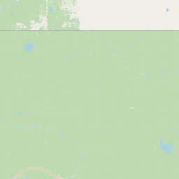
Map view of Jackpine Remnant Provincial Park

Use this park location map to pinpoint Jackpine Remnant Provincial Park in Canada, understand its exact geographic position, and read its mapped placement within the surrounding landscape more clearly.

Pigeon | © OpenStreetMap contributors

Location context for Jackpine Remnant Provincial Park

British Columbia
Park atlas

Compare nearby protected areas and regional boreal forest landscapes.

Explore Other Parks Near Jackpine Remnant Provincial Park and Surrounding Regions

Continue browsing other protected areas near Jackpine Remnant Provincial Park to examine connected northern ecosystems and regional forest reserves. Comparing adjacent conservation sites reveals the broader ecological patterns shaping the surrounding boreal terrain.
State or regional parkBritish Columbia
About 66 km away#1 closest

North

Maxhamish Lake Provincial Park and Protected Area: Mapping Northern British Columbia Wilderness

Boreal lake ecosystems and protected indigenous heritage lands

Spanning over 27,500 hectares, Maxhamish Lake Provincial Park and Protected Area is a remote boreal refuge characterized by its central lake and extensive coniferous forests. This park provides a critical habitat for moose, deer, and cold-water fish species while maintaining deep ties to the Fort Nelson First Nation and Acho Dene Koe. Its geography reveals a distinct northern basin, offering insight into the ecological character and protected landscape features of northeastern British Columbia.

Area
275.16 km²
IUCN
II
Water
Major water bodies
Season
Seasonal
A pale, minimalist watercolor painting of a river landscape with distant rolling hills, marshy grasses, and light tree clusters under a bright sky.
State or regional parkBritish Columbia
About 158 km away#2 closest

West

Liard River Hot Springs Provincial Park: Boreal Geothermal Mapping and Regional Geography

Protected northern wilderness, thermal water systems, and muskeg wetland terrain

Liard River Hot Springs Provincial Park serves as a protected geographic nexus where thermal water discharge creates a unique biological oasis. The park landscape combines expansive boreal forest with sensitive muskeg wetlands, centered around a natural hot spring system that supports orchid populations and regular wildlife sightings. This atlas entry provides essential context on the physical boundaries and ecological features that define this significant regional park in northern British Columbia.

Area
10.82 km²
Established
1957
IUCN
III
Relief
Lowland
State or regional parkBritish Columbia
About 166 km away#3 closest

Southwest

Kwadacha Wilderness Provincial Park: Geographic Boundaries and Regional Protected Area Context

Untouched mountain wilderness in northern British Columbia

Kwadacha Wilderness Provincial Park provides a rare, roadless mountain experience within the northeastern interior of British Columbia. Characterized by high-relief alpine ridges, dense boreal forests, and challenging river systems, the park represents an essential wilderness corridor that remains free from human infrastructure and standard road access, prioritizing ecological integrity over recreation.

Area
1,302.79 km²
Established
1973
IUCN
Ib
Relief
Mountain
State or regional parkBritish Columbia
About 180 km away#4 closest

South

Prophet River Hot Springs Provincial Park: Protected Landscape and Geothermal Geography

Remote backcountry wilderness in northeastern British Columbia

Prophet River Hot Springs Provincial Park is a specialized protected area known for its unique tufa mounds and geothermal features. Set against the mountainous backdrop of the Muskwa Ranges, this backcountry destination offers a compelling study of boreal and subalpine geography, accessible only by hiking or horseback through undisturbed wilderness corridors.

Area
1.84 km²
Established
1999
IUCN
II
Relief
Mountain
National parkNorthwest Territories
About 189 km away#5 closest

Northwest

Nahanni National Park Reserve National Park: Protected Landscape and Geographic Mapping

Explore the mapped terrain and protected area boundaries in Northwest Territories.

Navigate the protected landscape of Nahanni National Park Reserve, a designated national park within the Northwest Territories. This entry provides detailed insight into the park's mapped geographic boundaries and its role as a significant protected area. Understanding its place within the regional atlas allows for a deeper appreciation of its natural terrain and conservation significance, offering factual context for geographic exploration.

Area
30,050 km²
Established
1972
IUCN
II
Visitors
1.1K annual
State or regional parkBritish Columbia
About 191 km away#6 closest

South

Redfern-Keily Provincial Park: A Deep Dive into Muskwa Ranges Protected Geography

Remote Glacial Landscapes and Northern Wilderness Terrain

Redfern-Keily Provincial Park encompasses a significant stretch of remote wilderness in the Muskwa Ranges of northeastern British Columbia. Anchored by the eight-kilometer Redfern Lake and surrounding glaciers like the Ithaca and Achaean, the area serves as a primary example of intact boreal and subalpine geography. The terrain offers a rugged look at high-elevation ecosystems and glacial history within the Muskwa-Kechika Management Area.

Area
807.12 km²
Established
1999
IUCN
II
Relief
Mountain
State or regional parkBritish Columbia
About 194 km away#7 closest

Southwest

Dune Za Keyih Provincial Park and Protected Area: Watershed and Terrain Geography

Remote wilderness landscape in northern British Columbia

Dune Za Keyih Provincial Park and Protected Area protects the largest unlogged watershed in British Columbia. Situated within the Muskwa-Kechika Management Area, this remote wilderness is defined by the geological structures of the Rocky Mountain Trench, providing a continuous corridor of undisturbed mountain forest, riparian zones, and highland terrain.

Area
3,468.33 km²
Established
2001
IUCN
Ib
Relief
Mountain
State or regional parkBritish Columbia
About 215 km away#8 closest

West

Denetiah Provincial Park and Protected Area: Regional Geography and Wilderness Mapping

An undisturbed boreal reserve in the Stikine Region

Discover the geographic structure of Denetiah Provincial Park and Protected Area, a vast roadless landscape in northern British Columbia. This park protects pristine boreal forests, elongated glacial lake basins, and critical river headwaters that serve as a benchmark for northern conservation within the Muskwa-Kechika Management Area.

Area
1,053.49 km²
Established
1999
IUCN
II
Relief
Upland

Common questions about visiting, size, designation, and location context for Jackpine Remnant Provincial Park

Jackpine Remnant Provincial Park FAQs for park facts, access, geography, and protected area context

Find quick answers about Jackpine Remnant Provincial Park, including protected-area facts, park geography, trail and visitor context, and how the park fits into its surrounding country and regional landscape.
MoriAtlas Explorer

Continue Your Protected Areas Search Across the Global Atlas

Deepen your exploration by continuing the structured search for national parks and protected areas worldwide. Utilize the comprehensive filtering capabilities to compare different conservation landscapes and refine your understanding of global park geography. Discover more about the distribution and characteristics of protected natural areas.

Global natural geography