
Mori Atlas logo
Wildlife reserveJames Peak Wilderness

Mapping the glaciated summits, alpine tundra, and coniferous forests along the Continental Divide

James Peak Wilderness: A High Elevation Protected Wildlife Reserve in the Colorado Rockies

James Peak Wilderness represents a significant protected corridor within the central Colorado Rockies, encompassing rugged alpine terrain that rises above 13,000 feet. The area serves as a vital natural landscape east of the Continental Divide, defined by steep, glacier-carved valleys, rocky ridges, and dense subalpine forest ecosystems. This detailed geographic profile provides an overview of the terrain, watershed boundaries, and the wilderness area's integration into the larger Front Range protected network.

alpine wildernessRocky MountainsContinental Dividesubalpine foresthigh countyColorado Front Range
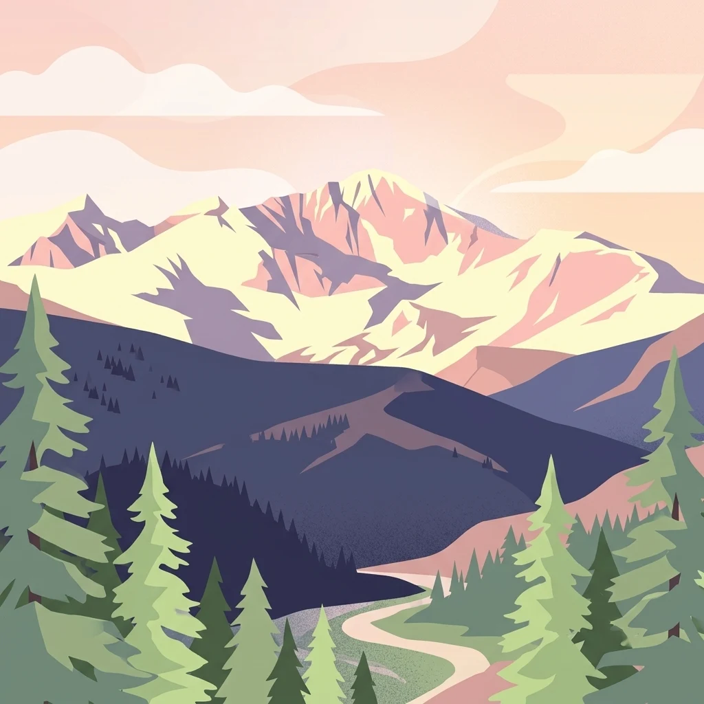
An illustration showing a path winding through a pine forest towards a tall, jagged mountain peak under a warm-toned sky.

James Peak Wilderness

Wildlife reserve

Park overview

Structured park overview, official facts, and landscape profile for James Peak Wilderness

James Peak Wilderness park facts, protected area profile, and essential visitor context

Review the core facts for James Peak Wilderness, including designation, size, terrain, visitor scale, habitats, and operating context in one park-focused overview.

About James Peak Wilderness

James Peak Wilderness occupies a strategic position in the central Colorado Rockies, sitting just east of the Continental Divide within the Arapaho and Roosevelt national forests. Although it covers a comparatively modest area, its location and elevation give it a strong alpine character that defines the experience of the wilderness. The terrain rises from forested slopes and montane valleys up to exposed tundra and rugged thirteeners, capturing the vertical range that makes the Colorado high country so distinctive.

The wilderness shares its identity closely with the surrounding protected landscapes. To the north it abuts the Indian Peaks Wilderness, one of the most heavily used wilderness areas in Colorado, and to the west it connects with the James Peak Protection Area, a related land-use designation designed to maintain the broader landscape character of the region. Together these units create a substantial block of conserved mountain landscape along the Front Range.

Within the wilderness, trails wind through glaciated valleys, subalpine forests, and open ridges, providing access to summits, scenic basins, and quiet backcountry settings. The combination of dramatic relief, ecological diversity, and proximity to the Denver metropolitan area makes James Peak Wilderness both a significant conservation area and a notable destination for backcountry recreation in the central Rockies.

Quick facts and research context for James Peak Wilderness

James Peak Wilderness is a federally designated U.S. Wilderness Area located in north central Colorado, east of the Continental Divide. It falls within the Arapaho and Roosevelt national forests and crosses the boundary between Gilpin and Clear Creek counties, with the small historic city of Black Hawk as its nearest community.

Covering approximately 17,000 acres, the wilderness contains more than 30 miles of trails and includes several high peaks above 13,000 feet, including James Peak and Parry Peak. It was established in 2002 through congressional legislation and is managed by the U.S. Forest Service under a wilderness preservation mandate.

Park context

Deeper park guide and search-rich context for James Peak Wilderness

James Peak Wilderness history, landscape, wildlife, and travel context

Explore James Peak Wilderness through its history, landscape character, ecosystems, wildlife, conservation priorities, cultural context, and seasonal travel timing in a structured park guide built for atlas discovery and search intent.

Why James Peak Wilderness stands out

James Peak Wilderness is best known for its dramatic high-elevation Rocky Mountain terrain immediately east of the Continental Divide. The area is characterized by alpine summits, rounded glacial basins, and dense coniferous forests that descend into the montane zone. The wilderness takes its name from James Peak, a 13,294-foot mountain honoring the botanist Edwin James, while Parry Peak, at 13,391 feet, is actually the highest point within the wilderness. Together with its neighbor Indian Peaks Wilderness, James Peak forms an important cluster of protected high country along the Colorado Front Range.
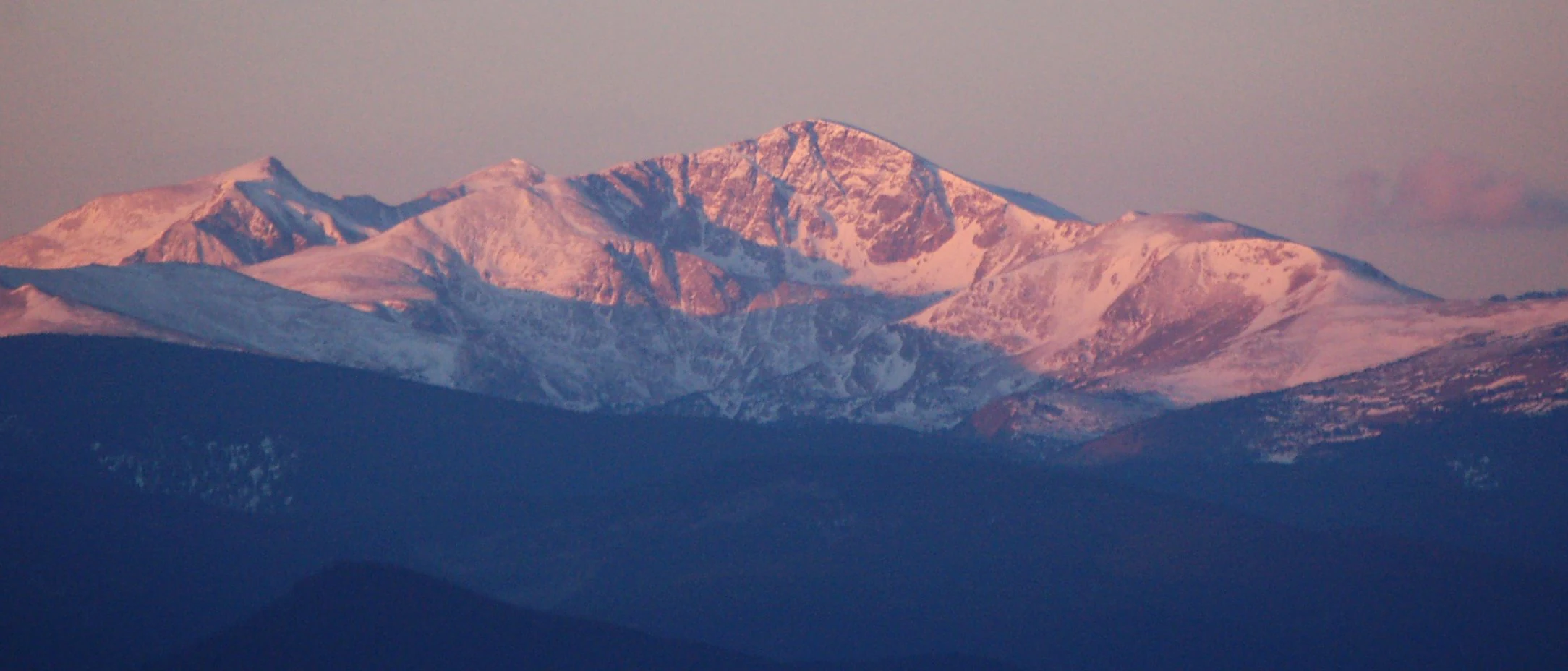
A panoramic, wide-angle view of James Peak covered in snow, glowing with golden-pink morning light, rising above dark, shadowed mountain foothills.
James Peak illuminated by the morning sun, viewed from the east.

James Peak Wilderness history and protected-area timeline

The James Peak Wilderness was established in 2002, following congressional action under H.R. 1576 in the 107th Congress in 2001. The designation elevated a portion of the Arapaho and Roosevelt national forests to wilderness status, placing it under the stricter management regime reserved for U.S. Wilderness Areas.

The name of the wilderness traces back to the mountain at its heart, James Peak. The peak was named in honor of Edwin James, a pioneer and botanist who traveled through the Rocky Mountains in the early nineteenth century as part of the Long Expedition. Notably, the present-day Pikes Peak was originally called James Peak before Zebulon Pike's expedition led to its renaming, after which the current James Peak took on the name. The mountain's relocation of this historical name reflects the broader role of early American scientific exploration in shaping Colorado's geographic identity.

James Peak Wilderness landscape and geographic character

The landscape of James Peak Wilderness is dominated by the steep, glacier-carved topography typical of Colorado's northern Front Range. Immediately east of the Continental Divide, the wilderness features sharp ridges, U-shaped valleys, and cirques shaped by past glacial activity. Several summits rise above 13,000 feet, with Parry Peak standing as the highest point at 13,391 feet, followed by the eponymous James Peak at 13,294 feet.

Below the alpine zone, the terrain transitions through subalpine meadows and into dense coniferous forests of spruce, fir, and pine. The elevation drop across the wilderness, combined with varied aspects and slope conditions, creates a mosaic of open tundra, rocky outcrops, forested slopes, and riparian stringers along the streams that drain the high country. The Continental Divide itself forms a defining western boundary, shaping both the scenery and the watershed dynamics of the area.

James Peak Wilderness ecosystems, habitats, and plant life

Because of its position straddling the eastern flank of the Continental Divide, James Peak Wilderness encompasses a full vertical gradient of central Colorado ecosystems. Lower elevations include montane forests, while mid-elevations support classic subalpine communities of Engelmann spruce and subalpine fir, and the highest terrain transitions into wind-exposed alpine tundra.

This ecological layering creates a compact but diverse mosaic of habitats within the wilderness. Glacial basins and cirque lakes hold cold, clear water; forested slopes provide cover for large and mid-sized mammals; and the alpine zones support hardy tundra vegetation adapted to short growing seasons. The wilderness's proximity to other protected areas, particularly Indian Peaks Wilderness, enhances the ecological continuity of the surrounding landscape, allowing wildlife and ecological processes to move across a broader block of high country.

James Peak Wilderness wildlife and species highlights

The elevation range and habitat diversity of James Peak Wilderness support a characteristic mix of Colorado high-country wildlife. Forested zones provide habitat for species commonly associated with the Rocky Mountains, while alpine and subalpine areas offer open terrain favored by other species adapted to harsh, exposed conditions.

The wilderness's connection with surrounding national forest lands and adjacent wilderness areas contributes to its value as wildlife habitat, allowing populations to move across a larger landscape. The combination of forest cover, water sources from snowmelt and cirque lakes, and open alpine expanses makes James Peak Wilderness a useful representative of central Rocky Mountain fauna patterns.

James Peak Wilderness conservation status and protection priorities

As a federally designated U.S. Wilderness Area, James Peak Wilderness carries a high level of environmental protection. Its wilderness status restricts road building, mechanized use, and other forms of development, preserving the area's natural condition and ecological processes.

The wilderness is particularly important in the context of the Colorado Front Range, where growing population centers exert increasing pressure on nearby mountain landscapes. By protecting a substantial block of subalpine and alpine habitat east of the Continental Divide, James Peak Wilderness helps maintain water quality, wildlife corridors, and scenic integrity across a region facing significant recreational and developmental demand.

Top sights and standout views in James Peak Wilderness

James Peak Wilderness stands out for its rugged alpine terrain on the eastern side of the Continental Divide, with multiple summits above 13,000 feet including Parry Peak, the wilderness's true high point. Its 30 miles of trails connect glaciated basins, subalpine forests, and windswept ridges typical of the central Colorado Rockies.

The wilderness is also notable for its integration into a larger protected landscape, linking directly with Indian Peaks Wilderness to the north and the James Peak Protection Area to the west, strengthening both ecological connectivity and long-term conservation value along the Front Range.

Best time to visit James Peak Wilderness

Summer and early autumn are typically the most accessible seasons in James Peak Wilderness, when snow has melted from most trails and the alpine zones are free of heavy snow cover. During this period, wildflower displays in subalpine meadows are at their peak, and high summits and basins become reachable on foot.

Winter and spring transform the wilderness into a much harsher environment dominated by deep snow and extreme cold, and most of the higher trails are buried under snowpack. Visitors during the colder months should expect a true winter backcountry experience, with significant avalanche risk on steep slopes and limited access to the alpine terrain.

Monthly climate preview

Long-term representative coordinate measurements for monthly temperature and precipitation patterns

James Peak Wilderness Climate Normals, Annual Temperature and Precipitation Rhythm

James Peak Wilderness exhibits a measured annual temperature and precipitation rhythm spanning long-term monthly averages from NASA Power climatology records. Reviewing the complete twelve-month temperature and precipitation profile provides deeper insight into local climate normals.
Annual mean4 °C
-7 °C17 °C
Jan-7°
Feb-7°
Mar-3°
Apr
May
Jun13°
Jul17°
Aug15°
Sep11°
Oct
Nov-2°
Dec-7°
Warmest month
July

16.7 °C

Coolest month
January

-7.3 °C

Wettest month
April

2.2 mm/day

Driest month
December

1 mm/day

Park location guide

Geography guide, regional context, and park location map for James Peak Wilderness

James Peak Wilderness park geography, regions, and map view in United States of America

Understand where James Peak Wilderness sits in United States of America through a broader geographic reading of the surrounding landscape, nearby location context, and its mapped position within the national park landscape.

How James Peak Wilderness fits into United States of America

The United States of America is a federal presidential republic and one of the world's largest countries by area and population. It consists of 50 states across a vast territory spanning multiple time zones, with its capital in Washington, D.C. and largest city in New York City. The nation has a diverse economy, influential political system, and significant cultural and military presence globally.

Wider geography shaping James Peak Wilderness in United States of America

The United States occupies a vast territory in North America, bordered by Canada to the north and Mexico to the south. The 48 contiguous states stretch from the Atlantic to the Pacific Ocean, while Alaska occupies the northwestern region and Hawaii is an archipelago in the Pacific. The country encompasses diverse terrain including the Rocky Mountains, Appalachian Mountains, Great Plains, and extensive river systems.

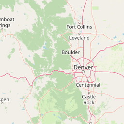
Map view of James Peak Wilderness

Use this park location map to pinpoint James Peak Wilderness in United States of America, understand its exact geographic position, and read its mapped placement within the surrounding landscape more clearly.

Pigeon | © OpenStreetMap contributors

Location context for James Peak Wilderness

Colorado

Visual reference for alpine terrain, subalpine forests, and glacial valleys

James Peak Wilderness Photos and Landscape Scenery

Visual records reveal the dramatic high-elevation topography and rugged terrain defining James Peak Wilderness along the Continental Divide. Examining these detailed landscape photographs provides a clearer understanding of the protected alpine ecosystems and glacial formations shaping the Colorado Front Range.

A panoramic, wide-angle view of James Peak covered in snow, glowing with golden-pink morning light, rising above dark, shadowed mountain foothills.

Park atlas

Discover connected high-country reserves and protected terrain along the Colorado Front Range.

Parks Near James Peak Wilderness: Exploring Nearby Protected Areas and Alpine Landscapes

Browsing other protected areas near James Peak Wilderness reveals a broader network of alpine summits, glacial valleys, and national forest reserves along the Continental Divide. Expanding the geographic scope helps connect individual mountain sanctuaries into a comprehensive regional view of the central Rockies.
A horizontal watercolor painting showing a range of purple and reddish-toned mountains in the distance, behind rolling green fields and a pale pinkish waterway in the foreground.
Protected landscapeColorado
About 1.7 km away#1 closest

North

Roosevelt National Forest: Mapping Wilderness and Protected Landscapes in Northern Colorado

Regional geography, river corridors, and alpine mountain terrain

Roosevelt National Forest encompasses a significant protected landscape across Larimer, Boulder, Gilpin, and Jefferson counties. The forest features a complex terrain of deep canyons, forested plateaus, and protected wilderness areas that form a scenic buffer along the eastern side of the Continental Divide and Rocky Mountain National Park.

Area
3,293.33 km²
Established
1902
Relief
Mountain
Climate
Subpolar
A watercolor painting of a mountain landscape featuring a small lake, grassy slopes, and conifer trees with a prominent rocky peak in the distance.
Wildlife reserveColorado
About 8.6 km away#2 closest

North

Indian Peaks Wilderness: Alpine Geography and Front Range Protected Landscapes

Mapping high country summits and glacial basins in Colorado

Indian Peaks Wilderness stands as a signature wildlife reserve along the Colorado Continental Divide. This atlas entry focuses on its complex system of thirteen-thousand-foot peaks, relict glaciers, and interconnected alpine lakes that define the Front Range. Gain insight into the protected boundaries and glacial geomorphology that characterize this high-country landscape near the Denver metropolitan region.

Area
310.44 km²
Established
1978
IUCN
Ib
Relief
Mountain
Protected landscapeGrand County
About 16 km away#3 closest

North

Arapaho National Recreation Area: Geographic Profile and Protected Landscape Context

High-country mountain reservoirs and forested mountain terrain

The Arapaho National Recreation Area defines a unique intersection of montane forest and water-based geography in Grand County, Colorado. As the home to the Great Lakes of Colorado, this protected landscape provides a critical connection point between the Colorado River headwaters and the Continental Divide. Examine the park's terrain, reservoir distribution, and its role as a forested gateway to the neighboring mountain regions.

Area
124.2 km²
Established
1978
Relief
Mountain
Climate
Alpine
A watercolor painting showing purple and white mountain peaks rising above green rolling hills and meadows in a wide panoramic format
Protected areaColorado
About 21 km away#4 closest

South

Mount Evans Wilderness: Alpine Landscapes and Protected Geography in Colorado

Glacial cirques and high-altitude wilderness ecosystems.

Mount Evans Wilderness offers a premier look at the Colorado Front Range, defined by its dramatic relief, sheer cliff lines, and extensive glacial history. This entry examines the wilderness as a protected zone that transitions from montane forests to tundra, providing a reference for high-elevation mountainous geography within the United States.

Area
301.09 km²
Established
1980
IUCN
Ib
Relief
Mountain
A soft watercolor illustration depicting a simplified, layered landscape of rolling hills and distant mountains in shades of light green, pale yellow, and soft pink.
Protected areaColorado
About 26 km away#5 closest

Southeast

Pike National Forest: Protected Mountain Landscapes and Regional Geography in Central Colorado

Granite peaks, montane forests, and diverse alpine terrain

Spanning from the rolling foothills of the Front Range to the high alpine summits of the Rocky Mountains, Pike National Forest is a significant protected area defined by its unique Pikes Peak granite bedrock and deep river-carved canyons. This analysis provides a structured look at its expansive wilderness boundaries, drainage basins, and the vertical transitions that characterize this vital central Colorado highland.

Area
4,478.27 km²
Established
1892
Relief
Mountain
Climate
Alpine
Protected landscapeColorado
About 30 km away#6 closest

South

White River National Forest: Mapping the Protected Landscapes and High Country of Central Colorado

Regional geography, wilderness boundaries, and mountain terrain data

Spanning from the high alpine tundra of the Sawatch Range to the volcanic plateaus of the Flat Tops, White River National Forest represents a significant protected area in the American West. This detail presents the geographic footprint, forest landscape, and complex mountain terrain that define this vital Colorado territory.

Area
9,251 km²
Established
1902
Relief
Mountain
Climate
Alpine
National parkColorado
About 34 km away#7 closest

North

Rocky Mountain National Park: National Park Protected Landscape in Colorado

Explore its mapped boundaries and regional geographic context.

Rocky Mountain National Park is a designated National Park within Colorado, crucial for understanding the distribution and geographic context of protected areas in the United States. This detail page provides an atlas-oriented perspective, emphasizing the park's mapped boundaries and its place within the natural landscape of the region. It is designed to facilitate a clear understanding of the park's protected status and its contribution to the atlas of natural landscapes, offering factual insights for geographic discovery.

Area
1,074.28 km²
Established
1915
IUCN
II
Visitors
4.2M annual
Wildlife reserveColorado
About 41 km away#8 closest

West

Eagles Nest Wilderness: Alpine Geography and Protected Landscape of the Colorado Gore Range

High-mountain protected area in the White River National Forest

Spanning the southern Gore Range, Eagles Nest Wilderness represents a core protected landscape in Colorado characterized by high-elevation peaks, glacial cirque lakes, and extensive backcountry trail networks. Its geography bridges the gap between deep coniferous forests and exposed alpine tundra, maintaining significant ecological and historical value within the mountainous terrain of Eagle and Summit Counties.

Area
546.79 km²
Established
1976
IUCN
Ib
Relief
Mountain

Common questions about visiting, size, designation, and location context for James Peak Wilderness

James Peak Wilderness FAQs for park facts, access, geography, and protected area context

Find quick answers about James Peak Wilderness, including protected-area facts, park geography, trail and visitor context, and how the park fits into its surrounding country and regional landscape.
MoriAtlas Explorer

Continue Your Protected Areas Search Across the Global Atlas

Deepen your exploration by continuing the structured search for national parks and protected areas worldwide. Utilize the comprehensive filtering capabilities to compare different conservation landscapes and refine your understanding of global park geography. Discover more about the distribution and characteristics of protected natural areas.

Global natural geography