
Mori Atlas logo
Protected areaJames River Face Wilderness

Examining the vertical terrain, quartzite geology, and mapped forest watersheds of this Blue Ridge wilderness

James River Face Wilderness: A Detailed Geographic Analysis of Virginia Blue Ridge Protected Landscapes

James River Face Wilderness represents a significant protected area within the Jefferson National Forest, capturing the dramatic vertical relief of the Blue Ridge Mountains in Virginia. This rugged terrain features sharp elevation changes from the crest of Highcock Knob down to the James River, encompassing a diverse mosaic of dry ridge-top pine forests and rich, sheltered cove hardwoods. The area is defined by its unusual geological character, particularly the expansive quartzite boulder fields of the Devils Marbleyard, which provide a distinct contrast to the surrounding mountain hollows and mature forest stands.

wilderness areaBlue RidgeAppalachian Mountainsnational forestJames Riverold growth forest
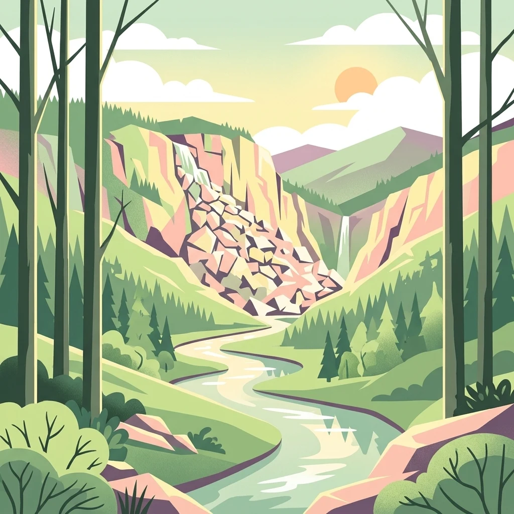
A stylized vector illustration showing a river flowing through a green valley with rocky cliffs, waterfalls, and tall trees in the foreground.

James River Face Wilderness

Protected area

Park overview

Structured park overview, official facts, and landscape profile for James River Face Wilderness

James River Face Wilderness park facts, protected area profile, and essential visitor context

Review the core facts for James River Face Wilderness, including designation, size, terrain, visitor scale, habitats, and operating context in one park-focused overview.

About James River Face Wilderness

James River Face Wilderness occupies a distinctive slice of Virginia's Blue Ridge, where the broad crest of the mountains drops abruptly to the deeply cut gorge of the James River. The wilderness lies within the Jefferson National Forest and is bounded on the northeast by the James River, on the west by Forest Service Road 35, and on the south by the Blue Ridge Parkway. Its position links two major geographic features of the southern Blue Ridge: the high spine of the Parkway corridor and one of the longest rivers in the eastern United States.

The most visually striking aspect of the wilderness is its topographic range. Highcock Knob reaches above 3,000 feet, while the James River lies near 650 feet, producing nearly the full elevation change of the Blue Ridge in a remarkably compact area. This abrupt change shapes nearly every other feature of the wilderness. The crest hosts dry, open forest communities dominated by chestnut oak and yellow pines, while the sheltered coves and lower drainages support richer mesic forests. Rock outcrops and boulder fields interrupt the forest cover, and the Devils Marbleyard presents one of the most unusual surface features in the region, an expansive slope of quartzite boulders that visually dominates the surrounding terrain.

The wilderness is also notable for the trails that traverse it. The Appalachian Trail crosses the James River within the area on a dedicated footbridge, then climbs back up to the ridge. Other routes, including Balcony Falls, Belfast, Gunter Ridge, Piney Ridge, and Sulphur Springs Trails, connect Forest Roads, trailheads, and stream drainages, offering access to most parts of the unit. These routes, combined with the wilderness's proximity to the Blue Ridge Parkway, make it a key link in the broader recreation network of Virginia's central Blue Ridge.

Management of the wilderness reflects its protected status under the National Wilderness Preservation System. Motorized equipment, motor vehicles, and mountain bikes are prohibited, group sizes are limited, and camping is regulated to maintain the area's natural conditions. The U.S. Forest Service also monitors air quality, tracking visibility, water chemistry, and plant health in response to regional emissions of sulfur compounds and ozone. The result is a wilderness that, while heavily visited relative to its size, remains a preserved reference area for Blue Ridge forest ecosystems and Appalachian landscape character.

Quick facts and research context for James River Face Wilderness

James River Face Wilderness is a small but topographically dramatic Blue Ridge wilderness in central Virginia, located in Bedford and Rockbridge Counties near the city of Buena Vista. It lies within the Jefferson National Forest and is part of the Glenwood Cluster of federally protected mountain lands. Established in 1975 under the Eastern Wilderness Act, it is managed by the U.S. Forest Service through the Glenwood-Pedlar Ranger Districts of the George Washington and Jefferson National Forests.

Protection and recognition

Documented terrestrial protection scope and international recognition records

James River Face Wilderness Protection Status and Recognition Data

James River Face Wilderness holds a documented terrestrial protection scope within the regional protected area network. Review the official designation history, management framework, and recognized conservation status details.

Protection details

Protection scope
Terrestrial
Transboundary protection
No
Park context

Deeper park guide and search-rich context for James River Face Wilderness

James River Face Wilderness history, landscape, wildlife, and travel context

Explore James River Face Wilderness through its history, landscape character, ecosystems, wildlife, conservation priorities, cultural context, and seasonal travel timing in a structured park guide built for atlas discovery and search intent.

Why James River Face Wilderness stands out

The wilderness is best known for its steep descent from the Blue Ridge crest down to the James River, the unusual quartzite boulder field of the Devils Marbleyard, and its contrast between dry, fire-scarred ridge-top forests and lush cove forests on the more sheltered slopes. Old growth trees in the Matt's Creek watershed and the Appalachian Trail crossing of the James River further define the area's outdoor identity.
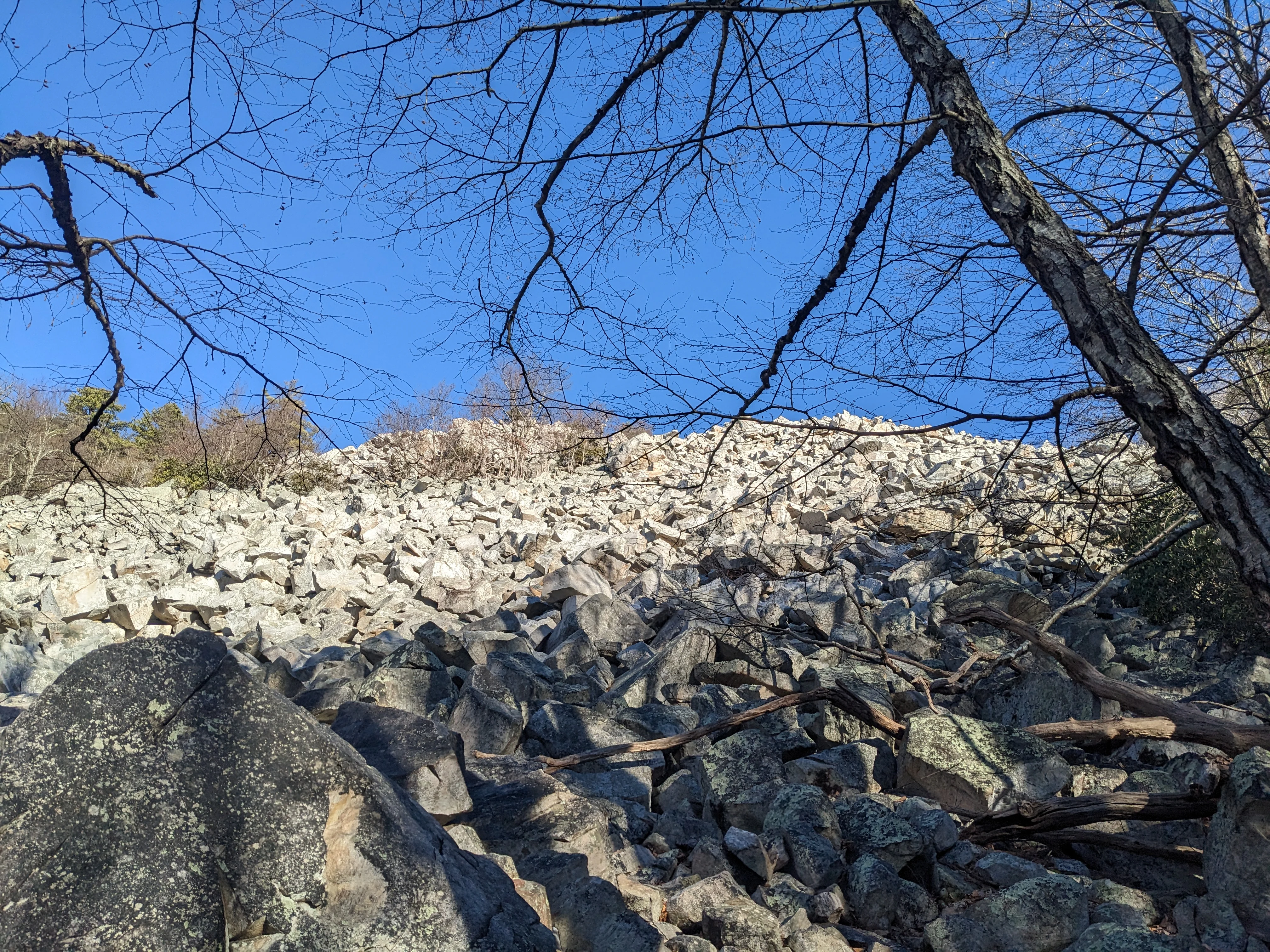
A large field of light-colored boulders and rocks covering a hillside, framed by dark bare tree branches in the foreground under a clear blue sky.
View of the Devils Marbleyard rock outcrop with bare trees framing the scene against a blue sky.

James River Face Wilderness history and protected-area timeline

James River Face Wilderness was designated by Congress in 1975 through the Eastern Wilderness Act, placing it within the National Wilderness Preservation System along with other significant Eastern U.S. wildlands. Its designation reflected growing recognition that even relatively small mountainous areas in the eastern United States could serve as reservoirs of natural plant and animal communities if given formal protection. Since designation, the wilderness has been managed by the U.S. Forest Service as part of the Glenwood and Pedlar Ranger Districts of the George Washington and Jefferson National Forests.

Before its wilderness status, the area had a long history of industrial use tied directly to its forested landscape. The lower elevations, particularly along the James River and in the valley bottoms, were developed for mineral extraction and timber harvesting. The former Francis T. Anderson Glenwood Estate, regarded as one of the finest principalities in western Virginia, operated the Glenwood Iron Furnace, an iron smelting enterprise that required enormous quantities of timber to produce the charcoal used in smelting. The surrounding forest was logged repeatedly over multiple generations, with first-growth timber stripped and second- and third-growth stands subsequently cut.

Although this industrial past left a visible mark on parts of the landscape, portions of the wilderness still harbor older forest. Old growth trees remain in the Matt's Creek watershed and along the James River, particularly near where the Appalachian Trail enters the Matt's Creek drainage. These remnants survive as living evidence of what the broader Blue Ridge forest once looked like, and they are an important reason the area was considered worthy of wilderness protection.

James River Face Wilderness landscape and geographic character

The landscape of James River Face Wilderness is defined by dramatic vertical relief. The crest of the Blue Ridge rises to above 3,000 feet at Highcock Knob, then drops sharply to the James River at roughly 650 feet, creating one of the steepest natural elevation changes in the central Virginia Blue Ridge. Two long ridges, Piney Ridge on the east and Gunter Ridge on the west, frame the wilderness and channel drainages down toward the river. The result is a landscape of layered topography, where summits, shoulders, hollows, and narrow creek valleys stack closely together and views open unexpectedly across the gorge.

Among the area's most unusual surface features is the Devils Marbleyard, a vast slope of quartzite boulders, some as large as school buses, piled along a rock outcrop. The boulder field is accessible to hikers and visually dominates the surrounding forest, giving the wilderness a landscape element that feels closer to a high-mountain talus field than to a typical mid-Atlantic forest. Elsewhere, the rocky slopes, exposed shoulders of the ridges, and fire-scarred hillsides contribute to an impression of harsh, rugged terrain, particularly on the drier, more exposed aspects.

Streams move rapidly through this terrain, descending from the ridge crest to the James River over short distances. These creeks produce small waterfalls, plunge pools, and rocky cascades, and they cut the sheltered coves that contrast sharply with the dry ridge-tops above. The overall landscape combines a deeply cut river gorge, elevated ridge crests, boulder fields, and forested hollows within a relatively small footprint, giving the wilderness a visual variety that belies its size.
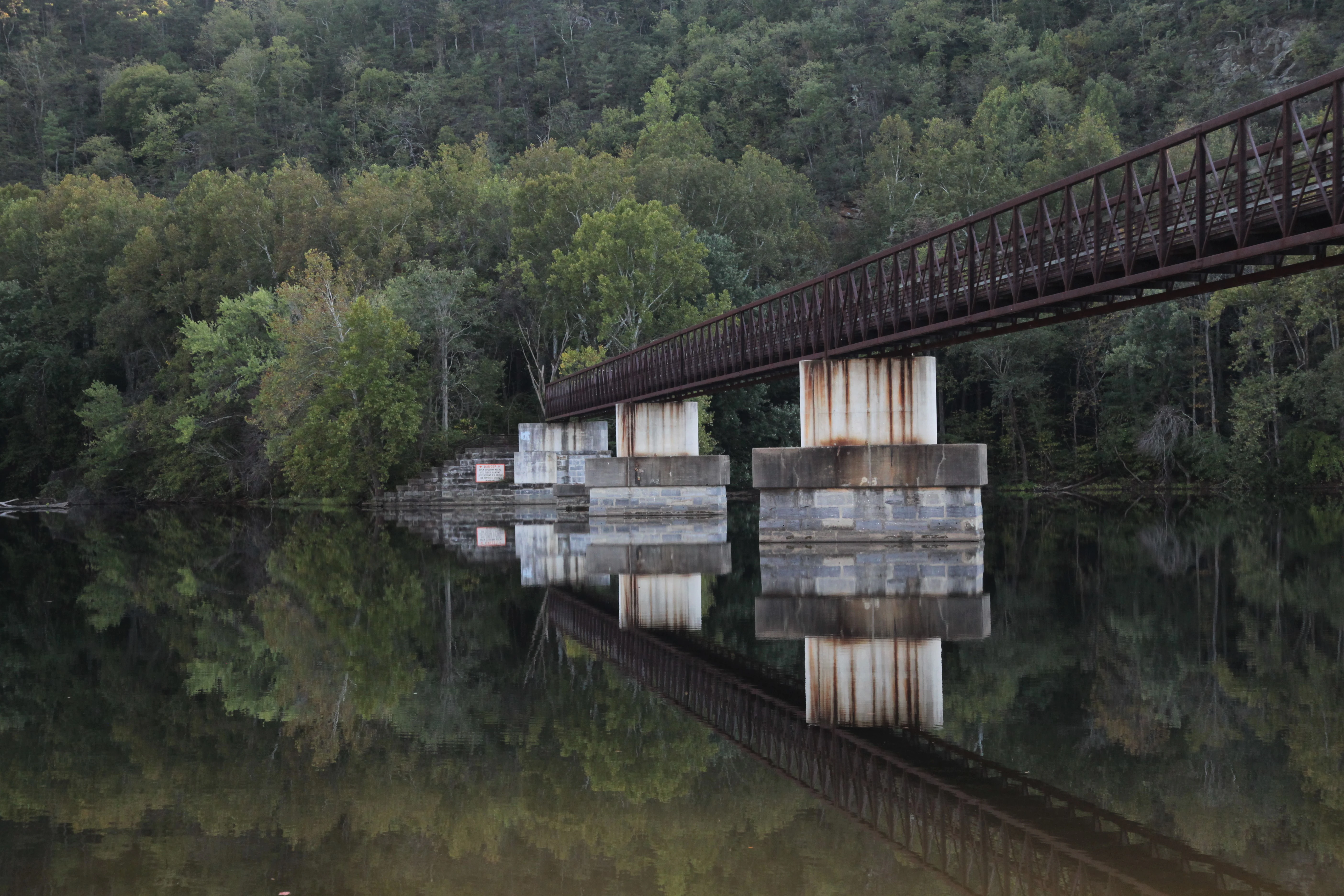
A metal footbridge with concrete piers spans a calm river, with the bridge structure and surrounding forest reflected in the still water below
Appalachian Trail footbridge crossing the James River in Virginia during autumn

James River Face Wilderness ecosystems, habitats, and plant life

The natural systems of James River Face Wilderness reflect the steep ecological gradients that come with rapid changes in elevation and aspect across the Blue Ridge. Dry, exposed slopes and ridgetops support open-canopy forests dominated by chestnut oak and various species of yellow pine, while the more sheltered coves hold much richer mesic forest communities. In specific locations, such as the coves near Highcock Knob, northern red oak and hickories become more prominent, and the lower, sheltered valleys support white oak, basswood, and tulip poplar.

A defining ecological feature of the wilderness is the presence of old growth forest in the Matt's Creek watershed and along sections of the James River where the Appalachian Trail enters the Matt's Creek drainage. These older stands are remnants of the pre-industrial forest and provide a rare reference point for what the broader Blue Ridge forest once looked like before extensive logging. They also create continuous canopy and structural diversity that supports a wider range of wildlife than the surrounding second- and third-growth stands that dominate many parts of the unit.

The wilderness's rock outcrops and boulder fields add another ecological dimension. Exposed mineral surfaces, talus slopes such as the Devils Marbleyard, cliff faces, and thin-soil ridgetops create distinct microhabitats with their own moisture, temperature, and vegetation patterns. These rocky areas contrast sharply with the nearby sheltered coves, producing a pattern in which very different plant communities can occur within walking distance of one another. This ecological compression is one of the core characteristics of the wilderness and is part of the reason it was preserved.
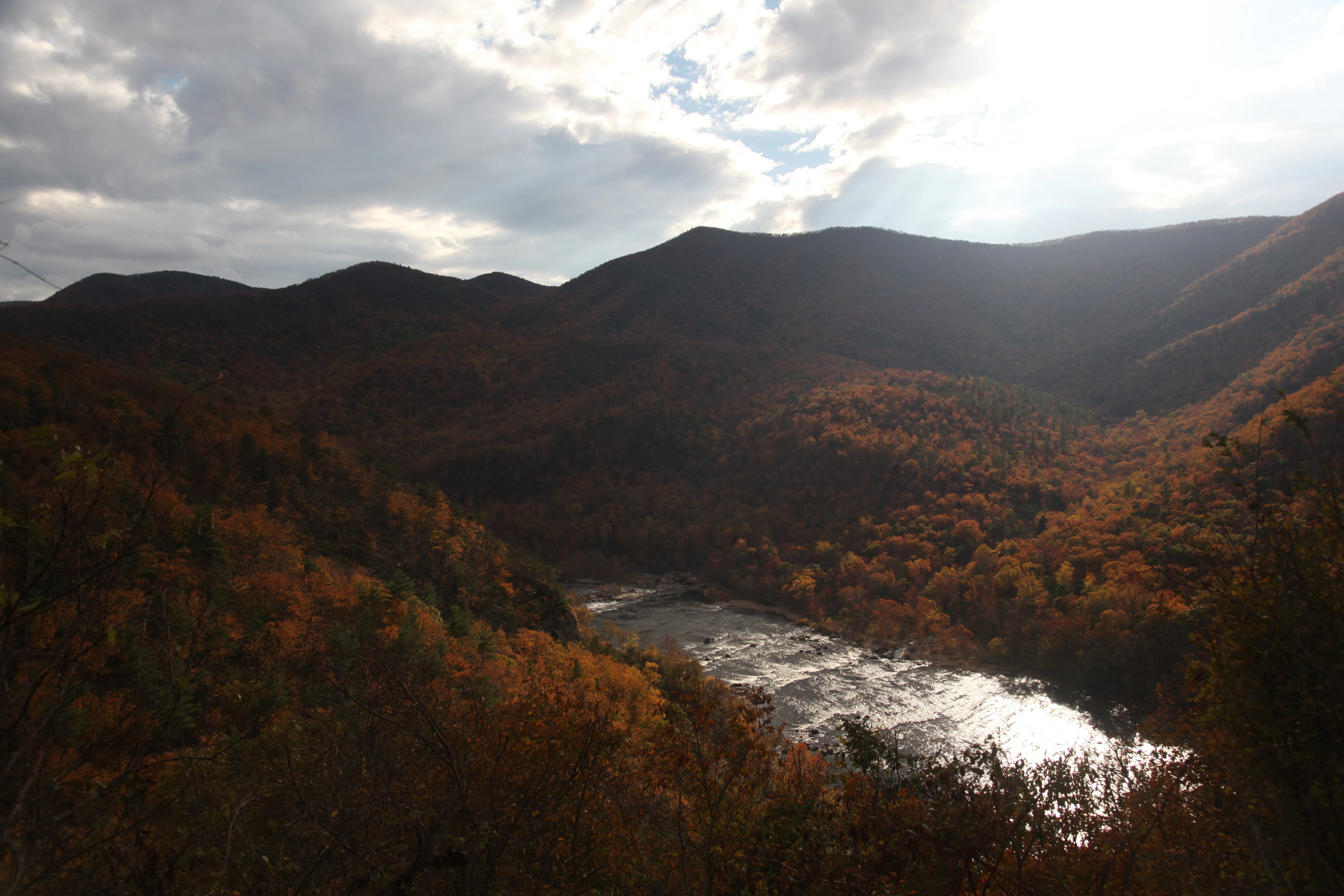
A mountain valley with a river reflecting sunlight, surrounded by hills covered in autumn-colored trees under a cloudy sky with bright sun glare.
View of the James River gorge and autumn foliage in the James River Face Wilderness, looking southwest from Virginia State Route 130.

James River Face Wilderness wildlife and species highlights

Wildlife in James River Face Wilderness reflects the diversity of forest conditions, rock habitats, and elevation zones found across the area. The combination of dry oak-pine ridges, rich cove forests, old growth stands, boulder fields, and streamside corridors supports a wide range of mammal, bird, and reptile species typical of the central Blue Ridge. The wilderness's protected status and inclusion in the National Wilderness Preservation System help maintain these populations as part of the broader regional gene pool of Appalachian species.

The most distinctive wildlife feature documented in the wilderness is the presence of the Allegheny woodrat, a species of conservation concern in the eastern United States. Allegheny woodrats have been observed at the rock outcrops of the Devils Marbleyard, where the boulder fields appear to provide shelter, denning sites, and foraging habitat. The local population, like many woodrat populations across the range, has been in decline, and researchers have investigated possible contributing factors including loss of food sources, loss of habitat quality, and mortality from parasites associated with raccoons.

Streams within the wilderness, including Matt's Creek and its tributaries, support aquatic communities typical of clear, rocky Blue Ridge streams, while the surrounding forest provides habitat for deer, black bear, small mammals, and a mix of resident and migratory songbirds and raptors. Edge habitats along the boulder fields and rock outcrops are particularly important for some of the area's less common species, including the woodrat, and represent a focal point for ongoing ecological attention within the wilderness.
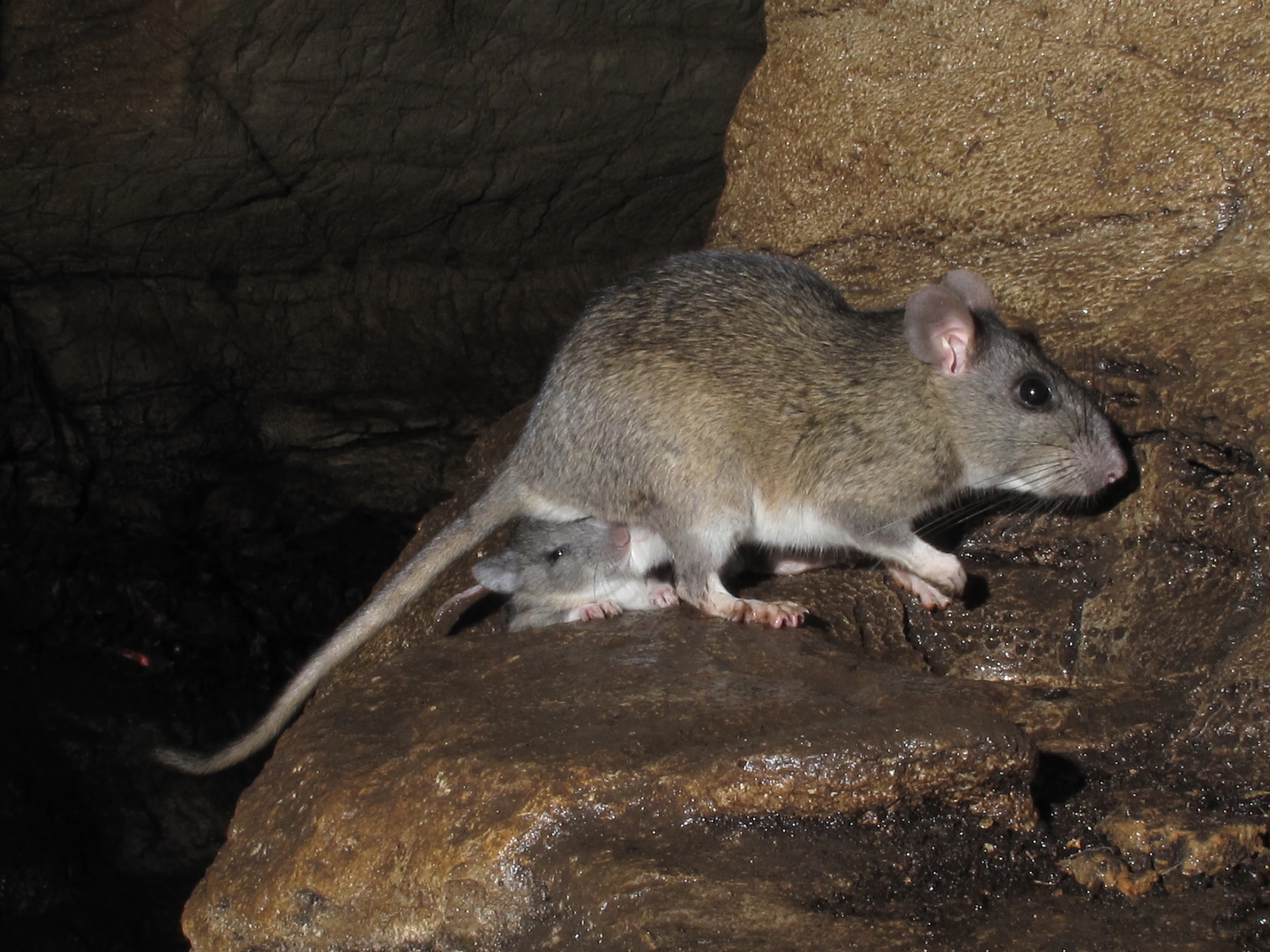
An Allegheny woodrat standing on a dark rocky surface with a smaller juvenile woodrat visible beneath it, photographed in low light conditions with flash
An Allegheny woodrat with a juvenile on a rocky surface in James River Face Wilderness

James River Face Wilderness conservation status and protection priorities

James River Face Wilderness was conserved primarily through the Eastern Wilderness Act of 1975, which added it to the National Wilderness Preservation System. The overarching conservation purpose of this designation is to maintain the wilderness in its present, natural condition and to preserve its full range of native plant and animal communities. Because wilderness areas collectively harbor more than half of the ecosystems found in the United States, even relatively small wilderness units like James River Face contribute meaningfully to national-scale biodiversity preservation and gene pool diversity.

The wilderness also plays a role in broader Appalachian conservation priorities. It is recognized as one of Virginia's Mountain Treasures by the Wilderness Society and is part of the Glenwood Cluster, a grouping of protected mountain lands in the central Blue Ridge that together support connected ecological processes as well as recreation opportunities. Adjacent wildlands, including the James River Face Wilderness Addition, Thunder Ridge Wilderness, and a series of conservation areas such as White Oak Ridge-Terrapin Mountain, North Creek, Wilson Mountain, and Cove Mountain, extend the conservation context beyond the wilderness boundary itself.

Active management focuses on keeping the wilderness in its natural state. Motorized equipment, motor vehicles, and mountain bikes are prohibited, group sizes are limited to ten people, and camping is regulated to minimize lasting human impact. The U.S. Forest Service also monitors air quality, especially visibility, water chemistry, and vegetation health, because regional emissions of sulfur compounds and ozone can cause haze, stream acidification, nutrient leaching, and direct plant injury. These long-term monitoring and regulatory efforts are central to maintaining the wilderness's value as a preserved ecological reference area in the southern Blue Ridge.

James River Face Wilderness cultural meaning and human context

The wilderness carries a tangible industrial and cultural history tied to the natural resources of the Blue Ridge. The lower elevations of the area were once part of the Francis T. Anderson Glenwood Estate, widely regarded as one of the finest principalities in western Virginia. Anderson's enterprise centered on the Glenwood Iron Furnace, a charcoal iron operation that required enormous timber inputs. Workers cut first-growth forest to feed the furnace and returned later to harvest second- and third-growth timber, leaving a layered pattern of human land use that still influences the present-day forest structure of parts of the wilderness.

Beyond the industrial past, the wilderness sits within a landscape that has long shaped regional identity in central Virginia. The James River, the Blue Ridge crest, and the Apple Orchard Mountain and Blue Ridge Parkway corridors above the wilderness are deeply embedded in the cultural geography of the area. Natural Bridge, one of Virginia's most iconic geological landmarks, lies only a few miles away, and the broader region carries a strong tradition of Appalachian outdoor recreation, including hiking the Appalachian Trail, which traverses the wilderness as it crosses the James River.

Top sights and standout views in James River Face Wilderness

James River Face Wilderness compresses the full vertical drama of Virginia's central Blue Ridge into a small, protected footprint, with the ridge crest at Highcock Knob above the James River just a few thousand feet below. The Devils Marbleyard, with its field of quartzite boulders the size of school buses, stands out as one of the most unusual geological features in the region and a focal point for both hikers and ecologists. The wilderness also harbors remnant old growth in the Matt's Creek watershed, includes a scenic crossing of the James River on the Appalachian Trail, and protects a sharp ecological contrast between dry chestnut oak and yellow pine ridges and rich cove forests of white oak, basswood, and tulip poplar.

Best time to visit James River Face Wilderness

Spring and fall tend to bring out the strongest character of the Blue Ridge in this area. Spring offers cool, comfortable hiking conditions, active stream flow in the creeks and tributaries that drop toward the James River, and fresh canopy cover in the cove forests. Fall is typically the most visually dramatic season, with foliage color shifting across the ridges and coves and crisp air offering clear views from the high points such as Highcock Knob and from the boulder fields of the Devils Marbleyard. Summer visits are possible but require preparation for hot, humid conditions in the lower drainages and along the river, as well as the increased presence of biting insects near streams.

Monthly climate preview

Long-term representative point measurements of annual temperature and precipitation rhythm

James River Face Wilderness Climate Normals and Monthly Temperature Patterns

James River Face Wilderness experiences a measured annual temperature range spanning from sub-zero winter minimums to warm summer maximums alongside consistent monthly precipitation. Reviewing the complete twelve-month climate profile provides detailed long-term averages across all recorded periods.
Annual mean13 °C
0 °C25 °C
Jan
Feb
Mar
Apr12°
May17°
Jun22°
Jul25°
Aug24°
Sep20°
Oct13°
Nov
Dec
Warmest month
July

24.6 °C

Coolest month
January

0.2 °C

Wettest month
September

3.6 mm/day

Driest month
February

2.6 mm/day

Park location guide

Geography guide, regional context, and park location map for James River Face Wilderness

James River Face Wilderness park geography, regions, and map view in United States of America

Understand where James River Face Wilderness sits in United States of America through a broader geographic reading of the surrounding landscape, nearby location context, and its mapped position within the national park landscape.

How James River Face Wilderness fits into United States of America

The United States of America is a federal presidential republic and one of the world's largest countries by area and population. It consists of 50 states across a vast territory spanning multiple time zones, with its capital in Washington, D.C. and largest city in New York City. The nation has a diverse economy, influential political system, and significant cultural and military presence globally.

Wider geography shaping James River Face Wilderness in United States of America

The United States occupies a vast territory in North America, bordered by Canada to the north and Mexico to the south. The 48 contiguous states stretch from the Atlantic to the Pacific Ocean, while Alaska occupies the northwestern region and Hawaii is an archipelago in the Pacific. The country encompasses diverse terrain including the Rocky Mountains, Appalachian Mountains, Great Plains, and extensive river systems.

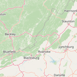
Map view of James River Face Wilderness

Use this park location map to pinpoint James River Face Wilderness in United States of America, understand its exact geographic position, and read its mapped placement within the surrounding landscape more clearly.

Pigeon | © OpenStreetMap contributors

Location context for James River Face Wilderness

Virginia

Explore protected landscape views, ridge crests, and rocky outcrop habitats.

James River Face Wilderness Photos and Scenery: Visualizing Blue Ridge Terrain

Visual documentation captures the dramatic elevation changes and rugged forest environments found across James River Face Wilderness. Examining field photography reveals the unique topography, boulder fields, and river gorges that define the protected mountain ecosystem.

A large field of light-colored boulders and rocks covering a hillside, framed by dark bare tree branches in the foreground under a clear blue sky.

A calm river reflecting forested hills with autumn foliage under a clear blue sky.

A metal footbridge with concrete piers spans a calm river, with the bridge structure and surrounding forest reflected in the still water below

A mountain valley with a river reflecting sunlight, surrounded by hills covered in autumn-colored trees under a cloudy sky with bright sun glare.

An Allegheny woodrat standing on a dark rocky surface with a smaller juvenile woodrat visible beneath it, photographed in low light conditions with flash

Park atlas

Compare surrounding mountain wildlands and regional forest reserves

Explore Protected Areas and Parks Near James River Face Wilderness

Browse adjacent protected landscapes and mountain environments connected to the Blue Ridge ecosystem. Compare neighboring terrain and regional park geography to expand your understanding of the surrounding conservation network.
Wildlife reserveVirginia
29 km away#1 closest

Northwest

Rich Hole Wilderness: Appalachian Wildlife Reserve and Forest Geography

Protected cove hardwood forest in western Virginia

Rich Hole Wilderness represents a protected high quality forest landscape located within the James River Ranger District. This area spans steep, narrow hollows and high ridge crests, providing critical habitat and showcasing old growth timber specimens. Use this resource to understand the park terrain, drainage patterns, and its position within the broader Appalachian forest network of western Virginia.

Area
26.1 km²
Established
1988
IUCN
Ib
Relief
Mountain
Wildlife reserveNelson County
33 km away#2 closest

Northeast

Priest Wilderness: A Deep Dive Into Appalachian Mountain Geography and Protected Forest Boundaries

High elevation ridge terrain in Nelson County, Virginia.

Priest Wilderness stands as a signature protected area in the Blue Ridge Mountains, defined by a dramatic 3,000 foot vertical gain and dense, mature hardwood forests. This documentation maps the rugged ridge and hollow topography that characterizes one of the most significant wilderness sections along the central Appalachian trail corridor.

Area
23.17 km²
Established
2000
IUCN
Ib
Relief
Mountain
Wildlife reserveVirginia
36 km away#3 closest

Northwest

Rough Mountain Wilderness: Mapping Appalachian Ridges and Protected Terrain

Remote wildlife reserve in western Virginia

Spanning over 9,000 acres, Rough Mountain Wilderness provides a rare example of undisturbed Appalachian forest. The area is characterized by consistently steep slopes, sharp ridgeline topography, and a deep sense of isolation within the George Washington and Jefferson National Forests of western Virginia.

Area
38 km²
Established
1987
IUCN
Ib
Relief
Mountain
Watercolor painting showing layers of soft green hills and mountain ridges fading into a light hazy background.
Protected landscapeWest Virginia
63 km away#4 closest

North

Monongahela National Forest: Protected Appalachian Landscapes and Regional Geography

Mapping West Virginia wilderness and mountain terrain

Monongahela National Forest protects nearly one million acres of the central Appalachian Mountains. This massive federally managed landscape is defined by the Allegheny Front, the highest peak in the Allegheny range at Spruce Knob, and iconic geological formations like Seneca Rocks. The region represents a vital intersection of climate, hydrology, and biodiversity in the eastern United States, housing eight distinct wilderness areas and complex high-altitude ecosystems.

Area
3,727.8 km²
Established
1920
Visitors
3M annual
Relief
Mountain
Watercolor painting of rolling hills, trees, and a river in a scenic landscape
National parkVirginia
67 km away#5 closest

Northeast

Shenandoah National Park: National Park Protected Landscape and Geography

Mapped terrain and protected area context in Virginia.

Shenandoah National Park is a designated national park in Virginia, offering a rich exploration of its protected landscape and geographic features. This page provides detailed atlas-oriented information, focusing on the park's mapped boundaries and its role within the regional geography. Discover the natural terrain and spatial identity of this important US protected area, ideal for understanding park landscapes.

Area
811.176 km²
Established
1935
IUCN
II
Visitors
1.7M annual
A soft watercolor illustration depicting a stream flowing through a forested valley with mountain ridgelines in the background.
Wildlife reserveUnited States of America
About 79 km away#6 closest

North

Ramseys Draft Wilderness: Appalachian Ridge and Valley Protected Landscape and Map Atlas

Examining wilderness boundaries and mountain stream geography in Virginia

Located in western Virginia, Ramseys Draft Wilderness is a federal protected area characterized by its extreme vertical relief and rugged Appalachian topography. Spanning from the main crest of Shenandoah Mountain to the valley floor, this wilderness serves as a vital corridor for high-elevation forest ecosystems, native brook trout, and neotropical migrant birds.

Area
26.38 km²
Established
1984
Relief
Mountain
Climate
Temperate
Wildlife reserveVirginia
82 km away#7 closest

West

Mountain Lake Wilderness: Protected Appalachian Geography and Mountain Landscapes

High-elevation wetlands and ridge-line geography in Virginia

Mountain Lake Wilderness protects a compact yet biologically diverse landscape where cool, moist conditions support rare mountain bogs and red spruce forests. This protected area along the Eastern Continental Divide features rocky outcrops like White Rocks and War Spur Overlook, providing panoramic views of the surrounding Ridge and Valley terrain within the Jefferson National Forest.

Area
44.66 km²
Established
1984
IUCN
Ib
Relief
Mountain
Watercolor illustration depicting a serene mountain landscape with a winding river, rolling hills, and scattered trees against a light background.
Protected landscapeVirginia
About 105 km away#8 closest

North

George Washington and Jefferson National Forests: Appalachian Protected Landscape Mapping

Explore mountain ridges, river valleys, and wilderness corridors in Virginia.

Covering one of the largest public forest blocks in the eastern United States, George Washington and Jefferson National Forests offer a unique look at the central Appalachian mountain terrain. The area includes extensive wilderness tracts, the Appalachian Trail corridor, and significant geological landmarks like the Breaks gorge. Analyze the protected landscape boundaries and topographic features that define this major regional watershed and forest network.

Area
7,247.65 km²
Established
1995
Relief
Mountain
Climate
Temperate

Common questions about visiting, size, designation, and location context for James River Face Wilderness

James River Face Wilderness FAQs for park facts, access, geography, and protected area context

Find quick answers about James River Face Wilderness, including protected-area facts, park geography, trail and visitor context, and how the park fits into its surrounding country and regional landscape.
MoriAtlas Explorer

Continue Your Protected Areas Search Across the Global Atlas

Deepen your exploration by continuing the structured search for national parks and protected areas worldwide. Utilize the comprehensive filtering capabilities to compare different conservation landscapes and refine your understanding of global park geography. Discover more about the distribution and characteristics of protected natural areas.

Global natural geography