
Mori Atlas logo
State or regional parkJedediah Island Marine Provincial Park

Understanding the island topography, sheltered bays, and marine boundaries of this British Columbia regional park.

Jedediah Island Marine Provincial Park: Mapped Geography and Protected Coastal Landscapes

Jedediah Island Marine Provincial Park occupies a distinctive position in the Strait of Georgia, forming a large, boat-access-only protected landscape within the Gulf Islands. This area encompasses a mosaic of forested coastal terrain, rocky headlands, and sheltered coves that define its regional geography. The park represents a significant conservation effort, preserving roughly 240 hectares of land alongside integrated marine corridors that serve as vital natural habitat.

Gulf Islandsisland parkmarine parkboat access onlyClass A parkcoastal forest
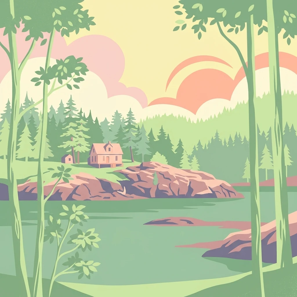
A stylized digital illustration showing a small cabin on a rocky, forested shoreline overlooking a tranquil body of water.

Jedediah Island Marine Provincial Park

State or regional park

Park overview

Structured park overview, official facts, and landscape profile for Jedediah Island Marine Provincial Park

Jedediah Island Marine Provincial Park park facts, protected area profile, and essential visitor context

Review the core facts for Jedediah Island Marine Provincial Park, including designation, size, terrain, visitor scale, habitats, and operating context in one park-focused overview.

About Jedediah Island Marine Provincial Park

Jedediah Island Marine Provincial Park sits in the southern Gulf Islands of British Columbia, in the sheltered waters of the Strait of Georgia between Vancouver Island and the mainland Sunshine Coast. Its position places it within a broader network of islands, channels, and marine passages that together form one of the province's most distinctive coastal landscapes. The combination of forested island terrain, indented shorelines, and open marine water defines both how the park looks and how it is experienced by visitors.

Although modest in total area compared to many of British Columbia's vast terrestrial parks, Jedediah Island stands out as one of the larger island-based protected areas in the BC system. Its roughly 240 hectares of land, paired with surrounding marine waters, create an environment where terrestrial and marine ecosystems meet directly along the shoreline. Forests, small coves, rocky outcrops, and open water all coexist within a compact setting, allowing the park to convey a layered coastal identity rather than a single dominant habitat type.

Access is one of the park's defining characteristics. There is no road or ferry connection to Jedediah Island itself, and visitors can only reach it by boat. The nearest practical staging point is Lasqueti Island, while the closest city is Sechelt on the mainland. This access pattern keeps visitor numbers low and gives the park a quieter, more self-reliant character than many other provincial parks in southern coastal British Columbia. Anyone visiting the island is free to camp, reinforcing the park's identity as a place for slow, boat-based exploration of the Gulf Islands.

The park also has a distinctive human history that continues to shape how it is understood. Long before it became a protected area, it served as a family retreat and later a homestead, and the 1990s transition from private land to Class A provincial park was driven by a community-led fundraising effort. That blend of natural Gulf Islands ecosystems, marine setting, boat-only access, and layered family and community history gives Jedediah Island a strong and recognizable identity within British Columbia's park system.

Quick facts and research context for Jedediah Island Marine Provincial Park

Jedediah Island Marine Provincial Park is a Class A provincial park in British Columbia, established on July 13, 1995, and managed by BC Parks. It lies within the Nanaimo Land District in the Strait of Georgia, between Vancouver Island and the mainland, and is one of the larger island-based parks in the provincial system.

The park totals roughly 603 hectares when marine and terrestrial areas are combined, with about 243 hectares of land. The nearest city is Sechelt on the BC mainland, while the nearest launch or access point is Lasqueti Island. Access to the park is exclusively by boat, and there are no road or ferry connections directly serving the island.

Protection and recognition

Documented conservation status and protected area governance metrics

Jedediah Island Marine Provincial Park Protection Status and Management Scope

Jedediah Island Marine Provincial Park maintains a documented mixed protection scope within its regional conservation framework. Official records compile administrative boundaries and governance designations to outline the management scope for this protected area.

Protection details

Protection scope
Mixed
Transboundary protection
No
Park context

Deeper park guide and search-rich context for Jedediah Island Marine Provincial Park

Jedediah Island Marine Provincial Park history, landscape, wildlife, and travel context

Explore Jedediah Island Marine Provincial Park through its history, landscape character, ecosystems, wildlife, conservation priorities, cultural context, and seasonal travel timing in a structured park guide built for atlas discovery and search intent.

Why Jedediah Island Marine Provincial Park stands out

Jedediah Island Marine Provincial Park is best known for being one of the largest island parks in British Columbia and for its combination of forested Gulf Islands terrain with protected marine surroundings. The park's sheltered bays and accessible-by-boat-only character give it a quiet, self-reliant feel that sets it apart from more developed coastal parks. The island's history is also a defining part of its identity. Decades of family use by the Mattice and Palmer families, followed by a fast community fundraising campaign that raised more than four million dollars in the 1990s, gave the park a strong human story that sits alongside its natural setting. Its location within the broader Salish Sea also placed it at the edge of the well-documented series of human foot discoveries that began in 2007.
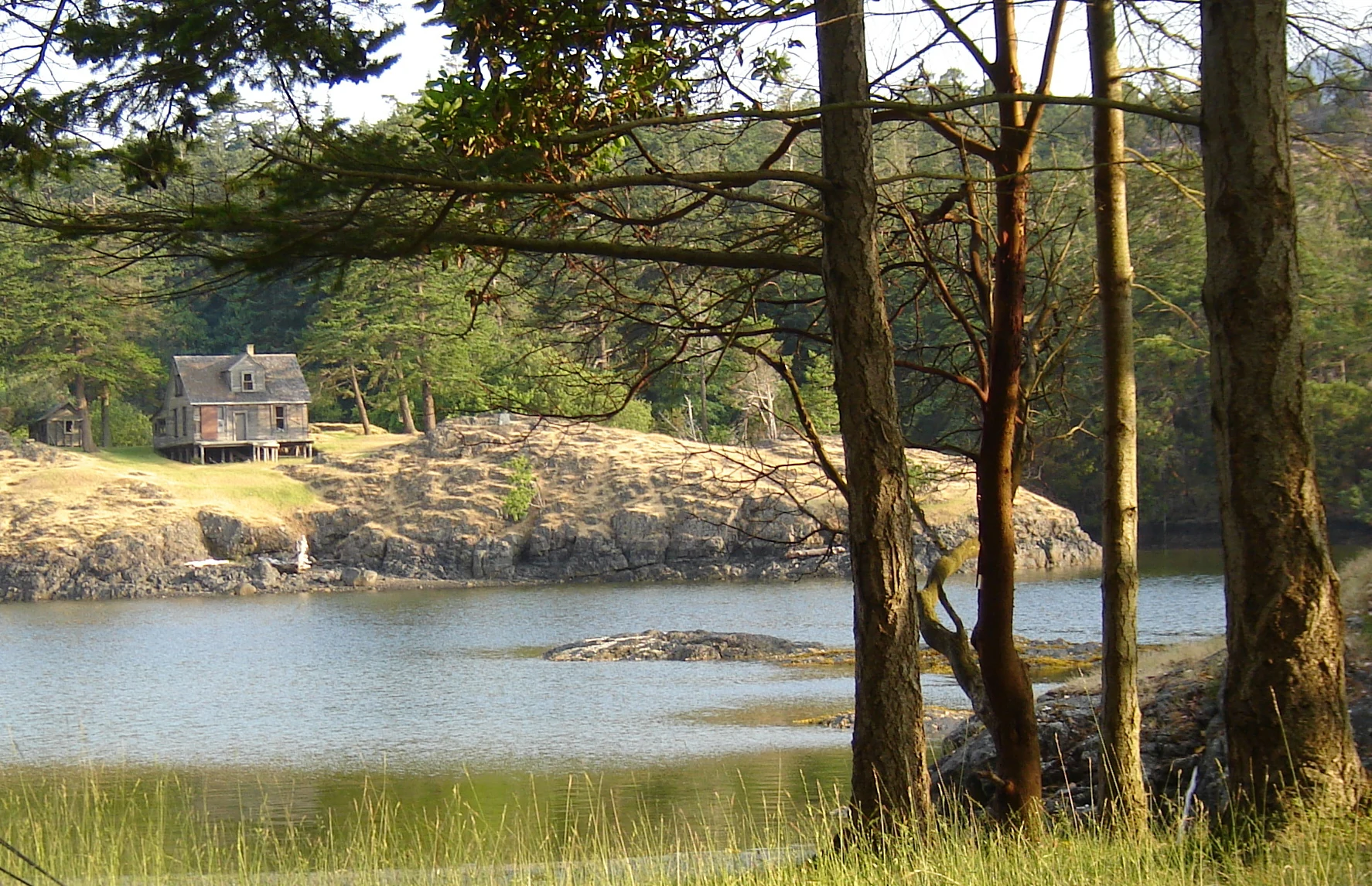
A small weathered wooden house sits on a rocky bluff overlooking a quiet bay surrounded by trees.
A historic homestead overlooking Home Bay on Jedediah Island.

Jedediah Island Marine Provincial Park history and protected-area timeline

The modern history of Jedediah Island is closely tied to the Mattice and Palmer families and their long relationship with the island as a private retreat and homestead. Evan and Mary Mattice, originally from Seattle, purchased the island in 1949 as a summer vacation destination for their family. Over the following decades they continued visiting with hopes of one day making it a full-time home, and the island gradually evolved from a seasonal getaway into a more enduring family place.

In 1972, Mary and her second husband, Albert W. Palmer, moved to Jedediah Island as full-time residents, where they lived for the next twenty years. Evan Mattice continued to visit regularly after Mary's remarriage until his death in the early 1990s. Their eldest son eventually brought his own family from Kirkland, Washington to the island in 1979, settling at Long Bay and beginning to clear land for horticulture farming. As the family expanded into the next generation, with plans for grandchildren to remain on the island, Mary Palmer decided to sell, opening the door to a new chapter for Jedediah.

Concern on nearby Lasqueti Island that the property might be sold privately after an earlier land trust commitment fell through led, in 1994, to a community-led fundraising campaign to save the island. Within less than six months, supporters raised more than four million dollars, with a major donation from the family of Dan Culver and additional contributions arriving from across British Columbia. The province's Minister for the Environment ultimately supported the effort, and the campaign exceeded its target. The deal remained uncertain until Mary Palmer secured Class A provincial park status for the island, guaranteeing it could not be logged or mined. With that protection in place, she signed the island over to become a new Gulf Islands provincial park.

The park was formally established on July 13, 1995, and has been managed since by BC Parks. In the summer of 2007, visitors on the island discovered a human foot on the beach, the first in what became a well-documented series of Salish Sea human foot findings over subsequent years. The foot recovered at Jedediah Island was traced to a man missing since 2004, with no suspicion of foul play, and the event added a notable, if somber, chapter to the island's post-protection history.

Jedediah Island Marine Provincial Park landscape and geographic character

The landscape of Jedediah Island Marine Provincial Park reflects the classic character of the southern Gulf Islands. Forested terrain meets an irregular, deeply indented shoreline, producing a mosaic of small bays, rocky headlands, and pebble beaches rather than a single dominant landform. The island's interior is shaped by coastal forest typical of the region's dry, mild maritime climate, with stands that gradually thin toward the water and expose rocky edges along the shore.

The marine setting is just as integral to the park's identity as the land itself. The surrounding waters of the Strait of Georgia, including channels and passages linking the island to Lasqueti Island and the mainland, frame the park's landmass and define the experience of arriving and moving around it. Sheltered coves and quiet bays, such as those visible from the island's interior elevations, give the park a varied coastal profile and shape how visitors encounter its scenery.

Because the park is reached only by boat and lacks road or ferry infrastructure, the landscape has remained relatively undisturbed compared with more accessible coastal areas. The resulting sense of space, combined with the small scale of the island, gives the park a contained, browseable landscape where forests, shoreline, and marine views are all within a short walk or paddle of one another.

Jedediah Island Marine Provincial Park ecosystems, habitats, and plant life

The natural character of Jedediah Island Marine Provincial Park is shaped by the meeting of southern Gulf Islands terrestrial ecosystems with protected marine waters. The island's forests are typical of the region's mild, relatively dry maritime climate, with a coastal woodland cover that has long coexisted with the island's small-scale human use. Openings from past land clearing and home sites blend into the broader forest matrix, producing a working and natural landscape that has gradually returned toward a wilder state under park management.

Along the shoreline, intertidal and shallow marine habitats form an important ecological transition between the forested land and the Strait of Georgia. The combined terrestrial and marine footprint of the park means that ecological processes on land and in the water are closely linked here, with nutrient exchange, wildlife movement, and shoreline dynamics shaping how the island functions ecologically.

The Class A status achieved before the park was established ensures that the island cannot be logged or mined, providing a strong baseline of protection for its terrestrial ecosystems. This long-term protection supports the gradual recovery of natural processes across the island and helps maintain the ecological character of the surrounding marine area as well.

Jedediah Island Marine Provincial Park wildlife and species highlights

Wildlife at Jedediah Island Marine Provincial Park reflects both the marine and terrestrial character of the southern Gulf Islands. Marine mammals are a defining presence, with Steller sea lions documented gathering on rocks within and around the park, adding a recognizable coastal wildlife signature. The wider Salish Sea context around the island supports an active marine mammal community that includes seals and other species typical of these protected coastal waters.

On land, the forested terrain supports the birdlife, small mammals, and shoreline species characteristic of Gulf Islands ecosystems. Intertidal zones around the island provide feeding areas for shorebirds and other water-associated species, while the island's interior forest provides cover for terrestrial wildlife adapted to coastal British Columbia conditions.

The combination of forested land and immediately adjacent marine habitat makes the park a place where marine and terrestrial wildlife experiences overlap. Visitors moving along the shore or between bays regularly encounter both land-based and sea-based wildlife, reinforcing the park's identity as a small but ecologically layered coastal protected area.

Jedediah Island Marine Provincial Park conservation status and protection priorities

Jedediah Island Marine Provincial Park holds real conservation significance because it protects roughly 240 hectares of southern Gulf Islands land together with a substantial surrounding marine area, in a region where coastal development pressure has historically been strong. The park's Class A designation, secured as a condition of the 1995 acquisition, guarantees that the island cannot be logged or mined, providing a durable level of protection that goes beyond ordinary provincial park status.

The park's establishment was itself a conservation milestone. A grassroots fundraising campaign that mobilized communities across British Columbia, supported by a major donation from the family of Dan Culver and provincial government backing, preserved an entire island from potential private sale and subdivision. This community-driven origin gives the park a strong conservation story that complements its ecological role.

Ecologically, the protected mix of forested island terrain and adjacent marine waters contributes to habitat connectivity within the Gulf Islands network. Maintaining this mosaic of land and sea in a protected state supports regional biodiversity, shoreline stability, and the long-term ecological health of one of the more populated coastal regions of British Columbia.

Jedediah Island Marine Provincial Park cultural meaning and human context

The cultural identity of Jedediah Island is closely tied to the Mattice and Palmer family history that preceded its protection. For several decades, the island served as a private retreat and eventually a homestead, with successive generations building homes, clearing land for horticultural farming, and establishing a multi-generational family presence at Long Bay and elsewhere on the island. This layered history of family use is part of what gives the park its strong sense of place.

The 1990s transition into a protected area also carries a cultural dimension. The community-led campaign that saved Jedediah Island drew support from across British Columbia and reflected a regional commitment to keeping sizeable islands out of private development. The role of Dan Culver's family as a major donor, alongside contributions from individuals across the province, marked the park as a product of community will as much as of government policy.

More widely, the island sits within the traditional waters and territory of the Indigenous peoples of the Salish Sea, a context it shares with the surrounding Gulf Islands. While the park's documented modern history centers on the Mattice and Palmer families and later community stewardship, its place in the broader coastal cultural landscape of British Columbia remains part of how the island is understood today.

Top sights and standout views in Jedediah Island Marine Provincial Park

Jedediah Island Marine Provincial Park stands out for its unusual combination of large-island status within the BC park system, boat-only access, and a strong story of community-driven protection. Its roughly 240-hectare land base, paired with significant surrounding marine waters, gives it a layered coastal character that distinguishes it from smaller, more fragmented Gulf Islands protected areas.

The park's history is itself one of its highlights: the rapid 1990s fundraising effort that raised more than four million dollars and the securing of Class A status before the island changed hands are uncommon chapters in the story of British Columbia provincial parks. Wildlife sightings such as Steller sea lions hauled out on local rocks, the quiet forested terrain, and the park's position within the Salish Sea all add to a distinctive visitor and conservation profile.

Best time to visit Jedediah Island Marine Provincial Park

The most comfortable periods to experience Jedediah Island Marine Provincial Park generally align with the late spring through early fall window that defines most southern Gulf Islands marine travel. During these months, calmer seas, longer daylight hours, and milder temperatures make boat access to the island more manageable and create the most inviting conditions for exploring its bays and shorelines.

Outside of this window, the park remains a destination but conditions become more demanding. Stronger winds, reduced daylight, and cooler temperatures in shoulder seasons and winter can limit how easily the island can be reached and how broadly the surrounding marine environment can be enjoyed. Wildlife viewing, shoreline exploration, and the quiet atmosphere of the park are typically most rewarding when conditions favor extended time on the water and along the island's varied coast.
Monthly climate preview

Long-term representative point measurements of annual temperature and precipitation rhythms

Jedediah Island Marine Provincial Park Climate Normals and Weather by Month

Representative coordinate records show monthly mean temperatures shifting between four and eighteen degrees alongside distinct precipitation variation across the twelve-month cycle. Reviewing the complete meteorological profile provides deeper insight into long-term climate patterns measured across the protected marine landscape.
Annual mean10 °C
4 °C18 °C
Jan
Feb
Mar
Apr
May13°
Jun15°
Jul18°
Aug18°
Sep15°
Oct10°
Nov
Dec
Warmest month
August

18.1 °C

Coolest month
December

4.2 °C

Wettest month
November

5.7 mm/day

Driest month
July

1 mm/day

Park location guide

Geography guide, regional context, and park location map for Jedediah Island Marine Provincial Park

Jedediah Island Marine Provincial Park park geography, regions, and map view in Canada

Understand where Jedediah Island Marine Provincial Park sits in Canada through a broader geographic reading of the surrounding landscape, nearby location context, and its mapped position within the national park landscape.

How Jedediah Island Marine Provincial Park fits into Canada

Canada is a federal parliamentary constitutional monarchy spanning North America from the Atlantic to the Pacific and Arctic Oceans. With a population of over 41 million, it is officially bilingual in English and French at the federal level. The country gained independence from the United Kingdom through a gradual process culminating in 1982.

Wider geography shaping Jedediah Island Marine Provincial Park in Canada

Canada occupies the northern portion of North America, sharing its longest international border with the United States. The country extends from the Atlantic Ocean to the Pacific Ocean and northward into the Arctic Ocean, giving it the longest coastline of any nation.

Map view of Jedediah Island Marine Provincial Park

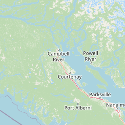
Use this park location map to pinpoint Jedediah Island Marine Provincial Park in Canada, understand its exact geographic position, and read its mapped placement within the surrounding landscape more clearly.

Pigeon | © OpenStreetMap contributors

Location context for Jedediah Island Marine Provincial Park

British Columbia
Recorded earthquake history

Explore Historical Earthquake Records for Jedediah Island Marine Provincial Park

Examine the documented history of seismic events identified near Jedediah Island Marine Provincial Park. This MoriAtlas collection offers a filterable view of regional earthquake data, supporting a better understanding of the seismic context surrounding this protected coastal area in the Gulf Islands.

Jedediah Island Marine Provincial Park Earthquake History

Catalogued events

11 events

Strongest magnitude

Magnitude 4.4

Most recent event

Apr 4, 2016

This history includes earthquakes recorded inside the park or within 50 km of its borders

Visual reference guide to forested Gulf Islands terrain, coastal shorelines, and marine environments.

Jedediah Island Marine Provincial Park Photos and Protected Landscape Scenery

Visual documentation of Jedediah Island Marine Provincial Park reveals the intricate geography of forested terrain, sheltered bays, and rugged shorelines across the Salish Sea. Examining these protected area photographs provides clear insight into the isolated coastal environment and maritime character defining the region.

A small weathered wooden house sits on a rocky bluff overlooking a quiet bay surrounded by trees.

A group of Steller sea lions swimming in choppy, splashing water with a dark, forested shoreline visible in the background.

Park atlas

Compare adjacent marine protected landscapes and regional island park geography

Explore Other Parks Near Jedediah Island Marine Provincial Park and Surrounding Coastal Areas

Continue browsing other coastal and marine protected areas located throughout the surrounding Strait of Georgia region. Comparing neighboring island habitats provides a broader geographic perspective on British Columbia conservation lands.
A pale, minimalist watercolor painting depicting a wide, sandy beach shoreline with a line of evergreen trees in the distance.
State or regional parkBritish Columbia
18 km away#1 closest

South

Rathtrevor Beach Provincial Park: Coastal Geography and Protected Land Overview

Vancouver Island coastal terrain and forested landscapes

Spanning over 300 hectares, Rathtrevor Beach Provincial Park protects a rare combination of fine sandy beaches and ancient Douglas fir groves along the Strait of Georgia. This coastal sanctuary on Vancouver Island serves as a critical habitat for migrating birds and represents a preserved segment of regional geography amidst the surrounding developed shoreline.

Area
3.47 km²
Established
1967
IUCN
II
Visitors
836.2K annual
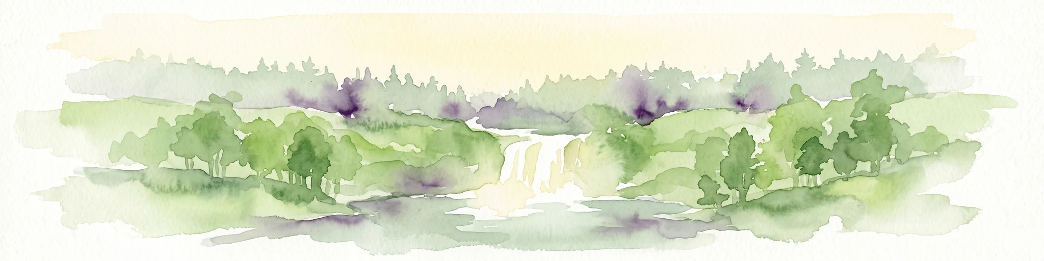
Watercolor painting of a waterfall surrounded by lush green trees and forest.
State or regional parkBritish Columbia
28 km away#2 closest

South

Englishman River Falls Provincial Park: Regional Geography and Protected Area Overview

Vancouver Island river canyon and coastal forest terrain

Englishman River Falls Provincial Park protects a concentrated area of canyon scenery and old-growth forest on the eastern side of Vancouver Island. The landscape is characterized by the dramatic steps of the Englishman River, deep plunge pools, and mature cedar and hemlock stands. This geography provides an essential look at the coastal rainforest ecosystems and river-fed topography that define the recreational corridors of British Columbia.

Area
0.97 km²
IUCN
II
Relief
Upland
Access
Easy access
A soft watercolor illustration depicting a winding river flowing through a lush green valley with coniferous forests on the hillsides and mountains in the background.
State or regional parkBritish Columbia
31 km away#3 closest

Southwest

Little Qualicum Falls Provincial Park: Regional Protected Landscape and Atlas Geography

River canyon and mountain lake habitat in British Columbia

Explore the structured geography of Little Qualicum Falls Provincial Park, a protected area characterized by its sequence of dramatic river cascades and old-growth Douglas Fir stands. This entry maps the park's key natural features, including the Cameron Lake shoreline and the rugged canyon terrain of the Little Qualicum River.

Area
4.4 km²
Established
1940
IUCN
II
Relief
Mountain
A horizontal watercolor illustration featuring a wooden boardwalk winding through a calm, light-filled landscape with soft green trees, grassy foreground, and rolling hills in the distance.
State or regional parkBritish Columbia
About 40 km away#4 closest

Southwest

MacMillan Provincial Park: Mapped Geography and Protected Forest Landscapes

Vancouver Island, British Columbia

Examine the mapped footprint of MacMillan Provincial Park, home to iconic old-growth Douglas fir trees and the Cameron River delta. This protected area serves as a biogeoclimatic transition zone, showcasing the rich, moisture-retentive coastal forest environment that defines this specific section of Vancouver Island.

Area
3.01 km²
Established
1947
IUCN
III
Visitors
543.7K annual
State or regional parkBritish Columbia
About 42 km away#5 closest

Southwest

Horne Lake Caves Provincial Park: Mapped Protected Landscapes and Cave Networks

Vancouver Island protected area and karst geography

Horne Lake Caves Provincial Park protects a distinct array of limestone cave systems, including Main, Riverbend, and Euclataws caves. The area bridges underground geological formations with surface-level river recreation along the Qualicum River, providing a comprehensive look at the karst and forested terrain of central-eastern Vancouver Island.

Area
1.58 km²
Established
1971
IUCN
II
Relief
Upland
A minimalist watercolor illustration showing rolling hills in the background and soft foliage in the foreground on a white background.
State or regional parkBritish Columbia
About 42 km away#6 closest

Southeast

Petroglyph Provincial Park: Protected Indigenous Heritage and Coastal Geography

Cultural landscape and bedrock carvings in British Columbia

Petroglyph Provincial Park preserves a remarkable concentration of ancient carvings etched into the sandstone bedrock of the Nanaimo River estuary. This protected area on Vancouver Island provides a rare look at how Indigenous traditions integrated with powerful natural features, offering a unique geographic context for studying historical rock art in the Pacific Northwest.

Area
0.02 km²
Established
1948
IUCN
III
Relief
Lowland
A watercolor painting showing a horizontal landscape with a green forest in the foreground and soft pink, layered rolling hills in the background.
State or regional parkBritish Columbia
48 km away#7 closest

Southeast

Morden Colliery Historic Provincial Park: Heritage Infrastructure and Regional Coal Mining History

Industrial landscape and historic rail corridor in British Columbia

Located near Nanaimo, this heritage site preserves the substantial concrete remains of the Morden Colliery. The park serves as a physical archive of southern Vancouver Island industrial life, contrasting engineering landmarks with local forest environments and interpretive trails along former coal railway alignments.

Area
0.04 km²
Established
1972
Relief
Lowland
Scope
Terrestrial
State or regional parkBritish Columbia
About 53 km away#8 closest

East

Plumper Cove Marine Provincial Park: Protected Marine Geography and Coastal Landscapes in Howe Sound

Exploring the forested trails and sheltered marine anchorages of Keats Island.

Plumper Cove Marine Provincial Park represents a vital protected landscape on the coast of British Columbia, defined by its blend of upland coastal forest and intimate, boat-accessed marine anchorages. This geography-focused profile traces the park's terrain, including its rocky shorelines, forest-covered bluffs, and the trail networks that connect visitors to the broader Howe Sound maritime environment.

Area
0.66 km²
Established
1960
IUCN
II
Relief
Upland

Common questions about visiting, size, designation, and location context for Jedediah Island Marine Provincial Park

Jedediah Island Marine Provincial Park FAQs for park facts, access, geography, and protected area context

Find quick answers about Jedediah Island Marine Provincial Park, including protected-area facts, park geography, trail and visitor context, and how the park fits into its surrounding country and regional landscape.
MoriAtlas Explorer

Continue Your Protected Areas Search Across the Global Atlas

Deepen your exploration by continuing the structured search for national parks and protected areas worldwide. Utilize the comprehensive filtering capabilities to compare different conservation landscapes and refine your understanding of global park geography. Discover more about the distribution and characteristics of protected natural areas.

Global natural geography