
Mori Atlas logo
Wildlife reserveJennie Lakes Wilderness

A detailed look at the granite peaks, subalpine forests, and alpine lakes of this protected California corridor.

Jennie Lakes Wilderness: Mapping the High Sierra Protected Landscapes in Tulare County

Jennie Lakes Wilderness serves as a crucial link in the high Sierra Nevada, bridging the protected terrain between Sequoia and Kings Canyon National Parks. This wildlife reserve in Tulare County features a rugged topography of glacially carved canyons, forested slopes, and elevated plateaus that reach over 10,000 feet at Mitchell Peak. Its geography encompasses a collection of alpine lakes, including Jennie Lake and Weaver Lake, which provide vital hydrological functions within the broader Sierra mountain system.

Sierra Nevadawilderness areaalpine lakessubalpine forestmountain peaksgranite terrain
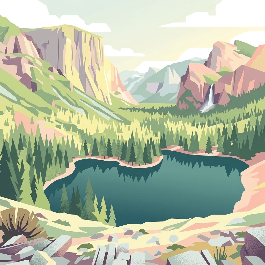
A digital illustration of an alpine lake surrounded by evergreen trees, towering mountain cliffs, and a small waterfall on the right, under a pale sky.

Jennie Lakes Wilderness

Wildlife reserve

Park overview

Structured park overview, official facts, and landscape profile for Jennie Lakes Wilderness

Jennie Lakes Wilderness park facts, protected area profile, and essential visitor context

Review the core facts for Jennie Lakes Wilderness, including designation, size, terrain, visitor scale, habitats, and operating context in one park-focused overview.

About Jennie Lakes Wilderness

Jennie Lakes Wilderness represents a compact but representative slice of California's high Sierra, capturing many of the landscape features that define the broader mountain range. Located within Sequoia National Forest and bordered by two of the state's most celebrated national parks, the wilderness offers a sense of remoteness while remaining accessible from the Fresno region to the west.

The terrain is shaped by glacial and erosional processes typical of the Sierra Nevada. The Boulder Creek canyon bisects the wilderness, reaching depths of about 1,000 feet, while the eastern portion rises into a high plateau bounded by a ridge. To the west, Shell Mountain rises to 9,594 feet near Weaver Lake, and Mitchell Peak forms the highest point at 10,365 feet. Six named and unnamed lakes, including Jennie Lake, Weaver Lake, and smaller remote ponds near JO Pass, dot the high country.

Ecologically, the wilderness showcases transitions between forested and alpine environments. Lodgepole pine, red fir, white fir, and white (mountain) pine dominate the slopes, with Jeffrey pine and juniper adding variety at lower elevations. Granitic outcroppings, meadows, and seasonal wildflower blooms contribute to the scenic richness. Black bears are commonly observed in the area, reinforcing the wilderness's role as functioning wildlife habitat.

Recreationally, Jennie Lakes supports day hiking, backpacking, horsepacking, fishing, and cross-country skiing. Roughly 26 miles of trails radiate from four trailheads, including Big Meadow, Rowell Meadow, Marvin Pass, and Stony Creek. The Forest Service actively manages visitor use to protect fragile riparian areas near the lakes, and Leave No Trace principles are encouraged throughout the wilderness.

Quick facts and research context for Jennie Lakes Wilderness

Jennie Lakes Wilderness is a federally designated wilderness area covering about 10,500 acres within California's Sequoia National Forest. It lies in Tulare County, northeast of Fresno, and is bordered by Sequoia National Park to the south and Kings Canyon National Park to the east.

Established in 1984 under the California Wilderness Act, the area is managed by the U.S. Forest Service and classified as IUCN Category Ib (wilderness area). Elevations range from roughly 6,640 feet to 10,365 feet at Mitchell Peak, with much of the terrain above 7,000 feet. Six lakes and 26 miles of trails anchor the wilderness's recreational and ecological character.

Protection and recognition

Documented terrestrial preservation scope and administrative designation records

Jennie Lakes Wilderness Protection Status and International Recognition

Jennie Lakes Wilderness maintains a registered terrestrial protection scope within official conservation inventories. Official records compile designated status details, management parameters, and international recognition sources for the protected landscape.

Protection details

Protection scope
Terrestrial
Transboundary protection
No
Park context

Deeper park guide and search-rich context for Jennie Lakes Wilderness

Jennie Lakes Wilderness history, landscape, wildlife, and travel context

Explore Jennie Lakes Wilderness through its history, landscape character, ecosystems, wildlife, conservation priorities, cultural context, and seasonal travel timing in a structured park guide built for atlas discovery and search intent.

Why Jennie Lakes Wilderness stands out

Jennie Lakes Wilderness is best known for its classic high Sierra combination of alpine lakes, forested ridges, and granitic peaks. The two principal lakes, Jennie Lake and Weaver Lake, sit above 9,000 feet in elevation and anchor the wilderness's identity, while Mitchell Peak provides sweeping views over the surrounding Sierra landscape. The wilderness is also distinguished by its position as a trail corridor linking Sequoia and Kings Canyon National Parks. Boulder Creek and Stony Creek arise within its borders, contributing to the hydrology of the broader Sierra Nevada.
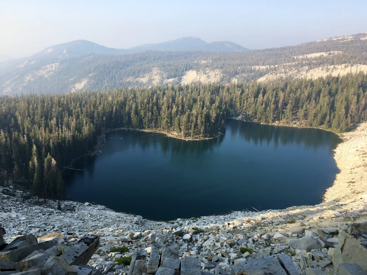
An elevated, wide view of a calm, dark-blue mountain lake surrounded by dense evergreen forest and steep, rocky, light-colored slopes.
A scenic view of Jennie Lake surrounded by conifer forest and rocky mountain slopes in the Jennie Lakes Wilderness.

Jennie Lakes Wilderness history and protected-area timeline

The landscape within Jennie Lakes Wilderness has a long human history tied to the Sierra Nevada. Jennie Lake itself takes its name from Jennie (Cortney) Ellis, wife of Sam Ellis, who is credited with discovering the lake in 1890. Sam Ellis later became Fresno County's Chief Game Warden and, beginning in 1914, led efforts to stock Golden trout in lakes and streams across the Sierra Nevada.

The area was formally protected as a congressionally designated wilderness through the California Wilderness Act of 1984. This designation added Jennie Lakes Wilderness to the National Wilderness Preservation System, placing it under federal management by the U.S. Forest Service as part of Sequoia National Forest. Since its establishment, the wilderness has gained recognition as both a recreational destination and a connective corridor between Sequoia and Kings Canyon National Parks.

Jennie Lakes Wilderness landscape and geographic character

Jennie Lakes Wilderness unfolds across a varied high Sierra terrain shaped by deep canyons, glacially influenced ridges, and exposed granite. The area's defining physical feature is the Boulder Creek canyon, which slices through the wilderness at depths of around 1,000 feet and serves as a hydrological link from the alpine lakes to the South Fork Kings River downstream.

The wilderness's topography is split between a high plateau bounded by a ridge in the east and a more rugged western portion dominated by Shell Mountain and Weaver Lake. Elevations rise sharply from about 6,640 feet to 10,365 feet at Mitchell Peak, creating strong vertical contrast across a relatively compact area. This elevation range supports classic Sierra transitions from forested slopes to subalpine and alpine zones.

Six lakes anchor the landscape, with Jennie Lake being both the largest and the highest at around 9,000 feet. Weaver Lake sits slightly lower and is more accessible from trailheads, while smaller ponds near JO Pass and along the southern edge of the wilderness add to a dispersed network of water features. Stony Creek drains a separate portion of the area, flowing toward the North Fork Kaweah River. Together, these water systems, ridges, and forested valleys create a landscape defined by its integration of lakes, peaks, and canyons.

Jennie Lakes Wilderness ecosystems, habitats, and plant life

Jennie Lakes Wilderness showcases classic Sierra Nevada high-country ecosystems, blending dense conifer forests with exposed rocky terrain and seasonal wildflower meadows. Lodgepole pine is particularly prominent, with red fir and white fir as primary co-dominant species, while white (mountain) pine contributes to the mixed-canopy upper elevations. At slightly lower elevations, Jeffrey pine and scattered junipers broaden the conifer composition.

The wilderness captures characteristic ecological transitions of the Sierra Nevada, from montane forests into subalpine environments where tree cover thins and granite outcroppings become more dominant. Wildflower displays are common during the summer months, enriching the meadow environments and contributing to the seasonal vitality of the landscape. Boulder Creek and other waterways support riparian habitats important to both wildlife and downstream watersheds.

Jennie Lakes Wilderness wildlife and species highlights

Wildlife in Jennie Lakes Wilderness reflects the broader biodiversity of the southern Sierra Nevada. Black bears are notably common throughout the area, moving across forested slopes and meadow edges in search of food. The forest types present, dominated by lodgepole pine, red fir, and white fir, support habitat for a range of mammal and bird species typical of mid- to high-elevation Sierra environments.

The wilderness's lakes and streams also play a role in supporting aquatic and riparian wildlife, historically tied to early efforts to stock Golden trout in the Sierra Nevada. The combination of dense forest cover, meadow openings, rocky ridgelines, and water sources provides a varied habitat mosaic that contributes to the area's ecological function as part of Sequoia National Forest.

Jennie Lakes Wilderness conservation status and protection priorities

Jennie Lakes Wilderness has been a federally protected landscape since 1984, when it was designated under the California Wilderness Act and added to the National Wilderness Preservation System. Its IUCN Category Ib classification reflects its status as a designated wilderness area with a high degree of ecological protection. As part of Sequoia National Forest, it contributes to the broader conservation network of the southern Sierra Nevada.

The wilderness's position between Sequoia and Kings Canyon National Parks enhances its conservation value, extending continuous protected habitat across a large portion of the Sierra high country. To safeguard fragile alpine ecosystems, the U.S. Forest Service has implemented protective measures, including restrictions on camping near the main lakes and active regulation of visitor use during peak summer months. These efforts aim to maintain the integrity of the lakeshores, riparian zones, and meadow habitats that define the wilderness.

Jennie Lakes Wilderness cultural meaning and human context

Jennie Lakes Wilderness carries a personal and regional history tied to early exploration of the Sierra Nevada. The naming of Jennie Lake after Jennie (Cortney) Ellis reflects the era when individual homesteaders, hunters, and early recreationists began defining the cultural geography of California's high country in the late 19th century. Sam Ellis, her husband, became a notable figure as Fresno County's Chief Game Warden and later led pioneering fish-stocking efforts across the Sierra.

The wilderness also holds significance as part of the broader Sequoia National Forest, a landscape long associated with rural communities, livestock grazing traditions, and outdoor recreation in the southern Sierra. Its proximity to Sequoia and Kings Canyon National Parks further embeds it within a region of deep recreational and natural heritage in California.

Top sights and standout views in Jennie Lakes Wilderness

The wilderness's principal highlight is its concentration of alpine lakes, with Jennie Lake and Weaver Lake serving as the most recognizable destinations. Mitchell Peak, at 10,365 feet, stands as another defining feature, offering panoramic views of the surrounding Sierra and adjacent national parks. The 26-mile trail network, anchored by four trailheads, makes this high-country experience accessible to a range of visitors.

Equally notable is the wilderness's connective role in the Sierra Nevada. By bordering both Sequoia National Park and Kings Canyon National Park, Jennie Lakes functions as an important transition zone linking two major protected landscapes, supporting long-distance backcountry travel and conservation connectivity across park and forest boundaries.

Best time to visit Jennie Lakes Wilderness

Summer is the primary season for visiting Jennie Lakes Wilderness, when snow has receded from higher elevations and wildflowers are in bloom across meadows and forest openings. This is also the busiest time, with the lakes drawing day hikers and backpackers on weekends and holidays.

Late spring and early fall can offer quieter conditions, though weather variability at higher elevations is significant. Cross-country skiing opportunities exist during winter months, when the area's snow cover transforms the landscape into a remote, snow-clad wilderness experience, though access becomes more challenging and requires preparation for winter travel conditions.

Monthly climate preview

Long-term representative monthly averages for temperature and precipitation

Jennie Lakes Wilderness Climate Normals and Annual Temperature Patterns

Representative coordinate records show measured variations in average temperature and precipitation across the twelve-month cycle. Detailed monthly climate data profiles provide deeper temperature ranges and precipitation trends for this protected mountain area.
Annual mean11 °C
3 °C22 °C
Jan
Feb
Mar
Apr
May12°
Jun17°
Jul22°
Aug21°
Sep18°
Oct12°
Nov
Dec
Warmest month
July

21.8 °C

Coolest month
December

2.7 °C

Wettest month
January

3 mm/day

Driest month
August

0.1 mm/day

Park location guide

Geography guide, regional context, and park location map for Jennie Lakes Wilderness

Jennie Lakes Wilderness park geography, regions, and map view in United States of America

Understand where Jennie Lakes Wilderness sits in United States of America through a broader geographic reading of the surrounding landscape, nearby location context, and its mapped position within the national park landscape.

How Jennie Lakes Wilderness fits into United States of America

The United States of America is a federal presidential republic and one of the world's largest countries by area and population. It consists of 50 states across a vast territory spanning multiple time zones, with its capital in Washington, D.C. and largest city in New York City. The nation has a diverse economy, influential political system, and significant cultural and military presence globally.

Wider geography shaping Jennie Lakes Wilderness in United States of America

The United States occupies a vast territory in North America, bordered by Canada to the north and Mexico to the south. The 48 contiguous states stretch from the Atlantic to the Pacific Ocean, while Alaska occupies the northwestern region and Hawaii is an archipelago in the Pacific. The country encompasses diverse terrain including the Rocky Mountains, Appalachian Mountains, Great Plains, and extensive river systems.

Map view of Jennie Lakes Wilderness

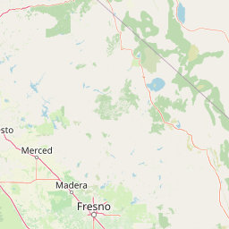
Use this park location map to pinpoint Jennie Lakes Wilderness in United States of America, understand its exact geographic position, and read its mapped placement within the surrounding landscape more clearly.

Pigeon | © OpenStreetMap contributors

Location context for Jennie Lakes Wilderness

Tulare County
Recorded earthquake history

Explore Recorded Seismic Activity and Earthquake History in Jennie Lakes Wilderness

Review documented seismic events associated with the high-elevation landscape of Jennie Lakes Wilderness. This catalogue provides organized access to historical earthquake records, including magnitude and epicentre distance, to support a deeper geographic understanding of the region's recorded seismic history through MoriAtlas.

Jennie Lakes Wilderness Earthquake Records

Catalogued events

21 events

Strongest magnitude

Magnitude 4.1

Most recent event

Dec 4, 2023

This history includes earthquakes recorded inside the park or within 50 km of its borders

Visual reference for alpine lakes, granite terrain, and high Sierra habitats

Jennie Lakes Wilderness Photos and Landscape Scenery

Visual documentation of Jennie Lakes Wilderness reveals rugged granite peaks, subalpine forests, and high-altitude lakes across the protected Sierra Nevada landscape. Detailed photography provides clear insight into local topography, glacial canyons, and environmental transitions connecting adjacent national parks.

An elevated, wide view of a calm, dark-blue mountain lake surrounded by dense evergreen forest and steep, rocky, light-colored slopes.

Park atlas

Compare nearby national parks and connected high Sierra protected areas

Parks Near Jennie Lakes Wilderness And Adjacent Protected Landscapes

Browse national parks and protected areas sharing geographic borders with Jennie Lakes Wilderness across the high Sierra Nevada. Comparing adjacent mountain terrain provides deeper context on regional elevation gradients, alpine lakes, and connected forest ecosystems.
National parkCalifornia
Park boundaries overlap#1 closest

North

Kings Canyon National Park National Park: California Protected Landscape & Geography Atlas

Mapped park boundaries and regional natural context.

Kings Canyon National Park stands as a key protected national park within California, offering a specific focus for geographic understanding and atlas-based exploration. This page details the park's mapped boundaries and its integration into the broader regional geography of California. For users interested in the distribution of protected lands and the mapping of natural landscapes, Kings Canyon National Park provides a crucial point of study within the comprehensive park atlas.

Area
1,869.25 km²
Established
1890
IUCN
II
Visitors
641K annual
Watercolor painting of a panoramic mountain landscape with stylized pine trees and soft green meadows.
Protected landscapeCalifornia
Park boundaries overlap#2 closest

South

Sequoia National Forest: Protected Sierra Nevada Geography and Mountain Terrain

A vast protected landscape spanning 1.1 million acres in California

Spanning Tulare, Kern, and Fresno counties, Sequoia National Forest preserves iconic giant sequoia groves across multiple river watersheds. The terrain features vertical relief exceeding 11,000 feet, showcasing a range of ecosystems from chaparral slopes and coniferous forests to glacial cirques and granite spires located within the southern Sierra Nevada range.

Area
4,829.17 km²
Established
1908
Relief
Mountain
Climate
Mediterranean
National parkCalifornia
Park boundaries overlap#3 closest

Southwest

Sequoia National Park National Park: Geographic Identity and Protected Landscape Atlas

Explore mapped boundaries and the terrain of this California protected area.

Gain a structured understanding of Sequoia National Park as a protected landscape, focusing on its mapped geographic boundaries and its context within California. This entry provides foundational data for exploring the park's natural terrain and its role in a broader atlas of conservation lands, ideal for users seeking detailed geographic information.

Area
1,635.19 km²
Established
1890
IUCN
II
Visitors
1.2M annual
A soft watercolor painting showing a range of gentle rolling hills and mountains in pale green, yellow, and violet tones against a white background.
Protected landscapeCalifornia
13 km away#4 closest

Northwest

Sierra National Forest: Protected Landscapes of the Central California Sierra Nevada

Geography of alpine lakes, conifer forests, and mountain basins

Spanning from 900 to nearly 14,000 feet in elevation, Sierra National Forest protects a massive vertical range of California terrain. Discover its iconic wilderness areas and reservoir-studded landscape, providing a deep look at the geographic connectivity between major national parks in the central Sierra Nevada.

Area
5,300 km²
Established
1893
Relief
Mountain
Climate
Alpine
A watercolor painting showing a panoramic view of mountain ranges, a treeline, and a calm body of water in the foreground.
Wildlife reserveCalifornia
22 km away#5 closest

North

John Muir Wilderness: Sierra Nevada Protected Landscape and High Mountain Geography

California wilderness area with glacial basins and granite peaks

John Muir Wilderness represents one of the largest protected high-elevation areas in the contiguous United States. Spanning the Sierra Nevada crest, its granite terrain is sculpted by Pleistocene glaciation into sharp arêtes, deep canyons, and hundreds of alpine lakes. This wilderness serves as a vital geographic anchor for mountain ecosystems, offering an extensive look at the high-country landscape of eastern California.

Area
2,641.76 km²
Established
1964
IUCN
Ib
Relief
Mountain
A horizontal watercolor painting depicting a mountain range in the background with rolling hills and a winding river or stream in the foreground.
Protected landscapeCalifornia
30 km away#6 closest

North

Inyo National Forest: An Atlas of Protected Landscapes and Sierra Nevada Geography

High altitude wilderness and volcanic terrain in Eastern California

Spanning from the arid Owens Valley floor to the 14,000 foot crest of the Sierra Nevada, Inyo National Forest remains a cornerstone of the American West. This protected landscape contains the Ancient Bristlecone Pine Forest, Mount Whitney, and the Mono Inyo volcanic chain, providing a dense geographic record of glacial, tectonic, and ecological diversity across a vast managed corridor.

Area
7,702.71 km²
Established
1907
IUCN
Ib
Relief
Mountain
National parkCalifornia
70 km away#7 closest

East

Death Valley National Park: Exploring California's Mapped Protected Landscape

View the geographic boundaries and desert terrain.

Access a detailed atlas perspective of Death Valley National Park, a protected national park situated in California. Understand the park's distinct mapped boundaries and its role within the regional geography. This resource highlights the unique desert landscape, offering focused insights into its protected-area identity and natural terrain for geographic discovery.

Area
13,848.4 km²
Established
1994
IUCN
II
Visitors
1.1M annual
A soft watercolor painting of rolling hills and mountain ridges, featuring shades of green, yellow, and faint pink on a white background.
Wildlife reserveCalifornia
84 km away#8 closest

Southeast

Domeland Wilderness: Granite Spires and Kern Plateau Geography in the Southern Sierra Nevada

A protected wilderness landscape on the California high plateau

Spanning over 130,000 acres, Domeland Wilderness offers a deep look into the geological transition zone of the southern Sierra Nevada. The protected landscape is characterized by its iconic granite domes and spires, vast summer range meadows for deer, and the winding course of the Wild and Scenic South Fork Kern River. This atlas entry details the rugged terrain, ridge boundaries, and ecological diversity found across this lightly visited high-altitude wilderness.

Area
526.42 km²
Established
1964
IUCN
Ib
Relief
Mountain

Common questions about visiting, size, designation, and location context for Jennie Lakes Wilderness

Jennie Lakes Wilderness FAQs for park facts, access, geography, and protected area context

Find quick answers about Jennie Lakes Wilderness, including protected-area facts, park geography, trail and visitor context, and how the park fits into its surrounding country and regional landscape.
MoriAtlas Explorer

Continue Your Protected Areas Search Across the Global Atlas

Deepen your exploration by continuing the structured search for national parks and protected areas worldwide. Utilize the comprehensive filtering capabilities to compare different conservation landscapes and refine your understanding of global park geography. Discover more about the distribution and characteristics of protected natural areas.

Global natural geography