

Mori Atlas logo
Nature reserveJenolan Karst Conservation Reserve

Mapping the underground river networks and surface karst valleys of New South Wales

Jenolan Karst Conservation Reserve: An Atlas of Australia's Most Ancient Limestone Landscapes

Jenolan Karst Conservation Reserve represents a globally significant protected landscape within the Central Tablelands of New South Wales. This detailed atlas entry examines the reserve's complex fluviokarst geography, encompassing over 300 cave entrances and the subterranean pathways of the Jenolan River. Beyond the limestone massifs, the terrain includes dramatic features like the Grand Arch and Carlotta Arch, illustrating a deeply integrated geological history spanning 340 million years.

limestone caveskarst landscapeUNESCO World HeritageGreater Blue Mountainssubterranean rivercave formations
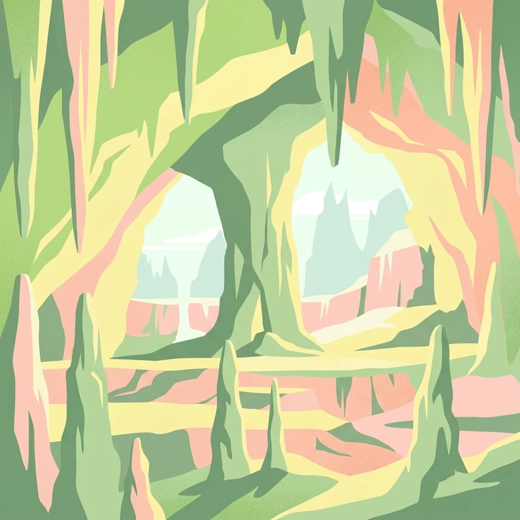
A stylized digital illustration of a cave interior featuring hanging stalactites and rising stalagmites in soft tones of green, yellow, and peach.

Jenolan Karst Conservation Reserve

Nature reserve

Park overview

Structured park overview, official facts, and landscape profile for Jenolan Karst Conservation Reserve

Jenolan Karst Conservation Reserve park facts, protected area profile, and essential visitor context

Review the core facts for Jenolan Karst Conservation Reserve, including designation, size, terrain, visitor scale, habitats, and operating context in one park-focused overview.

About Jenolan Karst Conservation Reserve

The Jenolan Karst Conservation Reserve is a protected area of approximately 3,083 hectares in the Central Tablelands of New South Wales, set within the broader Great Dividing Range. It occupies a forested valley west of the Blue Mountains, anchored by the dramatic limestone massif in which the Jenolan Caves are formed. The reserve is the most westerly of the eight protected areas that together make up the Greater Blue Mountains Area, a UNESCO World Heritage Site inscribed in 2000 for its outstanding natural values.

Geologically, the reserve is defined by Silurian-age limestone that has been shaped over hundreds of millions of years into an extraordinary variety of karst landforms. The Jenolan Caves are the system's most famous expression, a multi-level labyrinth of more than 40 kilometres of mapped passages and over 300 known entrances, traversed by the subterranean Jenolan River. Potassium-argon dating of clay within the caves places their formation at roughly 340 million years, making them the oldest known and dated open cave system in the world. The caves are rich in marine fossils, including corals, stromatoporoids, brachiopods, and gastropods, which together form one of the reserve's defining scientific resources.

The reserve's significance extends well beyond its geology. It is home to rare subterranean invertebrates, including species known only from the Jenolan system, and supports threatened surface species such as the greater sooty owl and the brush-tailed rock-wallaby. Its botanical values include rare plant species recorded within the reserve's forest and valley habitats. Management is shared between NSW National Parks and Wildlife Service and the Jenolan Caves Reserve Trust, and the caves are one of rural New South Wales's most popular visitor destinations.

Culturally, Jenolan holds deep meaning for Indigenous communities, including the Gundungurra and Wiradjuri peoples, whose Dreamtime stories and traditional uses of the caves long predate European arrival. The reserve also preserves a layered colonial and modern history, from the 1866 establishment of one of Australia's earliest conservation reserves to the heritage-listed Caves House and Australia's first hydro-electric power station. The combination of geological wonder, biodiversity, Indigenous heritage, and pioneering conservation history gives the Jenolan Karst Conservation Reserve a distinctive and enduring place in Australia's natural heritage.

Quick facts and research context for Jenolan Karst Conservation Reserve

The Jenolan Karst Conservation Reserve is a state-managed protected area in New South Wales, established in its current form on 6 December 1997 and classified as an IUCN Category III natural monument or feature. It lies within the Oberon local government area, roughly 175 kilometres west of Sydney and west of Katoomba in the Blue Mountains region.

The reserve is the most westerly component of the Greater Blue Mountains Area, inscribed on the UNESCO World Heritage List in 2000 for its outstanding natural values. The Jenolan Caves within it hold record status as the oldest dated open cave system in the world, formed in Silurian-age limestone and containing abundant marine fossils. The reserve is jointly managed by NSW National Parks and Wildlife Service and the Jenolan Caves Reserve Trust.

The caves historically known as the Fish River Caves came under government protection in 1866, making the reserve earlier than many of the world's first national parks and a foundational site in Australian conservation history.

Protection and recognition

Explore documented terrestrial protection metrics and official international designation history.

Jenolan Karst Conservation Reserve Protection Status and UNESCO Recognition

Jenolan Karst Conservation Reserve maintains a documented terrestrial protection status established in the year 2000. Official records incorporate international recognition through the Greater Blue Mountains Area UNESCO World Heritage listing.

International recognition

Protection details

Protection scope
Terrestrial
Designated year
2000
Transboundary protection
No
Park context

Deeper park guide and search-rich context for Jenolan Karst Conservation Reserve

Jenolan Karst Conservation Reserve history, landscape, wildlife, and travel context

Explore Jenolan Karst Conservation Reserve through its history, landscape character, ecosystems, wildlife, conservation priorities, cultural context, and seasonal travel timing in a structured park guide built for atlas discovery and search intent.

Why Jenolan Karst Conservation Reserve stands out

Jenolan is internationally renowned for its exceptionally ancient limestone cave system, which is recognised as the oldest known and dated open cave system in the world, with its formation traced back around 340 million years through potassium-argon dating of cave clay. The caves are celebrated for the visual richness of their calcite formations, which can be remarkably pure and white, as well as the sheer scale and complexity of the underground network. The reserve is also distinguished by the diversity of its karst features, which the New South Wales State Heritage Register describes as among the finest assemblages in Australia. The Jenolan River valley itself is regarded as one of the world's outstanding examples of fluviokarst, where surface and underground drainage systems have shaped a deeply integrated landscape of caves, sinkholes, and valleys. Beyond geology, the reserve is significant for its cultural depth, including Indigenous Dreamtime associations, the heritage-listed Caves House, and a tourism history reaching back to the mid-19th century. Together, these qualities give Jenolan a layered identity that combines scientific, aesthetic, and cultural importance.
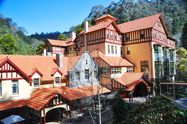
A large, multi-story historic hotel building with half-timbered walls, orange tile roofs, and stone accents, set against a backdrop of forested hills.
The historic Caves House hotel situated within the Jenolan Karst Conservation Reserve.

Jenolan Karst Conservation Reserve history and protected-area timeline

The Jenolan area has been part of the culture of local Indigenous peoples, particularly the Gundungurra and Wiradjuri, for thousands of years. The caves and surrounding land held significant meaning, and a Gundungurra Dreamtime creation story describes the shaping of the surrounding countryside through a contest between two ancestral beings. Indigenous people are also believed to have entered the caves as far as the subterranean water, which they considered to have curative powers.

European discovery is generally attributed to James Whalan around 1838, though some accounts point to 1841, in connection with pursuit of a local thief into the rugged limestone country. Awareness of the caves grew through his brother Charles Whalan, who conducted early visitors to the system in the 1840s. Originally known as the Fish River Caves, the system came under government protection in 1866, becoming only the second area in the world to be reserved specifically for conservation purposes. The following year, Jeremiah Wilson was appointed as the first Keeper of the Caves and went on to expand exploration of the known system.

By the 1870s, increased visitor numbers prompted early conservation measures, including banning souvenir collection and graffiti in 1872. The name Jenolan Caves was officially adopted in 1884. The same era saw investment in access infrastructure, including the famous Six Foot Track bridle route from Katoomba, constructed under the supervision of surveyor William Marshall Cooper and first traversed officially by Governor Lord Carrington in 1887. The grand Jenolan Caves House was completed in 1898, replacing an earlier wooden accommodation building.

Throughout the 20th century, additional caves were discovered, including discoveries by J. C. Wiburd in the early 1900s. Technological milestones were also reached at Jenolan, including the first electric lighting of a cave in the world, installed in the Chifley Cave in 1880, and the development of Australia's first hydro-electric power station, both of which reinforce the reserve's place in Australian heritage. The Jenolan Karst Conservation Reserve was formally established on 6 December 1997, building on more than 130 years of progressive protection and recognition, and the entire system was later incorporated into the Greater Blue Mountains Area World Heritage inscription of 2000. The caves and reserve were also added to the New South Wales State Heritage Register on 25 June 2004.

Jenolan Karst Conservation Reserve landscape and geographic character

The reserve sits within a deeply dissected section of the Great Dividing Range, where forested ridges, steep cliffs, and enclosed valleys frame the central limestone massif. The Jenolan River valley itself is one of the reserve's defining features, recognised as one of the most outstanding fluviokarst valleys in the world, where the interplay of surface and underground drainage has produced a richly integrated karst landscape.

Above ground, the terrain includes dramatic features such as the Grand Arch, through which the main road passes into the heart of the reserve, and the towering Devil's Coach House, a vast open-ended chamber adjacent to it. Higher still is the free-standing Carlotta Arch, a striking remnant of an older cavern system that long ago collapsed and eroded away. The tiny hamlet of Caves House sits almost dwarfed by the steeply rising cliffs around it, and the distinctive Blue Lake, formed by the weir that powered Australia's first hydro-electric scheme, adds another memorable surface feature.

The diversity of karst and cave types within the reserve is itself a defining element of the landscape, ranging from incipient surface depressions through to multistage cave developments and decayed remnants. McKeowns Valley, north of Blue Lake, is regarded as containing the finest assemblage of such features in Australia, illustrating the full range of processes that produce karst scenery. Together, these surface and underground features form a landscape of exceptional geological variety and visual distinctiveness.
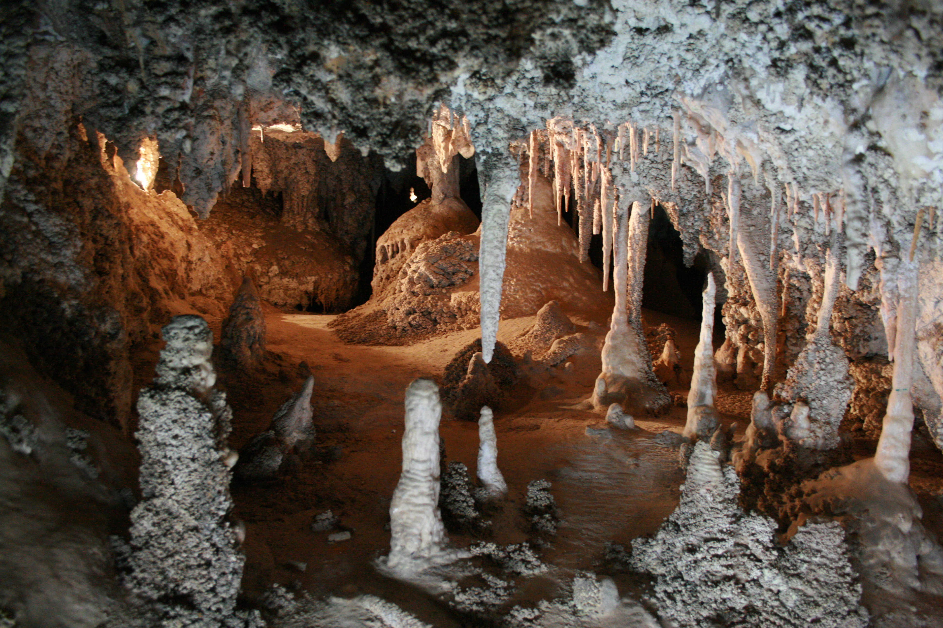
A variety of stalactites and stalagmites made of light-colored limestone inside a dimly lit cave, with artificial lighting creating warm shadows.
Limestone cave formations inside the Imperial Cave at Jenolan Karst Conservation Reserve.

Jenolan Karst Conservation Reserve ecosystems, habitats, and plant life

Ecologically, the reserve combines a steep, forested surface landscape with a unique subterranean environment, creating a layered habitat system that supports both common and rare species. The forest and valley habitats around the caves contain diverse native vegetation, while the caves themselves are home to some of NSW's most important assemblages of cave-dwelling invertebrates, including species that are known only from the Jenolan system.

The reserve's ecological significance is emphasised by the diversity of its karst environments, which range across multiple levels of the cave system and across a wide spectrum of surface forms. This variety of habitats supports rare and uncommon flora and fauna, with several plant species of conservation concern recorded within the reserve. The wet and sheltered conditions around cave entrances, together with the broader forested catchment of the Jenolan River valley, provide important refuge habitat for species that depend on stable microclimates and intact native vegetation.

Subfossil remains of vertebrates recovered from the caves, combined with abundant Silurian marine fossils preserved in the limestone bedrock, give the reserve a particularly strong scientific and educational profile. The integration of forest, valley, river, and cave habitats within a single protected area makes Jenolan an unusually rich site for studying the relationship between surface and underground ecological systems.
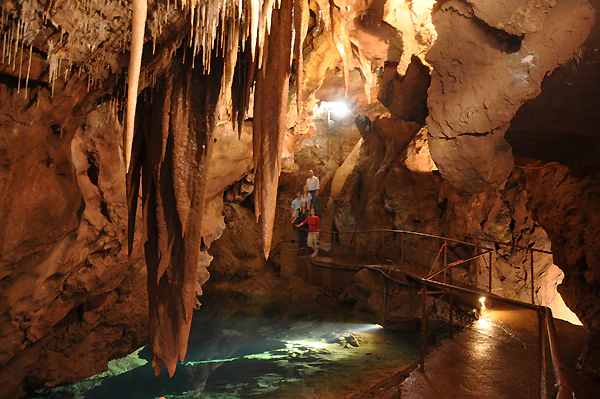
A group of people standing on a railed walkway inside a dimly lit limestone cave featuring large hanging stalactites and a clear pool of water below.
Visitors explore the illuminated limestone formations and subterranean pools within a Jenolan show cave.

Jenolan Karst Conservation Reserve wildlife and species highlights

Animal life at Jenolan includes both common native species and several rare or threatened animals, particularly those that depend on the caves and surrounding cliff and forest habitats. The caves provide roosting and shelter habitat for the greater sooty owl, one of Australia's rarer owl species, which has been recorded roosting in the Devil's Coach House chamber. Outside the caves, the reserve supports a population of the brush-tailed rock-wallaby, a species listed as vulnerable under the NSW National Parks and Wildlife Act.

Within the caves themselves, the reserve is recognised for containing the greatest diversity of cave invertebrates in New South Wales. Among the most notable is the opilionid arachnid Holonuncia cavernicola, known only from the Jenolan cave system, an example of the kind of endemic subterranean fauna that makes the reserve scientifically valuable. Subfossil vertebrate remains recovered from the caves, including Tasmanian devil bones and fossils of the now-extinct thylacine, add to the site's importance for understanding Australia's recent and deep-time faunal history.

Above ground, the surrounding forests and cliffs support typical central tablelands wildlife. The mix of rocky outcrops, wet forest, and sheltered valleys provides habitat for a range of native mammals, birds, and reptiles, with the greater sooty owl among the most prominent species of conservation interest.
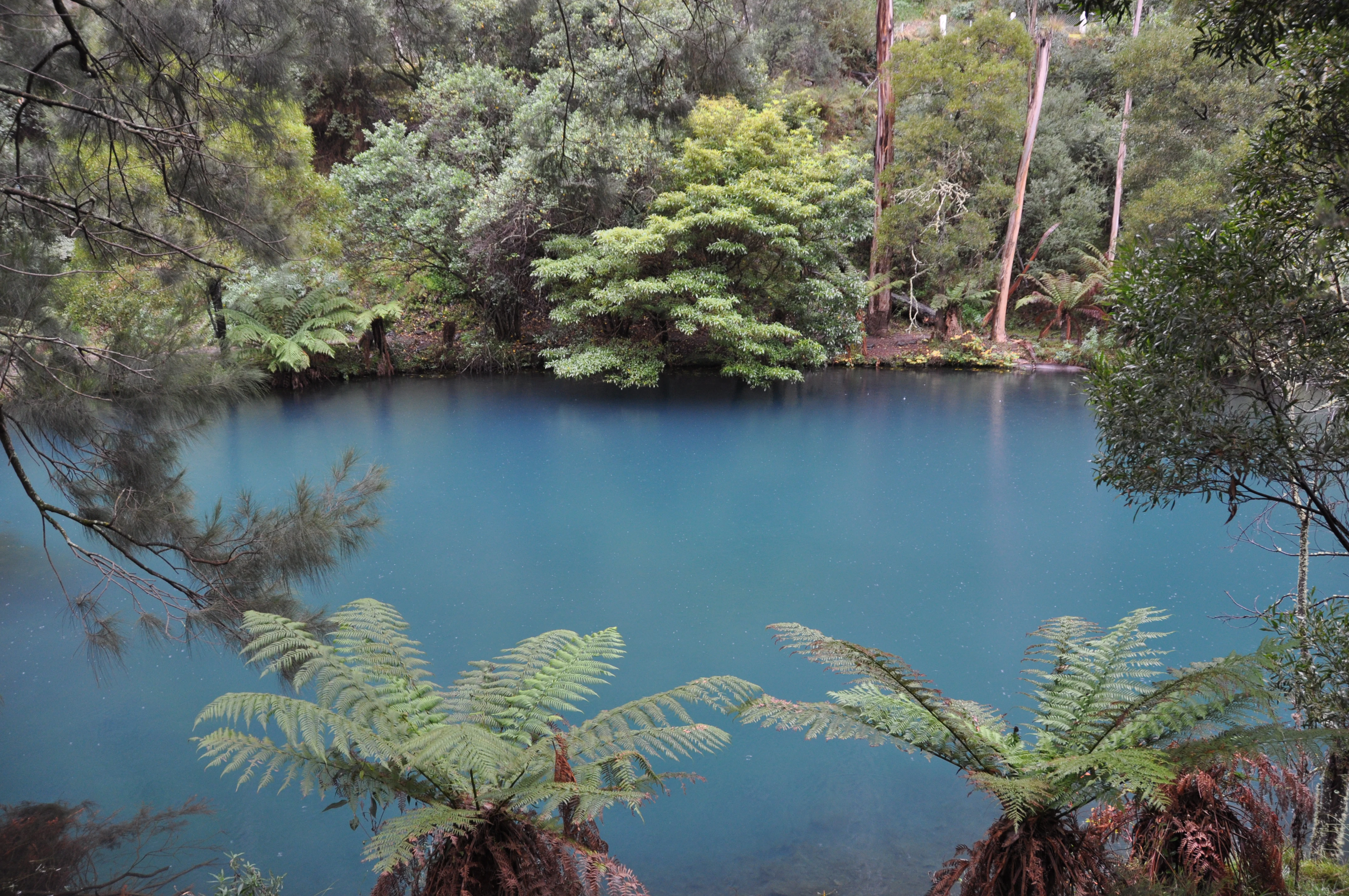
A tranquil, bright blue lake surrounded by dense Australian eucalyptus forest and large tree ferns in the foreground.
The vivid blue waters of the Blue Lake at the Jenolan Karst Conservation Reserve.

Jenolan Karst Conservation Reserve conservation status and protection priorities

The Jenolan Karst Conservation Reserve holds exceptional conservation significance as a protected karst landscape containing one of the world's most important cave systems. Its IUCN Category III designation recognises it as a natural monument or feature of outstanding geological and ecological value. The reserve has been protected since 1866, predating many of the world's most famous national parks and placing it among the earliest examples of conservation land management in Australia.

The reserve's conservation importance is reinforced by its inclusion in the Greater Blue Mountains Area, inscribed on the UNESCO World Heritage List in 2000 under natural criteria that recognise outstanding geological and ecological values. The caves and karst landscapes are valued as benchmark examples for scientific research and education, and the reserve is widely used by universities and research organisations, including CSIRO and the Australian Museum, as a site for studying karst processes and cave biodiversity.

Endemic and vulnerable species add further weight to the reserve's conservation profile. These include rare invertebrates found only in the Jenolan cave system, threatened wildlife such as the greater sooty owl and brush-tailed rock-wallaby, and several rare plant species identified within the reserve. The combination of ancient geology, restricted-range fauna and flora, and long history of formal protection makes Jenolan one of the most important natural heritage areas in New South Wales and a significant conservation landmark nationally.

Jenolan Karst Conservation Reserve cultural meaning and human context

Indigenous culture at Jenolan centres on the Gundungurra and Wiradjuri peoples, who have maintained connection with the caves and surrounding landscape for thousands of years. The caves and country were known by names such as Binomil or Bin-oo-mur, and the area features prominently in Gundungurra Dreamtime narratives, including a creation story describing a contest between two ancestral spirit beings that shaped the landscape. The subterranean water inside the caves was traditionally used for healing and ceremonial purposes, with Indigenous people carrying the sick into the system to bathe in the water.

The arrival of European settlers brought a second major cultural layer. The reserve's formal protection in 1866 made it one of the earliest conservation areas in the world, and subsequent decades added a rich built heritage, including the iconic Caves House of 1898, the Six Foot Track bridle route, and Australia's first hydro-electric power station. The caves were also a pioneering site for technological innovation, notably the first electric cave lighting in the world, installed in the Chifley Cave in 1880.
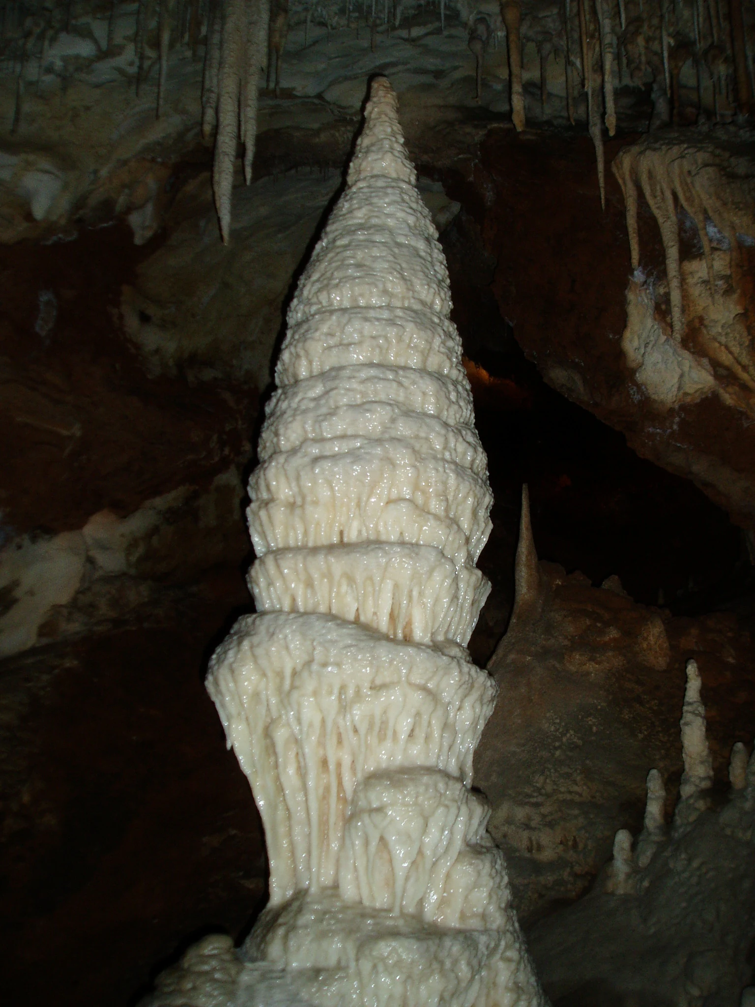
A large, white, cone-shaped stalagmite rising from the floor of a dark limestone cave, with smaller stalactites hanging from the ceiling above.
The Minaret stalagmite formation within the Jenolan Caves system.

Top sights and standout views in Jenolan Karst Conservation Reserve

The reserve's standout qualities include its globally significant geology, with cave clay dated to around 340 million years and a karst landscape widely regarded as one of the most diverse in Australia. Surface highlights include the Grand Arch, the monumental Devil's Coach House, the freestanding Carlotta Arch, and the Blue Lake, all set within a compact, deeply enclosed section of the Jenolan River valley.

Underground highlights include eleven developed show caves, the cathedral-sized chambers of the Lucas Cave, the famous Grand Column and Minaret formations in the River Cave, the rare aragonite formations of the Pool of Cerberus, and the extraordinarily decorated Temple of Baal with its Angel's Wing shawl. The reserve also stands out for its layered cultural heritage, its early conservation history, and its continuing importance as both a living research site and one of rural New South Wales's premier visitor destinations.
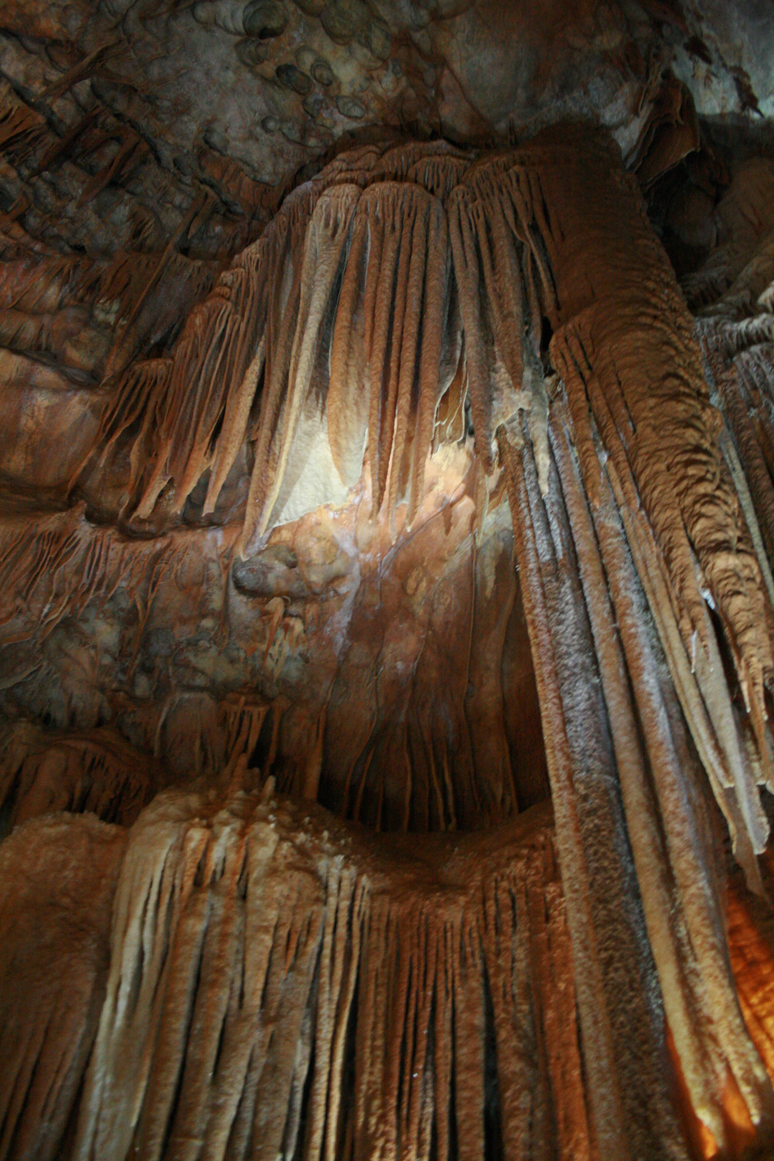
A collection of textured, brownish limestone stalactites and flowstone formations hanging from a cave ceiling.
Limestone cave formations inside the Orient Cave at Jenolan Karst Conservation Reserve.

Best time to visit Jenolan Karst Conservation Reserve

Jenolan lies in the cool upland climate of the Central Tablelands, where summers are mild to warm and winters are cool to cold, with occasional frosts. Spring and autumn tend to offer the most comfortable conditions for combining cave visits with the reserve's walking tracks, as forest colours, milder temperatures, and stable weather make the surrounding landscape especially rewarding.

Winter brings cooler temperatures inside and outside the caves but can also produce a quieter atmosphere and crisp conditions in the surrounding bushland. Summer is generally pleasant for cave touring, which remains a steady-temperature activity year-round, though bushwalking tracks can be warmer and busier at that time. Visitors interested in the underground experience may find the cooler months especially atmospheric, while those focused on forest scenery and walks often prefer the milder shoulder seasons.

Monthly climate preview

Examine long-term representative temperature ranges and monthly precipitation patterns for Jenolan Karst Conservation Reserve

Jenolan Karst Conservation Reserve Climate Normals and Annual Weather by Month

Representative coordinates record measured monthly temperature swings from sub-zero winter minimums to warm summer maximums alongside consistent precipitation rates. Detailed twelve-month climate profiles provide complete statistical context for this protected New South Wales landscape.
Annual mean13 °C
6 °C21 °C
Jan21°
Feb20°
Mar17°
Apr13°
May10°
Jun
Jul
Aug
Sep10°
Oct13°
Nov16°
Dec19°
Warmest month
January

20.7 °C

Coolest month
July

6.2 °C

Wettest month
February

3.6 mm/day

Driest month
May

1.4 mm/day

Park location guide

Geography guide, regional context, and park location map for Jenolan Karst Conservation Reserve

Jenolan Karst Conservation Reserve park geography, regions, and map view in Australia

Understand where Jenolan Karst Conservation Reserve sits in Australia through a broader geographic reading of the surrounding landscape, nearby location context, and its mapped position within the national park landscape.

How Jenolan Karst Conservation Reserve fits into Australia

Australia is a constitutional monarchy and federal parliamentary democracy comprising six states and ten territories. With a population of nearly 28 million, it is one of the world's most urbanised countries, with most people concentrated on the eastern seaboard. The country has a high Human Development Index and is known for its cultural diversity, ancient Aboriginal heritage, and unique wildlife.

Wider geography shaping Jenolan Karst Conservation Reserve in Australia

Australia occupies the entire Australian continent, the island of Tasmania, and numerous smaller islands. It is the world's flattest and driest inhabited continent, featuring vast deserts in the interior (the Outback), tropical rainforests along the eastern coast, and a coastline bordering the Indian and Pacific Oceans.

Map view of Jenolan Karst Conservation Reserve

Use this park location map to pinpoint Jenolan Karst Conservation Reserve in Australia, understand its exact geographic position, and read its mapped placement within the surrounding landscape more clearly.

Pigeon | © OpenStreetMap contributors

Location context for Jenolan Karst Conservation Reserve

New South Wales

Visualizing ancient limestone formations, rugged valleys, and protected terrain

Jenolan Karst Conservation Reserve Photos and Landscapes

Photographic records capture the complex topography and rare geological features defining Jenolan Karst Conservation Reserve. Detailed imagery reveals the intricate character of surface valleys, towering arches, and subterranean environments across the protected landscape.

A large, multi-story historic hotel building with half-timbered walls, orange tile roofs, and stone accents, set against a backdrop of forested hills.

A low-light interior view of a cave featuring large, illuminated limestone stalactites and flowstone formations, notably a large, thin, wing-like drape.

A variety of stalactites and stalagmites made of light-colored limestone inside a dimly lit cave, with artificial lighting creating warm shadows.

A group of people standing on a railed walkway inside a dimly lit limestone cave featuring large hanging stalactites and a clear pool of water below.

A tranquil, bright blue lake surrounded by dense Australian eucalyptus forest and large tree ferns in the foreground.

A large, illuminated central stalagmite column stands within a dark limestone cave, surrounded by smaller stalactites and straw formations hanging from the cavern ceiling.

A large, white, cone-shaped stalagmite rising from the floor of a dark limestone cave, with smaller stalactites hanging from the ceiling above.

A collection of textured, brownish limestone stalactites and flowstone formations hanging from a cave ceiling.

A cavern interior with limestone stalactites and stalagmites illuminated by vibrant red, green, and blue artificial lights.

A sepia-toned watercolor illustration showing a large, naturally formed stone archway in a rocky canyon landscape, with tiny figures of people standing at the base to provide scale.

A wide, slightly elevated view of the historic, multi-story Caves House building, featuring white walls with black timber framing and brown tiled roofs, surrounded by a dense forest canopy.

Interior view of a cave featuring light-colored limestone dripstone formations hanging above a dark pool of water.

Close up of pale, thin, rippled limestone shawl formations hanging from a cave wall.

A close-up view of a curved, ridged limestone formation resembling a crayfish back, illuminated in a dark cave setting.

A vintage sepia-toned photograph looking into the Nettle Cave, featuring large limestone rock formations and stone stairs with a thin metal handrail leading upward toward a bright cave entrance.

A framed view looking down from underneath the natural limestone rock formation of Carlotta Arch onto a tree covered valley and a winding blue creek below.

Park atlas

Compare regional mountain terrain, forest reserves, and connected protected landscapes.

Parks Near Jenolan Karst Conservation Reserve and Surrounding Protected Areas

Browse national parks and protected areas situated near Jenolan Karst Conservation Reserve across the Central Tablelands. Extending the geographic view helps trace regional conservation networks and compare surrounding highland terrain.
National parkNew South Wales
About 1.6 km away#1 closest

Southeast

Kanangra-Boyd National Park: A Protected Landscape within New South Wales' Geography

Mapped boundaries and regional park context.

Kanangra-Boyd National Park represents a significant protected area, offering valuable insights into the natural landscapes and geographic context of New South Wales. As a national park, it provides a clear example of mapped terrain and protected land distribution, crucial for anyone exploring the atlas of Australian conservation areas. Understanding this park contributes to a broader appreciation of its regional geography and specific landscape identity.

Area
686.6 km²
Established
1969
IUCN
Ib
Relief
Mountain
Watercolor illustration of a soft, pastel-colored landscape featuring rolling hills, gentle slopes, and sparse woodland against a light background.
Regional parkNew South Wales
About 26 km away#2 closest

Northeast

Ngula Bulgarabang Regional Park: Geography and Protected Land Profile

Upper Blue Mountains plateau and escarpment terrain

Located in the upper Blue Mountains of New South Wales, Ngula Bulgarabang Regional Park encompasses a distinct plateau characterized by both natural eucalypt bushland and a twentieth-century radiata pine plantation. This protected area overlooks the Megalong Valley, providing a vital connection between local escarpment ecosystems and the broader heritage-listed terrain of the region.

Area
3.06 km²
Established
2020
Relief
Upland
Climate
Temperate
National parkNew South Wales
About 33 km away#3 closest

Southwest

Abercrombie River National Park: A Protected Landscape in New South Wales

Explore its national park designation and mapped geography.

Delve into the details of Abercrombie River National Park, a designated national park situated in New South Wales. This entry focuses on its identity as a protected landscape, providing a geographically specific atlas perspective. Understand the extent of its mapped boundaries and its contribution to the regional geography, offering a clear view of its protected area status for discovery and reference.

Area
190 km²
Established
1995
IUCN
II
Relief
Mountain
National parkNew South Wales
About 46 km away#4 closest

Southeast

Nattai National Park: Protected Landscape Within New South Wales Geography

Mapped boundaries and regional context for this national park.

Nattai National Park represents a distinct protected landscape within the broader geographic context of New South Wales, Australia. This entry focuses on its identity as a national park, detailing its mapped boundaries and its significance for structured geographic and atlas exploration. Users can uncover the specific park identity and its role within the regional mapped terrain.

Area
489.84 km²
Established
1991
IUCN
II
Visitors
1K annual
National parkNew South Wales
About 46 km away#5 closest

Northeast

Blue Mountains National Park National Park: Mapped Protected Landscape Atlas

Explore New South Wales park geography and natural terrain.

Blue Mountains National Park, designated as a national park in New South Wales, offers a rich subject for geographic discovery and atlas exploration. This entry details its specific mapped boundaries and natural landscape features, providing essential context for understanding its place within Australia's protected areas. Engage with the park's core geographic identity and explore its protected terrain within a structured, map-focused dataset.

Area
2,679.54 km²
Established
1959
IUCN
II
Visitors
8.4M annual
National parkNew South Wales
About 51 km away#6 closest

South

Mares Forest National Park: New South Wales National Park Atlas and Protected Landscape

Explore mapped boundaries and forest terrain.

Mares Forest National Park, situated in New South Wales, offers a distinct protected landscape defined by its wet eucalyptus forest and kurrajong trees. As a national park, it provides valuable insight into the regional geography of the Southern Tablelands, showcasing its unique terrain and role as wildlife habitat. This park serves as an essential point for atlas-based exploration of Australia's conservation estate, highlighting its mapped boundaries and natural features.

Area
25.59 km²
Established
2010
IUCN
II
Relief
Upland
National parkNew South Wales
About 54 km away#7 closest

Northeast

Wollemi National Park: Mapping Australia's Protected Natural Landscape in New South Wales

Detailed geographic context and protected area exploration.

Wollemi National Park is a critical component of New South Wales' protected natural areas, offering rich opportunities for geographic discovery. This national park provides a distinct focus for understanding the mapped terrain and regional landscape context of Australia. Explore its position within New South Wales, uncovering the details that define its unique protected status and natural geography for dedicated atlas exploration.

Area
5,017.03 km²
Established
1979
IUCN
Ib
Relief
Mountain
Nature reserveNew South Wales
About 55 km away#8 closest

South

Wombeyan Caves Nature Reserve: Exploring the Marble Karst Landscapes of New South Wales

Geological formations and forest refuges in the Southern Highlands

The Wombeyan Caves karst reserve offers a distinct window into marble geology, featuring complex chambers and sculpted flowstone formations beneath the forested ridges of the Southern Highlands. This protected landscape serves as both a site of significant geological interest and a refuge for native wildlife, providing a layered terrain of subterranean paths and surface forest tracks across this part of New South Wales.

Area
5.68 km²
Established
1997
Relief
Mountain
Climate
Temperate

Common questions about visiting, size, designation, and location context for Jenolan Karst Conservation Reserve

Jenolan Karst Conservation Reserve FAQs for park facts, access, geography, and protected area context

Find quick answers about Jenolan Karst Conservation Reserve, including protected-area facts, park geography, trail and visitor context, and how the park fits into its surrounding country and regional landscape.
MoriAtlas Explorer

Continue Your Protected Areas Search Across the Global Atlas

Deepen your exploration by continuing the structured search for national parks and protected areas worldwide. Utilize the comprehensive filtering capabilities to compare different conservation landscapes and refine your understanding of global park geography. Discover more about the distribution and characteristics of protected natural areas.

Global natural geography