
Mori Atlas logo
State or regional parkJoffre Lakes Provincial Park

Mapping the glacial terrain, moraine formations, and protected high-altitude basins of the Lillooet Range

Joffre Lakes Provincial Park: A Comprehensive Geographic Atlas of Alpine Landscapes in British Columbia

Joffre Lakes Provincial Park represents a defining protected landscape in southwestern British Columbia, centered on a series of glacier-fed lakes carved into the steep, U-shaped valleys of the Lillooet Range. This geographic profile examines the park's distinct rock, ice, and water composition, including the iconic turquoise waters sustained by glacial rock flour and the surrounding high-altitude summits. Through structured mapping of its alpine terrain, this entry provides insight into the park's structural role within the provincial wilderness of the Coast Mountains.

glacier-fed lakesturquoise lakesalpine hikingCoast MountainsBritish Columbia provincial parkmountaineering
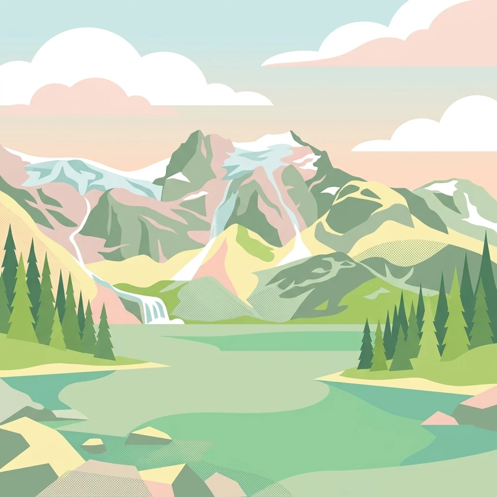
A flat-style vector illustration depicting a turquoise mountain lake with pine trees, waterfalls, and snow-covered peaks in a pastel color palette.

Joffre Lakes Provincial Park

State or regional park

Park overview

Structured park overview, official facts, and landscape profile for Joffre Lakes Provincial Park

Joffre Lakes Provincial Park park facts, protected area profile, and essential visitor context

Review the core facts for Joffre Lakes Provincial Park, including designation, size, terrain, visitor scale, habitats, and operating context in one park-focused overview.

About Joffre Lakes Provincial Park

Joffre Lakes Provincial Park sits in one of the most visually dramatic corners of British Columbia's Coast Mountains, where glaciers, moraines, and steep forested valleys converge to create a compact but powerful alpine landscape. Although the park is relatively small, encompassing roughly 14.87 square kilometres, it contains an unusually complete vertical profile, climbing from the valley floor near Highway 99 up through old-growth forest, glacial moraines, and rocky alpine terrain toward some of the Lillooet Range's most prominent peaks.

The defining feature of the park is the chain of three lakes: Lower, Middle, and Upper Joffre Lake. The lakes are fed by meltwater from glaciers in the surrounding mountains, and the fine sediment ground down by those glaciers, called rock flour, gives the water its intense, almost luminous blue-green color. The visual effect is enhanced by the narrow valley walls, hanging glaciers, and waterfalls that line the route between the lakes, making the trail into one of the most photographed alpine hikes in Canada.

Beyond the lakes themselves, the park functions as a gateway into the high country of the Lillooet Range. Peaks such as Mount Matier, Joffre Peak, Slalok Mountain, Mount Hartzell, and Mount Spetch rise above 2,500 to nearly 2,800 metres, drawing mountaineers with mixed snow, ice, and rock routes. In summer the same terrain makes the surrounding meadows and ridges accessible to hikers, while in winter the area transforms into a snow-covered climbing and ski touring zone.

The park is also notable for its management story. Originally designated as Joffre Lakes Recreation Area in 1988 and upgraded to full class A provincial park status in 1996, it has experienced one of the steepest rises in visitation of any BC park in recent years. BC Parks has responded by closing the park in 2020, then reopening it under a day-pass pilot program, alongside trail upgrades, improved parking enforcement, and seasonal shuttle connections aimed at balancing recreation with conservation of this fragile glacier-fed environment.

Quick facts and research context for Joffre Lakes Provincial Park

Joffre Lakes Provincial Park is a class A provincial park established in 1996, upgrading a recreation area first created in 1988, and is operated by BC Parks. It lies in the Squamish-Lillooet Regional District of British Columbia, roughly 35 kilometres east of Pemberton along Highway 99 and the Duffey Lake Road.

The park covers about 14.87 square kilometres and centers on three glacier-fed lakes, Lower, Middle, and Upper Joffre Lake, connected by a roughly 5 kilometre trail with about 370 metres of elevation gain. Surrounding peaks of the Lillooet Range, including Mount Matier and Joffre Peak, rise above 2,700 metres and define the park's dramatic alpine backdrop.

Protection and recognition

Documented terrestrial protection scope, management framework, and international recognition details

Joffre Lakes Provincial Park Protection Status and Conservation Record

Joffre Lakes Provincial Park holds a documented terrestrial protection status within its regional conservation framework. Regional records outline the established management scope and international recognition standing without unverified assumptions.

Protection details

Protection scope
Terrestrial
Transboundary protection
No
Park context

Deeper park guide and search-rich context for Joffre Lakes Provincial Park

Joffre Lakes Provincial Park history, landscape, wildlife, and travel context

Explore Joffre Lakes Provincial Park through its history, landscape character, ecosystems, wildlife, conservation priorities, cultural context, and seasonal travel timing in a structured park guide built for atlas discovery and search intent.

Why Joffre Lakes Provincial Park stands out

Joffre Lakes is best known for its three glacier-fed lakes, whose intense turquoise color comes from suspended glacial rock flour rather than mineral content alone. This vivid blue-green water, framed by moraines, waterfalls, and surrounding snow-capped peaks, has made the park a signature image of British Columbia's Coast Mountains. The park is also known as one of the most popular hiking and mountaineering destinations in southwestern British Columbia, combining a relatively accessible day-hike trail with serious high-altitude climbing routes on the surrounding summits. Its combination of natural color, alpine scenery, and proximity to the Vancouver region has turned it into a defining outdoor experience for the province.
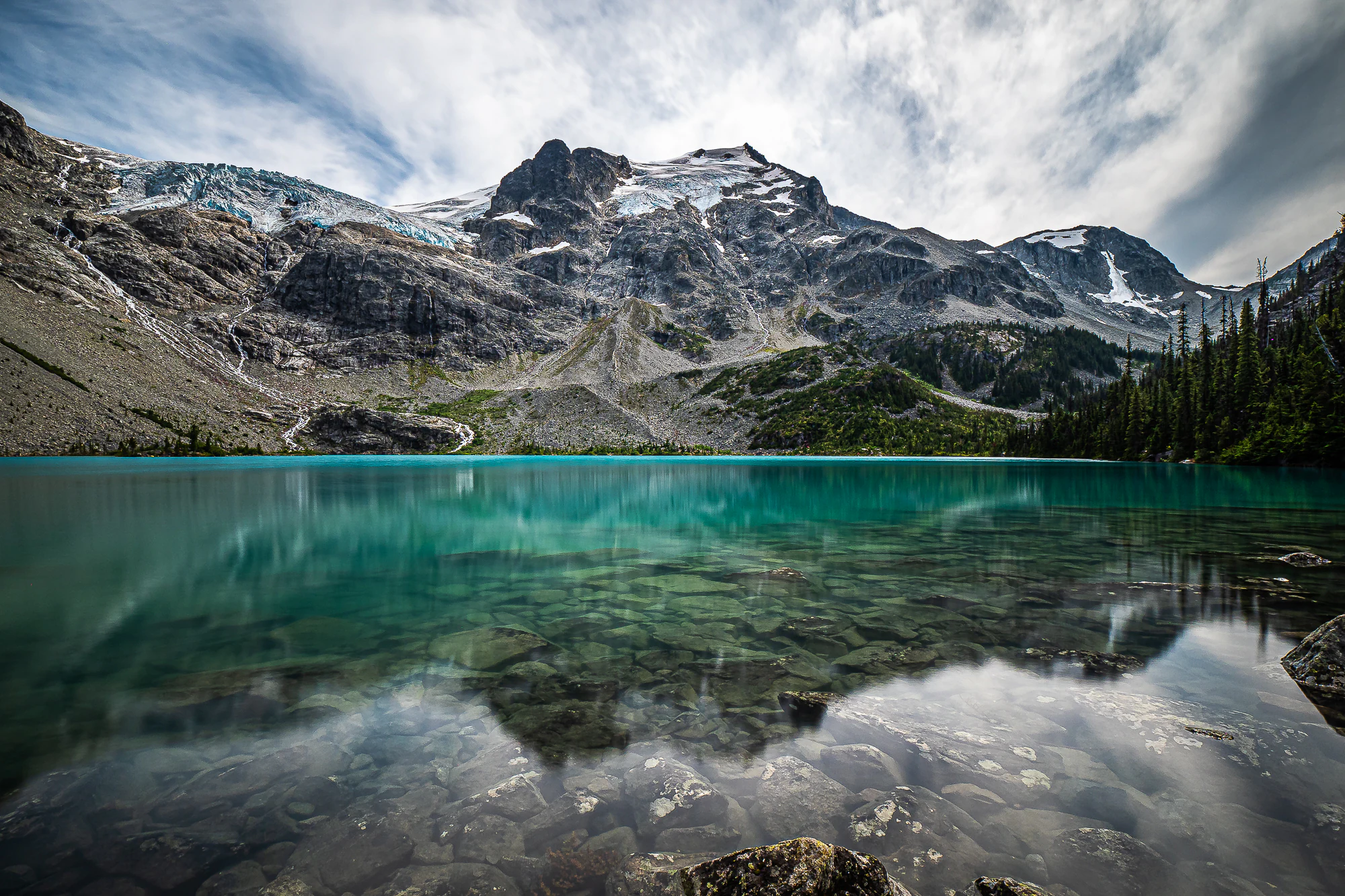
A wide angle view of a bright turquoise lake in the foreground, with clear water revealing submerged rocks, and a massive, snow-dusted, craggy mountain peak with a visible glacier in the background under a cloudy sky.
The turquoise waters of Upper Joffre Lake, reflecting the dramatic Matier Glacier and surrounding peaks.

Joffre Lakes Provincial Park history and protected-area timeline

The area that is now Joffre Lakes Provincial Park was first formally recognized by the provincial government in 1988, when it was designated as the Joffre Lakes Recreation Area. At that time the focus was on providing a managed outdoor recreation setting for hiking, camping, fishing, and, in winter, ski touring and snowshoeing in a region already gaining a reputation among mountaineers.

In 1996, the recreation area was elevated to a class A provincial park, placing it under the stronger and more formal protection framework of BC Parks. This change reflected both the growing recreational popularity of the lakes and a recognition of the ecological and scenic value of the surrounding alpine landscape, including its glacier-fed lake system and high peaks.

The park's most consequential chapter, however, has unfolded in the past decade. As visitation exploded, the park began to suffer from trail degradation, litter, and unsafe roadside parking along Highway 99. In response, BC Parks closed the park in 2020, and reopened it in 2021 under a pilot day-pass system designed to cap the number of users and reduce environmental stress. Trail upgrades along the route to Middle Joffre Lake have been ongoing since 2013 and accelerated in 2017, reshaping the experience of the trail itself while attempting to protect the underlying terrain.

These management changes have made Joffre Lakes an influential case study in how Canadian provincial parks are responding to surging demand for short, photogenic backcountry hikes close to major urban centers.

Joffre Lakes Provincial Park landscape and geographic character

The landscape of Joffre Lakes Provincial Park is a textbook example of a glacially carved Coast Mountain valley. Bedrock has been scoured and polished by successive ice masses, leaving behind steep walls, U-shaped contours, and a series of moraines that dam and shape the lakes themselves. The result is a compact amphitheatre of rock, ice, forest, and water compressed into a relatively small park footprint.

The trail from the parking lot to Upper Joffre Lake ascends roughly 370 metres over about 5 kilometres. Early on, the route crosses a prominent moraine that was left behind when the valley glaciers retreated, and then climbs past a waterfall that drains the upper basin. The terrain above the falls becomes rougher and less formally maintained as it enters true glacial alpine country.

Above the lakes, the skyline is dominated by the rugged summits of the Lillooet Range. Mount Matier, at 2,783 metres, is the highest peak in or near the park, followed closely by Joffre Peak at 2,721 metres. Other significant mountains include Slalok Mountain, Mount Hartzell, Mount Spetch, Mount Howard, Mount Taylor, and Tszil Mountain. These peaks support hanging glaciers and permanent snowfields, even in summer, and their meltwater is the source of the lakes' distinctive color.

Joffre Lakes Provincial Park ecosystems, habitats, and plant life

Ecologically, Joffre Lakes Provincial Park spans several distinct vegetation zones within a short distance, reflecting its steep elevation gradient and the strong influence of the Coast Mountains climate. The lower trail travels through dense coniferous forest typical of the Pacific Northwest, with stands of fir, hemlock, and cedar providing shade, moisture retention, and habitat complexity.

As the trail rises past the moraine and into the upper basin, the forest thins and is replaced by subalpine scrub, krummholz, and open meadows interspersed with rocky outcrops and glacial debris. Around and above the lakes, vegetation becomes sparse and hardy, dominated by low alpine shrubs, mosses, lichens, and wildflowers that bloom briefly during the short summer season.

The glacial influence that shapes the park's scenery also shapes its ecology. Cold meltwater, unstable moraine substrates, and short growing seasons at higher elevations create specialized habitats that differ markedly from the forested valley floor just a few kilometres away. This compressed ecological gradient gives the park an unusually high diversity of habitat types for its size.

Joffre Lakes Provincial Park wildlife and species highlights

Wildlife in Joffre Lakes Provincial Park reflects the broader character of the southern Coast Mountains, with species adapted to both coastal temperate forests and high alpine environments. During the summer months, mule deer and black-tailed deer are common residents of the park, often seen along the trail and around the lakeside meadows where vegetation is most accessible.

Black bears are also frequent summer visitors, drawn by berries and seasonal vegetation, while mountain goats inhabit the steeper rocky terrain and cliff bands of the surrounding peaks, where their climbing ability gives them access to rugged habitat largely beyond human reach. Visitors to the upper lakes occasionally see goats on the cliffs and talus slopes above the water.

Larger carnivores, including cougars, bobcats, and wolverines, are recorded as transients rather than regular residents. They move through the valley as part of broader home ranges that extend across the Lillooet Range. The park's dog prohibition is tied directly to the need to limit disturbance to these wildlife populations and to avoid conflicts with bears drawn to human food and scented items.

Joffre Lakes Provincial Park conservation status and protection priorities

From a conservation perspective, Joffre Lakes Provincial Park protects a representative and visually iconic example of a glacier-fed Coast Mountains valley, including the full chain of Lower, Middle, and Upper Joffre Lake together with their associated moraines, subalpine forests, and high alpine peaks. The compact size of the park, combined with its sharp elevation gradient, makes it an unusually efficient refuge for a wide range of habitats in a single protected area.

The park's conservation significance has only grown as pressures on it have intensified. By the late 2010s, Joffre Lakes had become one of the most heavily used day-hiking destinations in British Columbia, and the resulting trail erosion, waste accumulation, and roadside safety issues along Highway 99 posed serious threats to the very features that made the park attractive. BC Parks' decision to close the park in 2020 and then reopen it under a daily visitor cap reflects a recognition that unmanaged popularity can rapidly undermine conservation values.

Ongoing trail upgrades, the introduction of bear-proof food storage at the Upper Lake campground, the prohibition of campfires, and restrictions on dogs all point to a conservation strategy centered on keeping visitation within the ecological carrying capacity of the valley. In this sense, Joffre Lakes has become a working laboratory for how intensely visited alpine parks can be protected in the era of social-media-driven outdoor tourism.

Top sights and standout views in Joffre Lakes Provincial Park

The single most recognizable image from Joffre Lakes is the chain of vividly turquoise lakes backed by glaciers and high peaks, a combination that has come to symbolize the outdoor identity of southwestern British Columbia. Hiking the roughly five-kilometre trail past Lower, Middle, and Upper Joffre Lake remains the park's signature experience, accessible to day visitors but increasingly managed to protect the very environment that makes it special.

Beyond the lakes, the park's defining highlights include the surrounding Lillooet Range peaks, with Mount Matier and Joffre Peak serving as landmarks for mountaineers, and the small but well-situated campground at Upper Joffre Lake, which sits on a moraine shoreline and offers one of the most scenic backcountry-style campsites in the province. The park's modern history of overcrowding, closure, and the introduction of a day-pass system has itself become part of its identity, marking it as a flagship example of visitation management in Canadian provincial parks.

Best time to visit Joffre Lakes Provincial Park

The recommended hiking season at Joffre Lakes runs roughly from June through September, when snow has melted from the trail, the waterfalls are at their fullest from snowmelt, and the lakes display their most saturated turquoise color. This is also when wildlife such as deer and bears are most active in the valley, and when wildflower blooms briefly color the subalpine meadows around the upper lakes.

Late summer, typically July into early September, is generally considered the most reliable window for combining open trail conditions with stable weather and full lake color. Outside this window, the park remains open, but winter access is only practical on skis or snowshoes, and camping at Upper Lake is discouraged due to avalanche risk; experienced winter visitors tend to base themselves at Middle Joffre Lake instead.
Monthly climate preview

Long-term representative temperature ranges and monthly precipitation data

Joffre Lakes Provincial Park Climate Normals and Annual Weather Patterns

Joffre Lakes Provincial Park displays measured annual temperature variations and monthly precipitation averages derived from historical coordinate data. Examining the complete twelve-month climatology profile reveals detailed shifts in temperature minimums and maximums across the representative elevation.
Annual mean1 °C
-9 °C13 °C
Jan-8°
Feb-8°
Mar-5°
Apr-2°
May
Jun
Jul13°
Aug12°
Sep
Oct
Nov-5°
Dec-9°
Warmest month
July

12.6 °C

Coolest month
December

-8.8 °C

Wettest month
November

4.7 mm/day

Driest month
August

1.5 mm/day

Park location guide

Geography guide, regional context, and park location map for Joffre Lakes Provincial Park

Joffre Lakes Provincial Park park geography, regions, and map view in Canada

Understand where Joffre Lakes Provincial Park sits in Canada through a broader geographic reading of the surrounding landscape, nearby location context, and its mapped position within the national park landscape.

How Joffre Lakes Provincial Park fits into Canada

Canada is a federal parliamentary constitutional monarchy spanning North America from the Atlantic to the Pacific and Arctic Oceans. With a population of over 41 million, it is officially bilingual in English and French at the federal level. The country gained independence from the United Kingdom through a gradual process culminating in 1982.

Wider geography shaping Joffre Lakes Provincial Park in Canada

Canada occupies the northern portion of North America, sharing its longest international border with the United States. The country extends from the Atlantic Ocean to the Pacific Ocean and northward into the Arctic Ocean, giving it the longest coastline of any nation.

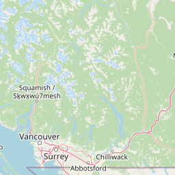
Map view of Joffre Lakes Provincial Park

Use this park location map to pinpoint Joffre Lakes Provincial Park in Canada, understand its exact geographic position, and read its mapped placement within the surrounding landscape more clearly.

Pigeon | © OpenStreetMap contributors

Location context for Joffre Lakes Provincial Park

British Columbia

Visualizing glacier fed alpine waters and rugged Coast Mountain terrain

Joffre Lakes Provincial Park Photos and Landscapes

Visual records capture the striking sequence of turquoise alpine lakes and glacial topography that define Joffre Lakes Provincial Park. Examining photographic documentation provides a clearer understanding of the protected valley environments, rugged peaks, and fragile subalpine habitats found across the region.

A wide angle view of a bright turquoise lake in the foreground, with clear water revealing submerged rocks, and a massive, snow-dusted, craggy mountain peak with a visible glacier in the background under a cloudy sky.

Park atlas

Compare regional mountain geography and adjacent wilderness reserves

Other Parks Near Joffre Lakes Provincial Park and Surrounding Protected Areas

Browse nearby provincial parks and protected landscapes situated throughout the surrounding Coast Mountain corridor. Compare adjacent alpine terrain and regional wilderness reserves to expand your geographic exploration.
A horizontal watercolor painting depicting a light, airy landscape with distant snow-capped mountains, rolling green hills, and coniferous forest edges.
State or regional parkBritish Columbia
About 14 km away#1 closest

Southwest

Garibaldi Provincial Park: An Atlas of Volcanic and Glacial Terrain in British Columbia

Protected wilderness in the Garibaldi Volcanic Belt

Garibaldi Provincial Park preserves a massive expanse of mountainous wilderness, defined by iconic landmarks such as The Black Tusk and Garibaldi Lake. The park represents a crucial study in vertical zonation, transitioning from temperate coastal forests to vast alpine meadows, glaciers, and jagged volcanic summits. Analyze the geological history and mapped protected boundaries that shape this significant British Columbia conservation area.

Area
1,950 km²
Established
1920
IUCN
II
Visitors
136K annual
A watercolor painting showing a soft-focus landscape with rolling green hills, distant mountains, and a central river or water feature.
State or regional parkBritish Columbia
About 67 km away#2 closest

South

Golden Ears Provincial Park: Geographic Atlas and Protected Landscape Overview

Coast Mountains terrain and protected wilderness boundaries

Golden Ears Provincial Park is a major protected wilderness in British Columbia, defined by the twin peaks of the Golden Ears massif and vast glacial lake systems like Alouette and Pitt. This site serves as a vital ecological corridor where lowland forests meet high subalpine ridges. Explore the park through its mapped boundaries and diverse ecological zones within the Pacific Northwest mountain landscape.

Area
609 km²
Established
1967
IUCN
II
Visitors
956.5K annual
A watercolor illustration of a mountain landscape featuring soft rolling hills, evergreen trees, and low-lying vegetation on a white background.
State or regional parkBritish Columbia
About 71 km away#3 closest

South

Pinecone Burke Provincial Park: Coast Mountain Wilderness and Protected Terrain Geography

Mapping a vast ecological corridor in British Columbia

Spanning over 38,000 hectares, Pinecone Burke Provincial Park represents a dramatic transition from the urban proximity of Coquitlam to the remote interiors of the southern Coast Mountains. The landscape is defined by its rugged relief, featuring subalpine meadows, deep freshwater systems, and historically significant forested slopes. This park provides a critical look at the complex topography of the Pacific Northwest, serving as a sanctuary for wildlife and a foundational piece of regional conservation.

Area
380 km²
Established
1995
IUCN
II
Relief
Mountain
State or regional parkBritish Columbia
About 77 km away#4 closest

Northeast

Marble Canyon Provincial Park: A Geological Exploration of British Columbia's Limestone Terrain

Mapping the canyons, mountain lakes, and microbialite ecosystems of the Marble Range.

Marble Canyon Provincial Park provides a dense concentration of natural features in British Columbia. The area protects a deep, river-carved limestone gorge, surrounding mountain slopes, and the distinct carbonate structures of Pavilion Lake. This site serves as a vital natural laboratory for geological and scientific research while offering an accessible landscape of cliffs and clear interior waters.

Area
25.44 km²
Established
1956
IUCN
II
Relief
Mountain
State or regional parkBritish Columbia
About 81 km away#5 closest

Northeast

Edge Hills Provincial Park: Mapping the Fraser Canyon and Interior British Columbia Geography

A remote protected fore-range between canyon and mountain

Edge Hills Provincial Park offers a study in interior British Columbia topography, where dramatic vertical relief from the Fraser River canyon meets high-elevation rolling hills. This undeveloped preserve highlights the transition between coniferous forests and dry grasslands, providing a distinct geographic perspective for those interested in Canadian protected landscapes and rugged mountain terrain.

Area
118.82 km²
Established
1995
IUCN
II
Relief
Mountain
A horizontal watercolor illustration depicting soft green rolling hills and distant purple mountains above a flat shoreline with patches of marsh grasses.
State or regional parkBritish Columbia
About 102 km away#6 closest

Southwest

Porteau Cove Provincial Park: Mapping Coastal Protected Landscapes in British Columbia

Geography of Howe Sound shorelines and marine habitats

Porteau Cove Provincial Park offers a unique geographic vantage point at the meeting of granite-sloped mountains and the Pacific waters of Howe Sound. This park detail covers the coastal landscape, including protected intertidal zones, artificial reef structures, and the surrounding terrain that characterizes this segment of the British Columbia coastline.

Area
0.5 km²
Established
1981
IUCN
II
Visitors
611.8K annual
A watercolor illustration showing a river winding through a valley with soft colored hills, a sandy bank in the foreground, and sparse trees along the shore.
State or regional parkBritish Columbia
About 109 km away#7 closest

Northeast

Juniper Beach Provincial Park: Geography and Protected Landscapes in British Columbia

Arid sagebrush steppe along the Thompson River corridor

Juniper Beach Provincial Park preserves a specialized pocket of desert ecology within British Columbia. Spanning 260 hectares, the area features a flat riverfront beach, steep bluffs, and open sagebrush slopes. This protected landscape offers a study in interior plateau geography, bridging the gap between riparian river systems and the dry, sun-exposed terrain of the Thompson Country.

Area
2.6 km²
Established
1989
IUCN
II
Relief
Lowland
A watercolor painting showing a soft, hazy landscape of a lake with green forest along the shore and distant purple mountains under a pale sky.
State or regional parkBritish Columbia
About 117 km away#8 closest

South

Davis Lake Provincial Park: Protected Forest and Lake Geography in British Columbia

Regional protected area with old-growth forest and waterfalls

Davis Lake Provincial Park represents a significant protected area in the Fraser Valley, characterized by its undisturbed Western Hemlock forest and the scenic descent of Murdo Creek into McDonald Falls. The park provides an essential look at the regional geography of southwestern British Columbia, balancing dense coniferous canopy with accessible lake-based terrain in a quiet, natural setting.

Area
0.75 km²
Established
1963
IUCN
II
Relief
Upland

Common questions about visiting, size, designation, and location context for Joffre Lakes Provincial Park

Joffre Lakes Provincial Park FAQs for park facts, access, geography, and protected area context

Find quick answers about Joffre Lakes Provincial Park, including protected-area facts, park geography, trail and visitor context, and how the park fits into its surrounding country and regional landscape.
MoriAtlas Explorer

Continue Your Protected Areas Search Across the Global Atlas

Deepen your exploration by continuing the structured search for national parks and protected areas worldwide. Utilize the comprehensive filtering capabilities to compare different conservation landscapes and refine your understanding of global park geography. Discover more about the distribution and characteristics of protected natural areas.

Global natural geography