
Trip Timing
When to Visit Kaieteur National Park: Seasonal Trade-offs and Best Times
Determining the best time to visit Kaieteur National Park requires balancing two primary, often conflicting, environmental variables: the accessibility provided by drier weather and the raw visual impact of the falls during periods of high water volume. Because the park is situated within the Guianan moist forests, the climate is characterized by significant annual rainfall, which directly dictates the flow rate of the Kaieteur Falls. Visitors seeking the most reliable trail conditions and clearer vistas for photography often favor the drier months, specifically February and March, when rainfall intensity reaches its annual nadir. During these months, lower humidity and more consistent daylight facilitate easier movement along the park trails that lead to the various viewpoints of the 741-foot drop.
The Trade-off Between Flow and Access
There is no single universally superior month for every traveler, as the experience shifts noticeably with the seasons. If your priority is to witness the falls at their most powerful, you may prefer the months following the heaviest rainy season, when the volume of water cascading over the escarpment is at its peak. However, this increased water volume comes with a greater likelihood of persistent cloud cover, higher humidity, and more challenging ground conditions in the surrounding jungle. Conversely, the drier season offers a more predictable schedule for air travel to and from the interior, though the waterfall itself, while always spectacular due to its immense scale, may not exhibit the same level of thunderous, saturated intensity seen during the wetter months.
Understanding Climatic Influences
Beyond rainfall, travelers should consider the interaction between humidity and temperature. Throughout the year, the park experiences relatively consistent mean temperatures, typically hovering between 23 and 25 degrees Celsius. However, the feeling of warmth is heavily influenced by the humidity levels, which fluctuate significantly alongside the rain cycles. Higher humidity during the wettest months can create a more oppressive atmosphere for extended hiking, whereas the lower relative humidity observed in the first quarter of the year often makes for a more comfortable outdoor experience. By weighing your appetite for the dramatic, flood-stage power of the falls against the practical benefits of lower humidity and dryer trail conditions, you can better select the timing that aligns with your personal travel goals. Always remember that these patterns represent long-term climatic averages rather than specific weather forecasts, meaning visitors should remain flexible and monitor current conditions as their departure date approaches.
Seasonal Planning
Best Months to Visit Kaieteur National Park for Balanced Conditions
Balancing Visibility and Hydrology for Your Visit
Choosing when to visit requires navigating the trade-off between the park's peak water volume and the drier conditions that facilitate trail exploration. Because the park experiences significant variations in rainfall, the best months for your visit depend heavily on whether you prioritize capturing the falls at their most powerful or enjoying drier, more stable walking conditions across the plateau.
The Drier Window: February and March
For travellers whose primary focus is access and comfort, the months of February and March represent the most consistent window. Climate data for this period shows the lowest precipitation levels, often dipping below 2.0 mm per day. During these months, the relative humidity also drops to its annual minimums, which can make long periods of outdoor activity more manageable. The lower rainfall significantly improves the condition of the forest trails, making it easier to reach the various viewpoints surrounding the cataract. If your itinerary is sensitive to slippery conditions or you prefer lower humidity, this late-first-quarter window offers the most reliable ground-level experience.
The High-Flow Window: Post-Rainy Season
While the dry months offer accessibility, the spectacle of the falls changes dramatically depending on the recent intensity of the rainy season. The primary rainy phase generally begins to taper off in the months following the mid-year peak. Many visitors find that the period immediately following the heavy rainfall months,specifically as you move into the latter part of the year,provides a visual balance. During these times, the volume of water remains substantial, offering the classic, thunderous experience for which the site is famous, while the rainfall intensity starts to decrease from the highs recorded in June and July. This creates a sweet spot for photography and landscape viewing where the power of the water remains at its zenith even as the weather stabilizes.
Seasonal Planning Considerations
Understanding the transition between these periods is vital for realistic expectations. The wettest months, specifically May through July, bring the highest daily precipitation levels, often exceeding 7.0 mm or more per day. While these months guarantee the maximum volume of water cascading over the escarpment, they also bring high humidity and saturated trails. Conversely, the transition months of September and October often act as a buffer. Comparing these patterns allows you to align your preferences with the park's natural cycle:
- February to March: Best for drier trails and clearer sky conditions, ideal for hikers and those avoiding peak humidity.
- September to November: Offers a balance of high water volume and moderating rainfall, suitable for those who prioritize the visual impact of the falls without the full intensity of the mid-year wet season.
- May to July: Recommended specifically for those whose primary objective is seeing the absolute maximum water volume, provided they are prepared for frequent rain and challenging trail conditions.
Climate Conditions
Annual Weather and Climate Patterns at Kaieteur National Park
Understanding the climate of this interior rainforest environment is essential for anticipating the environmental conditions you may encounter. Kaieteur National Park experiences a tropical jungle climate characterized by consistent warmth, with annual mean temperatures hovering in the low-to-mid 20s Celsius. While temperature remains relatively stable throughout the year, the primary shifts in the park environment are driven by variations in precipitation, which dictates the intensity of the waterfall and the humidity levels of the surrounding forest.
Annual Temperature Trends and Thermal Stability
Temperature in this region is remarkably consistent, reflecting its location deep within the interior. Daytime maximums typically climb into the low 30s Celsius, particularly during the drier months from February through April. Conversely, the humidity-heavy months of June and July see a slight cooling effect in daytime highs, often dropping toward the high 20s. It is important to note that these values represent historical climate normals from a fixed recording site at approximately 474 meters of elevation. Because the park encompasses a diverse forest canopy and exposed plateau areas, local conditions can vary significantly depending on your specific location near the falls or under the dense shade of the trees. These averages are long-term indicators of the thermal environment and should not be confused with real-time weather forecasts or daily highs and lows.
Patterns of Precipitation and Humidity
Rainfall is the most significant variable in the park's annual rhythm. The data indicates a clear escalation in precipitation beginning in April, which intensifies through May and reaches a peak in June and July. During these wetter months, daily precipitation rates rise sharply compared to the drier period between February and March. This high rainfall, combined with relative humidity that frequently exceeds 90 percent during the mid-year months, creates an environment where the forest remains constantly saturated. Visitors should anticipate that the moisture levels in the air directly correlate with the volume of the falls. Even outside the peak rainy season, the nature of a tropical rainforest ensures that short, localized showers are always a possibility, regardless of what the long-term averages suggest.
Wind, Daylight, and Atmospheric Context
Wind speeds in the park are generally low, remaining consistent throughout the year with subtle fluctuations between 0.8 and 1.4 meters per second. This low-wind environment allows the dense forest humidity to persist, particularly during the wet months when the air feels heavy and still. Daylight hours show minimal variance, typical of a location near the equator, ranging from approximately 11.7 hours in the winter months to just over 12.3 hours in June. While these daylight differences are slight, they provide a consistent window for daily activities. When planning your visit, rely on these seasonal patterns as general indicators of environmental behavior. Because the park functions as an undisturbed wilderness, these climate normals provide a reliable foundation for understanding the year, yet they cannot predict the specific rainfall or wind gusts that may influence any individual day of travel.
Seasonal Environment
Annual Weather Phases and Seasonal Transitions in Kaieteur National Park
The Drier Window: February and March
The most stable period for visiting the park centers on February and March. During these two months, the interior experiences its lowest precipitation levels, which typically results in improved trail conditions across the park. For visitors prioritizing hiking and clear visibility of the waterfall basin, this period is often preferred because the humidity levels drop from their peaks, and the reduced rainfall minimizes the risk of muddy, difficult paths. While the volume of water remains substantial due to the scale of the Potaro River, these months represent a drier rhythm that differentiates the experience from the rest of the year.
Transition to the Wettest Phase: April through August
As the year progresses into April, the environment shifts toward higher moisture levels. April serves as a bridge month where rain becomes more frequent, leading into the core wet period that spans from May through August. By June and July, the climate reaches its peak saturation, characterized by the highest monthly precipitation and near-maximum relative humidity. Travelers should expect consistent, often heavy rainfall during this window. While this period makes trail traversal more challenging due to mud and slippery conditions, it is precisely this high precipitation that feeds the river to its maximum volume. The waterfall is at its most thunderous and visually dramatic, offering a raw intensity that defines the Guianan interior at the height of its wet cycle.
The Secondary Stabilization: September through November
Following the peak wet season, the park enters a secondary, more moderate phase. Starting in September, precipitation begins a marked decline, and humidity starts to ease. This transitional window extends through November and acts as a cooling-down period for the landscape. Many visitors find this time of year offers a balanced environment. The ground begins to dry out, making remote forest trails more accessible than they were in mid-year, yet the water volume has not fully receded to the lows seen in the early-year dry season. It is a period of gradual environmental recovery where the forest remains lush and vibrant, but the persistent daily deluge of the previous months subsides.
Early-Year Transitions and Climate Stability
December and January serve as the final transition back toward the primary drier cycle. During these months, the environment stabilizes further, with precipitation levels remaining relatively consistent but significantly lower than the mid-year peak. Temperatures remain remarkably steady throughout the year, with daytime maximums hovering around 30 degrees Celsius. Because there is no pronounced cold season, the primary environmental change is dictated almost entirely by the shift in rainfall patterns. Visitors should remain aware that these seasonal phases are based on long-term climate normals. While these patterns describe the typical rhythm of the park, local weather can deviate, and unexpected rainfall can occur at any time within this tropical jungle climate.
Seasonal Experiences
Seasonal Shifts in Kaieteur National Park Landscapes and Wildlife
Visualizing Waterfall Impact Across Seasons
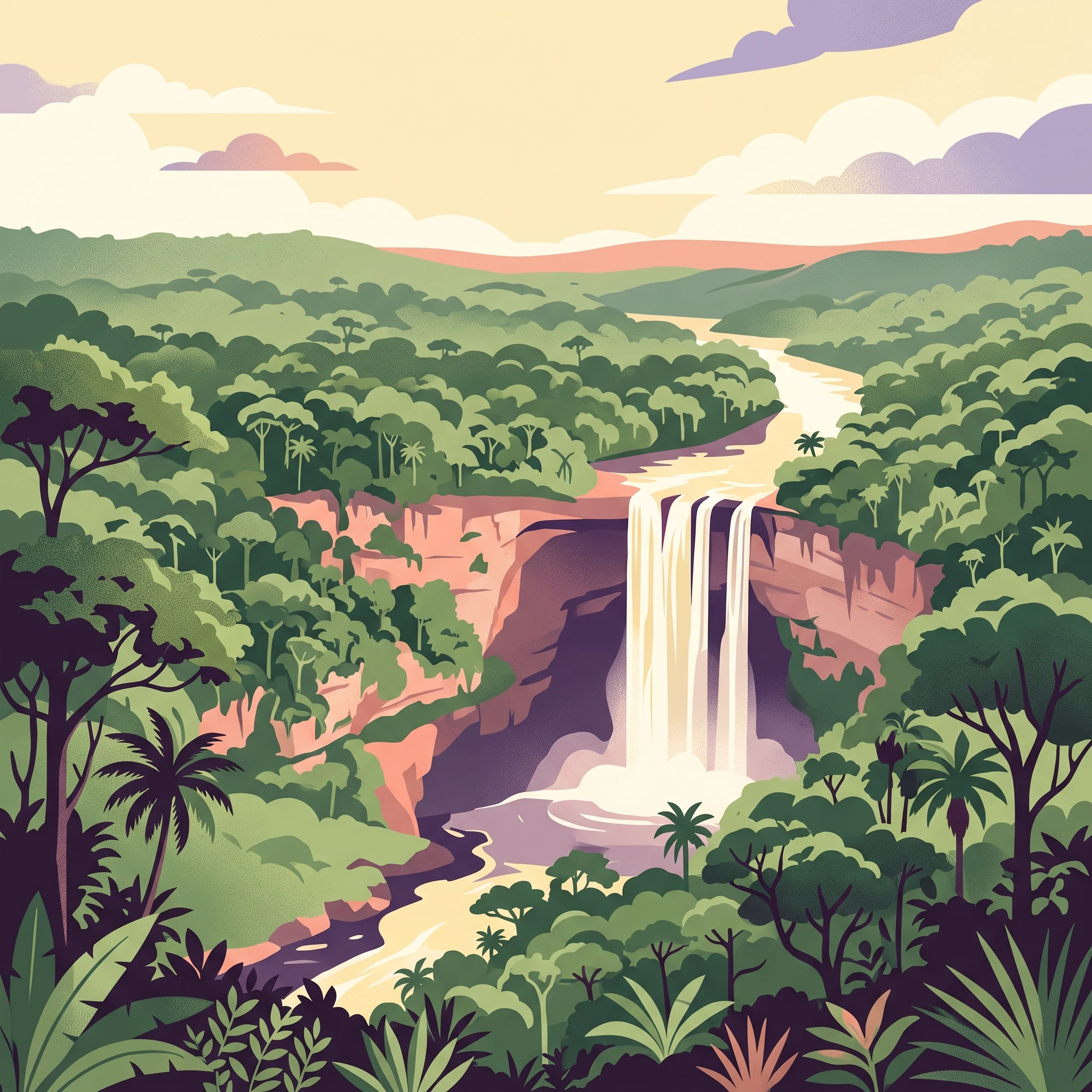
The most powerful element of a visit to Kaieteur National Park is the sheer scale of the falls, a reality that fluctuates significantly based on regional precipitation patterns. While the massive drop is a permanent feature, the water volume experiences notable shifts that transform the viewing experience. During the wetter months, particularly from May through July, the sheer force of the Potaro River surging over the ledge creates a thunderous, mist-heavy environment. This period offers the most dramatic sensory experience, as the increased rainfall ensures that the water volume is at its absolute peak, often creating a thick, spray-filled atmosphere that underscores the raw power of the site.
Conversely, the drier windows, typically found in February and March, provide a different aesthetic and sensory profile. While the volume of water is reduced compared to the mid-year peaks, the falls remain a major spectacle. The primary advantage of these drier months is improved visibility. Lower humidity and decreased precipitation levels can result in a more defined, crisp view of the geological drop and the surrounding landscape. Visitors who prioritize photography or a clear, expansive line of sight often find these drier months preferable, as the reduced spray minimizes the atmospheric haze that can sometimes obscure the full height of the drop during the height of the wet season.
Accessing the Biodiversity of the Guianan Moist Forest
The park serves as a refuge for specialized species that are highly sensitive to their environment, such as the golden rocket frog. This tiny amphibian relies entirely on the water trapped within the tank bromeliad, Brocchinia micrantha. Because these plants catch and hold rainwater, the frog population is intrinsically linked to the broader moisture cycle of the forest. Visiting during the transition phases, such as the arrival of the lighter rains in late August or September, can offer a unique opportunity to observe these micro-habitats when they are actively recharged but not overwhelmed by excessive precipitation.
Walking the trails around the falls requires careful attention to the seasonal ground conditions. In the wetter months, the forested paths can become muddy, slippery, and challenging to navigate, which may influence the duration or comfort of your exploration. The drier months provide much firmer, more stable footing, allowing for a more relaxed pace when walking to the various lookout points. This improved trail quality is a significant benefit for those who wish to spend more time exploring the surrounding forest floor without the constant concern of navigating saturated, uneven terrain. Regardless of when you choose to visit, the park remains a deep wilderness environment where conditions can change rapidly, necessitating a flexible approach to your time spent in the forest.
Travel Priorities
Choosing the Best Time to Visit Kaieteur National Park for Hiking and Wildlife
Navigating for Drier Conditions and Trail Comfort
Visitors whose primary goal is to traverse the park forest trails with relative ease should target the window from February through March. During this period, the park experiences its lowest monthly precipitation, with climate normals indicating around 1.8 to 2.2 millimeters of rainfall per day. These drier conditions translate into firmer soil on the ground and reduced mud accumulation along the paths leading toward the falls. The trade-off for this trail accessibility is a reduction in the sheer volume of water cascading over the escarpment compared to the wetter months of May and June. While the falls remain a powerful sight, you may encounter less of the atmospheric mist that characterizes the peak flow season, offering a clearer, if less intense, viewing experience.
Prioritizing Maximum Waterfall Volume and Dramatic Spray
If your motivation for visiting is to witness the falls at their absolute peak power, the transition into and the height of the wet season provide the most significant sensory impact. Historical data shows rainfall increasing significantly by May, peaking through June and July. During these months, the forest ecosystem is at its most saturated, and the Potaro River swells, driving the massive volume of water that makes the park world-famous. The primary trade-off for this dramatic spectacle is the higher likelihood of rain, which often leads to muddier trails and reduced visibility during cloud-heavy periods. Visitors choosing this timeframe should be prepared for more frequent precipitation and higher relative humidity, which often exceeds 90 percent during the peak wet months. This period is best suited for those who prioritize the sheer aesthetic scale of the waterfall over the convenience of dry hiking conditions.
Balancing Milder Temperatures and Longer Days
Travelers seeking to optimize their visit based on thermal comfort and daylight duration will find that the park exhibits consistent year-round stability, though subtle variations exist. Temperatures throughout the year generally maintain a mean of around 23 to 25 degrees Celsius, with maximum daily peaks rarely fluctuating outside the 27 to 32 degree range. March represents one of the warmest months, with average maximums reaching approximately 32 degrees Celsius, providing a bright, clear environment for those who prefer warmer hiking weather. In contrast, the months of June and July offer slightly cooler maximum temperatures, often dipping below 28 degrees Celsius, which can be more comfortable for sustained physical activity in the high-humidity environment of the tropical forest. Daylight hours are also notably consistent, peaking near 12.3 hours in June and tapering to just under 11.7 hours in December and January, a variation of less than an hour that rarely dictates the daily itinerary but can be noted for scheduling longer outdoor sessions during the mid-year months.
Logistics and Access
Seasonal Access and Operational Planning for Kaieteur National Park
Navigating Transportation to the Park
Access to this remote wilderness is almost exclusively facilitated by air travel. Most visitors reach the park via small aircraft departing from Ogle Airport in Georgetown. These flights typically utilize aircraft with a capacity of 15 passengers or fewer. Because the park is situated deep within the Guianan interior, surface transport is not a viable option for most independent travelers. Flight availability is contingent upon operator schedules, which are often structured around day-trip circuits. Travelers should anticipate that these services are demand-dependent, meaning they generally operate only when a full load of passengers is booked. Always contact local carriers or tour operators in Georgetown well before your intended travel dates to confirm current flight availability, group size requirements, and whether specific landing permits or visitor fees are included in your package.
Coordination and Booking Requirements
Practical planning requires shifting your mindset from independent, flexible exploration to organized, service-dependent logistics. Because airlines prioritize full-capacity trips, buying a one-way ticket is frequently difficult. Operators generally seek to fill all seats for both the outbound and return legs of a journey. If you are not traveling as part of a pre-arranged group, you may find it necessary to pay a full return fare even if you only intend to use one leg of the flight, unless other travelers are seeking the opposite route on the same day. Most hotels and travel agencies in Georgetown are accustomed to managing these arrangements and can assist in coordinating the necessary bookings. It is prudent to initiate these logistical discussions at least several days before your planned departure to avoid disappointment.
Understanding Park Status and Verification
While climate data indicates clear seasonal variations in rainfall and trail conditions, it does not dictate the operational status of the park. Official access, facility availability, and safety protocols are determined solely by the Kaieteur National Park Commission and relevant governance bodies. Environmental conditions, such as high water levels during the peak wet months, may influence the day-to-day experience of the falls, but do not assume these periods correlate with formal park closures. Always verify current operating procedures, entry requirements, and any temporary site restrictions directly through official sources before making non-refundable travel commitments. Reliance on climate averages as a proxy for facility status is discouraged, as operational rules can change independently of the underlying weather patterns.
Safety and Preparation
Weather, Safety, and Essential Preparation for Kaieteur National Park
Navigating Tropical Conditions and Humidity
Preparation for a visit to the Guianan moist forest requires a realistic understanding of the environment. High relative humidity is a constant factor, rarely dipping below 70 percent even during the drier periods of February and March. When planning your trip, expect a warm and muggy climate throughout the year. Because temperatures remain relatively consistent with mean values hovering between 23 and 25 degrees Celsius, you should prioritize moisture-wicking and breathable fabrics that dry quickly. Avoid heavy synthetic or cotton materials that retain moisture, as they will quickly become uncomfortable in this environment.
Terrain and Footwear Considerations
The trails surrounding the falls are located within a dense rainforest ecosystem, where ground conditions change rapidly based on recent rainfall. While the drier months offer more stable footing, the terrain remains natural, uneven, and potentially slippery regardless of the season. Sturdy, closed-toe footwear with reliable tread is essential for navigating the forest floor safely. Given the prevalence of frequent showers even outside the peak wet months, waterproof gear is a practical necessity. A lightweight, packable rain jacket or a durable poncho will serve you better than bulky rainwear that limits airflow.
Assessing Risk and Staying Informed
Safety in a remote wilderness area relies on both preparation and vigilance. The waterfall environment is dramatic, and it is important to remember that there are no safety barriers at the cliff edges. Visitors are expected to exercise personal caution and remain on designated paths at all times to protect both the fragile bromeliad-dependent ecosystem and themselves. Regarding health and hygiene, water quality in the interior forest should not be assumed as potable. Carrying your own water supply or bringing purification tablets for use if necessary is a sensible precaution to include in your planning.
Before finalizing your gear or itinerary, monitor current local meteorological reports. Climate normals provide a useful baseline for the typical annual patterns, but they do not substitute for actual weather forecasts. Check for official park alerts issued by the Kaieteur National Park Commission or local authorities, as these sources provide the most accurate information regarding current trail accessibility, forest conditions, and specific safety protocols for your planned dates of travel.
Travel Planning
How to Choose the Best Time to Visit Kaieteur National Park
Deciding when to travel to Kaieteur National Park is ultimately a personal balancing act between two distinct environmental experiences. Because the park is defined by its massive tropical waterfall, your decision rests on whether you prioritize the raw, thunderous power of peak water flow or the increased physical accessibility offered during the drier months. There is no universally superior time to visit, as each period offers a fundamentally different interaction with the Guianan forest.
Aligning Your Priorities with Seasonal Reality
If your primary goal is to ensure the most consistent trail conditions and reliable visibility of the falls without excessive precipitation, the drier window of February and March remains the most logical choice. During these months, the lower rainfall averages translate to more manageable forest paths and often clearer skies for viewing the 741-foot drop. This timeframe is particularly well-suited for travelers who are concerned about the logistical challenges of humid, rain-slicked jungle terrain or who prefer to minimize the risk of weather-related travel disruptions.
Conversely, if witnessing the falls at their maximum capacity is your singular priority, you may find the later months of the primary rainy season more compelling. While the trade-off involves navigating higher humidity and more frequent rain, the visual intensity of the water volume is unmatched during these periods. This choice requires a higher tolerance for challenging weather conditions and a readiness to adapt your schedule to the realities of a tropical rainforest environment.
Moving from Planning to Execution
Regardless of which window aligns with your preferences, remember that climate normals are based on long-term data trends rather than guarantees for your specific dates. Weather in this interior region of Guyana remains dynamic and can change rapidly. Always verify the current status of park access, flight schedules, and any active alerts from the Kaieteur National Park Commission before finalizing your travel plans. By choosing your dates based on your own tolerance for these environmental trade-offs, you will be better prepared to experience the park regardless of the conditions you encounter on the ground.