Mori Atlas logo
Wildlife reserveKaiser Wilderness

A compact high-elevation wilderness system defined by glacial cirques, alpine lakes, and dramatic ridgelines.

Kaiser Wilderness Protected Area: Mapping the Alpine Ridge and Granite Terrain of Central California

Kaiser Wilderness represents a concentrated expanse of central Sierra Nevada geography, rising from 7,200 to over 10,300 feet at the prominent Kaiser Peak. Located in Fresno County, the terrain features glacier-scoured granite, steep rock cirques, and dense coniferous forests. The protected boundaries encompass a self-contained ridge system that remains a vital part of the regional mountain ecosystem, separated from the deeper Sierra backcountry by the South Fork San Joaquin River canyon.

Sierra Nevadawilderness areaalpine wildernessgranite landscapealpine lakesconiferous forest

Kaiser Wilderness

Wildlife reserve

Park overview

Structured park overview, official facts, and landscape profile for Kaiser Wilderness

Kaiser Wilderness park facts, protected area profile, and essential visitor context

Review the core facts for Kaiser Wilderness, including designation, size, terrain, visitor scale, habitats, and operating context in one park-focused overview.

About Kaiser Wilderness

Kaiser Wilderness occupies a distinctive niche within California's Sierra Nevada as a compact but ecologically rich protected area. Although it covers only about 22,700 acres, it captures many of the elements that define the broader Sierra landscape: glaciated granite, alpine lakes, sheer rock faces, and a vertical gradient that supports an unusually diverse sequence of forest communities in a small area.

Located within the Sierra National Forest and managed by the U.S. Forest Service, the wilderness is part of a much larger network of federally protected lands. It sits across the South Fork San Joaquin River canyon from the deeper High Sierra country of the John Muir and Ansel Adams Wildernesses, which together form an almost continuous band of designated wilderness running along the spine of the range. This positioning makes Kaiser an appealing entry point to the Sierra for visitors based in Fresno and the Central Valley, while still preserving a strongly wilderness character.

Kaiser Peak dominates the high country of the area, rising above a ridge system that combines open alpine terrain with forested slopes. Lakes such as George Lake and Upper Twin Lake are characteristic destinations within the wilderness, with Upper Twin Lake notable for the small cave into which its outlet stream disappears before resurfacing downstream. Below these peaks and lakes, perennial streams sustain willow and alder communities that frame the drainage of the South Fork San Joaquin.

Although the wilderness is small compared to its giant neighbors to the east, it plays an important role in regional conservation and outdoor recreation. It supports day hiking, backpacking, horseback riding, fishing, rock scrambling, nature photography, and winter snowshoeing, and overnight trips require a wilderness permit. The Forest Service actively promotes Leave No Trace practices to maintain the wilderness character that defines Kaiser.

Quick facts and research context for Kaiser Wilderness

Kaiser Wilderness is a 22,700-acre federally protected wilderness in Fresno County, California, within the Sierra National Forest. Established on October 19, 1976, it is classified as IUCN Category Ib and managed by the U.S. Forest Service. The wilderness occupies an east-west ridge system between approximately 7,200 and 10,320 feet in elevation, anchored by Kaiser Peak at its high point.

It functions as one of five wilderness areas within the Sierra National Forest and contributes to a near-continuous chain of federal wildernesses that extends along the Sierra Nevada. The South Fork San Joaquin River canyon separates Kaiser from the deeper High Sierra, while Huntington Lake and China Peak lie immediately to the south, framing the wilderness between remote alpine terrain and developed Sierra recreation areas.

Protection and recognition

Explore terrestrial protection metrics and official conservation status records

Kaiser Wilderness Protection Status and International Recognition Data

Kaiser Wilderness maintains a documented terrestrial protection status with structured management scope records for conservation analysis. Designated conservation parameters establish the official geographic boundaries and administrative framework associated with the protected area.

Protection details

Protection scope
Terrestrial
Transboundary protection
No
Park context

Deeper park guide and search-rich context for Kaiser Wilderness

Kaiser Wilderness history, landscape, wildlife, and travel context

Explore Kaiser Wilderness through its history, landscape character, ecosystems, wildlife, conservation priorities, cultural context, and seasonal travel timing in a structured park guide built for atlas discovery and search intent.

Why Kaiser Wilderness stands out

Kaiser Wilderness is best known for its concentration of classic Sierra Nevada landforms compressed into a relatively small footprint, including glacier-scoured granite, cirque lakes, granitic cliffs, and the prominent Kaiser Peak. The area is distinguished from the broader High Sierra to its east by the deep canyon of the South Fork San Joaquin River, which gives Kaiser its own identity as a self-contained alpine ridge system. The wilderness is also recognized for its varied montane and subalpine forests, ranging from mixed conifer stands at lower elevations to lodgepole pine on the ridge, whitebark pine and Sierra juniper near timberline, and willow and alder thickets along the perennial streams that feed the South Fork San Joaquin. Together, these features make Kaiser a representative example of mid-elevation Sierra ecology within easy reach of Fresno.

Kaiser Wilderness history and protected-area timeline

Kaiser Wilderness became part of the National Wilderness Preservation System when the United States Congress formally designated it on October 19, 1976. From that point forward, the area was set aside and managed as wilderness rather than as a general part of the national forest, although it remained under the administration of the U.S. Forest Service within the Sierra National Forest.

The 1976 designation placed Kaiser among a generational wave of California wilderness additions that recognized the ecological and scenic value of the Sierra Nevada's smaller but distinctive landscapes. It was already surrounded by established outdoor recreation infrastructure in the surrounding Sierra National Forest, including Huntington Lake to the south, which shaped the way visitors approached the area while preserving its interior from development.

In recent years, the western portion of the wilderness was severely affected by the 2020 Creek Fire, which swept through the area and left trails badly damaged or destroyed. Thousands of fallen trees and emerging undergrowth now cover many of the formerly used paths in that section, an impact that continues to influence access and management decisions in the wilderness.

Kaiser Wilderness landscape and geographic character

Kaiser Wilderness occupies an east-west ridge system in the central Sierra Nevada, with terrain that rises from around 7,200 feet to more than 10,300 feet at Kaiser Peak. The South Fork San Joaquin River canyon runs along one side of the wilderness, creating a deep natural boundary that separates Kaiser from the higher country beyond and gives the area its compact, self-contained topographic character.

The physical landscape is dominated by glacier-scoured granite. Cirques carved into the rock hold alpine lakes, while granitic cliffs and slabs rise abruptly above the forested slopes. This combination of rounded glacial basins, exposed bedrock, and summit ridges gives Kaiser a terrain profile strongly reminiscent of the High Sierra, even at its smaller scale.

Subordinate landscape features include perennial streams that drain toward the South Fork San Joaquin, alpine meadows in localized basins, and rocky saddles connecting minor peaks along the main ridge. To the south, the topography descends toward the lake basin of Huntington Lake and the developed recreation areas around China Peak, creating a sharp contrast between the wild interior of Kaiser and the more managed landscapes just outside its boundaries.

Kaiser Wilderness ecosystems, habitats, and plant life

The ecological identity of Kaiser Wilderness is shaped by elevation, exposure, and the abrupt transitions between canyon slopes and high ridges. Forests cover much of the middle elevations, while the higher slopes and exposed ridges support more open subalpine plant communities.

At the lower and middle elevations, mixed conifer forests of white fir, Jeffrey pine, red fir, western white pine, and mountain hemlock form the dominant vegetation, creating layered canopies that respond to slope, aspect, and moisture. Along the drainages, willows and alders line the perennial streams that feed the South Fork San Joaquin River, providing a different habitat texture from the surrounding conifer forest.

Higher on the ridge, lodgepole pine stands dominate parts of Kaiser Ridge, while the approach to timberline introduces whitebark pine and Sierra juniper growing in krummholz mats shaped by wind and cold. This vertical sequence of forest types, from mixed conifer through lodgepole to stunted subalpine woodlands, gives the wilderness an unusually compact but complete representation of mid- to high-elevation Sierra vegetation.

Kaiser Wilderness wildlife and species highlights

Kaiser Wilderness supports the typical mix of Sierra Nevada fauna associated with mid- to high-elevation coniferous forests, alpine lakes, and rocky terrain. The area's combination of dense forest cover, open ridge habitat, and water features along the South Fork San Joaquin drainage provides habitat for a range of mammals, birds, and fish commonly found in this part of the range.

The lakes and streams within the wilderness, including George Lake and Upper Twin Lake, contribute to the area's value for fishing and to aquatic habitat in the broader South Fork San Joaquin watershed. Raptors and other birds adapted to cliff and ridge environments use the granitic outcrops and open slopes, while forest species occupy the mixed conifer and lodgepine stands across the ridge.

Kaiser Wilderness conservation status and protection priorities

Kaiser Wilderness has been a recognized component of the National Wilderness Preservation System since 1976, giving its granite ridges, alpine lakes, and conifer forests long-term protection from development and resource extraction. Managed by the U.S. Forest Service as part of the Sierra National Forest, the area is administered under wilderness management principles that emphasize preserving ecological processes and natural conditions.

The wilderness complements neighboring John Muir and Ansel Adams Wildernesses, contributing to a near-continuous chain of federal wilderness along the central Sierra Nevada. This connectivity strengthens regional conservation value by maintaining a broad band of protected habitat across elevation gradients. Wilderness permit requirements and the Forest Service's promotion of Leave No Trace principles reflect the active management approach used to minimize human impact within the area.

The 2020 Creek Fire highlighted both the vulnerability of Sierra ecosystems to large-scale disturbance and the importance of wilderness status in allowing natural recovery processes to unfold. The burned western portion of the wilderness is currently regenerating through undergrowth and fallen tree cover, illustrating the role of protected status in supporting long-term ecological recovery after major wildfire events.

Top sights and standout views in Kaiser Wilderness

Kaiser Wilderness packs many signature Sierra Nevada features into a compact footprint, including glacier-scoured granite, cirque lakes, subalpine ridges, and the prominent Kaiser Peak. Its proximity to Fresno and its position within the Sierra National Forest make it an accessible wilderness experience while still preserving a strongly wild interior.

The wilderness stands out for the contrast between the rugged, glacially shaped interior and the developed recreation landscapes immediately south at Huntington Lake and China Peak. Lakes such as George Lake and Upper Twin Lake, the disappearing outlet stream at Upper Twin, and the mix of conifer and subalpine vegetation further define Kaiser's identity as a representative and accessible piece of the central Sierra.

Best time to visit Kaiser Wilderness

The character of a visit to Kaiser Wilderness shifts sharply with the seasons. Summer and early fall are the most popular periods, when snow has largely melted from the ridges and lakes, trails are most usable, and the full range of recreational activities such as day hiking, backpacking, fishing, and horseback riding is typically accessible.

Winter transforms the area into a snow-covered landscape that supports snowshoeing and other snow-based recreation, though access becomes more difficult and conditions require careful preparation. Spring is a transitional season in which snowmelt, high water in streams, and lingering winter conditions at higher elevations can complicate travel, while fall generally offers quieter conditions, cooler temperatures, and striking seasonal color in the higher forests.

Monthly climate preview

Long-term representative point measurements for monthly weather patterns in Fresno County

Kaiser Wilderness Climate Normals, Annual Temperature and Precipitation Rhythm

Representative coordinate sampling reveals the measured annual temperature and precipitation rhythm across twelve distinct monthly intervals. Opening the complete climate profile provides full access to long-term averages for monthly temperature ranges and precipitation rates.
Annual mean7 °C
-2 °C18 °C
Jan-2°
Feb-2°
Mar
Apr
May
Jun14°
Jul18°
Aug18°
Sep14°
Oct
Nov
Dec-2°
Warmest month
July

18.3 °C

Coolest month
February

-1.7 °C

Wettest month
January

4.6 mm/day

Driest month
August

0.2 mm/day

Park location guide

Geography guide, regional context, and park location map for Kaiser Wilderness

Kaiser Wilderness park geography, regions, and map view in United States of America

Understand where Kaiser Wilderness sits in United States of America through a broader geographic reading of the surrounding landscape, nearby location context, and its mapped position within the national park landscape.

How Kaiser Wilderness fits into United States of America

The United States of America is a federal presidential republic and one of the world's largest countries by area and population. It consists of 50 states across a vast territory spanning multiple time zones, with its capital in Washington, D.C. and largest city in New York City. The nation has a diverse economy, influential political system, and significant cultural and military presence globally.

Wider geography shaping Kaiser Wilderness in United States of America

The United States occupies a vast territory in North America, bordered by Canada to the north and Mexico to the south. The 48 contiguous states stretch from the Atlantic to the Pacific Ocean, while Alaska occupies the northwestern region and Hawaii is an archipelago in the Pacific. The country encompasses diverse terrain including the Rocky Mountains, Appalachian Mountains, Great Plains, and extensive river systems.

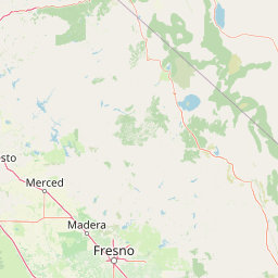
Map view of Kaiser Wilderness

Use this park location map to pinpoint Kaiser Wilderness in United States of America, understand its exact geographic position, and read its mapped placement within the surrounding landscape more clearly.

Pigeon | © OpenStreetMap contributors

Location context for Kaiser Wilderness

CaliforniaFresno County
Park atlas

Compare adjacent alpine landscapes, granite terrain, and regional wilderness boundaries.

Other Parks and Protected Areas Near Kaiser Wilderness in the Central Sierra Nevada

Browsing other protected areas near Kaiser Wilderness reveals broader regional geography across the central Sierra Nevada mountain corridor. Comparing these connected wilderness lands helps trace the varied topographic and ecological transitions defining the wider range.
A soft watercolor painting showing a range of gentle rolling hills and mountains in pale green, yellow, and violet tones against a white background.
Protected landscapeCalifornia
Mapped location lies within the park boundary#1 closest

Northwest

Sierra National Forest: Protected Landscapes of the Central California Sierra Nevada

Geography of alpine lakes, conifer forests, and mountain basins

Spanning from 900 to nearly 14,000 feet in elevation, Sierra National Forest protects a massive vertical range of California terrain. Discover its iconic wilderness areas and reservoir-studded landscape, providing a deep look at the geographic connectivity between major national parks in the central Sierra Nevada.

Area
5,300 km²
Established
1893
Relief
Mountain
Climate
Alpine
A watercolor painting showing a panoramic view of mountain ranges, a treeline, and a calm body of water in the foreground.
Wildlife reserveCalifornia
About 8 km away#2 closest

Southeast

John Muir Wilderness: Sierra Nevada Protected Landscape and High Mountain Geography

California wilderness area with glacial basins and granite peaks

John Muir Wilderness represents one of the largest protected high-elevation areas in the contiguous United States. Spanning the Sierra Nevada crest, its granite terrain is sculpted by Pleistocene glaciation into sharp arêtes, deep canyons, and hundreds of alpine lakes. This wilderness serves as a vital geographic anchor for mountain ecosystems, offering an extensive look at the high-country landscape of eastern California.

Area
2,641.76 km²
Established
1964
IUCN
Ib
Relief
Mountain
A horizontal watercolor painting depicting a mountain range in the background with rolling hills and a winding river or stream in the foreground.
Protected landscapeCalifornia
About 14 km away#3 closest

North

Inyo National Forest: An Atlas of Protected Landscapes and Sierra Nevada Geography

High altitude wilderness and volcanic terrain in Eastern California

Spanning from the arid Owens Valley floor to the 14,000 foot crest of the Sierra Nevada, Inyo National Forest remains a cornerstone of the American West. This protected landscape contains the Ancient Bristlecone Pine Forest, Mount Whitney, and the Mono Inyo volcanic chain, providing a dense geographic record of glacial, tectonic, and ecological diversity across a vast managed corridor.

Area
7,702.71 km²
Established
1907
IUCN
Ib
Relief
Mountain
Watercolor painting showing mountains, a winding river, and green forests in the foreground and background
National parkCalifornia
About 25 km away#4 closest

Northwest

Yosemite National Park: Protected Landscape Identity and Geographic Atlas Context

Mapped boundaries and regional setting for a key California national park.

Delve into the protected landscape identity of Yosemite National Park, examining its specific geographic features and its place within the broader atlas of California's natural areas. This entry provides detailed context on its mapped boundaries, regional positioning, and significance as a protected natural site, essential for understanding its landscape and conservation geography.

Area
3,070 km²
Established
1890
IUCN
II
Visitors
3.9M annual
National parkCalifornia
About 36 km away#5 closest

Southeast

Kings Canyon National Park National Park: California Protected Landscape & Geography Atlas

Mapped park boundaries and regional natural context.

Kings Canyon National Park stands as a key protected national park within California, offering a specific focus for geographic understanding and atlas-based exploration. This page details the park's mapped boundaries and its integration into the broader regional geography of California. For users interested in the distribution of protected lands and the mapping of natural landscapes, Kings Canyon National Park provides a crucial point of study within the comprehensive park atlas.

Area
1,869.25 km²
Established
1890
IUCN
II
Visitors
641K annual
Wildlife reserveCalifornia
About 57 km away#6 closest

North

Hoover Wilderness: Protected Alpine Geography in the Central Sierra Nevada, California

High-altitude glacial basins and Sierra crest wilderness

The Hoover Wilderness preserves a vital strip of high-elevation terrain along the eastern Sierra Nevada crest. Characterized by glacier-carved basins, interconnected alpine lakes, and sharp granite ridges, this protected area serves as a primary ecological gateway to the high country. Its landscape features define the headwaters of the Walker River, offering a compact yet significant look at California's protected alpine wilderness.

Area
518.89 km²
Established
1964
IUCN
Ib
Relief
Mountain
Watercolor painting of a panoramic mountain landscape with stylized pine trees and soft green meadows.
Protected landscapeCalifornia
About 58 km away#7 closest

South

Sequoia National Forest: Protected Sierra Nevada Geography and Mountain Terrain

A vast protected landscape spanning 1.1 million acres in California

Spanning Tulare, Kern, and Fresno counties, Sequoia National Forest preserves iconic giant sequoia groves across multiple river watersheds. The terrain features vertical relief exceeding 11,000 feet, showcasing a range of ecosystems from chaparral slopes and coniferous forests to glacial cirques and granite spires located within the southern Sierra Nevada range.

Area
4,829.17 km²
Established
1908
Relief
Mountain
Climate
Mediterranean
Watercolor painting of green rolling hills, a tree-lined foreground, and a soft pink sunset sky.
Protected landscapeCalifornia
About 60 km away#8 closest

Northwest

Stanislaus National Forest: Sierra Nevada Mountain Geography and Protected Wilderness Lands

California mountain terrain and forest landscape map

Stanislaus National Forest is a sprawling protected landscape located in the central Sierra Nevada of California. Characterized by volcanic and granite formations, the area protects critical watersheds, Wild and Scenic rivers, and large swaths of old growth forest that define the rugged mountain interior.

Area
3,634.48 km²
Established
1897
Relief
Mountain
Climate
Temperate

Common questions about visiting, size, designation, and location context for Kaiser Wilderness

Kaiser Wilderness FAQs for park facts, access, geography, and protected area context

Find quick answers about Kaiser Wilderness, including protected-area facts, park geography, trail and visitor context, and how the park fits into its surrounding country and regional landscape.
MoriAtlas Explorer

Continue Your Protected Areas Search Across the Global Atlas

Deepen your exploration by continuing the structured search for national parks and protected areas worldwide. Utilize the comprehensive filtering capabilities to compare different conservation landscapes and refine your understanding of global park geography. Discover more about the distribution and characteristics of protected natural areas.

Global natural geography