

Mori Atlas logo
National parkKampinoski Park Narodowy

Analyzing the mapped boundaries, wind-shaped dunes, and Vistula river floodplain habitats

Kampinoski Park Narodowy: A Protected Mosaic of Glacial Dunes and Wetlands in Masovian Voivodeship

Kampinoski Park Narodowy preserves a large remnant of the historic Masovian Forest within a glacial ice-marginal valley. This protected area features a striking juxtaposition of stabilized inland sand dunes and waterlogged peat bogs, creating a unique ecological contrast across the central Polish landscape. Our atlas provides a detailed look at the park boundaries, sandy ridges, and river corridors that define this significant lowland wilderness.

national parklowland forestinland duneswetlandsmarshespeatlands

Kampinoski Park Narodowy

National park

Park overview

Structured park overview, official facts, and landscape profile for Kampinos National Park

Kampinos National Park park facts, protected area profile, and essential visitor context

Review the core facts for Kampinos National Park, including designation, size, terrain, visitor scale, habitats, and operating context in one park-focused overview.

About Kampinos National Park

Kampinos National Park stretches across the sand- and wetland-dominated remainder of the historic Masovian Forest, the Puszcza Kampinoska, in the western part of the Warsaw Basin. Although the park itself sits within the strongly humanized surroundings of the Warsaw metropolitan region, it preserves a rare and ecologically valuable mosaic of inland dunes, peatlands, riverine forests, and the lower Vistula floodplain.

The defining character of the park comes from the contrast between its dunes and its bogs. Wind-deposited sand ridges and parabolic dunes, some reaching roughly 30 meters in height, alternate with wet depressions, peatlands, and floodplain wetlands. The largest dune complex, the Grochalskie Piachy, is considered one of the most intact inland dune formations in Europe and visually dominates large tracts of the protected area.

Forests cover the majority of the park, but they are far from uniform. The most widespread associations are fresh continental pine forests, often with an admixture of oak species. Wetland edges host alder swamp forests, lowland riparian forests, and mires, while exposed dune slopes support specialized dry-ground flora. This mosaic of habitats gives Kampinos its unusually strong botanical and ecological diversity for a lowland park.

The park is also an important node for European conservation networks. It has been designated a UNESCO Biosphere Reserve, it is part of the Natura 2000 network under the name Puszcza Kampinoska, and the European Parliament has recognized it as a refuge of European significance for birds. Together, these designations reflect Kampinos's role as both a local nature anchor near Warsaw and a nationally important stronghold for dune, wetland, and forest conservation.

Quick facts and research context for Kampinos National Park

Kampinos National Park is a Polish national park situated in the Masovian Voivodeship, directly to the northwest of Warsaw. It was created in 1959 and lies within the Warsaw Basin, a broad lowland shaped by the glacial Vistula pradolina.

Its landscape is dominated by inland dunes and bogs, with forests covering around three-quarters of the protected area. Since the 1950s, the park has worked to reverse centuries of agricultural clearance, gradually buying back and reforesting former farmland. It is now part of the UNESCO-designated Puszcza Kampinoska Biosphere Reserve.

Protection and recognition

Documented terrestrial protection scope and designation metrics

Kampinoski Park Narodowy Protection Status and Designation History

Kampinoski Park Narodowy maintains a documented terrestrial protection scope established in the year 2000. Structured records compile available designation history, management scope, and conservation status parameters.

Protection details

Protection scope
Terrestrial
Designated year
2000
Transboundary protection
No
Core area
58.23 km²
Buffer area
377.56 km²
Park context

Deeper park guide and search-rich context for Kampinos National Park

Kampinos National Park history, landscape, wildlife, and travel context

Explore Kampinos National Park through its history, landscape character, ecosystems, wildlife, conservation priorities, cultural context, and seasonal travel timing in a structured park guide built for atlas discovery and search intent.

Why Kampinos National Park stands out

Kampinos is best known for hosting one of the best-preserved inland dune complexes in Europe, set directly beside extensive lowland bogs and forests. The park's contrasting habitats, wind-shaped parabolic dunes on one side and waterlogged alder and riparian forests on the other, give it an unusually varied ecological character for a lowland Polish setting. It is also recognized for the recovery of emblematic large mammals such as the moose, beaver, and Eurasian lynx, all of which were either locally extinct or absent in the twentieth century and have returned to the park through deliberate reintroductions and natural recolonization.
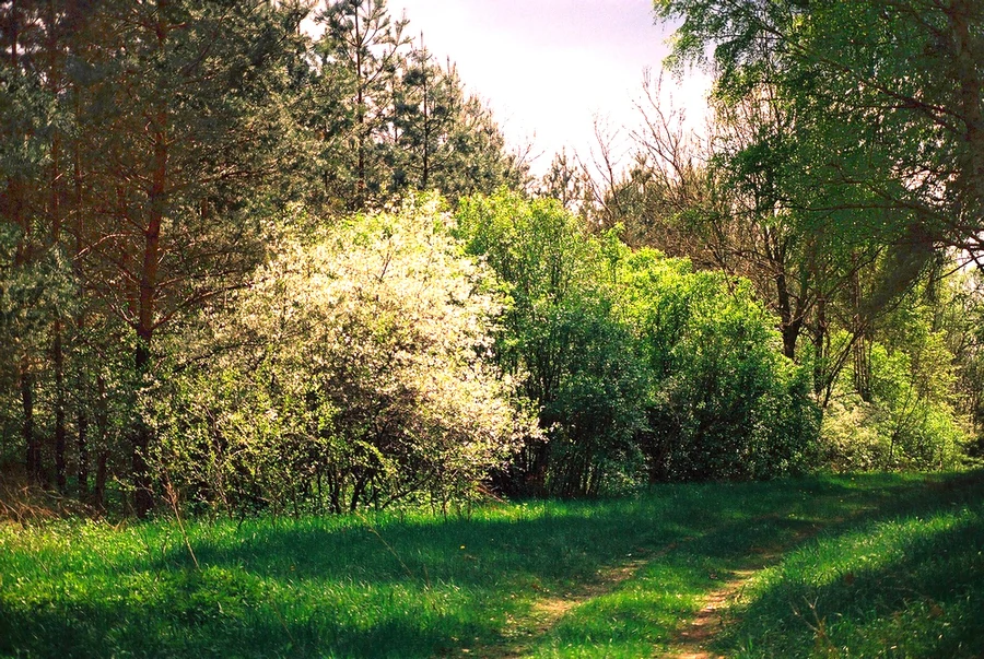
Kampinos National Park history and protected-area timeline

The forests now protected by Kampinos National Park have a long history of human pressure. From the seventeenth century onward, settlers gradually cleared woodland within the Kampinos Forest to create meadows and cropland, with villages expanding as more forest was converted to agriculture. By the early and mid-twentieth century, the remaining woodlands were increasingly fragmented and degraded.

Scientific interest in saving the Kampinos Forest dates to the 1930s, when researchers Roman and Jadwiga Kobendza conducted pioneering floristic, phytosociological, and geomorphological studies of the area. Their work led to the establishment of the first strict nature reserves within the forest, at Granica, Sieraków, and Zamczysko.

In 1959, the Polish Council of Ministers formally established Kampinoski Park Narodowy on an area of roughly 407 square kilometers. The park was reorganized and re-measured in 1997 to its current extent of about 385 square kilometers. From the late 1970s onward, the park began actively repurchasing former farmland to halt agricultural expansion, with the long-term goal of restoring forest cover on cleared sites. Estimating that centuries, not decades, are needed to fully restore a mature oak, alder, or mixed forest habitat, the park's reforestation strategy has continued to focus on gradually returning cleared land to woodland.

Today, the park also has plans to expand by roughly 462 hectares, mostly adjoining wetland-rich areas along its western and southern edges.

Kampinos National Park landscape and geographic character

The landscape of Kampinos is dominated by flat lowland terrain shaped by glacial and fluvial processes, yet richly detailed by its dunes and wetlands. During the last glaciation, the Vistula carved a broad pradolina, or ice-marginal valley, through this part of the Masovian Plain. Vast quantities of sand left behind by retreating ice and shifting river channels were later reworked by wind, producing the inland dunes that are the park's most striking visual feature.

The Grochalskie Piachy area contains the largest complex of sandy dunes in Poland and is regarded as one of the best-preserved inland dune formations in Europe. Parabolic dunes in the park reach about 30 meters in height, and elongated dune ridges wind across large stretches of the forest. Today many dunes are stabilized by pine forest, while their open, sandy faces host specialized dry-ground vegetation.

Between and around the dunes lie extensive peat bogs, mires, and wet depressions. Soils across the park are predominantly acidic and nutrient-poor sandy types, formed from aeolian sands, with patches of peat, muck, and gley soils in the wetter areas and occasional alluvial soils along the Vistula corridor. Along the western edge of the park runs the unregulated lower Vistula with its oxbow lakes, sandbars, islands, and willow thickets, completing a landscape that shifts repeatedly from dry pine-clad sand to waterlogged alder swamp and open river floodplain.
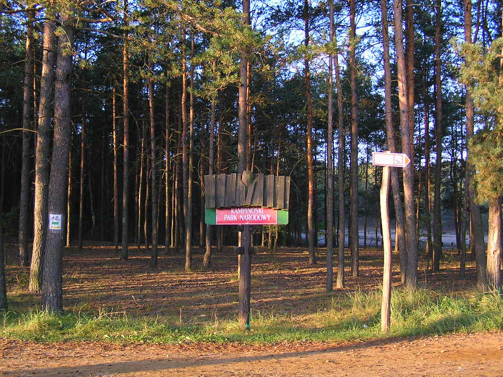
Kampinos National Park ecosystems, habitats, and plant life

Ecologically, Kampinos is defined by the close interplay of dry, acidic pine habitats and waterlogged wetland systems, an unusual combination in central Poland. Coniferous forest dominated by Scots pine on fresh, sandy soils is the single most widespread forest type, with oak, birch, ash, alder, and poplar playing supporting roles in different parts of the mosaic. Oak, particularly pedunculate and sessile oak, makes up roughly ten percent of the canopy in many stands, with red oak also present as an introduced North American species.

The wetlands are ecologically the most distinctive component. Alder swamp forests, lowland riparian forests, sedge mires, and peaty meadows occupy the depressions between dune ridges, while along the Vistula, oxbow lakes and sandbars support their own dynamic wetland vegetation complexes. Open dune sands host a different specialist flora, including spring sedge, Carthusian pink, sand thyme, sphagnum mosses, and bog bilberry.

More broadly, the vascular flora of the park includes around 1,442 recorded species. Botanists have documented glacial relicts, subatlantic, subcontinental, and boreal elements, as well as a surprising number of mountain species that persist locally in the dune and forest mosaic. At least 30 species have been lost, the majority from wet habitats, and around 100 species are considered threatened, underscoring both the richness and the fragility of the park's plant communities.
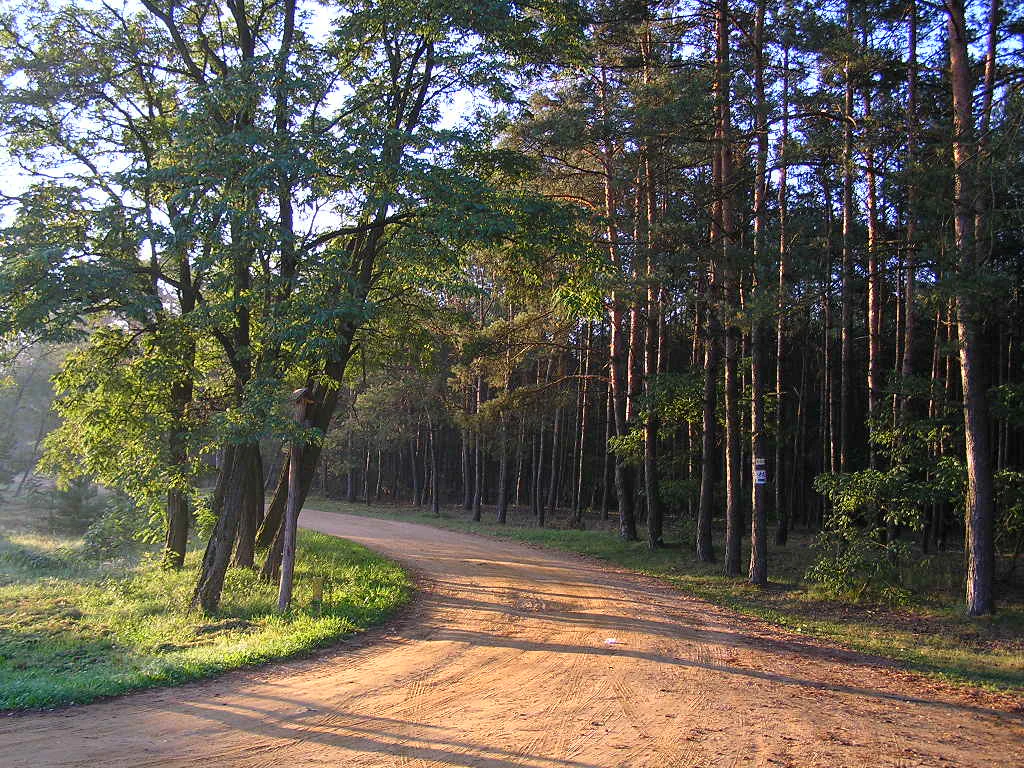
Kampinos National Park wildlife and species highlights

The animal life of Kampinos is shaped by the same dune and wetland contrast that defines its landscapes. Large mammals make a strong impression, both because of their visibility and because several of them have only recently returned to the area. The moose, considered a symbol of the park, has been present locally since the early 1950s, and reintroductions and natural spread have since brought back the Eurasian beaver and the Eurasian lynx. Other mammals present today include gray wolf, European otter, pine marten, red fox, raccoon dog, roe deer, red deer, wild boar, European badger, and seventeen bat species.

The park's open marshes, bogs, and rivers, along with fragments of cultivated land, support a rich bird community that has earned Kampinos formal recognition as a refuge of European significance for birds. Wetland and marshland species include short-eared owl, common crane, corncrake, great bittern, little bittern, aquatic warbler, and various harriers. Forest and woodland species include black stork, woodpeckers, and Eurasian eagle-owl, while riparian and aquatic zones along the Vistula host white stork, common kingfisher, and terns.

Together, these populations transform the park into one of the most biodiverse places in the Warsaw region and a key stronghold for both forest and wetland birdlife in Poland.
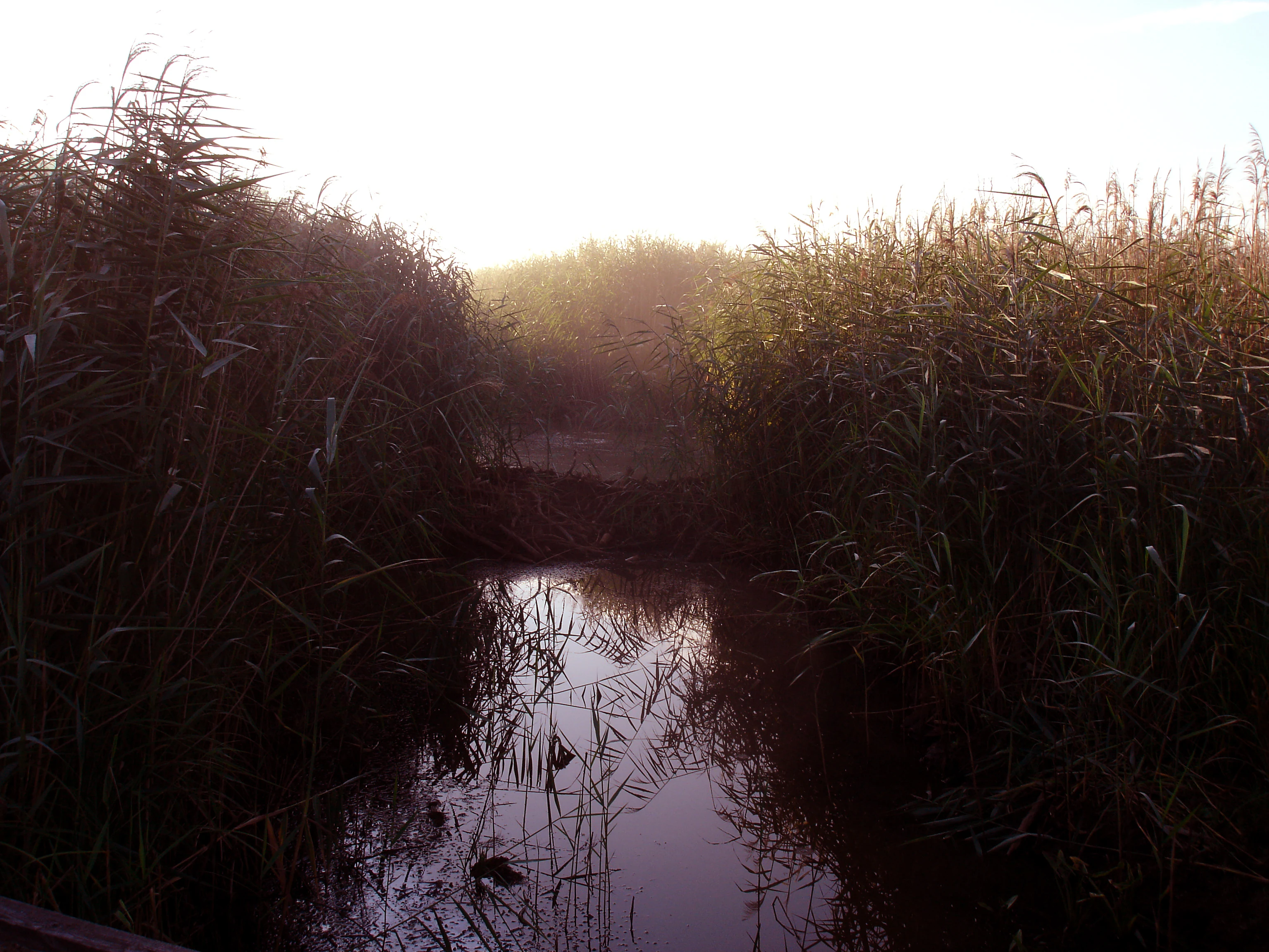
Kampinos National Park conservation status and protection priorities

Kampinos has long functioned as a critical conservation node for the central Masovian lowlands. Established in 1959, it was designed to reverse centuries of forest clearance and to anchor protection of the Kampinos Forest east of the lower Vistula. The introduction of active conservation management, including buyback of agricultural land and systematic reforestation, has been a defining feature of the park's approach since the late 1970s, recognizing that rebuilding mature forest on former farmland is a centuries-long process.

Twenty-two strict protection areas, covering roughly 15 percent of the park, form the most tightly protected core. The remainder is organized into active and landscape protection zones that allow for management interventions, education, and low-intensity recreation. This zoning reflects a clear division between undisturbed reference habitats and areas shaped by active stewardship.

The park also benefits from strong international recognition. Kampinos and its surrounding buffer zone have been a UNESCO Biosphere Reserve since 2000, with the strict protection areas forming its core zone, the active and landscape protection zones its buffer zone, and the park's broader buffer landscape its transition zone. It is part of the European Natura 2000 network under the designation Puszcza Kampinoska, and the European Parliament has formally recognized the area as a refuge of European significance for birds. Planned expansions of roughly 462 hectares, focused mostly on adjoining wetlands and ecologically valuable land along the western and southern edges, signal that the conservation role of the park continues to grow.

Kampinos National Park cultural meaning and human context

The lands protected by Kampinos have a deep and sometimes painful human history. The forest served as a theater of armed conflict during major Polish struggles for independence, with fighting reaching the area during the Kościuszko Uprising of 1794 and the January Uprising of 1863. Both graves of 1863 insurgents and a partisan cemetery are preserved within the park.

In the twentieth century, the area was again caught up in wartime violence. It saw fighting by the Poznań Army in September 1939, during the opening campaigns of the Second World War, and was the site of further conflict in 1944. The Palmiry Cemetery, located within the park, commemorates Polish civilians executed by German forces between 1939 and 1944, giving the landscape a significant role in the national memory of the war.

Beyond wartime memory, the park also contains layers of older cultural landscape. Pre-war villages, religious sites such as the Franciscan monastery at Niepokalanów on its edge, and historic estates like Żelazowa Wola, birthplace of Frédéric Chopin, are part of the broader cultural frame within which the park is experienced today.
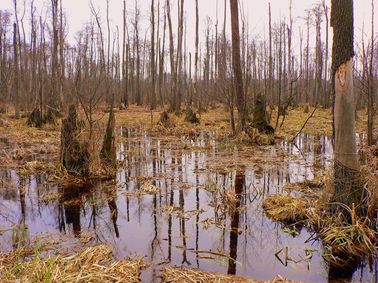
Top sights and standout views in Kampinos National Park

The defining highlights of Kampinos lie in the contrast between coast-like inland dunes and intimate wetland forests. The Grochalskie Piachy dune complex, the most striking single landform in the park, anchors its visual identity, while the surrounding bogs, alder swamps, and Vistula oxbows complete a landscape of unusual ecological density for a lowland setting just outside a major capital.

The park's recovery of charismatic mammals, notably moose as its emblem species and recent natural populations of beaver and lynx, gives visitors a tangible conservation story. Combined with formal recognition at the UNESCO, European bird, and Natura 2000 levels, this makes Kampinos a rare example of a recovering lowland forest landscape embedded in a heavily populated European region.
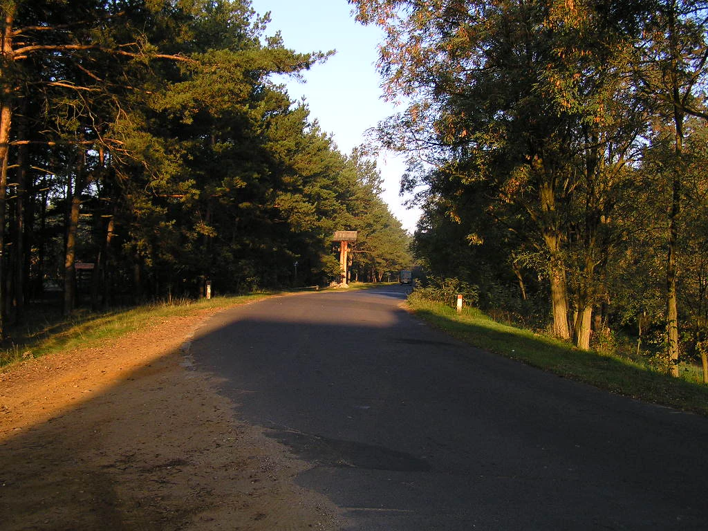
Best time to visit Kampinos National Park

Kampinos's character shifts noticeably with the seasons. Spring brings flooding across low-lying meadows and bogs, fresh green foliage, and a sharp increase in bird activity, including migrating cranes and breeding wetland species. Summer covers the dune slopes in warm pine green and brings the most stable weather for longer hiking and cycling, though mosquitoes along the wetter zones can be intense.

Autumn offers some of the most photogenic conditions across the park, with shifting leaf colors in oak and birch stands, mist over the bogs, and visible wildlife activity as deer and other mammals prepare for winter. Winter, when snow settles on the dunes and the park takes on a quieter atmosphere, suits visitors seeking solitude, despite shorter daylight hours in central Poland.
Monthly climate preview

Long-term monthly temperature and precipitation averages for Kampinoski Park Narodowy

Kampinoski Park Narodowy Climate Normals and Measured Temperature Rhythm

Historical measurements from 1991 to 2020 document the long-term annual temperature and precipitation rhythm across Kampinoski Park Narodowy. Reviewing the complete twelve-month dataset provides a detailed baseline of monthly averages for this protected area.
Annual mean8 °C
-4 °C20 °C
Jan-4°
Feb-2°
Mar
Apr
May14°
Jun18°
Jul20°
Aug19°
Sep14°
Oct
Nov
Dec-2°
Warmest month
July

19.9 °C

Coolest month
January

-3.7 °C

Wettest month
July

2.5 mm/day

Driest month
March

1.2 mm/day

Park location guide

Geography guide, regional context, and park location map for Kampinos National Park

Kampinos National Park park geography, regions, and map view in Poland

Understand where Kampinos National Park sits in Poland through a broader geographic reading of the surrounding landscape, nearby location context, and its mapped position within the national park landscape.

How Kampinos National Park fits into Poland

Poland, officially the Republic of Poland, is a Central European country spanning from the Baltic Sea in the north to the Carpathian Mountains in the south. It borders Germany, Czech Republic, Slovakia, Ukraine, Belarus, Lithuania, and Kaliningrad Oblast. The country has a temperate climate, diverse landscapes, and is known for its rich history, cultural heritage, and strong economic position within the EU.

Wider geography shaping Kampinos National Park in Poland

Poland occupies 312,696 km2 in Central Europe, extending from the Baltic Sea coast in the north to the Sudetes and Carpathian Mountains in the south. It borders Germany to the west, Czech Republic and Slovakia to the south, Ukraine and Belarus to the east, and Lithuania and Kaliningrad Oblast to the northeast. The landscape includes lowland plains, uplands, and mountain ranges.

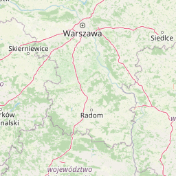
Map view of Kampinos National Park

Use this park location map to pinpoint Kampinos National Park in Poland, understand its exact geographic position, and read its mapped placement within the surrounding landscape more clearly.

Pigeon | © OpenStreetMap contributors

Location context for Kampinos National Park

Masovian Voivodeship
Natural feature types

Explore the Named Natural Features of Kampinoski Park Narodowy

Continue geographic discovery by browsing the specific landforms and water bodies of Kampinoski Park Narodowy. Use the MoriAtlas dataset to identify the dunes, wetlands, and forest corridors that structure this unique protected landscape.
Recorded earthquake history

Explore the Documented Earthquake History for Kampinoski Park Narodowy

Access the comprehensive catalogue of recorded seismic events associated by proximity with Kampinoski Park Narodowy. Use this data to review documented magnitudes and epicentre distances within the regional geography of the Masovian Voivodeship, as aggregated by MoriAtlas.

Kampinoski Park Narodowy Earthquake History

Catalogued events

19 events

Strongest magnitude

Magnitude 4.6

Most recent event

Apr 8, 1993

This history includes earthquakes recorded inside the park or within 50 km of its borders

Park atlas

Compare surrounding lowland habitats, inland dunes, and river valley reserves

Parks Near Kampinoski Park Narodowy and Regional Protected Landscapes

Browsing nearby national parks after viewing Kampinoski Park Narodowy reveals broader patterns in lowland forest conservation and glacial valley geography. Comparing related protected areas across the surrounding region helps contextualize distinct dune formations and wetland ecosystems.
National parkMasovian Voivodeship
Park boundaries overlap#1 closest

East

Kampinos National Park: Geographic Profile and Protected Forest Landscape Map

Inland dune formations and wetland habitats in Masovian Voivodeship

The expansive woodland of Kampinos National Park represents a critical protected area in Poland, characterized by its parabolic sand dunes and low-lying marshes. Gain insights into the geomorphological features of this UNESCO biosphere reserve and trace the complex hydrological network that defines its unique forest environment.

Area
385.44 km²
Established
1959
IUCN
II
Relief
Lowland
Protected landscapeLodzkie Voivodeship
2.6 km away#2 closest

Southwest

Sulejowski Park Krajobrazowy: Geography and Protected Landscape Mapping

Central Polish river valley and reservoir terrain

Examine the territorial boundaries and landscape character of Sulejowski Park Krajobrazowy. This protected area integrates riverine corridors, large reservoir habitats, and mixed lowland forests across the Lodzkie Voivodeship, providing a core reference for understanding the ecological geography of the central Pilica valley.

Area
170.26 km²
Established
1994
Relief
Lowland
Climate
Temperate
Nature reserveLodzkie Voivodeship
6 km away#3 closest

South

Łąki Ciebłowickie Nature Reserve: A Central Poland Floodplain Landscape Analysis

Protected riparian ecosystems and riverine lowland geography

Łąki Ciebłowickie represents an ecologically rich floodplain environment within the Lodzkie Voivodeship. This nature reserve preserves a sequence of vital lowland habitats ranging from marshy meadows to oak-hornbeam forests. Analyze the mapped boundaries and natural terrain features that define this protected riverine mosaic in the heart of central Europe.

Area
4.772 km²
Relief
Lowland
Climate
Temperate
Access
Access unknown
Nature reserveMasovian Voivodeship
About 7.8 km away#4 closest

Northeast

Dolina Wkry Nature Reserve: A Protected River Gorge and Riparian Forest Ecosystem in Masovia

Geographic analysis of breakthrough valley landscapes and lowland river habitats

This protected area centers on a narrow, gorge-like section of the Wkra River, which cuts through the older land surfaces of the Masovian Voivodeship. The reserve protects vital floodplain forest fragments and demonstrates a clear transition from river-edge alder woodlands to drier plateau slopes, providing a compact example of lowland riverine geomorphology.

Area
0.244 km²
Established
1991
Relief
Lowland
Climate
Temperate
Nature reserveŁódź Voivodeship
About 16 km away#5 closest

Southwest

Rezerwat przyrody Małecz: Protected Nature Reserve and Forest Landscape in Łódź Voivodeship

Floristic reserve and managed coniferous forest geography

Rezerwat przyrody Małecz is a key floristic site in Poland, safeguarding rare Pontic-origin flora and ancient forest stands. This reserve showcases the integration of strict protection zones with moist and dry mixed coniferous forest communities within the Spała Forest District, offering deep insight into regional botanical conservation.

Area
0.092 km²
Established
1987
Relief
Lowland
Climate
Temperate
Nature reserveLodzkie Voivodeship
About 19 km away#6 closest

Southwest

Rezerwat przyrody Meszcze Nature Reserve: Mapped Protected Landscape and Forest Ecology

Protected fresh mixed forest within the Sulejów Landscape Park context

Rezerwat przyrody Meszcze represents a compact, protected forest block in central Poland. Known for its historical small-leaved lime regeneration, this reserve provides a key case study for forest structure and lowland biodiversity within the Lodzkie Voivodeship, serving as an important part of the Sulejów Landscape Park's protected corridor.

Area
0.353 km²
Established
1959
Relief
Lowland
Scope
Terrestrial
Nature reserveMazowieckie
About 20 km away#7 closest

Southeast

Rezerwat przyrody Morysin: Protected Floodplain Landscapes and Historic Forest Reserves

A riparian heritage site in the Mazowieckie region

Situated in the Vistula floodplain, Rezerwat przyrody Morysin stands as a significant protected area defined by its massive old-growth trees and layered cultural history. The terrain incorporates diverse wetland features, including the Sobieski Canal and Wilanówka stream, creating a vital habitat for cavity-nesting species and a rare example of integrated natural and historic preservation.

Area
0.535 km²
Established
1996
Relief
Lowland
Climate
Temperate
Protected landscapeLodz Voivodeship
21 km away#8 closest

Southwest

Bolimowski Park Krajobrazowy: Geography of a Central Polish Protected Landscape Area

Rawka River valley mapping and Puszcza Bolimowska forest terrain

Bolimowski Park Krajobrazowy encompasses a unique mosaic of postglacial plains and riverine ecosystems in central Poland. The area is defined by the Rawka River, which forms a network of meanders, oxbow lakes, and terraces, while surrounding forests retain historical links to the vast primeval woods of Puszcza Bolimowska. This protected territory offers a significant habitat for diverse wildlife, including moose and beaver, within a landscape characterized by its shifting transition between deep forest, wet meadows, and light oak groves.

Area
205.123 km²
Established
1986
Relief
Lowland
Climate
Temperate

Common questions about visiting, size, designation, and location context for Kampinos National Park

Kampinos National Park FAQs for park facts, access, geography, and protected area context

Find quick answers about Kampinos National Park, including protected-area facts, park geography, trail and visitor context, and how the park fits into its surrounding country and regional landscape.
MoriAtlas Explorer

Continue Your Protected Areas Search Across the Global Atlas

Deepen your exploration by continuing the structured search for national parks and protected areas worldwide. Utilize the comprehensive filtering capabilities to compare different conservation landscapes and refine your understanding of global park geography. Discover more about the distribution and characteristics of protected natural areas.

Global natural geography