
Why Kitlope Heritage Conservancy stands out
The Kitlope is best known for holding the largest intact coastal temperate rainforest in the world, an intact watershed of old-growth forest running from ocean inlets up into glaciated mountain valleys. Its protection status was initiated through a Haisla-led campaign that halted commercial logging, making the conservancy both an ecological and a cultural landmark along the British Columbia coast. Equally distinctive is the area's Indigenous heritage. The Haisla name Huchsduwachsdu Nuyem Jees, meaning "source of milky blue waters," captures the spiritual and historical weight that the Haisla place on the landscape, and the conservancy stands out as an early example of formal co-management between BC Parks and a First Nation.
Kitlope Heritage Conservancy history and protected-area timeline
The Kitlope watershed lies within the ancestral homeland of the Haisla people, who for generations used the valley for hunting, fishing, and seasonal gathering. The Haisla were especially known along the trade routes of the Pacific coast for producing oolichan grease, a rendered fish oil traditionally harvested from the small oily fish that return to coastal rivers in late winter and early spring. This traditional activity tied the Haisla economy and culture closely to the rivers and estuaries of the Kitlope drainage.
By the early 1990s, the landscape faced a different kind of pressure. The logging company West Fraser Timber held leases covering major portions of the watershed and was preparing to begin industrial-scale harvesting. Concerned about the cultural and ecological consequences, the Haisla, working with Ecotrust, a Portland, Oregon-based conservation advocacy organization, lobbied both the company and the provincial government to halt logging in the drainage. In 1994, West Fraser agreed to relinquish its leases without compensation, removing the immediate threat of road-building and clearcutting from the watershed.
Two years later, on February 20, 1996, the British Columbia government established a Protected Area around the Kitlope in consultation with the Haisla Nation. The area did not become a conventional Provincial Park; instead, in 2008 it was re-designated as a Conservancy under the BC Parks system, a step that formalized joint management between BC Parks and the Haisla Nation. Conservancy status permits low-impact economic activities such as eco-tourism but prohibits heavy industrial uses including logging, mining, hydroelectric generation, and new road construction within the protected area.
The Kitlope's protection was widely seen as an important milestone for coastal conservation in British Columbia, where coastal temperate rainforest had been heavily logged in the more accessible southern parts of the province. The Kitlope was the first major portion of what would later be referred to as the Great Bear Rainforest to receive formal protection, influencing later conservation agreements across the province's central and north coast. Haisla Elder Cecil Paul, in his book Stories from the Magic Canoe of Wa'xaid, captured the deeper meaning of the campaign, describing how the Haisla viewed the protection effort as the preservation of stories, wisdom, and cultural identity embedded in the land, not simply the forest itself.
Kitlope Heritage Conservancy landscape and geographic character
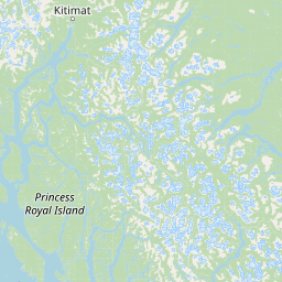
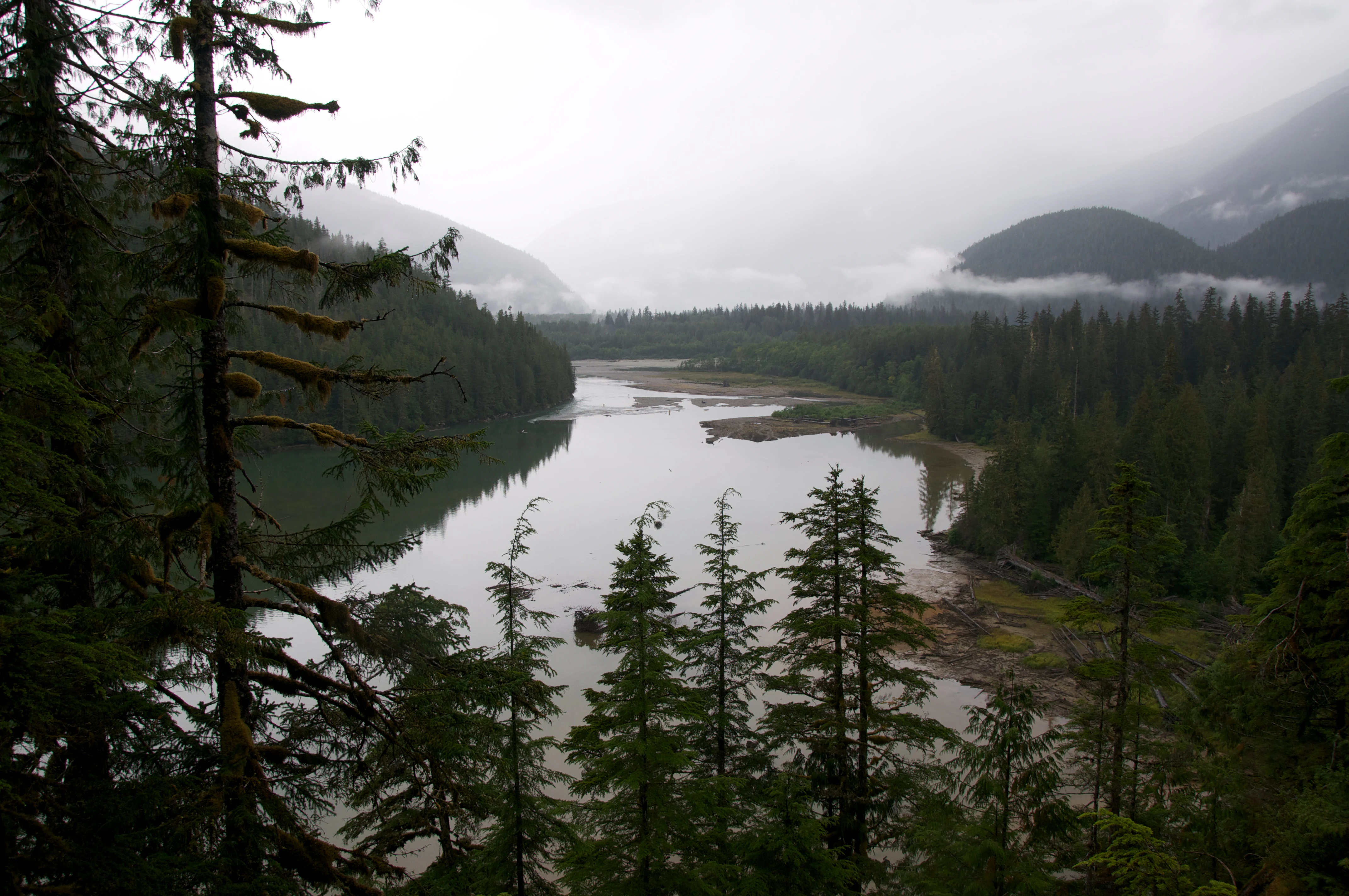
The Kitlope Heritage Conservancy occupies a dramatic transition zone between ocean and mountain along British Columbia's central coast. Beginning at the head of the Whidbey Reach of the Gardner Canal, a long fjord-like saltwater inlet, the landscape rises rapidly into steep forested slopes, river valleys, granite peaks, icefields, and active glaciers. Much of the park is mountainous. South of the Kitlope River, the granite domes and ridges form part of the Kitlope Range, a sub-range of the Kitimat Ranges, while in the north, the mountains are part of the Tochquonyalla Range, a sub-range of the Tahtsa Ranges. The highest elevations support permanent ice.
The valley floors, by contrast, are narrow and dynamic. Most of the major valleys are only one to two kilometers wide, and during the spring snowmelt, the Kitlope, Kalitan, Gamsby, Tsaytis, Kapella, and Tezwa rivers swell dramatically, carrying heavy loads of woody debris and gravel downstream. Several valleys, including the Gamsby, are characterized by broad braided channels of gravel laid down by these seasonal flood events, giving them an often raw, freshly reworked appearance.
The conservancy contains one major lake, Kitlope Lake, which is fed by the Tezwa River and drains into the Kitlope River just upstream of its estuary. The combination of estuary, coastal fjord, forested valley, alpine ridge, and glacier creates, within relatively few kilometers of horizontal distance, a full gradient of Pacific coastal topography from sea level into ice-covered peaks.
The Kitlope does not exist in isolation. It is embedded within a much larger network of wild landscapes that together define the central coast of British Columbia. Tweedsmuir Provincial Park, the largest protected area in the province, abuts the conservancy to the northeast, and the Fiordland Conservancy protects more than 80,000 hectares of coastal fjords along the Kitlope's western boundary. Combined with several smaller reserves, these protected areas cover more than 2.3 million hectares of undeveloped land across marine, coastal temperate rainforest, montane, and alpine ecological zones.
Kitlope Heritage Conservancy ecosystems, habitats, and plant life
The Kitlope Heritage Conservancy protects what is widely recognized as the largest continuous tract of coastal temperate rainforest in the world. This forest type, characterized by mild, wet maritime winters and cool, relatively dry summers, supports towering conifers including western redcedar, western hemlock, and Sitka spruce. Because the watershed has never been industrially logged, the Kitlope retains the structural complexity typical of old-growth coastal rainforest: continuous multi-layered canopies, massive amounts of coarse woody debris on the forest floor, and ancient trees that have grown for centuries.
Beyond the forest itself, the conservancy encompasses a full vertical sequence of Pacific coastal ecosystems. Estuarine and tidal environments line the head of Gardner Canal. Riparian zones fringe the broad, dynamic river valleys. Mid-elevation slopes transition into montane forest and rocky alpine terrain, and the highest elevations support icefields and glaciers that feed the rivers below. Because elevation, precipitation, and exposure change rapidly over short distances, the conservancy compresses a remarkable range of habitats into a relatively compact area.
The conservancy also sits at the heart of the broader Great Bear Rainforest, a region of intact coastal temperate rainforest stretching along the central and north coast of British Columbia. The Kitlope was the first major portion of this rainforest to receive permanent protection, and it remains a benchmark reference site for old coastal rainforest ecology in North America. The watershed's intactness supports natural hydrological and salmon cycles that have been lost or altered in most other coastal drainage basins along the Pacific coast.
Salmon, in particular, play a central ecological role. The Kitlope River and its tributaries support natural runs of Pacific salmon, drawing nutrient-rich marine-derived biomass inland, where it becomes a critical fertilizer for the surrounding forest, and supporting populations of grizzly bears, wolves, and other large mammals. Because logging, mining, road-building, and hydroelectric generation remain prohibited within the conservancy, the watershed functions as one of the few remaining coastal river systems in British Columbia whose ecological processes are largely intact from headwaters to tidewater.
Kitlope Heritage Conservancy wildlife and species highlights
The Kitlope Heritage Conservancy's intact coastal temperate rainforest and salmon-rich rivers support a full suite of large mammals typical of the central Pacific coast. Grizzly bears and black bears are prominent presences, following seasonal salmon runs into the river valleys and feeding on berries, sedges, and vegetation across alpine meadows in summer. Wolves range across the watershed as apex predators, while moose occupy riparian flats and wetland margins. Smaller mammals such as beavers, otters, and martens inhabit the river corridors and old-growth forests.
The conservancy is also significant for its birdlife. Bald eagles and other raptors are common along the coast, and the salmon-supported food web provides reliable resources for fish-eating birds. Estuarine and tidal habitats at the head of the Gardner Canal attract a variety of seabirds, waterfowl, and shorebirds responding to seasonal migrations along the Pacific flyway.
Anadromous fish are arguably the keystone of the Kitlope's wildlife profile. The Kitlope River, Tezwa River, and other tributaries support Chinook, coho, chum, pink, and sockeye salmon, as well as steelhead and trout. The estuary where the Kitlope empties into the head of Gardner Canal is a particularly important staging area for fish, and the unbroken forest cover along the rivers helps maintain cool, shaded, oxygen-rich water conditions critical for salmon spawning and juvenile survival.
Because the conservancy prohibits heavy industrial activity and prohibits road construction within its boundaries, the Kitlope's wildlife experiences fewer direct human disturbances than most other large drainage basins on the British Columbia coast. This relative quiet, combined with the intactness of forest and river habitats, makes the conservancy an important reference area for understanding coastal rainforest fauna in the absence of industrial pressure.
Kitlope Heritage Conservancy conservation status and protection priorities
The Kitlope Heritage Conservancy's central conservation significance is that it protects, in a single designation, the largest continuous block of coastal temperate rainforest remaining in the world. Coastal temperate rainforests once extended along much of the Pacific Northwest rim, but industrial logging has removed most of the original forest cover in more accessible southern and valley-bottom areas. The Kitlope's intactness, from tidewater to glacial headwaters, makes it a global benchmark for what original coastal rainforest ecosystems look like when their processes remain undisturbed.
The conservancy's protection originated in a Haisla-led campaign against industrial logging. In 1994, West Fraser Timber relinquished its leases without compensation, and in 1996 the British Columbia government established a Protected Area around the Kitlope in consultation with the Haisla Nation. In 2008, the area was re-designated as a Conservancy under the BC Parks system, formalizing co-management between BC Parks and the Haisla Nation. Conservancy status specifies that the area is protected from heavy industrial uses such as logging, mining, hydroelectric development, and new road construction, while still permitting managed low-impact economic activities such as eco-tourism.
The Kitlope was also the first major portion of the Great Bear Rainforest to receive formal protection. Although the term "Great Bear Rainforest" was originally coined by environmental organizations to describe the broader coastal forest region between Vancouver Island and Southeast Alaska, the Kitlope's earlier protection became a model and a cornerstone for subsequent conservation agreements along the central and north coast of British Columbia. Together with neighboring reserves, including Tweedsmuir Provincial Park and the Fiordland Conservancy, the Kitlope anchors a protected-area network of more than 2.3 million hectares of undeveloped land across marine, rainforest, and alpine ecological zones.
Salmon conservation is another defining element of the Kitlope's ecological importance. Because the watershed remains unlogged and lacks road-building, its salmon-bearing rivers retain natural flow regimes, sediment transport, and riparian forest cover. The Kitlope's role as a refuge for wild, naturally spawning salmon populations makes it an important reference point for salmon conservation along the British Columbia coast.
Kitlope Heritage Conservancy cultural meaning and human context
The Kitlope watershed is the ancestral homeland of the Haisla people, who have lived along this part of the British Columbia coast for generations. Their traditional economy combined marine fishing, river fishing, hunting, and seasonal gathering in the valley. The Haisla became famous along the broader Pacific coast trade network for their production of oolichan grease, a valuable and highly portable product that linked the Kitlope region with communities as far south as Vancouver Island and northern Washington.
The Indigenous name for the Kitlope, Huchsduwachsdu Nuyem Jees, captures how central the watershed is to Haisla identity. Translated as "source of milky blue waters," the name reflects both the distinctive appearance of glacial rivers entering the Gardner Canal and the spiritual and historical importance of the place. Preservation of the Kitlope was driven as much by a desire to maintain Haisla stories, teachings, and traditional use of the land as it was by ecological considerations.
Haisla Elder Cecil Paul, writing in Stories from the Magic Canoe of Wa'xaid, reframed the eventual protection of the watershed as fundamentally a cultural act. He argued that the Haisla did not merely save a forest; they protected a landscape in which their stories, language, and accumulated knowledge of how to live on the coast remain rooted. The 2008 re-designation of the protected area as a Conservancy under BC Parks formally embedded that relationship into governance, codifying co-management between the Haisla Nation and BC Parks as an ongoing framework for the conservancy's future.
Top sights and standout views in Kitlope Heritage Conservancy
The Kitlope Heritage Conservancy stands out among North America's coastal protected areas because it preserves, in a single designation, the largest remaining block of coastal temperate rainforest in the world. Its territory includes intact old-growth forest, salmon-rich glacial rivers, deep fjord-like inlets of the Gardner Canal, granite coastal mountains, and active glaciers, all in a roadless watershed that retains its natural processes.
Just as distinctive is the conservancy's origin story. The Kitlope was protected through a Haisla-led campaign that convinced a major logging company to walk away from its leases without compensation, and it remains co-managed by BC Parks and the Haisla Nation. As the first major portion of the Great Bear Rainforest to receive permanent protection, the Kitlope set the template for many of the subsequent conservation agreements that have shaped coastal British Columbia in the past two decades.
Best time to visit Kitlope Heritage Conservancy
The character of a visit to the Kitlope shifts dramatically with the seasons, even though conditions always remain relatively wet and mild by continental standards. Summer, generally from late June through early September, is the most accessible period. Long daylight hours, lower precipitation, and warmer temperatures make travel along the coast by boat or floatplane most practical, and the river valleys are at their most active with salmon, bears, and eagles.
Late spring, particularly during the snowmelt, brings heavy flooding along the Kitlope, Tezwa, and neighboring rivers, which can complicate travel through low-lying flatter areas and channels and make backcountry travel more challenging. Winter conditions are wet and dark, with heavy rainfall, snow at higher elevations, and limited daylight, so the conservancy is generally visited and accessed very little during the colder months.