Mori Atlas logo
State or regional parkKitsumkalum Provincial Park

Mapping the lakeside geography and forested river corridors within this protected area

Kitsumkalum Provincial Park: A Protected Landscape in the Northern Skeena Region of British Columbia

Kitsumkalum Provincial Park occupies a strategic position where Kitsumkalum Lake transitions into the Kitsumkalum River. This protected area represents the rugged, glacially shaped terrain of the northern British Columbia interior. Through these maps, observe how the coniferous forests and sandy shorelines connect to the wider Skeena watershed; providing a vital refuge for regional wildlife and preserving remnants of early twentieth-century settlement history.

provincial parkBritish ColumbiaSkeena regionlake and river landscapefreshwater habitatconiferous forest

Kitsumkalum Provincial Park

State or regional park

Park overview

Structured park overview, official facts, and landscape profile for Kitsumkalum Provincial Park

Kitsumkalum Provincial Park park facts, protected area profile, and essential visitor context

Review the core facts for Kitsumkalum Provincial Park, including designation, size, terrain, visitor scale, habitats, and operating context in one park-focused overview.

About Kitsumkalum Provincial Park

Kitsumkalum Provincial Park lies within the Skeena region of west central British Columbia, a remote and heavily forested part of the province defined by the Skeena River watershed and its tributary valleys. The park is anchored at the foot of Kitsumkalum Lake, where the Kitsumkalum River exits the lake and flows southward toward Terrace. This position gives the park both a calm lakeshore environment and a flowing river corridor, combining two of the characteristic freshwater settings of northern British Columbia.

Reached along Kalum Lake Road from Terrace, the park functions as a nearby getaway for residents of the surrounding region rather than a large destination park. Its modest footprint of roughly 40 hectares is sufficient to provide a sandy shoreline for launching canoes, kayaks, windsurfing boards, and small boats, as well as a small, user-maintained campground set among the lakeside forest. The atmosphere is shaped by the surrounding hills and the forested terrain that rises from the lake, giving the park an enclosed, northern wilderness feel despite its accessibility from Terrace.

Ecologically, the park sits within habitat ranges that support species characteristic of northern British Columbia's interior forests and waters. Visitors and local observers regularly note black bears, grizzly bears, and bald eagles in the area, and the lake itself supports fish populations that draw seasonal anglers. The river and lake corridor also acts as a natural travel route for wildlife moving through the Skeena region, heightening the sense that the park is part of a much larger working landscape rather than an isolated reserve.

Historically, the park lands carry the imprint of early settlement and resource use in the Kalum valley. Early homesteaders cleared land at the south end of the lake, ferries crossed the river in the 1920s and 1930s, and a roadhouse known as the Kalum Lake Hotel served travellers, miners, homesteaders, and tourists near what is now called Ackerman Point at the park's northern boundary. The provincial park itself was formally established in 1946 on a former Forest Service recreation site, drawing these layers of local history into a single protected setting on the lakeshore.

Quick facts and research context for Kitsumkalum Provincial Park

Kitsumkalum Provincial Park is a small British Columbia provincial park located on the east shore of the Kitsumkalum River at the foot of Kitsumkalum Lake, in the Skeena region of west central British Columbia. It is managed by BC Parks under IUCN Category II protection and covers roughly 40 hectares, having been established in 1946 on land originally used as a Forest Service recreation site. The park sits about 29 kilometres north of Terrace along Kalum Lake Road, and its setting combines a lakeshore shoreline with river-adjacent forest typical of the northern interior of the province.

Protection and recognition

Explore documented terrestrial conservation scope and official area recognition.

Kitsumkalum Provincial Park Protection Status and Mapped Boundaries

Kitsumkalum Provincial Park holds a documented terrestrial protection status covering its regional landscape. Structured records outline the core conservation scope and official designation details for this protected area.

Protection details

Protection scope
Terrestrial
Transboundary protection
No
Park context

Deeper park guide and search-rich context for Kitsumkalum Provincial Park

Kitsumkalum Provincial Park history, landscape, wildlife, and travel context

Explore Kitsumkalum Provincial Park through its history, landscape character, ecosystems, wildlife, conservation priorities, cultural context, and seasonal travel timing in a structured park guide built for atlas discovery and search intent.

Why Kitsumkalum Provincial Park stands out

Kitsumkalum Provincial Park is best known for its lakeside position at the outlet of Kitsumkalum Lake, where the Kitsumkalum River flows out toward Terrace. The park is appreciated as a quiet base for tent camping, small-boat and canoe launching on the lake, and seasonal fishing, all set within the forested landscape of the northern Skeena region. It is also notable for the wildlife that frequents the lake and river corridor, including black bears, grizzly bears, and bald eagles, and for the early twentieth century homesteading and ferry history that shaped the shoreline now within park boundaries.

Kitsumkalum Provincial Park history and protected-area timeline

The landscape around Kitsumkalum Lake was first opened up to wider use in the early twentieth century, when settlers and travellers began moving north from Terrace along the east shore of the Kitsumkalum River. By 1914, a wagon road reached the south end of the lake, and in the early 1920s George Cobb built a hotel at the lakeshore that served as a roadhouse for miners, homesteaders, and pole cutters heading further into the region. The site, later known as Ackerman Point, lay along a rudimentary motor route, and Cobb's Ferry, a long raft jokingly called the Queen Mary and powered by a walking horse, helped carry people and freight across the river.

Settlement along the lakeshore expanded through the 1920s and 1930s. In 1905, Matt Allard arrived in the area, built a cabin around 1912 on his pre-emption, and worked as a trapper and prospector on Maroon Mountain. In 1928, Ethel and Everett Dix purchased Cobb's hotel, upgraded the lodgings for wealthy American tourists drawn by hunting and fishing, and added a dance hall that became a regional gathering place. In 1934, Joseph Hart acquired the Allard farm, established mink and beaver farms on twelve hectares of cleared land, and held the property until Columbia Cellulose purchased the timber in the 1940s.

Transport along the river and lake shifted over time. In 1935–36, a subsidized small ferry replaced Cobb's raft at the lake outlet, only to be discontinued in the late 1940s. During the Second World War, soldiers from the Terrace military camp trained on Kalum Lake, using amphibious jeeps launched near the old hotel site. In 1971, a new logging road was completed up the east side of the lake; later taken over by the province and paved in 1984, it became the modern Kalum Lake Road that today reaches the park.

The park itself was created in 1946, when British Columbia set aside ten hectares at the site of a former Forest Service recreation site. The Allard/Hart farm's eastern shore portion was incorporated into the reserve, while the western shore became the separate Hart Farm Recreation Site. Over time the park expanded to about forty hectares, and many of the lakeshore's earlier buildings were eventually removed or relocated. In 1983, the log hotel and dance hall from the Dix era were moved to Terrace, where they became part of the Terrace Heritage Park Museum, taking the lake's early tourism history out of the park but preserving it nearby.

Kitsumkalum Provincial Park landscape and geographic character

Kitsumkalum Provincial Park sits within the glacially shaped terrain of northern British Columbia, where forested hills descend toward lakes and rivers that drain toward the Skeena. The park occupies a narrow zone at the southern end of Kitsumkalum Lake, a freshwater body that lies in a broader valley flanked by the higher ground of Maroon Mountain to the east and other Skeena highlands beyond. The transition from lake to river at the outlet creates a varied shoreline where still water gives way to a flowing channel.

Along the lakeshore, a sandy beach provides a natural launching point for small watercraft and gives the park its most open, light-filled character. Inland from the shore, the terrain is densely wooded with the coniferous forest typical of the region, with earlier clearing having shaped the south end of the lake through farming and later logging activity. The east shore setting is framed by the road corridor of Kalum Lake Road and the slopes that rise toward the interior plateau.

The Kitsumkalum River itself forms part of the park's defining landscape, linking the lake's still waters to the broader Skeena watershed. While the river corridor is narrow at the park's scale, its presence adds a moving-water element that contrasts with the calm of the lake above. Together, the lake outlet, sandy beach, and surrounding forest produce a compact but varied landscape for a park of this size, anchored firmly in the geography of the Skeena region.

Kitsumkalum Provincial Park ecosystems, habitats, and plant life

Kitsumkalum Provincial Park encompasses a transitional zone between a freshwater lake and a flowing river, set within the boreal-influenced forests of northern British Columbia. The shoreline and surrounding woodland support the typical plant communities of the Skeena region, where coniferous species dominate the slopes and lakeside flats, and previously cleared land at the south end of the lake has gradually returned to a more natural forest character following the end of early farming and logging operations nearby.

The lake itself is a key ecological feature, providing open water, a sandy littoral zone, and an aquatic habitat that supports fish populations important to both wildlife and seasonal anglers. The river outlet below the lake maintains dissolved oxygen levels and water movement that benefit aquatic life and shape the immediate riparian vegetation. This combination of lake and outflow creates a productive edge habitat where forest, shore, and open water meet.

Although the park is small, its position within the broader Skeena watershed means that species associated with the wider landscape pass through or use the area. The lake and river corridor functions as both habitat and travel route for animals moving through the surrounding mountains and valleys, contributing to the ecological value of what might otherwise appear to be a modest lakeside reserve.

Kitsumkalum Provincial Park wildlife and species highlights

The lake, river, and forest combination at Kitsumkalum Provincial Park supports a recognizable cross-section of northern British Columbia wildlife. Bears are among the park's most notable animals, with both black bears and grizzly bears known to inhabit the broader area and to use the lake and river corridor. Their presence reflects the rich berry-producing forest habitats and salmon-bearing streams typical of the Skeena region.

Bald eagles are also closely associated with the park, using the lakeshore and river outlet as hunting and perching habitat. The shoreline trees and the open water of the lake and river provide the kind of edge environment eagles favour for fishing and scavenging. The lake additionally supports fish populations that underpin both the eagle presence and the recreational fishing that draws visitors to the park.

Beyond these signature species, the park sits within habitat ranges that accommodate moose, other ungulates, smaller mammals, and a variety of resident and migrant birds typical of the northern interior. While the park's compact size means that wildlife observation often depends on knowing how to look quietly along the shoreline and forest edge, the surrounding landscape ensures that the area continues to function as a working wildlife corridor within the Skeena region.

Kitsumkalum Provincial Park conservation status and protection priorities

Kitsumkalum Provincial Park is formally protected under British Columbia's provincial park system and is classified as an IUCN Category II protected area, the same category applied to national parks worldwide. This designation frames the park as an area managed primarily for ecosystem protection and recreation, while also preserving the cultural and natural features of the Skeena region. The park's combination of lake, river, and forest gives it value as a representative example of the freshwater and forest environments that characterize northern British Columbia.

The park contributes to conservation in the Skeena watershed by safeguarding a portion of the Kitsumkalum Lake shoreline and the outlet where the river flows south toward Terrace. Protecting this habitat helps maintain water quality, fish populations, and the natural riparian community along the lake outlet, all of which are important for the broader ecosystem. The forest surrounding the park also provides feeding and travel habitat for species such as black bears, grizzly bears, and bald eagles that range widely across the region.

The park's small size means its conservation role is closely tied to the condition of the surrounding landscape, including areas managed for logging and recreation. Maintaining the integrity of the lakeshore, the river corridor, and the adjacent forest is therefore central to the park's environmental value, ensuring that a representative piece of the Skeena region's natural heritage remains protected even as land use around it continues to evolve.

Kitsumkalum Provincial Park cultural meaning and human context

The cultural landscape around Kitsumkalum Provincial Park is shaped by the layered history of settlement, resource extraction, and local hospitality that defined the northern Skeena region in the early twentieth century. The park's shoreline includes lands once attached to Matt Allard's homestead and Joseph Hart's mink and beaver farm, properties that reflect the broader pattern of individual land pre-emption, trapping, and small-scale farming that opened up northern British Columbia before the arrival of large industrial forestry.

At the north end of what is now the park, Ackerman Point preserves the memory of a more public chapter in the lake's history. George Cobb's early hotel and the later Dix family dance hall created a regional gathering place that drew miners, homesteaders, loggers, and tourists to the south end of Kitsumkalum Lake. When the original log buildings were relocated to Terrace in 1983 and incorporated into the Terrace Heritage Park Museum, this story of early roadhouse tourism, community dances, and wartime military training on the lake became part of the broader heritage resources of the Terrace area.

The road network that now connects the park to the wider region also carries a cultural imprint. Cobb's Ferry and its successor small ferry reflected the lake's role as a crossing point on local travel routes, while the eventual paving of Kalum Lake Road in 1984 marked the transition from a working resource road to a public route serving both industry and recreation. Together, these threads situate Kitsumkalum Provincial Park within a regional identity defined by natural resource economies, evolving transportation, and small but resilient lakeside communities.

Top sights and standout views in Kitsumkalum Provincial Park

Among the park's defining qualities are its lakeside setting at the outlet of Kitsumkalum Lake, the sandy shoreline suited to launching small watercraft, and its position within the broader wildlife-rich Skeena region. The compact campground and seasonal fishing opportunities make it a straightforward, low-key destination for visitors from Terrace. Equally important, the park preserves lands tied to early homesteading, ferry routes, and the old Kalum Lake Hotel and dance hall, whose surviving log buildings now anchor the Terrace Heritage Park Museum.

Best time to visit Kitsumkalum Provincial Park

Kitsumkalum Provincial Park is generally most rewarding from late spring through early autumn, when the lake ice has cleared, seasonal fishing is active, and the campground is usable. Summer brings the warmest conditions for canoeing, kayaking, and small-boat use from the sandy shoreline, and it is also the season when wildlife along the lake and river corridor is most active. Cooler shoulder seasons can offer quieter visits and a different atmosphere, though services are limited and the park is best experienced when road and weather conditions along Kalum Lake Road are favourable.
Monthly climate preview

Long term temperature and precipitation averages for a representative coordinate

Kitsumkalum Provincial Park Climate Normals and Annual Weather Patterns

Kitsumkalum Provincial Park exhibits a measured annual cycle featuring deep sub-zero winter minimums alongside warm summer maximums and varying daily precipitation rates. Examining the full twelve-month profile provides complete historical averages for detailed temperature and precipitation analysis.
Annual mean1 °C
-8 °C12 °C
Jan-8°
Feb-7°
Mar-5°
Apr-1°
May
Jun
Jul12°
Aug12°
Sep
Oct
Nov-4°
Dec-7°
Warmest month
July

11.8 °C

Coolest month
January

-7.8 °C

Wettest month
October

6.5 mm/day

Driest month
May

2.8 mm/day

Park location guide

Geography guide, regional context, and park location map for Kitsumkalum Provincial Park

Kitsumkalum Provincial Park park geography, regions, and map view in Canada

Understand where Kitsumkalum Provincial Park sits in Canada through a broader geographic reading of the surrounding landscape, nearby location context, and its mapped position within the national park landscape.

How Kitsumkalum Provincial Park fits into Canada

Canada is a federal parliamentary constitutional monarchy spanning North America from the Atlantic to the Pacific and Arctic Oceans. With a population of over 41 million, it is officially bilingual in English and French at the federal level. The country gained independence from the United Kingdom through a gradual process culminating in 1982.

Wider geography shaping Kitsumkalum Provincial Park in Canada

Canada occupies the northern portion of North America, sharing its longest international border with the United States. The country extends from the Atlantic Ocean to the Pacific Ocean and northward into the Arctic Ocean, giving it the longest coastline of any nation.

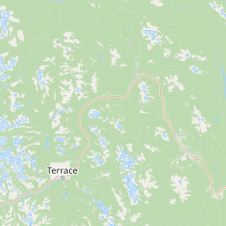
Map view of Kitsumkalum Provincial Park

Use this park location map to pinpoint Kitsumkalum Provincial Park in Canada, understand its exact geographic position, and read its mapped placement within the surrounding landscape more clearly.

Pigeon | © OpenStreetMap contributors

Location context for Kitsumkalum Provincial Park

British Columbia
Park atlas

Compare adjacent watershed landscapes and regional conservation areas across British Columbia.

Other Parks Near Kitsumkalum Provincial Park and Surrounding Protected Areas

Browse nearby provincial parks and protected areas sharing the forested valleys and river corridors of the Skeena region. Extending the geographic comparison reveals connected wildlife habitats and regional terrain variations across northern British Columbia.
A soft watercolor illustration depicting a winding creek bordered by pine forests, with rolling mountains in the background, set against a plain white background.
State or regional parkBritish Columbia
About 28 km away#1 closest

Southeast

Kleanza Creek Provincial Park: Coast Mountains Canyon and Salmon Protected Landscape

Regional protected geography in northwestern British Columbia

Kleanza Creek Provincial Park offers an intimate look at a rugged Coast Mountains landscape. The area is defined by its deep, forested rock canyons and the cascading waters of Kleanza Creek, which serve as essential habitat for spawning pink salmon. This protected site retains historical significance from nineteenth-century placer mining and provides a compact example of the complex terrain found in this part of British Columbia.

Area
2.69 km²
Established
1956
Relief
Mountain
Climate
Temperate
A soft watercolor illustration depicting a calm river scene with evergreen trees, a grassy riverbank, and distant rolling hills in pale green and pink tones.
State or regional parkBritish Columbia
About 55 km away#2 closest

Southwest

Exchamsiks River Provincial Park: Protected Old-Growth Forest Geography in British Columbia

A rare maritime Sitka spruce landscape in the Skeena River estuary

Situated at the meeting of the Exchamsiks and Skeena rivers, this provincial park protects a significant stand of unlogged old-growth coastal rainforest. The terrain provides a compact, ecologically essential example of the temperate habitat characteristic of British Columbia's north coast, featuring moisture-loving spruce and salmonberry understory landscapes.

Area
0.182 km²
Established
1956
Relief
Lowland
Climate
Temperate
State or regional parkBritish Columbia
About 66 km away#3 closest

West

Khutzeymateen Provincial Park: Protected Wilderness and Coastal Forest Geography

North Coast British Columbia protected area and estuary map.

Khutzeymateen Provincial Park represents a pivotal conservation achievement on the British Columbia North Coast. This wilderness sanctuary protects a critical estuarine complex where rugged mountain ranges meet a sheltered Pacific inlet. Beyond its designation as a grizzly bear stronghold, the park holds globally significant old-growth Sitka spruce forests, providing a rare look at an intact temperate rainforest landscape.

Area
450.52 km²
Established
1994
IUCN
Ib
Relief
Mountain
A soft watercolor painting of a winding river flowing through a lush, green landscape with forested hills in the background.
Nature reserveBritish Columbia
About 99 km away#4 closest

Southwest

Gamble Creek Ecological Reserve: Protected Nature Reserve Geography and Forest Map

British Columbia North Coast forest and peatland research landscape.

Situated on the North Coast of British Columbia, Gamble Creek Ecological Reserve is a designated nature reserve comprising forest and bog ecosystems. The protected area serves as an important site for studying plant communities, including sphagnum moss and coastal bog species, within a unique altitudinal transition between coastal hemlock and subalpine zones.

Area
10.26 km²
Established
1991
IUCN
Ia
Relief
Mixed relief
A watercolor painting showing a lake, a forested shoreline, and distant mountains in a soft palette.
State or regional parkBritish Columbia
About 106 km away#5 closest

Southwest

Diana Lake Provincial Park: Mapping Coastal Rainforest and Wetland Geography in British Columbia

An examination of North Coast forest and freshwater ecosystems

Diana Lake Provincial Park represents a significant protected area in British Columbia, showcasing the diverse ecological character of the North Coast. The park boundary encompasses a mosaic of old-growth rainforest, open blanket bogs, and freshwater aquatic systems. By protecting these varied terrains, the region maintains vital habitats for Pacific salmon species while providing a structured landscape for understanding the wet maritime environment of the Pacific Northwest.

Area
2.33 km²
Established
1980
IUCN
II
Relief
Upland
Watercolor painting of a coastal scene with green islands, coniferous trees, and soft, hazy mountains in the background, set against a white background.
Marine protected areaBritish Columbia
About 117 km away#6 closest

Southwest

Kitson Island Marine Provincial Park Map and Coastal Protected Area Atlas

Protected island and estuarine landscape in British Columbia

Kitson Island Marine Provincial Park encompasses a vital coastal island and the adjacent Flora Bank at the mouth of the Skeena River. This protected marine environment provides a rare example of accessible sandy beach terrain on the North Coast. Use this atlas resource to understand the park boundaries, island geography, and estuarine interface within the broader Inside Passage conservation network.

Area
0.45 km²
Established
1993
IUCN
II
Relief
Lowland
A horizontal watercolor painting showing a calm inlet surrounded by forested hills and distant mountains.
State or regional parkBritish Columbia
About 130 km away#7 closest

Southwest

Klewnuggit Inlet Marine Provincial Park: Regional Geography and Protected Area Mapping

Coastal inlet, freshwater lakes, and northern forest ecosystems.

Klewnuggit Inlet Marine Provincial Park showcases the dramatic meeting of mountain, forest, and sea. Spanning from the sheltered waters of the Grenville Channel to inland freshwater systems, the park offers a detailed study of northern coastal geography, fjord-like marine channels, and diverse bird and marine wildlife habitats.

Area
18 km²
Established
1993
IUCN
II
Relief
Mixed relief
A soft, light watercolor painting of a winding river flowing through a forested valley with distant, muted mountain ranges under a pale sky.
Protected areaBritish Columbia
About 156 km away#8 closest

South

Kitlope Heritage Conservancy: Coastal Temperate Rainforest and Mountain Watersheds

A vast protected area in the Kitimat-Stikine region of British Columbia

Spanning from the Gardner Canal to glaciated inland summits, the Kitlope Heritage Conservancy protects an entire, undisturbed watershed. It is defined by its transition from saltwater fjords through ancient, salmon-bearing river valleys to high granite peaks, acting as a vital benchmark for coastal ecosystem integrity in the Pacific Northwest.

Area
3,220.2 km²
Established
1996
IUCN
Ib
Relief
Mountain

Common questions about visiting, size, designation, and location context for Kitsumkalum Provincial Park

Kitsumkalum Provincial Park FAQs for park facts, access, geography, and protected area context

Find quick answers about Kitsumkalum Provincial Park, including protected-area facts, park geography, trail and visitor context, and how the park fits into its surrounding country and regional landscape.
MoriAtlas Explorer

Continue Your Protected Areas Search Across the Global Atlas

Deepen your exploration by continuing the structured search for national parks and protected areas worldwide. Utilize the comprehensive filtering capabilities to compare different conservation landscapes and refine your understanding of global park geography. Discover more about the distribution and characteristics of protected natural areas.

Global natural geography