
Mori Atlas logo
Nature reserveKleine und Mittelleber

Analyzing the post-glacial mire woodland and bog habitats within this protected German landscape

Kleine und Mittelleber Nature Reserve: Mapping the Protected Wetland Landscapes of Brandenburg

Kleine und Mittelleber represents a compact, ecologically layered nature reserve located in the Brandenburg region of eastern Germany. This protected area offers deep insight into post-glacial geomorphology, where ancient meltwater channels have evolved into a complex mosaic of transitional mires, floating mat bogs, and relic alder swamp forests. By examining the hydrological history and habitat structure of this site, enthusiasts gain a clearer understanding of how regional water balances and long-term conservation strategies shape the natural terrain of the Dahme-Spreewald district.

nature reserveBrandenburgDahme-SpreewaldTeupitzpeatlandmire woodland
A flat-style digital illustration depicting a valley framed by tall trees in the foreground, with a waterfall cascading down a mountain cliff in the distance.

Kleine und Mittelleber

Nature reserve

Park overview

Structured park overview, official facts, and landscape profile for Kleine und Mittelleber

Kleine und Mittelleber park facts, protected area profile, and essential visitor context

Review the core facts for Kleine und Mittelleber, including designation, size, terrain, visitor scale, habitats, and operating context in one park-focused overview.

About Kleine und Mittelleber

Kleine und Mittelleber sits in the southern part of Brandenburg, within the Dahme-Spreewald district and on the territory of the town of Teupitz. Although small in extent, the reserve concentrates a remarkable diversity of wetland and peatland habitats in one place, making it a representative example of the post-glacial wetland landscapes that recur across this part of eastern Germany. Its combination of strict nature reserve status with formal FFH designation reflects the emphasis placed on protecting both specific habitat types and individual species of European conservation concern.

The defining ecological story of Kleine und Mittelleber is one of post-glacial landscape evolution followed by modern hydrological disturbance. During the Weichselian glaciation the retreating ice left behind a network of meltwater channels; in this area one such channel gradually silted up, allowing peat formation and the slow development of a mire and swamp forest system. Today the area shows several stages of this process simultaneously, from actively forming transitional bogs and floating mats in the wetter depressions through to more established mire woodland and pine-edged drier forest on the surrounding ground.

The reserve is also shaped by its twentieth century human history. Because it lies close to the Wünsdorf military training area, large parts of the surrounding municipal land were restricted military zone during the time of the DDR. This restricted access, both limiting direct human pressure on parts of the landscape and constraining active land management. At the same time, interventions in the local water balance over recent decades have caused significant dieback of the alder swamp forest (Erlen-Bruchwald), leaving a forest mosaic that today is ecologically important but visibly altered. Established as a protected area on 9 June 1995, the reserve is named after two former small lakes, the Kleine Leber and the Mittlere Leber, both of which have since silted over completely, leaving peatland and swamp forest in their place.

For visitors and researchers, Kleine und Mittelleber illustrates how small protected areas can carry layered conservation value: a glacial geomorphological inheritance, an active peatland ecosystem with rare bog and swamp forest habitats, a damaged but recovering alder swamp forest, and a small set of highly characteristic protected species. Its proximity to other reserves in Dahme-Spreewald, such as the Mühlenfließ-Sägebach area, also places it within a wider network of protected sites that together safeguard the regional wetland and forest heritage of southern Brandenburg.

Quick facts and research context for Kleine und Mittelleber

Kleine und Mittelleber is a Naturschutzgebiet (strict nature reserve) in Brandenburg, Germany, situated west of Teupitz centre and southeast of the Egsdorf district within the Dahme-Spreewald district. The reserve covers approximately 66.53 hectares and is simultaneously designated as an FFH (Fauna-Flora-Habitat) area under the EU Habitats Directive. Its protected status took effect on 9 June 1995.

The landscape is post-glacial in origin, formed by meltwater channels from the Weichselian ice age that later filled in to create peatland and swamp forest. Mire woodland bordered by pine is the dominant habitat, with transitional and floating mat (Schwingrasen) bogs developing in the wetter hollows. Designated conservation targets include the Eurasian otter, the Large Copper butterfly (Großer Feuerfalter) and the Great Emerald Dragonfly (Große Moosjungfer). The reserve's name recalls two former lakes, the Kleine Leber and the Mittlere Leber, which have since completely silted over.

Protection and recognition

Documented conservation status, official boundaries, and international recognition records

Kleine und Mittelleber Protection Status and Natura 2000 Recognition Details

Kleine und Mittelleber maintains documented protected area status supported by formal Natura 2000 recognition records. Structured administrative records outline the official designation framework and international environmental designations.
Park context

Deeper park guide and search-rich context for Kleine und Mittelleber

Kleine und Mittelleber history, landscape, wildlife, and travel context

Explore Kleine und Mittelleber through its history, landscape character, ecosystems, wildlife, conservation priorities, cultural context, and seasonal travel timing in a structured park guide built for atlas discovery and search intent.

Why Kleine und Mittelleber stands out

Kleine und Mittelleber is best known as a compact, ecologically layered mire and swamp forest reserve that exemplifies Brandenburg's post-glacial landscape history. Its profile is shaped by the interplay of bog woodland, transitional mires and floating mat (Schwingrasen) bogs, set within a broader matrix of pine-fringed forest and degraded alder swamp. The reserve is also notable for combining strict nature protection with formal recognition as an EU Fauna-Flora-Habitat (FFH) site, which underscores its value for specific protected habitat types and species rather than for general scenic landscape alone. A defining feature of the area is the way past changes to the water balance have left visible marks on the landscape: large stands of alder swamp forest have died back because drainage and altered hydrology disrupted the wet conditions they depend on. This combination of recovering peatland habitats, damaged but ecologically valuable swamp forest remnants and rare species such as the Large Copper butterfly and the Great Emerald Dragonfly gives the reserve a distinctive conservation character compared with broader forest or lake reserves in the region.
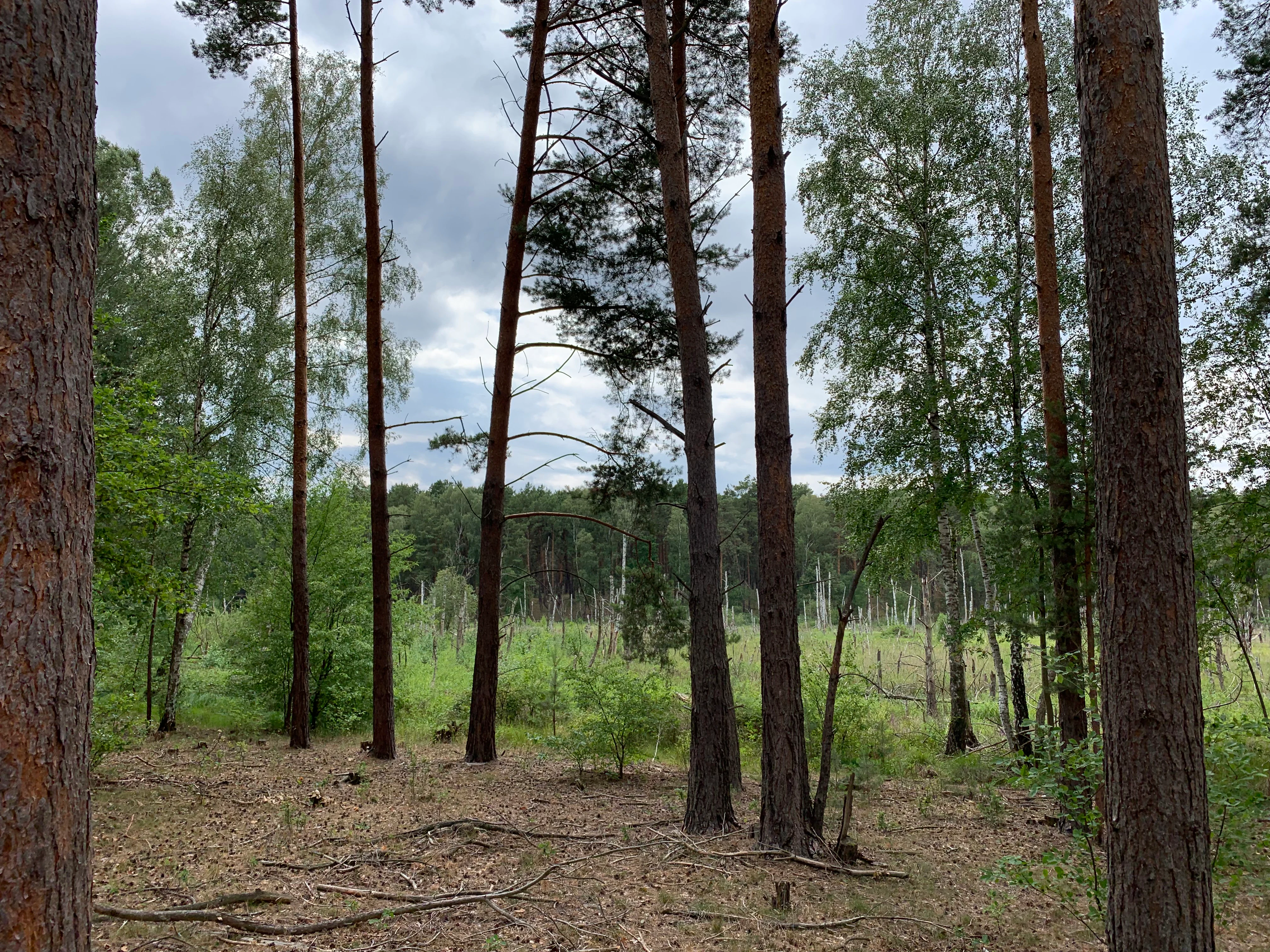
A view through pine tree trunks into a lush, green bog forest under a cloudy sky.
A view into the bog forest of the Kleine und Mittelleber nature reserve in Brandenburg.

Kleine und Mittelleber history and protected-area timeline

The landscape that Kleine und Mittelleber protects owes its basic form to the Weichselian glaciation, the most recent major ice age that shaped much of northern Germany. As the ice sheet retreated, meltwater cut channels into the emerging land surface; one such watercourse in this area gradually silted up and developed into a progressively paludified wetland, eventually forming the peatland and mire complex preserved in the reserve today.

In the twentieth century the region's history was strongly influenced by the nearby military training area at Wünsdorf. During the DDR era, large parts of the Teupitz municipal territory, including areas adjoining the present reserve, were designated military restricted zone. Access was limited and ordinary land use restricted, which had complex effects on the landscape: it reduced some forms of direct human pressure while also limiting opportunities for active habitat management.

Over recent decades, interventions in the local water balance have had a marked ecological impact. Drainage and other hydrological changes altered the wet conditions on which the alder swamp forest (Erlen-Bruchwald) depends, and large areas of this forest type died back. The visible legacy of that disturbance is still part of the reserve's character today.

Formal protection came relatively late, on 9 June 1995, when the area was designated as the Naturschutzgebiet Kleine und Mittelleber. The name itself is a reminder of the reserve's earlier hydrology: it refers to two small former lakes, the Kleine Leber and the Mittlere Leber, both of which have since completely silted over and no longer exist as open water.

Kleine und Mittelleber landscape and geographic character

Kleine und Mittelleber is a small, low-lying landscape shaped almost entirely by the legacy of glacial meltwater and subsequent peat formation. The terrain is gentle and dominated by wetland forms rather than dramatic relief, with the surface subtly patterned by former channels, silted-up lake basins and the progressing edges of active bog growth.

The most visually distinctive feature is the mosaic of wet and forested ground. Open, peat-forming hollows with transitional mires and floating mat (Schwingrasen) bogs are framed by mire woodland and edged by pine (Kiefern) on slightly drier ground. In the more altered parts of the reserve, the dead and dying remains of former alder swamp forest add an additional structural element, contributing both standing and fallen deadwood to the habitat complex.

Although the former lakes Kleine Leber and Mittlere Leber that gave the reserve its name no longer exist, their former basins continue to define the hydrological and ecological structure of the area. The result is a quiet, tightly textured wetland-forest landscape that reads more through its habitat variation and hydrological history than through topographic drama, and that fits naturally into the broader pattern of mire-dominated landscapes of southern Brandenburg.

Kleine und Mittelleber ecosystems, habitats, and plant life

Ecologically, Kleine und Mittelleber is best understood as a small but well-structured peatland and swamp forest complex. Its habitats include mire woodland (Moorwald) fringed by pine, transitional mires and floating mat bogs forming in the wetter depressions, and degraded but still ecologically significant remnants of alder swamp forest (Erlen-Bruchwald). The combination of habitats reflects different stages in the post-glacial paludification of the landscape.

The reserve's formal status as an FFH (Fauna-Flora-Habitat) site underlines the importance attached to these habitat types under the EU Habitats Directive. Protection here is not just generic forest protection but specifically targets the maintenance of bog woodland, mire transitions and swamp forest communities, as well as the specific animal species that depend on them.

A key ecological tension is provided by the degraded alder swamp forest. Past interventions in the water balance caused extensive dieback of alder, leaving a forest stand altered in composition and structure. While this is a conservation concern, the disturbed areas also contribute deadwood and structural complexity to the habitat mosaic, which in turn supports a wide range of invertebrates and other species. The combination of recovering active mires, damaged wetland forest and stable pine-edged woodland gives the reserve a layered ecological character.

Kleine und Mittelleber wildlife and species highlights

Despite its modest size, Kleine und Mittelleber supports a set of species that are specifically highlighted in its conservation objectives. The reserve places particular emphasis on the Eurasian otter (Fischotter), a mammal strongly associated with healthy wetland and aquatic systems and an indicator of hydrological integrity across the wider landscape.

Among invertebrates, the Large Copper butterfly (Großer Feuerfalter) is one of the named conservation targets. This species depends on specific wetland vegetation and is often associated with damp meadows, marsh edges and bog habitats, making the reserve's mire and swamp forest mosaic directly relevant to its persistence. The Great Emerald Dragonfly (Große Moosjungfer), a dragonfly of bog pools and acidic mire waters, is also highlighted as a protected species of the area.

Together with the rich invertebrate and aquatic fauna supported by transitional mires and floating mat bogs, these target species reflect a conservation approach that emphasises habitat-specific wildlife rather than general forest game species. The wildlife value of the reserve is therefore best read through its mire and swamp forest ecology.

Kleine und Mittelleber conservation status and protection priorities

Kleine und Mittelleber carries conservation significance on two overlapping levels. As a Naturschutzgebiet under Brandenburg state law, it receives strict protection aimed at preserving its habitats, hydrology and characteristic species. As a designated FFH (Fauna-Flora-Habitat) area, it is also part of the European Union's Natura 2000 network, with conservation objectives tied to specific habitat types and species listed under the Habitats Directive.

The reserve matters particularly because it preserves a small but representative example of post-glacial mire and swamp forest landscape, including transitional and floating mat bogs that are among the more threatened peatland habitat types in central Europe. Its designation also reflects concern over the ongoing loss of functional alder swamp forest, since past hydrological interventions have already caused substantial dieback of this habitat type within the area.

By combining strict nature protection with targeted species protection for the otter, the Large Copper butterfly and the Great Emerald Dragonfly, Kleine und Mittelleber serves as a focused conservation site where habitat-level and species-level objectives reinforce each other. Within the network of protected areas in the Dahme-Spreewald district, it forms an important local node for mire and swamp forest conservation in southern Brandenburg.

Kleine und Mittelleber cultural meaning and human context

Although the reserve itself is defined by natural values rather than human heritage, the surrounding landscape carries a clear cultural imprint. The reserve lies on the municipal territory of Teupitz, adjacent to villages such as Egsdorf, Töpchin, Tornow and Neuendorf, and near the Zossen locality of Lindenbrück with its community of Zesch am See. The pattern of villages and fields around the protected area reflects a long-standing agricultural and small-town settlement tradition in southern Brandenburg.

The most distinctive cultural layer, however, comes from the area's twentieth century military history. The reserve is close to the former Wünsdorf military training area, and during the DDR period much of the surrounding Teupitz municipal territory was restricted military zone with limited public access. This history shaped both how the landscape evolved and how it was later perceived and protected once access restrictions ended and formal nature conservation status was applied.

Top sights and standout views in Kleine und Mittelleber

Kleine und Mittelleber stands out for the density and variety of wetland and peatland habitats packed into its roughly 66 hectares, ranging from actively forming transitional and floating mat bogs through mire woodland to degraded but ecologically rich alder swamp forest remains. Its dual designation as both a strict Brandenburg Naturschutzgebiet and a European FFH site gives its conservation objectives a particularly clear focus on habitat types and species protected under the EU Habitats Directive.

The reserve is also distinctive in the way its modern ecological character is shaped by both natural and human history: a glacial meltwater origin, former lakes that have completely silted over, a DDR-era restricted military landscape, and twentieth century hydrological changes that left a legacy of alder swamp forest dieback. Together these layers make the reserve a small but information-rich example of how post-glacial landscapes, modern land use and active conservation intersect in contemporary Brandenburg.

Best time to visit Kleine und Mittelleber

Kleine und Mittelleber is a quiet wetland and forest reserve with no marked visitor infrastructure, so any visit is essentially a low-key nature experience rather than a programmed seasonal attraction. The peatland and swamp forest habitats are most atmospheric in the warmer half of the year, when the floating mat bogs, mire vegetation and dragonfly populations are most active and easier to observe.

Late spring and summer are the most rewarding periods for those interested in mire ecology and dragonflies such as the Große Moosjungfer, while early summer can also offer chances to see characteristic wetland butterflies including the Large Copper. In autumn and winter the reserve becomes a more subdued forest and bog landscape, with deadwood in the former alder swamp forest areas becoming a more prominent visual feature. As with all small nature reserves of this type, visits depend on local access rules and paths; conditions on the wet ground can be difficult outside the drier months.

Monthly climate preview

Measured monthly temperature ranges and precipitation patterns across Brandenburg

Kleine und Mittelleber Climate Normals and Long Term Temperature Rhythms

Kleine und Mittelleber records long term representative temperature variations and monthly precipitation averages from NASA Power climatology data spanning 1991 to 2020. Reviewing the complete twelve month profile provides detailed context on recorded minimums, maximums, and precipitation rhythms at this monitored coordinate.
Annual mean10 °C
-1 °C21 °C
Jan-1°
Feb
Mar
Apr
May14°
Jun18°
Jul21°
Aug20°
Sep15°
Oct
Nov
Dec
Warmest month
July

20.6 °C

Coolest month
January

-0.8 °C

Wettest month
July

2.5 mm/day

Driest month
April

1.1 mm/day

Park location guide

Geography guide, regional context, and park location map for Kleine und Mittelleber

Kleine und Mittelleber park geography, regions, and map view in Germany

Understand where Kleine und Mittelleber sits in Germany through a broader geographic reading of the surrounding landscape, nearby location context, and its mapped position within the national park landscape.

How Kleine und Mittelleber fits into Germany

Germany is a federal republic in Western and Central Europe with a population of over 83 million across sixteen constituent states. It is Europe's largest economy by nominal GDP and a major global exporter and importer. The capital is Berlin, and the country borders Denmark, Poland, Czech Republic, Austria, Switzerland, France, Luxembourg, Belgium, and the Netherlands.

Wider geography shaping Kleine und Mittelleber in Germany

Germany is located in Western and Central Europe, spanning 357,022 km². It borders Denmark to the north, Poland and the Czech Republic to the east, Austria and Switzerland to the south, and France, Luxembourg, Belgium, and the Netherlands to the west. The country has coastlines on the Baltic Sea and North Sea to the north, with the Alps located in the southern region.

Map view of Kleine und Mittelleber

Use this park location map to pinpoint Kleine und Mittelleber in Germany, understand its exact geographic position, and read its mapped placement within the surrounding landscape more clearly.

Pigeon | © OpenStreetMap contributors

Location context for Kleine und Mittelleber

Brandenburg

Visualizing post-glacial mire woodland and wetland habitats

Kleine und Mittelleber Landscape and Scenery Photography

Visual records reveal the intricate mosaic of transitional mires, floating mat bogs, and pine-fringed forest that characterize the protected area. Examining field photographs helps researchers and visitors understand the unique post-glacial terrain and hydrological history defining the reserve.

A view through pine tree trunks into a lush, green bog forest under a cloudy sky.

Park atlas

Compare regional wetland habitats, peatlands, and connected conservation areas across Brandenburg

Explore Parks Near Kleine und Mittelleber and Surrounding Protected Landscapes

Browsing other protected areas near Kleine und Mittelleber reveals the wider post-glacial wetland geography of the Dahme-Spreewald region. Comparing adjacent nature reserves helps evaluate similar mire ecosystems and regional conservation networks.
Nature reserveBrandenburg
2.2 km away#1 closest

Northeast

Töpchiner Seen Nature Reserve: Geographic Overview of Brandenburg Protected Landscapes

A glacial landscape mosaic of lakes, fens, and woodlands

Located in the Dahme-Spreewald district, Töpchiner Seen is a vital nature reserve showcasing deep peat deposits and diverse wetland vegetation. The protected area features a layered terrain, where open water connects to transition mires, calcareous meadows, and mature oak and pine forests, providing a stable habitat for specialized flora and fauna within the broader Brandenburg geography.

Area
3.75 km²
Established
1988
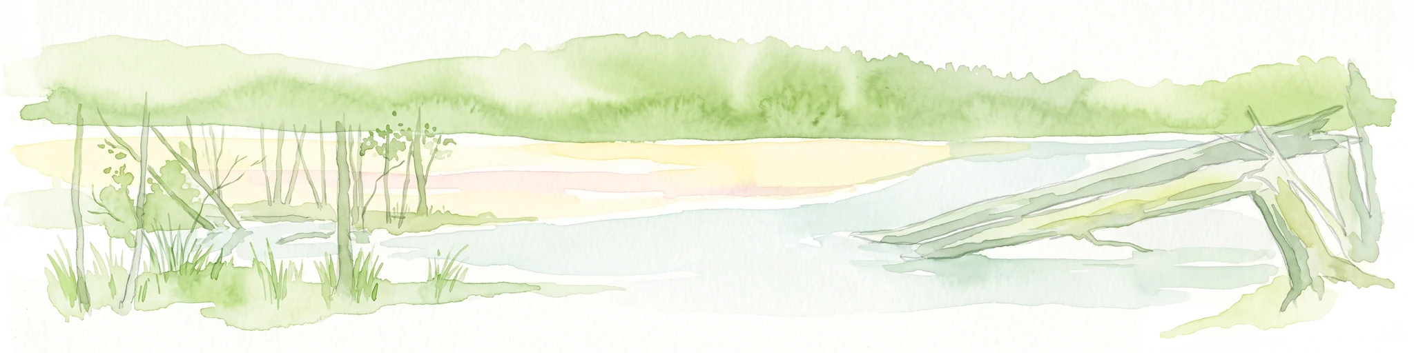
A wide panoramic watercolor illustration showing a lake landscape with green trees and a soft pink and yellow sky.
Nature reserveBrandenburg
3.1 km away#2 closest

Southeast

Briesensee und Klingeberg Nature Reserve: Mapped Landscapes and Glacial Terrain in Brandenburg

Protected glacial lakes and old-growth forest geography

Situated in the Dahme-Spreewald district, Briesensee und Klingeberg stands as a testament to Brandenburg's glacial past. The reserve protects complex aquatic and forest ecosystems, including genetically documented pine stands over 220 years old and the active Klingespring seepage site. Learn about the interaction between sandy moraine ridges and water-retaining depressions that sustain these rare mire and spring habitats within the German Natura 2000 network.

Area
0.799 km²
Established
2002
IUCN
IV
Nature reserveBrandenburg
6.8 km away#3 closest

East

Naturschutzgebiet Löptener Fenne, Wustrickwiesen: Mapped Geography and Protected Landscapes

Glacial mire and wetland systems in Brandenburg, Germany

The Naturschutzgebiet Löptener Fenne, Wustrickwiesen nature reserve provides a critical look at terrestrialized mire landscapes. Beneath its surface lie deep layers of lake-derived mud, marking this site as a key reference for understanding glacial meltwater history in eastern Germany. Today, the area serves as a focal point for active peatland renaturation and habitat management within the Dahme-Spreewald district.

Area
2.18 km²
Established
1998
IUCN
IV
Relief
Lowland
A watercolor painting showing a horizontal landscape of green trees and reflected water against a light, misty background.
Nature reserveBrandenburg
7 km away#4 closest

Southwest

Schöbendorfer Busch Nature Reserve: Mapped Protected Geography in Brandenburg

Lowland deciduous forest and glacial valley landscape.

Schöbendorfer Busch provides a window into the natural heritage of the Baruther Urstromtal. This nature reserve protects over 800 hectares of forest and agricultural mosaic, serving as a primary habitat for rare saproxylic beetles and bats. Its terrain, defined by glacial meltwater deposits and wet alder swamp environments, offers a distinctive example of Brandenburg forest conservation.

Area
8.31 km²
Established
1978
IUCN
IV
Nature reserveBrandenburg
11 km away#5 closest

East

Stintgraben Nature Reserve: Protected Stream Landscapes in Southern Brandenburg

Ecological connectivity between glacial lakes and river corridors.

Located in the Dahme-Spreewald district, Stintgraben is a protected stream corridor defined by its lowland riparian habitats and position between the Klein Köriser See and the Dahme river. This nature reserve provides essential ecological continuity within the broader Dahme-Heideseen region, offering a clear example of how small-scale protected areas maintain the natural integrity of Germany's glacial lake districts.

Area
1.09 km²
Established
1995
IUCN
IV
Nature reserveBrandenburg
13 km away#6 closest

Northeast

Katzenberge Nature Reserve: An Atlas of Glacial Moraine Woodlands in Brandenburg Germany

Protected oak forest habitats within the Dahme-Spreewald landscape

Katzenberge offers a focused look at the conservation of mature deciduous forest environments on sandy moraine soils. As a designated nature reserve within the Brandenburg region, the area serves as a primary reference point for studying habitat continuity and the unique glacial terrain that defines the south-eastern lowlands near the Dahme river.

Area
1.44 km²
Established
2004
IUCN
IV
Relief
Upland
Nature reserveBrandenburg
About 16 km away#7 closest

East

Streganzsee-Dahme Nature Reserve: Mapping Brandenburg Protected River Landscapes and Dunes

An ecological mosaic in the Dahme-Spreewald river corridor

Streganzsee-Dahme represents an intact Brandenburg riverine corridor characterized by sharply varied topography. The reserve encompasses water bodies, floodplain forests, fens, and dry sandland heaths. Its protected boundaries connect various biotopes, offering an essential look at the region's diverse lowland ecology and the structured geography of the local conservation network.

Area
4.36 km²
Established
1999
IUCN
IV
Relief
Lowland
Nature reserveBrandenburg
17 km away#8 closest

Northeast

Tiergarten Nature Reserve: Geography and Protected Habitat Mapping in Brandenburg, Germany

Ancient oak woodland, riparian wetlands, and historic forest trails.

Spanning 158 hectares, the Tiergarten nature reserve serves as an ecologically rich sanctuary of oak-hornbeam forests and wet meadows. This area, formerly a royal hunting ground, offers a dense mosaic of riparian zones along the Staabe river, protecting essential habitats within the broader Brandenburg landscape.

Area
1.58 km²
Established
1995
IUCN
IV

Common questions about visiting, size, designation, and location context for Kleine und Mittelleber

Kleine und Mittelleber FAQs for park facts, access, geography, and protected area context

Find quick answers about Kleine und Mittelleber, including protected-area facts, park geography, trail and visitor context, and how the park fits into its surrounding country and regional landscape.
MoriAtlas Explorer

Continue Your Protected Areas Search Across the Global Atlas

Deepen your exploration by continuing the structured search for national parks and protected areas worldwide. Utilize the comprehensive filtering capabilities to compare different conservation landscapes and refine your understanding of global park geography. Discover more about the distribution and characteristics of protected natural areas.

Global natural geography