
Mori Atlas logo
State or regional parkKlewnuggit Inlet Marine Provincial Park

A detailed atlas exploration of British Columbia's sheltered inlet ecosystems, forested ridges, and protected coastal waters.

Klewnuggit Inlet Marine Provincial Park: Coastal Landscape and Marine Geography Mapping

Klewnuggit Inlet Marine Provincial Park represents a vital protected landscape along the northern reaches of British Columbia's Inside Passage. The geography centers on a calm marine inlet branching from the Grenville Channel, characterized by steep forested slopes, narrow tidal reaches, and freshwater connections including Freda Lake and coastal waterfalls. This structured overview traces the park boundaries, marine-to-inland drainage patterns, and the rugged terrain that defines this remote coastal wilderness.

marine parkcoastal inletfjord-like scenerywaterfallcoastal forestwildlife viewing
Digital vector illustration of a scenic inlet with rocky foreground, evergreen trees, small waterfalls, and snow-capped mountains in the background under a soft light.

Klewnuggit Inlet Marine Provincial Park

State or regional park

Park overview

Structured park overview, official facts, and landscape profile for Klewnuggit Inlet Marine Provincial Park

Klewnuggit Inlet Marine Provincial Park park facts, protected area profile, and essential visitor context

Review the core facts for Klewnuggit Inlet Marine Provincial Park, including designation, size, terrain, visitor scale, habitats, and operating context in one park-focused overview.

About Klewnuggit Inlet Marine Provincial Park

Klewnuggit Inlet Marine Provincial Park protects one of the quieter side inlets reaching inland from Grenville Channel on British Columbia's north coast. The park sits on the mainland side of the channel, southeast of Prince Rupert, in a part of the coast long associated with the Inside Passage routes used by vessels, marine wildlife, and shore-based ecosystems.

The park's setting is defined by the meeting of marine and terrestrial environments. Around 292 hectares of foreshore extend into Grenville Channel, while roughly 1,508 hectares of upland rise around the inlet and connect inland to Freda Lake. The result is a continuous protected landscape of saltwater channel, sheltered inlet, forested slopes, small islets, and freshwater lake. The protection of this combination is one of the defining features of the park.

Like many British Columbia marine provincial parks, Klewnuggit Inlet is a place where natural processes dominate. There is little visible infrastructure in the park's protected zone, and its importance lies more in the persistence of habitat than in visitor facilities. Its inclusion in the BC Parks system reflects the province's long-running effort to protect intact coastal inlets, not just terrestrial reserves.

For visitors who reach the area, the park offers a coastal experience shaped by scenery and wildlife rather than amenities. Waters fall from Brodie Lake into the inlet; seabirds and ducks feed in the calm waters; harbour seals use the inlet with regularity; and the steep forested slopes give the channel its enclosed, fjord-like character on this stretch of the coast.

Quick facts and research context for Klewnuggit Inlet Marine Provincial Park

Klewnuggit Inlet Marine Provincial Park is a approximately 1,800 hectare BC Parks reserve on the east shore of Grenville Channel in northern coastal British Columbia, about 100 kilometres southeast of Prince Rupert.

Managed as IUCN Category II, the park pairs roughly 292 hectares of marine foreshore with about 1,508 hectares of surrounding upland, protecting an inlet, a connected lake, and the forested terrain around them.

Protection and recognition

Examine the documented conservation scope, management framework, and recognized status details

Klewnuggit Inlet Marine Provincial Park Protection Status and Designation Records

Klewnuggit Inlet Marine Provincial Park maintains a recorded mixed protection scope within its regional conservation boundaries. Official administrative designations and recognized international listings are compiled to establish verified park status details.

Protection details

Protection scope
Mixed
Transboundary protection
No
Park context

Deeper park guide and search-rich context for Klewnuggit Inlet Marine Provincial Park

Klewnuggit Inlet Marine Provincial Park history, landscape, wildlife, and travel context

Explore Klewnuggit Inlet Marine Provincial Park through its history, landscape character, ecosystems, wildlife, conservation priorities, cultural context, and seasonal travel timing in a structured park guide built for atlas discovery and search intent.

Why Klewnuggit Inlet Marine Provincial Park stands out

The park is best known for the sheltered waters of Klewnuggit Inlet on Grenville Channel, where plunging freshwater streams and forested slopes meet a calm marine inlet. It is also recognized for wildlife viewing potential, with sea ducks such as Barrow's goldeneyes feeding in the inlet and harbour seals frequenting the protected waters. The combination of a marine inlet, a freshwater lake system behind it, waterfalls like Brodie Lake Falls, and a scatter of small islets gives the park its distinctive coastal character within BC's network of marine provincial parks.
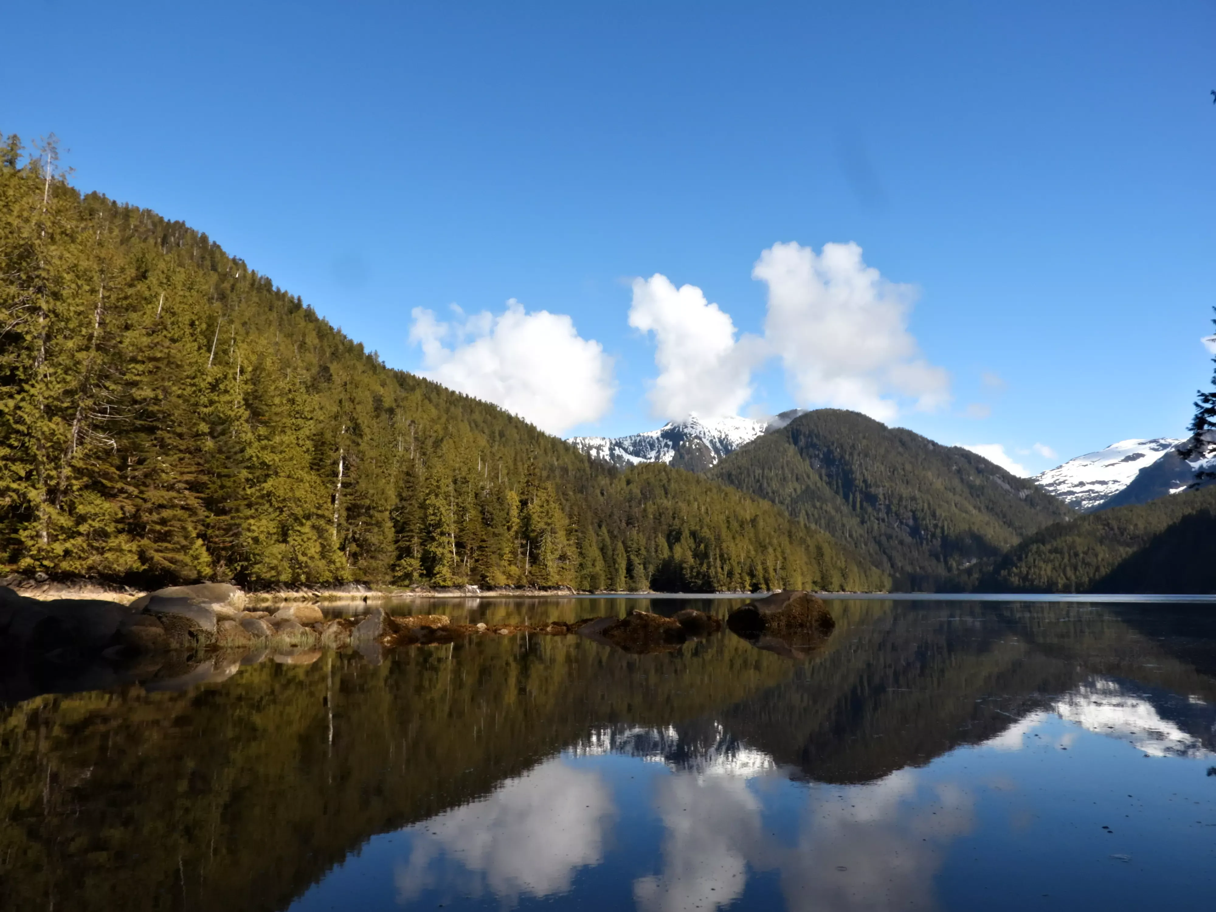
A wide, scenic view of a quiet, reflective inlet surrounded by dense coniferous forest and mountains with snow-covered peaks under a clear blue sky with light clouds.
A calm, reflective view of Klewnuggit Inlet in British Columbia, featuring forested slopes and distant snow-capped peaks.

Klewnuggit Inlet Marine Provincial Park history and protected-area timeline

Klewnuggit Inlet Marine Provincial Park was established on 14 June 1993 as part of BC Parks' continuing effort to add marine and coastal inlets to the provincial protected-area network.

The park's creation reflects a broader British Columbia conservation direction of the 1990s, when more attention was given to protecting the province's saltwater inlets, foreshore zones, and the ecological connections between coastal marine waters and adjacent forested uplands. Klewnuggit Inlet became one of the smaller but distinctive pieces of that coastal protection effort in the Grenville Channel area.

Klewnuggit Inlet Marine Provincial Park landscape and geographic character

The landscape of Klewnuggit Inlet Marine Provincial Park is shaped by the steep, forested coastline of northern British Columbia dropping into a calm, narrow marine inlet. Grenville Channel itself is one of the protected inside-coast waterways of the region, and the inlet reaches east from it as a quieter, branching arm.

Inside the park, the inlet splits into finger-like reaches where small islets rise from shallow water and forested slopes rise close to the shoreline. Brodie Lake empties into the inlet via a waterfall, and Freda Lake sits behind the coastal upland as part of the same connected drainage. The result is a layered landscape where marine inlet, freshwater lakes, and forested ridges interact over a relatively compact area.

The vertical relief, close cover of coastal forest, and narrow saltwater channel give the park a fjord-like feel, even though it sits well south of the more famous fjords farther down the coast. This combination of mountain-meets-sea topography is the dominant visual and ecological feature of the protected area.
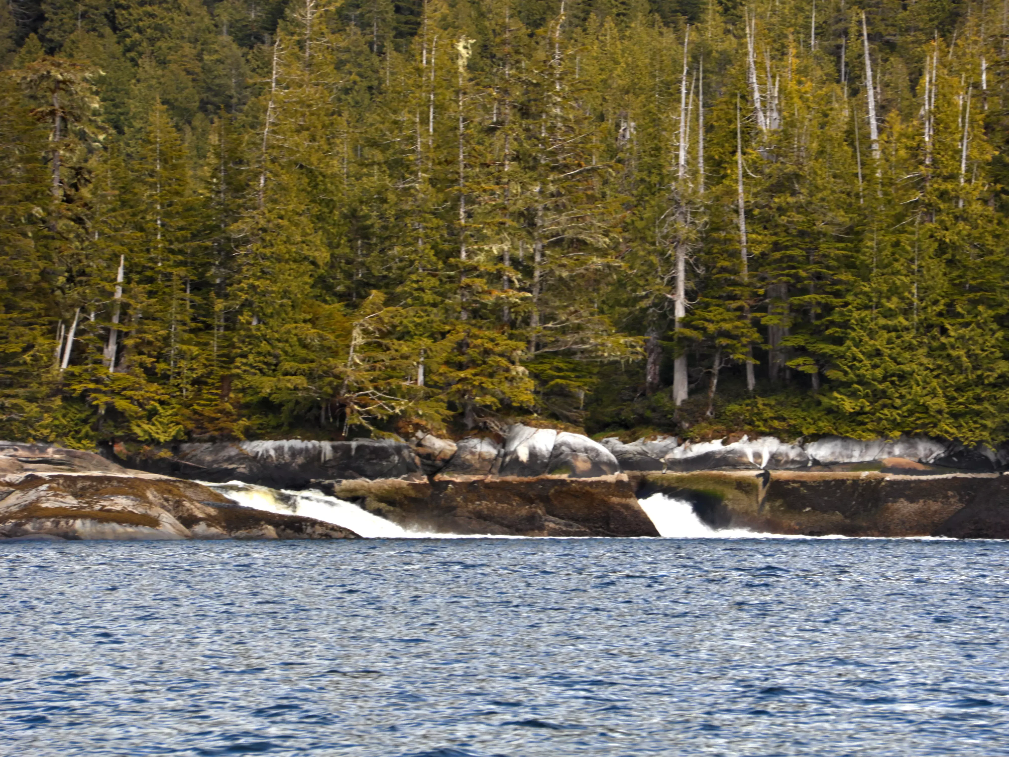
A low, rocky shoreline backed by a dense coniferous forest with small waterfalls cascading directly into the dark blue water of a marine inlet.
A small waterfall flowing from the wooded shoreline into Klewnuggit Inlet.

Klewnuggit Inlet Marine Provincial Park ecosystems, habitats, and plant life

Klewnuggit Inlet Marine Provincial Park preserves a transition zone between marine waters of Grenville Channel and the forested uplands of the British Columbia north coast mainland. The protected area maintains the linkage between saltwater foreshore, sheltered inlet waters, freshwater lake habitat, and adjacent forested slopes.

The marine portion of the park includes protected inlet waters and intertidal areas that are important for invertebrates, forage fish, and the species that depend on them. The upland portion protects coastal forest typical of the north Pacific coastline, including forests growing right down to the shore in many places. Freda Lake contributes an inland freshwater habitat that complements the inlet ecosystem.

Because the park was created with relatively low levels of development, the area retains a continuity of natural shoreline and forest cover that is increasingly unusual along busy shipping routes elsewhere in the region. This ecological continuity is a defining feature of the park's habitat identity.
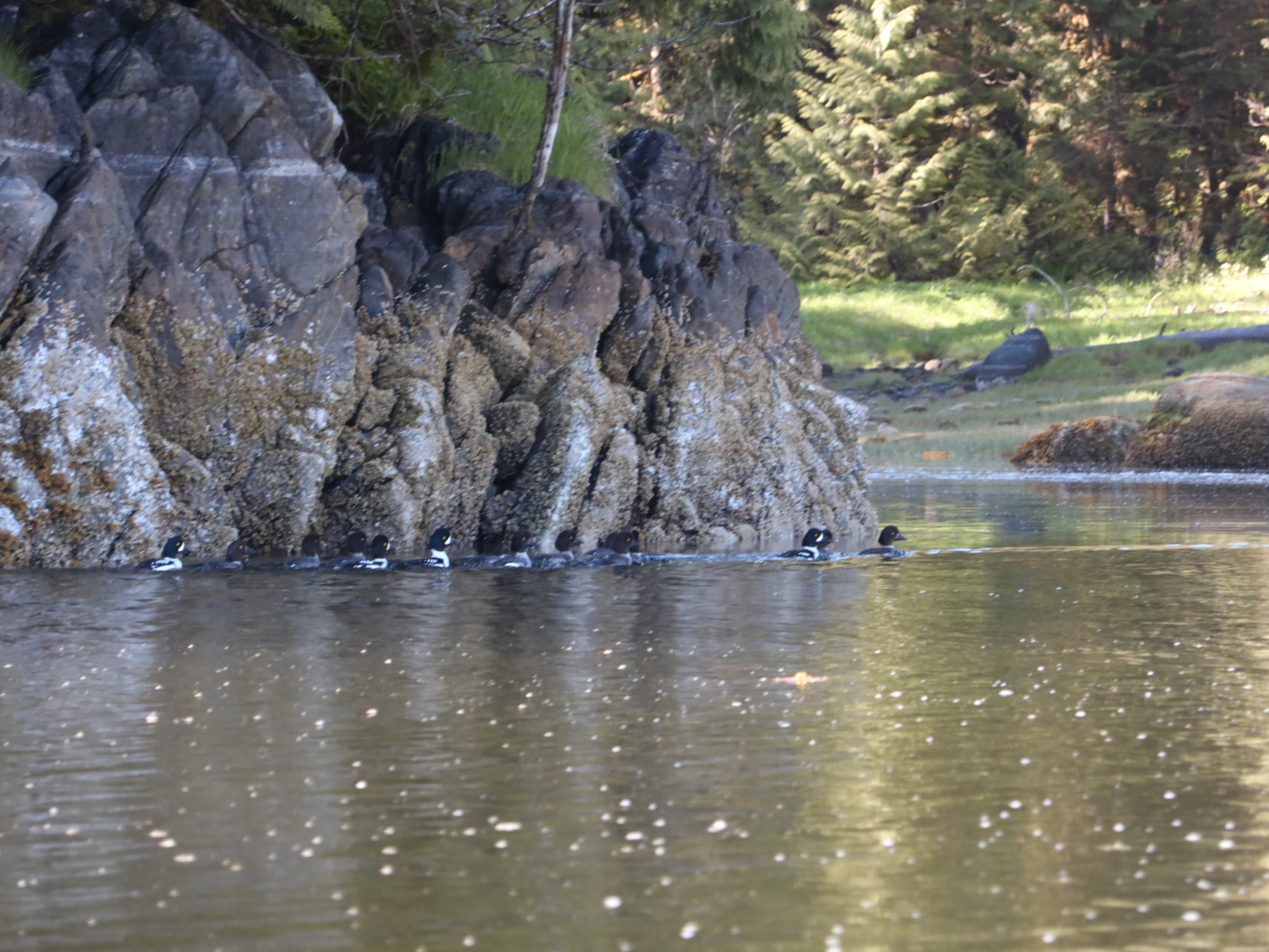
A small flock of black and white ducks swimming in single file along a craggy, mossy rock wall at the edge of a calm, dark-water inlet.
A small group of Barrow's goldeneyes swimming in the calm, protected waters of Klewnuggit Inlet.

Klewnuggit Inlet Marine Provincial Park wildlife and species highlights

Wildlife viewing is one of the strongest draws of Klewnuggit Inlet Marine Provincial Park. The sheltered waters of the inlet are used by flocks of sea ducks such as Barrow's goldeneyes, which forage in the calm channel waters. Harbour seals are also regularly present in the inlet, often approaching boats and shorelines with what observers describe as curious behaviour.

Beyond these well-documented species, the inlet and its surrounding forest provide habitat for typical northern coastal fauna. Marine birds, intertidal invertebrates, and coastal forest species all share this environment, and the protection of foreshore and upland together helps maintain the link between marine and terrestrial food webs.
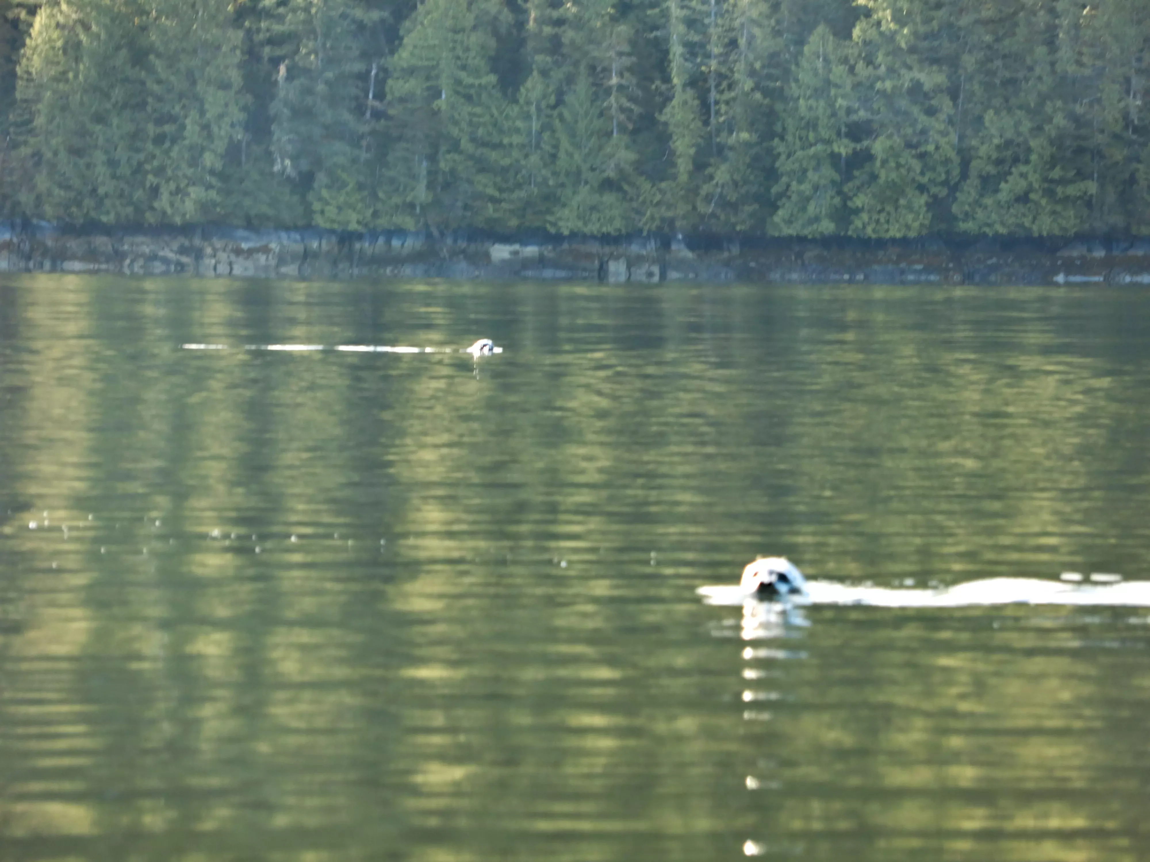
Two harbour seals swim with their heads above the surface of a calm inlet, with a dense coniferous forest visible on the shoreline in the background.
Harbour seals swimming in the calm waters of Klewnuggit Inlet.

Klewnuggit Inlet Marine Provincial Park conservation status and protection priorities

Klewnuggit Inlet Marine Provincial Park is managed under IUCN Category II, placing it among BC's more strictly protected reserves. The park's main conservation value lies in safeguarding a relatively undisturbed coastal inlet and its surrounding upland as a single protected unit.

By combining roughly 292 hectares of foreshore with about 1,508 hectares of upland, the park protects not just marine waters but also the forest, freshwater systems, and shoreline transitions that support them. This approach of pairing foreshore with upland protection mirrors the broader BC Parks strategy for marine coastal reserves in remote areas.

Its distance from Prince Rupert and limited access also help keep the park's habitats in a relatively undisturbed state, supporting the long-term ecological value of the inlet as a refuge for marine birdlife, seals, and associated coastal species.

Top sights and standout views in Klewnuggit Inlet Marine Provincial Park

Klewnuggit Inlet Marine Provincial Park's highlights include the protected inlets of Grenville Channel's east shore, the small islets scattered through the East Finger, and the dramatic Brodie Lake waterfall emptying into the sea. Together these features give the park its character as a coastal place defined by the meeting of forest, freshwater, and sheltered saltwater.

The presence of feeding flocks of Barrow's goldeneyes and approachable harbour seals adds a strong wildlife dimension, making the park as interesting for naturalists and paddlers as for travellers simply passing through Grenville Channel.

Best time to visit Klewnuggit Inlet Marine Provincial Park

Klewnuggit Inlet lies within the temperate coastal climate zone of northern British Columbia, where conditions are generally milder and wetter year-round than inland. Summer and early autumn typically offer the calmest boating conditions in Grenville Channel and the most comfortable scenery for viewing the inlet's waterfalls, forested shores, and islets. Wildlife viewing opportunities for seals and sea ducks tend to be consistent across the milder months. Visitors in shoulder seasons can expect heavier rainfall, reduced visibility, and more variable marine conditions.
Monthly climate preview

Long-term temperature ranges and precipitation patterns across the representative coordinate

Klewnuggit Inlet Marine Provincial Park Climate Normals and Monthly Weather Records

Historical climate normals for Klewnuggit Inlet Marine Provincial Park record mean monthly temperatures from 1.81 degrees Celsius to 14.14 degrees Celsius alongside shifting precipitation rates. Reviewing the complete twelve-month profile provides detailed meteorological data for the protected area.
Annual mean7 °C
2 °C14 °C
Jan
Feb
Mar
Apr
May
Jun12°
Jul14°
Aug14°
Sep12°
Oct
Nov
Dec
Warmest month
August

14.1 °C

Coolest month
January

1.8 °C

Wettest month
November

9.2 mm/day

Driest month
July

3.5 mm/day

Park location guide

Geography guide, regional context, and park location map for Klewnuggit Inlet Marine Provincial Park

Klewnuggit Inlet Marine Provincial Park park geography, regions, and map view in Canada

Understand where Klewnuggit Inlet Marine Provincial Park sits in Canada through a broader geographic reading of the surrounding landscape, nearby location context, and its mapped position within the national park landscape.

How Klewnuggit Inlet Marine Provincial Park fits into Canada

Canada is a federal parliamentary constitutional monarchy spanning North America from the Atlantic to the Pacific and Arctic Oceans. With a population of over 41 million, it is officially bilingual in English and French at the federal level. The country gained independence from the United Kingdom through a gradual process culminating in 1982.

Wider geography shaping Klewnuggit Inlet Marine Provincial Park in Canada

Canada occupies the northern portion of North America, sharing its longest international border with the United States. The country extends from the Atlantic Ocean to the Pacific Ocean and northward into the Arctic Ocean, giving it the longest coastline of any nation.

Map view of Klewnuggit Inlet Marine Provincial Park

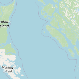
Use this park location map to pinpoint Klewnuggit Inlet Marine Provincial Park in Canada, understand its exact geographic position, and read its mapped placement within the surrounding landscape more clearly.

Pigeon | © OpenStreetMap contributors

Location context for Klewnuggit Inlet Marine Provincial Park

British Columbia

Visualizing the coastal landscapes, sheltered inlets, and forest habitats of northern British Columbia

Klewnuggit Inlet Marine Provincial Park Photos and Scenery

Visual documentation captures the steep forested slopes, calm saltwater channels, and fjord-like topography defining Klewnuggit Inlet Marine Provincial Park. Examining these protected area views reveals how marine inlets, waterfalls, and freshwater lakes intersect in a remote coastal setting.

A wide, scenic view of a quiet, reflective inlet surrounded by dense coniferous forest and mountains with snow-covered peaks under a clear blue sky with light clouds.

A view across a calm inlet towards small, rocky islets in the foreground, backed by a thick evergreen forest and snow-dusted mountains in the distance.

A low, rocky shoreline backed by a dense coniferous forest with small waterfalls cascading directly into the dark blue water of a marine inlet.

A small flock of black and white ducks swimming in single file along a craggy, mossy rock wall at the edge of a calm, dark-water inlet.

Two harbour seals swim with their heads above the surface of a calm inlet, with a dense coniferous forest visible on the shoreline in the background.

Park atlas

Compare adjacent marine environments, sheltered waterways, and protected coastal landscapes

Parks Near Klewnuggit Inlet Marine Provincial Park and Surrounding Coastal Reserves

Browse other protected areas and marine reserves situated along the coastal waterways of northern British Columbia. Comparing adjacent park geography reveals broader ecological patterns across the regional Inside Passage network.
A soft watercolor painting of a winding river flowing through a lush, green landscape with forested hills in the background.
Nature reserveBritish Columbia
About 61 km away#1 closest

North

Gamble Creek Ecological Reserve: Protected Nature Reserve Geography and Forest Map

British Columbia North Coast forest and peatland research landscape.

Situated on the North Coast of British Columbia, Gamble Creek Ecological Reserve is a designated nature reserve comprising forest and bog ecosystems. The protected area serves as an important site for studying plant communities, including sphagnum moss and coastal bog species, within a unique altitudinal transition between coastal hemlock and subalpine zones.

Area
10.26 km²
Established
1991
IUCN
Ia
Relief
Mixed relief
A watercolor painting showing a lake, a forested shoreline, and distant mountains in a soft palette.
State or regional parkBritish Columbia
About 68 km away#2 closest

Northwest

Diana Lake Provincial Park: Mapping Coastal Rainforest and Wetland Geography in British Columbia

An examination of North Coast forest and freshwater ecosystems

Diana Lake Provincial Park represents a significant protected area in British Columbia, showcasing the diverse ecological character of the North Coast. The park boundary encompasses a mosaic of old-growth rainforest, open blanket bogs, and freshwater aquatic systems. By protecting these varied terrains, the region maintains vital habitats for Pacific salmon species while providing a structured landscape for understanding the wet maritime environment of the Pacific Northwest.

Area
2.33 km²
Established
1980
IUCN
II
Relief
Upland
Watercolor painting of a coastal scene with green islands, coniferous trees, and soft, hazy mountains in the background, set against a white background.
Marine protected areaBritish Columbia
About 68 km away#3 closest

Northwest

Kitson Island Marine Provincial Park Map and Coastal Protected Area Atlas

Protected island and estuarine landscape in British Columbia

Kitson Island Marine Provincial Park encompasses a vital coastal island and the adjacent Flora Bank at the mouth of the Skeena River. This protected marine environment provides a rare example of accessible sandy beach terrain on the North Coast. Use this atlas resource to understand the park boundaries, island geography, and estuarine interface within the broader Inside Passage conservation network.

Area
0.45 km²
Established
1993
IUCN
II
Relief
Lowland
A soft watercolor illustration depicting a calm river scene with evergreen trees, a grassy riverbank, and distant rolling hills in pale green and pink tones.
State or regional parkBritish Columbia
About 77 km away#4 closest

North

Exchamsiks River Provincial Park: Protected Old-Growth Forest Geography in British Columbia

A rare maritime Sitka spruce landscape in the Skeena River estuary

Situated at the meeting of the Exchamsiks and Skeena rivers, this provincial park protects a significant stand of unlogged old-growth coastal rainforest. The terrain provides a compact, ecologically essential example of the temperate habitat characteristic of British Columbia's north coast, featuring moisture-loving spruce and salmonberry understory landscapes.

Area
0.182 km²
Established
1956
Relief
Lowland
Climate
Temperate
State or regional parkBritish Columbia
About 106 km away#5 closest

North

Khutzeymateen Provincial Park: Protected Wilderness and Coastal Forest Geography

North Coast British Columbia protected area and estuary map.

Khutzeymateen Provincial Park represents a pivotal conservation achievement on the British Columbia North Coast. This wilderness sanctuary protects a critical estuarine complex where rugged mountain ranges meet a sheltered Pacific inlet. Beyond its designation as a grizzly bear stronghold, the park holds globally significant old-growth Sitka spruce forests, providing a rare look at an intact temperate rainforest landscape.

Area
450.52 km²
Established
1994
IUCN
Ib
Relief
Mountain
A soft, light watercolor painting of a winding river flowing through a forested valley with distant, muted mountain ranges under a pale sky.
Protected areaBritish Columbia
About 123 km away#6 closest

Southeast

Kitlope Heritage Conservancy: Coastal Temperate Rainforest and Mountain Watersheds

A vast protected area in the Kitimat-Stikine region of British Columbia

Spanning from the Gardner Canal to glaciated inland summits, the Kitlope Heritage Conservancy protects an entire, undisturbed watershed. It is defined by its transition from saltwater fjords through ancient, salmon-bearing river valleys to high granite peaks, acting as a vital benchmark for coastal ecosystem integrity in the Pacific Northwest.

Area
3,220.2 km²
Established
1996
IUCN
Ib
Relief
Mountain
State or regional parkBritish Columbia
About 130 km away#7 closest

Northeast

Kitsumkalum Provincial Park: Geography and Landscape Atlas of Northern British Columbia

Mapped protected areas and forest terrain in the Skeena region

Kitsumkalum Provincial Park serves as a compact protected node within the mountainous landscape of northern British Columbia. This record details the park's transition from lake to river outlet, the surrounding coniferous forests, and the geographic significance of the Skeena watershed. Gain spatial insight into the park boundaries and the historical context of its shoreline where early homesteading once flourished.

Area
0.4 km²
Established
1946
IUCN
II
Relief
Lowland
A soft watercolor illustration depicting a winding creek bordered by pine forests, with rolling mountains in the background, set against a plain white background.
State or regional parkBritish Columbia
About 133 km away#8 closest

Northeast

Kleanza Creek Provincial Park: Coast Mountains Canyon and Salmon Protected Landscape

Regional protected geography in northwestern British Columbia

Kleanza Creek Provincial Park offers an intimate look at a rugged Coast Mountains landscape. The area is defined by its deep, forested rock canyons and the cascading waters of Kleanza Creek, which serve as essential habitat for spawning pink salmon. This protected site retains historical significance from nineteenth-century placer mining and provides a compact example of the complex terrain found in this part of British Columbia.

Area
2.69 km²
Established
1956
Relief
Mountain
Climate
Temperate

Common questions about visiting, size, designation, and location context for Klewnuggit Inlet Marine Provincial Park

Klewnuggit Inlet Marine Provincial Park FAQs for park facts, access, geography, and protected area context

Find quick answers about Klewnuggit Inlet Marine Provincial Park, including protected-area facts, park geography, trail and visitor context, and how the park fits into its surrounding country and regional landscape.
MoriAtlas Explorer

Continue Your Protected Areas Search Across the Global Atlas

Deepen your exploration by continuing the structured search for national parks and protected areas worldwide. Utilize the comprehensive filtering capabilities to compare different conservation landscapes and refine your understanding of global park geography. Discover more about the distribution and characteristics of protected natural areas.

Global natural geography