
Mori Atlas logo
Nature reserveKogelberg Nature Reserve

A rugged coastal mountain landscape protecting diverse fynbos, river corridors, and relic forests.

Kogelberg Nature Reserve: Mapping the Protected Fynbos Mountains of the Western Cape Region

Kogelberg Nature Reserve serves as a vital protected area within the Western Cape province of South Africa, preserving the heart of the fynbos biome. The landscape encompasses steep sandstone slopes, deep river gorges, and coastal mountain ridges that define this botanical hotspot. This territory functions as a core conservation zone, supporting an intricate geography of riparian forests and pristine mountain terrain across its protected boundaries.

fynbosmountain landscapebiodiversity hotspotCape Floral Regionprotected nature reservecoastal mountains
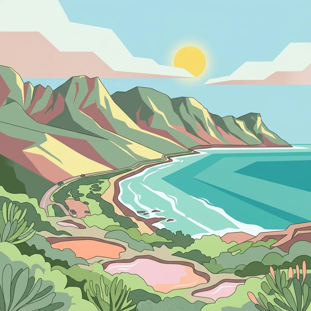
A colorful flat illustration depicting a coastal landscape with green mountains meeting a turquoise ocean, featuring a winding road along the cliffs, blooming fynbos in the foreground, and a bright yellow sun in the sky.

Kogelberg Nature Reserve

Nature reserve

Park overview

Structured park overview, official facts, and landscape profile for Kogelberg Nature Reserve

Kogelberg Nature Reserve park facts, protected area profile, and essential visitor context

Review the core facts for Kogelberg Nature Reserve, including designation, size, terrain, visitor scale, habitats, and operating context in one park-focused overview.

About Kogelberg Nature Reserve

Kogelberg Nature Reserve occupies a special place within South Africa's network of protected natural areas. Located along the mountainous coast east of Cape Town, it captures a major portion of the Kogelberg Mountain Range, a rugged sandstone terrain that drops toward False Bay and the surrounding coastal plain. Its position between Gordon's Bay and Kleinmond gives it a distinct coastal-mountain character, where steep slopes, deep gorges, river valleys, and forest pockets coexist within a compact reserve boundary.

The defining identity of the reserve is botanical. It protects a large share of Kogelberg Sandstone Fynbos, a vegetation type renowned for the sheer number of plant species packed into a small area. The reserve contains roughly 1,600 plant species, including many Protea and Erica species and an unusually high share of endemic plants. This scale of diversity in such a limited area has shaped Kogelberg's reputation as a globally important reference site within the Cape Floral Region and one of the most botanically rich protected landscapes in the world.

Ecologically, the reserve is more than a single vegetation type. While fynbos dominates the mountain slopes, the lower valleys and watercourses contribute a contrasting natural character. The riparian zone of the Palmiet River remains one of the least disturbed in the southwestern Cape and supports indigenous trees such as wild almond, butter-spoon, Rapanea, and yellowwoods. Shaded kloofs and ravines shelter small relic stands of Southern Afrotemperate Forest, places like Louwsbos, Platbos, and Oudebos where Afrotemperate forest species survive in micro-refugia within the broader fynbos matrix. Wetlands add a further layer to the ecological mosaic.

Administratively and conceptually, the nature reserve sits at the core of the larger Kogelberg Biosphere Reserve, a roughly 1,000-square-kilometre zoning framework in which the reserve functions as the strictly protected central area, surrounded by buffer zones of natural vegetation and environmentally compatible land use, and transition zones of conservation-aware farms and towns. This biosphere context reinforces the reserve's role not just as a stand-alone protected site, but as a regional anchor for long-term landscape conservation along the Cape's mountainous coast.

Quick facts and research context for Kogelberg Nature Reserve

Kogelberg Nature Reserve is a 3,000-hectare protected mountain landscape in South Africa's Western Cape, situated in the Kogelberg Mountains between Gordon's Bay and Kleinmond. It protects a major share of the Kogelberg Sandstone Fynbos vegetation type and is widely considered the heart of the fynbos biome.

The reserve contains roughly 1,600 plant species and is recognized for having one of the highest concentrations of plant diversity per unit area of any place in the world. It forms the core conservation area of the larger Kogelberg Biosphere Reserve and is managed under formal nature reserve standards.

Protection and recognition

Documented terrestrial conservation scope and established designation year

Kogelberg Nature Reserve Protection Status and Designation History

Kogelberg Nature Reserve maintains a documented terrestrial protection status established in the year 1987. Comprehensive conservation records outline the governing management scope and official designation history for this protected landscape.

Protection details

Protection scope
Terrestrial
Designated year
1987
Park context

Deeper park guide and search-rich context for Kogelberg Nature Reserve

Kogelberg Nature Reserve history, landscape, wildlife, and travel context

Explore Kogelberg Nature Reserve through its history, landscape character, ecosystems, wildlife, conservation priorities, cultural context, and seasonal travel timing in a structured park guide built for atlas discovery and search intent.

Why Kogelberg Nature Reserve stands out

Kogelberg Nature Reserve is best known for its extraordinary concentration of fynbos plant diversity, particularly within the Kogelberg Sandstone Fynbos vegetation type. It is often described as the heart of the fynbos biome and is a key reference site for understanding Cape Floral Region biodiversity. The reserve is also known for combining this botanical richness with a dramatic coastal mountain landscape, including sandstone peaks, river gorges such as the Steenbras, and contrasting forest pockets that support unusually varied vegetation within a relatively small area.
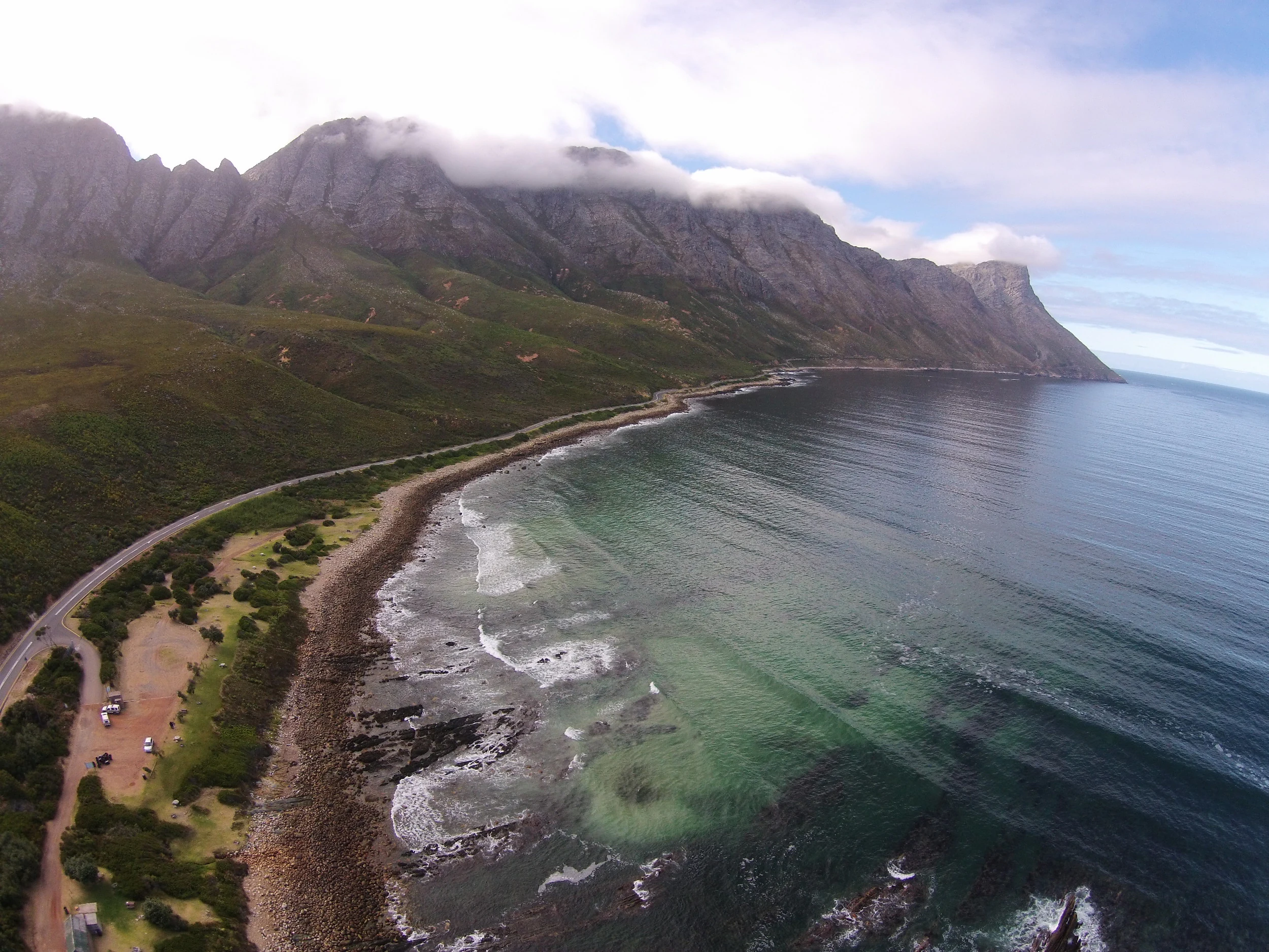
An aerial view of a coastline with a long beach and rocky shore, a winding coastal road, and high mountain ridges partially obscured by clouds.
Aerial view of the coastline at Kogel Bay, where steep coastal mountains meet the Atlantic Ocean.

Kogelberg Nature Reserve history and protected-area timeline

The protected landscape of Kogelberg has a long human history layered beneath its present-day conservation status. Before colonial contact, the mountains were inhabited by San hunter-gatherers and Khoi herders, whose shell-middens and burial sites still mark parts of the landscape. During the early colonial period, explorers occasionally entered the mountains and remarked on the area's dramatic scenery and wildlife, but the terrain proved too rugged and inaccessible for permanent settlement or farming, which helped keep the region largely intact.

In the early 19th century, the Cape Colony government designated the area as Crown Land. For decades afterward, it remained effectively untouched until 1935, when a road was finally built through the rugged terrain. Access brought rapid change: by 1937, the Department of Forestry had assumed control and began planning the conversion of the region into state timber plantations, a shift that would have fundamentally altered the mountain landscape.

The idea of preserving the area instead emerged in the mid-20th century, largely through the efforts of local landowner Harry Molteno. On 18 April 1951, he proposed establishing a nature reserve to his Cape Tercentenary Foundation board. A passionate fynbos advocate, Molteno argued for restoring the mountain range to its natural state. He secured the support of the Cape Western Conservancy and Professor Harold Compton of Kirstenbosch Botanical Gardens and, with his personal financial contribution, made the reserve a reality. The original protected area comprised land south of the N2 and west of the Palmiet River, complete with fencing, infrastructure, and biological surveys.

In 1987, the reserve's administration transferred to Cape Nature Conservation, under whose stricter standards the area formally gained its nature reserve designation. Later milestones include the construction of new visitor facilities in 2012 and continued expansion of the surrounding biosphere reserve framework that now envelopes the protected core.

Kogelberg Nature Reserve landscape and geographic character

The Kogelberg Mountain Range defines the physical character of the reserve. Much of the terrain consists of steep sandstone slopes, rocky ridges, and deeply incised valleys that fall toward the coast between Gordon's Bay and Kleinmond. The mountain slopes within the reserve are closed to the public and remain strictly protected, preserving the visual and ecological integrity of the rugged interior.

The reserve's landscape is strongly shaped by water. The Palmiet River runs through part of the reserve, supporting an almost untouched riparian corridor in the southwestern Cape. The Steenbras River Gorge offers another distinctive landform, with hiking access along valleys and waterfalls that frame a more approachable view of the otherwise restricted mountain interior.

Along the coast, the R44 road traces the mountainous edge of the reserve, offering sweeping views of cliffs, ocean, and mountain slopes. The interplay of mountains, ravines, rivers, and sea creates a compact yet visually varied landscape, where high fynbos slopes, forested kloofs, and coastal vistas sit within a single protected setting.
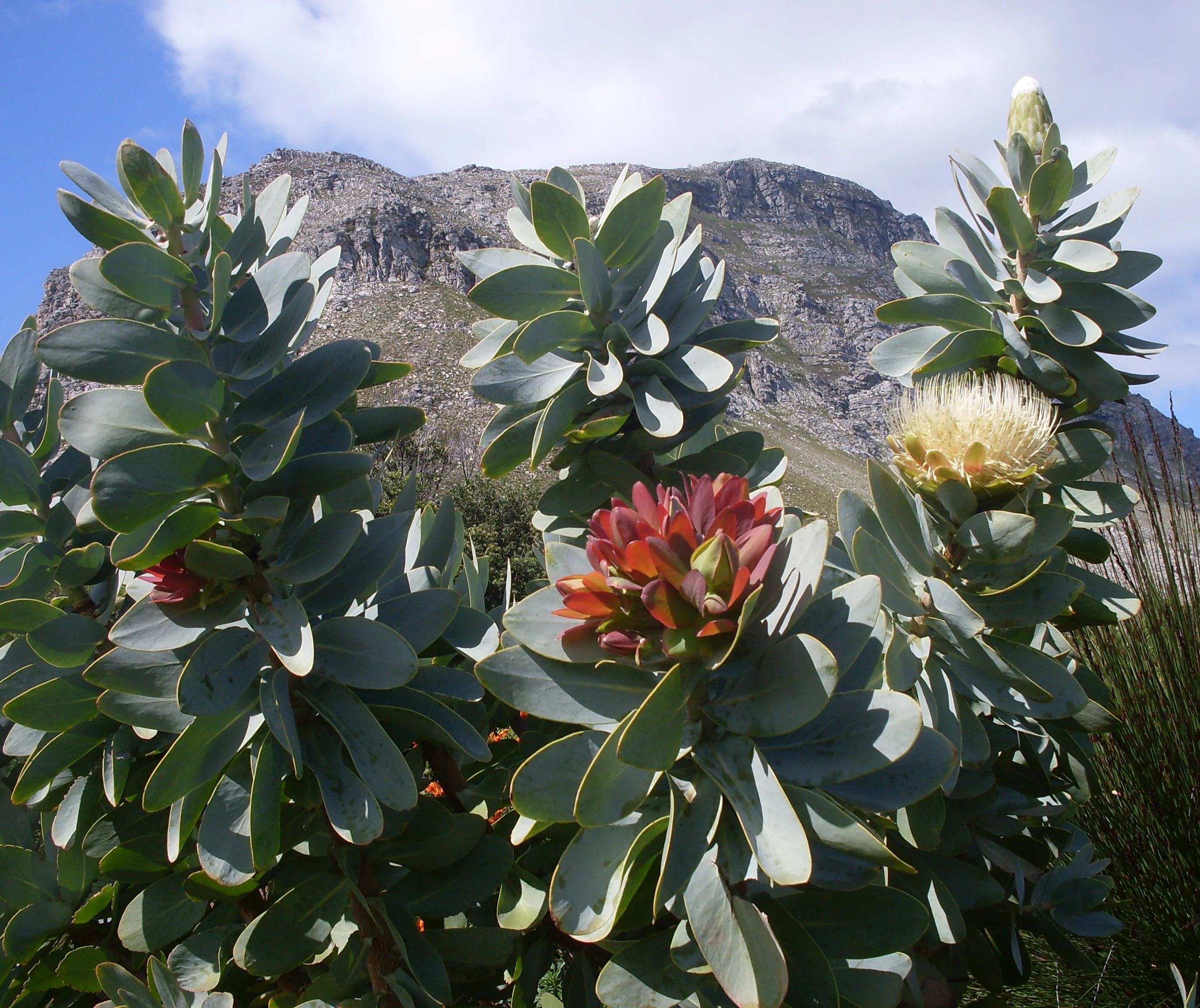
A close up view of a Protea nitida shrub with silvery-green leaves and a blooming flower head, set against a blurred, rocky mountain ridge under a blue sky.
Protea nitida, also known as the Waboom, thriving against the mountain backdrop of the Kogelberg Nature Reserve.

Kogelberg Nature Reserve ecosystems, habitats, and plant life

Kogelberg Nature Reserve is, above all, a sanctuary for the fynbos biome. The reserve's ecological identity is anchored in Kogelberg Sandstone Fynbos, a vegetation type found only within this part of the Cape and renowned for exceptional species richness. Hundreds of Erica species and a wide variety of Protea species contribute to the diversity, along with many plant families that are endemic either to the fynbos or to the Kogelberg area specifically. The mountains are commonly considered the heart of the fynbos biome, and the reserve captures a significant share of this irreplaceable vegetation.

Beyond the mountain fynbos, the reserve's nature is layered. Wetlands add a contrasting ecological tone, while the Palmiet River's riparian zone hosts indigenous trees and forest vegetation that is unusually well preserved. These forests include wild almond, butter-spoon, Rapanea, and yellowwoods, creating pockets of woodland within the broader fynbos landscape.

A further, more subtle layer of nature is found in the reserve's shaded ravines and river valleys. Small relic stands of Southern Afrotemperate Forest, such as those at Louwsbos, Platbos, and Oudebos, persist as micro-refugia where forest-adapted species survive within the fynbos-dominated terrain. Together, these systems give Kogelberg an unusually varied ecological character for a reserve of its size.
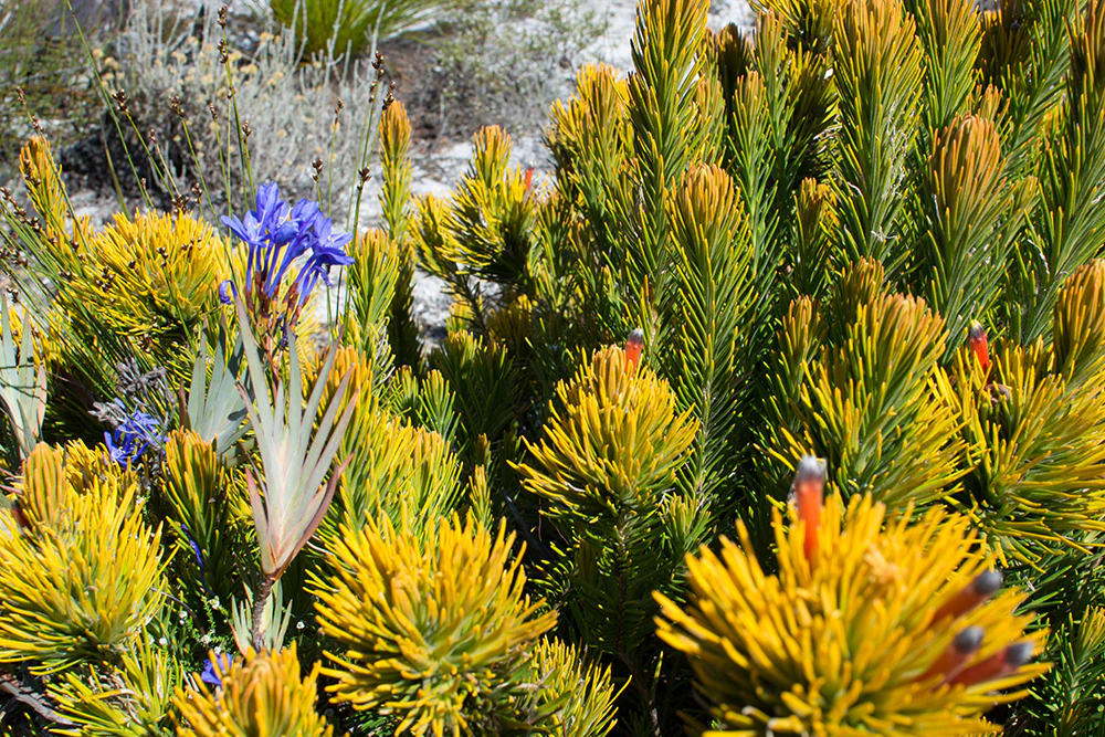
A close-up view of diverse fynbos plants including needle-like yellow-tipped foliage and small clusters of vibrant purple flowers in Kogelberg Nature Reserve.
Fynbos vegetation in Kogelberg Nature Reserve, showcasing diverse plant textures and colors.

Kogelberg Nature Reserve wildlife and species highlights

Kogelberg's wildlife character is shaped as much by its habitats as by any single species. The mountain fynbos, wetlands, riverine forests, and coastal edge each support different animal communities, and the reserve's strict protection of mountain slopes has helped preserve fauna patterns typical of the southwestern Cape.

Larger mammals such as the chacma baboon are part of the reserve's visible wildlife, often seen along forested and riverine areas like the Steenbras River Gorge. The combination of forest patches, rocky kloofs, and open fynbos slopes provides a mix of foraging and shelter habitats, while the coastal edge of the reserve occasionally reveals marine wildlife such as whales and dolphins visible from the scenic R44 road.

Birds, smaller mammals, reptiles, and insects benefit from the reserve's habitat diversity, where transitions between fynbos, wetland, and forest support varied feeding and breeding niches. The reserve's role within the broader Kogelberg Biosphere Reserve further strengthens habitat continuity for wildlife across the region.
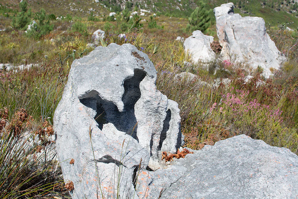
Several light grey, weathered rock outcrops stand in a field of fynbos, with a prominent rock in the foreground featuring a natural hollow or hole.
Weathered rock formations surrounded by indigenous fynbos vegetation in Kogelberg Nature Reserve.

Kogelberg Nature Reserve conservation status and protection priorities

Kogelberg Nature Reserve's conservation significance is rooted in the global importance of the fynbos biome. By protecting a substantial portion of the Kogelberg Sandstone Fynbos, the reserve safeguards a vegetation type whose plant diversity per unit area is unmatched anywhere else in the world. This makes the reserve not only a regional asset but also a globally meaningful conservation site within the Cape Floral Region.

The reserve's designation as the core conservation area of the Kogelberg Biosphere Reserve strengthens its conservation role. Surrounding buffer and transition zones extend habitat protection and ecologically sensitive land use outward from the strictly protected core, creating a graduated framework for long-term landscape conservation along the Cape coast.

Kogelberg also serves as a key reference area for fynbos research and management. Its long-standing ties to Kirstenbosch Botanical Gardens and conservation institutions, along with formal biological surveys, have helped establish it as a benchmark for understanding, monitoring, and protecting fynbos ecosystems. The continued strict protection of its mountain slopes, combined with the carefully managed access through valleys such as the Steenbras River Gorge, reflects an effort to balance ecological preservation with limited, low-impact public engagement.

Kogelberg Nature Reserve cultural meaning and human context

The cultural landscape of the Kogelberg Mountains stretches back to the region's earliest inhabitants. The mountains were home to San hunter-gatherers and Khoi herders, whose presence is still recorded archaeologically through shell-middens and burial sites scattered across the terrain. These traces of early indigenous life form part of the longer human story of the area.

During the colonial era, the ruggedness of the mountains discouraged permanent settlement, and early European explorers' accounts of the area's unusual beauty and abundant wildlife gradually shaped outside awareness of the landscape. The eventual push to protect the region in the 20th century, led by figures such as Harry Molteno and supported by institutions including the Cape Western Conservancy and Kirstenbosch Botanical Gardens, also became part of the reserve's cultural legacy, linking the natural heritage of the mountains to a wider Cape conservation tradition.
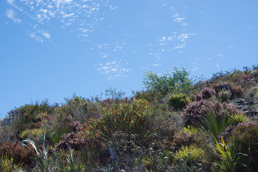
A close up view of fynbos scrubland vegetation covering a hillside under a blue sky with light clouds.
Fynbos vegetation covering the mountainous terrain of Kogelberg Nature Reserve.

Top sights and standout views in Kogelberg Nature Reserve

Standout qualities of Kogelberg Nature Reserve include its extraordinary botanical richness, with roughly 1,600 plant species concentrated within its 3,000 hectares, and its position at the heart of the Cape fynbos biome. The reserve's protection of a major share of Kogelberg Sandstone Fynbos, including numerous endemic and narrowly distributed species, places it among the most botanically significant protected areas in the world.

Equally notable is the reserve's ecological layering: from mountain fynbos to Palmiet River riparian forests, from relic Southern Afrotemperate Forest patches in shaded kloofs to coastal views along the R44 road. Combined with its role as the core conservation area of the Kogelberg Biosphere Reserve and its dramatic coastal mountain setting between Gordon's Bay and Kleinmond, Kogelberg offers a compact but exceptionally varied natural experience.
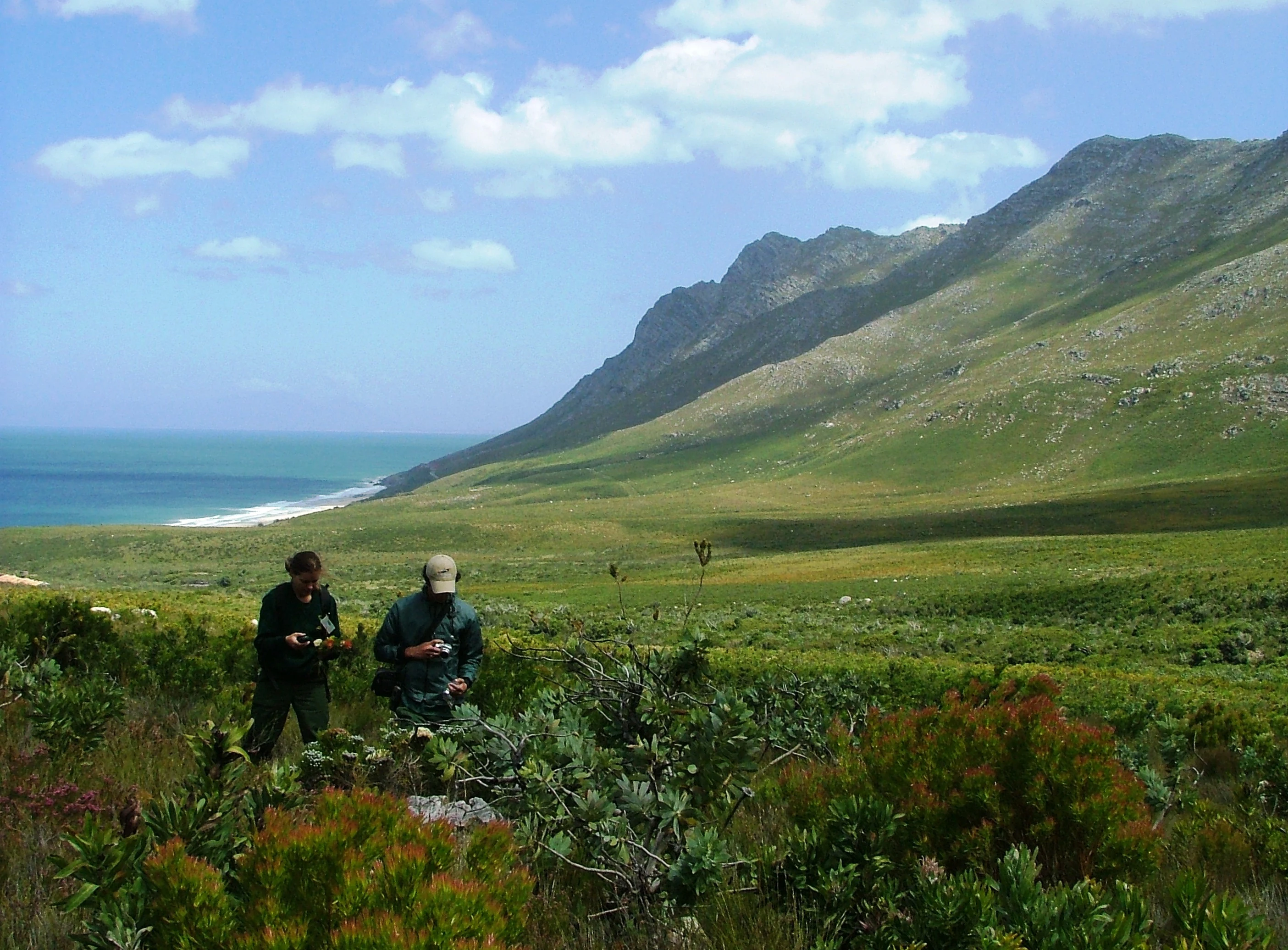
Two people standing in a vast, open landscape of coastal fynbos with steep, green mountains rising in the background next to the blue ocean.
Visitors exploring the coastal mountain slopes of Kogelberg Nature Reserve.

Best time to visit Kogelberg Nature Reserve

The Kogelberg Mountains enjoy a Mediterranean-type climate, where seasonal shifts largely shape the atmosphere of a visit. Winter and spring months, broadly from late autumn through to early spring, tend to be the greenest and most florally active period, when fynbos species, including Proteas and Ericas, are often at their most expressive and waterfalls in the Steenbras River Gorge run more strongly.

Summer months bring drier, warmer conditions, with clearer skies, more exposed mountain scenery, and opportunities to combine inland visits with views of coastal wildlife such as whales and dolphins from the scenic R44 road. Hiking and general exploration are often more comfortable in drier periods, while the wetter seasons reward visitors focused on flowers, greenery, and the lush character of the reserve's forested valleys and river systems.
Monthly climate preview

Long-term temperature and precipitation records measured at representative coordinate elevations

Kogelberg Nature Reserve Climate Normals and Monthly Weather Statistics

Representative coordinates record distinct seasonal variations in temperature and precipitation across the recorded monthly cycle. Examining twelve-month averages provides essential context for understanding long-term environmental patterns throughout the reserve.
Annual mean17 °C
14 °C20 °C
Jan20°
Feb20°
Mar19°
Apr18°
May16°
Jun15°
Jul14°
Aug14°
Sep15°
Oct16°
Nov17°
Dec19°
Warmest month
February

20.3 °C

Coolest month
August

14 °C

Wettest month
June

3.5 mm/day

Driest month
February

0.5 mm/day

Park location guide

Geography guide, regional context, and park location map for Kogelberg Nature Reserve

Kogelberg Nature Reserve park geography, regions, and map view in South Africa

Understand where Kogelberg Nature Reserve sits in South Africa through a broader geographic reading of the surrounding landscape, nearby location context, and its mapped position within the national park landscape.

How Kogelberg Nature Reserve fits into South Africa

South Africa is the southernmost country in Africa, spanning 1.22 million km² with a population of over 63 million. The country operates with three capital cities, Pretoria (executive), Cape Town (legislative), and Bloemfontein (judicial), and is renowned for its biodiversity, national parks, and multicultural society.

Wider geography shaping Kogelberg Nature Reserve in South Africa

South Africa occupies the southernmost region of Africa, with coastline along both the Atlantic Ocean to the west and the Indian Ocean to the east. The interior features elevated plateaus including the Highveld, with the Drakensberg escarpment marking the eastern highlands. The country shares borders with Namibia, Botswana, Zimbabwe, Mozambique, Eswatini, and Lesotho.

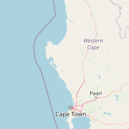
Map view of Kogelberg Nature Reserve

Use this park location map to pinpoint Kogelberg Nature Reserve in South Africa, understand its exact geographic position, and read its mapped placement within the surrounding landscape more clearly.

Pigeon | © OpenStreetMap contributors

Location context for Kogelberg Nature Reserve

Western Cape

Explore protected mountain terrain, fynbos vegetation, and coastal valley habitats.

Kogelberg Nature Reserve Photos and Landscape Scenery Visual Guide

Visual documentation captures the rugged topography, sandstone slopes, and rich fynbos vegetation that define the protected landscape. Examining detailed terrain imagery helps visitors understand the ecological layering and unique botanical character across the mountain reserve.

An aerial view of a coastline with a long beach and rocky shore, a winding coastal road, and high mountain ridges partially obscured by clouds.

A narrow, stony footpath cuts through low-lying shrubbery and colorful fynbos vegetation toward a backdrop of distant mountains under a blue sky.

A close up view of a Protea nitida shrub with silvery-green leaves and a blooming flower head, set against a blurred, rocky mountain ridge under a blue sky.

A close-up view of diverse fynbos plants including needle-like yellow-tipped foliage and small clusters of vibrant purple flowers in Kogelberg Nature Reserve.

Several light grey, weathered rock outcrops stand in a field of fynbos, with a prominent rock in the foreground featuring a natural hollow or hole.

A high-angle view of the Kogelberg Nature Reserve, featuring foreground fynbos vegetation and rocky outcrops leading to rolling mountain hills that descend toward the blue ocean in the distance.

A close up view of fynbos scrubland vegetation covering a hillside under a blue sky with light clouds.

Two people standing in a vast, open landscape of coastal fynbos with steep, green mountains rising in the background next to the blue ocean.

Park atlas

Compare adjacent mountain reserves and regional conservation areas across the Western Cape.

Explore Parks Near Kogelberg Nature Reserve and Surrounding Protected Landscapes

Continue exploring protected areas near Kogelberg Nature Reserve by browsing adjacent mountain reserves and coastal conservation zones. Comparing these surrounding protected landscapes reveals broader regional vegetation patterns and connected ecological corridors.
Watercolor painting of a mountain landscape with green foreground hills and soft purple mountain ranges in the background.
Nature reserveWestern Cape
About 37 km away#1 closest

North

Jonkershoek Nature Reserve: A Detailed Atlas of Mountain Catchment and Fynbos Ecology

Protected mountain geography near Stellenbosch, Western Cape

Jonkershoek Nature Reserve serves as a primary water source for the surrounding Western Cape landscape. This profile outlines the reserve's role in the Cape Floral Region, detailing its complex mountain topography, river headwaters, and significant fynbos plant communities that characterize the terrain.

Area
110 km²
Relief
Mountain
Climate
Mediterranean
Access
Easy access
National parkWestern Cape
About 38 km away#2 closest

Northwest

Table Mountain National Park: Mapped Protected Landscape and Geographic Context in Western Cape

National Park details focused on atlas exploration and regional geography.

Table Mountain National Park is a designated national park within the Western Cape region, offering a distinct geographic profile for atlas exploration. This entity provides detailed mapped boundaries and landscape context, crucial for understanding its role as a protected area in South Africa. Users can explore the specific geography that defines this park and its place within the broader regional context, making it a key point of interest for structured geographic discovery and map-based research.

Area
221 km²
Established
1998
Relief
Mountain
Climate
Mediterranean
Watercolor painting of a soft, hazy mountain landscape with rolling green hills and pink-toned foreground vegetation, presented in a wide panoramic aspect.
Biosphere reserveWestern Cape
About 51 km away#3 closest

West

Cape Floristic Region: A Detailed Geographic Atlas of the Western Cape Biodiversity Hotspot

Mapped protected biosphere reserve and fynbos landscapes

Explore the Cape Floristic Region, an expansive protected landscape within South Africa. This atlas provides a detailed look at the region's Mediterranean shrublands, sandstone-derived soil terrain, and its status as a singular floral kingdom. Understand the geography of the Western Cape through its mountain ranges and diverse ecological zones.

Area
78,555 km²
Established
2004
Nature reserveCape Town
About 54 km away#4 closest

Northwest

Tygerberg Nature Reserve: Geographic Mapping of a Cape Town Protected Landscape

Renosterveld shale ridges and urban conservation context

Tygerberg Nature Reserve stands as a compact, high-value protected area within Cape Town, safeguarding hundreds of plant species and threatened Renosterveld habitats. The park landscape features a recognizable chain of shale hills punctuated by historic termite mounds known as heuweltjies, offering a window into the regional ecology and natural history of the Western Cape.

Area
3 km²
Established
1973
Relief
Upland
Climate
Mediterranean
Biosphere reserveWestern Cape
About 62 km away#5 closest

North

Cape Winelands Biosphere Reserve: Geographic Overview and Protected Area Mapping

Western Cape mountain terrain and sustainable landscape integration

The Cape Winelands Biosphere Reserve serves as a model for integrated landscape management in South Africa. Situated along the Cape Fold Belt, this reserve protects crucial water catchments and endemic floral habitats while encompassing a globally recognized wine-producing region. Access detailed mapping of its core, buffer, and transition zones to see how conservation persists within a working agricultural environment.

Area
1,243.4 km²
Established
2007
Relief
Mountain
Climate
Mediterranean
A horizontal watercolor illustration depicting soft green rolling hills in the background, a line of light green trees in the midground, and foreground vegetation with tall reeds near a calm pinkish water channel.
Nature reserveWestern Cape
About 63 km away#6 closest

Southeast

Dyer Island Nature Reserve Complex: Protected Marine Islands and Coastal Ecosystems

A critical conservation node in the Western Cape

The Dyer Island Nature Reserve Complex encompasses a series of low lying, wind-swept rocky islets that function as a cornerstone for South African marine research. By preserving the crucial breeding grounds of African penguins and providing a hub for the Cape fur seal population, this reserve defines a unique stretch of the Western Cape marine geography where high concentrations of predators and prey interact.

Established
1988
IUCN
Ia
Water
Water-dominated
Nature reserveWestern Cape
About 69 km away#7 closest

East

Salmonsdam Nature Reserve: Atlas of Protected Landscapes in the Western Cape Overberg

Mountain fynbos, river gorges, and forest catchment geography.

Salmonsdam Nature Reserve is a compact protected expanse in the Overberg mountains of the Western Cape. The reserve encompasses the full Paardensberg River catchment, featuring complex terrain that ranges from high rocky ridges to the wet valley floor of Die Weivlakte. Its geography supports a high concentration of Afromontane forest patches and mountain fynbos habitats within a small, accessible area.

Area
8.34 km²
Established
1962
Relief
Mountain
Climate
Mediterranean
National parkWestern Cape
About 73 km away#8 closest

Southeast

Agulhas National Park: National Park Protected Landscape and Geographic Atlas

Mapped boundaries and regional geography in Western Cape.

Agulhas National Park is a protected national park in South Africa's Western Cape, vital for understanding regional geography and mapped landscape features. This entry focuses on its identity as a conservation area, detailing its protected landscape context and geographic setting within the broader atlas of Southern Africa. Explore the specific park boundaries and the unique terrain that defines this significant natural area.

Area
209.59 km²
Established
1998
IUCN
II
Relief
Lowland

Common questions about visiting, size, designation, and location context for Kogelberg Nature Reserve

Kogelberg Nature Reserve FAQs for park facts, access, geography, and protected area context

Find quick answers about Kogelberg Nature Reserve, including protected-area facts, park geography, trail and visitor context, and how the park fits into its surrounding country and regional landscape.
MoriAtlas Explorer

Continue Your Protected Areas Search Across the Global Atlas

Deepen your exploration by continuing the structured search for national parks and protected areas worldwide. Utilize the comprehensive filtering capabilities to compare different conservation landscapes and refine your understanding of global park geography. Discover more about the distribution and characteristics of protected natural areas.

Global natural geography