Mori Atlas logo
Nature reserveKuala Langat North Forest Reserve

A rare old-growth forest fragment serving as a vital ecological anchor in the Selangor lowland landscape

Kuala Langat North Forest Reserve: Protected Peat Swamp Geography and Landscape Mapping

Kuala Langat North Forest Reserve represents a significant remnant of ancient peat swamp forest within the rapidly developing lowland landscape of Selangor, Malaysia. This protected area holds deep historical significance, with canopy trees dating back roughly 8,000 years, and it continues to serve as a vital refuge for endemic wildlife and a cornerstone of regional conservation. Beyond its biological profile, the reserve maintains deep cultural connections to the traditional lands of the Temuan people.

peat swamp forestold growth forestlowland forestprotected forest reserveSelangorMalaysia

Kuala Langat North Forest Reserve

Nature reserve

Park overview

Structured park overview, official facts, and landscape profile for Kuala Langat North Forest Reserve

Kuala Langat North Forest Reserve park facts, protected area profile, and essential visitor context

Review the core facts for Kuala Langat North Forest Reserve, including designation, size, terrain, visitor scale, habitats, and operating context in one park-focused overview.

About Kuala Langat North Forest Reserve

Kuala Langat North Forest Reserve sits in the southern part of the Klang Valley region, within the Kuala Langat District of Selangor state in Peninsular Malaysia. It is one of a shrinking number of lowland peat swamp forests left in the state, a habitat type that has been heavily converted for agriculture and settlement across the Malay Peninsula. The reserve today covers 957.6 hectares, down dramatically from the 7,246.96 hectares originally gazetted in 1927, with the surroundings dominated by housing developments, plantations, and scattered Temuan settlements.

Ecologically, the reserve is characterized by peat swamp forest, a distinctive wetland forest type that develops on waterlogged, acidic peat soils. Portions of the canopy are old growth, with some stands estimated to be around 8,000 years old, making them living relics of the peninsula's pre-modern landscape. Key canopy species include members of the Dipterocarpaceae family, with Rubroshorea leprosula and Shorea uliginosa recorded within the reserve. The habitat supports a surprisingly rich vertebrate fauna given its small size and isolation, including charismatic mammals such as the Malayan sun bear, clouded leopard, and Malayan tapir.

Culturally and politically, the reserve is deeply tied to the Temuan Orang Asli community, who have used the forest since at least the late nineteenth century. A Temuan village, Busut Baru, was established near the reserve in 1993 after a previous settlement was displaced by the construction of Kuala Lumpur International Airport. Traditional Temuan burial grounds lie within the protected area, giving the forest direct cultural and spiritual significance beyond its ecological role.

Between 2020 and 2021 the reserve became the focus of an intense political debate after the Selangor state government proposed the degazetting of most of the forest for mixed development. A private company linked politically and economically to the Selangor government and royal family was allocated most of the land, and a sizable portion was briefly removed from the reserve system. The episode generated tens of thousands of public objections, was raised in the Selangor State Legislative Assembly, and attracted federal-level opposition. Following sustained pressure from lawmakers, civil society groups such as Pertahankan Hutan Simpan Kuala Langat Utara, and Temuan leaders, the state government reversed almost all of the degazetting, restoring the reserve to broadly its previous extent while setting aside a small area for community use.

Quick facts and research context for Kuala Langat North Forest Reserve

Kuala Langat North Forest Reserve is a 957.6 hectare protected peat swamp forest in Kuala Langat District, Selangor, Malaysia. It was first gazetted in 1927 with more than 7,246 hectares, meaning today's reserve represents only about 13% of its original extent.

The forest is old-growth peat swamp, with sections estimated at around 8,000 years old, and it is embedded in a broader landscape of oil palm, agriculture, Temuan villages, and suburban housing. It maintains cultural significance for the Temuan Orang Asli community, including as the location of traditional burial grounds, and is recognized as habitat for endemic species such as the Selangor pygmy flying squirrel and the Langat red fighting fish.

Protection and recognition

Documented terrestrial protection scope, management framework, and official recognition records

Kuala Langat North Forest Reserve Protection Status and Recognition Data

Terrestrial protection status for Kuala Langat North Forest Reserve highlights documented management scope and official administrative records. Conservation data details designated boundaries, territorial coverage, and verified recognition sources for the protected landscape.

Protection details

Protection scope
Terrestrial
Transboundary protection
No
Park context

Deeper park guide and search-rich context for Kuala Langat North Forest Reserve

Kuala Langat North Forest Reserve history, landscape, wildlife, and travel context

Explore Kuala Langat North Forest Reserve through its history, landscape character, ecosystems, wildlife, conservation priorities, cultural context, and seasonal travel timing in a structured park guide built for atlas discovery and search intent.

Why Kuala Langat North Forest Reserve stands out

Kuala Langat North Forest Reserve is best known as a surviving fragment of ancient peat swamp forest in increasingly developed Selangor. Its old-growth canopy, with trees estimated to be several thousand years old, represents one of the last vestiges of lowland peat swamp ecology on the western side of the Klang Valley. It is also well known for hosting rare and endemic wildlife tied specifically to this part of Peninsular Malaysia, including the Selangor pygmy flying squirrel and the Langat red fighting fish, and for being the subject of an internationally watched degazetting controversy between 2020 and 2021 that ultimately restored much of its protected status.

Kuala Langat North Forest Reserve history and protected-area timeline

The Kuala Langat North Forest Reserve has a history stretching back to the early twentieth century. It was first gazetted in 1927 with an area of 7,246.96 hectares, reflecting the period when colonial authorities were beginning to systematically classify and protect Peninsular Malaysia's forests under formal reserve legislation. Temuan Orang Asli communities, however, had already been living in and using the surrounding forests for generations; records indicate Temuan presence in the area since at least 1886.

In the decades after gazettement, the reserve's extent steadily contracted as surrounding land was converted to agriculture, plantations, and residential development. A more disruptive change came in 1993, when a Temuan community was relocated to a new settlement called Busut Baru, near the reserve, after their previous village was cleared for the construction of Kuala Lumpur International Airport. Compensation in the form of more than 400 hectares was promised to the community but was not immediately delivered.

The reserve's modern history is dominated by the degazetting controversy that began in February 2020. The Selangor Forestry Department proposed removing 940 hectares, equivalent to 97% of the reserve, citing fire risk and forest degradation. Further details surfaced in March 2020, when it was revealed that two companies, one with ties to the Selangor royal family and one linked to the state government under Menteri Besar Amirudin Shari, stood to gain from the change. Public hearings in September 2020 drew more than 45,000 objections, and a private member motion in the Selangor State Legislative Assembly rejected the plan unanimously. Despite this, the Selangor State Executive Council proceeded, and on 5 May 2020 the area was degazetted, with the action confirmed later that month. The degazetting was not publicized until August 2020, after which opposition lawmakers, government backbenchers, Temuan leaders, and a civil society coalition mounted public campaigns.

In response to sustained pressure, the state government announced on 8 September 2020 that it would cancel the development plan and regazette most of the reserve. A small portion, around 42 hectares, was set aside for the Temuan community at Busut Baru, and concerns about potential impacts from the MRL East Coast Rail Link were eased after an alternate route was chosen in December 2020. Additional replacement forest reserves elsewhere in Selangor, totalling several hundred hectares, were retained, leaving the Kuala Langat North Forest Reserve as a reduced but still legally protected fragment of its former extent.

Kuala Langat North Forest Reserve landscape and geographic character

The reserve lies on relatively flat lowland terrain in southern Selangor, characteristic of the peat dome systems that historically dominated parts of the Klang Valley periphery. The underlying peat soils are waterlogged and acidic, producing the distinctive hydrology and vegetation profile of peat swamp forest, with tall trees, dense understory layers, and a high water table that defines much of the year.

Surrounding the reserve is a sharply contrasting mosaic of land uses. To the north and west, suburban and peri-urban housing developments have expanded toward the reserve edge, while agricultural land, including oil palm plantations and smallholder plots, occupies other sides. Temuan villages are located within and adjacent to the forest, and traditional Temuan burial grounds lie inside the reserve itself, embedded within the forest landscape.

The reserve's modern appearance is that of a forest island embedded in a heavily modified matrix. Its boundary is unusually close to dense settlement for a protected area of this ecological sensitivity, which has made it both a refuge for forest-dependent species and a focal point of land-use conflicts.

Kuala Langat North Forest Reserve ecosystems, habitats, and plant life

Ecologically, the reserve is dominated by peat swamp forest, one of Southeast Asia's most threatened forest types. The canopy is built around tall, buttressed trees of the Dipterocarpaceae family, with Rubroshorea leprosula and Shorea uliginosa among the documented species. Because the forest has not been subjected to large-scale timber extraction, substantial portions qualify as old growth, with some stands estimated to be on the order of 8,000 years old.

Peat swamp forest is known for its distinctive hydrology. The substrate of accumulated plant material, partially decayed under waterlogged conditions, stores large amounts of carbon and creates a moist, shaded environment. This combination supports a specialized flora, with adaptations to waterlogged root conditions and acidic substrates, and a unique fauna tied to the specific structure of peat swamp habitat rather than surrounding dry-land forests.

Although the reserve is small, its isolation within an otherwise developed landscape makes its ecological role disproportionately important. It functions as a refuge for peat swamp specialists and as a source population for animal and plant species that might recolonize surrounding areas if conditions allow.

Kuala Langat North Forest Reserve wildlife and species highlights

The reserve supports a vertebrate community that is unusually diverse for a forest fragment of its size. Large mammals are among its most striking features, with reliable records of the Malayan sun bear, the Malayan tapir, and the clouded leopard. The occasional presence of black panthers, melanistic leopards, has also been noted.

Among smaller mammals, the reserve hosts at least five squirrel species: slender squirrels, three-striped ground squirrels, shrew-faced squirrels, plantain squirrels, and the endemic Selangor pygmy flying squirrel, which is tied specifically to this corner of Peninsular Malaysia. Rodents include Müller's giant Sunda rat and the Malayan field rat. Bat diversity includes the lesser short-nosed fruit bat and the trefoil horseshoe bat.

The waterways of the reserve harbor the endemic Langat red fighting fish, a freshwater species restricted to the Langat river system. Reptiles include reticulated pythons, along with the forest crested lizard and the oriental garden lizard, and at least five frog species have been identified. A survey in 2020 recorded 19 bird species, reflecting the reserve's continued importance for forest birds despite its reduced extent and fragmented surroundings.

Kuala Langat North Forest Reserve conservation status and protection priorities

The reserve's conservation significance is unusually high for its size, in large part because it preserves a rare example of old-growth lowland peat swamp forest in a region where this habitat has been almost entirely converted. Peat swamp forests are recognized regionally as particularly important reservoirs of biodiversity and carbon, and their loss has implications for both ecological function and climate. The forest stands in the reserve, with sections thousands of years old, represent a living link to a formerly widespread Peninsular Malaysian landscape.

The reserve also serves as a habitat island for endangered and endemic species, including the Selangor pygmy flying squirrel and the Langat red fighting fish, both of which have very limited distributions. Large mammals such as Malayan tapirs and clouded leopards depend on intact forest cover and are considered vulnerable across much of their range, making even small, well-protected fragments like KLNFR critical to their regional persistence.

The degazetting controversy of 2020 to 2021 drew national and international attention to the broader issue of forest reserve protection in Malaysia. Although the dispute ultimately reinforced the reserve's protected status and led to additional replacement forests elsewhere in Selangor, the episode underscored how vulnerable even legally gazetted reserves can be to political and economic pressure. The reserve now occupies a focal position within ongoing debates over lowland forest conservation, indigenous land rights, and the integrity of Malaysia's protected-area system.

Kuala Langat North Forest Reserve cultural meaning and human context

The Kuala Langat North Forest Reserve has long been part of the living landscape of the Temuan Orang Asli, one of the indigenous peoples of Peninsular Malaysia. Temuan communities have used the forest and its surroundings since at least 1886, drawing on its resources for hunting, gathering, medicine, and cultural practice. Traditional Temuan burial grounds are located within the reserve itself, making the forest not only an ecological asset but also a place of enduring cultural and spiritual significance.

In 1993 a Temuan community was relocated to the village of Busut Baru on the edge of the reserve after their previous settlement was cleared to make way for Kuala Lumpur International Airport. This relocation created an ongoing relationship between the village and the forest, and during the degazetting controversy Temuan leaders played a prominent role in defending the reserve, framing its protection as inseparable from their community's heritage and rights.

The reserve's cultural dimension is thus tightly entwined with its ecological and political history. The forest is at once a traditional territory, a burial landscape, a community compensation issue, and a contested site of development, which gives the question of its future a meaning that extends well beyond conservation biology.

Top sights and standout views in Kuala Langat North Forest Reserve

Among Kuala Langat North Forest Reserve's most notable qualities are its ancient peat swamp canopy, with trees estimated at roughly 8,000 years old, and its compact but rich vertebrate community that includes Malayan tapirs, clouded leopards, and Malayan sun bears within a reserve of less than 1,000 hectares. The presence of endemic species such as the Selangor pygmy flying squirrel and the Langat red fighting fish gives the reserve an outsized importance for the region's biodiversity.

Equally striking is the reserve's political and cultural profile. Its survival through a major 2020 to 2021 degazetting fight, supported by a coalition of legislators, environmental groups, and Temuan leaders, makes it one of the better-known recent cases of community-driven forest protection in Peninsular Malaysia.

Best time to visit Kuala Langat North Forest Reserve

The reserve's climate follows the typical equatorial pattern of Peninsular Malaysia, with relatively consistent warm temperatures and high humidity throughout the year. Rainfall is significant in all months, with heavier rainy periods tending to occur during the southwest monsoon and inter-monsoon phases, while somewhat drier interludes can appear during the northeast monsoon period.

For visitors interested in forest atmosphere, the wetter months tend to bring lusher conditions and higher water levels in the swampy interior, which can make some areas more difficult to traverse. Drier periods can offer marginally easier access, though rain remains possible year-round. Bird activity and mammal observations do not follow narrowly seasonal patterns as they would in a temperate forest, so timing visits around personal comfort and safer ground conditions is generally more relevant than chasing a specific migration or flowering window.

Monthly climate preview

Long-term average monthly temperature and precipitation data for Selangor

Kuala Langat North Forest Reserve Climate Normals and Temperature Rhythms

Kuala Langat North Forest Reserve records steady baseline temperatures alongside recorded monthly precipitation variations across a representative coordinate point. Reviewing the comprehensive twelve-month climatology profile helps trace long-term meteorological averages and seasonal patterns in detail.
Annual mean25 °C
25 °C26 °C
Jan25°
Feb25°
Mar26°
Apr26°
May26°
Jun26°
Jul25°
Aug25°
Sep25°
Oct25°
Nov25°
Dec25°
Warmest month
May

26.2 °C

Coolest month
January

24.6 °C

Wettest month
November

10.2 mm/day

Driest month
June

5 mm/day

Park location guide

Geography guide, regional context, and park location map for Kuala Langat North Forest Reserve

Kuala Langat North Forest Reserve park geography, regions, and map view in Malaysia

Understand where Kuala Langat North Forest Reserve sits in Malaysia through a broader geographic reading of the surrounding landscape, nearby location context, and its mapped position within the national park landscape.

How Kuala Langat North Forest Reserve fits into Malaysia

Malaysia is a federal constitutional monarchy located in Southeast Asia. The country consists of 13 states and three federal territories, divided by the South China Sea into Peninsular Malaysia on the Indochinese Peninsula and East Malaysia on the island of Borneo. With a population of over 34 million, it achieved independence from Britain in 1957 and became a modern federation in 1963. The country is recognized for its multicultural population, tropical climate, and significant economic role in the region.

Wider geography shaping Kuala Langat North Forest Reserve in Malaysia

Malaysia occupies a strategic position in Southeast Asia, split by the South China Sea into two distinct regions. Peninsular Malaysia lies on the Indochinese Peninsula, sharing a land border with Thailand to the north and maritime borders with Singapore, Vietnam, and Indonesia. East Malaysia occupies the northern portion of Borneo, sharing land borders with Brunei and Indonesia, and maritime borders with the Philippines and Vietnam. The country's terrain includes coastal plains, mountain ranges such as the Titiwangsa in the peninsula, and extensive tropical rainforests.

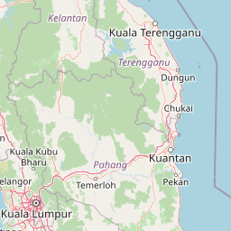
Map view of Kuala Langat North Forest Reserve

Use this park location map to pinpoint Kuala Langat North Forest Reserve in Malaysia, understand its exact geographic position, and read its mapped placement within the surrounding landscape more clearly.

Pigeon | © OpenStreetMap contributors

Location context for Kuala Langat North Forest Reserve

Selangor
Park atlas

Compare adjacent lowland reserves and related forest conservation landscapes across Selangor

Exploring Parks Near Kuala Langat North Forest Reserve and Regional Protected Areas

Browsing nearby protected areas provides valuable context for understanding lowland peat swamp ecosystems and regional forest remnants. Comparing adjacent reserves highlights shared ecological traits and broader conservation geography across the surrounding district.
Nature reserveSelangor
About 41 km away#1 closest

North

Templer Park: Protected Hill Forest Reserve and Landscape Geography in Selangor, Malaysia

Mature forest canopy and tropical stream terrain

Templer Park preserves a critical patch of mature lowland and hill forest within Selangor. Featuring multi-tiered waterfalls, shaded riverbanks, and limestone caves, the reserve supports high biological interest including rare endemic species. Its mapped boundaries reflect an essential green refuge amidst regional development, offering a window into the natural forest geography north of Kuala Lumpur.

Area
12.14 km²
Established
1954
Relief
Upland
Climate
Tropical
State or regional parkSelangor
About 45 km away#2 closest

North

Selangor State Park: Protected Rainforest and Geological Landscape Discovery

Highland water catchment and quartz ridge geography in Selangor

Selangor State Park forms a massive block of continuous tropical rainforest serving as the principal water supply for the Klang Valley. This protected area features rugged slopes, diverse river basins, and the dramatic 14-kilometer Klang Gates Quartz Ridge. Use this map-integrated record to understand the park's critical role in regional hydrological regulation and its significance as a research-anchored highland ecosystem.

Area
914.41 km²
Established
2007
Relief
Highland
Climate
Tropical
Wildlife reserveMalacca
About 65 km away#3 closest

Southeast

Tanjung Tuan Wildlife Reserve: Coastal Geography and Forested Cape Mapping

Coastal dipterocarp forest and raptor sanctuary in Malacca.

This forested coastal cape is an essential protected landscape situated along the Strait of Malacca. Characterized by its dense lowland dipterocarp forest, rocky headlands, and offshore islets, the reserve provides a crucial ecological connection for migratory birds and preserves a rich history of colonial maritime navigation and defense. Its geography offers a compact view of diverse coastal environments, ranging from mangrove fringes to the elevated ridge of Batu Putih.

Area
0.607 km²
Established
1921
Relief
Upland
Climate
Tropical
A watercolor painting showing a winding river flowing through green wetlands and forests with distant rolling hills.
Nature reserveSelangor
About 71 km away#4 closest

Northwest

Kuala Selangor Nature Park: Mapping the Coastal Wetland and Forest Mosaic of Selangor

A Managed Nature Reserve at the Selangor River Estuary

Kuala Selangor Nature Park represents a key protected landscape in Malaysia, where secondary forest meets an intricate system of estuarine wetlands. This atlas provides a detailed look at the park, focusing on the interplay between its freshwater ponds, mangrove fringes, and the coastal bunds that govern the habitat. It serves as an essential site for understanding coastal restoration and wetland ecology in the region of Selangor.

Area
2.4 km²
Established
1987
Relief
Lowland
Climate
Tropical
Nature reserveMalaysia
About 80 km away#5 closest

East

Pasoh Forest Reserve: Lowland Dipterocarp Protected Area in Peninsular Malaysia

Mapping tropical rainforest boundaries and ecological research zones

Situated in the interior of Peninsular Malaysia, Pasoh Forest Reserve protects a vital fragment of lowland dipterocarp rainforest. The reserve is globally recognized for its long-term forest dynamics plot, which tracks hundreds of thousands of trees to inform modern understanding of rainforest ecology. The mapped landscape displays clear boundaries between the dense protected forest and surrounding agricultural plantations, offering a distinct view of land use and tropical conservation.

Area
24.5 km²
Established
1987
Relief
Upland
Scope
Terrestrial
Wildlife reservePahang
About 109 km away#6 closest

Northeast

Tengku Hassanal Wildlife Reserve: Protected Forest and Mountain Geography in Pahang

Mapping a vast lowland dipterocarp forest sanctuary.

Spanning over 600 square kilometers, Tengku Hassanal Wildlife Reserve stands as a core protected area within Pahang. Its landscape includes riverine valleys and the steep montane terrain of the Benom Complex, supporting unique biodiversity and active wildlife conservation. This overview traces the park's geographic footprint and its role as an ecological corridor within the broader Titiwangsa mountain system.

Area
605.52 km²
Established
1923
Relief
Mountain
Climate
Tropical
A soft watercolor painting of a serene lake scene with rolling hills in the background, green vegetation along the banks, and pale pink blooms, likely lotus flowers, in the water.
Biosphere reservePahang
About 157 km away#7 closest

East

Chini Lake Biosphere Reserve: Protected Freshwater Geography in Pahang, Malaysia

Examining the interconnected lake basins and tropical wetland terrain

Chini Lake is an essential protected freshwater system in Pahang, Malaysia, comprising a series of twelve connected lake basins and tropical forest margins. This landscape is a recognized UNESCO Biosphere Reserve, characterized by seasonal lotus blooms, peat-influenced wetlands, and deep cultural connections to the indigenous Jakun communities. Discover the geography and environmental context of this river-fed ecosystem.

Area
50.85 km²
Established
2019
Relief
Lowland
Climate
Tropical
National parkJohor
About 175 km away#8 closest

East

Endau-Rompin National Park: Ancient Tropical Rainforest Protected Landscape in Johor, Malaysia

Explore unique mapped geography and ancient geological features.

Endau-Rompin National Park in Johor, Malaysia, is a testament to Earth's ancient history, housing tropical rainforests built upon geological formations around 248 million years old. This protected area offers a detailed look at rugged mountainous terrain, vital river systems, and a diverse mapped landscape, crucial for understanding regional geography and conservation. Its status as one of the oldest rainforest complexes makes it a significant site for exploring the planet's prehistoric natural heritage and protected land distribution.

Area
870 km²
Established
1993
IUCN
II
Relief
Mountain

Common questions about visiting, size, designation, and location context for Kuala Langat North Forest Reserve

Kuala Langat North Forest Reserve FAQs for park facts, access, geography, and protected area context

Find quick answers about Kuala Langat North Forest Reserve, including protected-area facts, park geography, trail and visitor context, and how the park fits into its surrounding country and regional landscape.
MoriAtlas Explorer

Continue Your Protected Areas Search Across the Global Atlas

Deepen your exploration by continuing the structured search for national parks and protected areas worldwide. Utilize the comprehensive filtering capabilities to compare different conservation landscapes and refine your understanding of global park geography. Discover more about the distribution and characteristics of protected natural areas.

Global natural geography