
Mori Atlas logo
National parkKukup Island

Tracing the tidal channels, mudflat systems, and coastal geography of this island reserve

Kukup Island National Park: A Protected Mangrove Wetland Landscape in Johor, Malaysia

(Pulau Kukup National Park)

Kukup Island National Park serves as a critical reference site for mangrove ecology in Johor, Malaysia, consisting of an uninhabited island almost entirely blanketed by closed-canopy forest. Its interior is defined by five distinct tidal river systems that thread through a complex network of channels, while extensive intertidal mudflats provide a vital habitat along the Strait of Malacca. This protected area functions as a key stopover point for migratory waterbirds and illustrates the essential role of tidal wetlands in coastal geomorphology.

mangrove forestmangrove islandintertidal mudflatsRamsar wetlandwetland of international importancemigratory birds
A digital illustration depicting a landscape with tall mountains, a central waterfall, a meandering river, stilt houses on the water, and boardwalks in a lush green valley.

Kukup Island

National park

Park overview

Structured park overview, official facts, and landscape profile for Kukup Island

Kukup Island park facts, protected area profile, and essential visitor context

Review the core facts for Kukup Island, including designation, size, terrain, visitor scale, habitats, and operating context in one park-focused overview.

About Kukup Island

Kukup Island is a protected mangrove island off the southwestern coast of Johor, situated near the southern tip of Peninsular Malaysia in the Strait of Malacca. Although small in overall extent, the island carries an outsized ecological weight because almost its entire land surface and its surrounding intertidal zone are dominated by mangrove forest and tidal mudflat. The combination of dense mangrove cover, a braided network of tidal channels, and exposed mudflats creates a complete, self-contained wetland ecosystem of unusual conservation value.

The island falls within the broader Pontian coastal landscape, not far from the better-known Tanjung Piai at the southernmost tip of mainland Asia. The mainland town of Kukup and a small jetty serve as the gateway for visitors arriving by boat, since the island itself is uninhabited and has no road or bridge connection. Once inside the protected boundary, the visitor experience is one of continuous mangrove forest, slow-moving tidal creeks, and shoreline mudflats that emerge at low tide to reveal a dense community of crabs, shells, and amphibious fish.

Ecologically, Kukup Island is often described as one of the largest remaining mangrove islands in Malaysia and is recognized internationally as a Ramsar wetland of importance. The mangrove forests act as a nursery for commercially significant fish and shellfish species in the Strait of Malacca, while also protecting the coast from erosion, buffering storm impacts, and filtering land-derived sediment that would otherwise affect nearshore waters. The international recognition of the site has helped secure its protection within the Johor state park system, even as mangrove forests elsewhere in the region have come under heavy pressure from aquaculture and coastal development.

For visitors, researchers, and conservation planners, Kukup Island represents a rare example of an intact mangrove-dominated island ecosystem that is both legally protected and ecologically functional. Its compact size, ease of access from the Johor mainland, and accessibility by short boat transfer make it a productive site both for ecotourism and for ongoing mangrove and migratory bird research in southern Peninsular Malaysia.

Quick facts and research context for Kukup Island

Kukup Island lies about one kilometre offshore from the Johor mainland in the Strait of Malacca and falls within the Pontian District of Johor, Malaysia. The island is governed by the Johor National Parks Corporation and was gazetted as a national park in 1997. In 2003 it was inscribed as a Ramsar Wetland of International Importance under the official name Pulau Kukup.

Its defining environmental character is mangrove and tidal mudflat, with the surrounding intertidal zone covering several square kilometres. The island is uninhabited, has no road network, and supports populations of macaques, wild boar, mudskippers, and fiddler crabs. It is most widely recognized for its role as a migratory bird stopover and for hosting one of the largest mangrove patches in Malaysia.

Protection and recognition

Documented conservation status, designation history, and Ramsar listing details for Kukup Island.

Kukup Island Protection Status and International Recognition Sources

Comprehensive protected area records outline the mixed conservation status and formal designation history established in 2003 for Kukup Island. Official international recognition data includes the registered Pulau Kukup Ramsar wetland designation source.

International recognition

Protection details

Protection scope
Mixed
Designated year
2003
Transboundary protection
No
Park context

Deeper park guide and search-rich context for Kukup Island

Kukup Island history, landscape, wildlife, and travel context

Explore Kukup Island through its history, landscape character, ecosystems, wildlife, conservation priorities, cultural context, and seasonal travel timing in a structured park guide built for atlas discovery and search intent.

Why Kukup Island stands out

Kukup Island is best known for its near-total cover of mangrove forest and its surrounding mudflat systems, which together create one of the largest uninhabited mangrove wetland landscapes in Peninsular Malaysia. It is widely cited as a Ramsar site because its tidal forests function as a critical refuge and feeding ground for migratory waterbirds traveling the East Asian flyway. The island is also notable for its unusual combination of small size and ecological density: every stream course, channel, and mudflat edge contributes to a tightly integrated mangrove ecosystem. This makes Kukup a benchmark site for studying coastal wetland processes, mangrove-dependent fauna, and the role of protected tidal forests in sustaining marine fisheries along the Strait of Malacca.
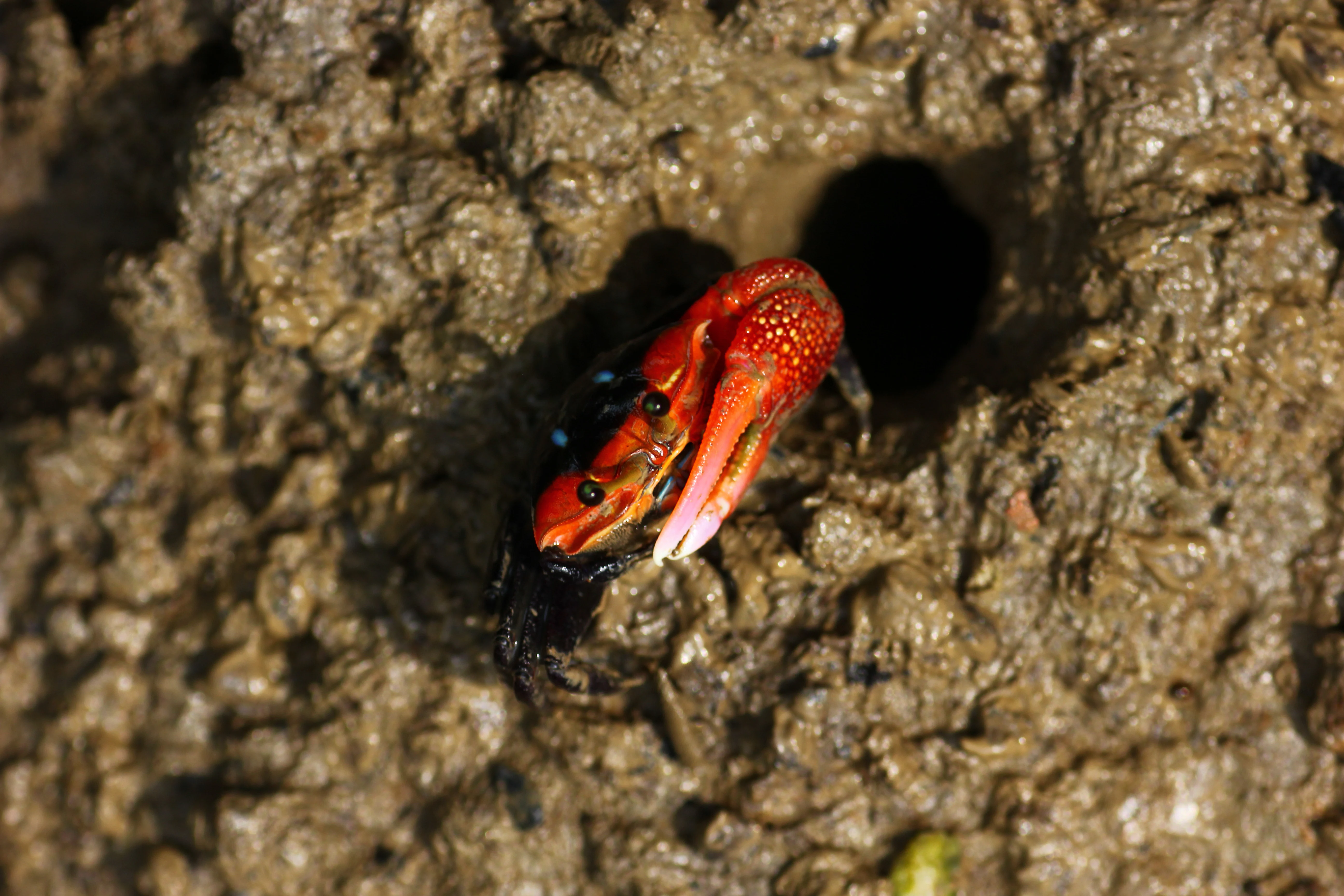
A small crab with a vibrant red shell and one oversized claw rests on textured dark brown mud next to a small dark hole.
A bright red fiddler crab emerging from its burrow in the mangrove mudflats of Kukup Island.

Kukup Island history and protected-area timeline

Kukup Island historically sat as a quiet stretch of coast with relatively little documentation. Local traditions link the name Kukup itself to the waters around the island: historical accounts recorded by the early Malay author Abdullah Munsyi described the surrounding strait as a haunt for pirates, and the related word telungkup (overturned) is often cited as the linguistic root of the place name, referring to boats that were reportedly capsized by pirates in the area. Historian Salleh Md. Don places the peak of maritime piracy around Kukup during the period of Dutch colonial activity between 1818 and 1824.

For much of the modern era the island remained a remote, undeveloped area. That changed in the 1990s when scientists began surveying the island's biodiversity and recognized the unusual extent and condition of its mangrove cover. Concerned about the conservation value of the site, the Johor state government gazetted Kukup Island as a national park on 27 March 1997 under the Johor State Park Corporation Enactment 1989.

A second landmark came on 31 January 2003, when Kukup Island was formally inscribed as a Wetland of International Importance under the Ramsar Convention, administered through its bureau in Geneva. The Ramsar designation highlighted the island's significance for migratory waterbirds and its broader role in preserving mangrove ecosystems in Southeast Asia. In late 2018 the island's protected status became the subject of a brief political controversy when the Johor state government moved to excise several state parks from the national park network, though Kukup continued to be managed as a Johor state park and remained open to conservation and tourism use.

Kukup Island landscape and geographic character

The physical landscape of Kukup Island is defined entirely by its mangrove-and-mudflat character. The island covers roughly just under five square kilometres of land, and that land is almost completely covered by closed-canopy mangrove forest rather than by any drier, terrestrial vegetation. Five named river systems cross and shape the island: Sungai Solok, Sungai Ular, Sungai Sedang, Sungai Tongkang, and Sungai Jempol, each contributing to a dense network of tidal creeks and channels that thread through the interior.

Around the island, an extensive mudflat system extends across approximately several square kilometres of intertidal land that is exposed at low tide. These mudflats form a transitional zone between the mangrove fringe and the open waters of the Strait of Malacca, and they are an essential visual and ecological component of the landscape. The island also functions as a windbreak, shielding the segment of Johor coast between it and Tanjong Piai.

Beyond the immediate coast, the landscape context is shaped by the island's proximity to two other notable features: the Strait of Malacca to the north and west, the narrower Kukup Strait to the south and east, and the neighbouring Pulau Pisang offshore. The result is a relatively flat, low-elevation coastal setting with no high ground, no rocky headlands, and no built environment; visual interest comes from the texture of the mangrove canopy, the tidal channels carving through the mudflats, and the changing patterns of exposed sediment as tides move in and out.
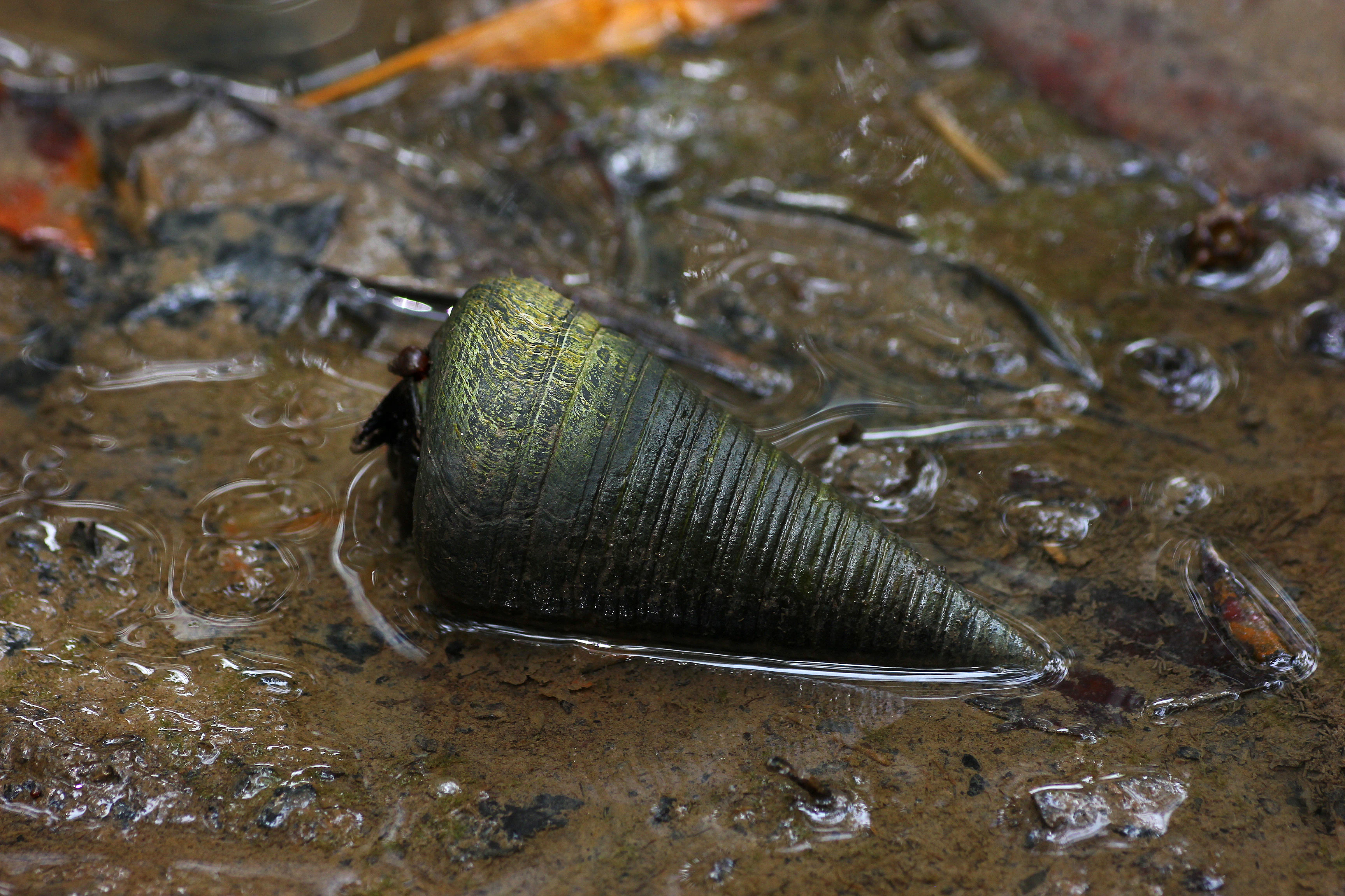
A close up view of a dark, conical Telescopium telescopium snail shell resting on wet, muddy ground.
A Telescopium telescopium snail in the mudflat environment of Kukup Island.

Kukup Island ecosystems, habitats, and plant life

Kukup Island's nature profile is dominated by mangrove wetland, supported by tidal mudflats and estuarine waters. The mangrove forest itself is the principal vegetation type, made up of mangrove trees adapted to salt-saturated soils and rhythmic tidal inundation. This forest functions as a continuous habitat layer across the entire island, rather than a narrow fringe, which is unusual in the Malaysian coastal context and gives the site particular conservation value.

The intertidal mudflats surrounding the island are an equally important part of the ecological system. They support a rich community of benthic invertebrates and provide feeding grounds for wading birds and shorebirds. Within the mangrove root systems and tidal pools, juvenile fish, shrimp, crabs, and gastropods find shelter and nursery habitat, contributing to the productivity of the broader Strait of Malacca fisheries. Snail species such as Telescopium telescopium are present in the mudflats, and amphibious fish such as mudskippers are characteristic of the mangrove-floor interface.

The forest also acts as a natural filter, trapping sediment and nutrients before they reach the open strait, and as a buffer against coastal erosion along this stretch of Johor shoreline. The combination of forest, mudflat, and tidal creeks produces a layered habitat mosaic on a very small land area, where each habitat depends directly on the others and on the tidal cycle that links them together.
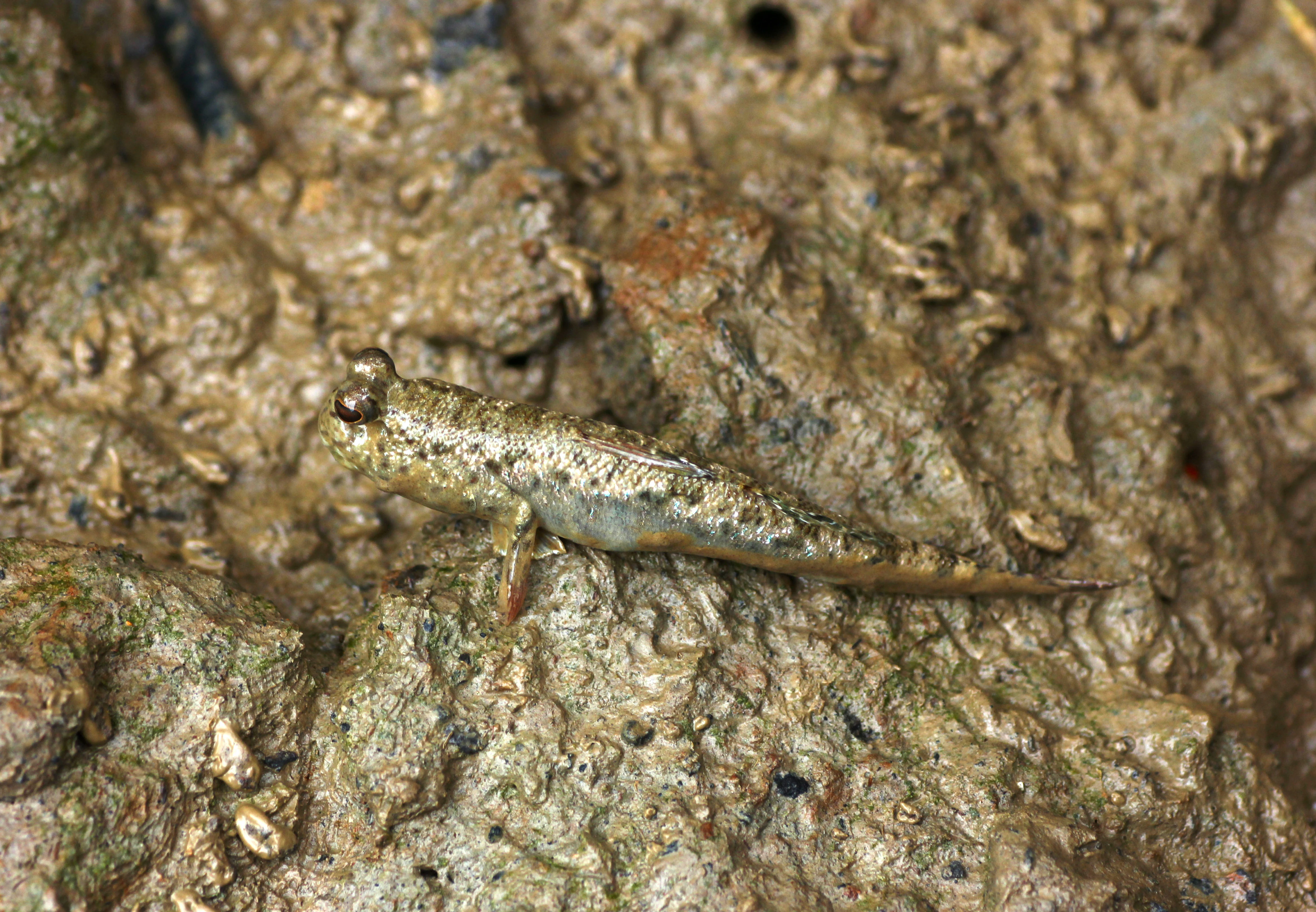
A close-up view of a mudskipper fish with prominent eyes resting on textured wet mud.
A mudskipper resting on the mudflats of Kukup Island.

Kukup Island wildlife and species highlights

Fauna on and around Kukup Island follows the patterns typical of a Southeast Asian mangrove ecosystem, with wildlife concentrated in the forest canopy, on the forest floor, and across the tide line. Crab-eating macaques are reported on the island, along with wild boar that move through the mangrove understorey, giving the site a modest but visible mammal presence despite its small size.

The intertidal zone is the most visible wildlife habitat. Mudskippers occupy the soft sediments between mangrove roots, fiddler crabs emerge in large numbers across the mudflats, and various gastropods and shellfish inhabit the wet substrate. Amphibious fish take advantage of shallow tidal pools that shift with the tide. These species collectively underpin the food web that supports larger fauna, particularly migratory and resident birds.

Kukup Island's wildlife significance is greatest as a stopover and feeding area for migratory waterbirds moving along the East Asian flyway between Australia and northern wintering grounds. The combination of mangrove shelter, open mudflat feeding habitat, and the island's position at the southern edge of Peninsular Malaysia makes it a regular staging site. The Ramsar designation reflects the site's recognised importance for these migratory populations, alongside its role in sustaining local fish, crustacean, and mollusc populations.
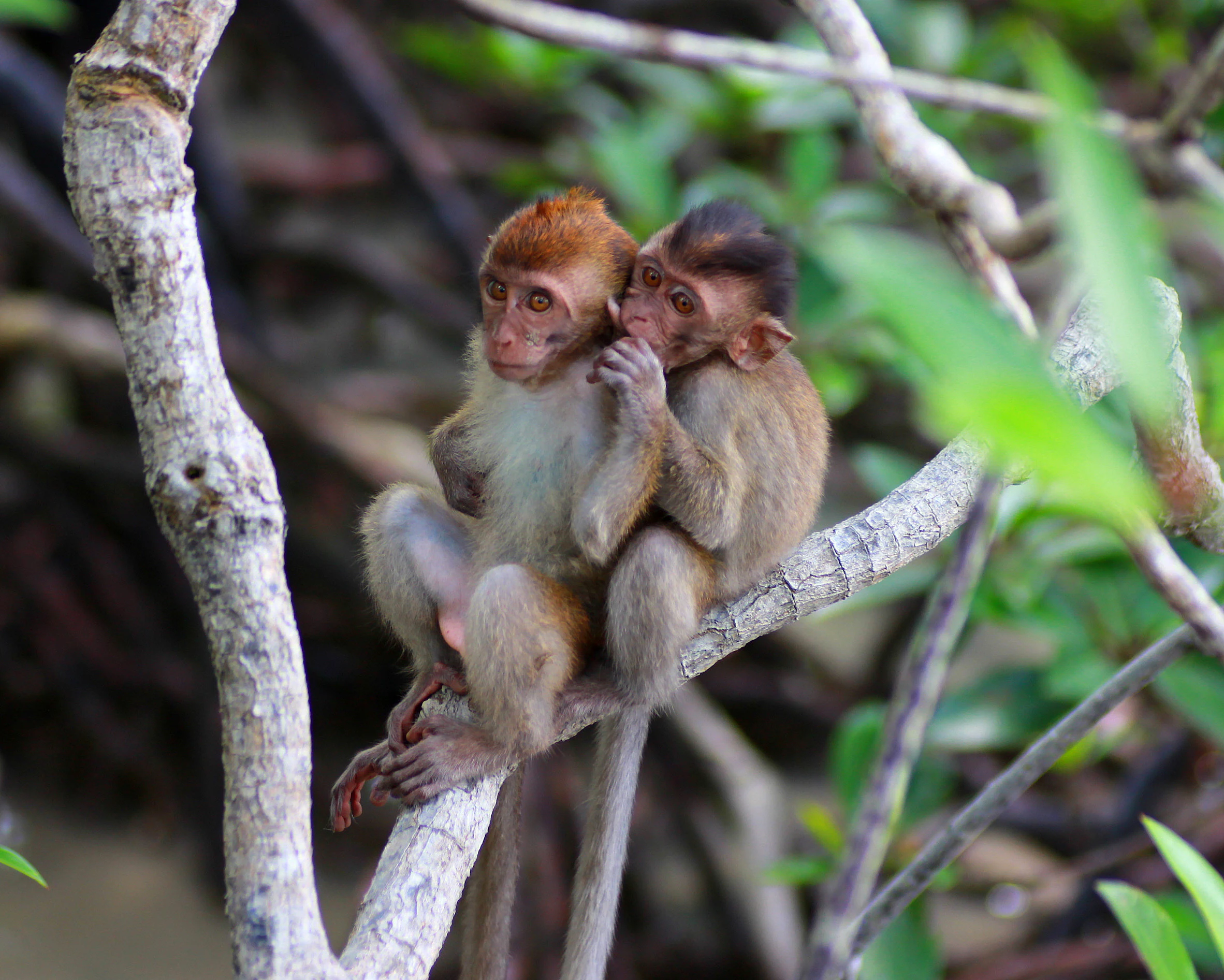
Two small juvenile crab-eating macaques sitting closely together on a mangrove branch in a natural forest setting.
Two juvenile crab-eating macaques perched in the mangrove forest of Kukup Island.

Kukup Island conservation status and protection priorities

Kukup Island is significant from a conservation perspective because it preserves one of the most complete and least disturbed mangrove systems in Malaysia. The island's near-total forest cover, lack of permanent settlement, and protected status under the Johor State Park Corporation combine to give it a level of ecological integrity that many other coastal sites in the region no longer retain. Its mangrove area is described locally as representing a substantial share of Malaysia's remaining mangrove forest, reinforcing its national importance.

Its formal recognition as a Ramsar Wetland of International Importance in 2003 elevates this significance to the international level. The Ramsar designation distinguishes Kukup as a wetland whose ecological character, biodiversity, and role in supporting migratory waterbirds justify protection under an international treaty framework. The official Ramsar name used is Pulau Kukup, and the site has been referenced as a Ramsar site with a global identifier, underscoring its place within the global network of important wetlands.

Beyond formal designations, the island contributes to conservation through the ecosystem services it provides. Its mangroves act as a nursery for commercially important fish and shellfish species, support the productivity of the Strait of Malacca, and protect the Johor coastline from erosion and storm impacts. In 2018 a brief administrative controversy arose when Johor state moved to release several state parks from national park status, but Kukup continued to be managed as a state park, meaning its core conservation function has been maintained.

Kukup Island cultural meaning and human context

The cultural setting of Kukup Island is tied closely to the coastal communities of Pontian District, where fishing, small-scale maritime trade, and a heritage linked to the Strait of Malacca have shaped local identity. The name Kukup itself is embedded in regional oral tradition, and historical Malay writing, including that of Abdullah Munsyi, refers to the waters around the island as a setting for piracy during the period of European maritime activity in the region. Historians such as Salleh Md. Don have traced this maritime history to the early nineteenth century.

In addition to documented history, the island carries a body of local folklore. One recurring legend tells of five celestial princesses whose youngest sister fell in love with a sailor; the four elder sisters are said to have cursed the island to sink in order to bring her back to the surface, and the resulting landscape is mythically interpreted as the muddy, mangrove-covered terrain seen today. Another local belief describes a giant serpent said to inhabit the open interior of the island and to swim between Pulau Kukup, Pulau Pisang in Malaysia, and Pulau Karimun in Indonesia.

These traditions sit alongside the more practical heritage of the modern Kukup fishing community and the broader Pontian coast, where the small town of Kukup functions as the gateway for visitors accessing the island by boat. Together, the documented maritime history and the local mythology give the site a cultural dimension that complements its ecological importance.
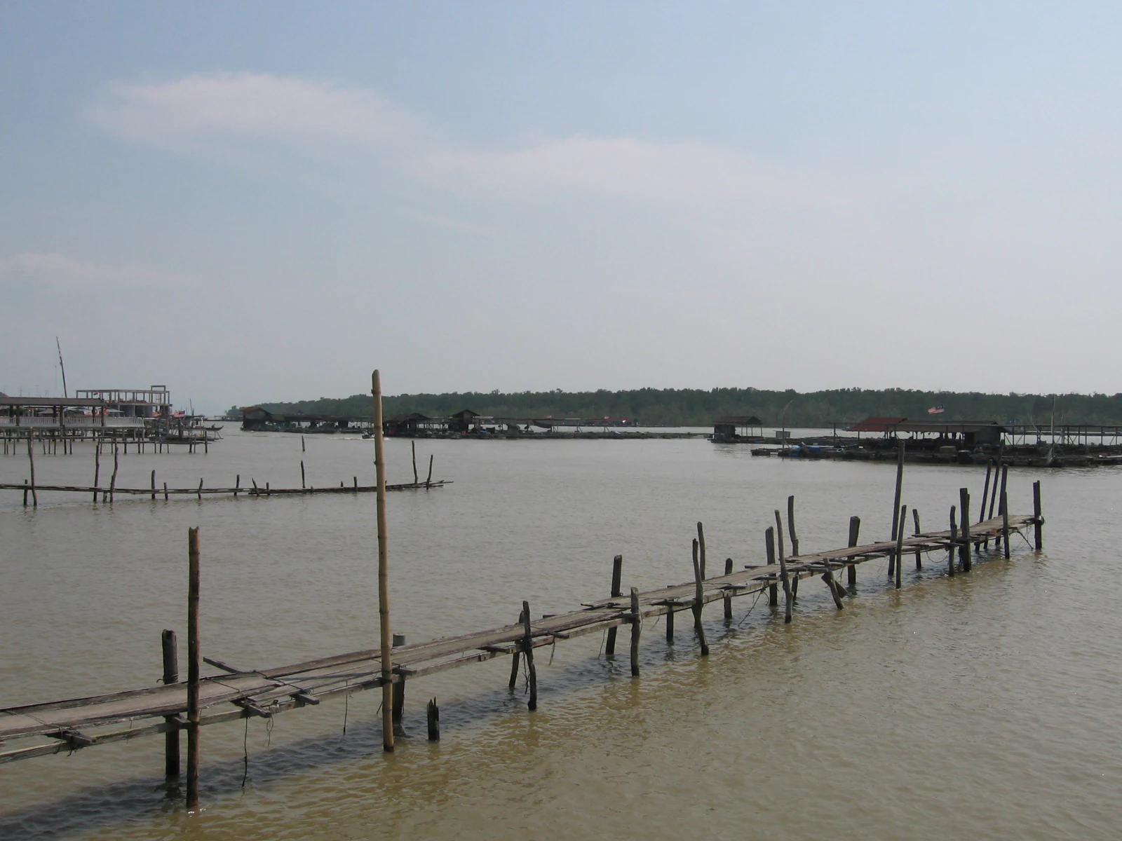
A wooden pier on stilts over calm brown water, leading toward distant mangrove tree lines under a hazy sky.
A wooden jetty extending into the waters near Kukup Island, Malaysia, with mangrove forests visible in the background.

Top sights and standout views in Kukup Island

Kukup Island stands out for being almost entirely covered by mangrove forest, with no human settlement, roads, or permanent structures interrupting the canopy. The island's combination of closed-canopy mangrove, five distinct tidal river systems, an encircling mudflat of several square kilometres, and proximity to the southern tip of mainland Asia gives it a compact but ecologically complete wetland profile.

Its recognition as a Ramsar Wetland of International Importance places it on the global map of important wetlands alongside other internationally recognised mangrove and coastal sites. As one of the gazetted national parks under the Johor State Park Corporation, and one of the largest mangrove islands in Malaysia, Kukup Island represents both a working conservation site and a reference example of how a small, mangrove-dominated island can sustain migratory birds, nursery fisheries, and coastal protection functions at the same time.
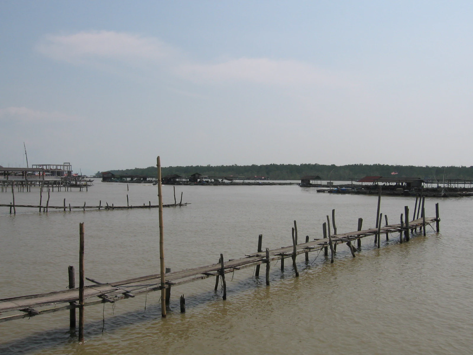
A wooden pier extends into murky, calm coastal waters with fishing structures visible in the distance and a dense forest line on the horizon.
A view of the waters surrounding Kukup Island, showing traditional wooden stilt structures used for fishing and aquaculture.

Best time to visit Kukup Island

The character of a visit to Kukup Island is shaped primarily by tides and by the seasonal movement of migratory birds, rather than by dramatic shifts in weather. Since the island's main landscapes are mangrove forest and mudflat, low tide exposes the mudflats and concentrates wading birds, fiddler crabs, and mudskippers around the shoreline, while high tide pushes wildlife into the mangrove channels and forest edge. Visitors who want the full visual signature of the site often time their arrival for low tide, when the surrounding sediments are visible and the tidal flats are most active.

Migratory bird activity is generally more prominent during the periods when species are moving along the East Asian flyway between Australia, Southeast Asia, and the Northern Hemisphere, with the island functioning as a stopover and feeding ground. The tropical climate of southwest Johor means warm, humid conditions year-round, with periods of heavier rainfall that can affect boat access and visibility. Choosing a period of settled weather during the bird migration windows tends to combine the strongest ecological displays with the calmest conditions on the water.

Monthly climate preview

Long-term representative averages and month-by-month weather patterns in Johor

Kukup Island Climate Normals, Annual Temperature and Precipitation Rhythm

Representative coordinate records show sustained mean temperatures and steady daily precipitation rhythms across the twelve-month climatology period. Examining the complete monthly profile provides detailed context on long-term temperature ranges and precipitation shifts at this protected location.
Annual mean27 °C
26 °C28 °C
Jan26°
Feb27°
Mar27°
Apr28°
May28°
Jun28°
Jul28°
Aug28°
Sep28°
Oct28°
Nov27°
Dec27°
Warmest month
May

28.5 °C

Coolest month
January

26.4 °C

Wettest month
November

9 mm/day

Driest month
February

3.6 mm/day

Park location guide

Geography guide, regional context, and park location map for Kukup Island

Kukup Island park geography, regions, and map view in Malaysia

Understand where Kukup Island sits in Malaysia through a broader geographic reading of the surrounding landscape, nearby location context, and its mapped position within the national park landscape.

How Kukup Island fits into Malaysia

Malaysia is a federal constitutional monarchy located in Southeast Asia. The country consists of 13 states and three federal territories, divided by the South China Sea into Peninsular Malaysia on the Indochinese Peninsula and East Malaysia on the island of Borneo. With a population of over 34 million, it achieved independence from Britain in 1957 and became a modern federation in 1963. The country is recognized for its multicultural population, tropical climate, and significant economic role in the region.

Wider geography shaping Kukup Island in Malaysia

Malaysia occupies a strategic position in Southeast Asia, split by the South China Sea into two distinct regions. Peninsular Malaysia lies on the Indochinese Peninsula, sharing a land border with Thailand to the north and maritime borders with Singapore, Vietnam, and Indonesia. East Malaysia occupies the northern portion of Borneo, sharing land borders with Brunei and Indonesia, and maritime borders with the Philippines and Vietnam. The country's terrain includes coastal plains, mountain ranges such as the Titiwangsa in the peninsula, and extensive tropical rainforests.

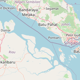
Map view of Kukup Island

Use this park location map to pinpoint Kukup Island in Malaysia, understand its exact geographic position, and read its mapped placement within the surrounding landscape more clearly.

Pigeon | © OpenStreetMap contributors

Location context for Kukup Island

Johor

Visual documentation of intertidal mudflats, river channels, and closed-canopy forest habitats

Kukup Island Photos and Scenery: Exploring the Mangrove Landscape and Tidal Wetlands

Photographic collections reveal the dense mangrove canopy and expansive tidal flats that define the uninhabited protected area. Visual records of the coastal terrain and estuarine channels help visitors interpret the ecological structure of the wetland sanctuary.

A small crab with a vibrant red shell and one oversized claw rests on textured dark brown mud next to a small dark hole.

A narrow, calm, murky waterway flows through a dense thicket of green mangrove trees on Kukup Island.

A close up view of a dark, conical Telescopium telescopium snail shell resting on wet, muddy ground.

A close-up view of a mudskipper fish with prominent eyes resting on textured wet mud.

Two small juvenile crab-eating macaques sitting closely together on a mangrove branch in a natural forest setting.

An elevated, high angle view of a lush green mangrove forest, with a narrow, murky channel of water winding through the thick vegetation.

A wooden pier on stilts over calm brown water, leading toward distant mangrove tree lines under a hazy sky.

A wooden pier extends into murky, calm coastal waters with fishing structures visible in the distance and a dense forest line on the horizon.

Park atlas

Discover related coastal wetlands and Johor conservation landscapes

Other Parks and Protected Areas Near Kukup Island for Regional Comparison

Comparing Kukup Island with other regional protected areas reveals broader patterns in tidal forest ecology and coastal mangrove distribution. Examining adjacent parks provides valuable context for understanding wetland conservation corridors across the Strait of Malacca.
Nature reserveJohor
About 11 km away#1 closest

Southeast

Tanjung Piai Nature Reserve: Geographical Atlas and Coastal Protected Landscape Overview

A Ramsar-designated mangrove sanctuary in Johor, Malaysia.

Tanjung Piai Nature Reserve represents a critical coastal ecosystem at the edge of the Malay Peninsula. This protected area functions as a vital corridor for migratory birds and local marine life, characterized by low-lying mudflats and extensive mangrove stands. The reserve marks the symbolic southern extremity of mainland Asia, balancing conservation priorities with the unique geographic significance of the Johor Strait shoreline.

Visitors
32.4K annual
Relief
Lowland
Climate
Tropical
Scope
Mixed
Nature reserveJohor
About 14 km away#2 closest

East

Pulai River Nature Reserve: Johor Coastal Mangrove and Estuarine Geography

Protected Ramsar wetland and coastal landscape in southern Malaysia.

Spanning from the highlands of Mount Pulai to the Tebrau Straits, Pulai River Nature Reserve acts as a major ecological interface in Johor. This site encompasses dense mangrove forest reserves and the country's single largest seagrass bed, serving as a primary study area for regional coastal conservation and wetland management.

Established
2003
Relief
Lowland
Scope
Mixed
Water
Water-dominated
National parkJohor
About 117 km away#3 closest

North

Endau-Rompin National Park: Ancient Tropical Rainforest Protected Landscape in Johor, Malaysia

Explore unique mapped geography and ancient geological features.

Endau-Rompin National Park in Johor, Malaysia, is a testament to Earth's ancient history, housing tropical rainforests built upon geological formations around 248 million years old. This protected area offers a detailed look at rugged mountainous terrain, vital river systems, and a diverse mapped landscape, crucial for understanding regional geography and conservation. Its status as one of the oldest rainforest complexes makes it a significant site for exploring the planet's prehistoric natural heritage and protected land distribution.

Area
870 km²
Established
1993
IUCN
II
Relief
Mountain
Marine protected areaJohor
About 122 km away#4 closest

Northeast

Sibu Island: Marine Protected Area and Coastal Landscape Analysis

Mapping the coral reefs and pyroclastic terrain of the Johor coast

Sibu Island is a protected marine area in the South China Sea, distinguished by its unique pyroclastic geology and surrounding coral reef ecosystems. This entry provides a structured look at the island's coastal geography, vegetation, and maritime boundaries off the coast of Mersing, Johor. Access detailed geographic context for this tropical landscape.

Area
4.05 km²
Established
1993
Relief
Lowland
Climate
Tropical
Protected areaJohor
About 133 km away#5 closest

Northeast

Tinggi Island Protected Area: Geography, Rainforest Terrain, and Johor Coastal Map

Mountainous forest meets extensive coral-rich coastal waters.

Located southeast of Mersing, Tinggi Island is defined by its dramatic silhouette and dense rainforest interior. The protected landscape stretches from the elevated peak of Mount Semundu down to a shoreline of white sand and coastal caves, creating a distinct marine and terrestrial environment unique to the Johor region.

Water
Major water bodies
Season
Year-round
A minimalist watercolor illustration depicting a tropical island coastline with sand beaches, green trees, and rolling hills in the background.
Marine protected areaJohor
About 138 km away#6 closest

Northeast

Besar Island Marine Protected Area: Coastal Geography and Protected Waters in Johor

Mapping the island's reef ecosystems and tropical landscape

Besar Island offers a distinct look at a small-scale marine protected area off the Johor coast. Its geography encompasses a transition from sandy beach fronts to a hilly, jungle-clad interior, all contained within a gazetted two-nautical-mile conservation zone. The surrounding waters support approximately 60 marine species, making this an essential case study for understanding protected marine habitats within the Babi Islands archipelago.

Area
4.77 km²
Relief
Upland
Climate
Tropical
Access
Easy access
A watercolor painting showing layers of soft green and pink rolling hills, with a line of trees in the midground and an open, flat foreground.
Protected areaJohor
About 146 km away#7 closest

Northeast

Rawa Island Protected Area: Coastal Geography and Island Landscape Context in Johor

A protected coral island within the Johor archipelago

Rawa Island serves as a significant protected landscape off the coast of Johor, Malaysia. Defined by its sharp contrast between rocky cliffs and clear, coral-filled waters, the island represents a crucial node in regional island geography. Delve into the spatial characteristics and environmental features of this South China Sea destination through our map-driven atlas framework.

Area
0.23 km²
Water
Water-dominated
Protected areaJohor
About 172 km away#8 closest

Northeast

Pemanggil Island Protected Landscape: Johor Offshore Geography and Island Topography

Mapping coastal features and inland terrain in the South China Sea.

Pemanggil Island serves as a significant geographic landmark within the Mersing cluster of Johor. This detailed atlas entry focuses on the island's structural composition, including its prominent central hill, the rocky interior, and coastal features such as Teluk Lancang. Understand the maritime geography and spatial character of this protected area within the context of the southern Malay Peninsula.

Area
8.82 km²
Relief
Upland
Climate
Tropical
Access
Moderate access

Common questions about visiting, size, designation, and location context for Kukup Island

Kukup Island FAQs for park facts, access, geography, and protected area context

Find quick answers about Kukup Island, including protected-area facts, park geography, trail and visitor context, and how the park fits into its surrounding country and regional landscape.
MoriAtlas Explorer

Continue Your Protected Areas Search Across the Global Atlas

Deepen your exploration by continuing the structured search for national parks and protected areas worldwide. Utilize the comprehensive filtering capabilities to compare different conservation landscapes and refine your understanding of global park geography. Discover more about the distribution and characteristics of protected natural areas.

Global natural geography