
Mori Atlas logo
Protected areaKwajalein Atoll

A detailed geographic examination of a large coral atoll structure, its enclosed lagoon, and isolated islet chains in the Pacific.

Kwajalein Atoll Protected Area: Analyzing the Geography and Mapped Lagoon of the Marshall Islands

Kwajalein Atoll stands as one of the largest coral atolls globally, framing a vast central lagoon with a chain of low-lying islands in the Ralik Chain of the Marshall Islands. This protected area reveals a complex geographic system defined by its maritime boundaries, reef-fringed shorelines, and a distinct convergence of Pacific island topography. Study the mapped spatial distribution of islets, navigable passes, and the expansive interior waters that characterize this significant Marshallese landscape.

coral atollPacific OceanMarshall IslandsRalik Chainlagoonredefined islands
A graphic illustration showing a cascading waterfall falling down a green mountain into a river winding through a forest.

Kwajalein Atoll

Protected area

Park overview

Structured park overview, official facts, and landscape profile for Kwajalein Atoll

Kwajalein Atoll park facts, protected area profile, and essential visitor context

Review the core facts for Kwajalein Atoll, including designation, size, terrain, visitor scale, habitats, and operating context in one park-focused overview.

About Kwajalein Atoll

Kwajalein Atoll is one of the most geographically and historically significant atolls in Micronesia. Lying in the Ralik Chain of the Marshall Islands, it stretches in an elongated oval shape across the central Pacific, its profile defined by more than ninety small islands arranged around a sprawling enclosed lagoon. The atoll's land area is small relative to its vast interior lagoon, and most of its islands rise only a couple of meters above the sea, giving the entire system the classic low, ring-shaped silhouette of a mature coral atoll that grew around an ancient volcanic foundation.

For the indigenous Marshallese people, Kwajalein has long been more than a physical place. In Marshallese cosmology, the main island is associated with an abundant flowering zebra wood tree said to carry spiritual meaning, and the harvesting of its blossoms is woven into traditional storytelling. The atoll's name itself derives from a Marshallese phrase about gathering flowers, illustrating how deeply the island is embedded in indigenous heritage even as outside powers have shaped its modern history.

Kwajalein's modern identity is inseparable from successive waves of foreign involvement. It was sighted by a Spanish expedition in 1543, later surveyed by Imperial Russian and German visitors, administered by Germany in the late nineteenth century, then taken under Japanese control during World War I as part of the South Seas Mandate. The Japanese expanded copra trading, built schools, and eventually fortified the atoll during the interwar and early World War II period, bringing both opportunity and hardship for local residents. The U.S. invasion of Kwajalein in early 1944 was one of the most intense amphibious operations of the Pacific War and left a deep historical mark on the atoll, including sunken vessels, bunkers, and memorials that remain part of the landscape today.

In the postwar era, Kwajalein became one of the most important Pacific platforms for U.S. strategic testing. It hosted elements of the early anti-ballistic missile programs, was used in preparations for nuclear testing at neighboring atolls, and evolved into the Ronald Reagan Ballistic Missile Defense Test Site, hosting radars, missile launch sites, telemetry systems, and a critical GPS monitoring ground station. Orbital launches have also been conducted from the atoll using the Pegasus rocket and, for several years, SpaceX's Falcon 1.

The social landscape mirrors this layered history. The main island, often called Kwaj, hosts a largely English-speaking U.S. military and civilian community, while nearby Ebeye is one of the most densely populated islands in the Marshall Islands, connected by causeway to other inhabited islets and serving as the local commercial and administrative center. The interplay between traditional Marshallese life, the military presence, and modern infrastructure makes Kwajalein an unusually complex Pacific atoll, where coral reef ecosystems, wartime heritage, and twenty-first-century defense and space technology all converge.

Quick facts and research context for Kwajalein Atoll

Kwajalein is located in the Ralik Chain of the Marshall Islands, in the North Pacific Ocean just south of the equator. It is one of the largest coral atolls in the world, formed around a subsiding volcanic base, and today encircles one of the planet's biggest lagoons.

The atoll comprises roughly 97 islands and islets, with a combined land area of about 16 square kilometers, and is administered by the Republic of the Marshall Islands while portions are leased to the United States for missile testing and space operations until the late twenty-first century.

Protection and recognition

Documented management scope and formal protected area designation records

Kwajalein Atoll Protection Status and International Recognition Data

Kwajalein Atoll protection status details outline mixed management frameworks and documented conservation boundaries. Structured recognition records provide verified administrative context for the protected area.

Protection details

Protection scope
Mixed
Transboundary protection
No
Park context

Deeper park guide and search-rich context for Kwajalein Atoll

Kwajalein Atoll history, landscape, wildlife, and travel context

Explore Kwajalein Atoll through its history, landscape character, ecosystems, wildlife, conservation priorities, cultural context, and seasonal travel timing in a structured park guide built for atlas discovery and search intent.

Why Kwajalein Atoll stands out

Kwajalein is best known as a center for U.S. missile defense testing and Pacific space operations. The Ronald Reagan Ballistic Missile Defense Test Site occupies several of its islands, including major radar installations and former anti-ballistic missile launch complexes. The atoll is also renowned for the scale and character of its enclosed lagoon, the historical weight of the 1944 Battle of Kwajalein, the densely populated Marshallese community on Ebeye, and the cultural importance of the atoll in Marshallese cosmology tied to the legendary zebra wood tree on Kwajalein Island.
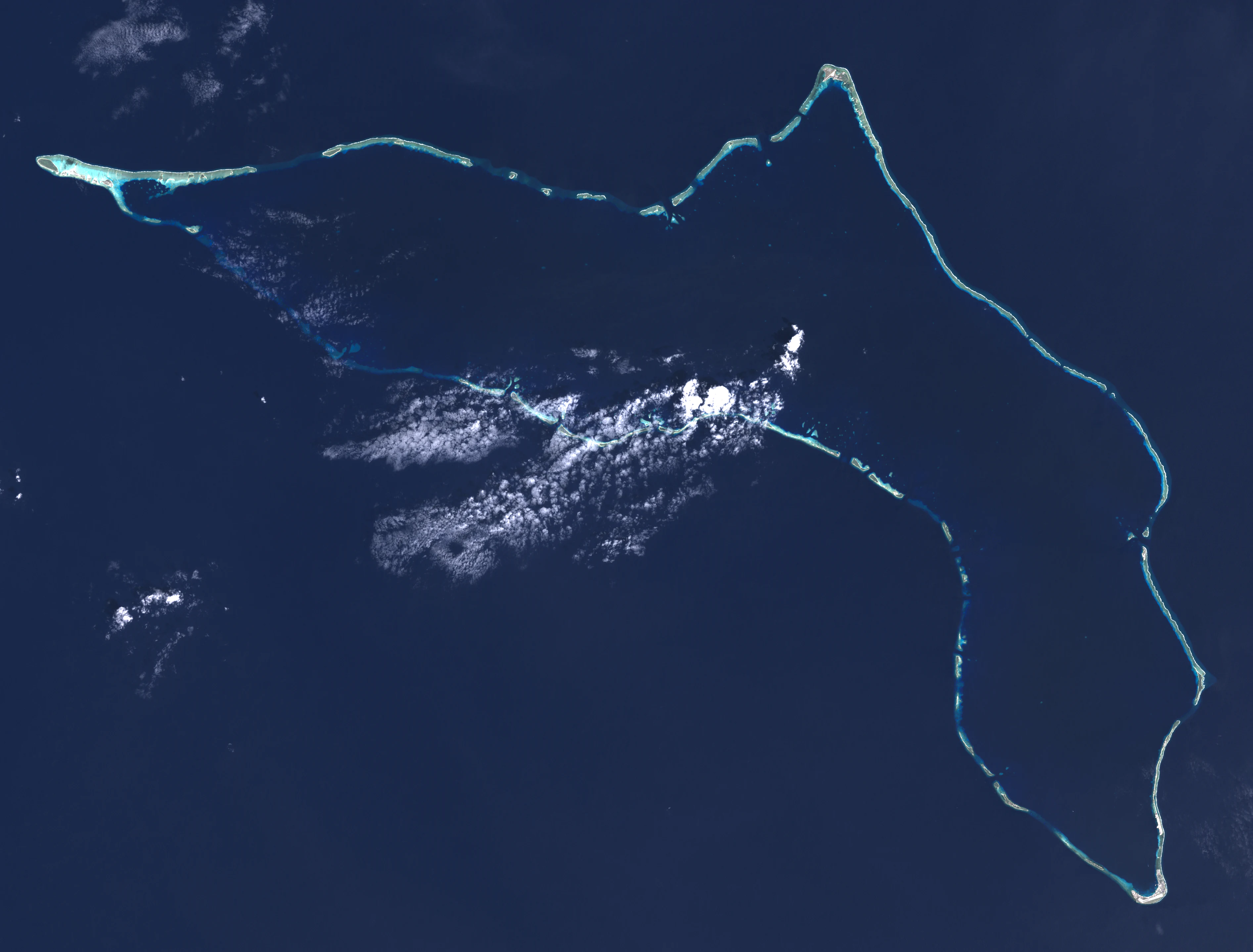
Top-down satellite image of Kwajalein Atoll showing the coral reef ring surrounded by deep ocean water.
A satellite view of Kwajalein Atoll in the Marshall Islands.

Kwajalein Atoll history and protected-area timeline

Kwajalein has a long and layered history that begins well before the modern era. In Marshallese oral tradition, the atoll is associated with spiritual symbolism and the gathering of flowers from a revered zebra wood tree, an image that continues to shape the atoll's identity and the meaning of its native name.

The first recorded European sighting occurred in January 1543 during the Spanish expedition of Ruy López de Villalobos, who charted the atoll as Los Jardines because of its lush appearance. The Spanish claim over the islands was nominal during the seventeenth and eighteenth centuries, and from the late 1700s through the early modern period, the atoll passed through several colonial hands. Imperial Russian Navy captain Ludwig von Hagemeister surveyed the area around 1828 to 1829, and in 1885 the German Empire formally annexed the Marshall Islands as a protectorate, ushering in a period of German administrative influence.

Japan entered the picture in the late nineteenth century through a combination of naval interest, civilian writings, and commercial activity by fishermen and traders. After joining the Allies in World War I, Japan seized the Marshall Islands and governed them under a League of Nations mandate, incorporating Kwajalein into its broader Nan'yō sphere. The prewar years saw copra trading, schools, and modest settlement, but the region was rapidly militarized after Japan left the League of Nations in 1933. Forced laborers, including Koreans, were brought to the atoll to build airstrips and fortifications, displacing some local residents to smaller islets and creating a period remembered as harsh and traumatic for both Marshallese and workers.

The American invasion on January 31, 1944, and the devastating bombardment that followed on February 1, 1944, became one of the defining moments of the Pacific War. The battle destroyed much of the Japanese military presence, but it also cost the lives of significant numbers of Marshallese, Koreans, and Japanese personnel. After the war, the United States administered the Marshall Islands as a United Nations Trust Territory and converted Kwajalein into a staging area and command center, including preparation for nuclear testing at Bikini and Enewetak. In the 1950s, the atoll transitioned into the Nike Zeus anti-ballistic missile program and gradually evolved into the modern Reagan Test Site.

Throughout the late twentieth and early twenty-first centuries, the U.S. military presence has shaped Kwajalein's economy, infrastructure, and demographics. Major lease arrangements were renegotiated as part of the Compact of Free Association between the Marshall Islands and the United States, with land payments and operating rights agreements continuing to be a focus of political discussion among landowners. Landowners undertook protests such as Operation Homecoming in the early 1980s, and negotiations over lease terms, payments, and the future of the testing range have remained an ongoing theme, alongside the increasing role of commercial rocket launches from islands such as Omelek.

Kwajalein Atoll landscape and geographic character

Kwajalein's physical landscape is a textbook example of a mature coral atoll. The structure likely began with ancient volcanic activity on the seafloor, after which coral growth encircled the slowly subsiding landmass, leaving a ring of low islands around a vast central lagoon. Today, the average elevation of the islands is only a few meters above sea level, and the surrounding ocean waters are warm and clear, often producing underwater visibility of around thirty meters on the ocean side.

The atoll's outline is unusually elongated, running broadly west-northwest to east-southeast along most of its length before bending southward on the eastern side. Its three largest islands mark its extremes: Ebadon to the west, Roi-Namur to the north, and Kwajalein Island to the south. Between these anchor points lie dozens of smaller islets, sand spits, and reef-fringed fragments, some connected by causeways and reef walkways, others separated by navigable passes such as South Pass, Gea Pass, and Bigej Pass.

The interior lagoon, one of the largest enclosed bodies of water within any Pacific atoll, dominates the landscape visually and ecologically. Smaller geographic features add variety: Meck Island was reshaped by berm construction for missile silos; Illeginni has stockpiles of dredged coral soil used for launch facilities; Legan contains one of the rare small inland lakes found in the Marshall Islands; and Bigej and Gugeegue stand out as densely vegetated, palm-covered islets that retain a more traditional island character. Coral reefs, both along the outer ocean edge and within the lagoon, frame the entire system and define the shoreline character of nearly every island.
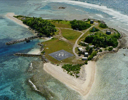
An aerial photograph of a small, low-lying tropical island surrounded by coral reef and ocean water. The island features a visible helipad, small buildings, and patches of vegetation.
Aerial view of Omelek Island within Kwajalein Atoll, showing the helipad and infrastructure.

Kwajalein Atoll ecosystems, habitats, and plant life

The natural environment of Kwajalein reflects its position in the tropical Pacific. The atoll experiences a tropical rainforest climate with consistently warm temperatures, high humidity, and substantial rainfall, supporting lush vegetation across most islands. Average temperatures vary only slightly through the year, while the naturally drier stretch from January through March provides a subtle seasonal rhythm within an otherwise constantly wet setting.

Vegetation across the atoll is typical of Marshall Islands ecosystems: dense stands of coconut palms and broadleaf tropical trees, jungle-like understory on less disturbed islets, and more modified landscapes on islands shaped by human activity. Vegetation on smaller islets such as Bigej and Gugeegue retains a particularly thick, forested character, while islands that have hosted military construction or industrial facilities show more sparse ground cover and built-up fill areas.

Marine ecosystems are the ecological centerpiece of the atoll. The surrounding ocean waters, typically warm and clear, support coral reefs along the outer rim and within the lagoon. These reefs connect many of Kwajalein's islands, in some cases forming walkable reef pathways at low tide, such as the corridor linking Kwajalein Island with smaller islets and ultimately with Ebeye. The lagoon itself hosts a complex mosaic of reef habitats, submerged wrecks from World War II and later eras, and sandy bottoms that collectively form the backbone of the atoll's natural character, even as much public attention focuses on the military and human-built features above the waterline.
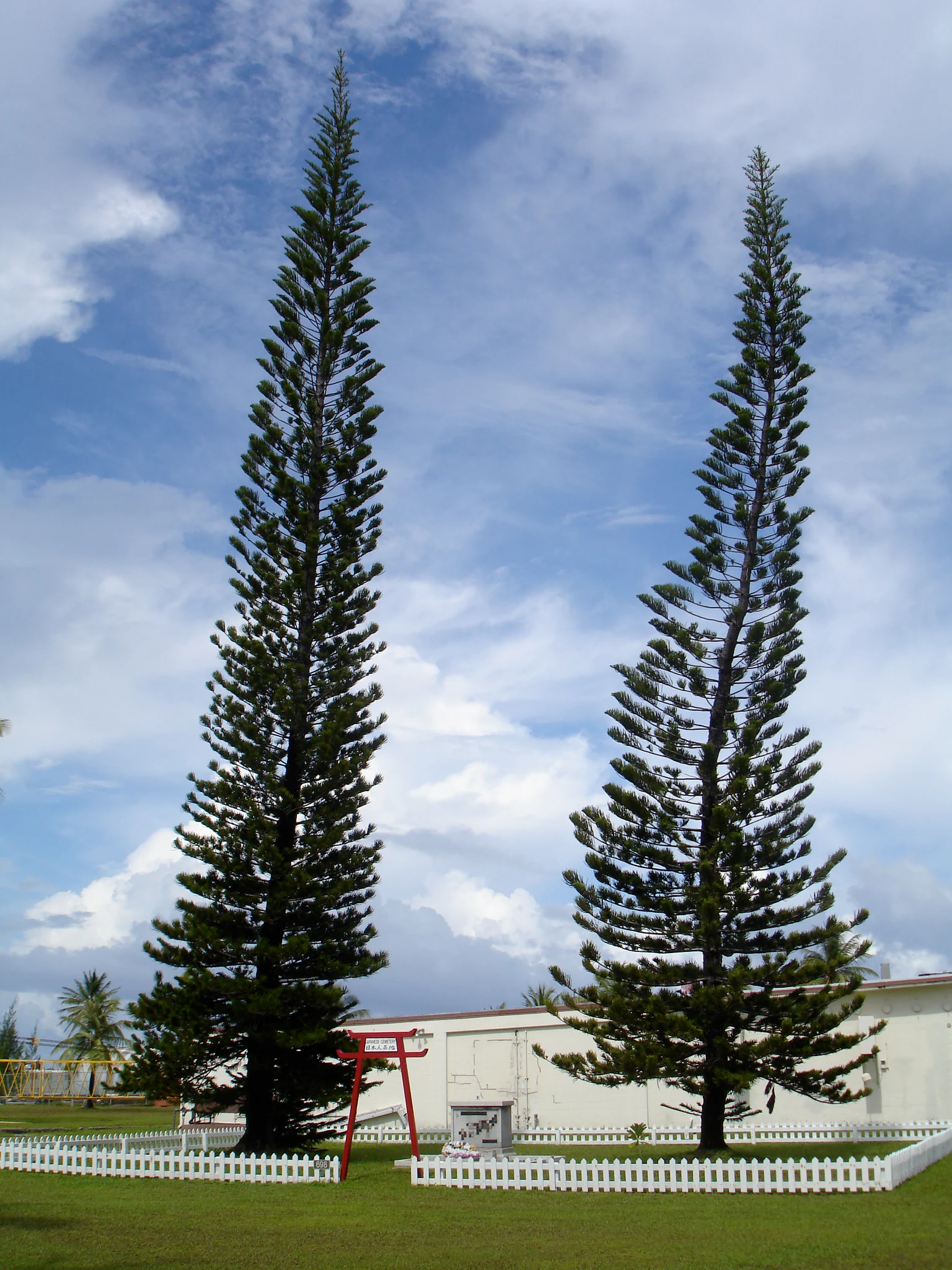
Two tall, slender coniferous trees stand beside a small red torii gate and a memorial plaque within a white-fenced enclosure on Kwajalein Atoll.
A memorial at the Japanese cemetery on Kwajalein Atoll, featuring tall columnar trees and a torii gate.

Kwajalein Atoll wildlife and species highlights

Although the Wikipedia source for Kwajalein emphasizes its human history, military infrastructure, and reef geography, the natural setting supports a tropical marine and island ecosystem typical of the central Pacific. Coral reefs around the atoll are inhabited by reef fish, sharks, and other marine fauna familiar to Micronesian waters, while the lagoon and ocean sides provide habitat for schooling pelagic species.

The atoll's many small islets create important seabird nesting habitat, with vegetation- and shoreline-based nesting sites used by various Pacific seabirds. The combination of forested interior islets, reef-fringed coastlines, and sheltered lagoon waters creates a mosaic of habitats that supports a recognizable atoll wildlife community, even if the documentation in this source is limited.

On land, native fauna follows Marshallese island patterns, with geckos, crabs, and other small island creatures playing an important role in island ecology. The atoll's dense populations of coconut palms also support a wide variety of insects and pollinator communities typical of Micronesian atolls, while the surrounding reefs and reefs flats sustain both resident and migratory marine life shaped by Pacific currents.
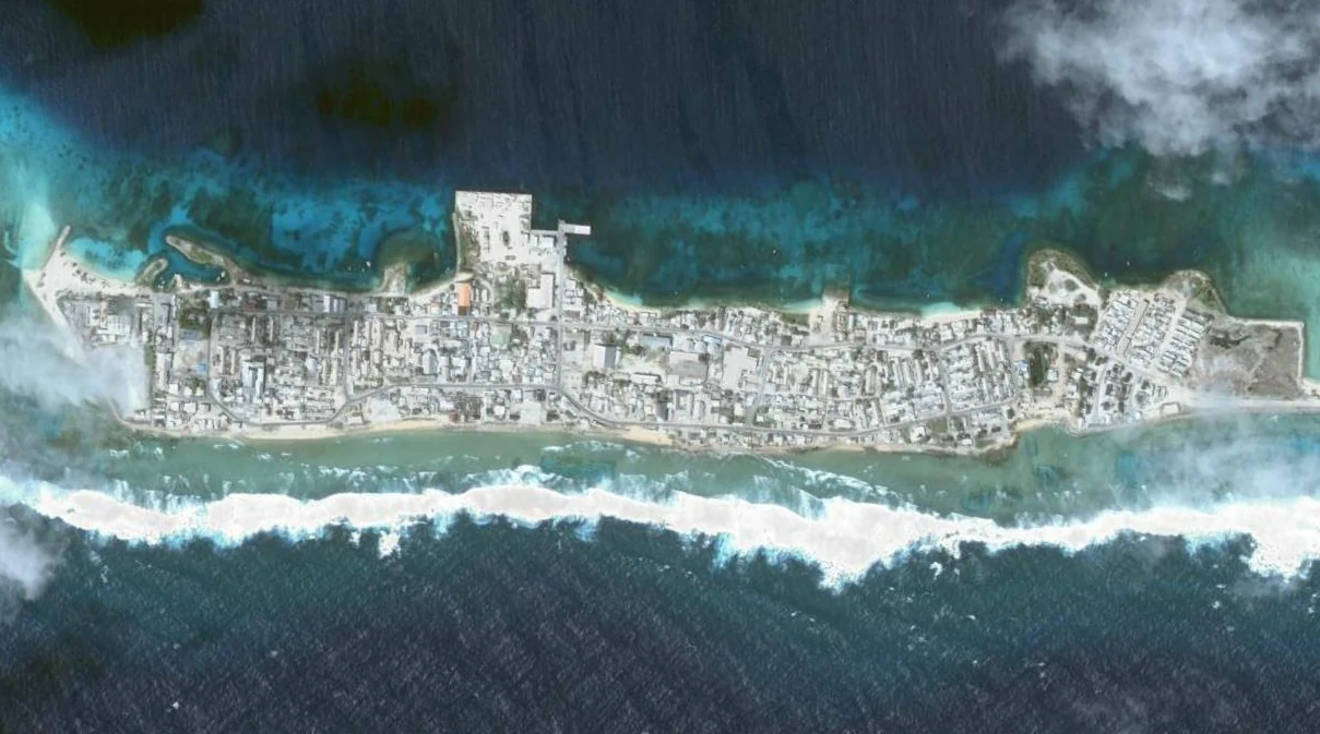
Top-down satellite view of a thin, densely developed island surrounded by turquoise and deep blue ocean water, showing distinct urban structure and reef formations.
Satellite imagery of Ebeye Island, a populated island within the Kwajalein Atoll.

Kwajalein Atoll conservation status and protection priorities

From a conservation perspective, Kwajalein sits at the intersection of ecological vulnerability and strategic geopolitical importance. As a low-lying coral atoll, it is intrinsically sensitive to sea-level rise, storm surge, and coral bleaching events driven by changing ocean conditions. The same reef systems that define the atoll's natural character are also affected by the long history of human activity, including World War II battle damage, postwar military construction, and modern testing operations.

The U.S. military presence has both constrained and shaped conservation outcomes. Restrictions on access to many islands have, in some places, preserved relatively undisturbed habitat and traditional vegetation. At the same time, dredging and fill operations to enlarge islands such as Kwajalein and Roi-Namur, the deposition of wartime wrecks in the lagoon, and ongoing missile and rocket testing across several leased islands represent significant and ongoing environmental pressures. The Compact of Free Association and related land use agreements have included discussions about environmental safeguards, but documentation in the provided source indicates that this remains an area of contested concern rather than settled policy.

The preservation of cultural heritage also functions as an important form of conservation on the atoll. Memorial sites on Kwajalein and Roi-Namur, the protection of culturally significant islands such as Enmat and other sacred chiefly sites, and dialogue over wartime remains and repatriation all reflect broader attempts to safeguard both natural and cultural values tied to Kwajalein's identity.

Kwajalein Atoll cultural meaning and human context

Kwajalein holds deep significance in Marshallese cultural identity. The atoll's traditional name, Kuwajleen, is thought to derive from a phrase referring to people who harvest flowers, an image connected to a sacred flowering tree believed to carry spiritual powers. This symbolism continues to inform how Marshallese speakers understand the atoll's enduring importance, even after more than a century of foreign administration and military use.

The atoll's chiefly lineages, particularly those associated with islands such as Enmat, maintain traditional concepts of land tenure and ritual access that continue to shape daily life. Concepts such as mo, or taboo, still govern access to certain sacred islets and burial sites. The matrilineal inheritance of land and the central role of irooj (chiefs), alaps (clan heads), and rijerbal (workers) remain structuring principles behind ongoing negotiations with the United States over property and compensation.

The wartime experience left another lasting cultural layer. Both Marshallese families and the families of Japanese and Korean laborers who died on the atoll maintain memorial traditions, with visitors periodically traveling to Kwajalein to pay respects at the cemetery and at the lagoon wrecks considered sacred graves. The National Historic Landmark designation of parts of Kwajalein and Roi-Namur reflects broader recognition of the atoll's shared and contested history, while Marshallese oral traditions continue to interpret colonization, militarization, and displacement as part of an ongoing narrative about the meaning of the atoll's flowers.

Aerial view of a thin, curved, sandy coral island atoll surrounded by dark blue ocean water, partially obscured by scattered white clouds.
Aerial view of a segment of Kwajalein Atoll, showing its low-lying coral landmass surrounded by the Pacific Ocean.

Top sights and standout views in Kwajalein Atoll

Among the most notable features of Kwajalein are the sheer scale of its enclosed lagoon, the dense inhabited strip formed by Ebeye and its connected islets, and the unmistakable military skyline of radars, tracking installations, and reconstructed islands that make the atoll one of the Pacific's most recognizable defense-testing platforms.

Equally distinctive are the wartime heritage assets scattered across the atoll, from Japanese bunkers preserved on Roi-Namur to a lagoon dotted with sunken vessels including the German cruiser Prinz Eugen, and the cultural resonance of islands such as Enubuj, Enmat, and Bigej, where military use, traditional chiefly authority, and everyday Marshallese life intersect. The combination of reef, lagoon, low coral islands, missile launch sites, and memorials gives Kwajalein an identity found nowhere else in the Marshall Islands.
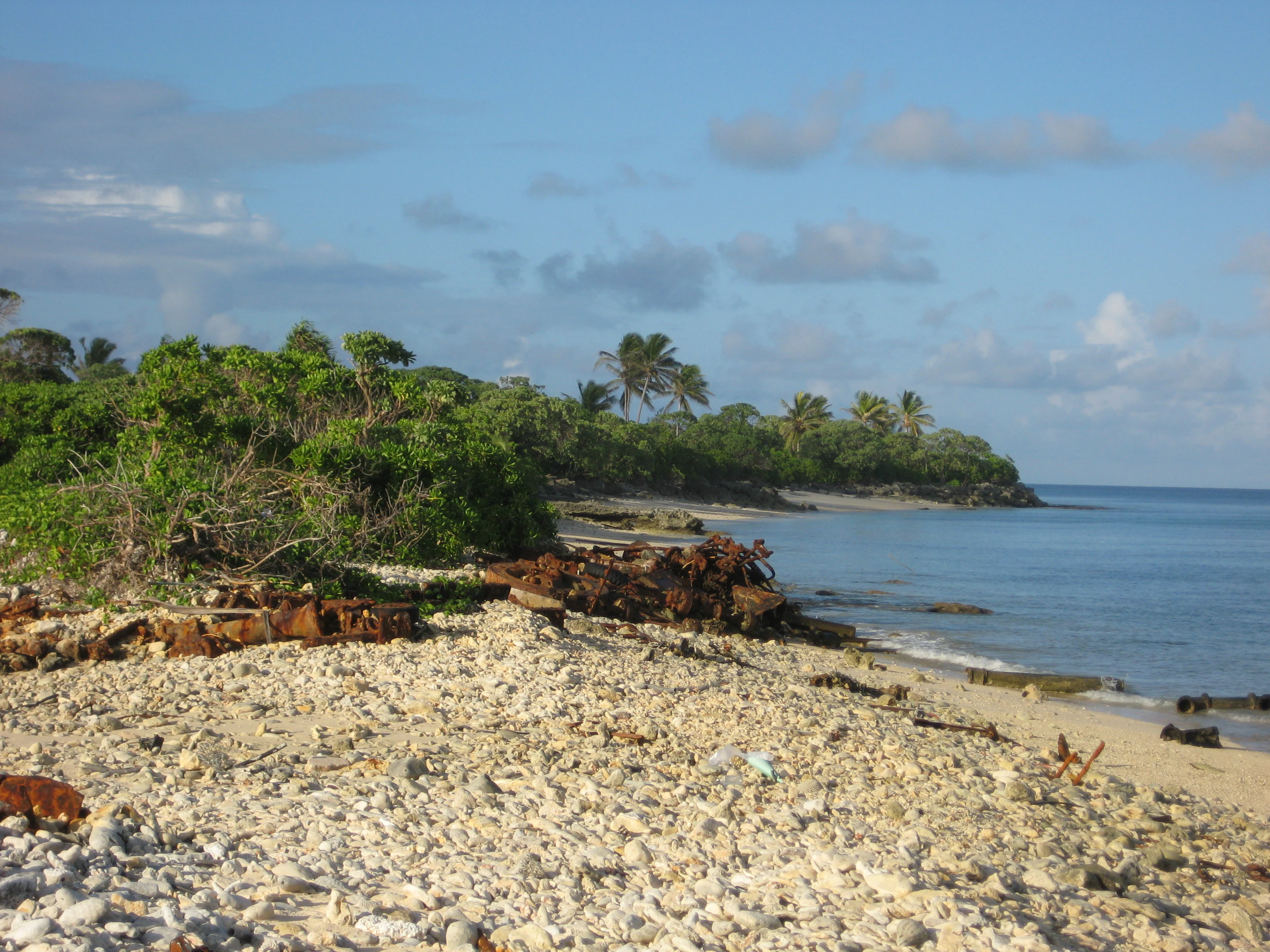
A sunny coastal scene featuring a rocky and sandy shoreline with scattered metal debris, leading into dense green tropical vegetation and palm trees under a blue sky.
A coastal view at the northern point of Gugeegue Island within Kwajalein Atoll, showing rocky shorelines and dense vegetation.

Best time to visit Kwajalein Atoll

Kwajalein sits in a wet tropical climate where temperatures remain warm year-round, so conditions vary more in rainfall than in temperature. The naturally drier stretch from January through March tends to bring slightly less rain and humidity, while the rest of the year is characterized by heavier showers, higher humidity, and lush conditions across the islands.

Because most of Kwajalein is a restricted military installation with limited tourism access, seasonal timing is less about visitor comfort and more about reef conditions, lagoon visibility, and the relative quiet of the testing range. Periods outside major missile and space-launch campaigns tend to feel calmer, and clearer weather windows toward the start of the year may coincide with better reef visibility and more comfortable outdoor conditions around the inhabited islets. In every season, however, the tropical climate keeps the atoll warm, humid, and rainfall-prone, making flexible expectations important.
Monthly climate preview

Monthly averages and long-term climate data derived from representative coordinate records

Kwajalein Atoll Climate Normals, Annual Temperature and Precipitation Patterns

Representative coordinate records for Kwajalein Atoll demonstrate consistent year-round thermal averages alongside shifting monthly precipitation totals. Detailed monthly breakdowns provide complete visibility into long-term climate normals across the protected area.
Annual mean28 °C
28 °C28 °C
Jan28°
Feb28°
Mar28°
Apr28°
May28°
Jun28°
Jul28°
Aug28°
Sep28°
Oct28°
Nov28°
Dec28°
Warmest month
November

28.3 °C

Coolest month
February

27.5 °C

Wettest month
October

8.2 mm/day

Driest month
February

2.6 mm/day

Park location guide

Geography guide, regional context, and park location map for Kwajalein Atoll

Kwajalein Atoll park geography, regions, and map view in Marshall Islands

Understand where Kwajalein Atoll sits in Marshall Islands through a broader geographic reading of the surrounding landscape, nearby location context, and its mapped position within the national park landscape.

How Kwajalein Atoll fits into Marshall Islands

The Marshall Islands is a sovereign island nation in Oceania, located in the Micronesia region of the Northwestern Pacific Ocean. The territory consists of 29 coral atolls and five main islands plus over 1,200 very small ones, divided across two island chains: Ratak in the east and Ralik in the west. The country gained independence from the United States in 1979 and maintains a Compact of Free Association with the US. It is notable for having the highest proportion of water to land of any sovereign state, at 98.62%.

Wider geography shaping Kwajalein Atoll in Marshall Islands

The Marshall Islands is located in the Micronesia region of the Northwestern Pacific Ocean, west of the International Date Line and north of the equator. The territory is composed of 29 coral atolls and five main islands, plus approximately 1,220 very small islets, divided into two island chains: Ratak (eastern) and Ralik (western). Maritime boundaries are shared with Wake Island to the north, Kiribati to the southeast, Nauru to the south, and the Federated States of Micronesia to the west.

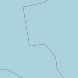
Map view of Kwajalein Atoll

Use this park location map to pinpoint Kwajalein Atoll in Marshall Islands, understand its exact geographic position, and read its mapped placement within the surrounding landscape more clearly.

Pigeon | © OpenStreetMap contributors

Location context for Kwajalein Atoll

Ralik Chain

Visual reference collection for the terrain, vast enclosed lagoon, and coral island environment.

Kwajalein Atoll Photos, Scenery, and Mapped Protected Landscapes

Visual records capture the distinctive physical geography, low coral formations, and expansive marine lagoon of Kwajalein Atoll. Examining these protected area views helps researchers understand the delicate balance between tropical island habitats and specialized defense facilities across the Ralik Chain.

Top-down satellite image of Kwajalein Atoll showing the coral reef ring surrounded by deep ocean water.

An aerial panoramic view of a long, narrow coral island surrounded by deep blue ocean, with an airstrip and support buildings visible on the island.

An aerial photograph of a small, low-lying tropical island surrounded by coral reef and ocean water. The island features a visible helipad, small buildings, and patches of vegetation.

Two tall, slender coniferous trees stand beside a small red torii gate and a memorial plaque within a white-fenced enclosure on Kwajalein Atoll.

Top-down satellite view of a thin, densely developed island surrounded by turquoise and deep blue ocean water, showing distinct urban structure and reef formations.

An aerial photograph of a low-lying coral island surrounded by turquoise lagoon waters and deep blue ocean, featuring an airstrip and scattered structures.

Aerial view of a thin, curved, sandy coral island atoll surrounded by dark blue ocean water, partially obscured by scattered white clouds.

A sunny coastal scene featuring a rocky and sandy shoreline with scattered metal debris, leading into dense green tropical vegetation and palm trees under a blue sky.

A view of an ocean beach at sunset with waves breaking on a rocky, sandy shore and tropical vegetation on the right.

Park atlas

Compare surrounding coral atolls and connected Pacific island landscapes.

Parks Near Kwajalein Atoll And Related Protected Areas In The Region

Browsing parks near Kwajalein Atoll reveals wider marine ecosystems and remote protected island geographies across the Pacific. Continuing the comparison helps connect unique lagoon formations with broader regional conservation landscapes.
Watercolor painting of a landscape showing a body of water surrounded by green land with trees and distant hills, with soft pink and purple washes on the sides
Protected areaMarshall Islands
About 202 km away#1 closest

Northeast

Likiep Atoll: A Mapped Protected Area in the Marshall Islands Ratak Chain

Coral atoll geography and historical colonial landscape features

Likiep Atoll consists of 65 islands encircling a 424 square kilometer lagoon. As a protected area in the Marshall Islands, it offers insight into low lying atoll topography, unique marine environments, and the cultural remnants of successive colonial administrations.

Area
10.26 km²
Relief
Lowland
Climate
Tropical
Access
Remote access
Protected areaMarshall Islands
About 291 km away#2 closest

North

Rongerik Atoll Protected Area: Mapping the Marshall Islands Coral Landscape

Remote coral atoll geography and lagoon structures in the Ralik Chain.

Rongerik Atoll presents a textbook example of Pacific atoll geography, where a cluster of small islets encloses an expansive lagoon. As a protected area located in the remote Marshall Islands, this site serves as a vital point of study for understanding coral reef systems and the isolated island terrain of the Ralik Chain. The landscape provides clear insights into the physical contrast between narrow coral landmasses and the deep interior waters characteristic of the region.

Area
1.68 km²
Relief
Lowland
Climate
Tropical
Access
Remote access
Protected areaMarshall Islands
About 300 km away#3 closest

Northeast

Ailuk Atoll Protected Area: Geography and Mapped Coral Landscapes in the Marshall Islands

Pacific atoll terrain, lagoon systems, and island geography

Study the geographic composition of Ailuk Atoll, featuring its classic ring of coral islets, deep-water reef passes, and vast central lagoon. This protected area offers insight into the subsidence-driven formation of Marshallese island chains and the enduring human reliance on traditional maritime navigation within a fragile Pacific ecosystem.

Area
5.4 km²
Relief
Lowland
Climate
Tropical
Access
Remote access
A minimalist watercolor painting featuring soft, light green hills in the foreground and faded, purple-toned mountains in the distant background, all set against a white backdrop.
Protected areaMarshall Islands
About 306 km away#4 closest

North

Rongelap Atoll Protected Area: Geography, Reef Structure, and Marshall Islands Context

Coral atoll terrain in the Pacific Ralik Chain

Located in the Ralik Chain of the Marshall Islands, Rongelap Atoll consists of 61 low-lying coral motus that enclose a lagoon covering 2,600 square kilometers. The atoll serves as a significant geographic study area, known for its distinct reef-built structure and its enduring role in Pacific history. This protected area continues to represent the ecological and cultural complexity of the Micronesian archipelago.

Area
21 km²
Relief
Lowland
Climate
Tropical
Access
Remote access
Protected areaMarshall Islands
About 311 km away#5 closest

Northwest

Ailinginae Atoll Protected Area: Geographic Overview and Mapped Lagoon Systems

Remote coral atoll landscape in the Marshall Islands

Uncover the geographic structure of Ailinginae Atoll, an uninhabited coral ring in the Marshall Islands characterized by its expansive internal lagoon and narrow island segments. This protected area offers significant insight into the terrain of low-lying Pacific atoll ecosystems and their role within the Ralik Chain geographic framework.

Area
2.8 km²
Relief
Lowland
Water
Water-dominated
Protected areaMarshall Islands
About 345 km away#6 closest

South

Namdrik Atoll Protected Area: Geography and Coastal Ecosystems in the Marshall Islands

A remote Ramsar-recognized coral atoll and marine wetland.

Namdrik Atoll is a distinctive coral atoll within the Ralik Chain of the Marshall Islands, recognized for its exceptional mangrove forests and protected marine ecosystems. This area consists of two wooded islands enclosing a large lagoon without navigable passes, creating an isolated habitat for sea turtles and diverse reef life. Explore the geography of this small, ecologically significant protected land that represents the unique environmental character of the central Pacific.

Area
2.8 km²
Established
2012
Relief
Lowland
Climate
Tropical
Nature reserveMarshall Islands
About 374 km away#7 closest

Southeast

Jaluit Atoll Nature Reserve: Protected Coral Landscapes in the Marshall Islands

Coastal reef and lagoon geography of the Ralik Chain

Jaluit Atoll constitutes a sprawling nature reserve in the Marshall Islands, characterized by its kite shaped lagoon and 91 low lying coral islets. As a recognized Ramsar wetland site, this protected area offers a deep look into Pacific atoll structure and the interplay between marine conservation and historical heritage. The atoll remains a central geographic feature of the Ralik Chain.

Area
11.34 km²
Established
2004
Relief
Lowland
Climate
Tropical
A watercolor painting showing a panoramic view of soft, green rolling hills, a cluster of trees, and a calm water surface in a light, muted palette.
Protected areaMarshall Islands
About 441 km away#8 closest

Southeast

Majuro: Mapping the Protected Coral Atoll Landscapes and Island Geography of the Marshall Islands

Regional atoll atlas and protected lagoon geography.

Majuro serves as the primary administrative and geographic anchor within the Marshall Islands. This detailed mapping showcases the atoll's signature structure, characterized by 64 narrow islets enclosing a massive, sheltered 295 square kilometer lagoon. Delve into the specific landforms and regional marine geography that define this Pacific protected environment.

Area
9.7 km²
Relief
Lowland
Climate
Tropical
Access
Moderate access

Common questions about visiting, size, designation, and location context for Kwajalein Atoll

Kwajalein Atoll FAQs for park facts, access, geography, and protected area context

Find quick answers about Kwajalein Atoll, including protected-area facts, park geography, trail and visitor context, and how the park fits into its surrounding country and regional landscape.
MoriAtlas Explorer

Continue Your Protected Areas Search Across the Global Atlas

Deepen your exploration by continuing the structured search for national parks and protected areas worldwide. Utilize the comprehensive filtering capabilities to compare different conservation landscapes and refine your understanding of global park geography. Discover more about the distribution and characteristics of protected natural areas.

Global natural geography