

Mori Atlas logo
Protected landscapeLake Chelan National Recreation Area

Mapping the dramatic intersection of deep glacial waters, mountain ridges, and remote valleys.

Lake Chelan National Recreation Area: An Atlas of North Cascades Protected Landscapes

Lake Chelan National Recreation Area encompasses 62,000 acres of rugged mountain terrain within the North Cascades of Washington State. This protected landscape is defined by the steep, forested slopes rising sharply from the deep, glacial waters of Lake Chelan and the winding corridor of the Stehekin River. Its geography captures a distinct wilderness character shaped by U-shaped troughs, high cirques, and alpine ridges accessible only by water, air, or remote trail systems.

lakealpine lakesNorth Cascadesmountain valleyremote destinationferry access
A colorful digital illustration featuring a winding river flowing through a deep mountain valley, with coniferous trees in the foreground and snowy peaks in the distance.

Lake Chelan National Recreation Area

Protected landscape

Park overview

Structured park overview, official facts, and landscape profile for Lake Chelan National Recreation Area

Lake Chelan National Recreation Area park facts, protected area profile, and essential visitor context

Review the core facts for Lake Chelan National Recreation Area, including designation, size, terrain, visitor scale, habitats, and operating context in one park-focused overview.

About Lake Chelan National Recreation Area

Lake Chelan National Recreation Area is one of the three units of the North Cascades National Park Service Complex in Washington State. It sits along the upper reaches of Lake Chelan, a long, narrow, and exceptionally deep lake that cuts deep into the heart of the Cascade Range. The recreation area wraps around the northern end of the lake and extends into the Stehekin Valley, where the Stehekin River continues to drain meltwater and seasonal rains from the surrounding high country.

The recreation area is bordered to the north and west by the South Unit of North Cascades National Park, placing it within a large, contiguous block of federally protected Cascade terrain. Although relatively compact in national terms, the area spans a considerable vertical range, with the lake surface sitting far below the jagged, glacier-carved ridges and peaks that rise on either side. This vertical relief produces a striking landscape of cliffs, hanging valleys, talus slopes, dense evergreen forest, and pockets of alpine meadow.

A defining feature of the Lake Chelan National Recreation Area is the absence of road access. Visitors cannot drive into the area; instead, they reach it by passenger ferry from the southern end of the lake near the town of Chelan, by floatplane, or on foot via hiking trails that descend from the Cascade crest, including the Pacific Crest Trail. In summer, a National Park Service off-road bus shuttles hikers from the trailheads down to the lakeshore and the small community of Stehekin. This restricted access has helped preserve the quiet, undeveloped character of the upper lake and its valley.

Stehekin itself, with fewer than 100 permanent residents, is more than a scenic stop along the lake. It is a functioning rural community, and the designation of the area as a national recreation area was shaped in part by the need to accommodate its residents. Rather than a strict preservation mandate like a national park, Lake Chelan National Recreation Area emphasizes outdoor recreation while allowing the community to continue its traditional way of life. The result is a rare blend of protected wilderness scenery, public recreation, and living cultural landscape within a single federally managed unit.

Quick facts and research context for Lake Chelan National Recreation Area

Lake Chelan National Recreation Area is a federally managed recreation area of about 61,958 acres in Chelan County, Washington. It was established on October 2, 1968, and is jointly administered with the neighboring North Cascades National Park as part of the North Cascades National Park Service Complex.

The recreation area encompasses the upper portion of Lake Chelan, a glacially carved lake that reaches depths of around 1,500 feet and stretches more than 50 miles, along with the Stehekin Valley and surrounding Cascade peaks. There are no vehicular roads into the area; access is by ferry, floatplane, or foot trail. The community of Stehekin, a small settlement with fewer than 100 year-round residents, lies within its boundaries, along with several structures listed on the National Register of Historic Places, including the Buckner Homestead Historic District and the Stehekin School.

Protection and recognition

Terrestrial protected area parameters, management scope, and international status records.

Lake Chelan National Recreation Area Protection Status and Formal Recognition Data

Lake Chelan National Recreation Area features documented terrestrial protection status and administrative records compiled for conservation analysis. Structured federal data details the official protected area designation and management scope without external assumptions.

Protection details

Protection scope
Terrestrial
Transboundary protection
No
Park context

Deeper park guide and search-rich context for Lake Chelan National Recreation Area

Lake Chelan National Recreation Area history, landscape, wildlife, and travel context

Explore Lake Chelan National Recreation Area through its history, landscape character, ecosystems, wildlife, conservation priorities, cultural context, and seasonal travel timing in a structured park guide built for atlas discovery and search intent.

Why Lake Chelan National Recreation Area stands out

Lake Chelan National Recreation Area is best known for the dramatic setting of Lake Chelan itself, an exceptionally deep and long glacially carved lake nestled into the ridges of the North Cascades. The lake, with depths approaching 1,500 feet and a length of more than 50 miles, is one of the defining geographic features of central Washington and the focal point of recreation in the area. Equally defining is the area's extraordinary remoteness. With no road access, the upper end of the lake and the Stehekin Valley retain a wilderness-like quality even though they lie within a recreation area rather than a formal wilderness zone. The combination of deep blue lake water, steep forested slopes, glacier-scoured peaks, and a small year-round community at Stehekin reachable only by boat, plane, or trail gives the recreation area a distinctive identity within the broader North Cascades landscape.
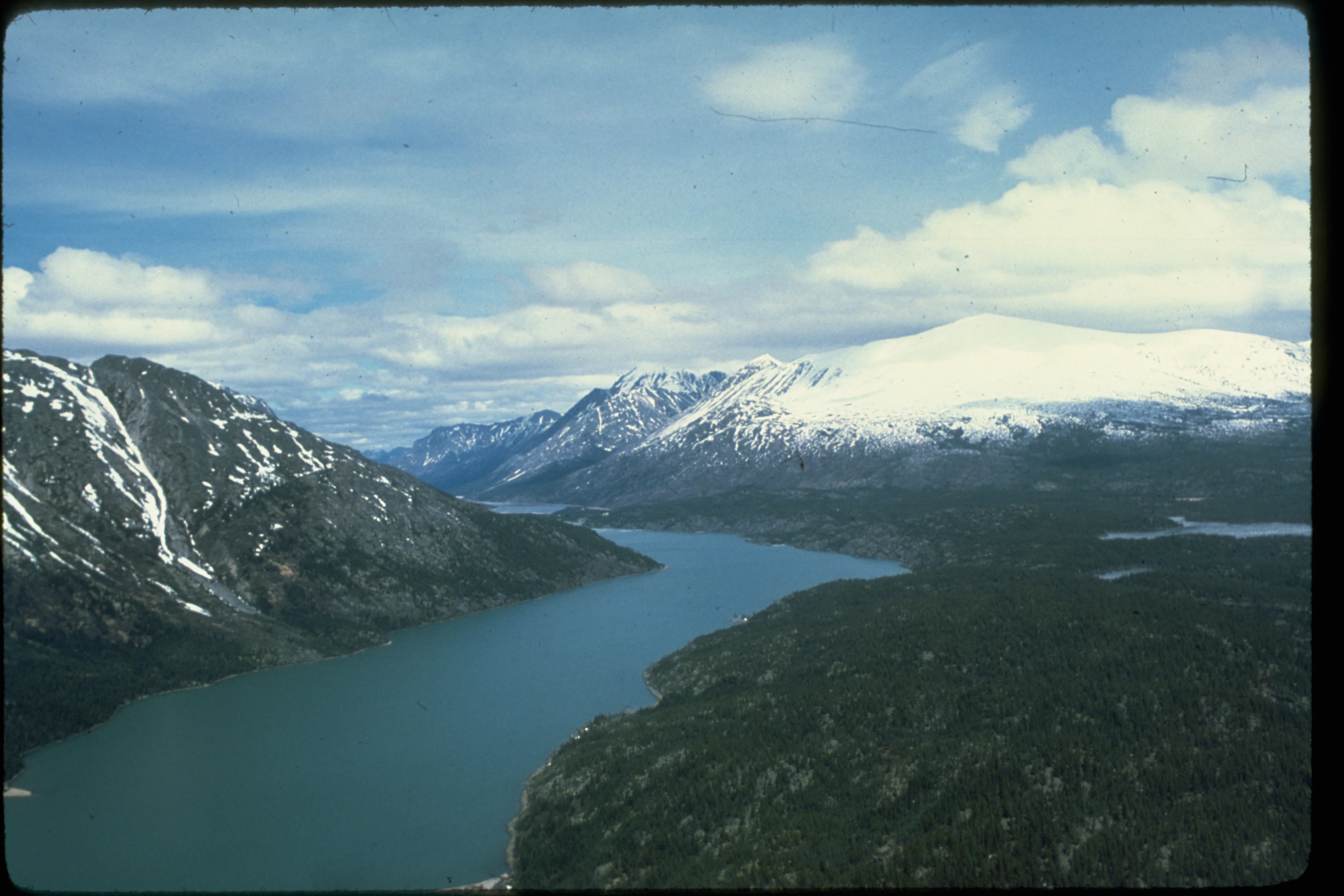
An aerial shot of a long, narrow lake winding through a valley, flanked by tall, snow-capped mountains and dense coniferous forest.
An aerial view of the northern end of Lake Chelan surrounded by the steep, snow-capped peaks of the North Cascades.

Lake Chelan National Recreation Area history and protected-area timeline

Lake Chelan National Recreation Area was established on October 2, 1968, as part of a broader federal effort to protect the wild character of the North Cascades. Its creation coincided with the establishment of the adjacent North Cascades National Park and the Ross Lake National Recreation Area, formalizing what is today known as the North Cascades National Park Service Complex.

The name Stehekin, used for the valley and the small community within the recreation area, comes from a Salish language word meaning roughly the way through. The name reflects the valley's long role as a passage for people and wildlife moving between the lake country and the higher reaches of the northern Cascades. Indigenous peoples long traveled this route, and later settlers, miners, homesteaders, and rangers followed the same corridor into the upper valley.

Early twentieth-century homesteading left a lasting mark on the area. Structures from this era, including the Buckner Homestead, the Purple Point-Stehekin Ranger Station House, and the one-room Stehekin School, survive within the recreation area and are listed on the National Register of Historic Places. They reflect the small-scale agricultural and administrative life that once characterized the remote valley.

From its earliest days, the National Park Service recognized that Stehekin's permanent residents meant the area could not be managed purely as a preservation unit. To avoid disrupting the lives of the local community, the agency chose a recreation-focused designation, with the state of Washington retaining certain authorities and the federal government holding proprietary rather than exclusive jurisdiction. This compromise has shaped the character of the recreation area ever since, balancing stewardship of the surrounding mountains and lake with the ongoing presence of Stehekin's year-round residents.

Lake Chelan National Recreation Area landscape and geographic character

The landscape of Lake Chelan National Recreation Area is defined by the tremendous contrast between the cold, deep waters of Lake Chelan and the steep, forested ridges of the Cascade Range that rise around it. The lake, more than 50 miles long and reaching depths near 1,500 feet, occupies a U-shaped trough carved by glaciers during past ice ages. Its narrow upper reaches are flanked by cliffs and forested slopes that climb sharply from the shoreline.

Above the lake and its wooded shoulders, the terrain becomes progressively more rugged. Glacially carved valleys, exposed rock faces, talus and scree slopes, and snowfields give way higher up to true alpine terrain. Peaks and ridges associated with the broader North Cascades crest define much of the horizon, and small remnant glaciers cling to high cirques on the surrounding mountains.

Water is a constant presence. The Stehekin River flows out of the upper end of Lake Chelan and tumbles down the valley, fed by snowmelt and runoff from the surrounding peaks. Its corridor, along with tributary creeks, creates a mosaic of riparian flats, gravel bars, and old growth forest along the valley floor. This combination of lake, river, forest, and high mountain country is the defining physical character of the recreation area.

Lake Chelan National Recreation Area ecosystems, habitats, and plant life

Ecologically, the recreation area sits within the moist, mountainous zone of the western North Cascades. The lower elevations around Lake Chelan and the Stehekin River are dominated by dense coniferous forest, with Douglas fir, western red cedar, hemlock, and other evergreen species typical of the Pacific Northwest. Old growth and mature second growth stands line much of the shoreline and valley, giving the area a deep, shaded character.

As elevation increases, forest gives way to subalpine parkland, meadows, and bare rock. Cold air drainage off the surrounding peaks, persistent snowpack at higher elevations, and the lacustrine climate of the deep lake create a varied microclimate within a relatively small area. Riparian zones along the Stehekin River and its tributaries support distinctive plant communities, while cliffs and rocky outcrops provide specialized habitat for cliff-dwelling plants and raptors.

The mixing of low-elevation forest, riverine habitat, lake shoreline, subalpine slopes, and high alpine terrain within a single protected unit gives Lake Chelan National Recreation Area a rich ecological gradient. This variety supports a wide range of wildlife and contributes to the strong sense of ecological transition that defines visits to the area.

Lake Chelan National Recreation Area wildlife and species highlights

Wildlife in Lake Chelan National Recreation Area reflects the layering of habitats from lakeshore to alpine ridge. Mule deer and black bears are among the most commonly encountered mammals, moving seasonally between low-elevation forest and higher summer range. Smaller mammals, including squirrels, chipmunks, and various mustelids, inhabit the forested slopes and valley floors.

The lake and the Stehekin River host fish populations typical of cold, clean Cascade waters, and support recreational angling. Along the shoreline, waterfowl, ospreys, bald eagles, and a variety of other birdlife are regularly observed. Above the lake, the forested ridges and meadows provide habitat for forest songbirds, woodpeckers, and raptors, while the rocky high country offers ranging habitat for species adapted to alpine and subalpine conditions.

Because access is limited and human use is dispersed across trails, ferry landings, and shoreline camps, wildlife encounters in the recreation area often feel unusually close and undisturbed. This combination of habitat diversity and low-impact visitation patterns gives the wildlife experience in the area a notably wild character, even though the surrounding land has a long history of human presence at Stehekin.

Lake Chelan National Recreation Area conservation status and protection priorities

Lake Chelan National Recreation Area was established to protect a landscape of exceptional natural value at the head of Lake Chelan and along the Stehekin Valley, ensuring that its lake, river, forests, and surrounding mountain terrain remained under federal stewardship as part of the broader North Cascades complex. Its location adjacent to the South Unit of North Cascades National Park means that conservation of the recreation area directly supports the ecological integrity of one of the most protected and wild mountainous landscapes in the contiguous United States.

From a conservation standpoint, the area's lack of road access is central to its value. With no highways cutting through the lake's upper basin and only foot, boat, and air access into Stehekin, the watershed of the upper lake and the Stehekin River has remained comparatively intact. This protects water quality, riparian systems, and the integrity of forest stands and wildlife corridors that extend deep into the southern North Cascades.

At the same time, the recreation area reflects a distinctive conservation approach. The decision to designate it as a national recreation area rather than a national park acknowledged the presence of the year-round community at Stehekin and the need to balance preservation with the continuity of rural mountain life. The result is a protected landscape where conservation of scenery, habitat, and watershed coexists with a small, persistent human settlement, an unusually nuanced model within the National Park System.

Lake Chelan National Recreation Area cultural meaning and human context

The cultural identity of Lake Chelan National Recreation Area is shaped strongly by the small community of Stehekin, whose name derives from a Salish word meaning the way through. Long before the arrival of homesteaders or the establishment of the recreation area, the upper Stehekin Valley and the lake served as a travel corridor between the lake country and the high northern Cascades, used by Indigenous peoples and later by prospectors, trail builders, and rangers.

In the twentieth century, homesteaders and early park-era rangers settled in the Stehekin Valley, leaving behind structures such as the Buckner Homestead, the Purple Point-Stehekin Ranger Station House, and the Stehekin School. These buildings, listed on the National Register of Historic Places, anchor the human story of the upper valley and remain an important part of how visitors experience the area.

The ongoing presence of Stehekin's residents means that Lake Chelan National Recreation Area is not simply a backdrop for outdoor recreation but a place where a small, isolated community continues to live within a federally protected landscape. This coexistence of cultural heritage, remote settlement, and preserved wilderness is one of the most distinctive aspects of the area's identity.

Top sights and standout views in Lake Chelan National Recreation Area

The standout features of Lake Chelan National Recreation Area center on the lake itself, the Stehekin Valley, and the surrounding North Cascades terrain. The lake's depth and length create a striking setting where steep forested ridges rise directly from the water, while the absence of road access preserves a rare sense of isolation within a federally managed area.

Equally distinctive is the community of Stehekin, with its historic homestead and ranger structures, and the unusual management approach that allows a year-round settlement to persist inside a national recreation area. Access experiences such as the passenger ferry up Lake Chelan, floatplane landings, and long-distance hikes in from the Pacific Crest Trail make arrival itself part of the area's appeal. Together, these features give the recreation area an identity that is both wild and quietly inhabited.

Best time to visit Lake Chelan National Recreation Area

Summer is the most practical and rewarding season to visit Lake Chelan National Recreation Area. The ferry to Stehekin runs regularly, the off-road shuttle along the Stehekin Valley road operates, hiking trails through the Cascades are largely snow-free, and the weather is most favorable for boating, fishing, and exploring the valley on foot.

In late spring and early fall, visitation drops and the landscape takes on a quieter character, though services and ferry schedules are reduced and high-country trails may still hold snow. Winter brings heavy snowfall to the surrounding mountains and effectively shuts down most recreational access to the upper lake and Stehekin, leaving the area primarily a destination for the warmer months. Visitors interested in wildflowers, high-country hiking, or warm lake conditions will find mid to late summer most rewarding, while those seeking a quieter experience may prefer the shoulder seasons.

Monthly climate preview

Long term temperature and precipitation patterns across representative coordinates

Lake Chelan National Recreation Area Climate Normals and Weather by Month

Lake Chelan National Recreation Area records distinct annual shifts in temperature and precipitation across its representative coordinate point from 1991 through 2020. Examining the complete monthly climate profile reveals detailed patterns in average highs, lows, and daily moisture distribution.
Annual mean2 °C
-7 °C14 °C
Jan-7°
Feb-6°
Mar-4°
Apr
May
Jun10°
Jul13°
Aug14°
Sep10°
Oct
Nov-3°
Dec-7°
Warmest month
August

13.6 °C

Coolest month
December

-7.3 °C

Wettest month
November

5.1 mm/day

Driest month
August

0.9 mm/day

Park location guide

Geography guide, regional context, and park location map for Lake Chelan National Recreation Area

Lake Chelan National Recreation Area park geography, regions, and map view in United States of America

Understand where Lake Chelan National Recreation Area sits in United States of America through a broader geographic reading of the surrounding landscape, nearby location context, and its mapped position within the national park landscape.

How Lake Chelan National Recreation Area fits into United States of America

The United States of America is a federal presidential republic and one of the world's largest countries by area and population. It consists of 50 states across a vast territory spanning multiple time zones, with its capital in Washington, D.C. and largest city in New York City. The nation has a diverse economy, influential political system, and significant cultural and military presence globally.

Wider geography shaping Lake Chelan National Recreation Area in United States of America

The United States occupies a vast territory in North America, bordered by Canada to the north and Mexico to the south. The 48 contiguous states stretch from the Atlantic to the Pacific Ocean, while Alaska occupies the northwestern region and Hawaii is an archipelago in the Pacific. The country encompasses diverse terrain including the Rocky Mountains, Appalachian Mountains, Great Plains, and extensive river systems.

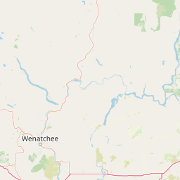
Map view of Lake Chelan National Recreation Area

Use this park location map to pinpoint Lake Chelan National Recreation Area in United States of America, understand its exact geographic position, and read its mapped placement within the surrounding landscape more clearly.

Pigeon | © OpenStreetMap contributors

Location context for Lake Chelan National Recreation Area

Chelan County
Natural feature types

Explore the Natural Features of Lake Chelan National Recreation Area

Navigate the physical geography of Lake Chelan National Recreation Area by browsing named landforms and water bodies. MoriAtlas organizes these features to help you visualize the complex terrain of this North Cascades landscape through a structured geographic lens.
Recorded earthquake history

Examine Recorded Earthquake History Near Lake Chelan National Recreation Area

Explore a structured collection of historical earthquake events associated with the North Cascades landscape surrounding Lake Chelan National Recreation Area. MoriAtlas provides a clear archive of recorded seismic data to support your investigation of regional geographic history and documented geological activity.

Lake Chelan National Recreation Area Earthquake History

Catalogued events

17 events

Strongest magnitude

Magnitude 4.6

Most recent event

May 28, 2022

This history includes earthquakes recorded inside the park or within 50 km of its borders

Visual reference guide to glacial lakes, river valleys, and rugged mountain terrain

Lake Chelan National Recreation Area Photos and Mountain Landscapes

Visual records capture the stark contrast between deep glacial waters and towering mountain peaks across the remote Stehekin Valley. Examining these protected area views reveals the rugged topography and distinct ecological habitats defining the surrounding North Cascades environment.

An aerial shot of a long, narrow lake winding through a valley, flanked by tall, snow-capped mountains and dense coniferous forest.

Park atlas

Compare adjacent protected areas and surrounding mountain geography in the North Cascades

Parks Near Lake Chelan National Recreation Area and Related Mountain Protected Landscapes

Browse other parks near Lake Chelan National Recreation Area to evaluate connected mountain ranges, river valleys, and glacially carved terrain. Comparing adjacent protected areas reveals broader regional geography across the wider Pacific Northwest landscape.
A soft watercolor illustration depicting a range of layered mountain peaks with green slopes and snow-covered summits against a white background.
Wildlife reserveWashington
Park boundaries overlap#1 closest

Southwest

Glacier Peak Wilderness: Mapping the Volcanic and Glaciated Geography of Washington State

A detailed look at one of the most remote volcanic reserves in the Cascade Range.

Defined by the presence of an isolated stratovolcano and extensive glacial systems, Glacier Peak Wilderness represents a significant protected area within the Washington Cascades. This overview details the rugged landscape, from the deeply incised river valleys of the Chiwawa and Suiattle to the high-alpine rock and ice environment at the peak summit, providing essential geographic context for this roadless wilderness.

Area
2,290.75 km²
Established
1960
IUCN
Ib
Relief
Mountain
Wildlife reserveWashington
Park boundaries overlap#2 closest

East

Lake Chelan-Sawtooth Wilderness: Geographic Atlas and Protected Landscape Overview

North Cascades Wilderness in Washington State

Located in the north-central Cascade Range of Washington, this protected wilderness area contains 63 glacial lakes and extensive alpine terrain. The region offers a complex landscape of cirques, subalpine meadows, and forested valleys that connect directly to the larger North Cascades protected network. Use this atlas to examine its mountainous geography and defined conservation boundaries.

Area
619.4 km²
Established
1984
IUCN
Ib
Relief
Mountain
National parkWashington
Park boundaries overlap#3 closest

Northwest

North Cascades National Park: US National Park Protected Landscape and Geographic Context

Explore mapped boundaries and regional Washington geography.

Gain insight into North Cascades National Park, a vital US National Park located in Washington. This entry focuses on its protected land status, mapped geographic extent, and its role within the regional atlas. Users seeking to understand the park's landscape character, natural terrain, and its specific location in Washington will find this an essential point for detailed park geography exploration and protected area discovery.

Area
2,042.26 km²
Established
1968
IUCN
II
Visitors
16.5K annual
A watercolor painting of a mountain landscape with soft-colored rolling hills, a green forest line, and foreground vegetation on a white background.
Protected landscapeWashington
Park boundaries overlap#4 closest

Northeast

Okanogan, Wenatchee National Forest: A Comprehensive Look at Washington's Protected Mountain Landscapes

Mapping ecological gradients and wilderness boundaries across the eastern Cascade Range

Spanning from the moist coniferous forests of the western Cascades to the arid plateaus of the Okanogan, this massive national forest protects an unmatched diversity of terrain. Explore the intricate geography of river-carved valleys, glacial cirques, and remote wilderness areas that characterize this critical environmental corridor in the Pacific Northwest.

Area
6,066.33 km²
Established
1911
Visitors
397K annual
Relief
Mountain
A watercolor painting showing a panoramic view of mountain peaks in the distance above green foothills and plains.
Protected landscapeWashington
13 km away#5 closest

Southwest

Mount Baker, Snoqualmie National Forest: Mapped Geography and Protected Landscape Analysis

Exploratory atlas of Washington's primary Cascade Range wilderness

Delve into the structural geography of Mount Baker, Snoqualmie National Forest. This protected area corridor serves as a major ecological transition zone between the Puget Sound lowlands and the interior Cascades, characterized by extensive glaciers, wild river systems, and iconic stratovolcanoes that define the regional landscape of Washington state.

Area
6,978 km²
Established
1974
Relief
Mountain
Climate
Alpine
A soft watercolor painting of a calm river or lake flowing through a green meadow with a forest and mountain range in the background.
Protected landscapeWashington
28 km away#6 closest

Northwest

Ross Lake National Recreation Area: A Glacial Reservoir Landscape in Washington

Mapping the Skagit River and North Cascades alpine corridor

Located in the heart of Washington, Ross Lake National Recreation Area preserves a unique landscape of connected reservoirs and deep, glacier-cut valleys. This protected area acts as a vital geographic link within the North Cascades, offering access to high-altitude peaks, riverine forests, and the distinct turquoise waters of Diablo Lake.

Area
475.81 km²
Established
1968
IUCN
V
Visitors
998K annual
A horizontal watercolor painting depicting a soft-focus mountain landscape with rolling green meadows, patches of coniferous forest, and distant pale mountains under a white sky.
State or regional parkBritish Columbia
61 km away#7 closest

North

E. C. Manning Provincial Park: A Comprehensive Geographic Atlas and Protected Area Overview

Mountainous terrain and ecological transitions in southern British Columbia

Spanning the cross section of the Canadian Cascades, E. C. Manning Provincial Park preserves a high-elevation landscape of wildflowers, glacial valleys, and mountain ridges. The protected area links temperate coastal rainforests with the arid interior, providing a study in regional hydrology and subalpine ecology defined by the Hozameen Range and the northern reaches of the Pacific Crest Trail.

Area
836.71 km²
Established
1941
IUCN
II
Visitors
1.1M annual
A horizontal watercolor painting showing a range of purple-tinted mountain peaks above a green forest and a light pinkish shoreline.
Wildlife reserveWashington
72 km away#8 closest

Northwest

Mount Baker Wilderness: Mapped Volcanic Peaks and Glacial Geography in Washington State

Protected wilderness boundaries in the Northern Cascades

Mount Baker Wilderness encompasses a vast mountain landscape characterized by an active stratovolcano and significant permanent snowfields. The terrain features a vertical gradient from dense west side conifer forests to exposed alpine summits, creating a distinct ecological corridor connected to neighboring protected areas in the Pacific Northwest.

Area
485.58 km²
Established
1984
IUCN
Ib
Relief
Mountain

Common questions about visiting, size, designation, and location context for Lake Chelan National Recreation Area

Lake Chelan National Recreation Area FAQs for park facts, access, geography, and protected area context

Find quick answers about Lake Chelan National Recreation Area, including protected-area facts, park geography, trail and visitor context, and how the park fits into its surrounding country and regional landscape.
MoriAtlas Explorer

Continue Your Protected Areas Search Across the Global Atlas

Deepen your exploration by continuing the structured search for national parks and protected areas worldwide. Utilize the comprehensive filtering capabilities to compare different conservation landscapes and refine your understanding of global park geography. Discover more about the distribution and characteristics of protected natural areas.

Global natural geography





