
Trip Timing Fundamentals
When is the Best Time to Visit Lake Manyara National Park for Your Safari?
Determining the best time to visit Lake Manyara National Park involves balancing the contrasting demands of wildlife visibility and the park's lush, seasonal transformation. Because the park relies on a mix of groundwater forest, alkaline lake shores, and woodland, your priorities dictate which season will provide the most rewarding experience. There is no single universal window, as the park undergoes significant physical changes between the dry and wet months that directly alter how animals congregate and how the landscape appears to the eye.
Seasonal Wildlife Dynamics and Visibility
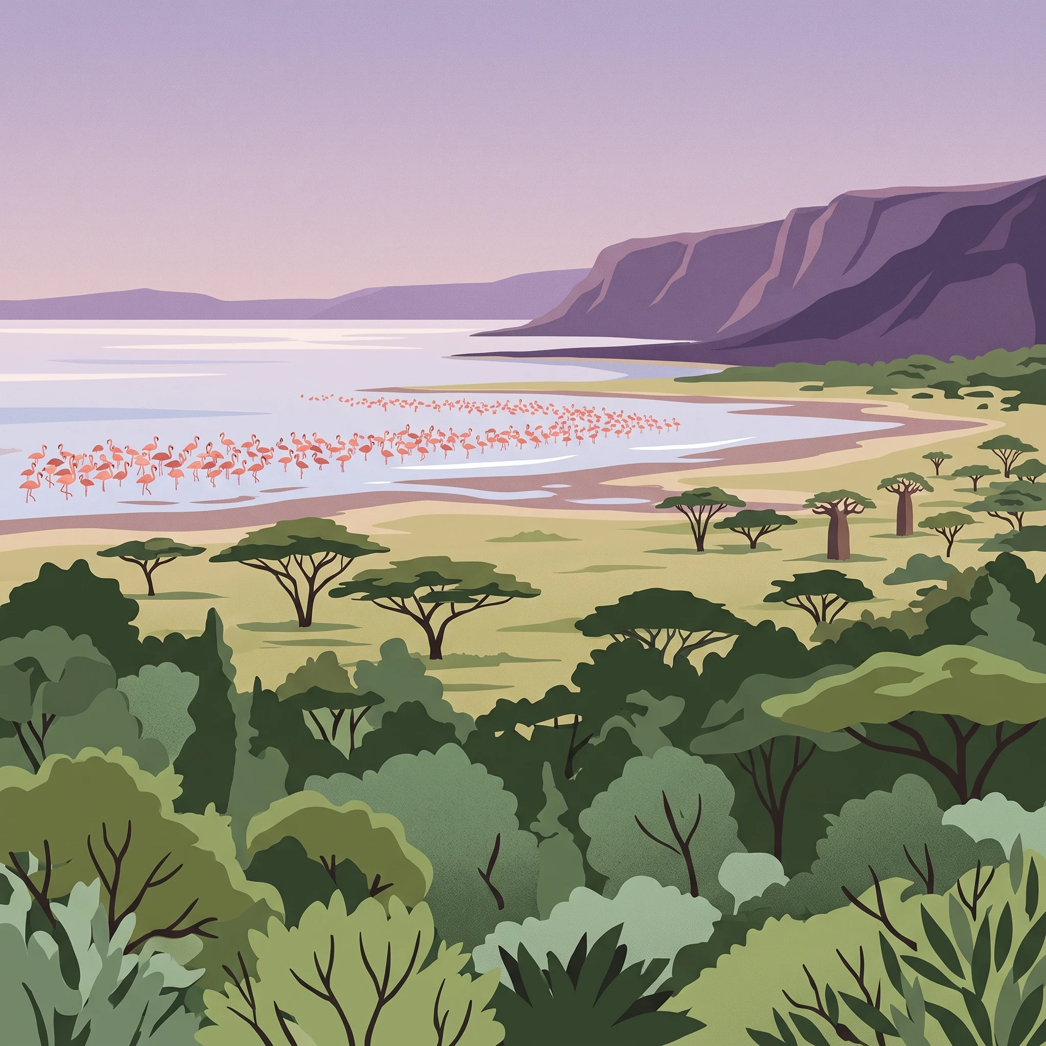
The primary trade-off for most travelers centers on the visibility of large mammals versus the richness of the avian and floral environment. During the peak dry months, the vegetation thins significantly and surface water becomes scarce, forcing wildlife to gather near reliable sources like the northern pools and spring-fed streams. This creates predictable and high-concentration sightings, which remains the most popular approach for those prioritizing large mammal photography and classic game viewing. Conversely, the arrival of rain turns the landscape into a dense, vibrant green, shifting the focus toward the park's famous birdlife. The expansive alkaline flats of the lake, which fluctuate in size based on the regional rainfall, become the center of activity when flamingo populations arrive to feed in the nutrient-rich waters.
The Influence of Precipitation and Geography
Lake Manyara National Park sits uniquely between the sheer, volcanic wall of the Great Rift Valley and the lake itself. This position means that the park's hydrology is inherently volatile. Rain does more than just nourish the flora; it dictates the accessibility of tracks and the expansion of the lake surface, which in turn influences where the wildlife can safely move. Visitors should note that while the heaviest precipitation occurs in the long rains, the transition periods are defined by shorter, more manageable bursts of weather that bring fresh growth without the persistent mud associated with the wettest months. The groundwater forest, a rare ecosystem sustained by perennial springs at the base of the escarpment, offers a unique, shaded environment that remains lush regardless of the immediate rainfall cycle, providing a consistent habitat that contrasts sharply with the seasonal variability of the open savanna.
Managing Expectations for Climate and Conditions
Temperature and humidity levels vary throughout the year, but the park maintains a generally warm climate moderated by its elevation. While travelers often focus on rain, it is the interaction between wind speed, daylight, and humidity that determines daily comfort. Days can start with cool, misty mornings near the forested base, eventually giving way to warm, clear afternoons. Understanding these patterns allows for better planning, as it highlights why specific months are better suited for photography, bird watching, or general exploration. By assessing these core environmental factors, you can align your travel dates with the specific park characteristics you value most, whether that is the clear, dry sightlines of the mid-year or the emerald-green, bird-rich scenery of the wetter months.
Seasonal Comparison
When to Visit Lake Manyara National Park: Best Months for Wildlife and Scenery
Peak Wildlife Viewing: June to October
For travelers prioritizing large mammal sightings, the primary dry season from June through October represents the most reliable window. During these months, the park undergoes a distinct transformation as the dense vegetation of the groundwater forest and acacia woodlands begins to thin. This natural thinning process significantly improves visibility for tracking elephants, giraffes, and the park's iconic tree-climbing lions. As surface water sources across the Rift Valley diminish, wildlife tends to congregate more predictably near the lake's edge and the perennial springs feeding the groundwater forests. Temperatures remain pleasant, with daytime highs typically ranging between 28 and 33 degrees Celsius, though early mornings are notably cooler, often dipping toward 10 to 12 degrees Celsius. Visitors should be prepared for brisk starts to morning game drives, while the afternoons remain warm and clear.
The Lush Spectacle: November to May
Visiting between November and May offers a different landscape, characterized by the seasonal influence of two distinct rain phases. The short rains in November and December, followed by the long rains from March through May, replenish the alkaline flats and expand the lake's surface area. This period is less about intense mammal tracking and more about the vivid transformation of the Rift Valley scenery. The groundwater forest becomes exceptionally lush, providing an intense, verdant backdrop for photography. This window is the definitive choice for bird enthusiasts. As the lake fills, it attracts large, shimmering congregations of flamingos and other water birds, creating one of the most recognizable spectacles in the region. Travelers choosing these months must accept the trade-off of potentially muddy track conditions, as the increased precipitation can make navigating the lower park areas more challenging. However, the reward is a landscape that feels transformed from the dusty, exposed plains of the mid-year dry spell into a thriving, colorful ecosystem.
Transition Periods: January and February
Situated between the short and long rains, January and February serve as a notable, drier gap in the wet season. This period often features clearer skies and more manageable humidity levels compared to the peak wet months of April and May. It offers a compromise for those who want to avoid the heaviest rains but desire a more vibrant, green landscape than what is found during the peak dry season. While game viewing remains generally strong, the specific patterns of animal movement are less predictable than in the heart of the dry season, as some water remains scattered across the landscape. This window is particularly well-suited for visitors focused on scenic diversity, as it captures the park while it remains green but allows for more reliable vehicle access on many of the park's key internal routes.
Climate Normals
Monthly Temperature, Rainfall, and Climate Patterns in Lake Manyara National Park
Understanding the Annual Climate Cycle
Lake Manyara National Park experiences a tropical savanna climate that is heavily influenced by its position within the Great Rift Valley and the cooling effects of its elevation, which sits around 1,277 meters. While regional temperatures remain warm throughout the year, the park exhibits distinct rhythmic variations in rainfall, humidity, and wind that fundamentally shift how the landscape feels and operates. It is essential to recognize that these figures represent long-term climate normals (1991–2020) and serve as an analytical baseline rather than a predictive forecast for any specific week or upcoming trip.
Thermal Patterns and Daily Temperature Ranges
Visitors will notice a consistent thermal pattern where average maximum temperatures peak in the months immediately preceding the two rainy seasons. Specifically, January and February often see daytime highs exceeding 33°C, providing a warm, dry environment. Conversely, the coolest period occurs during the heart of the southern winter months, particularly from June through August. During this time, average minimums drop toward 10–12°C, which can make early morning game drives noticeably brisk. Throughout the year, the diurnal temperature range is significant, with afternoons reliably warmer than the cool, sometimes misty dawn hours. This creates a reliance on layering, as the mid-afternoon heat contrasts sharply with the pre-dawn temperatures encountered during early wildlife outings.
Precipitation and Its Impact on Regional Humidity
Rainfall is the most defining variable for the park environment, with distinct cycles of moisture and aridity. The pattern follows a bimodal distribution: the primary wet season (the long rains) typically peaks from March to May, while a secondary, often shorter period occurs in November and December. April stands out as the wettest month in the annual cycle, with average precipitation levels significantly higher than the rest of the year. This period correlates with the highest humidity levels, often exceeding 74%. In contrast, the months of July, August, and September are characterized by minimal rainfall, dropping to near-zero precipitation daily averages. These dry months are marked by low relative humidity, often dipping below 60%, which assists in the rapid evaporation of stagnant water and dictates the gathering patterns of larger mammals near permanent springs and the lakeshore.
Wind and Daylight Variability
Wind and daylight hours provide secondary but important indicators of the changing seasons. Wind speeds are generally most pronounced toward the end of the long dry season, specifically from August through October, when sustained gusts can influence the feeling of the environment during open-vehicle safaris. In terms of daylight, the park experiences relatively stable hours of sun throughout the year, varying only slightly from roughly 11.8 hours in the middle of the year to 12.2 hours in December and January. While this fluctuation is minor, it dictates the window for daily activities. Even during the wettest months, like April, the reduction in direct sunshine is more a consequence of persistent cloud cover than a shortening of available daylight hours. These climate normals illustrate that while Lake Manyara is a year-round destination, the interplay between the drying effects of late-season winds and the moisture-heavy peak in April creates a highly dynamic environment that demands careful consideration when planning a visit.
Seasonal Climate Patterns
Understanding the Seasonal Weather Cycles of Lake Manyara National Park
Defining the Annual Environmental Phases
Lake Manyara National Park does not conform to a classic four-season calendar. Instead, its climate is defined by the interaction between the Great Rift Valley escarpment, groundwater-fed forests, and the fluctuating water levels of the alkaline lake. Visitors often organize their timing around two distinct dry-season phases and two rainy-season windows, each characterized by specific shifts in landscape density and wildlife behavior.
The Extended Dry Period: June through October
This season represents the most stable climatic phase in the park. Beginning in June, rainfall drops to negligible levels, typically less than 0.5 mm per day, and humidity levels descend from their annual highs. This period is defined by a gradual cooling trend early on, with average minimums dipping toward 10 degrees Celsius in July, followed by a steady warming that leads into the peak heat of October. As the surface water across the savanna evaporates, wildlife congregates near the permanent groundwater springs and the lake shoreline. This is the period when the acacia woodlands become less dense, facilitating better visibility for spotting the park's characteristic large mammals, including tree-climbing lions, elephants, and giraffes. The consistent, fair weather makes it the most predictable window for planning land-based activities.
The Short Rain Transition: November and December
November marks the start of the short rains, a critical transition when the park shifts from its dry, golden state toward a fresh, green landscape. Precipitation averages rise significantly as humidity levels climb back toward 65 percent. These rains are often intermittent rather than continuous, providing enough moisture to jumpstart vegetation growth without necessarily rendering the main game-viewing tracks impassable. This window is marked by a return of migratory birds and a slight cooling of the daily maximum temperatures compared to the heat of October. It serves as a bridge, offering the benefit of verdant scenery before the arrival of the heavier, long-rain period.
The Post-Rain Interlude: January and February
Between the short and long rains, the park experiences a brief, dry interlude characterized by clear, warm days and limited rainfall. With average maximum temperatures often exceeding 33 degrees Celsius, this period feels notably warmer than the winter months of June and July. Wildlife behavior during these months is tied to the availability of fresh grasses triggered by the preceding November rains, creating a window that combines the clarity of the dry season with the lush aesthetic of the wet season. It is a transitional phase that is highly sensitive to the timing of regional rainfall, meaning the exact start and end of this period can vary annually.
The Long Rains: March through May
This is the wettest segment of the year, with April typically recording the highest daily precipitation rates. Humidity reaches its annual peak, often exceeding 75 percent, while wind speeds increase as the weather patterns shift. The landscape undergoes its most dramatic transformation during these months, as the groundwater forests become exceptionally lush and the lake volume expands significantly. This period is characterized by soft, overcast days that contrast with the intense sunshine of the dry season. While these months offer a unique, vibrant atmosphere and peak bird-watching opportunities, the increased water levels can necessitate caution regarding ground conditions on remote park tracks, requiring visitors to remain flexible and verify current conditions with local authorities.
Seasonal Experiences
What Visiting Lake Manyara National Park Is Like Throughout the Year
Navigating the Groundwater Forest Experience
The dense, verdant groundwater forest situated near the northern entrance of the park serves as a year-round anchor for visitor experiences, but its character shifts significantly with the rainfall cycle. During the drier months from June to October, the forest floor is more accessible, offering clearer sightlines for spotting blue monkeys and olive baboons moving through the canopy. The structural density of the mahogany and fig trees provides a consistent, shaded refuge for these primates and various birds throughout the year, regardless of the seasonal precipitation peaks. Because these forests are fed by perennial springs from the Rift Valley escarpment, they remain lush and emerald-green even when the surrounding savanna turns a golden, arid brown during the peak of the dry season.
Seasonal Wildlife Spectacles and Habitat Access
The park experience is defined by how changing water levels dictate animal movement and human access to the alkaline lakefront. In the months following the heavier rainfall, typically peaking between April and May, the park landscape transforms. The higher water levels often result in flooded tracks, which may limit vehicle movement to specific well-maintained game drive routes. However, these same conditions create the primary ecological trigger for the iconic flamingo congregations along the lake's edge. Travelers interested in observing these vast avian colonies should anticipate that the most extensive shoreline presence occurs when environmental moisture supports the algae blooms the flamingos feed upon. Conversely, as the dry season progresses from July through September, the retreating shoreline concentrates hippo populations into more accessible pools in the north, providing more consistent viewing opportunities as the wider marshland dries.
Utilizing the Rift Valley Escarpment for Orientation
The Great Rift Valley escarpment provides a static but vital backdrop that influences the daily rhythm of a visit. In the months with lower relative humidity, such as August and September, the air clarity often allows for more dramatic photography of the escarpment walls and the scattered baobab trees clinging to the slopes. During the wetter months, the increased humidity and cloud cover can soften the light, which many photographers prefer for capturing the textures of the forest canopy and the rich, saturated tones of the vegetation. The hot springs at the southern end of the park remain a constant, distinct geological feature. Access to these springs is most reliable during the drier periods when the tracks leading south are less likely to be impeded by standing water or mud, making the late dry season an effective time for those prioritizing reach and mobility across the park's diverse southern and northern ecosystems.
Visitor Priorities
Choosing the Best Time to Visit Lake Manyara Based on Travel Goals
Balancing Wildlife Visibility and Comfort
Visitors prioritizing high-frequency wildlife sightings often find the dry months from June through October to be the most rewarding. During this window, the progressive reduction in rainfall forces large mammals, such as elephants and buffalo, to congregate near the few remaining permanent water sources. The thinner vegetation characteristic of this period reduces the concealment potential for predators, making them easier to spot within the acacia woodlands. The primary compromise for this goal is the temperature profile: while daytime highs remain manageable, the arrival of cooler, dry air can lead to lower nighttime temperatures, requiring layers for those prone to feeling cold during early morning game drives.
Prioritizing Avian Activity and Lush Landscapes
For travelers whose primary interest lies in the park's legendary bird populations, the wetter months between November and May offer a vastly different landscape. The increased rainfall triggers the growth of vibrant vegetation and causes the lake to expand, creating an ideal environment for migratory birds and the iconic flamingo congregations that feed on algae blooms. The groundwater forest becomes exceptionally lush, providing a sanctuary for a higher density of birdlife. The trade-off for this vibrancy is the increased humidity and potential for mud, which can affect the ease of traversing park tracks. Readers should anticipate that while the scenery is more verdant, the density of the foliage may make spotting individual large mammals more challenging than during the dry season.
Selecting for Milder Temperatures and Extended Light
The perception of an ideal temperature often dictates trip timing, particularly for those who find the intense heat of the late dry season uncomfortable. January and February often present a unique transitional period where the landscape remains lush from the short rains, yet the weather is characterized by clearer skies and a relative break in precipitation. These months offer a balance between the lushness of the wet season and the reliability of the dry season. Regarding daylight, the variation throughout the year is relatively minimal, as the park's equatorial proximity results in day lengths hovering near 12 hours. While the minor fluctuations in daylight are present, they are generally not significant enough to serve as the sole basis for selecting a travel window over other factors like rainfall or vegetation density.
Assessing Trade-offs in Walking and Movement
Those interested in exploring the park on foot, particularly through the groundwater forest, should consider the ground conditions influenced by the two annual rain cycles. During the peak of the long rains in April and May, the tracks and walking trails can become saturated, significantly limiting accessibility and movement. Conversely, the dry months provide firm, accessible trails but lack the dramatic aesthetic of the rain-fed forest. The preference here is a clear conflict between the desire for immersive, lush scenery and the practical requirement for stable, dry footing.
Logistics and Access
Practical Planning for Access to Lake Manyara National Park
Navigating to and Around the Park
Lake Manyara National Park is situated in northern Tanzania, with the primary gateway located to the southwest of Arusha. Travel planning often revolves around the roughly ninety-minute drive from this major regional hub. Visitors typically approach the park from the northern entrance, which sits conveniently near the main road network serving the broader northern safari circuit. Access from secondary locations such as Babati, the regional capital, is also possible, though travel times and route suitability can shift based on local infrastructure projects and current weather-related conditions. Because park road conditions are dynamic, visitors should confirm the current status of primary access routes with tour operators or official park authorities prior to departure.
Seasonal Impact on Park Accessibility
While the park remains open throughout the year, seasonal weather patterns influence the ease of movement within the sanctuary. During the drier months, track conditions generally remain stable, allowing for easier navigation through the groundwater forests and across the woodland plains toward the lake shore. As rainfall increases during the wet seasons, certain areas may become more challenging to navigate. Muddy terrain in the lower-lying regions near the lake can limit access to specific tracks, necessitating a more cautious approach to safari routes. Because these conditions change based on the volume and timing of local rainfall, there is no fixed schedule for route availability. Prospective travellers must always verify current park conditions with the Tanzania National Parks Authority to understand which areas are accessible during their specific travel dates.
Planning for Park Regulations and Requirements
All logistical arrangements, including the acquisition of entry permits and adherence to park regulations, are subject to the policies managed by the governing authorities. Information regarding current entry fees, permit procurement processes, and operating hours for park gates can change without notice. It is essential to consult official park channels or authorized local guides for the most accurate and up-to-date guidance on documentation and logistical requirements. Do not rely on outdated travel forums or anecdotal reports for permit information, as these do not reflect the current regulatory environment. Whether you are traveling independently or through a tour service, confirming these administrative details in advance is a vital component of your visit, ensuring that your itinerary aligns with the latest operational standards set for the protection of the biosphere reserve.
Safety and Preparation
Seasonal Weather Hazards and Packing for Lake Manyara National Park
Managing Thermal Shifts and Sun Exposure
Lake Manyara exhibits a significant diurnal temperature range that dictates your daily clothing choices. While midday temperatures often reach into the low 30s Celsius from January to March and again in October, nighttime and early morning temperatures can dip significantly, particularly during the cooler months of June and July when averages drop toward 10 degrees Celsius. Because safari activities often begin at dawn when the air is sharp and brisk, dressing in layers is the most effective approach. A lightweight, breathable base layer combined with a fleece or windbreaker will allow you to shed clothing as the sun climbs and the air warms throughout the morning.
Direct sun exposure is a persistent factor in this open landscape, even when cloud cover is present. The park environment, which blends open alkaline flats with sun-drenched woodland, provides limited natural shade during peak game-viewing hours. Standard sun protection, including hats and light, long-sleeved clothing, is generally recommended for all visitors regardless of the season. Because conditions can change rapidly between the sheltered groundwater forest and the exposed lake shore, maintaining your own supply of sun-shielding gear is a more reliable strategy than relying on the temporary shade of your safari vehicle.
Navigating Seasonal Rainfall and Track Conditions
Preparation for rain depends on the time of year, with the highest probability of heavy precipitation occurring during the long rains of April and May. During these months, the park terrain becomes significantly more challenging to navigate. Rain does not just impact the visitor experience, it affects the accessibility of certain tracks that may become muddy or difficult to traverse. While local guides monitor route conditions daily, you should prepare for the possibility that some areas of the park may become temporarily inaccessible. Ensure that your belongings, particularly sensitive electronics and camera equipment, are stored in moisture-resistant bags, as the humidity levels can climb above 75 percent during the wettest months.
Wildlife Safety and Interaction Protocols
Safety in the park is fundamentally rooted in observing natural boundaries. Wildlife, including large mammals like elephants and buffalo, should always be given the right of way. While the park is generally considered safe for visitors, the rule to remain inside your vehicle at all times is strictly enforced, except within specifically designated picnic areas. Be aware that baboons are highly active near these social spots and are known to be opportunistic feeders. Keep your vehicle windows closed and do not leave food exposed or unattended, as this attracts unwanted attention from local wildlife. Always verify the most current safety alerts and park-specific guidance with the Tanzania National Parks Authority or your tour operator before you set out, as specific trail closures or animal activity reports may fluctuate daily.
Finalizing Your Plans
How to Choose the Best Time to Visit Lake Manyara National Park
Evaluating Your Priorities for a Park Visit
Choosing the right time to travel to Lake Manyara depends on your individual tolerance for seasonal variation and your primary goals for the experience. If your goal is to maximize the visibility of large mammals, the months from June through October present the most reliable opportunity. During these dry months, the thinning vegetation and the concentration of wildlife around predictable water sources allow for more consistent sightings. The moderate temperatures and lower humidity during this period also make for comfortable safari days, though you should expect cooler mornings near the rift wall.
Conversely, if your travel interests lean toward avian life and the scenic vibrancy of the rift valley, the wetter months between November and May offer a distinct landscape. This is when the lake edges often see the arrival of significant flamingo populations and the groundwater forest reaches its peak density. You will experience higher humidity and the potential for rain, which can affect the condition of secondary tracks. This period is less about the convenience of animal spotting and more about the ecological richness of the park when water is abundant and the landscape is lush.
Aligning Seasonal Conditions with Travel Expectations
Transition periods such as the January-February window or the onset of the long rains in March provide a middle ground. These times often balance the lingering dry-season animal activity with the refreshing green growth brought on by intermittent showers. When deciding on your dates, consider that the park environment is dynamic. The scale of the lake and the accessibility of specific viewing areas are fundamentally dictated by the preceding weeks of rainfall. What might be a dry and dusty track in August can become a challenging, muddy route during the peak of the long rains in April.
There is no single best month that satisfies every visitor preference, as each season introduces its own set of trade-offs. The decision ultimately rests on whether you prioritize the ease of tracking megafauna against a stark, dry backdrop or the visual drama of a verdant, bird-filled wetland. Before finalizing your travel dates, always verify current operating conditions, such as park gate access and road statuses, through the Tanzania National Parks Authority. Climate normals provide a necessary baseline for understanding the year, but they do not serve as a forecast for the specific weather you will encounter on your trip. Reviewing current weather reports and local alerts remains a vital step in your final preparation.