
Mori Atlas logo
Protected areaLake Meredith National Recreation Area

Understanding the intersection of High Plains grasslands, reservoir shorelines, and Canadian River canyon terrain.

Lake Meredith National Recreation Area: Mapped Geography and Protected Landscapes of the Texas Panhandle

Lake Meredith National Recreation Area encompasses a significant reservoir and surrounding rugged canyon country within the Texas Panhandle. The protected area features a unique geological transition from open High Plains prairie to steep river-carved bluffs. This atlas entry provides essential context on the reservoir boundaries, riparian habitats, and the broader regional terrain that defines this versatile outdoor landscape in northern Texas.

national recreation areareservoirTexas PanhandleHigh PlainsCanadian Riverlake recreation
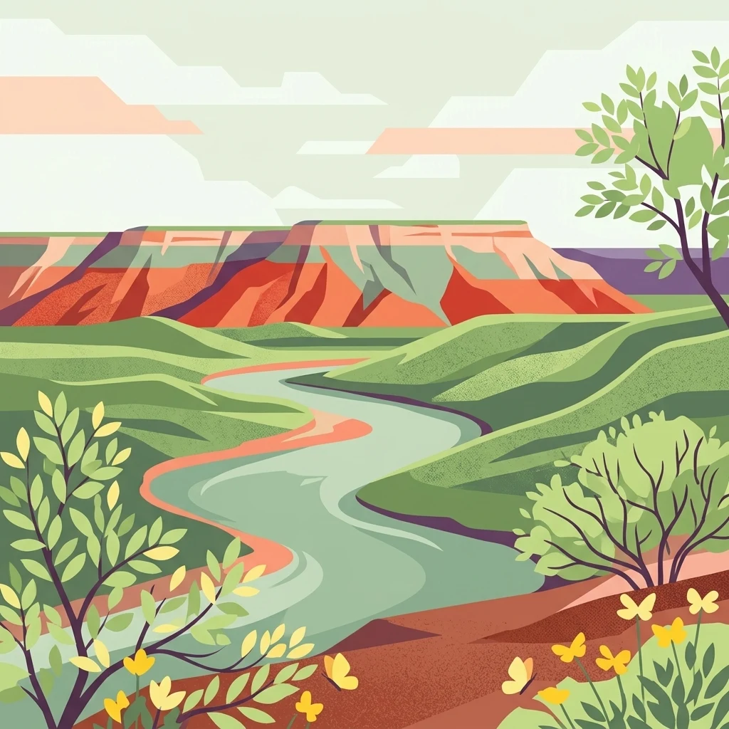
A digital illustration depicting a winding river flowing through a lush green valley toward a colorful red-rock mesa under a soft, light sky.

Lake Meredith National Recreation Area

Protected area

Park overview

Structured park overview, official facts, and landscape profile for Lake Meredith National Recreation Area

Lake Meredith National Recreation Area park facts, protected area profile, and essential visitor context

Review the core facts for Lake Meredith National Recreation Area, including designation, size, terrain, visitor scale, habitats, and operating context in one park-focused overview.

About Lake Meredith National Recreation Area

Lake Meredith National Recreation Area occupies a substantial portion of the northern Texas Panhandle, where the otherwise flat to gently rolling High Plains are cut by the Canadian River and its tributaries. The result is a landscape that alternates between wide, open prairie and more dramatic canyon edges and bluffs where the lake fills parts of the old river valley.

The lake is the focal point of the recreation area. Created by Sanford Dam on the Canadian River, Lake Meredith covers roughly 10,000 acres and supports boating, fishing, swimming, and a broad range of shoreline activities. Five boat-launch ramps have provided access for visitors, and a marina once enhanced the recreational offerings on the lake. The water itself has shaped visitor numbers and park character over the decades, with peak visitation in the 1980s and significant declines during periods of severe drought.

Beyond the water, the recreation area offers a network of land-based experiences. Hiking, camping, and hunting draw visitors into the surrounding plains and canyon flanks, where panhandle wildlife, wide skies, and quiet stretches of public land become part of the appeal. The area shares a boundary with Alibates Flint Quarries National Monument, a nationally important archaeological site, and the combined presence of natural and cultural resources gives Lake Meredith a notably layered identity.

As a national recreation area rather than a strictly protected wilderness reserve, Lake Meredith is designed to balance conservation with public enjoyment. The National Park Service manages it as a place where visitors can engage directly with the reservoir, its shoreline, and the surrounding Panhandle environment, while preserving the broader landscape for future use.

Quick facts and research context for Lake Meredith National Recreation Area

Lake Meredith National Recreation Area spans about 44,978 acres across Potter, Moore, and Hutchinson counties in the Texas Panhandle, with park headquarters in the small community of Fritch. Its centerpiece is the roughly 10,000-acre Lake Meredith reservoir, formed by Sanford Dam on the Canadian River.

The area was established as a national recreation area in 1990 and is managed by the National Park Service. It lies adjacent to Alibates Flint Quarries National Monument, one of the most significant prehistoric flint-quarrying sites in North America. The recreation area offers a mix of water-based and land-based activities, including fishing, boating, hiking, and camping.

Protection and recognition

Examine documented terrestrial protection scope and official recognition sources.

Lake Meredith National Recreation Area Protection Status and Recognition

Lake Meredith National Recreation Area features documented terrestrial protection status and managed conservation boundaries across its designated terrain. Structured protection records detail the operational scope and formal recognition history associated with this protected area.

Protection details

Protection scope
Terrestrial
Transboundary protection
No
Park context

Deeper park guide and search-rich context for Lake Meredith National Recreation Area

Lake Meredith National Recreation Area history, landscape, wildlife, and travel context

Explore Lake Meredith National Recreation Area through its history, landscape character, ecosystems, wildlife, conservation priorities, cultural context, and seasonal travel timing in a structured park guide built for atlas discovery and search intent.

Why Lake Meredith National Recreation Area stands out

Lake Meredith National Recreation Area is best known for the Lake Meredith reservoir itself, which has reshaped the Canadian River canyon country of the Texas Panhandle into a regional outdoor-recreation hub. The interplay between open High Plains grasslands and the deeply cut, sometimes rugged shoreline of the reservoir gives the area much of its visual identity. It is also notable for its proximity to Alibates Flint Quarries National Monument, connecting visitors to thousands of years of Indigenous quarrying history. The recreation area is recognized for combining classic reservoir-based recreation with the broader Panhandle landscape of prairies, bluffs, and canyon country.
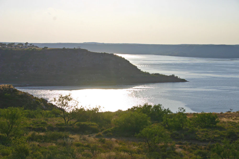
A wide landscape view of a reservoir at sunset with high bluffs rising from the water and scrubby vegetation in the foreground.
Sunset over the reservoir at Lake Meredith National Recreation Area.

Lake Meredith National Recreation Area history and protected-area timeline

The story of Lake Meredith National Recreation Area begins with water and land management in the Texas Panhandle. The reservoir at the heart of the park was created by Sanford Dam, a structure built on the Canadian River to harness and store water in an arid part of the state. As the reservoir filled, it transformed stretches of the Canadian River valley, flooding portions of the canyon country and reshaping how the region could be used for recreation.

Lake Meredith itself existed as a recreational resource for some time before it gained its current federally protected status. The area was formally established as Lake Meredith National Recreation Area on November 28, 1990, bringing the reservoir and a substantial surrounding landscape under the National Park Service.

Since then, the recreation area's history has been closely tied to water levels and public use. The 1980s brought peak visitation, with more than 1.9 million visitors recorded in 1984 alone. Subsequent droughts placed significant pressure on the lake, lowering water levels and affecting the activities it could support, including a marina that ultimately closed during the prolonged drought of 2011 to 2013. Visitor numbers have fluctuated in step with these conditions, while the surrounding cultural landscape, including its proximity to Alibates Flint Quarries National Monument, has added a deeper human-history dimension to the park's story.

Lake Meredith National Recreation Area landscape and geographic character

The landscape of Lake Meredith National Recreation Area sits firmly within the Texas Panhandle, a region defined largely by the flat to rolling character of the High Plains. From a distance, the terrain appears expansive and open, with broad sweeps of grassland and big skies typical of the Panhandle. Closer to the Canadian River, the topography changes sharply, revealing canyon walls, bluffs, and rugged slopes carved by the river and its drainage.

The lake itself softens this transition, settling into the contours of the old river valley and producing a shoreline that alternates between steep, rocky edges and gentler inlet slopes. The contrast between the open plains above and the more enclosed lake environments below gives the recreation area a layered sense of place, with the reservoir acting as both a visual anchor and a recreational centerpiece.

Around the water, the broader Panhandle environment remains prominent. Sparse shrub cover, prairie grasses, and the occasional rocky outcrop frame the lake, creating a sense of openness even where the shoreline narrows into canyon-like terrain. The result is a landscape that feels distinctly western, blending arid plains character with the sculpted influence of water and erosion along the Canadian River corridor.
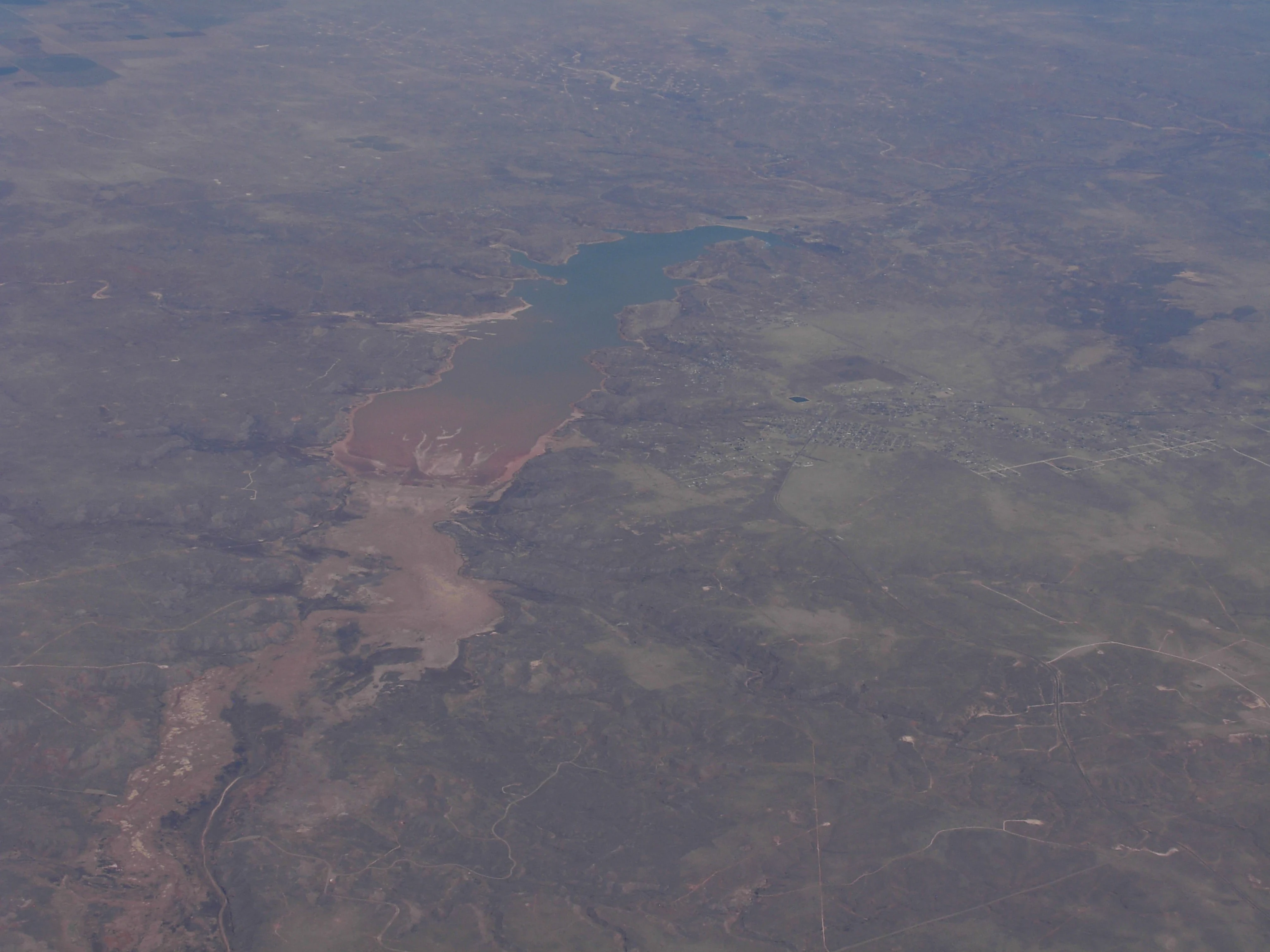
An aerial perspective of a reservoir surrounded by arid, sparsely vegetated terrain.
An aerial view of the reservoir at Lake Meredith National Recreation Area.

Lake Meredith National Recreation Area ecosystems, habitats, and plant life

Ecologically, Lake Meredith National Recreation Area reflects the semi-arid character of the Texas Panhandle, where High Plains grasslands meet the more sheltered environments along the Canadian River. The dominant vegetation across much of the recreation area is typical of the Panhandle: hardy grasses, low shrubs, and other drought-adapted plants that thrive in an environment with limited rainfall and wide temperature swings.

Where the lake's influence reaches, conditions change. Riparian zones along the Canadian River and the reservoir margins support denser plant growth, providing habitat for a wider variety of wildlife than the surrounding uplands. These transitional zones between dry prairie and the water's edge are the ecological hinge of the recreation area, creating pockets of greater productivity in an otherwise open landscape.

The reservoir also influences the local microclimate and habitat structure. In wetter periods, the lake's broad surface and shallow bays create habitat for waterbirds and fish, while the surrounding scrub and prairie support species typical of the southern Great Plains. Even during periods of drought, the remaining draw-down zones, rocky shoreline, and grasslands continue to provide habitat, underscoring the resilience of the Panhandle ecosystem and the importance of water resources in shaping its character.

Lake Meredith National Recreation Area wildlife and species highlights

Wildlife at Lake Meredith reflects the mixed character of the Texas Panhandle, where dry upland habitats meet more productive river and lake-margin environments. The surrounding grasslands and shrublands support species typical of the southern High Plains, including small mammals, reptiles, and a variety of birds adapted to open country. Coyotes, deer, and other game species are part of the broader landscape, and the area's hunting program is tied to this wildlife base.

The reservoir and its associated riparian habitat attract a wider range of wildlife. Waterbirds, shorebirds, and other species associated with lakes, marshes, and open water can be present around Lake Meredith, especially when water levels provide suitable conditions. The combination of open water, rocky shoreline, and adjacent grasslands means that visitors may encounter different wildlife communities within relatively short distances, from prairie-associated species in the uplands to water-oriented birds along the lake.

Fish populations in Lake Meredith are a central part of the recreation area's wildlife identity. The reservoir has historically supported angling for a variety of freshwater species, making fishing one of the most prominent ways visitors engage with the park's wildlife. While water levels have strongly affected both the fishery and broader wildlife patterns over time, the underlying habitat potential of the lake and its surroundings continues to define the area as an important Panhandle wildlife resource.

Lake Meredith National Recreation Area conservation status and protection priorities

Lake Meredith National Recreation Area plays a meaningful conservation role in the Texas Panhandle by protecting a substantial corridor of land around a major regional reservoir. With roughly 44,978 acres under federal stewardship, the recreation area preserves a sizable portion of the High Plains landscape and a significant stretch of the Canadian River, including its canyon flanks and surrounding uplands.

From a conservation perspective, the recreation area's importance lies in its combination of habitat, water, and hydrological context. Lake Meredith is a vital reservoir in a region where water is scarce, and the surrounding federal lands help protect watershed health, riparian vegetation, and the broader landscape mosaic. This is particularly relevant for the riparian zones and remaining wetlands, which concentrate biodiversity in an otherwise arid environment.

The recreation area's conservation significance is further enhanced by its proximity to Alibates Flint Quarries National Monument. Together, the two units link ecological protection with the preservation of Indigenous cultural resources, creating a broader protected landscape that values both natural systems and deep human history. Recurring drought cycles have underscored the vulnerability of the reservoir and its surrounding habitats, highlighting the importance of long-term management in maintaining the area's ecological value.

Lake Meredith National Recreation Area cultural meaning and human context

Although Lake Meredith National Recreation Area is primarily known as an outdoor-recreation destination, it shares a border with Alibates Flint Quarries National Monument, one of the most important prehistoric quarrying sites in North America. The flint quarries were used for thousands of years by Indigenous peoples who traveled across the Plains to obtain the distinctive, colorful Alibates flint for tools and weapons. The presence of this monument alongside the recreation area gives Lake Meredith a deeper cultural dimension, linking its modern recreational identity to a much older human story etched into the same landscape.

The wider Panhandle setting also carries broader cultural associations with ranching, Plains heritage, and the development of water infrastructure across the arid West. The construction of Sanford Dam and the creation of the reservoir represent an era of significant land- and water-management decisions that reshaped communities and land use in the region. Even as visitor patterns shift with drought and climate conditions, the layered history of the area continues to shape its identity today.

Top sights and standout views in Lake Meredith National Recreation Area

The defining highlight of Lake Meredith National Recreation Area is the reservoir itself, weaving into the canyon-cut Canadian River landscape and giving the Panhandle a regionally significant body of water. The interplay between the open High Plains and the lake's steeply edged shoreline creates a striking visual contrast that sets the area apart from many other Texas outdoor destinations.

Equally important is the recreation area's role within a broader landscape of public lands. Its proximity to Alibates Flint Quarries National Monument adds a significant cultural layer to the visit, while a full menu of water-based and land-based activities, from fishing to hiking and camping, makes it a versatile year-round destination. Together, these qualities make Lake Meredith both a local outdoor hub and a notable part of the National Park System's presence in the Texas Panhandle.

Best time to visit Lake Meredith National Recreation Area

The character of a visit to Lake Meredith National Recreation Area is strongly shaped by water levels and seasonal conditions in the Texas Panhandle. Cooler months from fall through spring tend to be comfortable for hiking, camping, and exploring the park's upland landscapes, and are often a productive time for wildlife viewing as birds and mammals are active across the open plains.

Summer brings heat typical of the Panhandle, but also the peak of the lake-based recreation season. Boating, swimming, and fishing are traditionally central during the warmer months, though the experience of these activities is closely tied to how full the reservoir is. Periods of drought can substantially reduce water levels and reshape which experiences are available, making flexible expectations important for visitors. In general, visiting when water levels are higher enhances the lake-based experience, while drier stretches still reward visitors who focus on the surrounding landscape, cultural sites, and the wide-open character of the Panhandle itself.
Monthly climate preview

Long-term representative point measurements of monthly temperature and precipitation patterns

Lake Meredith National Recreation Area Climate Normals and Annual Temperature Rhythm

Historical climate data for Lake Meredith National Recreation Area outlines a measured progression of monthly average temperatures and precipitation rates from representative coordinates. Reviewing the complete twelve-month normals provides deeper context on long-term meteorological trends across the terrain.
Annual mean15 °C
3 °C28 °C
Jan
Feb
Mar10°
Apr15°
May20°
Jun26°
Jul28°
Aug27°
Sep22°
Oct15°
Nov
Dec
Warmest month
July

28 °C

Coolest month
January

2.7 °C

Wettest month
June

2.6 mm/day

Driest month
February

0.5 mm/day

Park location guide

Geography guide, regional context, and park location map for Lake Meredith National Recreation Area

Lake Meredith National Recreation Area park geography, regions, and map view in United States of America

Understand where Lake Meredith National Recreation Area sits in United States of America through a broader geographic reading of the surrounding landscape, nearby location context, and its mapped position within the national park landscape.

How Lake Meredith National Recreation Area fits into United States of America

The United States of America is a federal presidential republic and one of the world's largest countries by area and population. It consists of 50 states across a vast territory spanning multiple time zones, with its capital in Washington, D.C. and largest city in New York City. The nation has a diverse economy, influential political system, and significant cultural and military presence globally.

Wider geography shaping Lake Meredith National Recreation Area in United States of America

The United States occupies a vast territory in North America, bordered by Canada to the north and Mexico to the south. The 48 contiguous states stretch from the Atlantic to the Pacific Ocean, while Alaska occupies the northwestern region and Hawaii is an archipelago in the Pacific. The country encompasses diverse terrain including the Rocky Mountains, Appalachian Mountains, Great Plains, and extensive river systems.

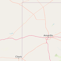
Map view of Lake Meredith National Recreation Area

Use this park location map to pinpoint Lake Meredith National Recreation Area in United States of America, understand its exact geographic position, and read its mapped placement within the surrounding landscape more clearly.

Pigeon | © OpenStreetMap contributors

Location context for Lake Meredith National Recreation Area

Texas
Recorded earthquake history

View Recorded Seismic History for Lake Meredith National Recreation Area

Access a detailed catalogue of historical earthquakes documented near Lake Meredith National Recreation Area. This MoriAtlas collection tracks epicenter proximity and magnitude records, helping to contextualize the seismic history of the Canadian River region within the Texas Panhandle.

Lake Meredith National Recreation Area Earthquake History

Catalogued events

16 events

Strongest magnitude

Magnitude 3.9

Most recent event

Aug 14, 2023

This history includes earthquakes recorded inside the park or within 50 km of its borders

Visual exploration of canyon terrain, reservoir waters, and High Plains scenery

Lake Meredith National Recreation Area Photos and Landscapes

Visual records capture the distinctive landscape character of Lake Meredith National Recreation Area, featuring rugged canyon walls, open prairie grass, and the expansive Canadian River reservoir. Photographic documentation reveals the geological diversity and protected habitats defining this unique Texas Panhandle ecosystem.

A wide landscape view of a reservoir at sunset with high bluffs rising from the water and scrubby vegetation in the foreground.

A wide landscape view of a flat-topped mesa and scrubby vegetation under a partly cloudy sky.

An aerial perspective of a reservoir surrounded by arid, sparsely vegetated terrain.

Park atlas

Compare surrounding regional geography, canyon terrain, and connected public lands.

Explore Other Parks and Protected Areas Near Lake Meredith National Recreation Area

Browse nearby national parks and protected landscapes that share the rugged terrain of the Texas Panhandle and the Canadian River corridor. Expanding the geographic comparison reveals broader regional ecosystems and connects public lands across the High Plains.
A horizontal watercolor painting showing a soft, stylized view of open, rolling grassland under a hazy sky, with yucca-like plants in the foreground.
Wildlife reserveTexas
79 km away#1 closest

Northwest

Rita Blanca National Grassland: Protected Shortgrass Prairie Geography and Map

Mapping the mosaic of federal lands in the Texas Panhandle

Rita Blanca National Grassland offers a detailed look at restored shortgrass prairie ecosystems within the southern Great Plains. The area consists of intermixed federal and private land parcels that define the regional geography of the Texas and Oklahoma borderlands. This protected landscape provides habitat for pronghorn, prairie dogs, and raptors across a semi-arid, gently sloping terrain.

Area
376.31 km²
Established
1960
Relief
Upland
Climate
Arid
Protected landscapeTexas
80 km away#2 closest

Southeast

McClellan Creek National Grassland: Protected Landscape and Texas Geography Atlas

Restored shortgrass prairie and riparian reservoir geography

Located in the Texas Panhandle, McClellan Creek National Grassland serves as a critical example of soil conservation and shortgrass prairie restoration. The protected area features open, rolling plains surrounding the impounded McClellan Lake, providing a focused look at the environmental history and geographic character of the southern Great Plains.

Area
5.86 km²
Water
Minor water
A horizontal watercolor painting depicting a soft-toned, misty prairie landscape with rolling green hills, patches of tall grass, and distant hazy ridgelines under a pale sky.
Wildlife reserveUnited States of America
123 km away#3 closest

East

Black Kettle National Grassland: Protected Prairie Geography and Regional Map Context

A restored mixed-grass ecosystem in the southern Great Plains

Spanning scattered parcels in Oklahoma and Texas, Black Kettle National Grassland functions as a representative sample of restored southern plains prairie. The terrain consists of sandy soils, rocky red hills, and leafy draws along the Washita River headwaters. This protected area preserves a complex ecological and historical landscape that defines the character of the southern Great Plains, now managed for habitat restoration and natural resource protection.

Area
126.61 km²
Established
1960
Relief
Upland
Climate
Temperate
A horizontal watercolor illustration of a wide, open prairie landscape featuring soft green hills, sparse shrubs, and grasses against a pale background.
Protected landscapeNew Mexico
133 km away#4 closest

West

Kiowa National Grassland: Protected Landscapes, Canyon Terrain, and Prairie Geography

Northeastern New Mexico shortgrass prairie and river canyon systems.

Kiowa National Grassland represents a distinctive protected landscape within the southwestern Great Plains, featuring a mix of rolling steppe, pinyon-juniper woodland, and the deep gorges of the Canadian River Canyon. This area offers significant insight into the regional geography of New Mexico, where historic Santa Fe Trail corridors and seasonal playa lakes define the local terrain and ecosystem.

Area
554.95 km²
Established
1960
Relief
Upland
Climate
Temperate
A pale, soft watercolor illustration of a wide, open prairie with gentle rolling hills in the background, low shrubs, and grasses in the foreground.
Protected areaKansas
142 km away#5 closest

North

Cimarron National Grassland: Mapping the Largest Protected Area in Kansas

Shortgrass prairie geography and historical riparian landscapes

Spanning over 100,000 acres in southwestern Kansas, Cimarron National Grassland serves as a major ecological refuge within the Great Plains. The protected area features a unique terrain characterized by sand sagebrush uplands, cottonwood-forested bottomlands, and the winding course of the Cimarron River. This mapping data highlights the intersection of modern wildlife conservation and the remnants of the historic Santa Fe Trail.

Area
437.77 km²
Established
1960
Relief
Upland
Climate
Arid
A wide watercolor painting showing a green grassy plain with distant hills and a row of purple circular shapes in the foreground.
Protected areaColorado
151 km away#6 closest

Northwest

Comanche National Grassland: Geographic Atlas of Southeastern Colorado Protected Plains

Exploring canyon systems and prairie landscape boundaries

Spanning across Baca, Otero, and Las Animas counties, Comanche National Grassland represents a distinctive protected landscape of shortgrass prairie and deep canyon networks. The region is marked by the dramatic Purgatoire River and Carrizo Creek systems, offering a rich study in semi-arid topography, riparian corridors, and fossil-rich geological formations within the Colorado plains.

Area
1,793.09 km²
Established
1960
Relief
Upland
Climate
Temperate
Watercolor painting of a gentle, rolling landscape with a small stream, a small waterfall, and scattered trees under a soft, light sky.
Protected landscapeNew Mexico
301 km away#7 closest

West

Santa Fe National Forest: Geographic Atlas and Protected Landscape Overview

New Mexico mountain geography and wilderness mapping

Santa Fe National Forest spans more than 1.5 million acres of Northern New Mexico, featuring a dramatic transition from canyon river systems to the high elevations of the Pecos Wilderness. This protected landscape contains a complex network of forest districts across the Jemez and Sangre de Cristo Mountains, defined by volcanic plateaus, alpine basins, and seasonal aspen forests. Use this resource to understand the park boundaries, regional mountain geography, and the interconnected nature of these protected lands.

Area
6,306.83 km²
Established
1915
Relief
Mountain
Access
Easy access
Watercolor painting of a serene mountain landscape featuring rolling hills, coniferous trees, and a lake in the foreground, rendered in light pastel tones.
Protected landscapeColorado
339 km away#8 closest

Northwest

San Isabel National Forest: Geographic Overview and Protected Mountain Landscape Atlas

Central Colorado alpine terrain and designated wilderness areas

Spanning eleven counties in central Colorado, San Isabel National Forest serves as a cornerstone of the Southern Rocky Mountains. The forest landscape is dominated by the Sawatch and Sangre de Cristo ranges, offering a unique atlas of alpine tundra, dense coniferous forests, and high-altitude peaks that define the character of the region. This protected area provides a vital habitat and a vast, rugged environment characterized by volcanic formations like the Spanish Peaks and glacial geological features.

Area
4,533.42 km²
Established
1902
Relief
Mountain
Climate
Alpine

Common questions about visiting, size, designation, and location context for Lake Meredith National Recreation Area

Lake Meredith National Recreation Area FAQs for park facts, access, geography, and protected area context

Find quick answers about Lake Meredith National Recreation Area, including protected-area facts, park geography, trail and visitor context, and how the park fits into its surrounding country and regional landscape.
MoriAtlas Explorer

Continue Your Protected Areas Search Across the Global Atlas

Deepen your exploration by continuing the structured search for national parks and protected areas worldwide. Utilize the comprehensive filtering capabilities to compare different conservation landscapes and refine your understanding of global park geography. Discover more about the distribution and characteristics of protected natural areas.

Global natural geography