Mori Atlas logo
Protected areaLake Sibaya

A vital Ramsar wetland interface between coastal dune forests and freshwater ecosystems

Lake Sibaya Protected Area: Mapping the Freshwater Landscapes of KwaZulu-Natal South Africa

(Lake Sibaya (Ramsar Site 528))

Lake Sibaya stands as South Africa's largest natural freshwater lake, situated within the coastal plains of northern KwaZulu-Natal. This protected area acts as a crucial freshwater anchor for the broader iSimangaliso conservation mosaic, where inland basins meet forested coastal dunes. The geography features shallow, expansive waters and a rich shoreline transition that supports high levels of bird diversity and complex hydrological research.

freshwater lakecoastal ecosystemRamsar wetlandUNESCO World HeritageiSimangalisoKwaZulu-Natal

Lake Sibaya

Protected area

Park overview

Structured park overview, official facts, and landscape profile for Lake Sibaya

Lake Sibaya park facts, protected area profile, and essential visitor context

Review the core facts for Lake Sibaya, including designation, size, terrain, visitor scale, habitats, and operating context in one park-focused overview.

About Lake Sibaya

Lake Sibaya is a substantial freshwater lake along the Maputaland coast of KwaZulu-Natal in eastern South Africa. With a surface of around 64 square kilometers, it ranks as the largest purely freshwater lake in the country and sits in a region better known internationally for its marine parks and coastal dune forests. The lake lies just a few kilometers inland from the Indian Ocean and is flanked by forested dunes, coastal grasslands, and sandy shorelines that form the feeder catchment for its waters.

The lake is administered today within the iSimangaliso Wetland Park, a vast UNESCO World Heritage Site that runs along the KwaZulu-Natal coast and links a chain of interlinking ecosystems from the Mozambique border south to the Greater St Lucia area. Historically, Lake Sibaya sat within the Greater St. Lucia Wetland Park, before the broader area adopted its current Zulu-rooted name, iSimangaliso, in 2009. International recognition of the lake and its surroundings began in 1991 when Lake Sibaya itself was designated a Ramsar Wetland of International Importance, and was extended in 1999 when the encompassing park received UNESCO World Heritage status.

Ecologically, Lake Sibaya is exceptionally productive for freshwater wildlife along the South African coast. A remarkable 279 bird species have been documented around the lake, reflecting a blend of open water, reed-fringed margins, swamp forests, and adjacent coastal habitats. The lake also supports commercial and subsistence fisheries and serves as a regional water source for nearby communities through the Mseleni Water Project and the Mbazwana Water Supply Scheme. Tourism infrastructure is concentrated at the lake's northern shore and includes Lake Sibaya Lodge, while private operations such as Thonga Beach Lodge and Ezemvelo KZN Wildlife's facilities at nearby Mabibi link Lake Sibaya to the broader coastal tourism experience around Sodwana Bay.

Quick facts and research context for Lake Sibaya

Lake Sibaya is a freshwater coastal lake in KwaZulu-Natal Province, South Africa, with a surface area of around 64 square kilometers. It lies within Maputaland, along the eastern coast of South Africa, and forms part of the iSimangaliso Wetland Park, formerly known as the Greater St. Lucia Wetland Park. The lake was inscribed as a Ramsar Wetland of International Importance on 28 June 1991, and the broader iSimangaliso landscape was declared a UNESCO World Heritage Site in December 1999.

The lake's catchment covers roughly 530 square kilometers and drains entirely within South Africa. Average depth is just under 11 meters, with a total water volume close to 700 million cubic meters. Around 279 bird species have been identified around the lake, reflecting its integration of freshwater, reedbed, dune forest, and coastal environments. Lake Sibaya is also a regional water source, supplying the Mseleni Water Project and the Mbazwana Water Supply Scheme.

Protection and recognition

Documented terrestrial designation history and international wetland recognition records

Lake Sibaya Protection Status and International Ramsar Recognition

Lake Sibaya maintains a documented terrestrial protection status established in 1991 alongside official international Ramsar site recognition. Structured conservation records outline the designated management scope and historical framework for this protected area.

International recognition

Protection details

Protection scope
Terrestrial
Designated year
1991
Transboundary protection
No
Park context

Deeper park guide and search-rich context for Lake Sibaya

Lake Sibaya history, landscape, wildlife, and travel context

Explore Lake Sibaya through its history, landscape character, ecosystems, wildlife, conservation priorities, cultural context, and seasonal travel timing in a structured park guide built for atlas discovery and search intent.

Why Lake Sibaya stands out

Lake Sibaya is best known as South Africa's largest freshwater natural lake and as a vital component of the iSimangaliso Wetland Park, the country's first UNESCO World Heritage Site. It has been recognized internationally under the Ramsar Convention since 1991, and is celebrated for its extraordinarily rich waterbird diversity, with nearly 280 species recorded on and around its shores. Its other defining trait is its setting within the broader Maputaland conservation landscape, where freshwater lake, coastal dune forest, Indian Ocean beaches, and the iSimangaliso ecosystems meet. Lake Sibaya therefore acts as both a productive freshwater ecosystem and a freshwater anchor for a much larger mosaic of protected coastal habitats.

Lake Sibaya history and protected-area timeline

Lake Sibaya's modern significance began with its formal international recognition in the early 1990s. On 28 June 1991, the lake was designated a Ramsar Wetland of International Importance, one of the early South African sites to receive this status and a reflection of the freshwater and ecological values already understood by conservation scientists working in the Maputaland region.

Following the broader regional conservation consolidation of the 1990s, the surrounding landscape was formalized as the Greater St. Lucia Wetland Park and inscribed as a UNESCO World Heritage Site in December 1999. Lake Sibaya then became both a Ramsar site in its own right and a core component of a much larger internationally protected coastal mosaic. The Greater St. Lucia Wetland Park was renamed iSimangaliso Wetland Park in 2009, marking a renewed regional identity under which Lake Sibaya continues to be administered today.

Research conducted in the 2000s and early 2010s added a further layer to the lake's environmental history. Between 2001 and 2014, Lake Sibaya experienced an almost four meter decline in water level. Studies concluded that the primary cause was sustained below-average rainfall throughout the 2001 to 2011 period, but commercial afforestation in the catchment, beginning in the 1990s, contributed roughly 1.4 meters of that drop. Domestic water abstractions from the lake had minor impact over the same period. This work established Lake Sibaya as an important case study in catchment management, sustainable yield, and the trade-offs between forestry, water supply, and lake health in coastal South African landscapes.

Lake Sibaya landscape and geographic character

Lake Sibaya occupies a basin set just inland of the KwaZulu-Natal coastal dunes, giving it a distinctive interface between freshwater and a sandy, forested seaside environment. The lakeshore is rimmed by dunes, patches of dune forest, coastal grasslands, and emergent reeds that pattern the shoreline around the basins. The lake itself is shallow, with an average depth of just under 11 meters, and its wide, open waters reflect the bright, sunny conditions of the northern KwaZulu-Natal coast.

Topographically, the wider landscape is part of the Maputaland coastal plain, a low-lying region running north toward the Mozambique border and characterized by long, vegetated dune ridges and subtle transitions between wetland, forest, and beach. Just east of the lake lies the Indian Ocean, reached through a strip that includes the community of Mabibi and the resort gateway of Sodwana Bay. Between the lake and sea, surface elevation stays close to sea level, and the gentle relief emphasizes the interplay of water bodies rather than dramatic landforms, a quiet geography that contrasts with the visually striking wildlife and vegetation patterns of the area.

Lake Sibaya ecosystems, habitats, and plant life

The freshwater environment of Lake Sibaya is the defining ecological anchor of the site and one that is rare along South Africa's predominantly marine-focused east coast. Although the lake is shallow, it sustains a diverse aquatic ecosystem, with habitats ranging from open water to submerged vegetation, fringing reedbeds, and swampy margins that link the lake to adjacent dune forest and wetlands.

These freshwater habitats are embedded in a complex of surrounding ecosystems. Dune forest, coastal grassland, woody thicket, and reed marsh all intersect with the lake basin, creating extended ecological gradients across a relatively narrow coastal strip. This mosaic supports a high concentration of bird species as well as varied fish, amphibian, and invertebrate communities. The lake also functions as part of a wider wilderness corridor that connects coastal wetlands inland from the sea, and its water sources feed both the lake's ecology and downstream ecosystems further afield.

Lake Sibaya wildlife and species highlights

Lake Sibaya's most prominent wildlife feature is its bird diversity. A total of 279 bird species have been identified around the lake, an unusually high count for a freshwater body of its size and one that reflects the lake's combination of open water, reedbeds, dune forest, and coastal mosaic habitats. The lake supports a wide range of waterbirds, waders, and forest-dependent species, and it is an important component of regional bird survey and conservation efforts in KwaZulu-Natal.

Beyond birdlife, the lake is inhabited by freshwater fish populations that have been the focus of historical fisheries research, while its margins and surrounding forest support a typical Maputaland mix of small mammals, reptiles, and amphibians. The lake sits alongside the marine ecosystems of iSimangaliso, and the proximity of freshwater and marine habitats makes it a particularly fruitful area for observing ecological transitions between inland and coastal wildlife.

Lake Sibaya conservation status and protection priorities

Lake Sibaya's conservation significance stretches beyond its own shoreline. As Ramsar Site 528, designated in 1991, the lake is formally recognized as a Wetland of International Importance, underscoring the value of its freshwater ecology within a national and global context. Its inclusion in the Greater St. Lucia Wetland Park, inscribed as a UNESCO World Heritage Site in December 1999, embedded the lake within one of Africa's flagship conservation complexes.

Conservation management has had to grapple with the lake's role as both a habitat and a water source. Research into the lake's falling water levels over 2001 to 2014 linked most of the decline to drought-driven below-average rainfall from 2001 to 2011, but identified commercial afforestation in the catchment, beginning in the 1990s, as a significant secondary cause. Yield modeling further concluded that, with current forestry areas and abstraction levels, no additional sustainable yield could be drawn from the lake without unacceptable ecological consequences, and that roughly 5 square kilometers of forestry would need to be removed to release one million cubic meters per year for domestic use. This body of work positions Lake Sibaya as an important case study in balancing wetland protection, catchment forestry, and human water supply in a UNESCO-listed coastal landscape.

Lake Sibaya cultural meaning and human context

Lake Sibaya lies in the Maputaland region of KwaZulu-Natal, also known as Umhlabuyalingana, an area with deep cultural roots in northern Zululand and southern Mozambique. The lake carries more than one local name, including Sibaya and Sibhaya, which are still used by communities in and around the catchment. The renaming of the broader protected area to iSimangaliso Wetland Park in 2009 reflected a deliberate step to foreground Zulu cultural and linguistic identity in the management and presentation of the landscape.

The lake has long been intertwined with local livelihoods, supporting fisheries activities and serving as a water source for nearby communities through the Mseleni Water Project and the Mbazwana Water Supply Scheme. Tourism in the region is anchored by small local communities such as Mabibi and adjacent resorts, including Lake Sibaya Lodge on the northern shore, which tie the economic life of the area to the wider national and international recognition of the lake and its surrounding park.

Top sights and standout views in Lake Sibaya

Lake Sibaya is South Africa's largest natural freshwater lake and a Ramsar Wetland of International Importance. It sits within the iSimangaliso Wetland Park, South Africa's first UNESCO World Heritage Site, placing the lake at the heart of one of the country's most celebrated conservation landscapes.

Its most striking statistic is its bird richness: 279 species have been identified around the lake, showcasing a remarkable intersection between freshwater, reedbed, dune forest, and coastal habitats. At the same time, the lake is a working water source for nearby communities and a living laboratory for catchment-level water research, illustrating the practical conservation challenges of balancing forestry, water supply, and ecosystem health in a coastal setting.

Best time to visit Lake Sibaya

The climate around Lake Sibaya falls within the warm, humid conditions typical of northern KwaZulu-Natal's coast, and seasonality here differs from the cooler, drier inland areas of South Africa. The cooler, drier months of the South African winter, generally May through August, tend to bring more comfortable temperatures for wildlife viewing and outdoor activities, while the warmer, wetter summer months of November through February bring lush conditions and high bird activity around the lake and its surrounding wetlands.

Because the area combines freshwater lakes, dune forest, and Indian Ocean beaches, any visit offers contrasting microhabitats within short distances. Birdwatching can be rewarding across the year, while beach activity and reef exploration near adjacent Sodwana Bay are most pleasant in the warmer months. The dramatic drop in lake levels observed between 2001 and 2014 also reminds visitors that the lakescape itself can vary considerably between periods of normal rainfall and prolonged drought, adding a dynamic physical dimension to the experience of the site.
Monthly climate preview

Track monthly temperature variations and precipitation averages across the protected landscape

Lake Sibaya Climate Normals, Long-Term Temperature and Precipitation Rhythm

Historical climatology records outline Lake Sibaya average temperature ranges alongside monthly precipitation patterns across the representative coordinate. Detailed month-by-month climate normals provide a complete analytical profile for studying annual weather rhythms.
Annual mean23 °C
19 °C26 °C
Jan26°
Feb26°
Mar25°
Apr23°
May21°
Jun19°
Jul19°
Aug20°
Sep22°
Oct22°
Nov24°
Dec25°
Warmest month
February

25.9 °C

Coolest month
July

18.8 °C

Wettest month
January

4.5 mm/day

Driest month
June

0.6 mm/day

Park location guide

Geography guide, regional context, and park location map for Lake Sibaya

Lake Sibaya park geography, regions, and map view in South Africa

Understand where Lake Sibaya sits in South Africa through a broader geographic reading of the surrounding landscape, nearby location context, and its mapped position within the national park landscape.

How Lake Sibaya fits into South Africa

South Africa is the southernmost country in Africa, spanning 1.22 million km² with a population of over 63 million. The country operates with three capital cities, Pretoria (executive), Cape Town (legislative), and Bloemfontein (judicial), and is renowned for its biodiversity, national parks, and multicultural society.

Wider geography shaping Lake Sibaya in South Africa

South Africa occupies the southernmost region of Africa, with coastline along both the Atlantic Ocean to the west and the Indian Ocean to the east. The interior features elevated plateaus including the Highveld, with the Drakensberg escarpment marking the eastern highlands. The country shares borders with Namibia, Botswana, Zimbabwe, Mozambique, Eswatini, and Lesotho.

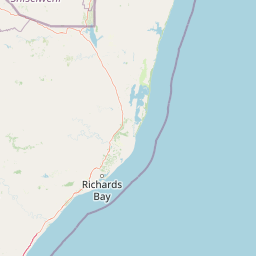
Map view of Lake Sibaya

Use this park location map to pinpoint Lake Sibaya in South Africa, understand its exact geographic position, and read its mapped placement within the surrounding landscape more clearly.

Pigeon | © OpenStreetMap contributors

Location context for Lake Sibaya

KwaZulu-Natal
Park atlas

Compare regional protected areas and coastal wilderness zones across Maputaland

Explore Parks Near Lake Sibaya And Connected Protected Landscapes

Browse national parks and protected areas situated near Lake Sibaya to evaluate regional conservation networks and coastal wetland ecosystems. Extending geographical comparison reveals how freshwater basins and dune forests connect across the wider KwaZulu-Natal landscape.
A soft watercolor painting of a serene lakeside landscape with green rolling hills and calm water.
Protected areaKwaZulu-Natal
16 km away#1 closest

North

Kosi Bay Protected Area: Mapped Geography and Coastal Lake Systems in KwaZulu-Natal

Coastal lake geography and protected wetland boundaries

Kosi Bay forms a complex wetland chain in KwaZulu-Natal, characterized by four linked lakes and a clear estuary mouth. The terrain transitions from coastal dunes and sandy beaches to mangrove-lined channels and Maputaland forest, providing a rich study of regional water systems and protected land boundaries.

Established
1991
Water
Water-dominated
Season
Year-round
A watercolor landscape illustration showing soft, blended washes of light green, yellow, and pale pink, depicting rolling hills and sparse trees against a white background.
Wildlife reserveKwaZulu-Natal
48 km away#2 closest

Northwest

Ndumo Game Reserve: Geographic Atlas and Protected Landscape Overview

Wetlands and riverine ecosystems of Maputaland, KwaZulu-Natal

Ndumo Game Reserve represents a distinct protected landscape where the Pongola and Great Usutu rivers shape a dense mosaic of pans, floodplains, and sand forests. As a Ramsar site, this compact wildlife reserve serves as an essential case study in regional geography and the conservation of riverine corridors along the Mozambique border.

Area
102 km²
Established
1924
Relief
Lowland
Climate
Subtropical
Nature reserveKwaZulu-Natal
About 64 km away#3 closest

West

Phongolo Nature Reserve: Mapped Protected Landscapes of Northern KwaZulu-Natal

Historic reserve terrain at the Lebombo escarpment

Spanning over 10,000 hectares, Phongolo Nature Reserve represents a critical geographic unit defined by the Pongolapoort Dam and the surrounding Lebombo range. Its terrain transitions from clay-rich lowveld plains to dramatic high-altitude rocky escarpments, forming a complex protected environment within the KwaZulu-Natal borderlands. Explore the mapped extent and structural biodiversity of this long-standing South African conservation site.

Area
104.85 km²
Established
1894
IUCN
IV
Relief
Mountain
Nature reserveKwaZulu-Natal
About 113 km away#4 closest

Southwest

Hluhluwe, Imfolozi Park Nature Reserve: Detailed Protected Area and Regional Geography

Explore mapped boundaries and landscape context in KwaZulu-Natal.

Hluhluwe, Imfolozi Park, designated as a nature reserve, offers a distinct protected landscape within KwaZulu-Natal, South Africa. This entity page provides an atlas-focused view, emphasizing the park's mapped boundaries and its contribution to the region's protected area network. Understand its geographic setting and unique landscape character through structured data, essential for any explorer keen on mapping protected lands.

Area
960 km²
Established
1895
Relief
Mountain
Climate
Subtropical
Wildlife reserveKwaZulu-Natal
About 123 km away#5 closest

West

Ithala Game Reserve: Mapping the Protected Landscape and Ancient Geology of KwaZulu-Natal

A rugged wilderness reserve defined by dramatic escarpment and river valley topography.

Ithala Game Reserve represents a critical protected area in South Africa where deep river valleys meet the high-altitude grasslands of the Ngotshe Mountains. Its topography provides a unique study in vertical relief, featuring exposed sandstone cliffs and dolerite spires. The reserve serves as a prime example of ecological diversity within the region, combining ancient geological formations with a successfully reestablished mosaic of bushveld, savanna, and forest habitats.

Area
296.53 km²
Established
1973
IUCN
IV
Relief
Mountain
National parkEswatini
About 136 km away#6 closest

Northwest

Hlane Royal National Park: Eswatini's Vast Protected Savanna Woodland Landscape

Mapped geography and protected area context in northeastern Eswatini.

Delve into Hlane Royal National Park, Eswatini's most extensive protected territory, a prime example of lowland bushveld savanna. This national park is defined by its expansive woodland terrain, dotted with ancient trees and seasonal water pans, creating a dynamic landscape. It is an essential component for understanding the regional geography and the distribution of protected areas within Southern Africa, offering significant opportunities for landscape exploration.

Area
300 km²
IUCN
VI
Relief
Lowland
Climate
Subtropical
Wildlife reserveKwaZulu-Natal
About 158 km away#7 closest

Southwest

Thula Thula Private Game Reserve: Protected Wildlife Habitats and Geography

Bushveld and riverine geography in the KwaZulu-Natal Zululand corridor

Thula Thula Private Game Reserve features a unique intersection of bushveld habitats and river systems within South Africa. This reserve provides important protected land for elephants, rhinoceros, and over 350 avian species. It remains a key geographic entity for understanding the Royal Zulu Biosphere and the conservation history of the northeastern KwaZulu-Natal region.

Area
45 km²
Established
1911
Scope
Terrestrial
A soft, artistic watercolor painting showing rolling green hills in the background with a winding path and fields in the foreground, set against a white background.
Wildlife reserveKwaZulu-Natal
About 174 km away#8 closest

Southwest

Babanango Game Reserve: Exploring Geographic Boundaries and Rewilding Landscapes

Protected wildlife habitats in central KwaZulu-Natal

Centrally positioned in the White Umfolozi River valley, Babanango Game Reserve serves as a model for large-scale biodiversity restoration. Its terrain features a mix of mistbelt grasslands, thornveld, and river frontage supported by ancient geological structures. The reserve preserves both ecological integrity and cultural heritage near historic sites, reflecting a shift toward community-led conservation in modern South African landscape management.

Area
200 km²
Established
2017
Relief
Mixed relief
Climate
Subtropical

Common questions about visiting, size, designation, and location context for Lake Sibaya

Lake Sibaya FAQs for park facts, access, geography, and protected area context

Find quick answers about Lake Sibaya, including protected-area facts, park geography, trail and visitor context, and how the park fits into its surrounding country and regional landscape.
MoriAtlas Explorer

Continue Your Protected Areas Search Across the Global Atlas

Deepen your exploration by continuing the structured search for national parks and protected areas worldwide. Utilize the comprehensive filtering capabilities to compare different conservation landscapes and refine your understanding of global park geography. Discover more about the distribution and characteristics of protected natural areas.

Global natural geography