
Mori Atlas logo
Marine protected areaLang Tengah Island

Examining the island boundaries, marine park terrain, and forest ecosystems in Terengganu

Lang Tengah Island Marine Protected Area: A Geographic Profile of Malaysia East Coast Landscapes

Lang Tengah Island serves as a distinctive marine protected area situated within the South China Sea, located off the northeastern coastline of Peninsular Malaysia. The island terrain features a primary rainforest core that transitions into white sand beaches and extensive coral reef structures. This geographic overview highlights the physical characteristics of the island and its role within the marine environments of the Terengganu region.

tropical islandisland getawaymarine parkcoral reefsea turtle nestingsnorkelling
A flat, stylized illustration of a mountain valley featuring a prominent waterfall cascading down a cliff, surrounded by evergreen forests and clouds, in a pastel color palette.

Lang Tengah Island

Marine protected area

Park overview

Structured park overview, official facts, and landscape profile for Lang Tengah Island

Lang Tengah Island park facts, protected area profile, and essential visitor context

Review the core facts for Lang Tengah Island, including designation, size, terrain, visitor scale, habitats, and operating context in one park-focused overview.

About Lang Tengah Island

Lang Tengah Island is a small, forested tropical island in the South China Sea, lying off the northeast coast of peninsular Malaysia. Geographically it belongs to the Redang Islands archipelago, situated between Pulau Redang to the south and the Perhentian Islands to the north. Administratively it falls within Kuala Nerus District in the state of Terengganu, although from a travel standpoint it is reached from the small fishing village of Tanjung Merang, about 45 minutes north of Kuala Terengganu.

The island is compact, on the order of a square kilometre in area, and is largely covered by primary tropical forest that extends close to the shoreline. Its beaches are clean and white, and the waters around the island are known for their clear, turquoise quality. Much of Lang Tengah's appeal lies underwater: the surrounding marine area is part of a designated marine park, and the coral reefs here are notable for abundant reef fish life, regular sightings of rays, and the occasional shark.

What distinguishes Lang Tengah most strongly from its neighbours is its quieter, more low-key atmosphere. While the nearby islands of Redang and the Perhentians have become well-known resort destinations with significant tourist infrastructure and visitor numbers, Lang Tengah has remained comparatively undeveloped. Accommodation is limited to a small number of resort hotels, and most visitors come specifically for the combination of easy reef diving, snorkelling, and a quieter tropical island experience. The island is also recognised as a nesting ground for sea turtles, particularly green turtles, which come ashore during the warmer months.

In terms of access, Lang Tengah is reached by boat from the mainland rather than by road. Ferries and speedboats operate from the jetty at Tanjung Merang, with journey times varying depending on conditions and vessel type. Because of its position along Malaysia's monsoon-affected east coast, the island has a strongly seasonal character, with most resorts operating primarily during the calmer months and scaled-down or suspended operations during the rougher monsoon period.

Quick facts and research context for Lang Tengah Island

Lang Tengah Island is part of the Redang Islands archipelago in the South China Sea, administratively located in Kuala Nerus District, Terengganu, Malaysia. It lies roughly 40 kilometres northeast of Kuala Terengganu and is reached by boat from the mainland jetty at Tanjung Merang.

The island is small, on the order of one square kilometre in area, and is covered largely by primary tropical forest. Its surrounding waters are designated as a marine park area and are known for clear turquoise visibility, healthy coral reefs, and seasonal green turtle nesting. The island's character is distinctly low-key, with only a small number of resort hotels and a quieter profile than the neighbouring Redang and Perhentian islands.

Protection and recognition

Examine the documented conservation scope and international designation records for Lang Tengah Island.

Lang Tengah Island Protection Status and Protected Area Recognition Facts

Lang Tengah Island maintains a mixed protection scope with documented administrative records detailing its conservation framework. Evaluation of official protection status helps researchers analyze management parameters across the designated territory.

Protection details

Protection scope
Mixed
Transboundary protection
No
Park context

Deeper park guide and search-rich context for Lang Tengah Island

Lang Tengah Island history, landscape, wildlife, and travel context

Explore Lang Tengah Island through its history, landscape character, ecosystems, wildlife, conservation priorities, cultural context, and seasonal travel timing in a structured park guide built for atlas discovery and search intent.

Why Lang Tengah Island stands out

Lang Tengah Island is best known for its clear, turquoise tropical waters and its healthy coral reef ecosystem, which supports a wide variety of reef fish as well as occasional sharks and rays. The surrounding waters are part of a designated marine park, and the island is one of the recognised sea turtle nesting sites along Malaysia's east coast, particularly for green turtles between roughly April and October. Equally distinctive is its contrast with neighbouring islands: while Redang and the Perhentians are relatively busy resort destinations, Lang Tengah retains a quieter, more low-key character with only a handful of small resorts and a largely forested interior. This combination of accessible reef diving, turtle nesting beaches, and a peaceful tropical setting defines the island's identity.
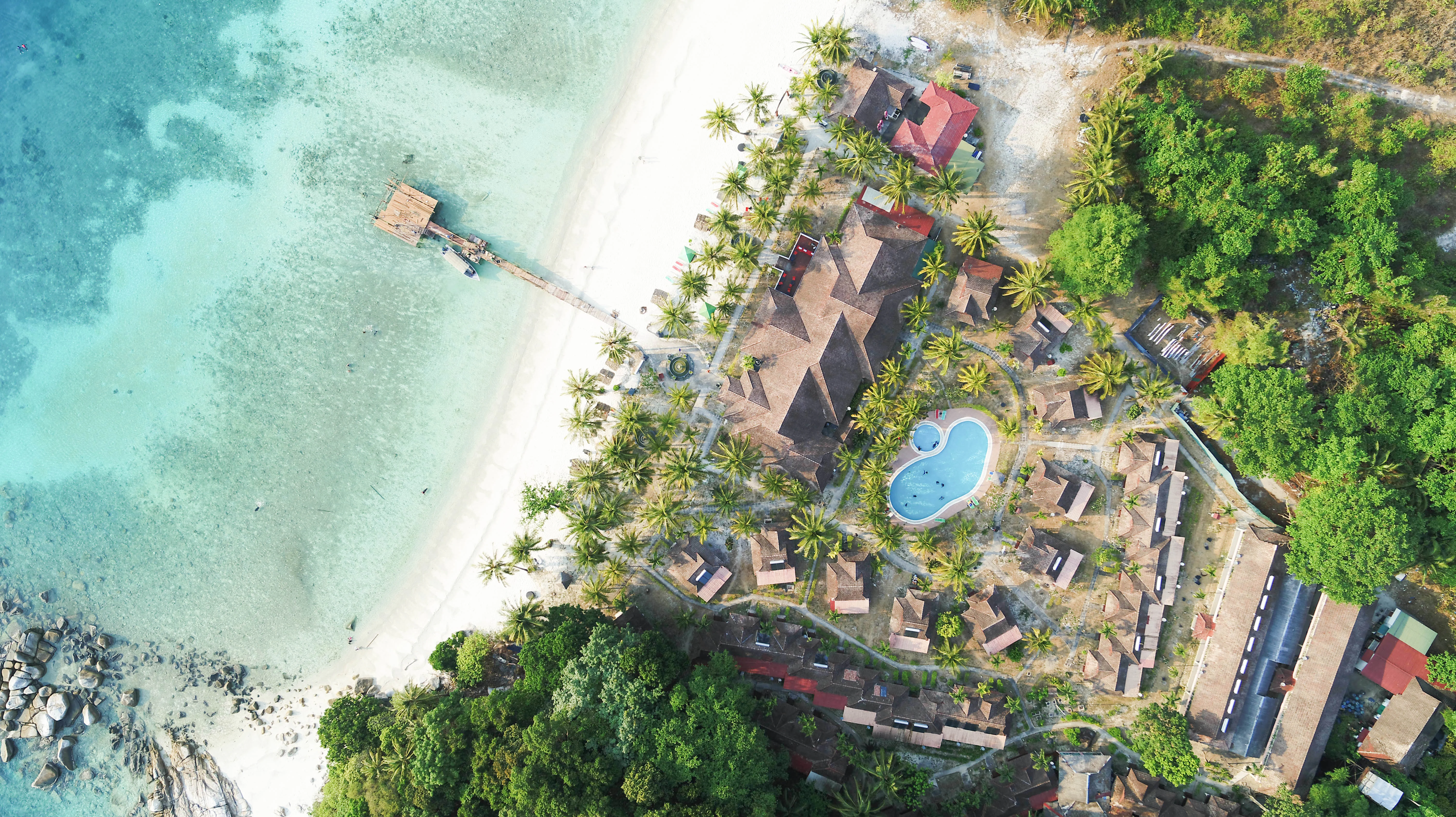
An aerial view showing a beach resort on Lang Tengah Island, with white sand beach, turquoise water, a wooden pier, and resort buildings nestled in tropical vegetation.
Aerial view of the Sari Pacifica Beach Resort on Lang Tengah Island.

Lang Tengah Island landscape and geographic character

Lang Tengah Island is a small, low-lying tropical island in the South China Sea, with clean white-sand beaches and a deeply forested interior. The terrain is dominated by primary rainforest that runs close to the shoreline in many places, giving the island a dense, green character from the water. There are no major hills, dramatic cliffs, or large inland features documented; instead, the landscape is shaped primarily by its beaches, its forested core, and the surrounding sea.

The marine landscape is a defining part of the island's profile. Waters around Lang Tengah are known for their turquoise clarity in good conditions, and the seabed is shaped by coral reef structures that support a wide variety of reef-associated life. The combination of forest meeting white-sand beach, set within clear tropical sea, gives the island a visually classic Malaysian east coast character that contrasts with the more built-up scenes on nearby Redang and the Perhentians.
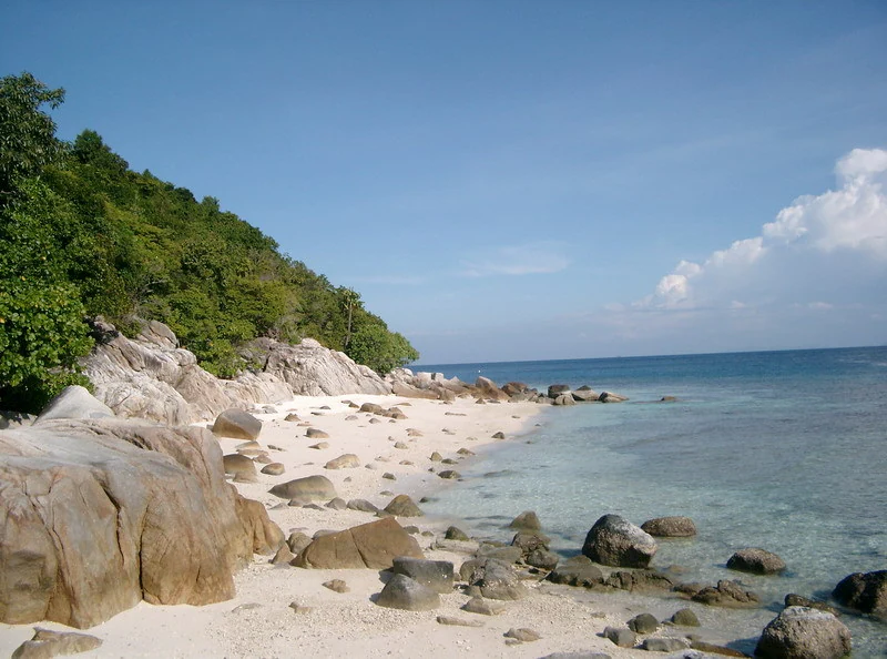
A sunny coastal scene showing a white sandy beach with large boulders and dense tropical forest meeting the turquoise sea.
A rocky beach shoreline on Lang Tengah Island with turquoise waters.

Lang Tengah Island ecosystems, habitats, and plant life

The natural environment of Lang Tengah Island is shaped by two closely linked systems: the tropical forest that covers most of the interior, and the coral reef ecosystem that surrounds the island in the South China Sea. The forest is described as primary, meaning it retains much of its original tree cover and structural complexity, and it plays a key role in maintaining the island's overall ecological condition and freshwater balance.

The marine side of the island's nature is particularly significant. The surrounding waters are part of a designated marine park area, and the coral reefs here are considered healthy by regional standards, with abundant reef fish life. Turtles are a flagship ecological presence, with green turtles nesting on the island during the warmer half of the year and hawksbill turtles recorded occasionally. Smaller wildlife, including a variety of frogs, lizards, monitor lizards, and insects, as well as a wide range of birds, is supported by the island's forest cover.

Because the island is small and surrounded by reef, there is a strong interaction between land and sea ecosystems: forested slopes drain into reef habitats, and nesting beaches serve as critical habitat for marine species. This integrated land-and-sea character is one of the defining aspects of Lang Tengah's natural profile.
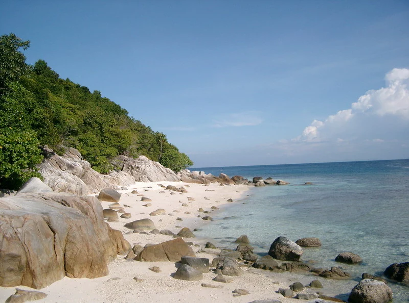
A tropical beach with white sand, scattered grey boulders, lush green vegetation on a hillside, and clear blue water under a bright sky.
A scenic view of a white sand beach at Lang Tengah Island, featuring large boulders and tropical vegetation.

Lang Tengah Island wildlife and species highlights

Wildlife on Lang Tengah Island is split between the forested interior and the surrounding reef and beach habitats. The most prominent and widely recognised animals are sea turtles: green turtles nest on the island roughly between April and October, and hawksbill turtles are also recorded occasionally and seen in surrounding waters. Nesting beaches are therefore a key seasonal focus for wildlife on the island.

In the water, the reef ecosystem supports a rich variety of reef fish, with regular sightings of rays and occasional sharks, indicating a relatively healthy predator presence within the reef system. Larger monitor lizards, known locally as biawak, are present across the island, generally keeping to quieter areas away from resort beaches, while smaller monitors are commonly seen patrolling the shoreline at dawn.

Terrestrial wildlife is typical of small Malaysian tropical islands: a wide variety of birds, frogs, lizards, and insects inhabit the forest interior. While these species are less visible to casual visitors than the marine life, they form the backbone of the island's broader biodiversity and contribute to the intact, forested character that distinguishes Lang Tengah from more developed neighbouring islands.
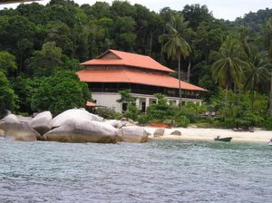
A view from the water showing a multi-tiered building with a red tile roof set against a backdrop of dense green forest, with large granite boulders and a sandy beach in the foreground.
A coastal resort building nestled among lush tropical vegetation on Lang Tengah Island.

Lang Tengah Island conservation status and protection priorities

Conservation significance on Lang Tengah Island is closely tied to its marine park status and its role as a sea turtle nesting site. The waters around the island are part of a designated marine park, which provides a framework for protecting coral reefs and reef-associated species from more damaging forms of fishing and development. Healthy reefs with abundant fish life, plus seasonal turtle nesting, indicate that the marine environment here retains significant ecological value.

The forested interior also contributes to conservation, as primary forest cover helps stabilise the island, supports terrestrial wildlife, and reduces sediment runoff into the reef system. The limited scale of resort development on the island, relative to nearby destinations, has helped limit the direct pressure on both forest and reef habitats, although seasonal tourism cycles still concentrate visitor impact during peak months.

On a regional level, the island forms part of a chain of important marine and coastal habitats along the Terengganu coast that includes Redang and the Perhentians. Its turtle nesting populations in particular connect it to wider sea turtle conservation efforts in the South China Sea, even though much of the management focus for Lang Tengah is around maintaining water quality, reef health, and nesting beach condition.

Top sights and standout views in Lang Tengah Island

Lang Tengah Island's strongest points of distinction are its clear, turquoise waters and healthy coral reefs, set against a backdrop of largely undisturbed tropical forest. The island's quieter, low-key resort scene, with only a handful of small hotels, sets it apart from the busier neighbouring islands of Redang and the Perhentians.

Seasonal green turtle nesting between April and October is a defining ecological highlight, and the surrounding marine park waters are known for abundant reef fish, rays, and occasional shark sightings. Together, these features make the island a focused choice for visitors who want accessible reef diving and a peaceful tropical environment, rather than a high-volume beach destination.

Best time to visit Lang Tengah Island

Like the rest of Malaysia's east coast, Lang Tengah Island is strongly seasonal because of the northeast monsoon from the South China Sea. During the rougher monsoon months, roughly from October through March, most resorts on the island close and ferry transport schedules are heavily restricted, making this period unsuitable for normal tourism.

The calmer, drier months outside the monsoon window are the most rewarding time to visit. Clearer skies and calmer seas tend to bring out the best in the turquoise water visibility and make diving and snorkelling more enjoyable. This period also overlaps with the green turtle nesting season, which runs roughly from April to October, allowing visitors to potentially witness turtle activity on nesting beaches alongside good reef conditions.
Monthly climate preview

Long term temperature and precipitation patterns across the year

Lang Tengah Island Climate Normals and Monthly Temperature Records

Lang Tengah Island exhibits sustained monthly average temperatures paired with distinct shifts in precipitation over the annual cycle. Reviewing the complete twelve month dataset provides deeper insight into measured long term climate normals for this representative coordinate.
Annual mean28 °C
26 °C29 °C
Jan26°
Feb26°
Mar27°
Apr28°
May29°
Jun29°
Jul28°
Aug28°
Sep28°
Oct28°
Nov28°
Dec27°
Warmest month
May

29 °C

Coolest month
January

26.3 °C

Wettest month
November

16.3 mm/day

Driest month
February

2.8 mm/day

Park location guide

Geography guide, regional context, and park location map for Lang Tengah Island

Lang Tengah Island park geography, regions, and map view in Malaysia

Understand where Lang Tengah Island sits in Malaysia through a broader geographic reading of the surrounding landscape, nearby location context, and its mapped position within the national park landscape.

How Lang Tengah Island fits into Malaysia

Malaysia is a federal constitutional monarchy located in Southeast Asia. The country consists of 13 states and three federal territories, divided by the South China Sea into Peninsular Malaysia on the Indochinese Peninsula and East Malaysia on the island of Borneo. With a population of over 34 million, it achieved independence from Britain in 1957 and became a modern federation in 1963. The country is recognized for its multicultural population, tropical climate, and significant economic role in the region.

Wider geography shaping Lang Tengah Island in Malaysia

Malaysia occupies a strategic position in Southeast Asia, split by the South China Sea into two distinct regions. Peninsular Malaysia lies on the Indochinese Peninsula, sharing a land border with Thailand to the north and maritime borders with Singapore, Vietnam, and Indonesia. East Malaysia occupies the northern portion of Borneo, sharing land borders with Brunei and Indonesia, and maritime borders with the Philippines and Vietnam. The country's terrain includes coastal plains, mountain ranges such as the Titiwangsa in the peninsula, and extensive tropical rainforests.

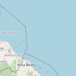
Map view of Lang Tengah Island

Use this park location map to pinpoint Lang Tengah Island in Malaysia, understand its exact geographic position, and read its mapped placement within the surrounding landscape more clearly.

Pigeon | © OpenStreetMap contributors

Location context for Lang Tengah Island

Terengganu

Visualizing tropical rainforest terrain, white sand beaches, and coral reef habitats.

Lang Tengah Island Photos and Protected Marine Scenery Explorer

Visual records illustrate the dense primary rainforest and turquoise marine environments defining Lang Tengah Island. Examining these field photographs reveals the distinct protected area character and coral reef topography of the Terengganu coast.

An aerial view showing a beach resort on Lang Tengah Island, with white sand beach, turquoise water, a wooden pier, and resort buildings nestled in tropical vegetation.

A sunny coastal scene showing a white sandy beach with large boulders and dense tropical forest meeting the turquoise sea.

A tropical beach with white sand, scattered grey boulders, lush green vegetation on a hillside, and clear blue water under a bright sky.

A view from the water showing a multi-tiered building with a red tile roof set against a backdrop of dense green forest, with large granite boulders and a sandy beach in the foreground.

Park atlas

Compare adjacent island reserves, coral ecosystems, and regional coastal habitats

Explore Parks Near Lang Tengah Island and Surrounding Marine Protected Areas

Browsing parks near Lang Tengah Island reveals connected marine protected areas and neighboring island reserves across the Terengganu coast. Comparing these surrounding coastal landscapes provides a wider geographic perspective on tropical marine habitats and regional conservation zones.
A watercolor painting of a tropical island coastline with palm trees, green vegetation, rocks in the foreground, and distant purple mountains under a soft light.
Marine protected areaTerengganu
About 15 km away#1 closest

East

Redang Island Marine Protected Area: Coastal Terrain and Reef Ecosystems

Geographic atlas of the Terengganu island archipelago

Redang Island is a prominent marine protected area within the South China Sea, characterized by its forested interior, sheltered bays like Teluk Dalam, and expansive coral reef systems. As a key ecological site off the Terengganu coast, the island provides a unique study in island geography and marine conservation, offering detailed insights into the protected reef environments and coastal morphology of Peninsular Malaysia.

Area
24.2 km²
Relief
Upland
Climate
Tropical
Access
Moderate access
A watercolor illustration of a wooden pier extending into calm wetland waters, with lush green shorelines and trees on both sides.
State or regional parkTerengganu
About 22 km away#2 closest

Southwest

Setiu Wetlands State Park: Geography and Protected Area Atlas of Terengganu

Coastal lagoons, mangrove forests, and riverine ecosystems

Encompassing the largest natural wetland on Malaysia's east coast, Setiu Wetlands State Park serves as a critical protected landscape where sea, sand, and forest meet. This atlas entry details the park's 23,000 hectare expanse, highlighting the complex hydrological network of lagoons and river basins that support diverse habitats, including peat swamps and seagrass beds.

Area
230 km²
Established
2018
Relief
Lowland
Climate
Tropical
An illustrative style image of a dramatic mountain valley featuring cliffs, two waterfalls, and a forested foreground at sunset.
Marine protected areaTerengganu
About 22 km away#3 closest

Northwest

Perhentian Islands Marine Protected Area: Terengganu Coastal and Archipelago Geography

Mapped marine boundaries and tropical island terrain

An immersive look at the Perhentian Islands, a protected nine-island archipelago in the South China Sea. Analyze the distinct marine geography, from fringing coral reefs and shallow reef flats to the forested inland hills of Perhentian Besar and Perhentian Kecil. This overview provides spatial context for one of Malaysia's most recognizable marine environments, emphasizing the protected status of its surrounding waters and reef habitats.

Area
15.955 km²
Established
1994
Relief
Lowland
Climate
Tropical
A soft-toned watercolor painting of a tropical island beach with a natural rock arch formation and palm trees.
Protected areaTerengganu
About 75 km away#4 closest

Southeast

Kapas Island: A Detailed Geographic Overview of the Protected Terengganu Coastal Landscape

Topography, Marine Protection Zones, and Island Geography

Kapas Island offers a focused look at the intersection of coastal geography and conservation management. This small archipelago features a tropical jungle core and protected sandy perimeters, providing a clear map of local reef health and coastal biodiversity in the Terengganu region of Malaysia.

Area
1.5 km²
Relief
Lowland
Climate
Tropical
Access
Easy access
National parkPahang
About 128 km away#5 closest

South

Taman Negara National Park: Pahang Protected Area with Mapped Boundaries for Geographic Discovery

Explore the unique landscape context within Pahang, Malaysia.

Delve into Taman Negara National Park, a significant protected area situated in Pahang, Malaysia. This detailed view highlights the park's mapped boundaries and its contribution to the regional geography. Understand the protected landscape and its place within the natural terrain of Peninsular Malaysia, essential for atlas-based geographic exploration.

Area
4,343 km²
Established
1938
IUCN
II
Relief
Mixed relief
Protected areaTerengganu
About 140 km away#6 closest

Southeast

Tenggol Island: A Geographic Overview of Terengganu's Protected Tropical Marine Landscape

Mapping reefs, forest interior, and regional maritime terrain

Tenggol Island stands as a distinct protected area off the coast of Terengganu, defined by its sharp 272-meter forested peak and complex underwater topography. This overview provides data on its coastal bays, rocky points, and fringing reef zones, offering a clear understanding of the island's unique position within the East Coast of Peninsular Malaysia's marine geography.

Area
2.62 km²
Relief
Upland
Climate
Tropical
Access
Moderate access
National parkNarathiwat Province
About 158 km away#7 closest

Northwest

Budo, Su-ngai Padi National Park: Protected Tropical Rainforest Geography

Explore mapped boundaries and mountain landscapes in Southern Thailand.

Budo, Su-ngai Padi National Park is a critical protected area safeguarding one of Thailand's last significant tracts of intact tropical rainforest. Situated within the rugged Budo mountain range of Narathiwat Province, its landscape is defined by dense evergreen forests, steep terrain, and numerous waterfalls. This national park offers substantial geographic context for understanding conservation landscapes and regional terrain in peninsular Thailand, serving as a valuable addition to any atlas exploration.

Area
341 km²
Established
1999
IUCN
II
Relief
Mountain
A watercolor painting showing a quiet lakeside scene with dense green forests in the background and soft, purplish mountains rising behind them.
State or regional parkPerak
About 172 km away#8 closest

West

Belum-Temengor: Ancient Rainforest Complex and Protected Landscape Geography in Perak

Mapping the forest ridges and lake archipelago of the northern Malay Peninsula

Spanning over 130 million years of ecological history, Belum-Temengor represents a massive, continuous block of tropical rainforest. The terrain transitions from high-altitude hill forests in the north to the flooded valleys and forested islands of Tasik Temengor. This complex serves as a vital water catchment and a sanctuary for diverse flora and fauna within the broader mountainous geography of the Perak region.

Area
1,175 km²
Established
2007
Relief
Mountain
Climate
Tropical

Common questions about visiting, size, designation, and location context for Lang Tengah Island

Lang Tengah Island FAQs for park facts, access, geography, and protected area context

Find quick answers about Lang Tengah Island, including protected-area facts, park geography, trail and visitor context, and how the park fits into its surrounding country and regional landscape.
MoriAtlas Explorer

Continue Your Protected Areas Search Across the Global Atlas

Deepen your exploration by continuing the structured search for national parks and protected areas worldwide. Utilize the comprehensive filtering capabilities to compare different conservation landscapes and refine your understanding of global park geography. Discover more about the distribution and characteristics of protected natural areas.

Global natural geography