Mori Atlas logo
Nature reserveLangheck bei Nittel

Examining the ecological boundaries and botanical terrain of this calcareous grassland habitat

Langheck bei Nittel: A Protected Nature Reserve in the Upper Moselle Valley Landscape

(Naturschutzgebiet Langheck bei Nittel)

Langheck bei Nittel is a protected nature reserve situated on the sun-exposed slopes of the Upper Moselle valley in Rheinland-Pfalz. This site acts as a key ecological stepping stone within the regional network of dry grasslands, preserving a complex mosaic of nutrient-poor soils, dry shrubs, and rare orchid habitats. The reserve demonstrates the importance of active conservation management in maintaining traditional semi-open landscapes and thermophilic vegetation structures.

nature reservecalcareous grasslandKalkmagerrasenorchidsdry grasslandUpper Moselle

Langheck bei Nittel

Nature reserve

Park overview

Structured park overview, official facts, and landscape profile for Langheck bei Nittel

Langheck bei Nittel park facts, protected area profile, and essential visitor context

Review the core facts for Langheck bei Nittel, including designation, size, terrain, visitor scale, habitats, and operating context in one park-focused overview.

About Langheck bei Nittel

Langheck bei Nittel is a small but ecologically rich nature reserve in the Upper Moselle valley, in the western German state of Rhineland-Palutinate. It lies within the municipal territory of Nittel, on a sun-exposed slope at around 330 meters in elevation along the road linking Nittel with Fisch in the Saargau region. Despite covering only about 42 hectares, the site is disproportionately important for biodiversity conservation in the region.

The protected area is set on nutrient-poor calcareous soils that historically supported light grazing and hay-making. These low-intensity traditional land uses prevented scrub encroachment and allowed a very diverse plant community to develop, dominated by warm-loving dry grassland (Kalkmagerrasen) and associated habitats such as dry shrubs, dry forest fragments, mesotrophic oat-grass meadows, and thermophilic flower-rich edge vegetation. Because the agricultural uses that maintained these habitats have largely disappeared, the reserve is now managed actively, with regular bush removal required to preserve the open landscape.

The reserve was established in 1998 by the Bezirksregierung Trier, the regional authority responsible for nature protection in the area at the time. Its formal purpose is the preservation, restoration, and development of species-rich, warm-loving calcareous grassland complexes in the Nitteler Moseltal natural area, with strong emphasis on biotope connectivity, endangered species protection, and scientific and cultural-historical significance. Langheck bei Nittel is especially noted for its over-regional value for biotope and species conservation, functioning as a key node in the mosaic of near-natural habitats along the Upper Moselle.

Quick facts and research context for Langheck bei Nittel

Langheck bei Nittel is a 42-hectare nature reserve in the municipality of Nittel in the Trier-Saarburg district of Rhineland-Palatinate, Germany. The protected site lies at about 330 meters above sea level along the road from Nittel to the village of Fisch.

The reserve was designated in 1998 by the Bezirksregierung Trier to preserve a near-natural complex of calcareous grassland, dry shrubs, dry forest fragments, and species-rich meadows in the Upper Moselle landscape (Nitteler Moseltal natural area). It is particularly valued for its orchids, insect fauna, and role as a habitat for endangered plant and animal species.

Protection and recognition

Examine official designation records and management frameworks for Langheck bei Nittel.

Langheck bei Nittel Protection Status and International Recognition Records

Examine the verified protection status and administrative framework established for Langheck bei Nittel. Review official designation records and international recognition data compiled within the global protected area database.

Protection details

WDPA ID
318711
Park context

Deeper park guide and search-rich context for Langheck bei Nittel

Langheck bei Nittel history, landscape, wildlife, and travel context

Explore Langheck bei Nittel through its history, landscape character, ecosystems, wildlife, conservation priorities, cultural context, and seasonal travel timing in a structured park guide built for atlas discovery and search intent.

Why Langheck bei Nittel stands out

Langheck bei Nittel is best known for its exceptionally rich orchid flora, which thrives on the warm, dry calcareous soils of the Upper Moselle slopes. Species documented on site include the Man Orchid (Orchis anthropophora), Lady Orchid (Orchis purpurea), Lesser Butterfly Orchid (Platanthera bifolia), Pyramidal Orchid (Anacamptis pyramidalis), Lizard Orchid (Himantoglossum hircinum), and Late Spider Orchid (Ophrys holosericea). The reserve is also recognized as a stronghold of thermophilic insect communities and as a textbook example of how traditional past grazing and mowing, combined with active bush control, can maintain semi-open, species-rich dry grassland on poor soils. It is one of the most botanically celebrated small nature reserves along the German Moselle.
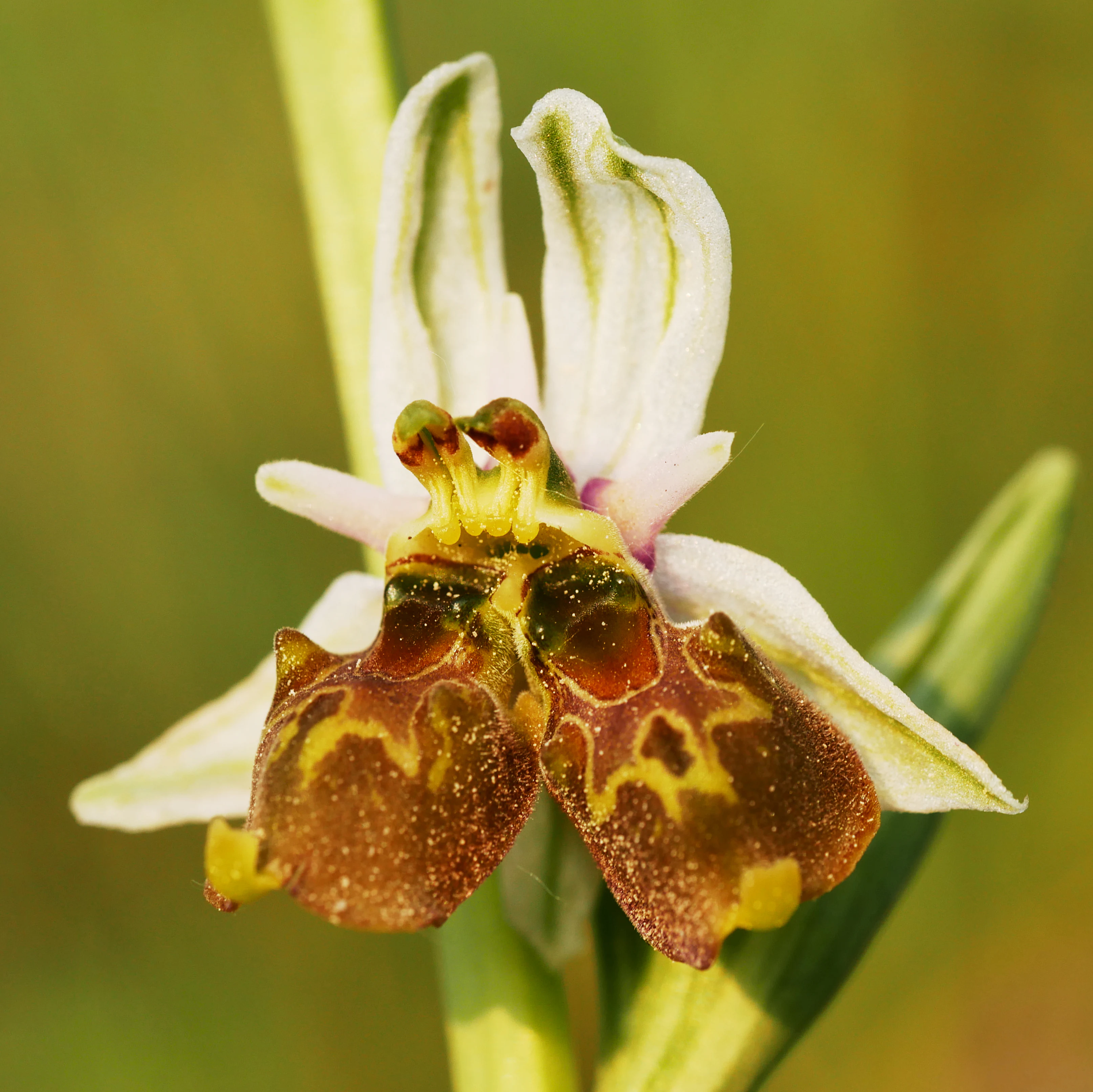
Close up, macro photograph of a bee orchid flower displaying a double blossom mutation, showing distinct, patterned reddish-brown labella and pale green sepals.
A rare double blossom mutation of the bee orchid (Ophrys holoserica) found within the Langheck nature reserve.

Langheck bei Nittel history and protected-area timeline

The landscape of Langheck bei Nittel has been shaped by human land use for generations. The site was historically used as pasture for livestock and was occasionally mown for hay. These traditional management practices kept the vegetation open and prevented the encroachment of shrubs and trees, which allowed nutrient-poor soils to support a remarkable variety of plant species.

As traditional grazing and mowing declined across much of the German countryside, the management that had maintained the open character of these slopes was lost. In response to the ecological value of the remaining habitat, the Bezirksregierung Trier officially designated the area as a nature reserve (Naturschutzgebiet) in 1998 under the name Langheck bei Nittel. The protection order set out clear conservation goals, including the preservation and restoration of the calcareous grassland complex, the safeguarding of dry shrub and forest fragments, the protection of orchids and insects, and the maintenance of biotope connectivity within the Upper Moselle valley.

Since designation, ongoing management, particularly regular bush clearance, has been necessary to prevent succession toward woodland and to keep the open grassland and its associated flora and fauna intact. The reserve is today recognized as one of the most botanically rewarding protected sites in the Trier-Saarburg district.

Langheck bei Nittel landscape and geographic character

Langheck bei Nittel occupies a sun-exposed slope in the Upper Moselle valley, within the natural area known as the Nitteler Moseltal. The terrain lies at about 330 meters above sea level and falls within the broader mosaic of hills and valleys that characterize the wine-growing and orchard landscapes of this part of the Moselle.

The physical setting is defined by dry, nutrient-poor, calcareous soils derived from the limestone geology typical of the Upper Moselle. These thin, stony soils retain little moisture and create the conditions that support warm-loving dry grassland (Kalkmagerrasen) rather than dense forest. The slope habitat is interspersed with patches of dry shrub and small fragments of thermophilic woodland, giving the landscape a semi-open character with frequent transitions between grassland, scrub, and forest edge.

The resulting scenery is one of gently sloping grassland with scattered shrubs and trees, framed by the wider Moselle landscape. Although the topography is not dramatic, the unusual openness of the slope and the diversity of vegetation structures make this a visually distinctive site within its region.
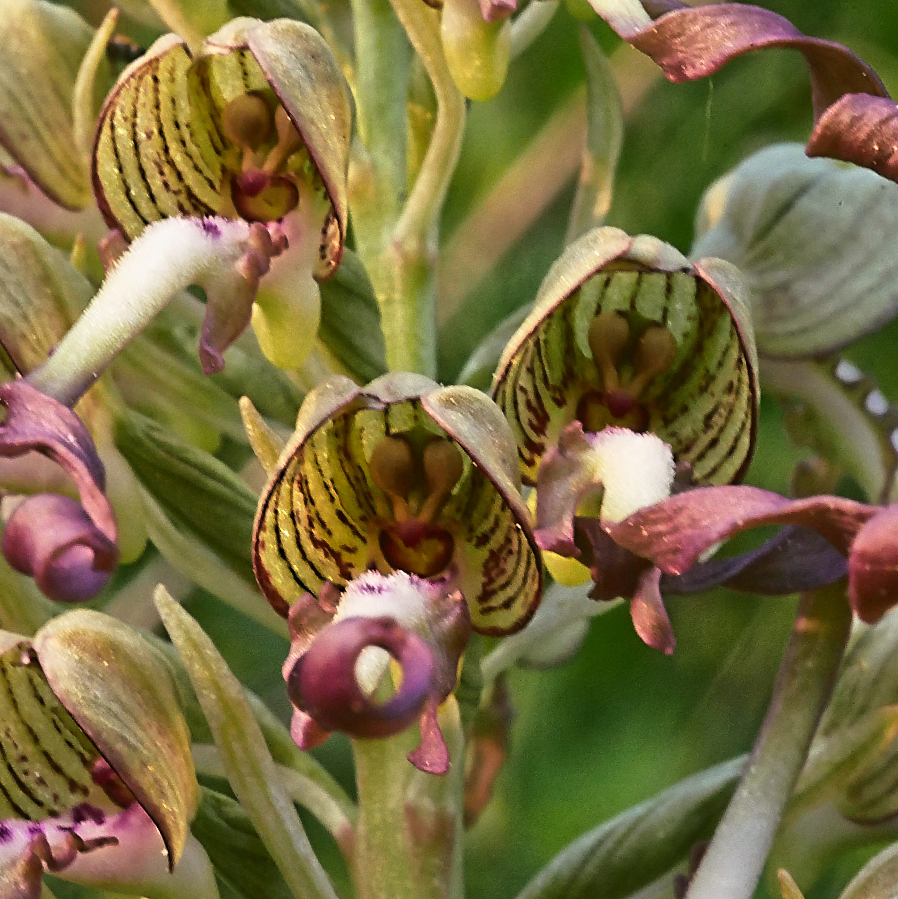
Macro photograph of several Lizard Orchid flowers with greenish-striped hoods and distinctive purple, twisted lip petals.
Close-up view of Lizard Orchid (Himantoglossum hircinum) blossoms found within the Langheck bei Nittel nature reserve.

Langheck bei Nittel ecosystems, habitats, and plant life

The ecological identity of Langheck bei Nittel is built around its calcareous dry grassland (Kalkmagerrasen) and the closely linked habitats that surround it. The prevailing semi-open vegetation is a complex mosaic of dry grassland, thermophilic edge communities, dry shrubs, and small dry forest fragments, all developed on warm, nutrient-poor limestone soils.

Because the soils are thin and dry, only low-growing, drought- and warmth-adapted plants thrive. Traditional grazing and mowing kept these grasslands open; today, the reserve is managed actively through bush clearance to maintain the same open structure. This combination of soil type, climate, and management has produced one of the most species-rich small grassland habitats in the Upper Moselle region, with high botanical and entomological diversity concentrated over a compact area.

The reserve also plays an important ecological role as a stepping stone in the regional network of near-natural biotopes. Its combination of open grassland, scrub, and forest fragments provides a wide range of microhabitats within a small surface area, which supports both generalist and highly specialized species and helps maintain biotope connectivity along the Moselle valley.
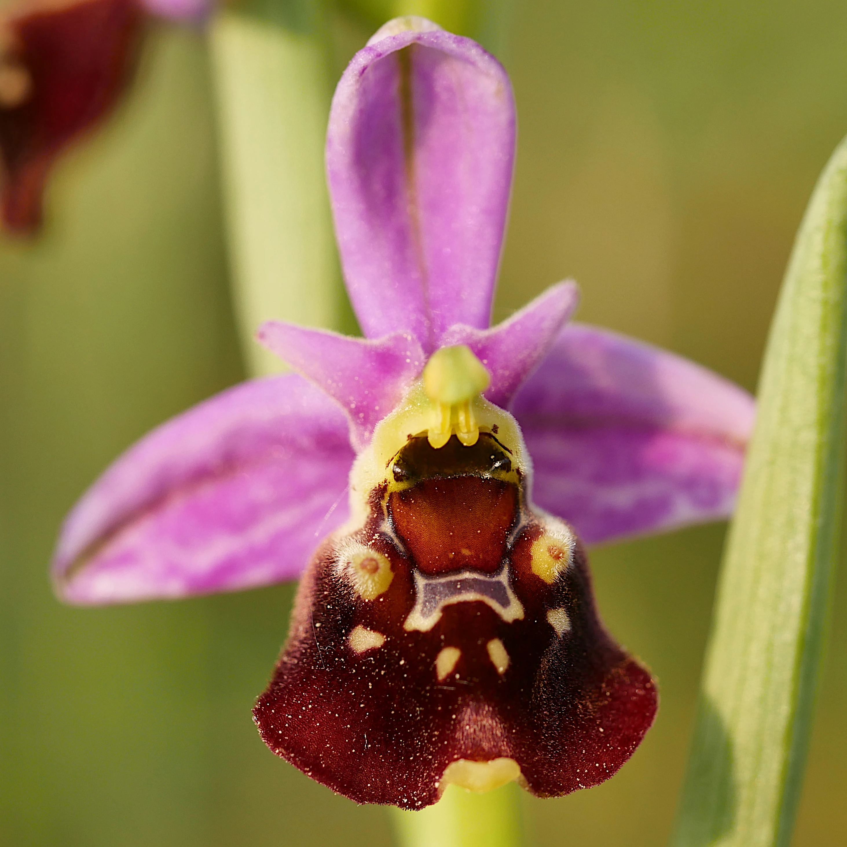
A close-up view of a purple and brown Late spider orchid flower with a complex, patterned lip, centered against a soft, blurred green background.
A detailed view of a Late spider orchid (Ophrys holoserica) at Langheck bei Nittel.

Langheck bei Nittel wildlife and species highlights

Langheck bei Nittel is primarily valued for its exceptionally rich orchid flora and its associated insect fauna. The reserve shelters multiple rare orchid species, including the Man Orchid (Orchis anthropophora), Lady Orchid (Orchis purpurea), Lesser Butterfly Orchid (Platanthera bifolia), Pyramidal Orchid (Anacamptis pyramidalis), Lizard Orchid (Himantoglossum hircinum), and Late Spider Orchid (Ophrys holosericea). These orchids are not only attractive to visitors but also depend on the very specific microclimates and soils of the calcareous grassland.

The warm, dry conditions and abundant wildflowers support a rich community of insects, including bees, butterflies, and other pollinators that depend on the late spring and summer blooms of the grassland. The mosaic of open ground, shrubs, and edge habitats creates nesting and feeding conditions for various insect groups that are themselves considered endangered in the broader region.

Birds and other animals also use the site, although the reserve's wildlife profile is most strongly defined by its invertebrate and botanical richness. The combination of orchids and their specialized insect partners is a key reason the area is recognized as having over-regional importance for biotope and species conservation.
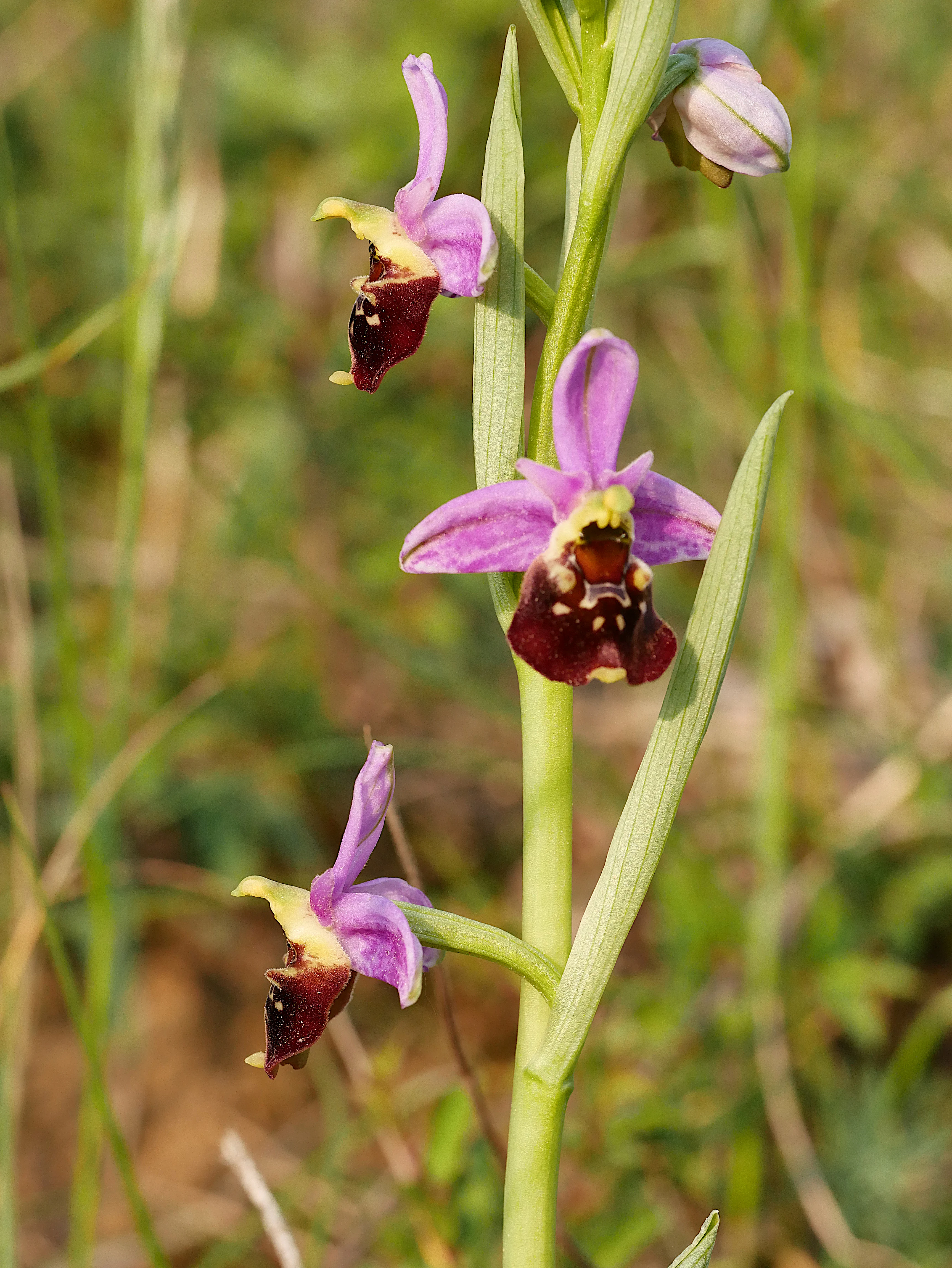
Close-up view of a Late spider orchid stalk with three distinct pink and dark brown flowers.
A Late spider orchid (Ophrys holoserica) in bloom within the Langheck nature reserve.

Langheck bei Nittel conservation status and protection priorities

The protection of Langheck bei Nittel primarily targets the preservation, restoration, and development of a near-natural complex of warm-loving calcareous grassland on the Upper Moselle. The reserve's official conservation objectives include safeguarding Kalkmagerrasen, dry shrubs, dry forest fragments, species-poor oat-grass meadows, and thermophilic, flower-rich edge communities, as well as protecting the populations of endangered animal and plant species that depend on these habitats.

Because the grassland is a product of traditional low-intensity land use, conservation at Langheck is not purely passive. Regular bush clearance is required to prevent succession toward woodland and to keep the open, sun-exposed character of the slope. This active management is essential to maintain the conditions that orchids and many specialized insects require.

The reserve is recognized for its over-regional significance for biotope and species protection, as well as for biotope connectivity in the Upper Moselle. It also holds scientific and cultural-historical value, since the grassland reflects a long history of human interaction with the landscape. In the context of the Trier-Saarburg district, Langheck bei Nittel stands out as a model of how a small area of traditional farmland can be transformed into a high-value conservation site with disproportionate ecological relevance.

Langheck bei Nittel cultural meaning and human context

The cultural dimension of Langheck bei Nittel is closely tied to the long agricultural history of the Upper Moselle. The open calcareous grassland that the reserve protects was not a natural wilderness but a product of generations of grazing and occasional mowing on soils too poor and steep for more intensive farming. This cultural landscape is one reason the site is recognized for its cultural-historical significance alongside its natural values.

The Upper Moselle region itself is known for its wine-growing tradition, and small dry grassland refuges like Langheck reflect the same warm, calcareous conditions that made the surrounding slopes suitable for viticulture. Today, the reserve represents a living link between traditional rural land use and modern nature conservation practice in Rhineland-Palatinate.
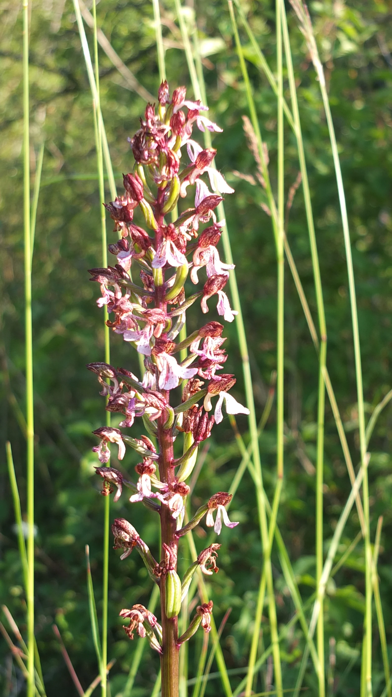
A close up view of an Ohnsporn orchid stalk with pink and dark purple flowers standing among tall green blades of grass.
The Ohnsporn orchid, a species found in the Langheck bei Nittel nature reserve.

Top sights and standout views in Langheck bei Nittel

Langheck bei Nittel is a compact nature reserve with an exceptional concentration of orchid species for its size, including several nationally notable species such as the Man Orchid, Lady Orchid, Lizard Orchid, and Late Spider Orchid.

The reserve also stands out for its high-quality mosaic of calcareous dry grassland, dry shrubs, and dry forest fragments, all maintained on the steeply traditional agricultural land through active management. Its location along the Upper Moselle and its role in regional biotope connectivity make it a key site for both scientific study and orchid-focused ecotourism in the Trier-Saarburg district.
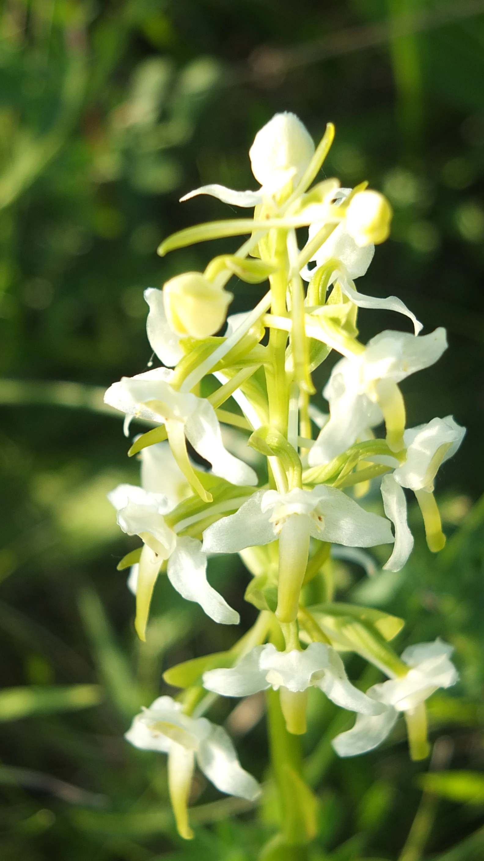
A vertical close-up shot of a white orchid with a pale green stem and buds, set against a blurred green background.
A close-up view of an orchid in the Langheck bei Nittel nature reserve.

Best time to visit Langheck bei Nittel

The reserve is at its most rewarding in late spring and early summer, when the majority of orchids are in flower and the dry grassland is at its botanical peak. May and June typically bring the main orchid bloom, while the surrounding shrubs and edge vegetation continue to support a rich insect fauna into mid-summer.

Because the value of the site depends on its open, warm character, visitors during the cooler months will find fewer flowers and far less insect activity. The dry, sun-exposed nature of the slope also means visits are more pleasant on warm, calm days, when both the flora and the pollinating insects are most active.

Monthly climate preview

Track long-term average monthly temperatures and precipitation patterns across the protected landscape.

Langheck bei Nittel Climate Normals and Annual Temperature Rhythm

Representative coordinate records show sustained shifts in monthly temperature ranges alongside steady precipitation rates throughout the year. Reviewing the complete twelve-month climatology dataset clarifies long-term regional weather trends and temperature variations.
Annual mean9 °C
0 °C19 °C
Jan
Feb
Mar
Apr
May13°
Jun17°
Jul19°
Aug19°
Sep14°
Oct
Nov
Dec
Warmest month
July

19.1 °C

Coolest month
January

0.4 °C

Wettest month
December

2.7 mm/day

Driest month
April

1.6 mm/day

Park location guide

Geography guide, regional context, and park location map for Langheck bei Nittel

Langheck bei Nittel park geography, regions, and map view in Germany

Understand where Langheck bei Nittel sits in Germany through a broader geographic reading of the surrounding landscape, nearby location context, and its mapped position within the national park landscape.

How Langheck bei Nittel fits into Germany

Germany is a federal republic in Western and Central Europe with a population of over 83 million across sixteen constituent states. It is Europe's largest economy by nominal GDP and a major global exporter and importer. The capital is Berlin, and the country borders Denmark, Poland, Czech Republic, Austria, Switzerland, France, Luxembourg, Belgium, and the Netherlands.

Wider geography shaping Langheck bei Nittel in Germany

Germany is located in Western and Central Europe, spanning 357,022 km². It borders Denmark to the north, Poland and the Czech Republic to the east, Austria and Switzerland to the south, and France, Luxembourg, Belgium, and the Netherlands to the west. The country has coastlines on the Baltic Sea and North Sea to the north, with the Alps located in the southern region.

Map view of Langheck bei Nittel

Use this park location map to pinpoint Langheck bei Nittel in Germany, understand its exact geographic position, and read its mapped placement within the surrounding landscape more clearly.

Pigeon | © OpenStreetMap contributors

Location context for Langheck bei Nittel

Rheinland-Pfalz

Visualizing the dry calcareous slopes, rare orchid habitats, and protected terrain along the Upper Moselle valley

Langheck bei Nittel Photos, Calcareous Grassland Landscapes, and Scenery

Browse detailed imagery documenting the sun-exposed limestone slopes and specialized plant communities that define Langheck bei Nittel. Visual references reveal the open grassland structure and transitional scrub borders that characterize this protected natural environment.

Close up, macro photograph of a bee orchid flower displaying a double blossom mutation, showing distinct, patterned reddish-brown labella and pale green sepals.

Two flowering stalks of Lady orchid, featuring dense spikes of light pink, purple-spotted petals, set against a blurred green background.

Macro photograph of several Lizard Orchid flowers with greenish-striped hoods and distinctive purple, twisted lip petals.

A close-up view of a purple and brown Late spider orchid flower with a complex, patterned lip, centered against a soft, blurred green background.

Close-up view of a Late spider orchid stalk with three distinct pink and dark brown flowers.

A close-up vertical shot of a tall Lizard Orchid flower spike with twisted petals, surrounded by green meadow vegetation.

A close up view of an Ohnsporn orchid stalk with pink and dark purple flowers standing among tall green blades of grass.

A vertical close-up shot of a white orchid with a pale green stem and buds, set against a blurred green background.

A close-up view of a vibrant magenta pyramidal orchid flower in a green meadow with a clear blue sky in the background.

Park atlas

Discover adjacent calcareous grasslands and connected regional nature reserves

Explore Other Parks Near Langheck bei Nittel and Surrounding Protected Areas

Compare Langheck bei Nittel with other protected areas across the surrounding Upper Moselle valley. Broadening your park search reveals how similar limestone terrain and orchid habitats connect throughout the region.
A soft watercolor painting of a landscape featuring a small river or pond in the center, flanked by green trees on the left and pink-flowered trees on the right, with low hills in the distance.
Nature reserveLuxembourg
About 3.4 km away#1 closest

Northwest

Naturschutzgebitt Kelsbaach Nature Reserve: A Geographical Overview of Luxembourg Landscapes

Dolomite rock formations and protected dry grassland ecosystems

Naturschutzgebitt Kelsbaach preserves a distinctive environmental gradient across the Moselle valley hillsides in Luxembourg. From exposed dolomite cliffs and arid plateau grasslands to the shaded Kelsbaach stream gorge, the reserve illustrates the complex interplay of regional geology and microclimate. This protected area offers a precise look at local biodiversity habitats and the lasting impact of historical land use on the natural terrain.

Area
0.755 km²
Established
1998
Relief
Upland
Climate
Temperate
Watercolor painting of a green, rolling hillside landscape with faint pink floral details in the foreground.
Nature reserveRheinland-Pfalz
About 7.6 km away#2 closest

Northeast

Perfeist bei Wasserliesch: Protected Grassland and Botanical Mapping in Rheinland-Pfalz

A regional sanctuary for rare orchids and calcareous meadow flora.

Perfeist bei Wasserliesch represents a significant protected area within the German Moselle landscape. Spanning 22 hectares of dry, sun-exposed calcareous soil on the Liescher Berg, the reserve offers a focused look at open grassland ecology. Its unique status as a botanical reference point highlights how small-scale protected land maintains rare plant species and fragile meadow habitats against the backdrop of the surrounding Moselle valley hill country.

Area
0.22 km²
Established
1986
Nature reserveRhineland-Palatinate
About 9.7 km away#3 closest

East

Wiltinger Saarbogen: Mapping the Natural Saar River Meander and Floodplain Habitats

A critical protected nature reserve in the Rhineland-Palatinate river landscape.

Wiltinger Saarbogen remains a rare, natural river arc within the Saar valley. This protected area offers a deep look into riverine geography, featuring a concentrated mosaic of gravel banks, reed-fringed wetlands, and riparian forests that stand in contrast to the engineered shipping canals of the region.

Area
1.67 km²
Established
1997
Watercolor painting of a rolling green forest landscape with a winding path and soft, abstract hills in the background.
Nature reserveRhineland-Palatinate
About 14 km away#4 closest

Northeast

Mattheiser Wald Nature Reserve: A Protected Forest Landscape in Rhineland-Palatinate

Ecological mapping of urban forest and valley terrain

Mattheiser Wald represents a vital nature reserve and Natura 2000 site in the Trier region. The area is characterized by high-value oak and hornbeam woodland, abandoned military disturbance zones that host rare wildlife, and an intricate stream valley system. This atlas entry provides a detailed look at the reserve's topography and its status as a critical conservation landscape within an urban environment.

Area
4.47 km²
Established
2003
Relief
Upland
Climate
Temperate
Nature reserveLuxembourg
About 15 km away#5 closest

West

Cornelysmillen-Schucklai Nature Reserve: Geographic and Protected Area Overview

Wetland ecosystems on the Luxembourg plateau

Cornelysmillen-Schucklai serves as a key protected area of national interest, encompassing a mosaic of marshland, meadows, and deciduous woodland. This reserve acts as a vital corridor for moisture-dependent plant communities and threatened bird populations, defining the hydrological character of the plateau region with its intricate stream systems and restored pond basins.

Area
1.437 km²
Established
2023
Relief
Upland
Climate
Temperate
Watercolor painting of a green, rolling landscape with scattered trees and soft, faded hills in the background.
Nature reserveLuxembourg
About 15 km away#6 closest

West

Naturschutzgebitt Aarnescht Nature Reserve; Geographic Atlas and Protected Area Profile

Exploring calcareous dry grasslands and ecological mosaic habitats in Luxembourg

Discover the geographic composition of Naturschutzgebitt Aarnescht, a premier nature reserve in Luxembourg. This profile details the site's unique Keuper sediments, extensive orchid populations, and varied terrain, including traditional orchards and oak low-forests that form a vital protected landscape.

Area
0.752 km²
Established
1988
Relief
Upland
Climate
Temperate
A horizontal watercolor painting of a wetland scene with still water, grassy banks, small islands, and rolling hills in the background.
Nature reserveSchengen
About 16 km away#7 closest

South

Haff Réimech Nature Reserve: Wetland Geography and Protected Landscape in Schengen

Reclaimed industrial wetlands in the Moselle river valley

Haff Réimech is a protected wetland sanctuary located in the Moselle valley near Schengen. The reserve features approximately forty shallow lakes created from former sand and gravel pits, now surrounded by reedbeds and riparian woodland. This mosaic landscape serves as a key site for migratory bird species, demonstrating a unique transition from industrial extraction to a managed, ecologically rich floodplain environment.

Area
1.008 km²
Established
1998
Relief
Lowland
Climate
Temperate
Nature reserveSaarland
About 16 km away#8 closest

Southeast

Steilhänge der Saar Nature Reserve: Mapped Protected Landscapes and River Valley Geography

Protected river slopes and forested terrain in Saarland

The Steilhänge der Saar nature reserve encompasses steep, wooded hillsides rising above the Saar river valley. This consolidated protected area features complex ecological gradients between rocky, sun-exposed upper slopes and shadowed tributary streams, serving as a critical habitat zone and a defining feature of the regional Saarland landscape.

Area
10.86 km²
Established
2017
IUCN
IV

Common questions about visiting, size, designation, and location context for Langheck bei Nittel

Langheck bei Nittel FAQs for park facts, access, geography, and protected area context

Find quick answers about Langheck bei Nittel, including protected-area facts, park geography, trail and visitor context, and how the park fits into its surrounding country and regional landscape.
MoriAtlas Explorer

Continue Your Protected Areas Search Across the Global Atlas

Deepen your exploration by continuing the structured search for national parks and protected areas worldwide. Utilize the comprehensive filtering capabilities to compare different conservation landscapes and refine your understanding of global park geography. Discover more about the distribution and characteristics of protected natural areas.

Global natural geography