

Mori Atlas logo
Wildlife reserveLaquipampa Wildlife Refuge

Mapping the tropical dry forest terrain and Andean foothill corridors of this critical reserve

Laquipampa Wildlife Refuge: A Protected Landscape in the Lambayeque Region of Northern Peru

(Refugio de Vida Silvestre Laquipampa)

Laquipampa Wildlife Refuge encompasses a vital stretch of tropical dry forest within the Lambayeque Region, bridging the arid Pacific coast and the rugged slopes of the western Andes. This protected area safeguards a vertical mosaic of deciduous forests and sheltered ravines, offering essential habitat for the white-winged guan and the spectacled bear. The refuge serves as a key node for understanding the ecology and geographic distribution of threatened dry-forest landscapes in northern Peru.

dry foresttropical dry forestwhite-winged guanspectacled bearAndean foothillsbirdwatching

Laquipampa Wildlife Refuge

Wildlife reserve

Park overview

Structured park overview, official facts, and landscape profile for Laquipampa Wildlife Refuge

Laquipampa Wildlife Refuge park facts, protected area profile, and essential visitor context

Review the core facts for Laquipampa Wildlife Refuge, including designation, size, terrain, visitor scale, habitats, and operating context in one park-focused overview.

About Laquipampa Wildlife Refuge

Laquipampa Wildlife Refuge is a nationally designated protected area in the Lambayeque Region of northern Peru, in the Ferreñafe Province, with its landscape extending across the hills and valleys surrounding the highland town of Incahuasi. The refuge was established in 2006 to protect a significant remnant of the tropical dry forests that once stretched more broadly across the Pacific lowlands and lower Andean slopes of northwestern Peru. Today, the refuge is recognized as one of the most important conservation areas for this forest type in the country.

The protected area belongs to the national system administered by SERNANP, the Peruvian national agency responsible for natural protected areas, and is classified as a wildlife refuge, a status aligned with habitat and species management under international conservation frameworks. Its boundaries are designed to encompass the seasonal habitats needed by both lowland dry-forest species and those that move between elevations, particularly the white-winged guan in lower forested zones and the spectacled bear in the higher, more humid parts of the refuge.

Beyond its role in safeguarding individual species, Laquipampa represents an important ecological transition zone where dry Pacific-slope vegetation meets the western fringes of the Andes. This gives the refuge a layered character, with cactus- and bromeliad-rich slopes giving way to denser deciduous woodland where conditions are moister. The result is a protected landscape that combines the biological distinctiveness of Peru's northern dry forests with the broader Andean influence, supporting a wide range of plant and animal communities within a relatively compact administrative area.

Quick facts and research context for Laquipampa Wildlife Refuge

Laquipampa Wildlife Refuge covers roughly 113 square kilometers of tropical dry forest in the Lambayeque Region of northern Peru, administered by SERNANP. Established on 7 July 2006, it lies in the Ferreñafe Province and is classified as an IUCN Category IV habitat and species management area. Its conservation remit focuses on dry-forest biodiversity, with particular attention to the white-winged guan and the spectacled bear, together with a range of endemic and range-restricted bird and mammal species.

Protection and recognition

Documented protection history and official international recognition metrics for conservation analysis

Laquipampa Wildlife Refuge Protection Status and Designated Terrestrial Conservation Scope

Laquipampa Wildlife Refuge maintains a documented terrestrial protection scope within the global conservation registry. Official protection status records outline baseline administrative boundaries and management designations for this protected area.

Protection details

Protection scope
Terrestrial
Transboundary protection
No
Park context

Deeper park guide and search-rich context for Laquipampa Wildlife Refuge

Laquipampa Wildlife Refuge history, landscape, wildlife, and travel context

Explore Laquipampa Wildlife Refuge through its history, landscape character, ecosystems, wildlife, conservation priorities, cultural context, and seasonal travel timing in a structured park guide built for atlas discovery and search intent.

Why Laquipampa Wildlife Refuge stands out

Laquipampa is best known for protecting one of the most important remaining stands of tropical dry forest in northern Peru and for serving as a stronghold for the white-winged guan, a critically endangered bird that has become closely associated with the refuge. The protected area also hosts populations of the spectacled bear, and it is valued by researchers and conservationists as a key site for understanding the ecology of the seasonally dry forests of the Lambayeque region.
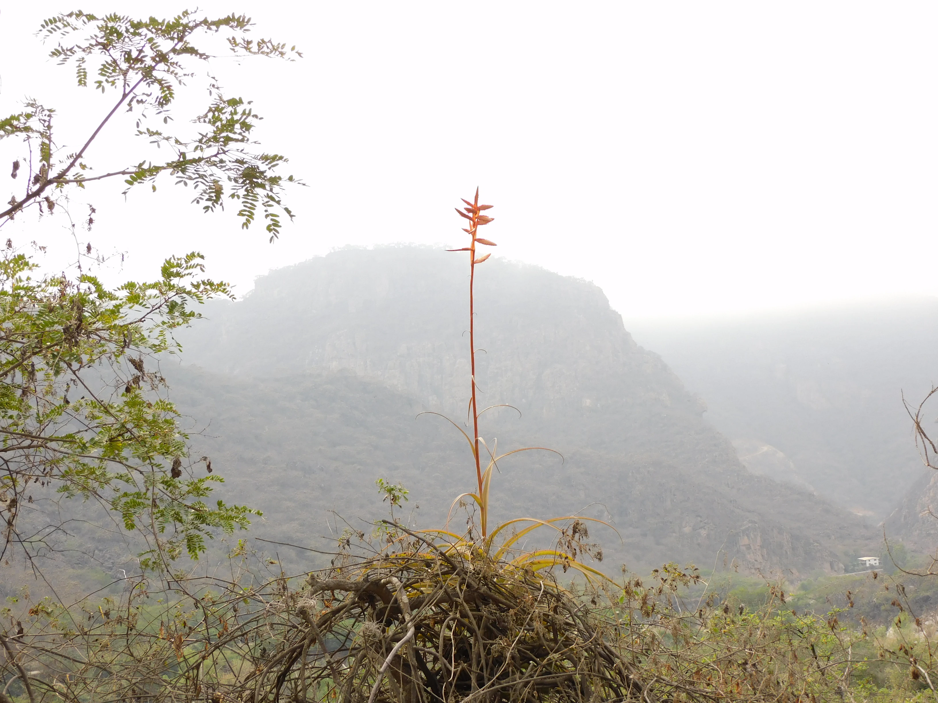
A close-up shot of a single Tillandsia plant with a tall, slender stalk topped with a bright orange flower, situated in the foreground with a hazy, out-of-focus mountain slope in the background.
A blooming Tillandsia plant against a misty mountainous backdrop in Laquipampa Wildlife Refuge.

Laquipampa Wildlife Refuge history and protected-area timeline

The areas that today compose Laquipampa Wildlife Refuge were historically part of the broader tropical dry forest belt of northwestern Peru, a landscape long shaped by seasonal drought cycles and limited human settlement in its rougher uplands. For much of the twentieth century, these dry forests were steadily cleared for agriculture, fuelwood, and cattle grazing, and their ecological importance only became widely recognized relatively late.

A decisive step came in 2006, when the Peruvian government officially established the refuge through the national protected-areas system, with the explicit purpose of conserving dry-forest habitat and its associated species. The designation was tied closely to safeguarding the white-winged guan, whose precarious status had made the area a priority for conservation intervention, and it also recognized the ecological value of the refuge for the spectacled bear and other dry-forest fauna. Since its establishment, the refuge has been administered by SERNANP, which oversees visitor management, conservation programs, and monitoring efforts across the protected area.

Laquipampa Wildlife Refuge landscape and geographic character

The landscape of Laquipampa is defined by the rugged hills and valleys of the lower western Andes in northern Peru, where steep slopes create a mosaic of dry, exposed terrain and sheltered ravines that retain moisture through the dry season. The refuge sits in the transition between the arid Pacific coastal lowlands and the higher Andean elevations, giving the area a vertical gradient compressed into a relatively small geographic footprint.

Visually, the refuge is dominated by tropical dry forest, an ecosystem whose character changes sharply with the seasons. In the wetter months, deciduous trees leaf out and the slopes turn green, while the dry season reduces the vegetation to a more open, sometimes thorny landscape with bare branches and pale trunks. Bromeliads, including epiphytic species such as those of the genus Tillandsia, are conspicuous features of the canopy and rocky outcrops, adding to the botanical distinctiveness of the terrain.

Roughly 113 square kilometers of these forested hills and intervening valleys fall within the refuge's boundaries. Elevations within the area span both the low dry-forest zones favored by the white-winged guan and the higher, more humid habitats that support the spectacled bear, allowing the landscape to act as a vertical refuge for species whose needs change with altitude and season.

Laquipampa Wildlife Refuge ecosystems, habitats, and plant life

Laquipampa's natural character is anchored in its tropical dry forests, an ecosystem that has been dramatically reduced across northwestern South America and is considered among the most threatened forest types in the region. Within the refuge, this ecosystem is shaped by a pronounced dry season followed by a concentrated wet period, and the flora and fauna of the area are adapted to those cycles.

The vegetation includes a mixture of deciduous trees such as Tara spinosa, Loxopterygium huasango, Bursera graveolens, and Eriotheca ruizii, alongside dense populations of epiphytic plants, particularly bromeliads, that occupy tree canopies and rocky surfaces. Together, these plant communities define the structural and functional character of the dry forest, providing nesting sites, food resources, and microhabitats for animals across the refuge.

Ecologically, the refuge functions as both a lowland dry-forest sanctuary and an entry point for species associated with wetter montane environments. This dual identity allows Laquipampa to contribute to broader ecological connectivity along the Andean slopes, where dry forests and cloud-forest habitats meet and where seasonal migrations and elevational movements occur.

Laquipampa Wildlife Refuge wildlife and species highlights

Wildlife is the most visible reason for the refuge's protection, with birds playing a particularly prominent role in its identity. The white-winged guan, a critically endangered cracid endemic to the dry forests of northwestern Peru, is the refuge's flagship species and a major focus of conservation attention. The bearded guan, another forest-dwelling cracid, is also recorded in the area, and the refuge provides habitat for several range-restricted passerines, including the Piura chat-tyrant and the blue seedeater, as well as the Andean condor soaring over the higher slopes.

Among mammals, the spectacled bear stands out as a species of special interest, reflecting the refuge's position along the Andean foothills. White-tailed deer are also present in forested habitats, while smaller mammals such as the Southern tamandua and the Guayaquil squirrel occupy different layers of the dry-forest canopy and understory.

While Laquipampa is not typically framed as a high-density mammal reserve, its combination of dry-forest birds, range-restricted passerines, montane mammals, and other dry-forest fauna gives it a wildlife profile of disproportionate importance given its relatively small size. For researchers and conservationists, the refuge offers a concentrated setting in which to study the interactions between fragile dry-forest communities and the larger Andean ecosystems that border them.

Laquipampa Wildlife Refuge conservation status and protection priorities

Laquipampa Wildlife Refuge was established in 2006 with the explicit goal of conserving tropical dry forests and their biodiversity in a context where this ecosystem has been heavily reduced across northern Peru. The refuge is administered by SERNANP as part of Peru's national system of protected areas, and its designation reflects recognition that the dry forests of Lambayeque hold globally significant biodiversity, including endemic and threatened species that depend on the area for survival.

The refuge is particularly important for the conservation of the white-winged guan, a species whose remaining populations are concentrated in scattered dry-forest patches, with Laquipampa among the most important of those patches. The protected area's habitat also supports the spectacled bear, whose presence elevates the refuge's conservation value by linking it to broader Andean conservation strategies.

Beyond individual species, Laquipampa represents a key site for understanding how tropical dry forests can be protected and restored under modern management frameworks. Its category as a wildlife refuge reflects a management approach centered on habitat and species conservation rather than strict wilderness preservation, allowing for targeted interventions such as habitat protection, species monitoring, and controlled research that support long-term ecological recovery.

Top sights and standout views in Laquipampa Wildlife Refuge

The refuge's defining highlight is the convergence of threatened dry-forest biodiversity and Andean montane influence in a single protected landscape, anchored by the presence of the white-winged guan and the spectacled bear. The protected area is also notable for its bromeliad-rich tropical dry forests, including Tillandsia species that give the canopy and rocky outcrops a distinctive appearance. Together, these qualities make Laquipampa a flagship site for the conservation of dry forests in northern Peru.

Best time to visit Laquipampa Wildlife Refuge

The character of a visit to Laquipampa is shaped strongly by the dry-and-wet seasonal cycle of Peru's northern tropical dry forests. The wet season typically brings greener vegetation, active flowering of trees, and more conspicuous bird activity, including calling and displaying guans, which can make wildlife observation especially rewarding. The dry season offers clearer views across the hills, easier walking conditions on dry-forest slopes, and a more open landscape in which deciduous trees have shed their leaves, though bird and mammal activity may be more concentrated near remaining water sources.

Monthly climate preview

Monthly temperature ranges and precipitation patterns derived from long term records

Laquipampa Wildlife Refuge Climate Normals, Temperature and Precipitation

Laquipampa Wildlife Refuge exhibits consistent monthly temperature averages alongside measurable precipitation variations across the representative coordinate dataset. Examining the complete twelve month climate profile reveals detailed temperature extremes and precipitation normals for deeper geographical study.
Annual mean21 °C
20 °C22 °C
Jan21°
Feb22°
Mar22°
Apr22°
May22°
Jun21°
Jul21°
Aug21°
Sep21°
Oct21°
Nov20°
Dec21°
Warmest month
March

22 °C

Coolest month
November

20.2 °C

Wettest month
February

1.4 mm/day

Driest month
August

0.1 mm/day

Park location guide

Geography guide, regional context, and park location map for Laquipampa Wildlife Refuge

Laquipampa Wildlife Refuge park geography, regions, and map view in Peru

Understand where Laquipampa Wildlife Refuge sits in Peru through a broader geographic reading of the surrounding landscape, nearby location context, and its mapped position within the national park landscape.

How Laquipampa Wildlife Refuge fits into Peru

Peru is a megadiverse country in western South America with a population of over 34 million. It spans three distinct geographic regions: the Pacific coastal desert in the west, the Andes mountains running north to south, and the Amazon rainforest in the east. The country has one of the longest histories of civilization in the world, tracing back to the Caral-Supe civilization of the 10th millennium BCE, and was home to the Inca Empire before Spanish colonization in the 16th century.

Wider geography shaping Laquipampa Wildlife Refuge in Peru

Peru is located in western South America along the Pacific coast. The country encompasses three major geographic regions: the coastal desert plains along the Pacific, the Andes mountain range extending from north to southeast, and the Amazon basin rainforest in the eastern interior. It shares borders with Ecuador and Colombia to the north, Brazil to the east, Bolivia to the southeast, and Chile to the south.

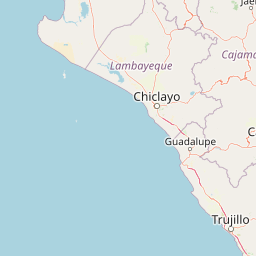
Map view of Laquipampa Wildlife Refuge

Use this park location map to pinpoint Laquipampa Wildlife Refuge in Peru, understand its exact geographic position, and read its mapped placement within the surrounding landscape more clearly.

Pigeon | © OpenStreetMap contributors

Location context for Laquipampa Wildlife Refuge

Lambayeque Region
Recorded earthquake history

Review Recorded Seismic Activity near Laquipampa Wildlife Refuge

Browse the documented earthquake history associated with the geographic footprint of Laquipampa Wildlife Refuge. This collection allows researchers and visitors to examine past seismic events, including magnitude and distance metrics, providing a factual view of activity within the Lambayeque Region of Peru.

Laquipampa Wildlife Refuge Earthquake History

Catalogued events

11 events

Strongest magnitude

Magnitude 5

Most recent event

Jun 12, 2025

This history includes earthquakes recorded inside the park or within 50 km of its borders

Visualizing tropical dry forest habitats and rugged Andean foothills across Northern Peru

Laquipampa Wildlife Refuge Photos, Landscape Scenery, and Protected Terrain

Visual records capture the distinctive vegetation shifts, steep valley slopes, and sheltered ravines defining Laquipampa Wildlife Refuge. Examining field photography helps researchers and observers understand the seasonal adaptations of threatened dry forest ecosystems.

A close-up shot of a single Tillandsia plant with a tall, slender stalk topped with a bright orange flower, situated in the foreground with a hazy, out-of-focus mountain slope in the background.

Park atlas

Compare regional landscapes, Andean foothills, and neighboring conservation zones.

Explore Parks Near Laquipampa Wildlife Refuge and Surrounding Protected Areas

Browsing other protected areas near Laquipampa Wildlife Refuge allows visitors to examine related dry forest ecosystems and Andean transition zones. Extending the geographic review provides valuable context on regional conservation corridors and neighboring wildlife habitats.
Wildlife reserveCajamarca
38 km away#1 closest

Southeast

Bosques Nublados de Udima Wildlife Refuge: Protected Andean Cloud Forest and River Basin

A critical mountain reserve in the Cajamarca region of northern Peru.

Situated on the dramatic western slopes of the Andes, Bosques Nublados de Udima Wildlife Refuge protects 12,183 hectares of cloud forest ecosystem. The reserve is characterized by a sharp vertical gradient dropping over 1,000 metres toward the Zaña River basin, preserving both rare Amazonian-linked plant species and significant pre-Columbian archaeological irrigation structures.

Area
121.83 km²
Established
2011
IUCN
IV
Relief
Mountain
Protected areaCajamarca Region
39 km away#2 closest

East

Pagaibamba Protection Forest: Geography and Protected Area Landscape Analysis

Highland Watershed Protection in the Cajamarca Andes

Pagaibamba Protection Forest represents a key protected land entity in northern Peru. Focused on maintaining the local water cycle, the area showcases dense cloud forest vegetation and steep Andean terrain. Use this mapping data to analyze its ecological boundaries, watershed significance, and regional landscape context in the Cajamarca department.

Area
20.784 km²
Established
1987
IUCN
VI
Relief
Mountain
National parkCajamarca Region
67 km away#3 closest

East

Cutervo National Park: Peru's Oldest National Park Atlas and Protected Landscape

Andean Montane Forests and Mapped Geography of a Pioneering Protected Area

As Peru's oldest national park, established in 1961, Cutervo National Park offers a unique glimpse into the protected geography of the northern Peruvian Andes. Located in the Cajamarca Region, it preserves diverse Andean montane forests and páramo grasslands across a significant elevation gradient from 1,550 to 3,500 meters. This page details the park's landscape, including its role as a headwater conservation area and its position within a critical South American ecoregion, providing rich context for geographic and protected-area exploration.

Area
82.14 km²
Established
1961
IUCN
II
Relief
Mountain
Wildlife reserveCajamarca Region
147 km away#4 closest

Southeast

Sunchubamba Game Reserve: Geographic Overview of Protected Andean Landscapes in Northern Peru

Examining dry forest ecosystems and managed habitat in the Cajamarca Region

Explore the unique environmental footprint of Sunchubamba Game Reserve, a protected area in northern Peru characterized by its blend of native dry forests and non-native tree plantations. This record details the reserve as a historical hacienda site that now serves as an important study in land-use, wildlife management, and the evolution of Andean highland conservation practices.

Area
597.35 km²
Established
1977
IUCN
VI
Relief
Mountain
Wildlife reserveAmazonas Region
152 km away#5 closest

Northeast

Chayu Nain Communal Reserve: Mapped Protected Landscapes and Regional Geography in Peru

Andes to Amazon ecological transition zone in the Amazonas region

Chayu Nain Communal Reserve functions as a critical stronghold for endemic wildlife and represents a major achievement in communal conservation. Its sandstone geology and elevational gradients create a distinct terrain that sustains rare primate populations, lowland tapirs, and complex forest mosaic habitats in northern Peru.

Area
235.98 km²
Established
2009
IUCN
VI
Relief
Upland
National parkZamora Chinchipe
159 km away#6 closest

North

Yacurí National Park: Protected Andean Lakes and Volcanic Landscape in Zamora Chinchipe

Discover highland geography and the ancient Inca Trail.

Yacurí National Park is a key protected landscape in Ecuador's southern Andes, celebrated for its remarkable collection of over 46 high-altitude lakes set within dramatic volcanic terrain. Situated in Zamora Chinchipe province, the park preserves a vital stretch of the Inca Trail, complete with archaeological sites. This national park offers a rich exploration of Andean geography, páramo ecosystems, and significant cultural heritage, making it a cornerstone of the region's protected areas.

Area
431 km²
Established
2009
IUCN
II
Relief
Mountain
Nature reserveZamora Chinchipe
187 km away#7 closest

Northeast

Reserva Biológica Cerro Plateado: Andean and Amazonian Landscape and Protected Area Context

Vertical gradient and mountain forest geography in Zamora Chinchipe

Spanning elevations from 840 to 3,120 meters, Reserva Biológica Cerro Plateado represents a significant conservation effort within the Zamora Chinchipe province. The reserve preserves intact montane cloud forests and paramo, serving as a vital link between the eastern Andean slopes and the Nangaritza watershed in southeastern Ecuador.

Area
307.607 km²
Established
2010
IUCN
Ia
Relief
Mountain
A watercolor illustration of layered green hills and distant mountain ridgelines, depicted in soft pastel tones against a white background.
Nature reserveSan Martin
193 km away#8 closest

East

Alto Mayo Protection Forest: Geographic Boundaries and Andean Slope Landscape Mapping

Protected watershed and cloud forest in San Martin, Peru

Spanning the eastern Andes, Alto Mayo Protection Forest functions as a foundational watershed for the Mayo River basin. This reserve preserves significant cloud forest habitats and high-gradient terrain, serving as an important link between Andean highlands and the Amazonian lowlands. Study the topographic features, hydrological network, and protected boundaries that define this crucial Peruvian wilderness.

Area
1,820 km²
Established
1987
IUCN
VI
Relief
Mountain

Common questions about visiting, size, designation, and location context for Laquipampa Wildlife Refuge

Laquipampa Wildlife Refuge FAQs for park facts, access, geography, and protected area context

Find quick answers about Laquipampa Wildlife Refuge, including protected-area facts, park geography, trail and visitor context, and how the park fits into its surrounding country and regional landscape.
MoriAtlas Explorer

Continue Your Protected Areas Search Across the Global Atlas

Deepen your exploration by continuing the structured search for national parks and protected areas worldwide. Utilize the comprehensive filtering capabilities to compare different conservation landscapes and refine your understanding of global park geography. Discover more about the distribution and characteristics of protected natural areas.

Global natural geography
