
Mori Atlas logo
Wildlife reserveLatir Peak Wilderness

Understanding the alpine tundra, high summits, and drainage systems of this northern New Mexico landscape.

Latir Peak Wilderness: A Detailed Map and Geographic Overview of Protected Mountain Terrain

Latir Peak Wilderness encompasses over 20,000 acres of protected high country within the Sangre de Cristo Mountains of northern New Mexico. This region is defined by its vertical zonation, transitioning from dense montane forests to expansive alpine tundra around Latir Mesa. Mapped boundaries showcase a rugged environment anchored by multiple peaks exceeding 12,500 feet and integrated by the Lake Fork of Cabresto Creek drainage system.

wilderness areaSangre de Cristo Mountainsalpine tundraalpine peaksmontane foresthigh country
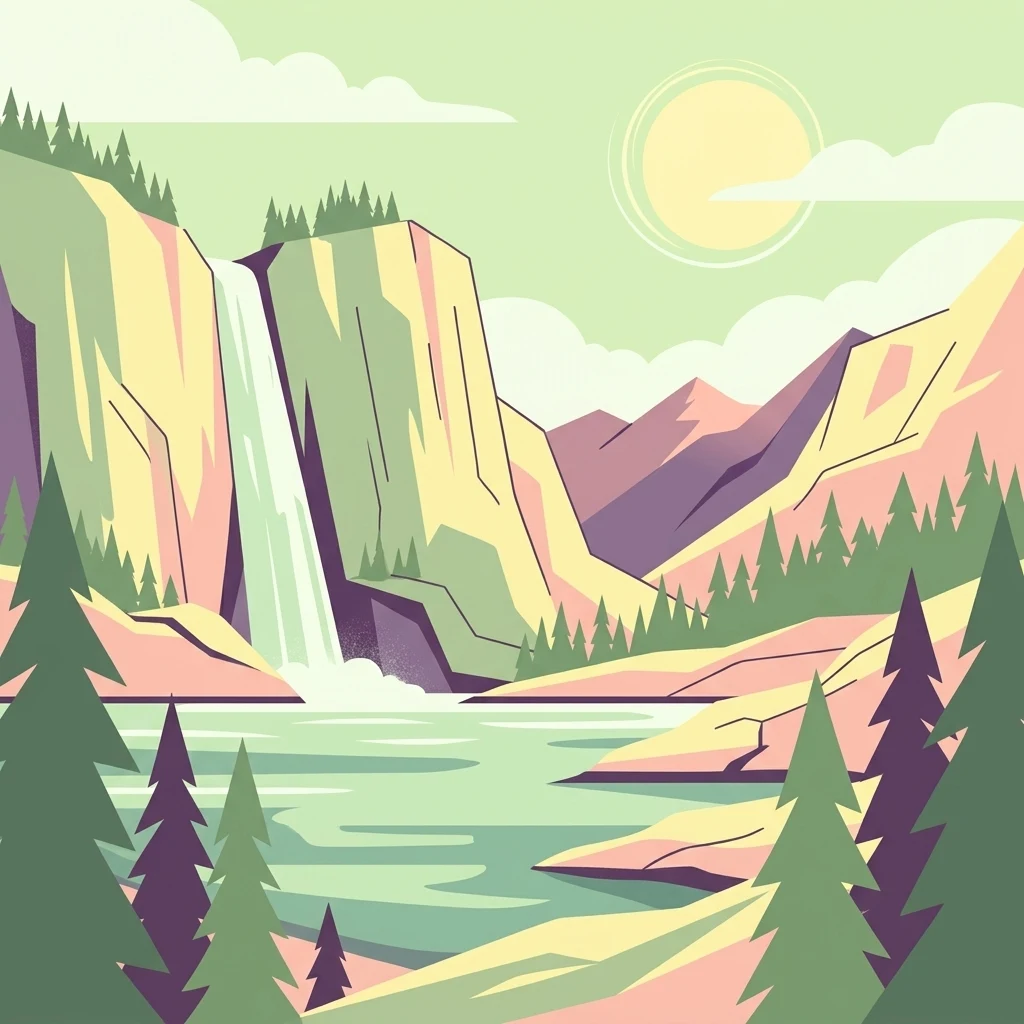
A digital illustration depicting a waterfall cascading from rocky cliffs into a lake, with evergreen trees in the foreground and a pale sun in a pastel sky.

Latir Peak Wilderness

Wildlife reserve

Park overview

Structured park overview, official facts, and landscape profile for Latir Peak Wilderness

Latir Peak Wilderness park facts, protected area profile, and essential visitor context

Review the core facts for Latir Peak Wilderness, including designation, size, terrain, visitor scale, habitats, and operating context in one park-focused overview.

About Latir Peak Wilderness

Latir Peak Wilderness occupies the northern end of the Sangre de Cristo Mountains in northern New Mexico, enclosed within the broader Carson National Forest. Although it covers a relatively modest 20,506 acres, the wilderness reaches into the alpine zone of the range, with four named 12,000-foot summits rising from a single upland block: Venado Peak at 12,734 feet, Latir Peak at 12,708 feet, Latir Mesa at 12,692 feet, and Virsylvia Peak at 12,594 feet. This concentration of high terrain gives the area a strong mountain identity even though its overall footprint is limited.

Ecologically, the wilderness spans a sharp elevation gradient. Lower and middle slopes are cloaked in dense montane and subalpine forest, while the broad Latir Mesa exposes a more open alpine tundra landscape at the north end of the area. The juxtaposition of heavy forest cover and wind-swept high plateau within one designated unit is a defining characteristic of the wilderness and influences both its scenery and its wildlife.

Most of the wilderness drains through the Lake Fork of Cabresto Creek, which begins at Heart Lake in the high country and continues down toward the boundary of the area. Just outside the wilderness, the creek is impounded as Cabresto Lake, which also serves as the principal trailhead for visitors entering the wilderness. This combination of a high alpine water source, a defined creek corridor, and a low-elevation reservoir gives the area a coherent hydrological story that ties its peaks, meadows, and forests together.

Latir Peak Wilderness is administered by the U.S. Forest Service and was formally designated in 1980, placing it among the early rounds of wilderness designations carried out under the broader 1964 Wilderness Act framework. Its proximity to the small communities of Questa and the surrounding northern New Mexico landscape means it functions both as a mountain refuge for wildlife and as a high-country destination for hikers, anglers, and others exploring the northern Sangre de Cristos.

Quick facts and research context for Latir Peak Wilderness

Latir Peak Wilderness is a U.S. wilderness area in Taos County, New Mexico, managed by the U.S. Forest Service as part of Carson National Forest. It covers 20,506 acres and was designated in 1980 under the higher protective standard of the National Wilderness Preservation System, giving it an IUCN Category Ib designation. The wilderness includes Venado Peak at 12,734 feet, the highest point in the area, along with Latir Peak at 12,708 feet, Latir Mesa at 12,692 feet, and Virsylvia Peak at 12,594 feet.

Protection and recognition

Documented conservation scope and official recognition details for Latir Peak Wilderness

Latir Peak Wilderness Protection Status and Territorial Designation

Terrestrial protection status and administrative designation history define the conservation framework surrounding Latir Peak Wilderness. Structured preservation records outline the verified boundaries and official management scope established for this protected alpine landscape.

Protection details

Protection scope
Terrestrial
Transboundary protection
No
Park context

Deeper park guide and search-rich context for Latir Peak Wilderness

Latir Peak Wilderness history, landscape, wildlife, and travel context

Explore Latir Peak Wilderness through its history, landscape character, ecosystems, wildlife, conservation priorities, cultural context, and seasonal travel timing in a structured park guide built for atlas discovery and search intent.

Why Latir Peak Wilderness stands out

Latir Peak Wilderness is best known for its concentration of high Sangre de Cristo summits clustered around Latir Mesa, including four named peaks above 12,500 feet. The transition from dense conifer forest to exposed alpine tundra across this relatively compact area is one of its most recognizable features. Heart Lake and the Lake Fork of Cabresto Creek drainage also draw attention, both as defining landscape elements and as habitat for native Rio Grande cutthroat trout.
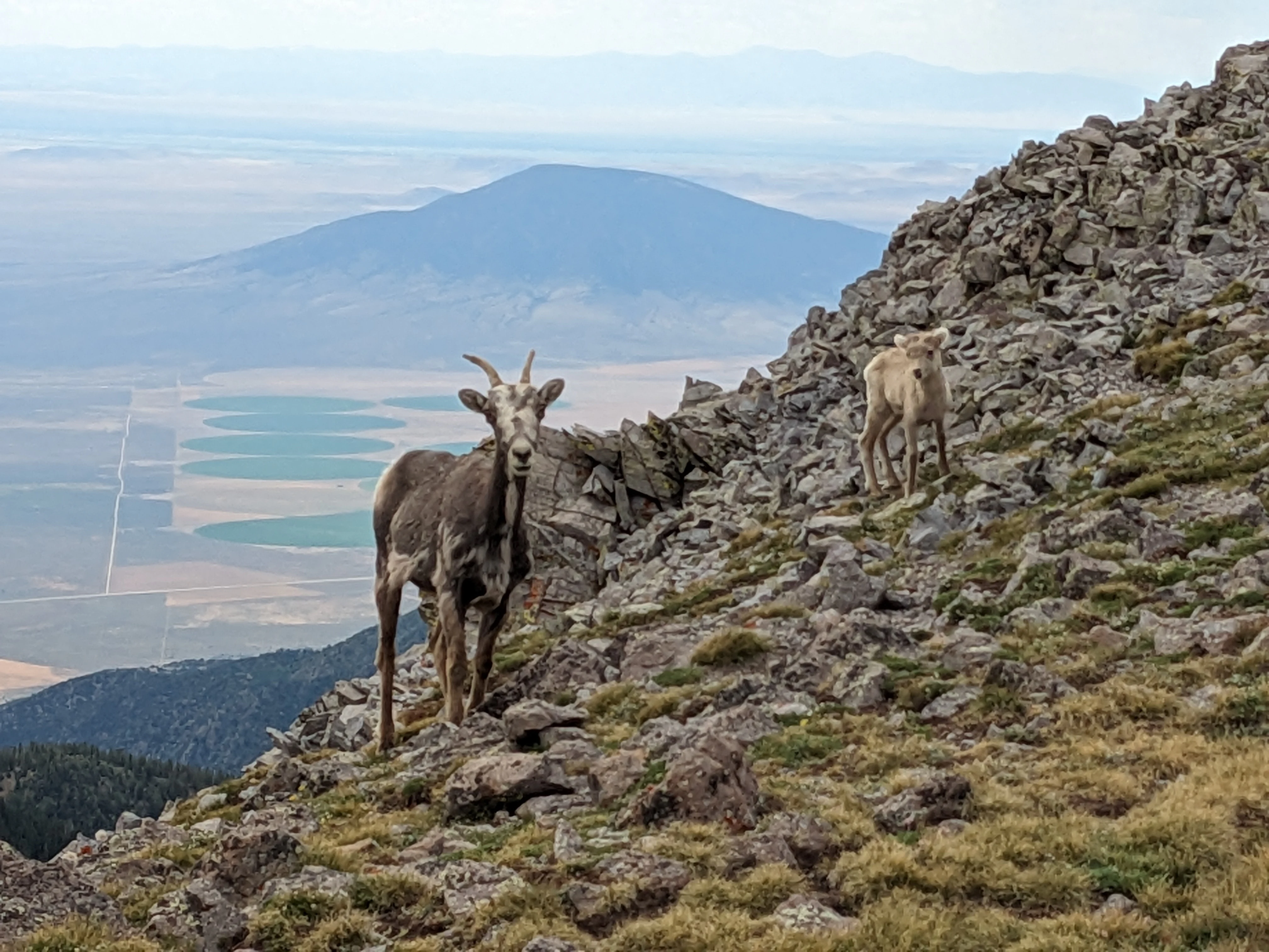
Two mountain goats standing on a steep, rocky mountainside with an expansive view of a valley and agricultural fields in the background.
Mountain goats navigating the rocky, high-elevation terrain near Latir Peak.

Latir Peak Wilderness history and protected-area timeline

Latir Peak Wilderness was formally designated in 1980 as part of the U.S. wilderness preservation system, with management assigned to the U.S. Forest Service within Carson National Forest in northern New Mexico. Its designation placed the area under the heightened protection standards associated with wilderness status, distinguishing it from the surrounding national forest lands while keeping it within the same administrative framework. Beyond this foundational designation event, the public Wikipedia source provides limited additional historical detail, and no broader narrative of establishment, prior management regimes, or later boundary changes is documented in the material available.

Latir Peak Wilderness landscape and geographic character

The landscape of Latir Peak Wilderness is shaped by the northern Sangre de Cristo Mountains, with rugged, high-elevation terrain dominating the area. Four named peaks above 12,500 feet, Venado Peak, Latir Peak, Latir Mesa, and Virsylvia Peak, crowd the skyline and define the topographic identity of the wilderness. Latir Mesa in particular gives the area one of its most recognizable features, a broad upland surface that contrasts sharply with the forested slopes below.

The landform pattern transitions from steep forested slopes rising out of the creeks and valleys to exposed, rounded alpine terrain on the mesa. Heart Lake sits high in the drainage system and acts as a source for the Lake Fork of Cabresto Creek, one of the unifying landscape elements of the wilderness. Cabresto Lake, formed by impounding the same creek just outside the wilderness, connects the high country to the lower trailhead environment and shapes how visitors move through the area.

Although the wilderness is compact in size by regional standards, its elevation range and the way forest, meadow, tundra, lakes, and creeks are arranged within its boundaries give it a visually varied mountain landscape. The northern Sangre de Cristos in this section show a clear vertical zonation, from wooded draws through open montane parks to bare rock and tundra near the summits.
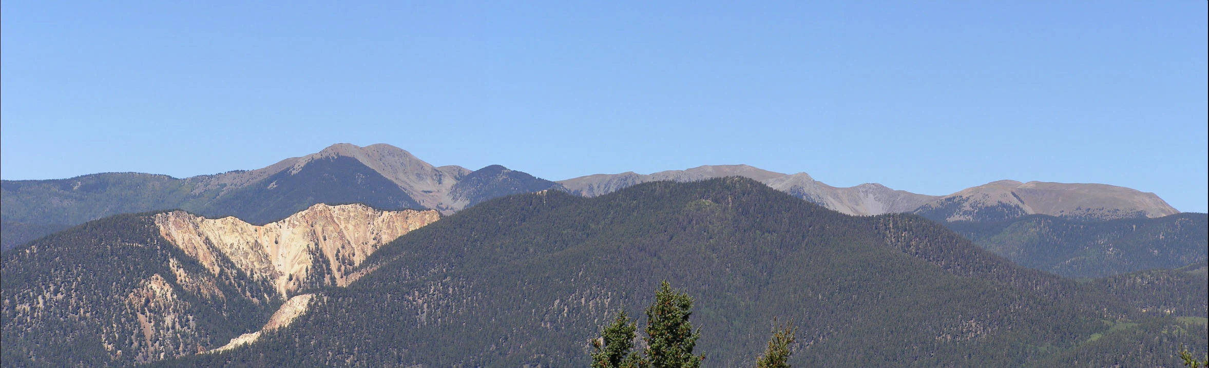
A wide, panoramic view of a mountain range under a clear blue sky, featuring dark, pine-covered slopes and exposed rocky summits.
A panoramic view of the rugged ridgelines and forest slopes of the Latir Peak Wilderness in New Mexico.

Latir Peak Wilderness ecosystems, habitats, and plant life

The natural character of Latir Peak Wilderness reflects the ecological zonation typical of the southern Rocky Mountains compressed into a small area. Lower elevations support dense conifer forest, which transitions upward into more open subalpine woodland and ultimately into alpine tundra along Latir Mesa and the highest peaks. This layered structure within a single wilderness unit gives it strong habitat diversity for its size.

Heart Lake and the Lake Fork of Cabresto Creek corridor anchor the aquatic and riparian ecology of the area. Cool, snowmelt-fed streams descending from the high country create habitats for sensitive aquatic species, including the native Rio Grande cutthroat trout found in the area's waterways. Riparian vegetation along these creeks adds another habitat layer against the otherwise conifer-dominated slopes.
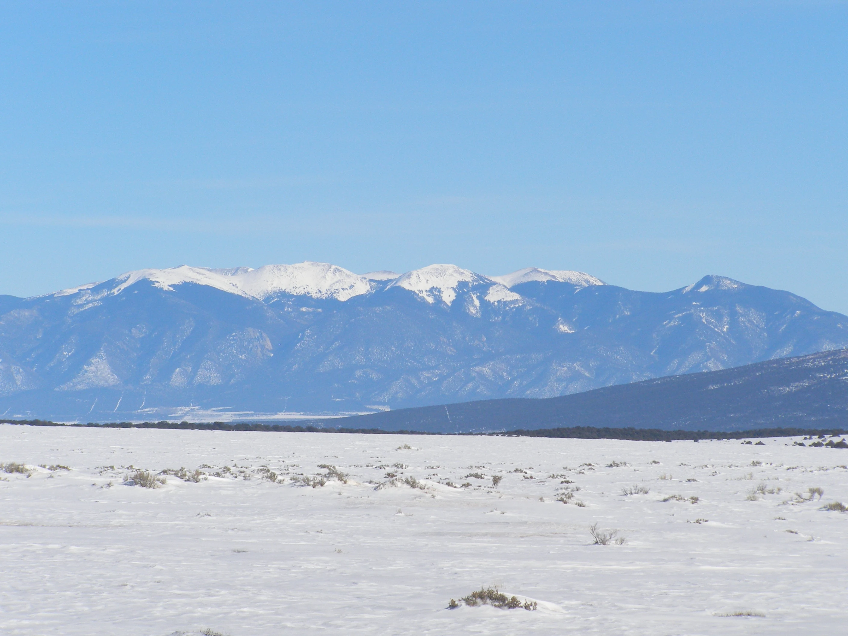
A distant, snow-capped mountain range rises above a flat, snow-covered plain under a clear blue sky.
A view of the Sangre de Cristo Mountains, which include the Latir Peak Wilderness, from the surrounding landscape.

Latir Peak Wilderness wildlife and species highlights

Wildlife in Latir Peak Wilderness is characteristic of mixed montane and alpine environments in the northern Sangre de Cristo Mountains, with mammal species ranging from small mammals such as pika, marmot, marten, and muskrat to larger carnivores including black bear, mountain lion, bobcat, coyote, and fox. Mule deer move through the forested slopes and meadows, while badger and beaver are also present in suitable habitat. Ferret is listed among the area's wildlife, although this should be understood against the broader, difficult conservation context of black-footed ferret recovery in the region.

Birdlife includes species adapted to both forest and high-elevation terrain, with the boreal owl representing the cool, dense conifer habitat and ptarmigan associated with exposed alpine ground. Mountain goats are also documented in the area, a notable presence given the rugged, high-elevation character of Latir Peak and surrounding summits. Streams host native Rio Grande cutthroat trout, an important conservation-relevant species in this part of New Mexico.

Taken together, the wildlife pattern reflects a transition from dense forest wildlife communities in the lower and middle elevations to species adapted to harsh alpine conditions higher up, with the riparian corridor of Cabresto Creek providing an additional habitat axis running through the wilderness.

Latir Peak Wilderness conservation status and protection priorities

Latir Peak Wilderness is conserved primarily through its 1980 designation as a federally protected wilderness area, which restricts road-building, mechanized use, and other activities that could alter its character. Its classification under IUCN Category Ib reflects this high level of protection. Within the wider Carson National Forest, the wilderness functions as a refuge for the full suite of habitats found in the northern Sangre de Cristo Mountains, from dense forest to alpine tundra, and as intact habitat for species sensitive to human disturbance.

The presence of native Rio Grande cutthroat trout in the area's streams gives the wilderness particular conservation relevance beyond its scenic value, as this subspecies is a focus of regional conservation efforts in New Mexico. Maintaining cold, clean, connected stream habitat in the Lake Fork of Cabresto Creek and its tributaries is therefore a meaningful conservation role played by the wilderness, alongside its role in protecting alpine wildlife communities above treeline.

Top sights and standout views in Latir Peak Wilderness

The standout features of Latir Peak Wilderness are its cluster of high Sangre de Cristo summits, including Venado Peak, the highest point at 12,734 feet, and the broad alpine tundra of Latir Mesa that sits among them. Heart Lake and the Lake Fork of Cabresto Creek give the area a defined high-country water system, while Cabresto Lake just outside the boundary ties the wilderness to accessible trailhead country. The combination of dense conifer forest, open alpine ground, native trout streams, and large-mammal presence in a compact 20,506-acre unit gives the wilderness a strong and recognizable identity within Carson National Forest.

Best time to visit Latir Peak Wilderness

Summer and early fall are typically the most accessible window for experiencing Latir Peak Wilderness, when alpine tundra around Latir Mesa is largely free of snow, high-country lakes such as Heart Lake are approachable, and trailhead access via Cabresto Lake is most reliable. Midsummer conditions support sightings of mountain goats grazing high slopes and the full expression of the area's wildflower and tundra character. Winter conditions bring heavy snow cover to the high elevations of the northern Sangre de Cristos and effectively close off most non-expert travel into the wilderness, restricting winter use to those equipped and experienced for snow travel.

Monthly climate preview

Long term average temperature and monthly precipitation rhythm for New Mexico

Latir Peak Wilderness Climate Normals and Annual Weather Patterns

Representative coordinate records show measured multi year temperature variation and monthly precipitation amounts across the protected area. Examining the complete twelve month climate profile reveals detailed weather by month patterns for this high elevation terrain.
Annual mean6 °C
-5 °C19 °C
Jan-5°
Feb-3°
Mar
Apr
May10°
Jun17°
Jul19°
Aug18°
Sep14°
Oct
Nov
Dec-5°
Warmest month
July

19.1 °C

Coolest month
January

-5 °C

Wettest month
July

2.1 mm/day

Driest month
January

0.9 mm/day

Park location guide

Geography guide, regional context, and park location map for Latir Peak Wilderness

Latir Peak Wilderness park geography, regions, and map view in United States of America

Understand where Latir Peak Wilderness sits in United States of America through a broader geographic reading of the surrounding landscape, nearby location context, and its mapped position within the national park landscape.

How Latir Peak Wilderness fits into United States of America

The United States of America is a federal presidential republic and one of the world's largest countries by area and population. It consists of 50 states across a vast territory spanning multiple time zones, with its capital in Washington, D.C. and largest city in New York City. The nation has a diverse economy, influential political system, and significant cultural and military presence globally.

Wider geography shaping Latir Peak Wilderness in United States of America

The United States occupies a vast territory in North America, bordered by Canada to the north and Mexico to the south. The 48 contiguous states stretch from the Atlantic to the Pacific Ocean, while Alaska occupies the northwestern region and Hawaii is an archipelago in the Pacific. The country encompasses diverse terrain including the Rocky Mountains, Appalachian Mountains, Great Plains, and extensive river systems.

Map view of Latir Peak Wilderness

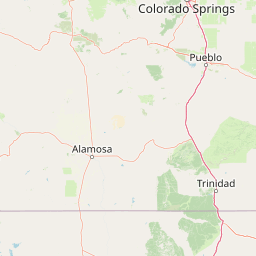
Use this park location map to pinpoint Latir Peak Wilderness in United States of America, understand its exact geographic position, and read its mapped placement within the surrounding landscape more clearly.

Pigeon | © OpenStreetMap contributors

Location context for Latir Peak Wilderness

New Mexico
Recorded earthquake history

Explore Historical Earthquake Records near Latir Peak Wilderness

Access the MoriAtlas catalogue of historical seismic events associated by location with Latir Peak Wilderness. Use these documented records to examine the seismic history of the surrounding northern New Mexico landscape and the Sangre de Cristo Mountains.

Latir Peak Wilderness Earthquake History

Catalogued events

42 events

Strongest magnitude

Magnitude 4.3

Most recent event

Jun 25, 2026

This history includes earthquakes recorded inside the park or within 50 km of its borders

Visual exploration of high mountain peaks, alpine tundra, and protected wilderness terrain

Latir Peak Wilderness Photos and Landscape Scenery

Visual records capture the rugged high-elevation terrain, dense conifer forests, and exposed alpine tundra defining Latir Peak Wilderness. Examining protected area imagery provides a clear reference for understanding the vertical zonation and landform patterns across the northern Sangre de Cristo Mountains.

Two mountain goats standing on a steep, rocky mountainside with an expansive view of a valley and agricultural fields in the background.

A clear alpine lake surrounded by dense evergreen forests and mountain slopes under a partly cloudy sky.

A wide, panoramic view of a mountain range under a clear blue sky, featuring dark, pine-covered slopes and exposed rocky summits.

A distant, snow-capped mountain range rises above a flat, snow-covered plain under a clear blue sky.

Park atlas

Compare adjacent mountain terrain and protected areas across the northern ranges

Explore Other Parks Near Latir Peak Wilderness and Surrounding Protected Landscapes

Browse other parks near Latir Peak Wilderness to examine connected alpine terrain, high-country watersheds, and protected landscapes across the surrounding region. Extending the geographic review helps map regional elevation profiles and compare southern Rocky Mountain ecosystems.
Watercolor painting of a serene mountain landscape featuring rolling hills, coniferous trees, and a lake in the foreground, rendered in light pastel tones.
Protected landscapeColorado
56 km away#1 closest

North

San Isabel National Forest: Geographic Overview and Protected Mountain Landscape Atlas

Central Colorado alpine terrain and designated wilderness areas

Spanning eleven counties in central Colorado, San Isabel National Forest serves as a cornerstone of the Southern Rocky Mountains. The forest landscape is dominated by the Sawatch and Sangre de Cristo ranges, offering a unique atlas of alpine tundra, dense coniferous forests, and high-altitude peaks that define the character of the region. This protected area provides a vital habitat and a vast, rugged environment characterized by volcanic formations like the Spanish Peaks and glacial geological features.

Area
4,533.42 km²
Established
1902
Relief
Mountain
Climate
Alpine
Watercolor painting of soft, layered mountain ranges behind green hills and patches of evergreen trees on a white background.
Protected landscapeColorado
57 km away#2 closest

Northwest

Rio Grande National Forest: Atlas and Geographic Profile of a Southern Colorado Landscape

Watershed geography and Continental Divide terrain analysis.

Rio Grande National Forest represents an immense protected landscape encompassing diverse terrain from high desert steppe to rugged alpine peaks. This profile details the forest's hydrological significance as the source of the Rio Grande and its role as a massive ecological transition zone in the Mountain West. Examine the boundaries and mountain geography that define this critical protected area.

Area
7,500 km²
Established
1908
Relief
Mountain
Climate
Boreal
Watercolor painting of a gentle, rolling landscape with a small stream, a small waterfall, and scattered trees under a soft, light sky.
Protected landscapeNew Mexico
75 km away#3 closest

Southwest

Santa Fe National Forest: Geographic Atlas and Protected Landscape Overview

New Mexico mountain geography and wilderness mapping

Santa Fe National Forest spans more than 1.5 million acres of Northern New Mexico, featuring a dramatic transition from canyon river systems to the high elevations of the Pecos Wilderness. This protected landscape contains a complex network of forest districts across the Jemez and Sangre de Cristo Mountains, defined by volcanic plateaus, alpine basins, and seasonal aspen forests. Use this resource to understand the park boundaries, regional mountain geography, and the interconnected nature of these protected lands.

Area
6,306.83 km²
Established
1915
Relief
Mountain
Access
Easy access
National parkColorado
About 99 km away#4 closest

North

Great Sand Dunes National Park and Preserve: Colorado's Unique Mapped Landscape

Explore the natural terrain and protected boundaries.

Great Sand Dunes National Park and Preserve offers a unique protected landscape within Colorado, characterized by its distinct natural terrain and extensive dune fields. This destination provides valuable context for atlas exploration, detailing the park's mapped boundaries and its specific geographic setting. Understand its significance as a protected area and appreciate the unique natural features that define its landscape for a richer geographic discovery.

Area
603.1 km²
Established
2004
IUCN
V
Visitors
432.5K annual
Protected landscapeColorado
104 km away#5 closest

Northwest

San Juan National Forest: Geographic Overview of a Major Southern Colorado Protected Landscape

Mapped terrain across the Southern San Juan Mountains

San Juan National Forest represents a massive protected landscape in western Colorado, defined by its rugged alpine peaks, dense conifer forests, and glacial valleys. This atlas entry details the forest boundary, its position along the Continental Divide, and the surrounding transition into the Colorado Plateau. It provides a structured look at the terrain that connects diverse ecosystems, from high-altitude tundra to expansive mesa country, within one of the largest national forests in the American West.

Area
7,603.42 km²
Established
1905
Relief
Mountain
Climate
Alpine
A horizontal watercolor illustration of a wide, open prairie landscape featuring soft green hills, sparse shrubs, and grasses against a pale background.
Protected landscapeNew Mexico
115 km away#6 closest

Southeast

Kiowa National Grassland: Protected Landscapes, Canyon Terrain, and Prairie Geography

Northeastern New Mexico shortgrass prairie and river canyon systems.

Kiowa National Grassland represents a distinctive protected landscape within the southwestern Great Plains, featuring a mix of rolling steppe, pinyon-juniper woodland, and the deep gorges of the Canadian River Canyon. This area offers significant insight into the regional geography of New Mexico, where historic Santa Fe Trail corridors and seasonal playa lakes define the local terrain and ecosystem.

Area
554.95 km²
Established
1960
Relief
Upland
Climate
Temperate
A pale, minimalist watercolor painting showing a horizontal landscape with a thin treeline in the midground and soft, blue-toned mountain peaks in the background against a white sky.
Wildlife reserveSandoval County
128 km away#7 closest

Southwest

Dome Wilderness: Volcanic Domes and Protected Forest Geography in Sandoval County

High-desert wilderness area in the Jemez Mountains

Dome Wilderness is a protected natural area in Sandoval County, New Mexico, defined by its exposed volcanic domes and dramatic post-fire recovery landscape. Sitting within the Santa Fe National Forest, the terrain preserves both natural geological features and significant prehistoric archaeological sites. Its unique visual character, shaped by the 1996 Dome Fire, contrasts open, fire-swept slopes with dense coniferous forest stands.

Area
21 km²
Established
1980
IUCN
Ib
Relief
Mountain
Protected landscapeSandoval County
About 147 km away#8 closest

Southwest

Jemez National Recreation Area: Geography and Protected Land Map Overview

Exploring volcanic plateaus and river canyons in northern New Mexico

Jemez National Recreation Area represents a key protected landscape in Sandoval County, encompassing diverse forested uplands and steep volcanic canyons. The area serves as a focal point for understanding the geological legacy of the Jemez Mountains, providing a clear window into how river incision and ancient volcanic activity have shaped the regional terrain. Its proximity to national forest lands and the Valles Caldera system makes it a vital unit for geographic study and mapped landscape exploration.

Area
233.3 km²
Established
1993
Visitors
1.6M annual
Relief
Mountain

Common questions about visiting, size, designation, and location context for Latir Peak Wilderness

Latir Peak Wilderness FAQs for park facts, access, geography, and protected area context

Find quick answers about Latir Peak Wilderness, including protected-area facts, park geography, trail and visitor context, and how the park fits into its surrounding country and regional landscape.
MoriAtlas Explorer

Continue Your Protected Areas Search Across the Global Atlas

Deepen your exploration by continuing the structured search for national parks and protected areas worldwide. Utilize the comprehensive filtering capabilities to compare different conservation landscapes and refine your understanding of global park geography. Discover more about the distribution and characteristics of protected natural areas.

Global natural geography