
Visitor Planning
When is the Best Time to Visit Lauca National Park
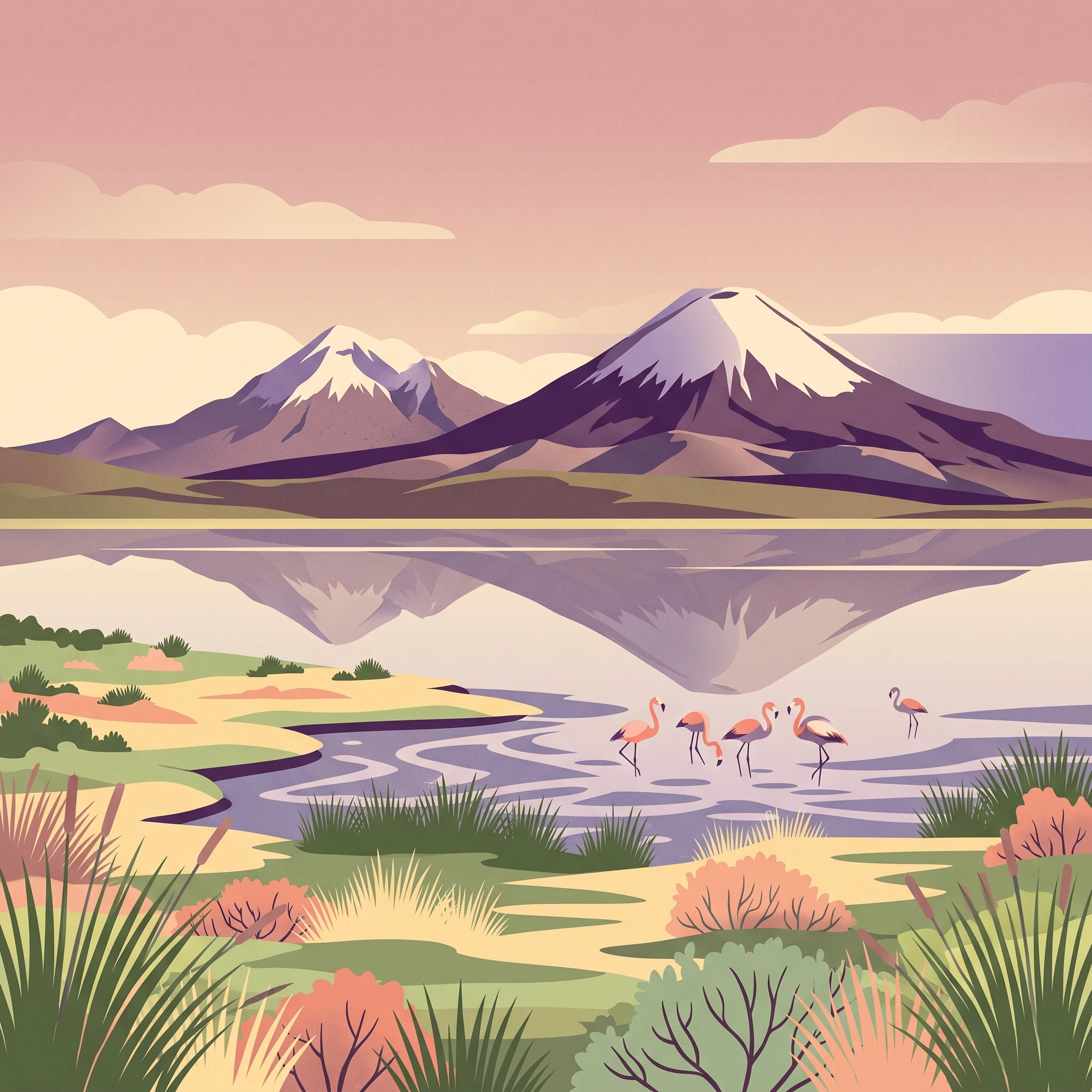
Determining the best time to visit Lauca National Park requires balancing the desire for clear, stable weather against the reality of high-altitude environmental extremes. The most favorable window for travel typically falls between May and November. During these months, the park experiences its driest period, characterized by vast, cloudless skies that perfectly frame the iconic volcanic horizons of the Parinacota and Sajama peaks. Visitors prioritizing photography, wildlife viewing, and clear mountain vistas will find this interval provides the most consistent access to the park's primary visual landmarks and high-altitude plateau trails.
Navigating the High-Altitude Trade-Offs
While the dry season offers the most predictable weather for site access, it also exposes travelers to the most intense thermal fluctuations of the year. Because the park is situated at elevations ranging from 3,200 to over 6,300 meters, nighttime temperatures frequently drop well below freezing, even during the height of the dry season. The perception of warmth is heavily influenced by intense solar radiation during the day, yet the air remains thin and crisp. Travelers should expect a sharp, immediate cooling effect as soon as the sun dips below the volcanic skyline. Choosing when to visit is less about finding a temperate period and more about selecting the level of exposure to cold that one is prepared to manage through proper gear and physiological acclimatization.
The Relationship Between Precipitation and Visitation
Humidity and precipitation patterns dictate the rhythm of the year in the Chilean altiplano. The period outside of the dry months sees an uptick in cloud cover and atmospheric instability, which can obscure the dramatic volcanic backdrops that define the park experience. Although rain is rarely heavy, the increased moisture during the wetter months can alter the accessibility of remote trails and impact the visibility of the wetlands that support the park's diverse bird populations. For those planning a trip, recognizing that the park remains a harsh, high-desert environment regardless of the month is essential. The trade-off is clear: visitors who prioritize dry, expansive views should aim for the middle of the year, while those interested in the subtle seasonal changes of the Andean wetlands must be prepared for more frequent shifts in mountain weather. Regardless of the chosen month, the fundamental constraints of altitude and rapid temperature drops remain constant factors that dictate the quality and safety of every visit.
Seasonal Planning
Best Months for Visiting Lauca National Park at a Glance
The Primary Window for Clear Landscapes: May to November
The most reliable period for visiting is the dry season, which typically spans from May through November. During these months, the high-altitude plateau experiences minimal precipitation, providing the stable atmospheric conditions necessary to view the volcanic silhouettes, such as the Parinacota and Sajama volcanoes, against clear, deep-blue skies. For travelers prioritizing photography and visibility, this window is the most effective. The trade-off for these pristine vistas is the intensification of night-time temperatures, which consistently drop significantly below freezing. While daytime solar radiation provides relief, the lack of cloud cover during the dry season allows heat to escape rapidly at night, making thermal preparation mandatory regardless of the sunlit daytime maximums.
Transition Phases and Mid-Year Choices
- May and June: These early dry-season months offer a quiet transition from the wetter summer phase. Humidity levels drop sharply, and the risk of significant precipitation is at its lowest. Visitors during this time often encounter the first onset of deep-night cold, as the warming influence of the summer moisture dissipates.
- July and August: These represent the peak of the dry, cold cycle. While these months are technically the coldest in terms of average temperature, they offer the highest probability of clear weather for those aiming to hike or view wildlife, such as vicuñas grazing in the wetlands. The winds during this period can increase slightly, which adds a distinct wind-chill factor to the already sharp ambient temperatures.
- September to November: This window serves as the bridge toward the warmer months. As daylight hours increase and the sun gains intensity, the average daytime temperature climbs back toward the 20 degree Celsius mark. This period is suitable for travelers who prefer slightly more temperate daylight hours for walking or birdwatching, though they must accept that late-afternoon or evening cloud cover may begin to return as the moisture cycle shifts.
Navigating the Wet Season: December to April
For most visitors, the period from December through April introduces an increased risk of scattered precipitation and higher humidity. While the park does not close entirely, the likelihood of cloud-obscured volcanic peaks and more volatile weather patterns increases. This season suits travelers who are less focused on clear-sky photography and more interested in the park's lush wetland activity, which flourishes during the intermittent rains. Visitors choosing these months should remain flexible, as the afternoon weather can change rapidly. This is the least predictable time to visit, and those arriving during these months must prioritize robust weather-resistant gear to manage the combination of moisture and persistent high-altitude cold.
Climate Data
Monthly Temperature, Precipitation, and Daylight Normals for Lauca National Park
Understanding the climate of this high-altitude region requires looking past simple seasonal labels to see the interplay between extreme elevation and moisture. The park functions as a high-desert environment, where the thin air and proximity to the equator create a distinct relationship between solar intensity and temperature stability. Please note that the measurements provided reflect long-term climate normals rather than a live weather forecast, and localized conditions across the diverse volcanic terrain can vary significantly from these base values.
The Daily Temperature Swing
One of the most persistent climate characteristics is the intense diurnal temperature variation. Regardless of the month, daytime highs frequently reach into the mid-to-high teens or low twenties Celsius, while nighttime lows consistently drop below freezing. This gap is most pronounced during the cooler, drier months of June and July, when clear skies allow heat to escape rapidly into the atmosphere after sunset. Visitors should anticipate that the air temperature will feel significantly colder than the raw numbers suggest, particularly when wind gusts, which remain steady throughout the year, strip warmth from exposed skin. The combination of intense solar radiation during the day and sub-zero temperatures at night is the fundamental climate reality for anyone planning their arrival.
Annual Precipitation Patterns and Humidity
While the park remains generally arid, there is a clear distinction between the driest months and the more humid period that begins in late summer. From May through August, precipitation is minimal, creating the stable conditions that define the primary visitor window. During these months, relative humidity levels often drop below thirty percent, contributing to the stark, dry character of the altiplano. Starting in December, moisture levels begin to rise, and by the peak of the wet season, the increased cloud cover and periodic precipitation alter the landscape. This shift in humidity is a key driver for the change in visibility and ground conditions, though the park rarely experiences high-rainfall events compared to lower-elevation regions. Travelers should interpret these lower humidity levels in the winter as an indicator of skin and respiratory dehydration risks, rather than just a lack of rain.
Daylight Hours and Solar Intensity
Daylight duration follows a predictable annual curve, reaching its shortest point in June with approximately 10.9 hours of potential sunlight. By December, this increases to roughly 13 hours. While the variation in daylight hours is relatively modest, the impact of solar intensity is magnified by the high altitude. The strength of the sun remains powerful even in the shorter, cooler days of the austral winter. This makes midday hours feel considerably warmer than the mean temperatures indicate, allowing for comfortable exploration if you are shielded from the wind. Conversely, as soon as the sun drops behind the volcanic peaks, the drop in temperature is immediate and severe. Planning activities around the solar cycle is critical, as the briefest days of the year provide the most limited windows for safe outdoor transit before the hazardous freezing temperatures of night take hold.
Seasonal dynamics
Understanding seasonal climate phases and transitions in Lauca National Park
Defining the dry and humid phases of the altiplano
Lauca National Park does not follow a conventional four-season cycle. Because of its extreme elevation and high-desert location, the environmental rhythm is governed primarily by moisture levels and solar intensity. Instead of spring, summer, autumn, and winter, visitors encounter two distinct phases: the long, arid dry season and the brief, humid summer cycle. Understanding these transitions is critical for planning, as the park climate remains harsh and altitude-dependent throughout the entire calendar.
The arid winter and shoulder season
From May through November, the park remains firmly in a dry, high-visibility phase. This period is defined by low precipitation and significant humidity drops, often dipping below 30 percent. While this is colloquially treated as the winter period, travelers should note that the defining characteristics are cold, clear air and immense solar radiation during the day. Daytime temperatures during this phase generally remain moderate, but the lack of cloud cover allows heat to escape rapidly once the sun sets.
By late September and October, the transition toward the warmer season begins. Visitors will notice a slight increase in daytime heat as temperatures climb toward the annual peak, though the nights remain consistently frigid, frequently reaching deep sub-zero levels. This extended window from May to November is characterized by stability, as the lack of moisture limits cloud buildup and facilitates the clear, dramatic volcanic views for which the region is known.
The humid summer cycle
Beginning in December and extending through early April, the park enters its humid phase. This period is the antithesis of the dry months, marked by increased cloud cover, higher humidity levels,often approaching 60 percent,and a greater likelihood of passing afternoon precipitation. While temperatures during this time are at their most comfortable, particularly during the early morning and late afternoon, the shifting weather patterns can obscure volcanic peaks and change the character of the wetlands.
This cycle is not a monsoon in the tropical sense but rather a period of increased atmospheric instability. The increase in moisture significantly alters the sensory experience of the park. While the landscapes appear greener, the risk of rapid, localized weather shifts becomes more pronounced. Travelers should view this phase as a more dynamic, less predictable time to visit compared to the arid stillness of the winter months.
Interpreting transitional volatility
Transitions between these two phases are gradual rather than abrupt. Late November serves as a critical tipping point where the dry, crisp conditions begin to yield to increased moisture. Conversely, April acts as the drying-out period, where the high-altitude air sheds its moisture and the frequency of clear, blue-sky days begins to return. During these transition months, visitors should be prepared for mixed weather, where sunny, dry mornings can occasionally shift into cloudy, unsettled afternoons. These months require the most flexible planning, as the park shifts its fundamental character between the arid, high-visibility state and the humid, cloud-prone cycle.
Seasonal Experiences
What Visiting Lauca National Park is Like Through the Year
Visiting this high-altitude landscape is defined by the interaction between the intense diurnal solar cycle and the specific hydrological patterns of the Andean altiplano. The experience of the park changes significantly based on the presence of seasonal moisture, which influences everything from the accessibility of remote volcanic lookouts to the visibility of the lake systems.
Wildlife Observation and Seasonal Cycles
Wildlife viewing is a primary motivation for visiting the park, and these encounters are tied to the availability of water and the movement of species across the wetlands. During the dryer months from May to November, animals such as vicuñas and viscachas tend to congregate near stable water sources, including the shores of Chungara Lake and the Laguna de Cotacotani. Because the landscape remains arid, these permanent water features become reliable hubs for fauna. Birdwatchers specifically benefit from these stable periods, as lower water volatility can make observation points along the marshes more accessible. In contrast, the summer months from December to April bring increased humidity and, occasionally, higher water levels in the wetland systems. While this period supports the growth of grasses that attract Andean geese and other grazing species, it can also lead to more dispersed wildlife, making them harder to track compared to the concentrated groupings seen during the mid-winter dry window.
Accessing Volcanic Landscapes and Trails
The experience of exploring the volcanic terrain, including the approaches to Parinacota and the various lookout points near the border, is highly dependent on cloud cover and atmospheric stability. The dry season, particularly the months of September through November, often provides the clearest conditions for photography and hiking. During these months, the lower humidity reduces the likelihood of afternoon cloud buildup around the higher peaks, which can obscure the 6,000-meter volcanic cones. Hiking on trails like Las Cuevas is most comfortable when the wind speeds are lower and the air remains crisp. Travelers planning to spend time in the village of Parinacota or at the thermal springs should note that while the air is dry, the lack of moisture does not prevent cold. Even on clear, sunny days that seem perfect for outdoor photography, the high elevation ensures that once the sun dips or clouds pass over, the temperature drops rapidly, changing the activity from an enjoyable walk to a cold-weather endurance experience.
Seasonal Utility of Hot Springs
The presence of thermal pools provides a specific experiential contrast to the park's ambient environment. Because the park experiences year-round nocturnal sub-zero temperatures, the hot springs near the park boundaries and along the Las Cuevas route serve a functional role in mitigating the effects of altitude-related fatigue. These spots are consistently popular, but their utility increases significantly during the colder, dry winter months when the difference between the ambient air and the spring water is most pronounced. While they are available throughout the year, the experience of these thermal features is most rewarding when the air temperature is at its lowest, as it provides a necessary break from the exposure of the high-altitude plateau.
Visitor Priorities
Timing Your Visit to Lauca National Park Based on Travel Priorities
Balancing Daytime Warmth and Nocturnal Cold
If your primary motivation for visiting is to enjoy the most comfortable outdoor conditions, focus on the shoulder months of September through November. During this window, the diurnal temperature swing,while always significant due to the high-altitude, high-desert environment,begins to soften as the sun grows stronger and humidity levels remain relatively low. While June and July offer the most consistent atmospheric stability, they also bring the year's coldest overnight temperatures, frequently dipping below -5°C on average. By visiting in the late spring transition, you experience a higher mean daily temperature, which makes extended exploration of volcanic trails and wetland paths less taxing for those sensitive to the extreme thermal variations of the Andean range.
Prioritizing Clear Skies for Volcanic Photography
Photographers aiming for the most dramatic, cloud-free views of the Parinacota Volcano and the surrounding altiplano should prioritize the peak dry season from July through September. These months feature the lowest precipitation levels and the lowest relative humidity percentages in the annual cycle. The air is at its crispest during this period, offering the best chance for long-distance visibility across the salt flats and mountain peaks. The trade-off is the intensity of the solar radiation and the persistent, biting wind that characterizes these months. Because the sky is rarely obstructed by moisture-laden clouds during this time, the lighting is intense and harsh at midday, requiring careful planning to capture the landscape during the softer light of the early morning or late afternoon.
Planning for Wildlife and Birding Success
For those interested in the park's famous birdlife, such as the Chilean flamingo or the Andean goose, the timing considerations shift toward water availability. While the absolute driest months of June and July are excellent for access, the slightly more humid months of November and December offer a different experience. As the transition toward the wetter summer phase begins, the wetlands around Chungará Lake and Laguna de Cotacotani often see an increase in biological activity. Visitors prioritizing wildlife should note that while the animals are present year-round, the return of slightly higher humidity and the lengthening of daylight hours in November contribute to a more vibrant, albeit more variable, environment for observing species that rely on these high-altitude water systems.
Maximizing Daylight for Extended Exploration
Travelers who require the longest possible periods of daylight to accommodate slower movement at altitude should aim for the months of November and December. During this period, the park experiences its peak daylight duration, exceeding 13 hours per day. This extra time is helpful for those navigating the rugged terrain where altitude-related fatigue can slow down daily progress. However, this shift in the calendar also marks the start of the transition away from the most stable, arid weather patterns. Choosing this period involves a deliberate trade-off: you gain precious hours of light, but you must accept a higher probability of moisture and cloud cover compared to the profound stillness of the mid-year dry months.
Access and Logistics
Seasonal Access and Operational Considerations for Visiting Lauca National Park
Navigating Access and Regional Infrastructure
Access to this high-altitude protected area is heavily influenced by regional infrastructure in Chile's Far North. The primary entry point for most travelers is the city of Arica, which serves as the logistical hub for expeditions into the Andean highlands. While the route from Arica to the park boundary is generally well-maintained, the sheer altitude gain over a relatively short distance creates a challenging physical environment that dictates travel timing. Because the region is part of a high-altitude ecosystem, road conditions can shift rapidly with weather events or seasonal maintenance cycles. Travelers must always consult official authorities for current, real-time reports on road status, potential closures due to landslides, or seasonal infrastructure updates that are not captured in historical climate averages.
Official Park Regulation and Visitor Rules
Management of the park is overseen by CONAF (Corporación Nacional Forestal). Official guidelines regarding entry, permissible activities, and restricted zones are subject to periodic review and adjustment. You should prioritize visiting the official CONAF website for the current park status, any mandatory permit requirements, and specific regulations governing vehicle access or commercial group entry. Never assume that historical access patterns or anecdotal accounts from previous years reflect the current operating reality. Official signage within the park and briefings at designated visitor points provide the most accurate guidance on which zones are open to the public and where environmental protection efforts may limit access during specific times of the year.
Practical Planning for High-Altitude Logistics
Planning your visit requires acknowledging the distance and travel time involved in reaching the altiplano. The logistical reality of this remote terrain means that spontaneous detours are rarely feasible. You should finalize your itinerary based on the assumption that infrastructure, such as fuel availability and communication services, is extremely limited once you leave the coastal region. Because weather patterns can influence the reliability of mountain roads, it is prudent to build flexibility into your schedule. Before departure, verify the latest local alerts regarding transit routes and park facility openings. Relying on verified information sources, rather than generalized climate patterns, ensures that your trip remains safe and complies with current park management directives.
Safety and Preparation
Weather, Safety, and Seasonal Preparation for Lauca National Park
Navigating High Altitude and Thermal Exposure
Preparation for this park centers on the reality of its extreme elevation, which averages over 4,000 meters. Regardless of the month, the thin atmosphere provides less protection against solar radiation than at sea level. Visitors should expect intense UV exposure even on cloudy days. Because of the rapid temperature swings that occur between midday highs and nocturnal lows, layering remains the most effective strategy for managing thermal comfort. During the dry season months from May through November, clear skies often lead to sharper nocturnal temperature drops, as the lack of moisture allows heat to escape quickly from the altiplano landscape. Travelers should prioritize clothing that accommodates these wide daily shifts rather than relying on heavy outerwear that cannot be removed as temperatures climb throughout the afternoon.
Seasonal Weather Impacts on Daily Safety
While the park remains generally accessible, the seasonal shift toward the humid summer months between December and April brings a higher likelihood of afternoon cloud cover and periodic precipitation. These conditions can significantly alter visibility and surface conditions on hiking routes. Wind is a consistent environmental factor that intensifies the sensation of cold, particularly in the open expanses surrounding Chungará Lake and the wetlands. When planning a visit during the transitional months of September and October, stay mindful that weather patterns can shift rapidly, and the high-altitude terrain can become more difficult to navigate if unexpected precipitation occurs. Always check the latest meteorological reports for the Arica-Parinacota region before departing.
Operational Preparedness and Local Guidance
Safety in a wilderness area at this scale depends on proactive information gathering. Because road status and route accessibility can change due to local weather events, maintenance, or regional authorities, travelers must verify conditions through official channels, such as the Corporación Nacional Forestal (CONAF) website, before heading into the mountains. This is especially vital for those planning to travel independently or venture toward the more remote volcanic sectors. Avoid relying on long-term climate averages to gauge current daily conditions, as these data sets describe historical norms rather than providing a live forecast. When you arrive at the park, heed all posted signage, stick to marked trails to minimize environmental impact and personal risk, and ensure your transit plans account for the time required to descend safely from high altitudes if you experience symptoms related to the elevation. If you are uncertain about specific route safety or the requirements for accessing restricted areas, consult local rangers who possess the most current information regarding park conditions and visitor regulations.
Final Decision Framework
How to Choose the Best Time for Your Lauca National Park Visit
Selecting the right time to visit this high-altitude landscape is less about finding a perfect month and more about prioritizing the specific environmental trade-offs that align with your travel objectives. The decision framework rests on a binary distinction between the dry, stable season from May to November and the more volatile, humid conditions of the summer months. If your priority is clear, long-range photography of volcanic peaks like Parinacota or hiking through the altiplano with consistent, dry visibility, the shoulder months of September and October often provide the most balanced experience. These months combine the reliability of the dry season with slightly milder, albeit still freezing, nights compared to the peak winter chill of July and August.
For those drawn to wildlife observation, such as viewing flamingos in the wetlands or vicuñas grazing near the lake margins, the dry season remains essential for reliable road access and predictable animal behavior. However, travelers must remain cognizant that the altitude is a constant factor that does not fluctuate with the calendar. Regardless of the month you choose, the physical stress of being at over 4,000 meters remains a significant reality. The intense solar radiation during the day requires consistent protection, and the rapid drop in temperature after sunset is a non-negotiable hazard that dictates your gear and shelter requirements. Relying on warm, moisture-wicking layers is mandatory throughout the entire year, as the thin mountain air offers little protection against the thermal extremes of the Andean climate.
Your final decision should be informed by a healthy skepticism of climate normals. While these long-term averages provide a baseline for what to expect, they are not a substitute for the variable reality of mountain weather. High-altitude environments are prone to sudden atmospheric shifts that can impact road access and visibility in minutes. Before finalizing your departure, you must verify current conditions through official channels like CONAF or local transit authorities. If you encounter alerts regarding road closures or severe weather, adjust your itinerary accordingly rather than attempting to adhere to a rigid seasonal schedule. By treating your travel dates as a flexible window based on these shifting environmental realities, you ensure a safer and more manageable experience in this dramatic high-altitude wilderness.