
Mori Atlas logo
Nature reserveLeiverbachtal und Talhänge

Mapping the natural terrain, floodplain mosaic, and slope forest dynamics in the Oberbergischer Kreis

Leiverbachtal und Talhänge: A Comprehensive Geography of this Protected Stream Valley Nature Reserve

(Naturschutzgebiet Leiverbachtal und Talhänge)

Leiverbachtal und Talhänge represents a core component of the Bergisches Land protected landscape network in Germany. This nature reserve preserves a characteristic Mittelgebirg valley where a meandering brook, moist meadows, and mature broadleaf forests create a structural mosaic. The area showcases the transition from active stream floodplains to steeply incised side valleys, reflecting the distinct geographic character of the Oberbergischer Kreis.

stream valleyriparian woodlandwet meadowtall-herb floodplainbeech forestoak forest
An illustration of a lush mountain valley featuring a stream, a small waterfall in the distance, and a prominent tree stump in the foreground.

Leiverbachtal und Talhänge

Nature reserve

Park overview

Structured park overview, official facts, and landscape profile for Leiverbachtal und Talhänge Nature Reserve

Leiverbachtal und Talhänge Nature Reserve park facts, protected area profile, and essential visitor context

Review the core facts for Leiverbachtal und Talhänge Nature Reserve, including designation, size, terrain, visitor scale, habitats, and operating context in one park-focused overview.

About Leiverbachtal und Talhänge Nature Reserve

Leiverbachtal und Talhänge lies within the gently rolling uplands of the Oberbergischer Kreis, a landscape shaped by shallow valleys, small streams, mixed forests, and traditional grassland use. The reserve follows the Leiverbach and its tributaries from the area around Oberbeck in the northeast down to where it approaches the Wupper south of Niederhombrechen, where it shares a boundary with the neighboring Wuppertalsperre slopes and shores reserve.

The protected area combines a hydrological system with a wooded valley framework. Along the stream, narrow buffer strips of rough vegetation, patches of meadowsweet tall-herb communities, and small sections of alder floodplain forest form a near-natural corridor. Drier slopes above the floodplain support beech forests with oak, sometimes with pine and hornbeam, and locally mature to very old timber, along with a continuous presence of deadwood that supports a rich forest-floor flora and a notable share of holly in the understory.

Besides its ecological content, the reserve is significant as part of the wider network of protected valleys in the Oberbergischer Kreis. Together with adjacent areas such as Ufer und Talhänge der Wuppertalsperre, Wiebachtal und Talhänge, and the Dörpetal und Quellsiefen, it forms one of the structural backbones of regional biodiversity conservation in this part of the Bergisches Land.

Quick facts and research context for Leiverbachtal und Talhänge Nature Reserve

Leiverbachtal und Talhänge is a German nature reserve (Naturschutzgebiet) located in the municipality of Hückeswagen, Oberbergischer Kreis, in the state of North Rhine-Westphalia. It covers about 92 hectares and follows the Leiverbach stream and its tributaries through a forested valley on the edge of the Bergisches Land.

The reserve is catalogued under the official identifier GM-084 and is recognized as an IUCN Category IV Habitat and Species Management Area. It was placed under protection in 2006 and is integrated into the regional landscape plan reaffirmed in 2013, administered by the lower landscape authority of the Oberbergischer Kreis.

Its core protection targets are the Leiverbach and its springs, valley forests, wet meadows, and the slopes above the floodplain, together with the conversion of non-native spruce stands toward more typical broadleaf forest.

Protection and recognition

Review documented terrestrial protection scope and official designation records for Leiverbachtal und Talhänge.

Leiverbachtal und Talhänge Protection Status and Designated Area Records

Leiverbachtal und Talhänge maintains a documented terrestrial protection scope backed by official database registry records. Designated area metrics provide clear administrative context for conservation tracking and geographic research.

Protection details

Protection scope
Terrestrial
Transboundary protection
No
WDPA ID
378229
Park context

Deeper park guide and search-rich context for Leiverbachtal und Talhänge Nature Reserve

Leiverbachtal und Talhänge Nature Reserve history, landscape, wildlife, and travel context

Explore Leiverbachtal und Talhänge Nature Reserve through its history, landscape character, ecosystems, wildlife, conservation priorities, cultural context, and seasonal travel timing in a structured park guide built for atlas discovery and search intent.

Why Leiverbachtal und Talhänge Nature Reserve stands out

The reserve is best known for its near-natural stream ecosystem, where the Leiverbach flows through a mosaic of meadows, alder floodplain forest, and beech-oak slope woodland. The brook features a gravelly-sandy bed with naturally formed pools, varied flow regimes, and deadwood influences that create a structurally rich aquatic habitat. It is also recognized for the combination of moist meadows dominated by meadowsweet (Mädesüß), small spring brooks flanked by intact riparian woodland, and the surrounding high forest with a significant share of old and dead wood. The valley is a representative example of a Bergisches Land Mittelgebirg valley, valued as much for its structural diversity as for any single species.
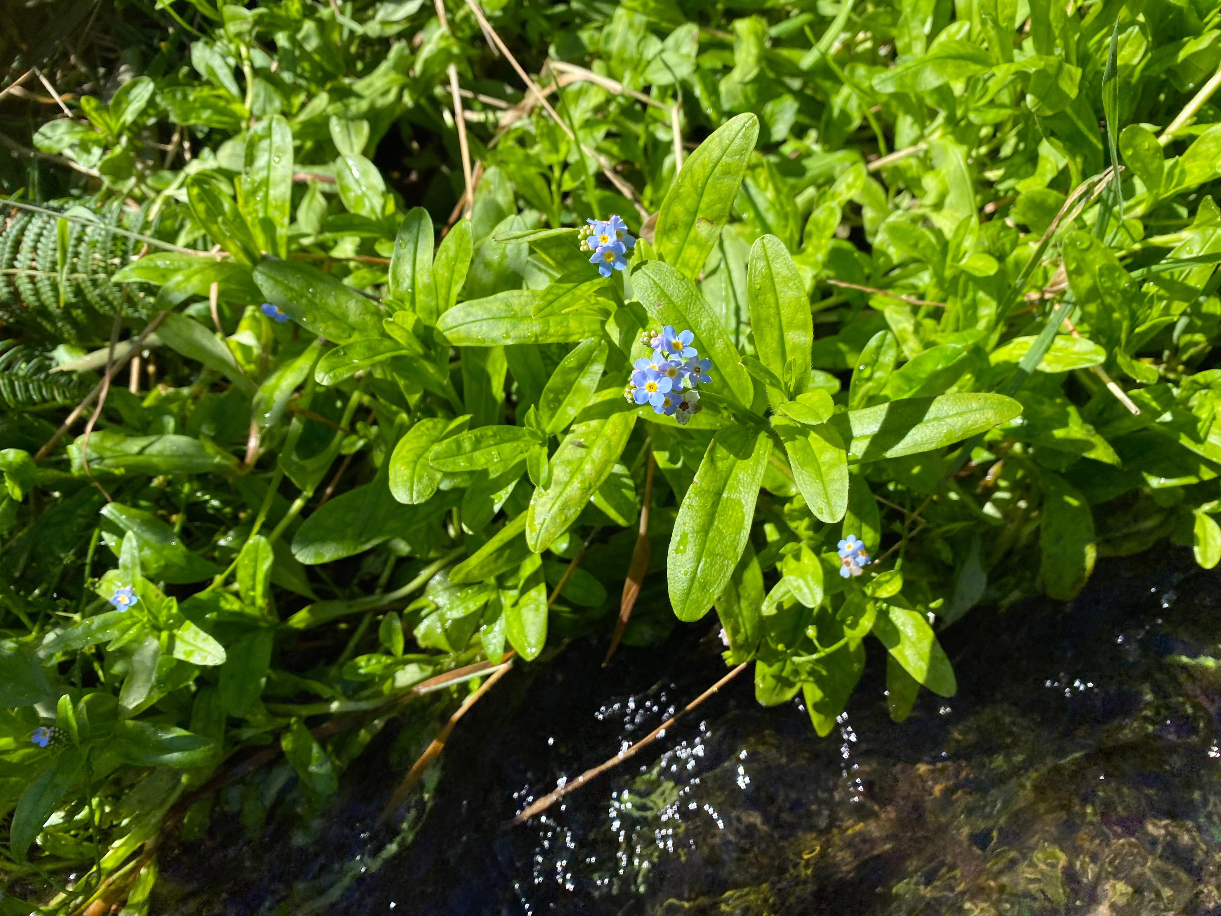
A close up view of small, light blue flowers known as marsh forget-me-nots, growing in dense green vegetation along the edge of a flowing stream.
Marsh forget-me-nots blooming along the bank of the Leiverbach stream.

Leiverbachtal und Talhänge Nature Reserve history and protected-area timeline

The area now protected as Leiverbachtal und Talhänge was placed under formal nature conservation protection in 2006 under the designation GM-084. The initial designation was later reinforced through integration into the updated landscape plan (Landschaftsplan) for the region, which became legally binding in 2013.

The reserve is administered by the lower landscape authority (Untere Landschaftsbehörde) of the Oberbergischer Kreis under North Rhine-Westphalia state nature conservation law. Management priorities established in the landscape plan include the conservation and development of the streams, their tall-herb floodplain vegetation, and the surrounding alder forests, along with the gradual removal of non-native spruce plantations and the extensification of grassland use.

Leiverbachtal und Talhänge Nature Reserve landscape and geographic character

The reserve occupies a typical Mittelgebirg valley in the Bergisches Land, with elevations ranging across the protected area from roughly 252 to 356 meters above sea level. The valley floor is shaped by the Leiverbach and a network of small spring brooks that descend through steeply incised side valleys, locally called Siefen.

The floodplain (Talaue) varies in width, opening out around the Pixberger Mühle and narrowing again in the upper reaches. Patches of moist and wet meadow, areas of abandoned grassland, and small floodplain woodland stands sit beside the stream, while the flanking slopes rise into closed forest cover. The result is a layered landscape of brook, floodplain, marshy tall-herb vegetation, and slope forest, characteristic of low mountain stream valleys in this part of North Rhine-Westphalia.
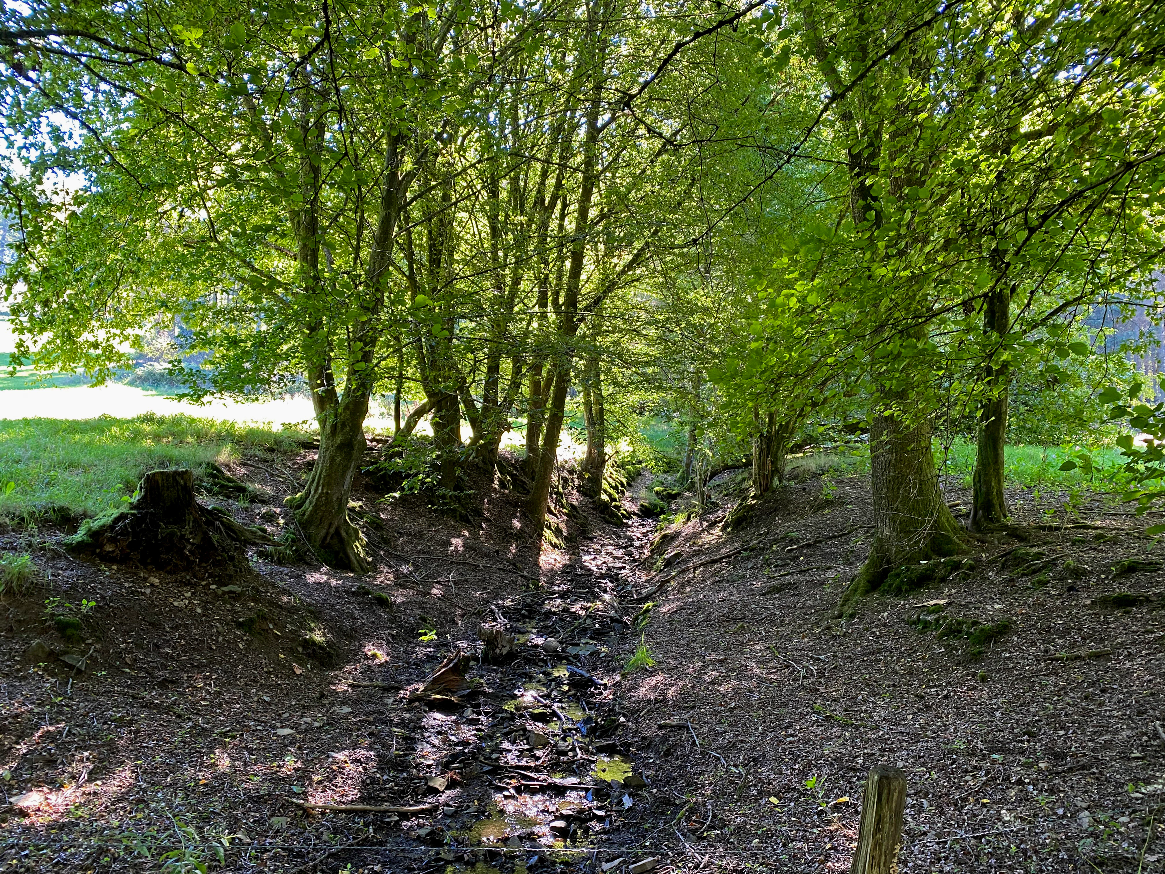
A small stream flowing over stones through a leafy green forest floor with trees on both sides.
A shaded stream bed winding through the woodland of the Leiverbachtal und Talhänge nature reserve.

Leiverbachtal und Talhänge Nature Reserve ecosystems, habitats, and plant life

Ecologically, Leiverbachtal und Talhänge is defined by the interplay of aquatic, wet grassland, and forest habitats. The Leiverbach itself features a near-natural course with a gravelly and sandy bed, widths of roughly one to five meters, alternating fast and slow sections, and natural pools formed over time; deadwood accumulations in the channel help create local variation in flow.

Along the brook, riparian woodland, small flood meadows, and meadowsweet-dominated tall-herb communities form a wet vegetation complex. In the forests, the dominant types are wavy-hair grass beech forests (Hainsimsen-Buchenwälder) with varying shares of oak, as well as pure oak woodland; some stands form open hall-like structures with mature and heavy timber as the leading growth class. Old and dead wood is a regular feature in nearly all broadleaf areas, and beech regenerates naturally. Holly (Stechpalme) is a notable element in the shrub layer.

Parts of the former spruce stands have been cleared in small to medium patches and reforested with site-appropriate broadleaves, with beech planted under the existing spruce and oak to gradually shift the stands toward a more natural composition.
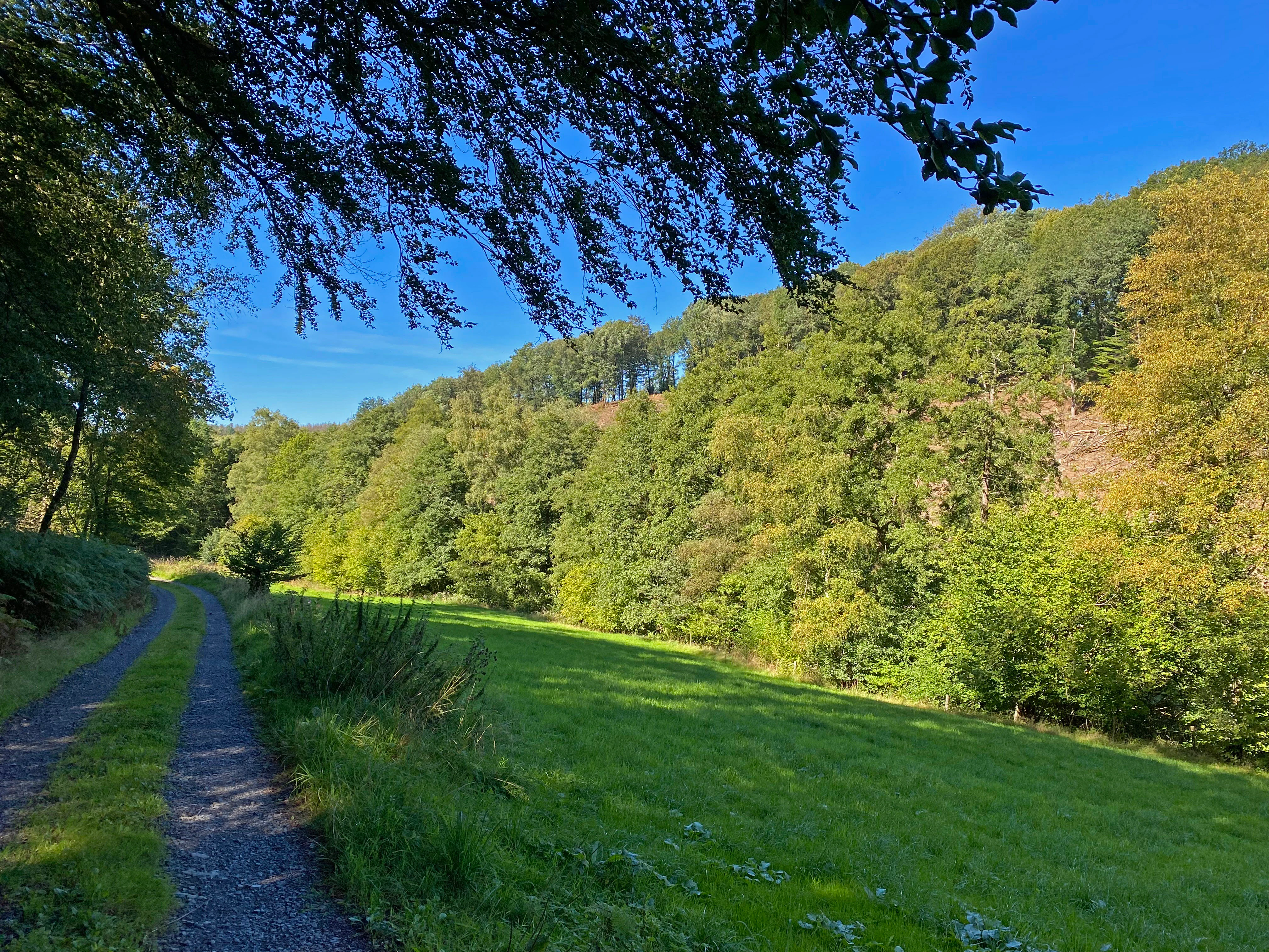
A gravel path runs along the edge of a green meadow, with a dense forested hillside rising in the background under a clear blue sky.
A rural trail winds alongside a lush meadow at the edge of the forest in Leiverbachtal und Talhänge.

Leiverbachtal und Talhänge Nature Reserve wildlife and species highlights

The source material emphasizes botanical rather than faunal content, so descriptions of wildlife in the strict sense are limited. The reserve is nonetheless identified as a regionally significant habitat mosaic supporting diverse plant communities across flowing water, damp meadow, and forest environments.

Botanical surveys have documented a range of moisture-loving and wet-meadow species in and around the Leiverbach, including meadowsweet (Filipendula ulmaria), ragged robin (Lychnis flos-cuculi), thyme-leaved milkwort (Polygala serpyllifolia), rampion bellflower (Campanula rapunculus), marsh marigold (Caltha palustris), marsh skullcap (Scutellaria galericulata), sneezewort (Achillea ptarmica), and bistort (Bistorta officinalis). The presence of devil's-bit scabious (Succisa pratensis), which is classified as endangered on the relevant Red List, was confirmed in the valley in 2023, although it faces pressure from invasive Himalayan balsam (Impatiens glandulifera). In the broader sense, the deadwood-rich forest, the well-structured stream, and the extensive moist meadows also provide habitat structure for stream invertebrates, amphibians, and the typical forest fauna of the Bergisches Land low mountains.
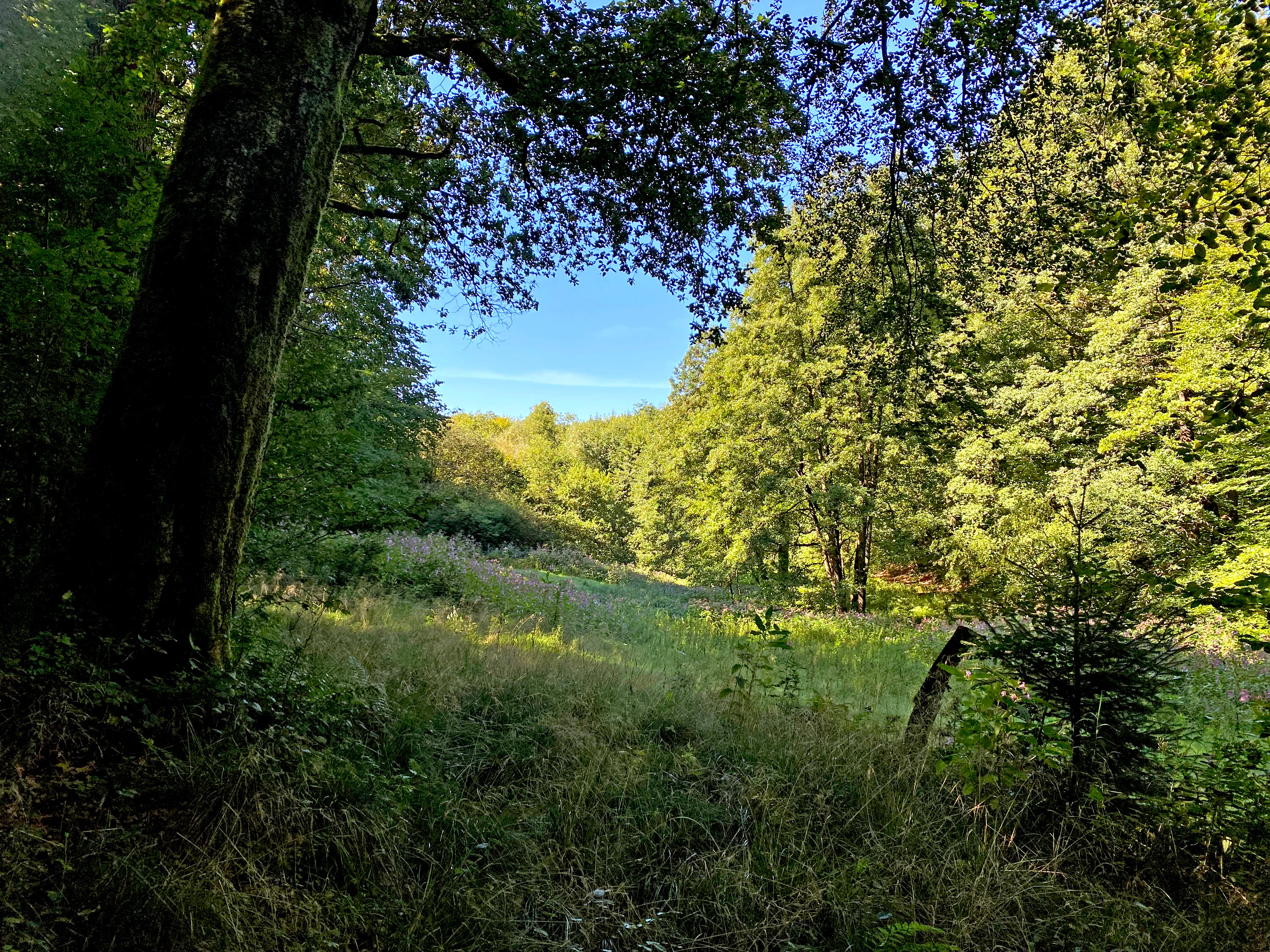
A green meadow surrounded by dense deciduous forest under a clear blue sky, showing a mix of grassy textures and tall trees.
A sunlit floodplain meadow nestled between forest slopes in the Leiverbach valley.

Leiverbachtal und Talhänge Nature Reserve conservation status and protection priorities

Leiverbachtal und Talhänge is registered as a Naturschutzgebiet under German federal and state nature conservation law and is classified as an IUCN Category IV Habitat/Species Management Area. The reserve's specific conservation goals are the preservation and development of the streams and their tall-herb floodplain vegetation, the protection of accompanying alder forests, the extensification of grassland use, and the removal or conversion of non-native spruce plantations.

Its conservation value is rooted in structural diversity rather than any single species: the combination of flowing waters, species-rich wet grassland, and slope-appropriate high forest creates a habitat mosaic that is typical for the region yet increasingly rare. Inclusion in the landscape plan of the Oberbergischer Kreis, together with direct adjacency to the Wuppertalsperre slopes and shores reserve, strengthens its role in the regional biotope network. Official monitoring describes the area as moderately impacted but with a predominantly positive development trend, indicating that conservation efforts are having a stabilizing effect on habitats and species composition.

Leiverbachtal und Talhänge Nature Reserve cultural meaning and human context

Cultural context in the narrow sense is not a primary focus of the source material, which centers on ecological and conservation content. The reserve nonetheless sits within a long-settled low-mountain landscape where traditional land uses, including extensive grazing, hay meadow management, and small-scale forestry, have shaped the present-day mosaic of meadows, riparian woodland, and forest.

Place names such as Pixberger Mühle (a historic mill site) and references to surrounding villages like Hummeltenberg, Oberbeck, Niederhombrechen, and Kormannshausen indicate that the valley has supported mixed rural settlement for a long time, with the brook and its mills historically serving practical as well as landscape-forming roles.
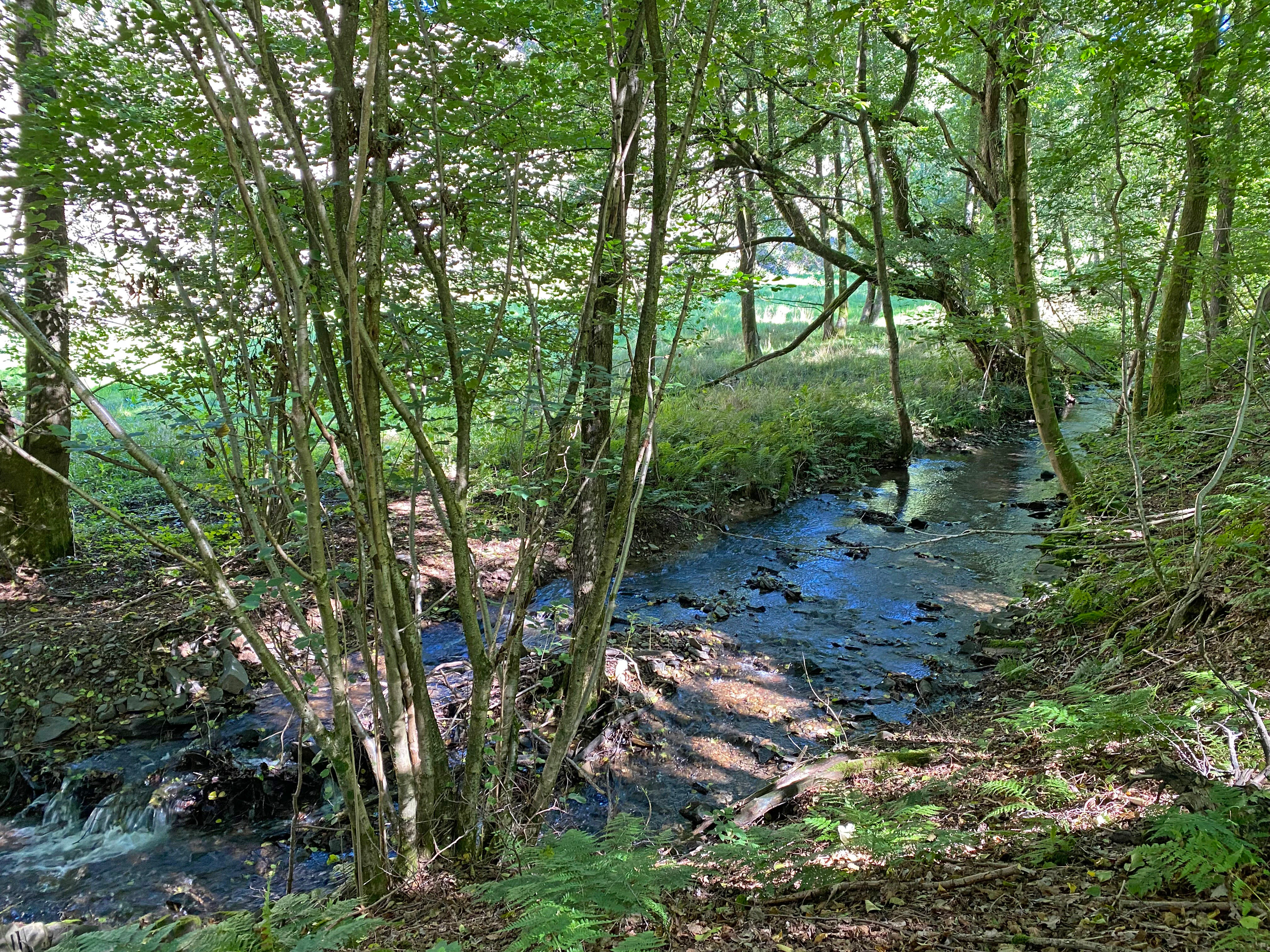
A small stream flowing over stones through a dense, leafy forest with a green meadow visible in the background.
The Leiverbach stream flowing through the wooded nature reserve, north of Pixberger Mühle.

Top sights and standout views in Leiverbachtal und Talhänge Nature Reserve

The reserve's standout features include a near-natural, meandering low-mountain stream with a gravelly bed, natural pools, and deadwood-driven flow variation; a floodplain mosaic of wet meadows, meadowsweet tall-herb communities, riparian woodland, and small areas of still-managed damp hay meadow; and slope forests dominated by beech with oak, notable old and dead wood, and a distinctive understory share of holly.

Equally notable is the active shift away from spruce monoculture toward site-appropriate broadleaf forest through small-scale clearings and underplanting, combined with the documented presence of regionally rare plants such as devil's-bit scabious, all set within a landscape that exemplifies a Bergisches Land Mittelgebirg valley.
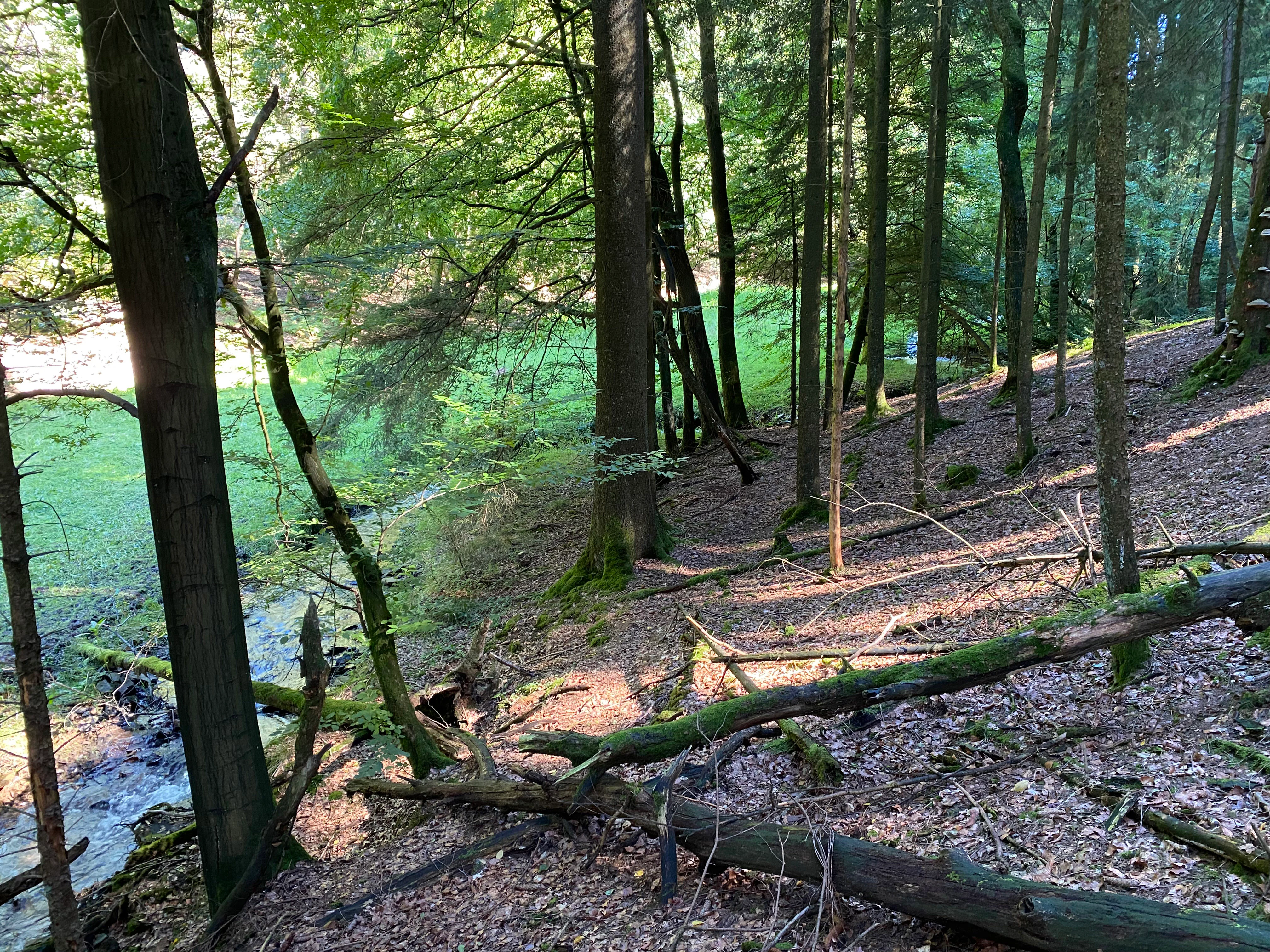
A downward view into a forested valley with a small stream flowing through the middle, flanked by trees and a moss-covered fallen log in the foreground.
A small stream flowing through the forested valley of the Leiverbachtal nature reserve.

Best time to visit Leiverbachtal und Talhänge Nature Reserve

Seasonal guidance can only be drawn indirectly from ecological content. Late spring and early summer are typically the most rewarding periods for viewing the wet meadows and tall-herb communities along the Leiverbach, when meadowsweet and other moisture-loving plants are in bloom. Autumn offers a different perspective through forest color, mushroom fruiting in the deadwood-rich beech stands, and the chance to observe late-season wetland species such as devil's-bit scabious. Winter reveals the valley's structural character most clearly, with leaf-off views of the meandering brook, the mosaic of meadows and woodland, and the shape of the surrounding slopes.

Monthly climate preview

Long-term monthly temperature and precipitation patterns recorded for Leiverbachtal und Talhänge

Leiverbachtal und Talhänge Climate Normals and Annual Temperature Rhythm

Representative coordinates document measured monthly temperature ranges alongside daily precipitation averages across the protected terrain. Analyzing complete monthly climate normals clarifies the broader seasonal rhythm defined by NASA power datasets.
Annual mean9 °C
0 °C18 °C
Jan
Feb
Mar
Apr
May13°
Jun16°
Jul18°
Aug18°
Sep14°
Oct
Nov
Dec
Warmest month
July

18.3 °C

Coolest month
January

0.3 °C

Wettest month
December

3 mm/day

Driest month
April

1.8 mm/day

Park location guide

Geography guide, regional context, and park location map for Leiverbachtal und Talhänge Nature Reserve

Leiverbachtal und Talhänge Nature Reserve park geography, regions, and map view in Germany

Understand where Leiverbachtal und Talhänge Nature Reserve sits in Germany through a broader geographic reading of the surrounding landscape, nearby location context, and its mapped position within the national park landscape.

How Leiverbachtal und Talhänge Nature Reserve fits into Germany

Germany is a federal republic in Western and Central Europe with a population of over 83 million across sixteen constituent states. It is Europe's largest economy by nominal GDP and a major global exporter and importer. The capital is Berlin, and the country borders Denmark, Poland, Czech Republic, Austria, Switzerland, France, Luxembourg, Belgium, and the Netherlands.

Wider geography shaping Leiverbachtal und Talhänge Nature Reserve in Germany

Germany is located in Western and Central Europe, spanning 357,022 km². It borders Denmark to the north, Poland and the Czech Republic to the east, Austria and Switzerland to the south, and France, Luxembourg, Belgium, and the Netherlands to the west. The country has coastlines on the Baltic Sea and North Sea to the north, with the Alps located in the southern region.

Map view of Leiverbachtal und Talhänge Nature Reserve

Use this park location map to pinpoint Leiverbachtal und Talhänge Nature Reserve in Germany, understand its exact geographic position, and read its mapped placement within the surrounding landscape more clearly.

Pigeon | © OpenStreetMap contributors

Location context for Leiverbachtal und Talhänge Nature Reserve

Nordrhein-WestfalenOberbergischer Kreis

Visual exploration of low mountain stream valleys, wetlands, and slope forests in the Bergisches Land region.

Leiverbachtal und Talhänge Photos and Protected Area Scenery

Visual records document the meandering stream ecosystem, wet floodplain meadows, and mature slope forests defining the protected nature reserve. Photographic documentation reveals the intricate topography, riparian vegetation structures, and habitat mosaics characterizing the regional low mountain landscape.

A close up view of small, light blue flowers known as marsh forget-me-nots, growing in dense green vegetation along the edge of a flowing stream.

A sunny, grassy meadow valley bordered by trees and forested slopes under a clear blue sky.

A small stream flowing over stones through a leafy green forest floor with trees on both sides.

A gravel path runs along the edge of a green meadow, with a dense forested hillside rising in the background under a clear blue sky.

A green meadow surrounded by dense deciduous forest under a clear blue sky, showing a mix of grassy textures and tall trees.

A gravel trail curves through a lush green meadow bordered by deciduous trees under a clear blue sky.

A small stream flowing over stones through a dense, leafy forest with a green meadow visible in the background.

A downward view into a forested valley with a small stream flowing through the middle, flanked by trees and a moss-covered fallen log in the foreground.

A narrow dirt trail runs alongside a small, shaded stream in a dense, deciduous forest, with sunlight filtering through the tree canopy.

A view of the Leiversiepen stream valley featuring a large overturned tree root ball covered in vibrant green moss, with dense deciduous forest in the background.

A close-up view of a hard fern with dark green, narrow fronds growing among moss and grasses on a forest floor.

A forest scene showing a small stream valley with tall deciduous trees, mossy tree trunks, and fallen branches on the forest floor covered with autumn leaves.

A large, weathered dead tree trunk stands in a lush green forest, covered in numerous shelf-like fungi, with healthy trees in the background.

A sunny, green landscape featuring a small stream area overgrown with tall grass and wildflowers, bordered by a forest edge with mature trees, and rolling meadows in the background under a clear blue sky.

Close-up of a purple devils-bit scabious flower with a small bee on top, set against a blurry green meadow background.

A peaceful, sun-dappled stream flowing through a lush, green alluvial forest with deciduous trees and grassy banks.

Park atlas

Compare adjacent stream valleys and regional nature reserves across the Bergisches Land

Parks Near Leiverbachtal und Talhänge and Surrounding Protected Landscapes

Browse nearby protected areas sharing similar low mountain terrain and stream valley ecosystems with Leiverbachtal und Talhänge. Comparing adjacent reserves reveals the broader regional distribution of protected habitats across the Oberbergischer Kreis.
Nature reserveNorth Rhine-Westphalia
About 3.2 km away#1 closest

South

Wupperaue bei Westenbrücke Nature Reserve Landscape and Geographic Mapping

Protected riparian floodplain in the Oberbergischer Kreis

This nature reserve protects a vital 2.3 kilometer segment of the Wupper river valley. Its landscape is characterized by a mosaic of wet meadows, alder and willow stands, and riparian corridors, providing a crucial stepping-stone habitat within the Hückeswagen area of North Rhine-Westphalia.

Area
0.318 km²
Established
2013
IUCN
IV
Nature reserveOberbergischer Kreis
About 5.2 km away#2 closest

Northwest

Wupper bei Radevormwald: Protected River Valley and Riparian Woodland Geography

Nature reserve landscape in the Oberbergischer Kreis region

Wupper bei Radevormwald serves as a critical protected area within the Wupper river corridor, featuring a mosaic of beech-oak forests and floodplain alder stands. The reserve highlights the contrast between calm, impounded reaches and energetic, meandering water sections, providing an essential study of river valley morphology and natural recovery in the Bergisches Land.

Area
1.208 km²
Established
2003
IUCN
IV
Relief
Upland
Nature reserveNordrhein-Westfalen
About 5.6 km away#3 closest

Northwest

Wilhelmsthaler und Haller Bachtal Nature Reserve: Bergisches Land Landscape and Map

A study of protected stream valleys and habitat mosaics in North Rhine-Westphalia.

Located in Remscheid, the Wilhelmsthaler und Haller Bachtal nature reserve protects a diverse array of interconnected stream-side and grassland habitats. This area demonstrates the ecological value of traditional valley landscapes in the Bergisches Land, providing essential connectivity for rare flora and local stream ecosystems through its unique relief and water corridors.

Area
0.103 km²
Established
2003
IUCN
IV
Relief
Upland
A horizontal watercolor painting depicting a meandering stream flowing through open, green, and pink-toned marshy grasslands bordered by a distant treeline.
Nature reserveNordrhein-Westfalen
About 8.7 km away#4 closest

North

Spreeler Bachtal Nature Reserve: Geography and Protected Valley Landscapes

An upland nature reserve in the Bergisches Land region of Germany.

This nature reserve centers on the meandering Spreeler Bach, a gravel-bedded stream defining a diverse protected area in North Rhine-Westphalia. The terrain includes wet meadows, spring-fed grassland, and managed deciduous forests on steeply rising valley slopes. It serves as a prime example of targeted habitat conservation within the larger slate landscapes of the Bergisches Land, straddling administrative boundaries between Radevormwald and Ennepetal.

Area
0.21 km²
Established
2019
IUCN
IV
A horizontal watercolor illustration depicting rolling hills, forest patches, and a soft, hazy valley against a white background.
Nature reserveNorth Rhine-Westphalia
About 9.3 km away#5 closest

Southwest

Mausbachtal Nature Reserve in North Rhine-Westphalia: Protected Stream Valley and Forest Landscapes

Regional stream valley network and deciduous forest landscape

This protected area in the Oberbergischer Kreis offers a window into the Bergische Hochflächen topography. The reserve highlights a mosaic of near-natural beech forest, wet meadows, and floodplain woodland, forming an integral link in the regional stream network connected to the Große Dhünn.

Area
0.237 km²
Established
2013
IUCN
IV
Watercolor painting of a rolling landscape with soft green hills, forest patches, and a winding stream.
Nature reserveGermany
About 9.6 km away#6 closest

South

Schwarzenbachtal Nature Reserve: Regional Protected Landscape and Stream Valley Atlas

A mapped overview of protected habitats in North Rhine-Westphalia

Schwarzenbachtal serves as a vital protected area in Germany, defined by its elongated brook valley and intricate transitions between wet meadows and dry grassland mosaics. As part of the Bergisches Land stream network, this nature reserve illustrates the ecological significance of small-scale valley landscapes and their role in regional conservation geography.

Area
0.082 km²
Established
2013
Relief
Upland
Climate
Temperate
A wide watercolor illustration showing a winding river flowing through a green valley with pink and purple flowers in the foreground and soft yellow hills in the background.
Nature reserveNordrhein-Westfalen
About 9.8 km away#7 closest

Northwest

Leyerbachtal Nature Reserve: A Protected Valley and Industrial Heritage Site in Remscheid

An alluvial landscape and low-mountain stream corridor in Germany

Leyerbachtal serves as a vital protected corridor featuring a meandering brook, expansive gravel banks, and species-rich wet meadows. Located in the heart of the Bergisches Land, this nature reserve integrates high-value ecological habitats with the historic industrial remnants of Remscheid's water-powered past.

Area
0.151 km²
Established
2003
IUCN
IV
A flat, vector-style illustration of a valley with a winding path in the foreground, coniferous trees, a waterfall, and rocky cliffs under a light sky.
Nature reserveOberbergischer Kreis
About 9.8 km away#8 closest

Southeast

Ibachtal und Nebenbäche Nature Reserve: Geographic Overview and Protected Stream Landscape

Stream valley connectivity in the Oberbergischer Kreis

Trace the landscape of the Ibachtal und Nebenbäche nature reserve through its distinct stream valleys, alder gallery forests, and botanically diverse wet meadows. This area serves as a primary example of stream-based ecological protection in the Bergisches Land, characterized by narrow ravine-like tributaries and expansive floodplain grassland.

Area
0.268 km²
Established
2013
IUCN
IV

Common questions about visiting, size, designation, and location context for Leiverbachtal und Talhänge Nature Reserve

Leiverbachtal und Talhänge Nature Reserve FAQs for park facts, access, geography, and protected area context

Find quick answers about Leiverbachtal und Talhänge Nature Reserve, including protected-area facts, park geography, trail and visitor context, and how the park fits into its surrounding country and regional landscape.
MoriAtlas Explorer

Continue Your Protected Areas Search Across the Global Atlas

Deepen your exploration by continuing the structured search for national parks and protected areas worldwide. Utilize the comprehensive filtering capabilities to compare different conservation landscapes and refine your understanding of global park geography. Discover more about the distribution and characteristics of protected natural areas.

Global natural geography