
Mori Atlas logo
Wildlife reserveLinville Gorge Wilderness

Mapping the vertical terrain and old-growth forest boundaries of this historic Appalachian wildlife reserve

Linville Gorge Wilderness: A Deeply Carved Protected Landscape in the Blue Ridge Mountains

Linville Gorge Wilderness stands as a landmark of American conservation within the Pisgah National Forest of western North Carolina. Often called the Grand Canyon of North Carolina, the area features a dramatic 1,400-foot descent from rim to river, preserving a road-free canyon floor and extensive tracts of rare old-growth forest. This wilderness remains a defining example of rugged Appalachian geography, shaped by natural erosion and protected since the early years of the Wilderness Act.

wilderness areagorgecanyonBlue Ridge Mountainsold-growth forestAppalachian forest
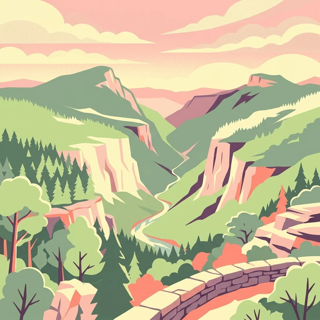
A colorful digital illustration showing a deep river gorge with steep cliffs, dense forest, and a stone wall in the foreground under a sunset sky.

Linville Gorge Wilderness

Wildlife reserve

Park overview

Structured park overview, official facts, and landscape profile for Linville Gorge Wilderness

Linville Gorge Wilderness park facts, protected area profile, and essential visitor context

Review the core facts for Linville Gorge Wilderness, including designation, size, terrain, visitor scale, habitats, and operating context in one park-focused overview.

About Linville Gorge Wilderness

Linville Gorge Wilderness sits in the heart of the North Carolina Blue Ridge, where the Linville River has carved a winding, steep-walled canyon between Linville Mountain on one side and Jonas Ridge on the other. Encompassing roughly 11,786 acres inside the Pisgah National Forest, the wilderness protects one of the most rugged and least road-disturbed landscapes in the eastern United States. The river flows through the bottom of the gorge hundreds of feet below the rim, and travelers approaching the canyon from above encounter sheer cliffs, narrow ridges, and dense forest that all reinforce the area's reputation as a true backcountry environment.

Often dubbed the "Grand Canyon of North Carolina," the gorge draws visitors for its striking scenery as well as for its ecological significance. The steepness of the terrain made the gorge impractical to settle and unprofitable to log, which is why its forests have survived in a largely undisturbed, old-growth state while much of the surrounding Blue Ridge was cleared in the early 20th century. Today the wilderness harbors a rich mosaic of hardwoods and pines, an unusually intact forest canopy, and a thriving community of wildlife.

Managed by the U.S. Forest Service under the National Wilderness Preservation System, the area combines strong conservation protections with active recreational use. Hikers, backpackers, rock climbers, and anglers all make use of the gorge, but the wilderness designation intentionally limits infrastructure: trails are rougher than those typical of state or national parks, and the bottom of the canyon remains free of roads. This balance of access and preservation is central to Linville Gorge's identity as one of the earliest and purest examples of federally designated wilderness in the country.

Quick facts and research context for Linville Gorge Wilderness

Linville Gorge Wilderness is a federally designated wilderness area in Burke County, North Carolina, situated within the Pisgah National Forest and administered by the U.S. Forest Service. It covers roughly 11,786 acres and centers on the Linville River as it cuts through the Blue Ridge Mountains.

The gorge is recognized as the third largest wilderness area in North Carolina and one of only two designated wilderness gorges in the Southern United States. It was among the very first areas included in the National Wilderness Preservation System when the Wilderness Act took effect in 1964, and it remains the only U.S. gorge or canyon to have held that designation continuously from the Act's first year without any change in acreage. The terrain is exceptionally steep, with the river flowing roughly 1,400 feet below the surrounding ridge tops.

Protection and recognition

Documented terrestrial protection scope and conservation status facts

Linville Gorge Wilderness Protection Status and International Recognition

Linville Gorge Wilderness maintains a documented terrestrial protection scope without imported international recognition sources. Official conservation records outline the baseline administrative status and management framework associated with the protected landscape.

Protection details

Protection scope
Terrestrial
Transboundary protection
No
Park context

Deeper park guide and search-rich context for Linville Gorge Wilderness

Linville Gorge Wilderness history, landscape, wildlife, and travel context

Explore Linville Gorge Wilderness through its history, landscape character, ecosystems, wildlife, conservation priorities, cultural context, and seasonal travel timing in a structured park guide built for atlas discovery and search intent.

Why Linville Gorge Wilderness stands out

Linville Gorge Wilderness is best known for its dramatic, deep-cut canyon scenery, widely compared to the Grand Canyon and frequently referred to as the "Grand Canyon of North Carolina." The wilderness preserves about 10,000 acres of virgin old-growth forest, a rare condition in the Blue Ridge because the gorge's forbidding terrain prevented industrial logging that scarred surrounding slopes in the early 20th century. It is also recognized as one of the oldest entries in the U.S. National Wilderness Preservation System, designated in the inaugural year of the Wilderness Act, and as a sanctuary for diverse Appalachian wildlife including black bear, wild turkey, and raptors such as peregrine falcons. The combination of pristine forests, vertical terrain, and absence of roads has made it a benchmark for true wilderness character in the eastern United States.
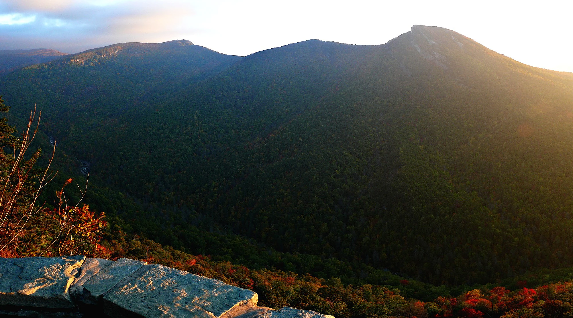
A wide angle landscape view of forested mountains and a deep canyon at sunrise, taken from a stone observation wall.
Sunrise view over the rugged landscape of Linville Gorge from the Wiseman's View overlook.

Linville Gorge Wilderness history and protected-area timeline

Long before European settlement, the Linville River and its gorge were part of the homeland of Cherokee peoples, who called the river "Ee-see-oh," meaning "river of many cliffs." The name "Linville" itself dates to the colonial era, when the river was named for John and William Linville, European explorers who were killed in the gorge by the Shawnee in 1766.

European-American settlement never deeply penetrated the gorge. Throughout the 19th and early 20th centuries, the steep walls and narrow floor of the canyon made farming and road building impractical, and the surrounding region became a center of the logging industry. The Linville Gorge itself escaped the clearcutting that transformed much of the Blue Ridge because the forbidding terrain made commercial timber operations unprofitable. As a result, forests inside the gorge survived largely in their original, old-growth condition, an outcome that today distinguishes Linville from virtually every other major gorge in North Carolina.

Formal protection arrived in stages. In 1952, land in the area was purchased using funds donated by John D. Rockefeller Jr. Then, in 1964, the Wilderness Act was approved by Congress and signed into law by President Lyndon B. Johnson. Linville Gorge was included among the very first wilderness areas of the new National Wilderness Preservation System, making the gorge a charter member of America's modern wilderness system. It remains the only U.S. canyon or gorge to have been designated wilderness in the inaugural year of the Wilderness Act and to have retained that exact designation without change in acreage. Today the area is administered by the Grandfather Ranger District of the U.S. Forest Service.

Linville Gorge Wilderness landscape and geographic character

Linville Gorge Wilderness is defined by its dramatic vertical relief and the deep, twisting channel its river has cut through the Blue Ridge. From rim to river, the elevation drop is roughly 1,400 feet, a scale unusual for the eastern United States and a defining reason the area earned its "Grand Canyon" nickname. The gorge runs generally north to south along the Linville River, with Jonas Ridge forming much of the eastern rim and Linville Mountain rising to the west.

The terrain inside the wilderness is remarkably varied. Steep cliff walls, exposed rock faces, narrow ridgelines, boulder fields, and forested benches all alternate along the river's course. Several distinctive landmarks shape the skyline, including Table Rock at the southern end of the gorge, Hawksbill Mountain, Shortoff Mountain, and the formation known as Sitting Bear. From overlooks such as Wiseman's View, the interior of the canyon opens up in a sweeping panorama of cliffs, ridges, and forested slopes.

Of the four major gorges in North Carolina, Linville Gorge is the only one without a road in its bottom, and that absence is central to the wilderness's landscape character. No major dams, bridges, or other industrial structures interrupt the gorge, and the river corridor remains almost entirely shaped by natural erosion and forest cover. The combination of vertical terrain, intact ridgelines, and a road-free river bottom gives the area a wild, primeval appearance rarely matched elsewhere in the Southern Appalachians.
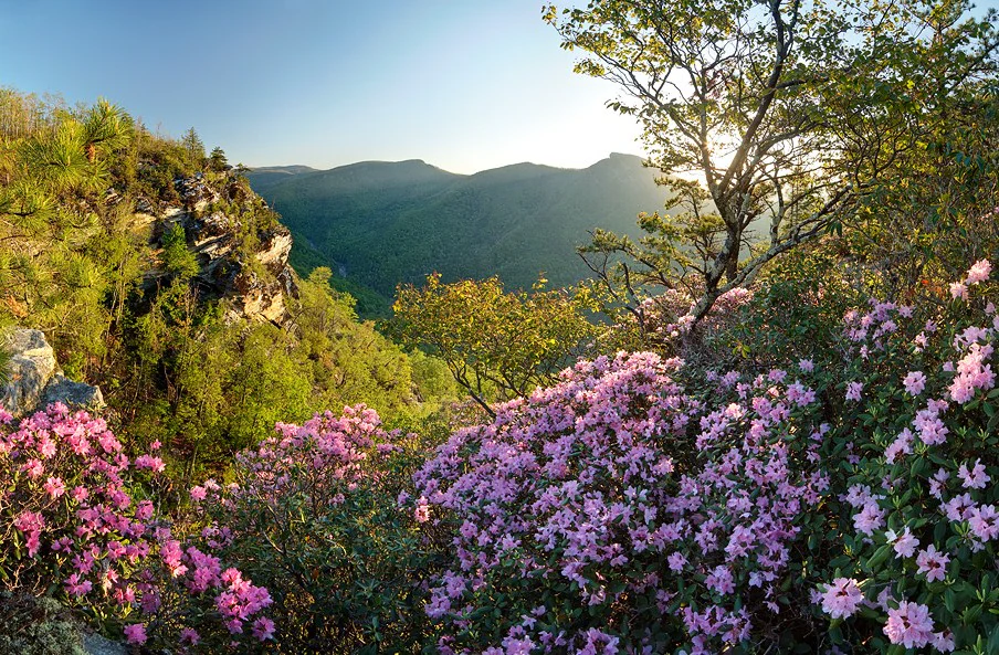
A sunny mountain landscape featuring pink rhododendron flowers in the foreground and a deep, tree-covered canyon in the background.
A scenic overlook at Wiseman's View during spring, featuring blooming rhododendrons against the rugged canyon landscape of Linville Gorge.

Linville Gorge Wilderness ecosystems, habitats, and plant life

Linville Gorge Wilderness protects what is widely regarded as one of the most intact forest ecosystems remaining in the Blue Ridge Mountains. Because the steep walls made industrial logging impractical, roughly 10,000 acres of the gorge remain in a largely virgin, old-growth condition, a status almost unique in the modern Southern Appalachians.

The vegetation is a dense, diverse mosaic typical of mid-elevation Appalachian forests. Hardwoods dominate much of the canopy, mixed with native pines and a wide variety of smaller trees, shrubs, and herbaceous plants that thrive in the sheltered microclimates of the gorge. The river bottom, north- and south-facing slopes, and exposed rim each support subtly different plant communities, contributing to a botanical richness that has earned the area a strong reputation among naturalists.

The wilderness also encompasses notable aquatic habitat along the Linville River, a cold-water stream that supports stocked trout populations and contributes to the broader health of the surrounding watershed. Above the gorge, the river's surroundings transition into the broader Pisgah National Forest landscape, but within the wilderness boundary the combination of forest, cliff, and river creates a tightly knit natural system.
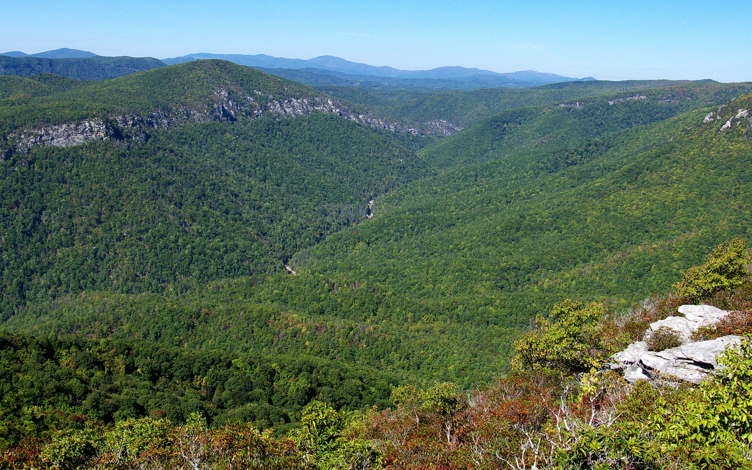
A wide, elevated landscape view of a deep, forested river gorge on a clear, sunny day, with rocky cliff edges in the foreground and blue mountains in the far distance.
A view looking north over the Linville Gorge, featuring dense forest cover and rugged cliff lines.

Linville Gorge Wilderness wildlife and species highlights

Linville Gorge supports a rich and visible wildlife community, in large part because its steep walls and road-free bottom have sheltered animals from heavy human pressure. Mammals common to the wilderness include black bear, foxes, raccoons, white-tailed deer, gray squirrel, and other familiar Appalachian species. Wild turkey and ruffed grouse are present in the forest, and the area is also well known for raptors, including hawks, owls, and vultures that make use of the updrafts along the cliff walls.

The gorge is particularly important for peregrine falcons, which nest on its high cliffs. To protect nesting birds, the U.S. Forest Service periodically closes specific cliff areas to rock climbing during the breeding season, a management practice that reflects the wilderness's role as a key raptor habitat in the region.

Reptiles such as copperheads and timber rattlesnakes are part of the gorge's ecosystem and are encountered by hikers in the warmer months, while the Linville River itself is included in North Carolina's trout stocking program and supports brown, brook, and rainbow trout. Together, the variety of forest mammals, nesting raptors, river-dwelling fish, and the occasional large predators such as black bears give the wilderness a strong and recognizable wildlife character.
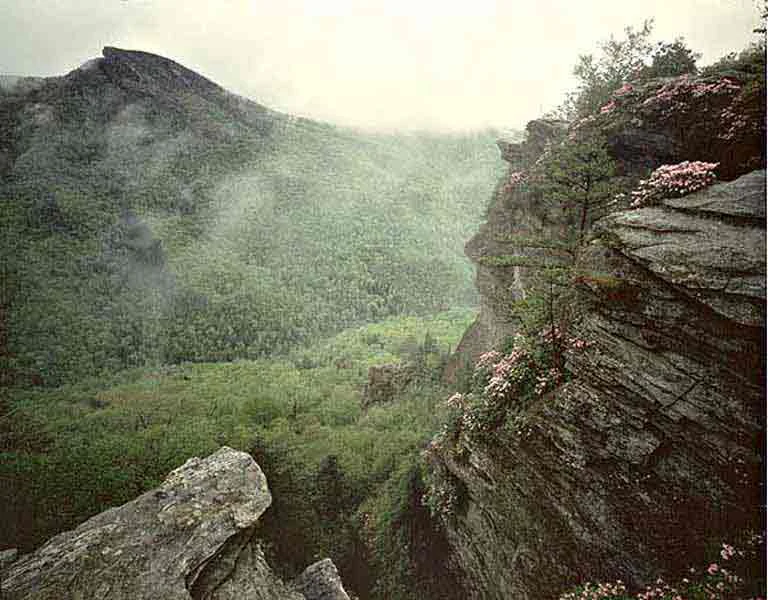
A wide angle scenic shot of a deep forested gorge with rocky cliffs in the foreground and a mountain peak in the background under an overcast sky.
A view overlooking the Linville Gorge Wilderness from Wiseman's View, featuring rugged cliffs and blooming mountain laurel.

Linville Gorge Wilderness conservation status and protection priorities

Linville Gorge Wilderness occupies an important place in American conservation history. It is one of the original wilderness areas designated under the Wilderness Act of 1964, meaning it was among the very first landscapes formally placed into the National Wilderness Preservation System when that system was created. It is also the only U.S. gorge or canyon to have been included in that inaugural group and to have retained both its wilderness designation and its original acreage ever since.

Ecologically, the area's importance lies in its unusually well preserved old-growth forest. The Blue Ridge Mountains were heavily logged in the late 19th and early 20th centuries, but the gorge's steep walls made industrial timber extraction unprofitable, sparing the interior forest from clearcutting. Roughly 10,000 acres of virgin forest still stand inside the wilderness, representing one of the largest contiguous blocks of old-growth southern Appalachian forest in the region.

The wilderness is also valued for its clean, free-flowing river, its nesting habitat for peregrine falcons, and its role in the larger Pisgah National Forest landscape. Management by the U.S. Forest Service's Grandfather Ranger District emphasizes keeping the gorge free of new roads and major infrastructure, limiting group sizes for campers, requiring permits during peak season, and balancing recreational use with the protection of its forest, cliff, and river ecosystems.

Linville Gorge Wilderness cultural meaning and human context

The gorge is deeply rooted in the cultural history of western North Carolina. Before European settlement, the area was inhabited by Cherokee peoples, who knew the Linville River as "Ee-see-oh," meaning "river of many cliffs." That name reflects an intimate, descriptive relationship with the landscape and remains a reminder of the gorge's longstanding significance to Indigenous communities of the southern Appalachians.

European-American contact with the gorge dates to the colonial era. The river and gorge were named for John and William Linville, explorers who were killed in the area by the Shawnee in 1766. The forbidding terrain then discouraged permanent settlement, and when the surrounding region was overtaken by the logging industry in the early 20th century, the gorge again was left largely untouched because its cliffs made commercial extraction impractical.

Today the cultural identity of Linville Gorge lies largely in its wilderness character and outdoor recreation traditions. Hiking, backpacking, rock climbing, and fishing in the gorge have shaped a regional outdoor culture centered on tough terrain and minimal infrastructure, with nearby landmarks such as Linville Falls and Linville Caverns extending visitor interest into the broader Blue Ridge.
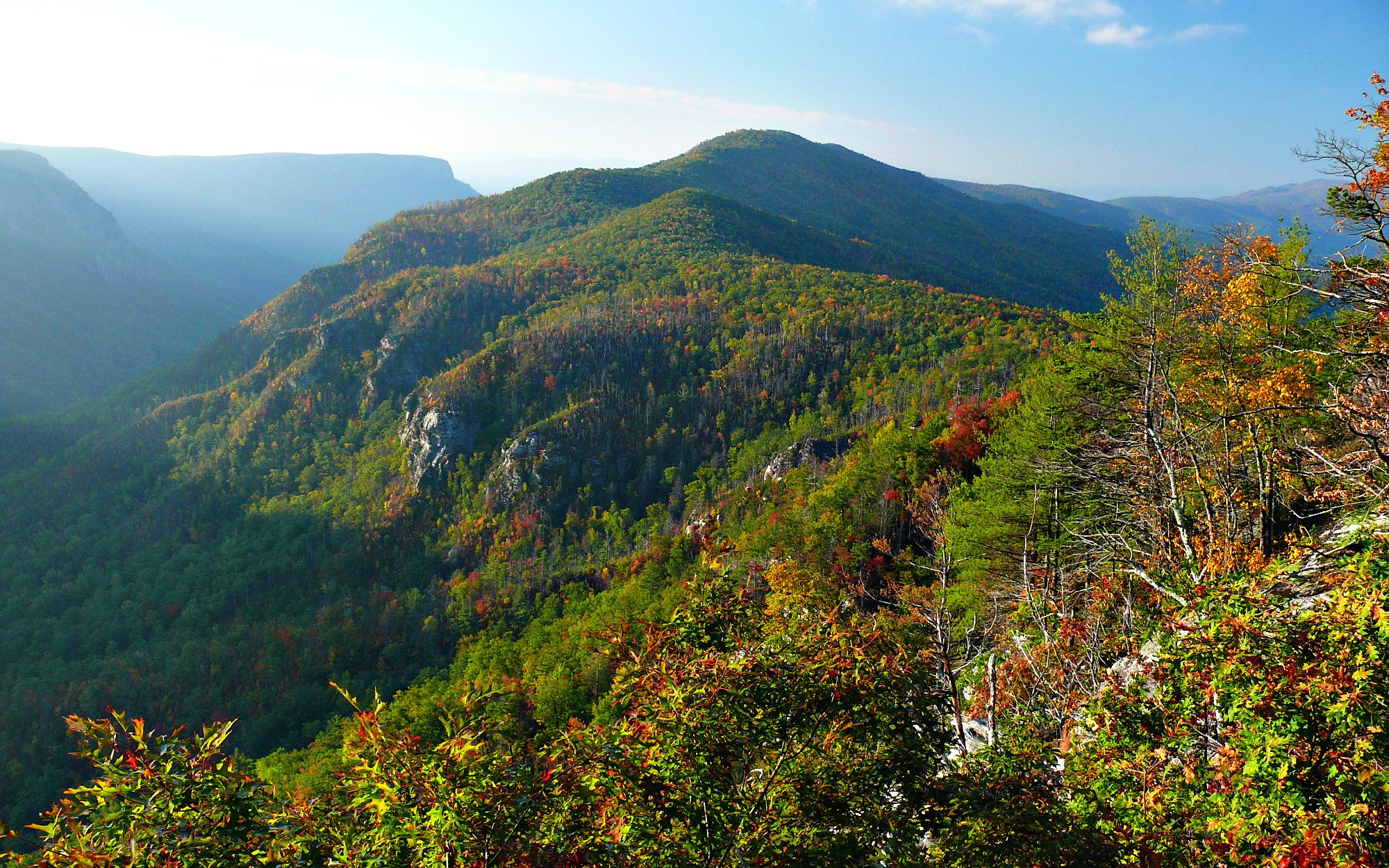
A wide, elevated view of a green, forested mountain ridge and canyon during early morning light, with foliage displaying early autumn colors in the foreground.
Sunrise over the rugged landscape of Linville Gorge Wilderness as seen from Wiseman's View.

Top sights and standout views in Linville Gorge Wilderness

Linville Gorge Wilderness stands out as one of the most rugged and least road-disturbed canyons in the eastern United States, with about 10,000 acres of old-growth forest still surviving inside its boundaries. Its vertical relief of roughly 1,400 feet from rim to river, combined with cliffs, pinnacles such as Table Rock and Hawksbill Mountain, and a road-free river bottom, give it a wild, primeval atmosphere that few other Appalachian landscapes can match.

The wilderness also carries rare historical significance: it is one of the first-designated wilderness areas of the National Wilderness Preservation System, the only canyon in the original 1964 group to retain that designation without alteration, and a key nesting site for peregrine falcons. Together, these features make Linville both a working wilderness for hikers and climbers and a benchmark site for the American wilderness preservation movement.
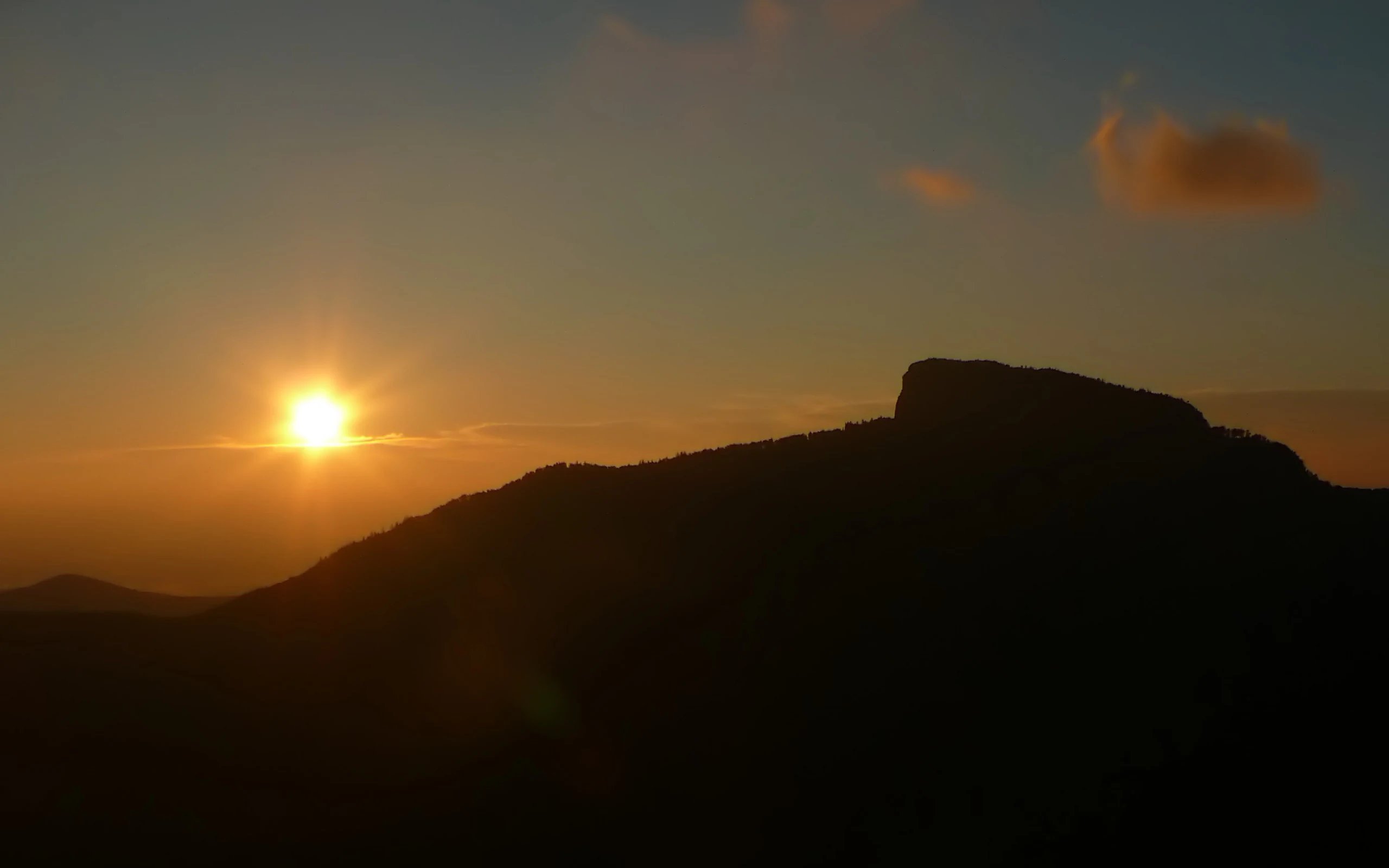
A backlit silhouette of a rocky mountain ridge at sunrise, with the sun low in the sky, creating a warm glow against the dark terrain.
Sunrise silhouette of Table Rock, a prominent geological feature in the Linville Gorge Wilderness.

Best time to visit Linville Gorge Wilderness

Linville Gorge Wilderness is appealing through much of the year, with each season offering a different character. Spring brings fresh green foliage along the gorge walls and historically higher water in the Linville River, while summer offers long days but warmer, more demanding conditions on the steep trails, and the season when the Forest Service requires permits for camping on weekends and holidays from May through October. Fall is widely considered one of the most rewarding periods, with cooler temperatures, strong visibility from the rim overlooks, and the hardwood forests of the Blue Ridge in autumn color. Winter visits tend to be quieter, with snow sometimes highlighting the dramatic cliffs and ridge lines, though trail conditions can be more difficult.

Because the wilderness has no road through the bottom of the canyon, all visitors must descend and ascend on foot, which makes weather and foot conditions more important than in flatter parks. Planning around milder temperatures, stable weather, and lower water levels generally yields a safer and more rewarding experience.

Monthly climate preview

Long-term representative temperature ranges and precipitation patterns across twelve recorded months

Linville Gorge Wilderness Climate Normals and Monthly Weather Records

Representative coordinates record mean monthly temperatures spanning from near freezing up to warm summer peaks alongside steady precipitation distribution throughout the year. Reviewing the complete monthly climate normals for Linville Gorge Wilderness provides deeper analytical depth regarding long-term thermal rhythms and moisture values.
Annual mean12 °C
1 °C23 °C
Jan
Feb
Mar
Apr12°
May16°
Jun21°
Jul23°
Aug22°
Sep19°
Oct12°
Nov
Dec
Warmest month
July

22.7 °C

Coolest month
January

0.5 °C

Wettest month
July

3.9 mm/day

Driest month
October

2.8 mm/day

Park location guide

Geography guide, regional context, and park location map for Linville Gorge Wilderness

Linville Gorge Wilderness park geography, regions, and map view in United States of America

Understand where Linville Gorge Wilderness sits in United States of America through a broader geographic reading of the surrounding landscape, nearby location context, and its mapped position within the national park landscape.

How Linville Gorge Wilderness fits into United States of America

The United States of America is a federal presidential republic and one of the world's largest countries by area and population. It consists of 50 states across a vast territory spanning multiple time zones, with its capital in Washington, D.C. and largest city in New York City. The nation has a diverse economy, influential political system, and significant cultural and military presence globally.

Wider geography shaping Linville Gorge Wilderness in United States of America

The United States occupies a vast territory in North America, bordered by Canada to the north and Mexico to the south. The 48 contiguous states stretch from the Atlantic to the Pacific Ocean, while Alaska occupies the northwestern region and Hawaii is an archipelago in the Pacific. The country encompasses diverse terrain including the Rocky Mountains, Appalachian Mountains, Great Plains, and extensive river systems.

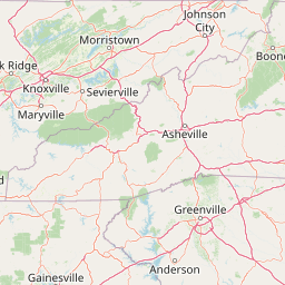
Map view of Linville Gorge Wilderness

Use this park location map to pinpoint Linville Gorge Wilderness in United States of America, understand its exact geographic position, and read its mapped placement within the surrounding landscape more clearly.

Pigeon | © OpenStreetMap contributors

Location context for Linville Gorge Wilderness

Burke CountyNorth Carolina
Recorded earthquake history

Review the Historical Earthquake Catalogue for Linville Gorge Wilderness

Examine recorded seismic history near Linville Gorge Wilderness through a structured catalogue of events. MoriAtlas presents these historical records to provide clear, accessible data on nearby epicentres, event magnitudes, and depths for researchers interested in regional Appalachian seismicity.

Linville Gorge Wilderness Earthquake History

Catalogued events

5 events

Strongest magnitude

Magnitude 3.1

Most recent event

Dec 15, 2014

This history includes earthquakes recorded inside the park or within 50 km of its borders

Visualizing rugged Appalachian terrain, vertical canyon walls, and protected forest habitats

Linville Gorge Wilderness Landscape and Scenery Photography Gallery

Photographic records capture the steep vertical relief, deep river gorges, and ancient forest canopy defining Linville Gorge Wilderness. Visual exploration reveals the protected natural terrain, dramatic rim overlooks, and primeval character shaping this southern mountain sanctuary.

A wide angle landscape view of forested mountains and a deep canyon at sunrise, taken from a stone observation wall.

Panoramic view of a deep mountain gorge at sunrise with rocky cliffs on the left and flowering rhododendrons in the foreground.

A sunny mountain landscape featuring pink rhododendron flowers in the foreground and a deep, tree-covered canyon in the background.

A wide, elevated landscape view of a deep, forested river gorge on a clear, sunny day, with rocky cliff edges in the foreground and blue mountains in the far distance.

A wide angle scenic shot of a deep forested gorge with rocky cliffs in the foreground and a mountain peak in the background under an overcast sky.

Wide panoramic landscape view from a high rocky vantage point looking over a dense forest covered canyon gorge with distant layered ridgelines.

A wide, elevated view of a green, forested mountain ridge and canyon during early morning light, with foliage displaying early autumn colors in the foreground.

A backlit silhouette of a rocky mountain ridge at sunrise, with the sun low in the sky, creating a warm glow against the dark terrain.

A wide, dramatic landscape view of forested mountains and a deep valley under a moody, cloud-filled sunset sky.

A multi-tiered waterfall flows down through a deep, rocky canyon surrounded by dense pine and hardwood forest.

A wide view of a deep, forested canyon with a river running through the bottom, taken from a high vantage point with bare tree branches in the foreground.

A high-angle scenic view of a prominent rocky ridge and deep gorge, with dense forested slopes and hazy distant mountains in the background.

A stone-paved overlook with a simple wooden railing at the edge of a cliff, framed by overhanging trees with early autumn foliage, overlooking a deep, forested mountain gorge.

A daytime view of a large, green-covered mountain with a prominent, rocky cliff face reaching toward a clear blue sky, viewed from a nearby wooded ridge.

A distant, flat-topped mountain covered in forest stands against a clear sky, viewed through foreground tree branches.

A high angle panoramic view looking over a vast, dense green forest canopy towards a hazy mountain range in the distance, with patches of a bright blue lake visible in the mid-ground.

Park atlas

Compare connected protected landscapes and regional wilderness geography

Explore Other Parks Near Linville Gorge Wilderness and Surrounding Appalachian Regions

Visitors exploring Linville Gorge Wilderness can continue comparing protected areas across the surrounding Blue Ridge terrain. Expanding the geographic scope reveals related wilderness reserves, river gorges, and highland forests throughout the region.
Watercolor painting of a winding trail through grassy hills with mountains in the background, using a soft pastel color palette of greens, purples, and yellows.
Protected landscapeNorth Carolina
Park boundaries overlap#1 closest

Southwest

Pisgah National Forest: Protected Appalachian Mountain Geography and Regional Mapping

An extensive mountain forest in western North Carolina

Pisgah National Forest represents a major protected landscape in the southern Appalachian Mountains of North Carolina. Its diverse terrain includes high peaks above 6,000 feet, dense hardwood forests, and deep river gorges. Recognized as a historic center for professional forestry, the area protects extensive watersheds and wilderness zones, offering a detailed case study in Appalachian geography, conservation science, and rugged mountain topography.

Area
2,075.06 km²
Established
1916
Relief
Mountain
Climate
Temperate
Protected areaVirginia
81 km away#2 closest

North

Lewis Fork Wilderness: Geography and Protected Land Profile in Southwestern Virginia

High-elevation Appalachian backcountry and ridgeline mapping

Spanning the ridgelines near the summit of Mount Rogers, Lewis Fork Wilderness serves as a key ecological anchor for Virginia. This protected backcountry offers a dense mosaic of forest types, ranging from oak-hickory stands to rare spruce-fir habitats. The landscape features steep terrain and pristine mountain streams, providing a concentrated look at the environmental complexity of the southern Appalachian Mountains.

Area
24.59 km²
Established
1984
IUCN
Ib
Relief
Mountain
A soft, horizontal watercolor painting depicting layers of rolling mountain ridges and evergreen forests in shades of green, yellow, and light pink.
Protected landscapeVirginia
About 82 km away#3 closest

North

Mount Rogers National Recreation Area: Virginia Appalachian Highlands Protected Landscape

Mapping high-elevation ridgelines and wilderness corridors.

Located in southwestern Virginia, Mount Rogers National Recreation Area preserves a vast expanse of southern Appalachian mountain terrain. The landscape features spruce-fir forests, alpine-style balds, and deep valley watersheds. This protected area serves as a primary geographic anchor for hikers and conservationists, housing the highest peak in the state and extensive federally designated wilderness segments within its borders.

Area
626.52 km²
Established
1966
Relief
Mountain
Climate
Temperate
Wildlife reserveGrayson County
84 km away#4 closest

Northeast

Little Wilson Creek Wilderness: Protected Appalachian Forest and High Elevation Geography

Mapping the ridges, stream systems, and balds of Grayson County

Little Wilson Creek Wilderness is a significant protected area in southwestern Virginia, featuring elevations exceeding 4,800 feet. The region spans a diverse ecological landscape of rare high country bogs, northern hardwood forests, and old growth remnants that drain into the New River system. Gain insights into the terrain and boundaries of this prominent Blue Ridge Mountain wilderness.

Area
22.1 km²
Established
1984
IUCN
Ib
Relief
Mountain
Wildlife reserveVirginia
93 km away#5 closest

Northeast

Raccoon Branch Wilderness: Mapping Protected Wildlife Reserves in Southwest Virginia

Rugged quartzite ridges and Appalachian stream corridors

The Raccoon Branch Wilderness represents a significant protected area within the Southern Blue Ridge mountains. Its geography is characterized by parallel ridgelines and deeply cut drainage channels that support rare plant communities and endangered aquatic life. This wilderness serves as a vital component of the regional Mount Rogers cluster, preserving a representative segment of Appalachian highland terrain.

Area
17.1 km²
Established
2009
IUCN
Ib
Relief
Mountain
National parkTennessee
98 km away#6 closest

West

Great Smoky Mountains National Park: Exploring Its Protected Landscape and Regional Geography

Tennessee's premier national park, mapped for landscape discovery.

Delve into the protected area identity of Great Smoky Mountains National Park, a significant natural landmark within Tennessee. This page provides detailed context on its mountainous terrain, mapped ecological zones, and its foundational role in the broader geography of eastern North America. Understanding the park's specific protected landscape features and its geographic setting is essential for appreciating its unique conservation value.

Area
2,114.15 km²
Established
1934
IUCN
II
Visitors
12.2M annual
A pale, abstract watercolor painting depicting gentle, tree-covered mountain ridges against a white background.
Wildlife reserveNorth Carolina
103 km away#7 closest

Southwest

Middle Prong Wilderness: High-Elevation Appalachian Forest and Watershed Geography

Rugged ridges and headwaters in the Pisgah National Forest

Middle Prong Wilderness encompasses nearly 7,900 acres of protected southern Appalachian terrain. This rugged landscape, ranging from deep valley floors to wind-swept high-elevation ridges, serves as a vital protected corridor adjacent to Shining Rock Wilderness, showcasing a complex mosaic of hardwood and spruce-fir forest ecosystems within the Blue Ridge Mountains.

Area
32 km²
Established
1984
IUCN
Ib
Relief
Mountain
A horizontal watercolor painting depicting a soft green landscape with rolling hills, a meandering stream, and foreground grasses against a light white background.
Protected landscapeNorth Carolina
108 km away#8 closest

Southwest

Nantahala National Forest: Geographic Overview of Protected Appalachian Mountain Landscapes

Mapping deep river gorges and temperate rainforests in North Carolina

The Nantahala National Forest represents a significant conservation achievement, encompassing diverse southern Appalachian mountain terrain. The landscape features deep river gorges, ancient old-growth forests, and extensive networks of waterfalls. This overview provides mapped context on its vast wilderness areas, including Joyce Kilmer-Slickrock, and the long-distance trail corridors that traverse this temperate rainforest region.

Area
2,150 km²
Established
1920
Relief
Mountain
Climate
Temperate

Common questions about visiting, size, designation, and location context for Linville Gorge Wilderness

Linville Gorge Wilderness FAQs for park facts, access, geography, and protected area context

Find quick answers about Linville Gorge Wilderness, including protected-area facts, park geography, trail and visitor context, and how the park fits into its surrounding country and regional landscape.
MoriAtlas Explorer

Continue Your Protected Areas Search Across the Global Atlas

Deepen your exploration by continuing the structured search for national parks and protected areas worldwide. Utilize the comprehensive filtering capabilities to compare different conservation landscapes and refine your understanding of global park geography. Discover more about the distribution and characteristics of protected natural areas.

Global natural geography