

Mori Atlas logo
Protected areaListertalsperre

Mapping the historic masonry dam, watershed geography, and surrounding forested ridges.

Listertalsperre Protected Area and Reservoir Landscapes in the Sauerland Region of Germany

Listertalsperre represents a significant example of early twentieth-century engineering embedded within the low mountain terrain of the Sauerland. As a gravity dam constructed using the Intze principle, the site now functions as an essential forebay within the broader reservoir system of North Rhine-Westphalia. The surrounding landscape encompasses dense forest ridges, narrow valleys, and protected waterfowl habitats that contribute to the regional ecological and hydrologic character.

damreservoirSauerlandRothaargebirgenature parkdrinking water
A flat vector-style illustration of a large stone arch dam spanning a reservoir, surrounded by dense evergreen forests, hills, and a calm body of water with a small boat.

Listertalsperre

Protected area

Park overview

Structured park overview, official facts, and landscape profile for Listertalsperre

Listertalsperre park facts, protected area profile, and essential visitor context

Review the core facts for Listertalsperre, including designation, size, terrain, visitor scale, habitats, and operating context in one park-focused overview.

About Listertalsperre

Listertalsperre lies in the central Sauerland, between the towns of Meinerzhagen, Attendorn, and Olpe, embedded in the rolling, forested ridges of the Naturpark Sauerland-Rothaargebirge. The reservoir is fed by the Lister river and its tributaries the Beche and Herpeler Bach, and stretches roughly 4.5 kilometers in length through a narrow, wooded valley.

The dam itself is a 42-meter-high gravity wall built from rough stone masonry following the Intze principle, a common design for early twentieth-century German dams that uses a wedge on the water side to reduce uplift pressure on the structure. Completed in 1912 and ceremonially inaugurated in 1913, the reservoir was created to secure drinking and industrial water for the fast-growing Ruhr region and to stabilize the flow of the Lenne river downstream.

When the much larger Biggetalsperre was built upstream in the late 1950s and commissioned in 1965, the Bigge reservoir extended down into the Lister valley. Listertalsperre was submerged to about two thirds from the air side and converted from a stand-alone dam into a Vorbecken, or forebay, regulating water entering the larger system. The original power station at the dam foot had to be demolished in 1963 to make way for this arrangement, and a new tower power station with a Kaplan turbine was installed at the south end of the dam.

Today the lake is operated by the Ruhrverband, an Essen-based water management association that controls eight dams in the Sauerland. Listertalsperre generates a modest amount of hydroelectricity and supports drinking water supply in the Kreis Olpe, while also functioning as one of the region's popular recreational lakes, with a paved walking and cycling path along the dam crest, sailing, swimming, diving, angling, and numerous campsites and holiday apartments along the shoreline.

Quick facts and research context for Listertalsperre

Listertalsperre is a 42-meter-high gravity dam built from broken stone between 1909 and 1912 in the Sauerland, North Rhine-Westphalia. The dam impounds the Lister river and creates a roughly 4.5-kilometer-long lake that today functions as a forebay for the much larger upstream Biggetalsperre. Since 1965 the reservoir has been owned by the Ruhrverband and used primarily for drinking water supply in the Kreis Olpe and for low-flow augmentation of the Ruhr river. A small nature reserve at the Lister inflow protects reed belts and waterfowl habitat within the broader recreational lake landscape of the Naturpark Sauerland-Rothaargebirge.

Protection and recognition

Documented terrestrial protection scope, designation year, and recognition sources

Listertalsperre Protection Status and Designated Conservation History

Listertalsperre holds a documented terrestrial protection status established in 2001, reflecting its official designation history. Structured records compile available management scope and international recognition data for comprehensive conservation analysis.

Protection details

Protection scope
Terrestrial
Designated year
2001
Transboundary protection
No
Park context

Deeper park guide and search-rich context for Listertalsperre

Listertalsperre history, landscape, wildlife, and travel context

Explore Listertalsperre through its history, landscape character, ecosystems, wildlife, conservation priorities, cultural context, and seasonal travel timing in a structured park guide built for atlas discovery and search intent.

Why Listertalsperre stands out

Listertalsperre is best known for being one of the older dams in the Sauerland, an early example of Intze-keil masonry dam construction, and for its transformation from a stand-alone industrial water supply into a forebay of the modern Bigge reservoir system. The lake is also recognized for its role in regional drinking water supply, its small protected waterfowl habitat at the Lister inflow, and its popularity as a recreational lake for swimming, sailing, diving, and angling in the Sauerland-Rothaargebirge nature park.
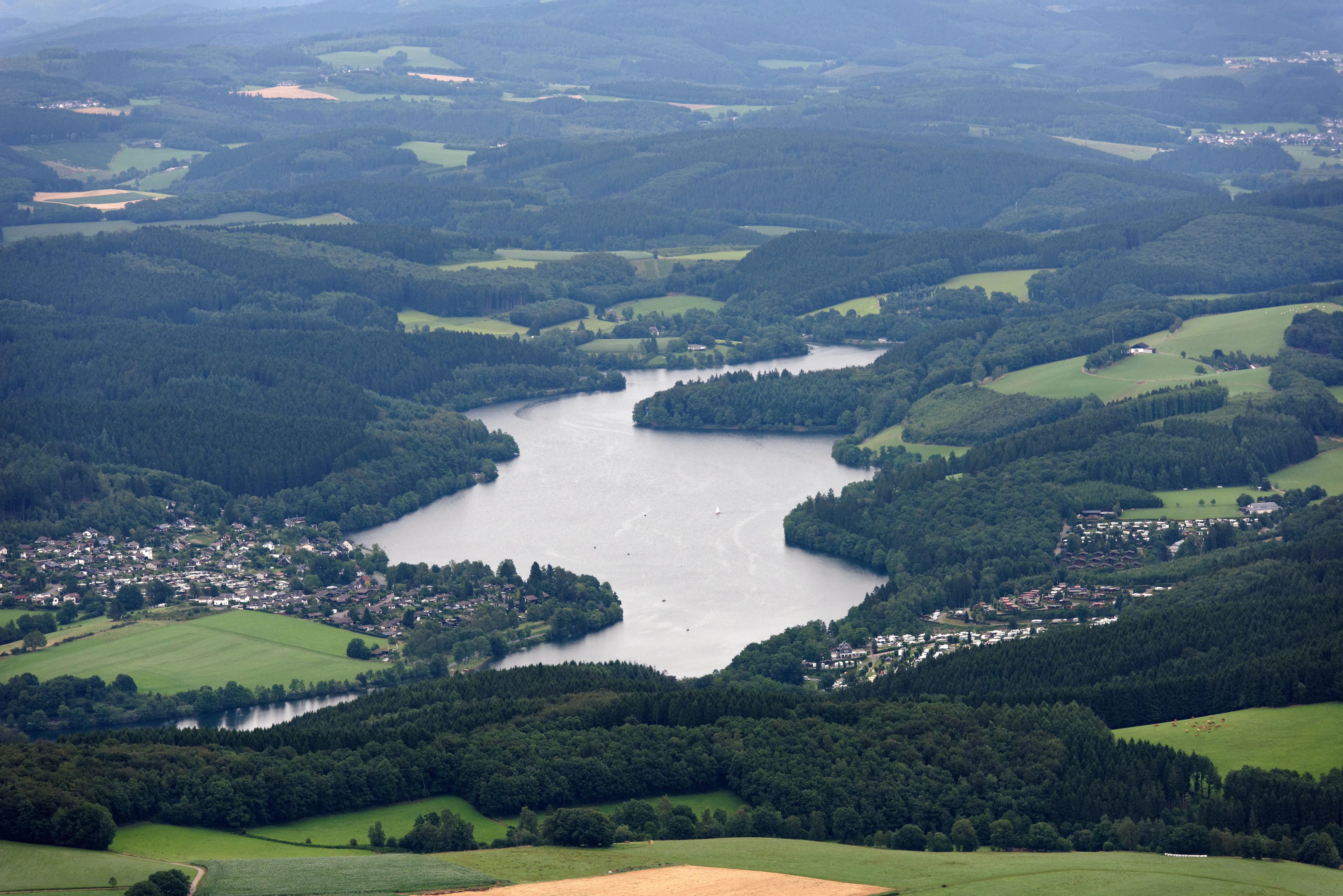
An aerial view of the Listertalsperre reservoir, surrounded by lush green forests, grassy hills, and residential areas.
Aerial view of the Listertalsperre reservoir in the Sauerland region of Germany.

Listertalsperre history and protected-area timeline

The history of Listertalsperre begins with the founding of the Ruhrtalsperrenverein in 1899, an association created to secure water supplies for the booming Ruhr industrial region. The government master builder Ernst Link identified the Lister valley as a particularly suitable dam site, and his 1905 expert report led to the founding of the Listertalsperrengenossenschaft, a cooperative that built the dam with financial support from the Ruhrtalsperrenverein.

Construction began on 13 September 1909 and the dam was ceremonially inaugurated on 5 July 1913 by the cooperative's director Kluge of Braunschweig. The gravity dam with its characteristic Intze wedge on the water side was a typical example of Sauerland dam engineering of the period, with a 264-meter-long crown and a 42-meter height producing a 4.5-kilometer-long reservoir.

Early in its history, the dam incorporated a small hydroelectric power station with two generators of 370 kilowatts each, financed by the cooperative to offset construction costs. In 1908, the Ruhrtalsperrenverein took over this hydropower facility when local electricity companies showed little interest, and in 1912 a power exchange agreement was reached with the Elektrizitätswerk Siegerland. These activities evolved into the Lister- und Lennekraftwerke, later a wholly owned subsidiary of the Ruhrverband. A third generator of 920 kilowatts was added in 1915 as demand grew.

A 1943 British Royal Air Force raid during Operation Chastise, the famous "Dambusters" mission, targeted the Listertalsperre together with the Möhne and Eder dams. The attack on Listertalsperre failed to breach it, although the simultaneous strikes on the Möhne and Eder dams caused devastating flooding downstream. After the war, growing water demand led to the construction of the much larger Biggetalsperre above Attendorn between 1957 and 1965. This new dam swallowed the upper two thirds of the Lister reservoir and reduced the older dam to a forebay, the role it still plays today.

Listertalsperre landscape and geographic character

The Listertalsperre sits in a wooded, gently sloping section of the central Sauerland, a low mountain region characterized by densely forested ridges, narrow valleys, and small stream systems. The reservoir follows the Lister valley for about 4.5 kilometers, with a maximum width of around 400 meters, winding between the slopes of the Rothaargebirge foothills near the Bundesautobahn 45.

The dam is a prominent engineered feature in this otherwise natural setting: a 264-meter-long, 42-meter-high wall of rough broken stone, finished with a flatter crown that carries a roadway and a walking and cycling path. The water side shows the characteristic Intze wedge, while the air side displays the textured, irregular masonry that makes the dam a recognizable landmark in the landscape. Scour outlets and the original valve tower structures add to the dam's distinctive silhouette.

Surrounding the lake are small villages such as Hunswinkel, Windebruch, Kalberschnacke, Herpel, Eichen, and Wörmge, connected by local roads that frame the reservoir within a cultural landscape of mixed forest, pasture, and rural settlement. Campgrounds, marinas, and walking trails have been laid out along the shoreline, integrating the dam into the broader recreational landscape of the Naturpark Sauerland-Rothaargebirge.
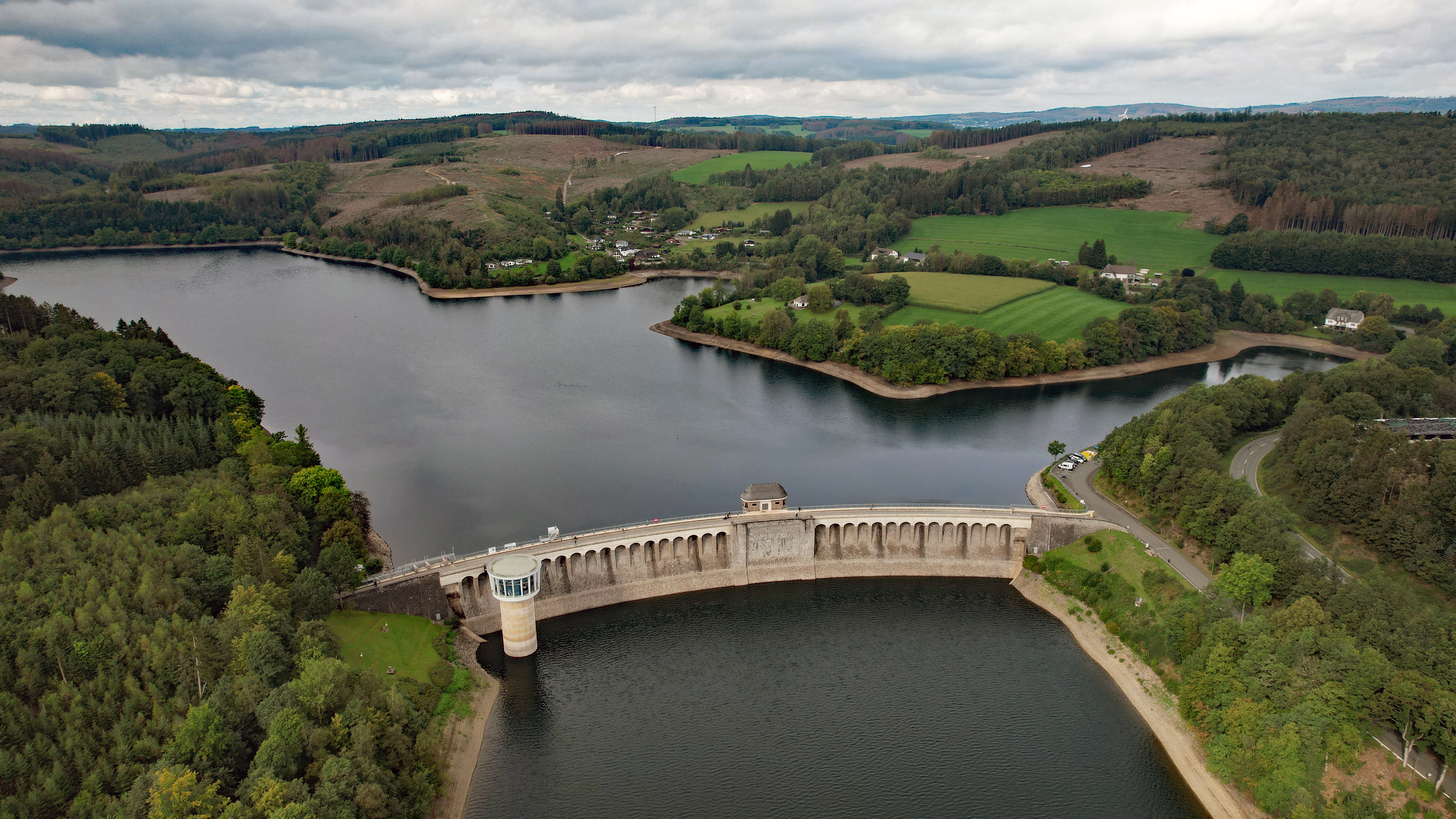
An aerial shot of a large curved concrete dam spanning across a wide reservoir, surrounded by lush green hills, forests, and fields under a cloudy sky.
Aerial view of the historic Listertalsperre dam and reservoir in North Rhine-Westphalia.

Listertalsperre ecosystems, habitats, and plant life

Ecologically, Listertalsperre represents a typical Sauerland reservoir habitat, where conifer and mixed beech forest on the surrounding slopes meets an open water body with fringing reed and floating vegetation. The submerged upper end of the lake, where the Bigge reservoir reaches into the Lister valley, has softened the transition between the two water bodies into a broad, shallow aquatic zone.

The most ecologically distinct area is the protected zone at the inflow of the Lister, where reed belts and floating leaf vegetation support a population of water knotweed. These reed and marsh communities provide both breeding habitat and shelter along the shoreline, and they are reinforced by the protection status attached to this segment of the lake.

Since 2013, the lake and its shoreline have also been embedded in the larger Landschaftsschutzgebiet Biggesee / Listersee, which places roughly 738 hectares under landscape protection and ties the reservoir into a broader ecological framework of low mountain forests, streams, and agricultural land in the Sauerland.
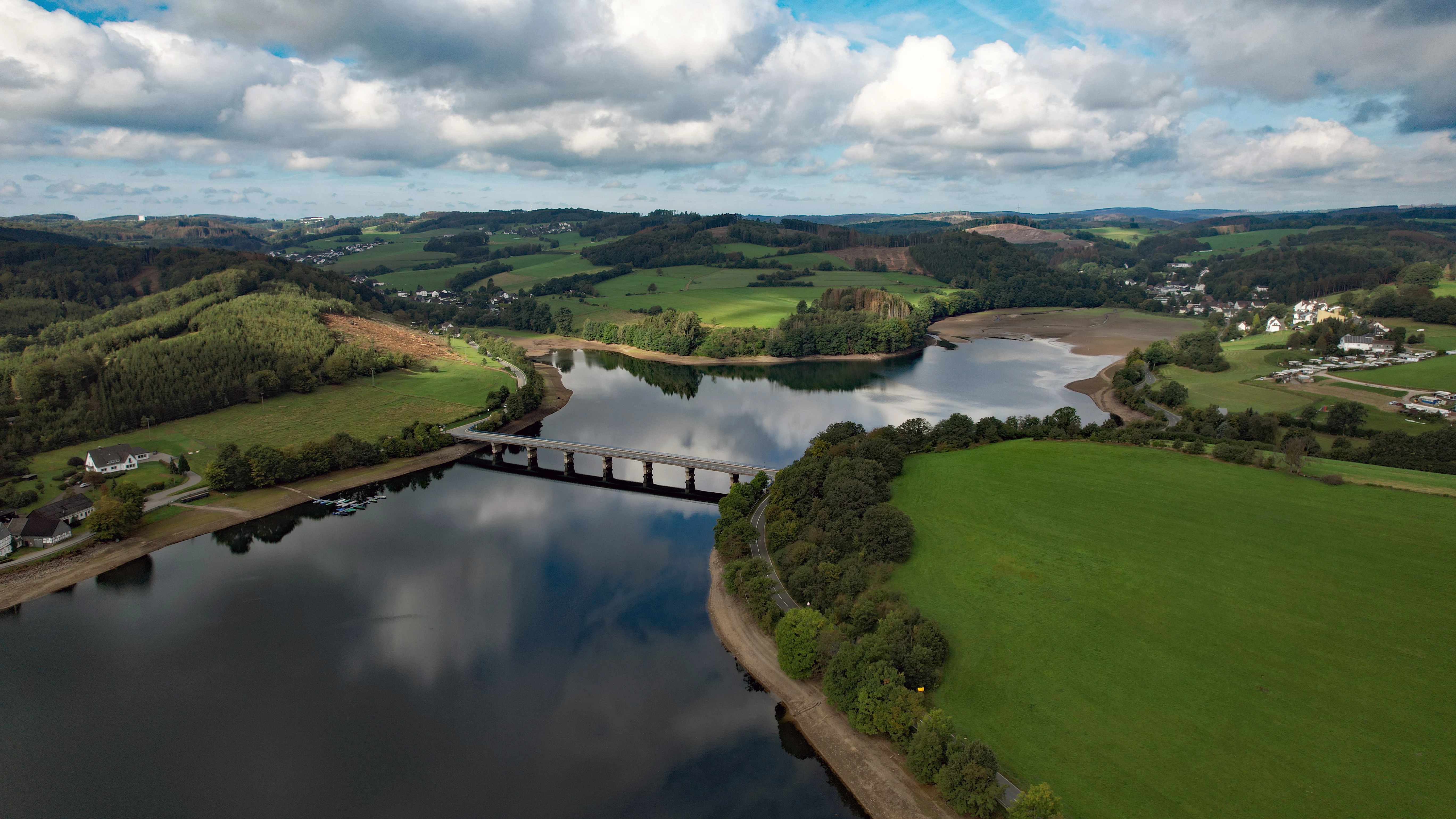
An aerial shot of a long reservoir bridge spanning a calm body of water, surrounded by green fields, pastures, and rolling hills under a cloudy sky.
Aerial view of the Listertalsperre reservoir and its surrounding hilly landscape in the Sauerland region.

Listertalsperre wildlife and species highlights

The protected inflow area of the Lister is the most wildlife-relevant part of the lake. It is regularly used as a breeding and resting site by great crested grebes, coots, and mallards, all of which nest in the reed and floating leaf vegetation at the head of the reservoir. The site is classified as an important refuge and stepping-stone biotope especially for waterfowl, providing refuge during migration and breeding.

The lake also supports a notable population of the strongly threatened pond mussel, which lives in the protected shallows at the Lister inflow. Larger parts of the open water are additionally important for fish, with a structured fish population that includes whitefish, pike, maraene, trout, Alpine char, and pike-perch, as well as eel. The Ruhrverband manages fish stocks using its own hatchery at the Möhnetalsperre, ensuring ecological balance between recreational angling and conservation.
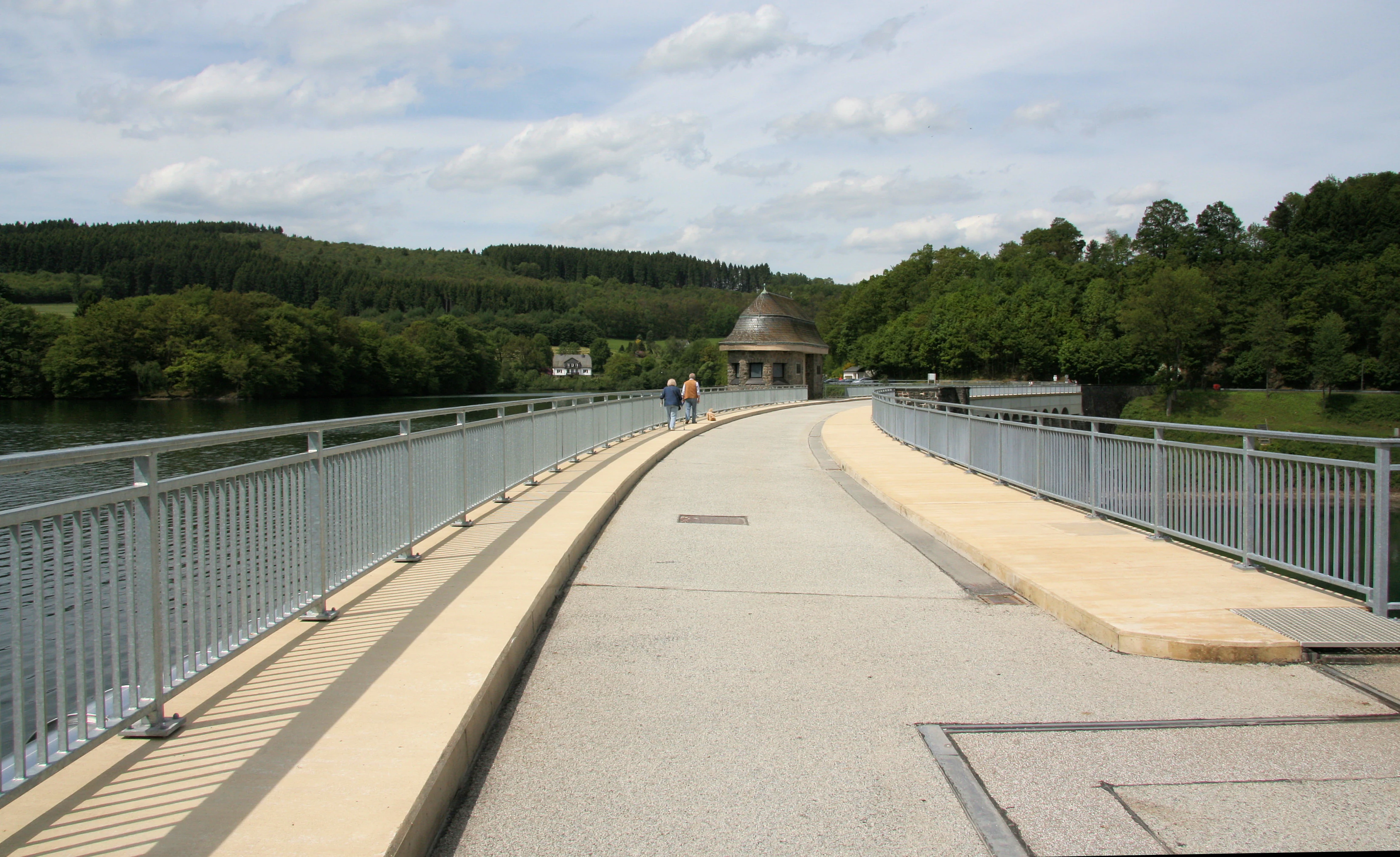
A paved path runs across the dam wall of a reservoir, flanked by metal railings on both sides. In the distance, a small dome-roofed structure sits on the dam, with people walking towards it. Green forested hills surround the water.
A view across the dam wall of the Listertalsperre.

Listertalsperre conservation status and protection priorities

Conservation at Listertalsperre centers on a small, designated nature reserve at the Lister inflow, protected since 2001 under the Landschaftsplan Nr. 6 Meinerzhagen of the Märkischer Kreis. Although only a few hectares in size, this reserve safeguards one of the most ecologically valuable parts of the reservoir, including reed communities, floating leaf vegetation, and waterfowl breeding sites.

Beyond this core area, the protection story of the lake is tightly bound to its broader role in regional water management. As part of the Ruhrverband's water supply system, the reservoir supports low-flow augmentation of the Ruhr and drinking water extraction for the Kreis Olpe, both of which are themselves conservation-relevant services that sustain downstream ecosystems and municipal water security.

Since 2013, the lake and its shore areas have been incorporated into the Landschaftsschutzgebiet Biggesee / Listersee, a landscape protection area of roughly 738 hectares. This layered protection, from the small nature reserve at the inflow to the surrounding landscape protection area, places the reservoir within a comprehensive regional conservation framework for the Sauerland foothills.

Listertalsperre cultural meaning and human context

The lake is closely tied to the small villages of the Lister and Bigge valleys: Hunswinkel, Windebruch, Kalberschnacke, Herpel, Eichen, and Wörmge. These settlements have grown alongside the dam and its recreational use, with campsites, ferry-like marinas, and holiday apartments now an established part of the local economy.

The dam also has a recognized place in the industrial heritage of the Ruhr region. As one of the earlier reservoirs built for water supply to the heavy industry of the Ruhr area, it represents the early twentieth-century engineering effort to manage the water resources of the Sauerland for the benefit of the lowland industrial heartland of Germany. This dual identity, as both an industrial-era waterworks and a modern Sauerland recreation lake, shapes how local communities relate to the Listertalsperre today.
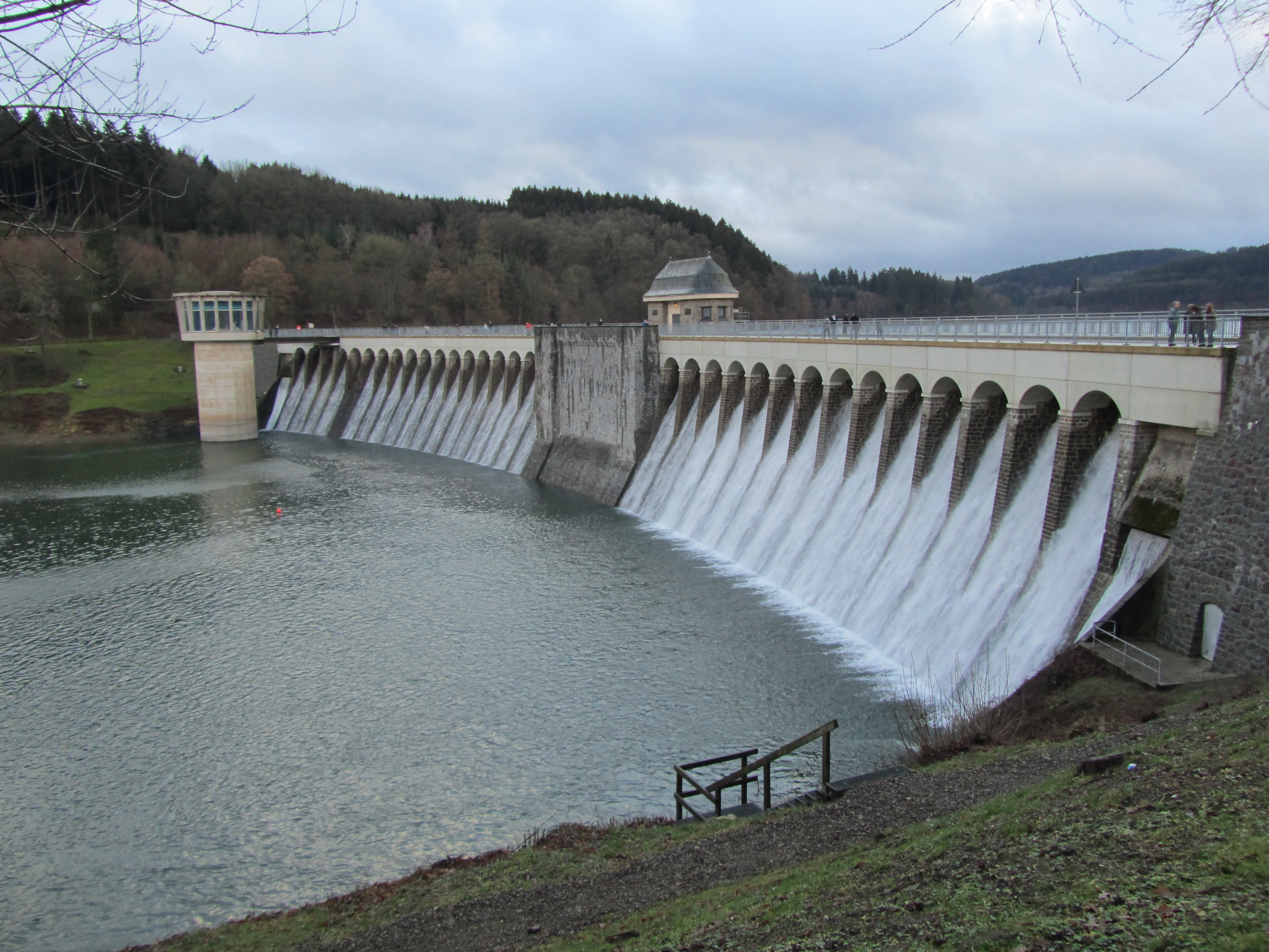
A stone dam spillway with multiple arched openings, releasing cascading water into the reservoir behind a forested hillside under an overcast sky.
The historic dam spillway at Listertalsperre during a period of water discharge.

Top sights and standout views in Listertalsperre

Among the highlights of Listertalsperre are the historic broken-stone masonry dam with its characteristic Intze wedge, the dramatic wartime significance of the failed 1943 Operation Chastise raid, and the unusual hydrological role of the lake as a forebay for the much larger upstream Biggetalsperre.

Equally noteworthy are the protected waterfowl habitat at the Lister inflow, the layered system of nature and landscape protection that surrounds the lake, and the broad mix of recreational uses, from angling and sailing to diving and walking the dam crest, that make it a year-round Sauerland destination.
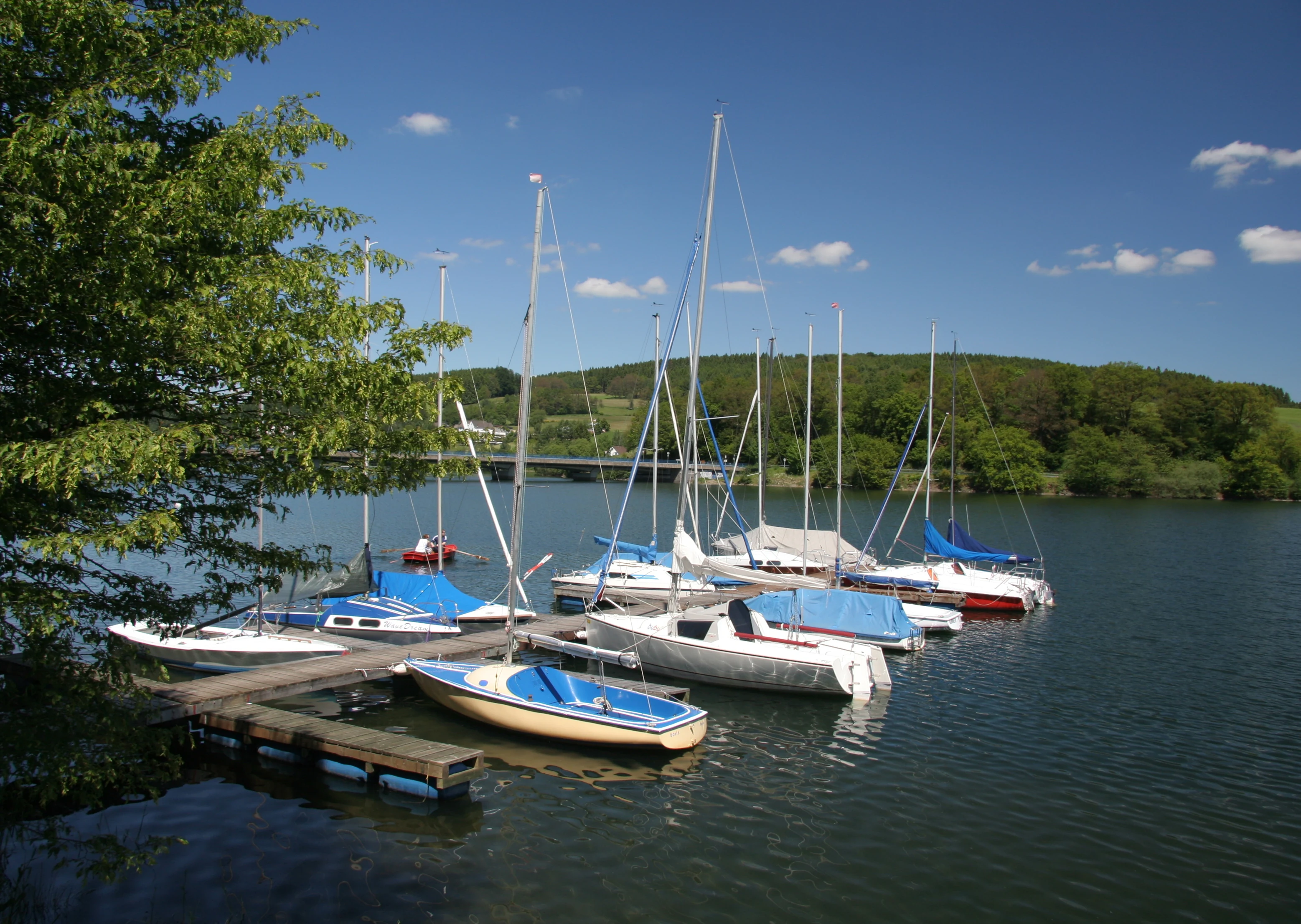
A group of small sailboats moored to a wooden dock on a calm lake, with green, forested hills in the background under a blue sky.
Small sailboats docked on the calm waters of the Listertalsperre reservoir.

Best time to visit Listertalsperre

Late spring through early autumn is the most rewarding period to visit Listertalsperre, when water levels are typically stable, swimming and sailing conditions are best, and the protected reed zones at the Lister inflow are most active with breeding waterfowl. Summer brings the warmest water and the liveliest atmosphere around the campsites and marinas. The surrounding forests of the Sauerland also make autumn a scenic season for walking and cycling along the dam crest and surrounding trails. Winter visits offer a quieter, more dramatic experience, with the dam occasionally seen overflowing amid the bare, forested ridges of the Rothaargebirge.


Monthly climate preview

Long-term representative measurements of monthly temperature ranges and daily precipitation patterns

Listertalsperre Climate Normals, Annual Temperature and Precipitation Profiles

Listertalsperre records long-term monthly temperature averages ranging from negative values in winter to warm peaks alongside steady daily precipitation rates. Examining the full twelve-month profile provides detailed meteorological context across the representative elevation point.
Annual mean8 °C
-1 °C17 °C
Jan-1°
Feb
Mar
Apr
May12°
Jun15°
Jul17°
Aug17°
Sep13°
Oct
Nov
Dec
Warmest month
July

17.4 °C

Coolest month
January

-0.7 °C

Wettest month
December

3 mm/day

Driest month
April

1.8 mm/day

Park location guide

Geography guide, regional context, and park location map for Listertalsperre

Listertalsperre park geography, regions, and map view in Germany

Understand where Listertalsperre sits in Germany through a broader geographic reading of the surrounding landscape, nearby location context, and its mapped position within the national park landscape.

How Listertalsperre fits into Germany

Germany is a federal republic in Western and Central Europe with a population of over 83 million across sixteen constituent states. It is Europe's largest economy by nominal GDP and a major global exporter and importer. The capital is Berlin, and the country borders Denmark, Poland, Czech Republic, Austria, Switzerland, France, Luxembourg, Belgium, and the Netherlands.

Wider geography shaping Listertalsperre in Germany

Germany is located in Western and Central Europe, spanning 357,022 km². It borders Denmark to the north, Poland and the Czech Republic to the east, Austria and Switzerland to the south, and France, Luxembourg, Belgium, and the Netherlands to the west. The country has coastlines on the Baltic Sea and North Sea to the north, with the Alps located in the southern region.

Map view of Listertalsperre

Use this park location map to pinpoint Listertalsperre in Germany, understand its exact geographic position, and read its mapped placement within the surrounding landscape more clearly.

Pigeon | © OpenStreetMap contributors

Location context for Listertalsperre

Kreis OlpeNordrhein-Westfalen

Protected area views, masonry dam architecture, and forested valley scenery.

Listertalsperre Photos and Visual Landscapes: Exploring the Sauerland Reservoir

Visual documentation captures the forested ridges, narrow valleys, and historic stone masonry defining the Listertalsperre protected environment. Detailed photography reveals the unique topography and water habitats shaping this regional Sauerland landscape.

An aerial view of the Listertalsperre reservoir, surrounded by lush green forests, grassy hills, and residential areas.

An overhead aerial view of a curved concrete dam wall separating two bodies of dark water, with a small observation tower in the water and a road leading to the bank.

An aerial shot of a large curved concrete dam spanning across a wide reservoir, surrounded by lush green hills, forests, and fields under a cloudy sky.

An aerial shot of a long reservoir bridge spanning a calm body of water, surrounded by green fields, pastures, and rolling hills under a cloudy sky.

A paved path runs across the dam wall of a reservoir, flanked by metal railings on both sides. In the distance, a small dome-roofed structure sits on the dam, with people walking towards it. Green forested hills surround the water.

A wide view of the Listertalsperre reservoir with a calm water surface and trees lining the banks.

A stone dam spillway with multiple arched openings, releasing cascading water into the reservoir behind a forested hillside under an overcast sky.

A group of small sailboats moored to a wooden dock on a calm lake, with green, forested hills in the background under a blue sky.

A wide angle view of the concrete dam wall stretching across the Listertalsperre reservoir, with a small stone tower on the right and forested hills in the background.

A wide shot showing a large campground nestled into a forested hillside overlooking the Listertalsperre reservoir, with a small boat visible on the water.

A group of people standing in and near the water on a small sandy beach at the edge of the Listertalsperre reservoir, with a long bridge visible in the background against rolling green hills.

Park atlas

Compare regional park geography and adjacent forested valley reserves in Sauerland

Explore Parks Near Listertalsperre and Surrounding Protected Landscapes

Browse other parks near Listertalsperre to evaluate adjacent forested ridges, valley reservoirs, and regional protected landscapes. Comparing nearby protected areas reveals broader patterns in regional conservation terrain and low mountain topography.
Nature reserveKreis Olpe
About 8.3 km away#1 closest

Southeast

Naturschutzgebiet Ahetal und Langes Siepen: Geography and Protected Area Overview

Nature reserve in the Rothaar foothills, Kreis Olpe

Covering the Ahe valley and its headwater catchment, this nature reserve is defined by its exceptionally dense concentration of seepage springs and near-natural brooks. The landscape transitions from shaded alder-lined seepage valleys into open, species-rich grassland, providing a critical refuge for local woodland species. As part of the Rothaarvorhöhen biotope network, it represents a significant, compact example of central upland stream valley geography.

Area
0.407 km²
Established
2020
Water
Major water bodies
Nature reserveNorth Rhine-Westphalia
About 9 km away#2 closest

North

Heinrich-Bernhard-Höhle Nature Reserve and Karst Landscape in North Rhine-Westphalia

Examining the geology and protection status of the Sauerland karst system

The Heinrich-Bernhard-Höhle represents a unique convergence of conservation designations, functioning as a nature reserve, paleontological monument, and FFH habitat area. Centered on a 192-meter limestone cave network, the site preserves essential subterranean geological structures and surface beech forests within the North Rhine-Westphalia region.

Area
0 km²
Established
1934
Relief
Upland
Access
Highly restricted
A soft watercolor illustration of a landscape featuring green rolling hills, a meandering river or stream, and distant low mountains under a light sky.
Nature reserveNorth Rhine-Westphalia
About 9.3 km away#3 closest

Northeast

Naturschutzgebiet Ahauser Klippen und Stausee: Protected Area and Limestone Landscape Atlas

A key nature reserve in the Attendorn-Elsper limestone basin of North Rhine-Westphalia.

Naturschutzgebiet Ahauser Klippen und Stausee is a compact yet ecologically rich nature reserve defined by carbonate geology and steep cliff biotopes. The area serves as a core refugial site within the Sauerland, integrating diverse forest stands, rare fissure vegetation, and essential waterbird resting zones at the reservoir edge.

Area
0.239 km²
Established
2003
IUCN
IV
Relief
Upland
Nature reserveKreis Olpe
About 9.9 km away#4 closest

Southeast

Naturschutzgebiet Olpetal und Altenkleusheimer Bachtal: Protected Valley and Brook Geography

Riparian ecosystems in the Kreis Olpe district

Located in the Rothaar foothills, this nature reserve spans nearly 37 hectares of stream valleys and floodplain meadows. The protected landscape includes alder-lined watercourses, spring-fed wetlands, and diverse slope vegetation, serving as a core component of the regional biotope network in North Rhine-Westphalia.

Area
0.372 km²
Established
2020
Relief
Upland
Climate
Temperate
A horizontal watercolor painting depicting a gentle, light-filled landscape featuring soft green trees, rolling hills, and a small water feature.
Nature reserveNorth Rhine-Westphalia
About 11 km away#5 closest

Northeast

Hohe Ley Nature Reserve: Limestone Cliffs and Forest Geography in North Rhine-Westphalia

Protected calcareous woodland and raptor breeding habitat

This nature reserve in the Sauerland region features a prominent limestone cliff and a complex mosaic of woodruff and wavy hair grass beech forests. As part of a larger European habitat network, the reserve supports rare dry grassland and ravine woodland communities. Its topography provides critical nesting sites for eagle owls and common kestrels, anchoring a valuable ecological corridor within the local landscape.

Area
0.498 km²
Established
1981
Watercolor painting of a soft, rolling landscape with light green fields, scattered trees, and muted pink-toned hills.
Nature reserveNorth Rhine-Westphalia
About 11 km away#6 closest

North

Naturschutzgebiet Oberes Elsetal: Protected Brook Valley Geography in North Rhine-Westphalia

Mapping riparian ecosystems and low mountain range stream habitats.

Naturschutzgebiet Oberes Elsetal offers a detailed look at the structural interplay between spring-fed brooks and adjacent marshy grasslands. This nature reserve in the Südsauerländer Bergland provides an instructive map of how riparian alder gallery woodland, oak-hornbeam forest, and wet meadow communities converge in a compact, highly specialized valley setting.

Area
0.053 km²
Established
1998
Relief
Upland
Scope
Terrestrial
Nature reserveKreis Olpe
About 13 km away#7 closest

Northeast

Wunderwäldchen Nature Reserve: Mapping Botanical Biodiversity in the District of Kreis Olpe

A cross-boundary woodland refuge in the Sauerland region

Wunderwäldchen is a protected nature reserve spanning the border of two municipalities in Kreis Olpe. This small beech and oak woodland serves as a critical botanical refuge, sustaining rare plant species on its carbonate-enriched soils. It remains a key example of how even minute, fragmented habitats provide essential ecological value within the densely managed landscapes of the Lenne valley.

Area
0.007 km²
Established
1981
IUCN
IV
Relief
Upland
Nature reserveNordrhein-Westfalen
About 17 km away#8 closest

North

Naturschutzgebiet Schlänke: Woodland Conservation in the Märkischer Kreis Region

Protected beech-forest terrain and spring-blooming flora

Spanning roughly 0.6 hectares, Naturschutzgebiet Schlänke is a focused nature reserve dedicated to the preservation of native deciduous woodland. The site occupies a north-facing slope, creating specific moisture conditions that sustain a notable population of spring snowflakes, marking it as a significant botanical patch within the broader forested landscape of Plettenberg.

Area
0.006 km²
Established
1985
Relief
Upland
Climate
Temperate

Common questions about visiting, size, designation, and location context for Listertalsperre

Listertalsperre FAQs for park facts, access, geography, and protected area context

Find quick answers about Listertalsperre, including protected-area facts, park geography, trail and visitor context, and how the park fits into its surrounding country and regional landscape.
MoriAtlas Explorer

Continue Your Protected Areas Search Across the Global Atlas

Deepen your exploration by continuing the structured search for national parks and protected areas worldwide. Utilize the comprehensive filtering capabilities to compare different conservation landscapes and refine your understanding of global park geography. Discover more about the distribution and characteristics of protected natural areas.

Global natural geography