

Mori Atlas logo
Protected areaLittle High Rock Canyon Wilderness

A focused geographic look at the canyon-centered wilderness and high desert terrain of the Great Basin

Little High Rock Canyon Wilderness: An Atlas of Rugged Canyon Terrain and Protected Nevada Landscapes

Little High Rock Canyon Wilderness stands as a protected corridor within the broader High Rock country of northwestern Nevada. This narrow, basalt-walled canyon provides a dramatic contrast to the surrounding sagebrush uplands and playa edges of the Great Basin. Map this unique protected area to understand its position within the Black Rock-High Rock landscape and explore the intersection of rugged desert geology with regional history.

wilderness areaGreat Basin desertBlack Rock Desert regioncanyon landscapesagebrush steppeBureau of Land Management

Little High Rock Canyon Wilderness

Protected area

Park overview

Structured park overview, official facts, and landscape profile for Little High Rock Canyon Wilderness

Little High Rock Canyon Wilderness park facts, protected area profile, and essential visitor context

Review the core facts for Little High Rock Canyon Wilderness, including designation, size, terrain, visitor scale, habitats, and operating context in one park-focused overview.

About Little High Rock Canyon Wilderness

Little High Rock Canyon Wilderness occupies a compact but visually striking position within the larger mosaic of protected lands in the Black Rock-High Rock country of northwestern Nevada. Managed by the Bureau of Land Management and formally designated in 2000, it belongs to a network of ten wilderness areas associated with the Black Rock Desert-High Rock Canyon Emigrant Trails National Conservation Area. The wilderness lies between High Rock Canyon Wilderness to the north and High Rock Lake Wilderness to the east, reinforcing its identity as part of a connected desert-canyon landscape rather than a stand-alone tract.

The defining feature of the area is the canyon for which it is named. Where much of the surrounding region consists of broad basalt tablelands, sagebrush flats, and dry playa edges tied to the Black Rock Desert, Little High Rock Canyon drops into a narrower, more enclosed corridor with steeper walls and more varied terrain. This contrast gives the wilderness a textured feel within an otherwise expansive and open setting, and it provides habitat conditions that differ from the surrounding uplands.

Although smaller than many of the neighboring wilderness blocks, the area is closely tied to broader regional trails and travel corridors. The High Rock Canyon system is recognized as part of the historic Applegate-Lassen emigrant route, and the broader network of canyons, springs, and desert uplands around Little High Rock Canyon has long served as seasonal ground for indigenous peoples, later travelers, and frontier-era livestock operations. Together, the canyon geology, the desert context, and the layered human history give the wilderness a distinctive place within Nevada's BLM-managed conservation landscape.

Quick facts and research context for Little High Rock Canyon Wilderness

Little High Rock Canyon Wilderness is a Bureau of Land Management wilderness area located in the Black Rock Desert region of northwestern Nevada. Designated in 2000, it sits south of the High Rock Canyon Wilderness and west of the High Rock Lake Wilderness, and is one of ten wilderness areas grouped within the Black Rock-High Rock NCA complex administered out of Winnemucca.

The terrain is centered on a steep, narrow canyon cut into the broader High Rock landscape, transitioning into the surrounding sagebrush steppe and basalt flats that characterize this part of the Great Basin. The area is closely associated with the historic Applegate-Lassen emigrant trail corridor and with significant early twentieth-century events involving the region's indigenous peoples and frontier livestock operators.

Protection and recognition

Examine the terrestrial protection scope and documented designation details for this wilderness area.

Little High Rock Canyon Wilderness Protection Status and Recognition Data

Little High Rock Canyon Wilderness maintains a documented terrestrial protection scope within the regional conservation network. Review the structured administrative records and official designation attributes associated with this protected landscape.

Protection details

Protection scope
Terrestrial
Transboundary protection
No
Park context

Deeper park guide and search-rich context for Little High Rock Canyon Wilderness

Little High Rock Canyon Wilderness history, landscape, wildlife, and travel context

Explore Little High Rock Canyon Wilderness through its history, landscape character, ecosystems, wildlife, conservation priorities, cultural context, and seasonal travel timing in a structured park guide built for atlas discovery and search intent.

Why Little High Rock Canyon Wilderness stands out

Little High Rock Canyon Wilderness is best known for the deep, rugged side canyon itself, which provides one of the more sheltered and topographically dramatic breaks in the otherwise expansive sagebrush and playa country of the Black Rock-High Rock region. Equally distinctive is the canyon's place in the history of the Northern Paiute band of Mike Daggett. The 1911 conflict that began here, culminating in the Battle of Kelley Creek near Winnemucca, is a defining episode in the wilderness's identity and is commemorated by a plaque placed at the canyon in 2005. The wilderness therefore stands out as a place where remote Great Basin landscape and documented frontier-era indigenous history intersect.

Little High Rock Canyon Wilderness history and protected-area timeline

Long before its designation as a wilderness, the Little High Rock Canyon area carried a significant place in the human history of northwestern Nevada. The canyon sits within the traditional lands of the Northern Paiute people, and the wider High Rock corridor was used historically by indigenous groups moving through the desert basins and along water sources in the canyon system.

The canyon's most prominent historical episode occurred in the winter of 1911. Mike Daggett and his band were camped at Little High Rock Canyon, where they ran low on food and killed cattle from nearby rangelands. When a cattleman and three sheepmen went to investigate the missing stock, Daggett and his party killed them at the camp. Pursued eastward across the desert, the group was eventually tracked to Kelley Creek near Winnemucca, where the Battle of Kelley Creek took place. Daggett and seven members of his band were killed along with one member of the pursuing posse, while only four children of the band survived.

The canyon itself remained part of the broader emigrant and ranching landscape of the High Rock country through the twentieth century. In 2000, the area was formally designated as Little High Rock Canyon Wilderness through the National Wilderness Preservation System, placing it under Bureau of Land Management management and grouping it with neighboring wildernesses within the Black Rock-High Rock NCA complex. In 2005, a commemorative plaque describing the events of 1911 was placed at Little High Rock Canyon, marking the site as a place of documented historical significance alongside its protected natural value.

Little High Rock Canyon Wilderness landscape and geographic character

The landscape of Little High Rock Canyon Wilderness is defined by a sharp contrast between enclosed canyon terrain and the open desert that surrounds it. The canyon's walls rise abruptly out of the basalts and sage flats, creating a narrow, more sheltered corridor that runs roughly north toward the larger High Rock Canyon system. The result is a small but visually dramatic break in an otherwise broad and gently sloping terrain.

Outside the canyon, the wilderness transitions into the characteristic landforms of the northwestern Nevada Great Basin: rolling sagebrush uplands, scattered basalt outcrops, dry washes, and playa edges associated with the Black Rock Desert complex. Elevations in the area are high relative to the broader desert, and the combination of open flats and sudden canyon incision gives the area a layered sense of depth. Elevations along the wilderness reach around 1,677 meters at the highest referenced points, putting the area squarely within the high-desert character of the region.

The broader viewshed encompasses the long, sinuous profile of High Rock Canyon itself and, in clear conditions, the distant horizons of the Black Rock Desert playa. This setting reinforces the wilderness's role as a transitional piece in a much larger landscape, where the small, focused canyon geography provides one of the more sheltered, textured environments within a vast and open terrain.

Little High Rock Canyon Wilderness ecosystems, habitats, and plant life

Little High Rock Canyon Wilderness captures a small but ecologically meaningful slice of the High Rock country. The canyon's walls and seasonal drainage concentrate moisture and create microclimates that differ from the surrounding uplands, and the transition from canyon bottom to sagebrush flat supports a typical Great Basin gradient of desert vegetation. Where water persists in the canyon system, plant life shifts toward denser riparian and wash-edge communities.

Sagebrush steppe dominates the broader wilderness, with the characteristic mix of basin sagebrush, rabbitbrush, and other drought-adapted shrubs that cover much of northwestern Nevada. The basalt and ash-derived soils of the region host hardy bunchgrasses and forbs that bloom seasonally, while the rocky canyon walls and talus provide habitat for raptors and other cliff-associated wildlife. Despite its modest size, the area contributes to ecological connectivity within the larger Black Rock-High Rock conservation complex, allowing species to move between the canyons, uplands, and desert flats.

The wilderness also reflects the harsh climatic character of the region, with cold winters, hot dry summers, and limited surface water for much of the year. Vegetation and wildlife patterns across the area are shaped accordingly, favoring species adapted to wide temperature swings, sparse moisture, and the seasonal productivity pulses typical of high-desert ecosystems.

Little High Rock Canyon Wilderness wildlife and species highlights

The wildlife of Little High Rock Canyon Wilderness reflects the broader ecological character of the Black Rock-High Rock region, with species typical of sagebrush steppe, rocky canyon habitat, and the playa margins of northwestern Nevada. Mule deer and pronghorn are among the larger mammals moving through the area, using the canyons and uplands for cover and the open flats for foraging. Smaller mammals such as jackrabbits, ground squirrels, and various rodent species are common across the sagebrush slopes and along the canyon's edges.

The canyon's steep walls, talus, and sheltered ledges provide nesting and perching habitat for raptors, and the broader desert supports typical Great Basin birdlife including sagebrush-associated songbirds. Reptiles adapted to arid conditions, including various lizard species, are part of the wildlife community, and seasonal water sources, where present, concentrate both birds and mammals.

Because the wilderness sits between High Rock Canyon Wilderness and High Rock Lake Wilderness, it functions as part of a larger network of habitat for wide-ranging species. Although the area itself is small, it adds structural diversity to the landscape and supports wildlife movement corridors that link canyon habitats with the surrounding sagebrush uplands and desert flats of the High Rock-Emigrant Trails conservation area.

Little High Rock Canyon Wilderness conservation status and protection priorities

Little High Rock Canyon Wilderness is protected under the National Wilderness Preservation System and managed by the Bureau of Land Management, giving it long-term federal protection against development, road construction, and other forms of landscape alteration. Its designation in 2000 added a focused canyon-centered component to the broader conservation strategy of the Black Rock-High Rock region, building on the foundation provided by the surrounding Black Rock Desert-High Rock Canyon Emigrant Trails National Conservation Area.

The area's conservation value lies in its physical character as well as its connectivity. The narrow canyon preserves a distinct rugged landform within an otherwise vast, open desert, maintaining habitat conditions that differ from the surrounding uplands. By grouping ten wilderness areas within the larger NCA complex, BLM conservation planning effectively treats Little High Rock Canyon as one piece in a much larger protected mosaic, where small individual wildernesses contribute collectively to ecological function across the region.

The placement of a commemorative plaque at the canyon in 2005 also reflects an effort to recognize the area's cultural and historical integrity alongside its natural values, integrating the protection of an important site in Northern Paiute and frontier-era history into the broader management of the wilderness.

Little High Rock Canyon Wilderness cultural meaning and human context

Little High Rock Canyon sits within the traditional lands of the Northern Paiute, whose seasonal movements and use of water sources in the High Rock canyon system shaped the human history of the region long before Euro-American arrival. The canyon's sheltered terrain and any water it held would have made it a meaningful place within that broader pattern of desert life.

The canyon's most noted cultural significance comes from its central role in the events of 1911, when Mike Daggett and his band camped there during a harsh winter. The conflict that followed, culminating in the Battle of Kelley Creek near Winnemucca, is part of a difficult and well-documented chapter in the history of indigenous-settler relations and frontier-era livestock operations in Nevada. Daggett's band, the stockmen who pursued them, and the surviving children became part of the region's remembered past.

Today, a plaque installed at Little High Rock Canyon in 2005 acknowledges the site's significance, allowing the wilderness to function not only as a natural area but also as a place of historical memory within the broader Applegate-Lassen emigrant trail landscape and the wider cultural heritage of the High Rock country.

Top sights and standout views in Little High Rock Canyon Wilderness

Little High Rock Canyon Wilderness offers a compact, canyon-centered experience within the expansive Great Basin desert, packing rugged slopes, sheltered terrain, and dry washes into a small but visually distinct part of the Black Rock-High Rock landscape. Its position between the larger High Rock Canyon Wilderness and High Rock Lake Wilderness makes it a natural waypoint in understanding the broader protected landscape of northwestern Nevada.

The wilderness's other defining highlight is its documented historical significance, from the long indigenous presence in the High Rock country to the events of 1911 and the commemorative plaque at the canyon. Together, the geological character of the canyon and its layered human history give the area a depth that sets it apart from many of the surrounding, larger desert wilderness blocks.

Best time to visit Little High Rock Canyon Wilderness

The most pleasant conditions in Little High Rock Canyon Wilderness, as with the rest of the Black Rock-High Rock country, typically come in the spring and fall months. Spring brings cooler temperatures, occasional wildflower response in the sage flats, and the most active movement of wildlife across the broader landscape, while autumn offers stable, mild weather and clear desert air well suited to longer views across the canyon country.

Summer in this part of Nevada is hot and dry, with intense sun exposure on the surrounding flats and limited surface water, which can make canyon exploration more demanding. Winters are cold and sometimes snowy, with the same historical conditions that have shaped the canyon's human story, and access can be limited by weather. Because the area is remote, durable planning and attention to seasonal temperature swings matter as much as the specific season chosen.

Monthly climate preview

Long-term representative temperature and precipitation averages recorded for Nevada

Little High Rock Canyon Wilderness Climate Normals and Monthly Weather Patterns

Representative coordinates record measured monthly temperature swings and precipitation averages across the protected terrain. Analyzing twelve-month climatology profiles clarifies long-term thermal rhythms and moisture distributions throughout the protected area.
Annual mean8 °C
-3 °C21 °C
Jan-3°
Feb-1°
Mar
Apr
May11°
Jun16°
Jul21°
Aug20°
Sep15°
Oct
Nov
Dec-3°
Warmest month
July

21.4 °C

Coolest month
December

-2.9 °C

Wettest month
May

1 mm/day

Driest month
August

0.2 mm/day

Park location guide

Geography guide, regional context, and park location map for Little High Rock Canyon Wilderness

Little High Rock Canyon Wilderness park geography, regions, and map view in United States of America

Understand where Little High Rock Canyon Wilderness sits in United States of America through a broader geographic reading of the surrounding landscape, nearby location context, and its mapped position within the national park landscape.

How Little High Rock Canyon Wilderness fits into United States of America

The United States of America is a federal presidential republic and one of the world's largest countries by area and population. It consists of 50 states across a vast territory spanning multiple time zones, with its capital in Washington, D.C. and largest city in New York City. The nation has a diverse economy, influential political system, and significant cultural and military presence globally.

Wider geography shaping Little High Rock Canyon Wilderness in United States of America

The United States occupies a vast territory in North America, bordered by Canada to the north and Mexico to the south. The 48 contiguous states stretch from the Atlantic to the Pacific Ocean, while Alaska occupies the northwestern region and Hawaii is an archipelago in the Pacific. The country encompasses diverse terrain including the Rocky Mountains, Appalachian Mountains, Great Plains, and extensive river systems.

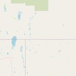
Map view of Little High Rock Canyon Wilderness

Use this park location map to pinpoint Little High Rock Canyon Wilderness in United States of America, understand its exact geographic position, and read its mapped placement within the surrounding landscape more clearly.

Pigeon | © OpenStreetMap contributors

Location context for Little High Rock Canyon Wilderness

Nevada
Recorded earthquake history

Explore the Documented Earthquake History of Little High Rock Canyon Wilderness

Review documented seismic events associated with the geography of Little High Rock Canyon Wilderness through our structured historical database. This collection offers direct access to event details for those studying the regional seismicity of this remote Nevada landscape without any hazard assessments.

Little High Rock Canyon Wilderness Earthquake History

Catalogued events

19 events

Strongest magnitude

Magnitude 4.4

Most recent event

Jul 1, 2022

This history includes earthquakes recorded inside the park or within 50 km of its borders

Park atlas

Compare adjacent desert canyons, high desert terrain, and regional wilderness landscapes.

Parks Near Little High Rock Canyon Wilderness and Surrounding Protected Areas

Browsing parks near Little High Rock Canyon Wilderness reveals connected protected areas and rugged desert terrain across northern Nevada. Expanding the geographic comparison provides deeper insight into regional high-desert landscapes and adjacent canyon ecosystems.
Wildlife reserveNevada
1.5 km away#1 closest

North

East Fork High Rock Canyon Wilderness: Protected Basin and Canyon Geography

Remote Nevada high desert and basalt canyon landscapes

Managed as a federal wilderness area, this reserve protects the rugged northeast rim of High Rock Canyon in northern Nevada. The landscape is defined by steep volcanic edges, dry drainage systems, and vast, open horizons characteristic of the Great Basin high desert. This area serves as a quiet contrast to the surrounding multi-use terrain, offering an unbroken view of one of the most desolate and striking geographic corridors in the American West.

Established
2000
IUCN
Ib
Relief
Highland
Climate
Arid
Protected landscapeCalifornia
50 km away#2 closest

West

Modoc National Forest: Protected Landscape and Warner Mountains Geography

High desert volcanic terrain in northeastern California

Modoc National Forest encompasses a massive expanse of volcanic plateaus and rugged mountain ridges in the northeastern corner of California. This protected area offers significant geographic variety, transitioning from arid sagebrush basins to lush, high-elevation conifer forests. It serves as a vital natural landscape, home to the South Warner Wilderness and large stands of old-growth timber, reflecting the unique geologic history of the regional lava flows.

Area
6,695.09 km²
Established
1904
Relief
Mountain
Access
Moderate access
A wide watercolor illustration showing a calm body of water surrounded by green hills, conifer trees, and reeds in the foreground.
Protected landscapeCalifornia
115 km away#3 closest

Southwest

Lassen National Forest: Mapped Geography and Protected Landscapes of Northern California

Volcanic terrain and expansive old growth ecosystems

Lassen National Forest represents a vast protected landscape in Northern California, defined by its severe volcanic geology and resilient conifer forests. This atlas entry provides essential geographic context regarding the forest boundaries, the volcanic rim of Mount Tehama, and the intricate river systems shaping the region. Explore the terrain, from accessible lava tubes to the wilderness areas preserved within this significant mountain corridor.

Area
4,331.53 km²
Established
1905
Relief
Mountain
Climate
Temperate
A watercolor painting showing soft green hills, distant pink-hued mountains, and a pale blue lake in a serene, stylized landscape.
Protected landscapeNevada
131 km away#4 closest

Southeast

Humboldt, Toiyabe National Forest: Protected Landscape and Regional Mountain Geography

A vast network of Nevada mountain ranges and alpine wilderness

Humboldt, Toiyabe National Forest serves as a defining public land entity across Nevada and eastern California. As the largest national forest in the contiguous United States, it preserves a striking collection of isolated mountain ranges, including the Ruby Mountains and the rugged Jarbidge wilderness, within a broader basin-and-range landscape. Examine the boundaries and terrain that characterize this complex, high-desert ecosystem.

Area
25,454 km²
Established
1908
Relief
Mountain
Access
Easy access
Protected landscapeCalifornia
136 km away#5 closest

Southwest

Plumas National Forest: Mapped Geography and Protected Landscape Features in California

Exploring the Sierra Nevada watershed and wilderness terrain

Plumas National Forest serves as a critical protected landscape in northern California, anchoring the headwaters of the Feather River system. This atlas entry details the forest's rugged canyons, high elevation mountain lakes, and significant old growth conifer stands that define its role within the northern Sierra Nevada ecosystem.

Area
4,640 km²
Established
1907
Relief
Mountain
Climate
Mediterranean
Wildlife reserveOregon
167 km away#6 closest

Northwest

Gearhart Mountain Wilderness: Protected Mountain Geography and Forest Atlas

High elevation terrain in the Fremont Winema National Forest

Spanning the border between Lake and Klamath counties, Gearhart Mountain Wilderness stands as a testament to the diverse mountain geography of south-central Oregon. The area features a complex mosaic of white fir, ponderosa pine, and pure lodgepole stands, set within a glacially sculpted landscape of cirques and ridges. This protected refuge serves as a key headwater source and mountain sanctuary, offering expansive vistas that span from the southern Cascades to the far horizon of the Oregon desert landscape.

Area
92.36 km²
Established
1943
IUCN
Ib
Relief
Mountain
National parkCalifornia
167 km away#7 closest

Southwest

Lassen Volcanic National Park: Protected Landscape Identity and Geographic Context

Discover the mapped boundaries and natural terrain of this California national park.

Gain a structured understanding of Lassen Volcanic National Park as a protected landscape. This detail page provides essential geographic context, focusing on the park's mapped boundaries and its specific terrain characteristics within California. It is designed for users seeking detailed information about the park's protected status and its placement within the broader atlas of natural areas, emphasizing its unique geographic identity and conservation significance.

Area
430.8 km²
Established
1916
IUCN
II
Visitors
504.8K annual
A soft watercolor painting depicting a serene landscape with gentle green hills, a small forest, and a calm lake at sunrise or sunset.
Protected landscapeCalifornia
169 km away#8 closest

West

Shasta, Trinity National Forest: Mapping the Protected Landscapes of Northern California

Volcanic peaks, expansive reservoirs, and rugged mountain wilderness

Spanning over two million acres, Shasta, Trinity National Forest represents a major protected landscape in Northern California. The geography includes the iconic Mount Shasta volcano and the complex shoreline of Shasta Lake, while hosting expansive wilderness areas and diverse terrain ranging from oak-forested foothills to alpine meadows.

Area
8,942.87 km²
Established
1954
Relief
Mountain
Climate
Temperate

Common questions about visiting, size, designation, and location context for Little High Rock Canyon Wilderness

Little High Rock Canyon Wilderness FAQs for park facts, access, geography, and protected area context

Find quick answers about Little High Rock Canyon Wilderness, including protected-area facts, park geography, trail and visitor context, and how the park fits into its surrounding country and regional landscape.
MoriAtlas Explorer

Continue Your Protected Areas Search Across the Global Atlas

Deepen your exploration by continuing the structured search for national parks and protected areas worldwide. Utilize the comprehensive filtering capabilities to compare different conservation landscapes and refine your understanding of global park geography. Discover more about the distribution and characteristics of protected natural areas.

Global natural geography

