Mori Atlas logo
Wildlife reserveLittle Picacho Wilderness

An authoritative atlas exploration of protected wilderness boundaries and desert wildlife habitats

Little Picacho Wilderness: Mapping the Volcanic Ridges and Desert Ecosystems of California

Little Picacho Wilderness represents a significant protected landscape in southeastern California, characterized by dark, sharply contoured volcanic ridges and arid Sonoran desert terrain. This wildlife reserve spans across diverse desert basins and dry washes near the lower Colorado River corridor, providing essential habitat for desert bighorn sheep and free-roaming wild horse populations. The terrain shifts from low-lying desert flats to the prominent summit of Picacho Peak, offering a stark geographic contrast within the regional landscape.

desert wildernessSonoran Desertvolcanic ridgeswild horsesdesert bighorn sheepdesert tortoise

Little Picacho Wilderness

Wildlife reserve

Park overview

Structured park overview, official facts, and landscape profile for Little Picacho Wilderness

Little Picacho Wilderness park facts, protected area profile, and essential visitor context

Review the core facts for Little Picacho Wilderness, including designation, size, terrain, visitor scale, habitats, and operating context in one park-focused overview.

About Little Picacho Wilderness

Little Picacho Wilderness occupies a remote and visually dramatic corner of southeastern California, set within the arid landscape of Imperial County. It represents the southern continuation of the Chocolate Mountains, an extensive desert range that spans the California, Arizona border region. The wilderness lies adjacent to the lower Colorado River corridor, placing it within the broader Lower Colorado River Valley ecosystem that links California and Arizona.

The defining character of the wilderness is geological rather than ecological, expressed through the dark, jagged volcanic ridges of the Little Picacho range. These mountains stand out from the lighter-colored desert basins around them, giving the area a moody, sharply textured appearance. Picacho Peak, the highest prominence in the range, anchors the northern end of the wilderness and creates a strong visual focal point for visitors approaching from the river.

Despite its relatively modest elevation range, the area is rugged, with steep washes, rocky slopes, and challenging terrain. The wilderness is administered by the Bureau of Land Management and was formally designated in 1994 as part of federal efforts to preserve outstanding examples of desert landscape. Today it serves as a protected refuge for desert wildlife and a landscape of strong scenic and ecological significance within the Sonoran Desert region.

Quick facts and research context for Little Picacho Wilderness

Little Picacho Wilderness is a federal wilderness area managed by the U.S. Bureau of Land Management in Imperial County, California. It lies in the southern reaches of the Chocolate Mountains, just north of the Colorado River and near the Arizona border. The area was designated as wilderness in 1994.

The wilderness spans roughly 38,000 acres of Sonoran desert landscape with elevations between about 200 and 1,500 feet. Its defining landmarks include the dark volcanic ridges of the Little Picacho range and Picacho Peak at its northern end. The area is recognized for habitat supporting desert bighorn sheep, desert tortoise, wild burros, spotted bats, and the Picacho wild horse herd.

Protection and recognition

Examine the documented terrestrial conservation scope and recognition history

Little Picacho Wilderness Protection Status and International Recognition

Little Picacho Wilderness maintains a documented terrestrial protection scope within the regional conservation network. Review the recorded management context, official designation status, and international recognition details compiled for this protected area.

Protection details

Protection scope
Terrestrial
Transboundary protection
No
Park context

Deeper park guide and search-rich context for Little Picacho Wilderness

Little Picacho Wilderness history, landscape, wildlife, and travel context

Explore Little Picacho Wilderness through its history, landscape character, ecosystems, wildlife, conservation priorities, cultural context, and seasonal travel timing in a structured park guide built for atlas discovery and search intent.

Why Little Picacho Wilderness stands out

The wilderness is best known for the deeply contrasting dark volcanic ridges and peaks of the Little Picacho range that rise sharply from the surrounding desert flats near the Colorado River. Its Picacho Peak anchors the northern end of the wilderness and serves as a visible landmark for the entire area. It is also widely recognized for hosting the Picacho wild horse herd, which ranges across the northwestern portion of the wilderness. Combined with its populations of desert bighorn sheep and desert tortoise, the area has a strong identity as a desert wildlife refuge set within a striking, rugged landscape.

Little Picacho Wilderness history and protected-area timeline

Little Picacho Wilderness was formally designated as a federal wilderness area in 1994, placing its rugged Chocolate Mountains terrain under formal long-term protection.

The wilderness area is managed by the U.S. Bureau of Land Management and forms part of a network of protected desert landscapes along the lower Colorado River. Its establishment recognized both the geological character of the dark volcanic ridges and the importance of the region as habitat for desert species such as bighorn sheep, desert tortoise, and the well-known Picacho wild horse herd.

Beyond its formal designation history, the area has long been a background landscape for travelers, military activity, and ranching traditions along the Colorado River corridor. The presence of free-roaming horses in the northwestern portion of the wilderness reflects the longer history of livestock and working animals in the region, even as the area is now managed primarily for wilderness and wildlife values.

Little Picacho Wilderness landscape and geographic character

The landscape of Little Picacho Wilderness is dominated by the dark, sharply contoured ridges of the Little Picacho range. These mountains form a visually distinct linear feature within the surrounding Sonoran desert, distinguished by their darker volcanic rock and steep, irregular profiles. Picacho Peak, the most prominent summit, marks the northern end of the range and stands as the wilderness's central landmark.

Elevations within the wilderness range from roughly 200 feet near the surrounding desert flats to about 1,500 feet at the higher ridges. Between the rocky uplands lie broad desert basins, dry washes, and boulder-strewn slopes typical of the southeastern California desert. The terrain is rugged and often difficult to traverse, with sparse vegetation and exposed rock dominating the higher ground.

Adjacency to the Colorado River corridor adds to the landscape's contrast, as the steep dark ridges of the Little Picacho range meet the lighter tones of the lower river valley. This juxtaposition creates one of the most visually striking desert mountain settings along the California side of the Colorado River.

Little Picacho Wilderness ecosystems, habitats, and plant life

The wilderness falls within the warm, arid Sonoran Desert, where plant communities are adapted to extreme heat, low rainfall, and rocky substrates. Vegetation across the area is sparse and widely spaced, dominated by drought-resistant desert shrubs, creosote and other hardy shrubs, and small groupings of cacti and yuccas on flats and lower slopes. The higher rocky ground supports different mixes of dry-adapted species, while the washes provide narrow corridors of denser desert vegetation.

Ecologically, the wilderness functions primarily as a protected desert habitat block within the broader lower Colorado River ecosystem. Because it spans a real range of elevation and terrain, the area supports a mosaic of desert habitat types rather than a single uniform environment. Steep rocky slopes, broad bajadas, sandy flats, and wash systems each carry their own characteristic plant and animal communities.

This habitat diversity is central to the wilderness's ecological value. It allows different species to occupy different parts of the area depending on water availability, slope exposure, and shelter. The combination of rugged uplands and open lowlands is a defining ecological feature of the Little Picacho Wilderness.

Little Picacho Wilderness wildlife and species highlights

Wildlife is one of the strongest identity elements of Little Picacho Wilderness. The area is notable for hosting the Picacho wild horse herd, which ranges across roughly the northwestern 5,000 acres of the wilderness. These free-roaming horses are a recognized and characteristic feature of the area and contribute to its public profile in the region.

Beyond the wild horses, the wilderness supports populations of desert bighorn sheep, an iconic species of the desert mountains of the American Southwest. The rugged ridges and rocky terrain of the Little Picacho range provide important habitat for these animals, which depend on steep, remote terrain for safety and movement. Desert tortoises also occur in the area, anchoring the slower-moving wildlife profile of the wilderness.

Other species documented in the wilderness include wild burros and the spotted bat, both part of the broader desert fauna of the lower Colorado River region. The combination of large mammals, reptiles, and bat species gives the wilderness a varied and ecologically meaningful wildlife community, even though the harsh climate limits the overall density of animal life.

Little Picacho Wilderness conservation status and protection priorities

Little Picacho Wilderness is a federally designated wilderness area managed by the Bureau of Land Management, providing long-term protection for the rugged volcanic terrain at the southern end of the Chocolate Mountains. Its designation in 1994 reflected recognition of both the area's geological character and its ecological importance within the lower Colorado River corridor.

From a conservation standpoint, the wilderness contributes to the broader network of protected desert landscapes along the California, Arizona border region. By preserving continuous blocks of rugged habitat adjacent to the Colorado River, it supports populations of desert-dependent species such as bighorn sheep and desert tortoise that require large, relatively undisturbed landscapes.

The presence of the Picacho wild horse herd also makes the wilderness a focal point for discussions of free-roaming horse management in the western United States. As a result, the area plays a role not only in habitat conservation but also in the more complex management questions that arise when designated wilderness areas overlap with the historic ranges of unmanaged horse populations.

Little Picacho Wilderness cultural meaning and human context

The Little Picacho Wilderness lies in a part of the Colorado Desert with a long human history tied to river travel, ranching, and cross-border movement between California and Arizona. The lower Colorado River corridor south of Blythe has long served as a route of travel and trade, and the surrounding desert landscapes have been used for grazing livestock for generations.

The presence of free-roaming wild horses in the northwestern portion of the wilderness reflects this deeper ranching history. Working horses and burros historically ranged across the desert as part of local ranching operations, and some animals became feral over time. Today, these free-roaming horses are part of the area's identity and a recognized cultural as well as ecological feature.

The region also carries a long association with military use, as the desert areas along the Arizona, California border have hosted training activities for many decades. This layered history of travel, grazing, and military presence gives the wilderness a richer cultural context than its remote terrain alone might suggest.

Top sights and standout views in Little Picacho Wilderness

The wilderness's defining visual feature is the dark, sharply contoured Little Picacho mountain range, which forms a striking backdrop against the lighter desert flats of the lower Colorado River corridor. Picacho Peak gives the wilderness a recognizable northern anchor and a strong sense of geographic identity.

Equally defining is the area's wildlife character. The Picacho wild horse herd in the northwestern portion of the wilderness is one of the most notable free-roaming horse populations in southeastern California, and the presence of desert bighorn sheep and desert tortoise adds further ecological weight. Together, these elements make Little Picacho a desert wilderness where dramatic scenery and wildlife presence reinforce each other.

Best time to visit Little Picacho Wilderness

Given the harsh desert climate of the lower Colorado River Valley, cooler months are generally the most comfortable period for experiencing the wilderness. From late autumn through early spring, daytime temperatures tend to be moderate, making the rugged terrain easier and safer to traverse. Wildlife viewing, including opportunities to observe the wild horse herd and desert bighorn sheep, can be rewarding during these cooler seasons when animals are more active during daylight hours.

Summer conditions in this part of California are extremely hot, which significantly limits ground-level comfort and can pose serious risks for unprepared travelers. The dramatic contrast between dark volcanic ridges and bright desert skies can be especially striking in the cooler months and during morning and evening light, when the landforms cast long shadows across the washes below.
Monthly climate preview

Long-term average temperature and precipitation patterns sampled across twelve months

Little Picacho Wilderness Climate Normals and Monthly Temperature Rhythms

Representative coordinate records show measured monthly temperature variations spanning mean values from twelve to thirty-four degrees Celsius alongside low daily precipitation levels. Reviewing the complete twelve-month climatology profile provides deeper analytical insight into long-term thermal and moisture trends.
Annual mean23 °C
12 °C34 °C
Jan13°
Feb14°
Mar18°
Apr21°
May26°
Jun31°
Jul34°
Aug34°
Sep31°
Oct24°
Nov17°
Dec12°
Warmest month
July

34.1 °C

Coolest month
December

12 °C

Wettest month
February

0.5 mm/day

Driest month
June

0 mm/day

Park location guide

Geography guide, regional context, and park location map for Little Picacho Wilderness

Little Picacho Wilderness park geography, regions, and map view in United States of America

Understand where Little Picacho Wilderness sits in United States of America through a broader geographic reading of the surrounding landscape, nearby location context, and its mapped position within the national park landscape.

How Little Picacho Wilderness fits into United States of America

The United States of America is a federal presidential republic and one of the world's largest countries by area and population. It consists of 50 states across a vast territory spanning multiple time zones, with its capital in Washington, D.C. and largest city in New York City. The nation has a diverse economy, influential political system, and significant cultural and military presence globally.

Wider geography shaping Little Picacho Wilderness in United States of America

The United States occupies a vast territory in North America, bordered by Canada to the north and Mexico to the south. The 48 contiguous states stretch from the Atlantic to the Pacific Ocean, while Alaska occupies the northwestern region and Hawaii is an archipelago in the Pacific. The country encompasses diverse terrain including the Rocky Mountains, Appalachian Mountains, Great Plains, and extensive river systems.

Map view of Little Picacho Wilderness

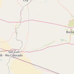
Use this park location map to pinpoint Little Picacho Wilderness in United States of America, understand its exact geographic position, and read its mapped placement within the surrounding landscape more clearly.

Pigeon | © OpenStreetMap contributors

Location context for Little Picacho Wilderness

California
Recorded earthquake history

Examine the Recorded Earthquake History of Little Picacho Wilderness

Review documented seismic events that have occurred in the vicinity of the Little Picacho Wilderness. This archive organizes historical earthquake records by distance to provide geographic context for the region, supported by comprehensive data from USGS event catalogues.

Little Picacho Wilderness Earthquake History

Catalogued events

6 events

Strongest magnitude

Magnitude 3.4

Most recent event

Feb 6, 1989

This history includes earthquakes recorded inside the park or within 50 km of its borders

Park atlas

Compare adjacent desert landscapes and regional wilderness reserves across the lower river corridor

Other Parks Near Little Picacho Wilderness and Surrounding Protected Areas

Explore nearby national parks and protected areas sharing the stark volcanic terrain of Little Picacho Wilderness. Comparing adjacent desert reserves provides a broader geographic perspective on the rugged ecosystems flanking the lower Colorado River corridor.
Wildlife reserveCalifornia
About 17 km away#1 closest

Northwest

Indian Pass Wilderness: Protected Sonoran Desert Geography and Terrain Mapping

Analyzing desert mountain slopes and riparian corridors in California

Indian Pass Wilderness represents a key protected-area unit where the arid Chocolate Mountains descend into the Lower Colorado River Valley. The area is defined by its dramatic drainage patterns, including Julian Wash, and its role as a transition zone between desert upland and riparian edge, serving as a critical study for understanding southwestern desert geography and protected landscape boundaries.

Area
131.19 km²
Established
1994
IUCN
Ib
Relief
Mountain
A soft watercolor illustration depicting a panoramic desert landscape with prominent rugged purple mountains in the background, rolling green hills in the midground, and saguaro cacti in the foreground.
Wildlife reserveArizona
103 km away#2 closest

Northeast

Eagletail Mountains Wilderness: Mapping Arizona Sonoran Desert Protected Areas

Remote ridgelines and desert basin geography in central Arizona.

Analyze the desert mountain terrain of the Eagletail Mountains Wilderness. This protected area features jagged rocky peaks, open desert plains, and a unique position near the Bouse Wash headwaters, making it a key study for Arizona desert geography and arid-land preservation.

Area
407 km²
IUCN
Ib
Relief
Mountain
Climate
Arid
National parkCalifornia
109 km away#3 closest

Northwest

Joshua Tree National Park: Mapped Protected Landscape and Regional Geography in California

Explore unique park boundaries and natural terrain across Southern California.

Joshua Tree National Park is a vital protected area in California, known for its distinctive natural landscape and geographic setting. This entry provides detailed information on the park's mapped boundaries and the unique terrain it encompasses, serving as a key point for atlas exploration of protected lands. Understand the regional geography and the specific character of this significant national park.

Area
3,217.9 km²
Established
1994
IUCN
II
Visitors
3.1M annual
Watercolor painting showing a soft landscape with rolling hills in the background and a grassy plain with sparse trees and water in the foreground.
Wildlife reserveUnited States of America
About 111 km away#4 closest

North

Riverside Mountains Wilderness: Mapping the Desert Peaks and Protected Landscapes of California

A rugged desert wildlife reserve within the Lower Colorado River Valley

Riverside Mountains Wilderness features a tightly woven mosaic of dry drainages, rocky slopes, and sheltered canyon pockets. Situated in Riverside County, California, this protected area showcases a striking transition between steep mountain crags and open desert flats, providing a meaningful look at the Sonoran and Colorado Desert ecosystems along the Colorado River corridor.

Area
97.14 km²
Established
1994
Relief
Mountain
Climate
Arid
Wildlife reserveCalifornia
124 km away#5 closest

West

Fish Creek Mountains Wilderness: Mapping the Rugged Colorado Desert Plateau in California

Exploring desert ridges and ancient shoreline remnants

Fish Creek Mountains Wilderness offers a study in desert geomorphology, rising as an abrupt plateau above the surrounding basin. This Bureau of Land Management protected area contains intricate erosional landforms, including twisting canyons and natural rock tanks sustained by limestone outcrops. These features create a critical desert wildlife habitat that maintains moisture long after seasonal storms, offering a quiet, undisturbed perspective on the broader Imperial County landscape.

Area
86.7 km²
Established
1994
IUCN
Ib
Relief
Mountain
Watercolor painting of a desert scene with rolling hills in the background and saguaro cacti in the foreground.
Wildlife reserveMaricopa County
145 km away#6 closest

Northeast

Hummingbird Springs Wilderness: A Protected Sonoran Desert Landscape in Maricopa County

Rugged mountain terrain and desert wash networks

Spanning more than 31,000 acres, Hummingbird Springs Wilderness serves as a core protected area in the Sonoran Desert. The geography encompasses the Belmont Mountains, providing a stark contrast of arid peaks and sandy basins that extend through western Maricopa County. This roadless wilderness represents an essential connection between adjacent protected lands, maintaining a vast and isolated desert environment shaped by centuries of geological forces.

Area
126.26 km²
Established
1990
IUCN
Ib
Relief
Mountain
National parkEnsenada Municipality
About 167 km away#7 closest

Southwest

Constitution 1857 National Park National Park: Mapped Protected Landscape Discovery

Geographic context and park boundaries for Ensenada Municipality.

Delve into the protected landscape of Constitution 1857 National Park, a key national park entity located in the Ensenada Municipality. This resource highlights the park's distinct geographic features and mapped protected area, crucial for atlas exploration and understanding the regional natural terrain. Gain structured insight into the park's identity and its role within the wider geographic context.

Area
50.09 km²
Established
1962
IUCN
II
Relief
Mountain
Watercolor painting of a mountain landscape with rolling green hills and small evergreen trees, with soft purple mountain silhouettes in the distance.
Protected landscapeCalifornia
192 km away#8 closest

Northwest

San Bernardino National Forest: Geography and Protected Landscape Atlas

Transverse and Peninsular mountain ranges in California

Spanning over 820,000 acres, San Bernardino National Forest offers a look at one of Southern California's most significant protected landscapes. The forest features seven wilderness areas and a dramatic range of elevation, moving from arid chaparral to old-growth mixed conifer forests. Our geographic mapping traces the unique structure of four intersecting mountain ranges, detailing the terrain from deep canyons to high alpine peaks.

Area
3,333.87 km²
Established
1907
Relief
Mountain
Climate
Mediterranean

Common questions about visiting, size, designation, and location context for Little Picacho Wilderness

Little Picacho Wilderness FAQs for park facts, access, geography, and protected area context

Find quick answers about Little Picacho Wilderness, including protected-area facts, park geography, trail and visitor context, and how the park fits into its surrounding country and regional landscape.
MoriAtlas Explorer

Continue Your Protected Areas Search Across the Global Atlas

Deepen your exploration by continuing the structured search for national parks and protected areas worldwide. Utilize the comprehensive filtering capabilities to compare different conservation landscapes and refine your understanding of global park geography. Discover more about the distribution and characteristics of protected natural areas.

Global natural geography