Mori Atlas logo
Protected landscapeLocalidad Rupestre de Chamangá

Analyzing the prehistoric rock art and open-air granite formations across Flores Department terrain.

Localidad Rupestre de Chamangá: A Distinctive Protected Landscape of Central Uruguay

(Paisaje Protegido Localidad Rupestre de Chamangá)

Localidad Rupestre de Chamangá encompasses over 12,000 hectares of rolling prairie and gallery woodlands in the department of Flores, Uruguay. This protected landscape is internationally recognized for holding the largest concentration of open-air rock paintings in the country, featuring abstract geometric motifs etched directly onto exposed granite outcrops. The area provides a critical window into prehistoric cultural heritage within a living, working rural matrix of pastoral grasslands and streamside ecosystems.

rock artpictographsprehistoric heritageopen-air paintingsprotected landscapegranite outcrops

Localidad Rupestre de Chamangá

Protected landscape

Park overview

Structured park overview, official facts, and landscape profile for Chamangá Rock Art Protected Landscape

Chamangá Rock Art Protected Landscape park facts, protected area profile, and essential visitor context

Review the core facts for Chamangá Rock Art Protected Landscape, including designation, size, terrain, visitor scale, habitats, and operating context in one park-focused overview.

About Chamangá Rock Art Protected Landscape

Chamangá Rock Art Protected Landscape lies in the heart of Uruguay's department of Flores, a region of low, rolling terrain traditionally associated with extensive cattle raising and crop agriculture. The protected area extends over more than 12,000 hectares east of the departmental capital, Trinidad, encompassing a broad rural landscape shaped by gentle undulations, granite outcrops, the Chamangá and Los Molles streams, gallery forests along those watercourses, and occasional wetlands.

While the surrounding scenery is typical of the Uruguayan countryside, the protected landscape's significance lies overwhelmingly in its archaeological record. The site contains 44 inventoried rock paintings, forming the most important pictograph concentration in Uruguay and representing more than two-thirds of the country's total known rock art. What truly distinguishes Chamangá is the open-air setting of these paintings: rather than being enclosed in caves or protected by rock overhangs, the pictographs are exposed on granite outcrops across open fields, a circumstance that is globally rare and adds both vulnerability and visibility to the cultural heritage.

The pictographs themselves are predominantly abstract and geometric in style. Documented motifs include framed designs, lozenges, cruciform patterns, Greek-key or fret-like grecas, rectangles, zigzags, vertical parallel lines, comb-like dentate bands, and finely incised engravings. This repertoire suggests continuity with broader prehistoric graphic traditions of the region, while the open-air context makes Chamangá a key reference point for understanding how such art was integrated into the wider landscape rather than restricted to shelters.

Administrative recognition came in 2010, when the area was incorporated into Uruguay's National System of Protected Areas under the category of Paisaje Protegido, or Protected Landscape. Beyond national protection, Chamangá has been proposed for inclusion on UNESCO's World Heritage List, reflecting its outstanding universal value as a rock art site. The protected area is therefore unusual in Uruguay for combining cultural heritage protection with the conservation of a working rural landscape.

Quick facts and research context for Chamangá Rock Art Protected Landscape

Chamangá is a protected cultural-natural landscape covering approximately 12,000 hectares in the department of Flores, Uruguay, east of Trinidad. It was admitted to Uruguay's National System of Protected Areas in 2010 and is administered under the category of Paisaje Protegido, or Protected Landscape.

The area contains the country's most important concentration of rock paintings, with 44 pictographs inventoried in the site, representing over two-thirds of Uruguay's total registered pictographs. The paintings are exceptional because they occur in open-air exposures on granite outcrops rather than inside caves or rock shelters.

Protection and recognition

Explore terrestrial protection records and official designation data

Localidad Rupestre de Chamangá Protection Status and Conservation Scope

Localidad Rupestre de Chamangá maintains documented terrestrial protection boundaries within the regional conservation network. Structured conservation records outline the established designation scope and international recognition status for this protected landscape.

Protection details

Protection scope
Terrestrial
Transboundary protection
No
Park context

Deeper park guide and search-rich context for Chamangá Rock Art Protected Landscape

Chamangá Rock Art Protected Landscape history, landscape, wildlife, and travel context

Explore Chamangá Rock Art Protected Landscape through its history, landscape character, ecosystems, wildlife, conservation priorities, cultural context, and seasonal travel timing in a structured park guide built for atlas discovery and search intent.

Why Chamangá Rock Art Protected Landscape stands out

Chamangá is best known for being home to the largest open-air rock art complex in Uruguay, with pictographs painted directly onto granite outcrops in open fields rather than within caves. The paintings, which include framed motifs, lozenges, cruciform shapes, grecas, rectangles, zigzags, vertical parallel lines, comb-like dentate patterns, and fine-line engravings, form an abstract geometric repertoire that is unusual both nationally and internationally. The site is also notable for the scale of its protected landscape setting, where the rock art is embedded within a living rural matrix of prairie, streamside woodland, and grazing land. This combination of prehistoric cultural heritage and pastoral countryside gives Chamangá a distinctive mixed identity as both an archaeological and a landscape conservation site.
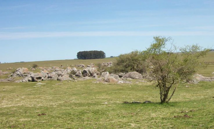
A wide, outdoor landscape view showing a field with a cluster of grey, rounded granite rocks, scattered small trees, and a distant grove of dark trees under a clear blue sky.
A granitic rock outcrop typical of the landscape at Localidad Rupestre de Chamangá.

Chamangá Rock Art Protected Landscape history and protected-area timeline

Chamangá entered Uruguay's formal system of nature and cultural protection in 2010, when it was designated a Paisaje Protegido, or Protected Landscape, and incorporated into the country's National System of Protected Areas under Law No. 17.234. The designation recognized both the cultural importance of its prehistoric rock paintings and the broader value of the surrounding rural landscape in which they occur.

By the time of its formal protection, the site had already accumulated an inventory of 44 pictographs, making it the most important rock art complex in Uruguay. Recognition at the national level opened the way for international attention, and the area was placed on the path toward a UNESCO World Heritage nomination. It joined UNESCO's tentative list process under the title 'Chamangá: A Rock Paintings Area', reflecting an effort to frame it as a site of outstanding universal value rather than merely a national curiosity.

Although precise dates for the original creation of the paintings are not detailed in the available sources, the pictographs are understood as part of Uruguay's prehistoric indigenous graphic tradition. The open-air, exposed nature of the paintings meant that for most of their existence they were unprotected, and their survival into modern inventories depends largely on the granite substrates on which they were executed.

Chamangá Rock Art Protected Landscape landscape and geographic character

The Chamangá protected landscape covers more than 12,000 hectares of gently rolling Uruguayan countryside, with a topography characterized by soft undulations rather than steep relief. Soils across much of the area are highly fertile, supporting the extensive cattle raising and agriculture that shape the region's modern land use. This productive quality means that the protected area is not a wilderness reserve but a working rural landscape that has been formally recognized for its cultural and natural values.

The hydrology of the site is defined by the Chamangá and Los Molles streams, which cut through the terrain and support ribbons of native woodland. These gallery forests follow the watercourses and add vertical structure and biodiversity to an otherwise open prairie landscape. Scattered bañados, or shallow wetlands, form additional ecological features that punctuate the rolling countryside.

Outcropping granite is the landscape element of greatest cultural significance. These bedrock exposures break through the thin soils and grasslands in scattered locations across the terrain, and it is precisely on these outcrops that the prehistoric pictographs were painted. Their visibility in the open fields is unusual and gives the cultural landscape a distinctive visual identity, where natural geology, prehistoric graphic art, and modern pastoral land use coexist across the same terrain.

Chamangá Rock Art Protected Landscape ecosystems, habitats, and plant life

The ecological character of Chamangá is dominated by Uruguayan prairie ecosystems, with native grasslands occupying the gently undulating terrain and supporting extensive livestock grazing. The high-fertility soils that make the area attractive for agriculture also sustain a productive grassland flora adapted to seasonal grazing pressure. This is fundamentally a working rural ecosystem rather than a wilderness system, and its ecological value is closely tied to the maintenance of traditional extensive land use.

Along the Chamangá and Los Molles streams, native woodland forms narrow corridors of forest that contrast with the surrounding open prairie. These gallery forests create ecotones between aquatic, riparian, and grassland habitats and provide important habitat structure for local wildlife, while also helping stabilize stream banks and protect water quality. Scattered wetlands, or bañados, contribute additional habitat diversity and are typical features of the lowland Uruguayan countryside.

The combination of prairie, woodland patches, and small wetlands gives Chamangá a mosaic ecological profile. Although the area's international fame rests on its rock art, the surrounding ecosystems provide the environmental setting within which the prehistoric paintings were created and continue to be preserved, linking the site's natural and cultural values within a single protected landscape.

Chamangá Rock Art Protected Landscape conservation status and protection priorities

Chamangá's conservation significance is rooted in its combined natural and cultural profile. The protected area safeguards more than 12,000 hectares of productive Uruguayan countryside, including native grasslands, streamside woodland along the Chamangá and Los Molles creeks, and scattered wetlands. Its protected status, granted in 2010 under Law No. 17.234 as a Paisaje Protegido, acknowledges that maintaining traditional extensive grazing and agricultural use is itself part of the conservation strategy for the landscape.

The most internationally distinctive conservation value of the area lies in the prehistoric rock paintings preserved on its granite outcrops. With 44 inventoried pictographs representing more than two-thirds of Uruguay's entire known rock art corpus, the site is arguably the single most important repository of this heritage in the country. Because the paintings are exposed to open-air conditions rather than sheltered in caves, their preservation depends directly on the integrity of the surrounding landscape and the protection regime that the Paisaje Protegido designation provides.

The effort to include Chamangá on UNESCO's World Heritage tentative list, under the title 'Chamangá: A Rock Paintings Area', has given the conservation effort international visibility. This recognition underscores the site's outstanding universal value as a rock art complex and frames the local protected area as part of a broader global cultural heritage network, while also reinforcing the importance of managing grazing, agriculture, and visitor pressure in ways that keep the granite outcrops and their pictographs intact.

Chamangá Rock Art Protected Landscape cultural meaning and human context

Chamangá carries deep prehistoric cultural significance as part of Uruguay's indigenous rock art tradition. The pictographs were created by the region's prehistoric inhabitants and are dominated by abstract geometric motifs, including framed designs, lozenges, cruciforms, fret-like grecas, rectangles, zigzags, vertical parallel lines, comb-like dentate patterns, and finely incised lines. The abstract style suggests participation in a wider regional graphic tradition, while the open-air setting distinguishes Chamangá from the more sheltered rock art traditions of other parts of the world.

In the modern era, the surrounding landscape is defined by extensive cattle raising and crop agriculture, reflecting the long-standing rural identity of the department of Flores. This pastoral land use has shaped both the visual character of the protected landscape and the conservation approach taken to preserve it, blending local economic life with protection of cultural heritage.

The pursuit of UNESCO World Heritage recognition has added a new layer of cultural framing, positioning Chamangá not only as a national heritage site but as a candidate site of outstanding universal value. The interest expressed by UNESCO in supporting the preservation of Uruguayan prehistoric rock art reflects the wider international recognition that Chamangá's open-air pictographs carry.

Top sights and standout views in Chamangá Rock Art Protected Landscape

Chamangá stands out for the sheer scale of its rock art concentration within Uruguay, holding 44 pictographs that together account for more than two-thirds of the country's total inventoried rock paintings.

The site's open-air exposure on granite outcrops is exceptionally rare, with paintings placed directly in open countryside rather than within caves or rock shelters, making Chamangá a globally distinctive reference for studying prehistoric art in landscape context.

The protected landscape status combines cultural heritage protection with the conservation of a living rural matrix of prairie, streamside woodland, and small wetlands, while the site's inclusion on the path to UNESCO World Heritage recognition underscores its outstanding universal value.

Best time to visit Chamangá Rock Art Protected Landscape

Chamangá's appeal is primarily archaeological and cultural rather than seasonal, and the site can be appreciated in different ways depending on the time of year. The Uruguayan countryside experiences a temperate climate, with warmer months offering lush, green pastures that emphasize the rural character of the protected landscape, while drier periods tend to produce more golden grasslands and clearer visibility across the open terrain where the rock outcrops and their pictographs lie exposed.

Spring and autumn are typically the most balanced seasons for understanding the site, when temperatures are mild, the prairie and gallery woodland are visually expressive, and outdoor exposure to the open-air pictograph outcrops is comfortable. Regardless of season, visitors should expect the site to be experienced as a working rural landscape rather than a developed tourist attraction, with the rock art viewed in the context of traditional grazing and agricultural land.
Monthly climate preview

Long-term representative monthly temperature and precipitation patterns

Localidad Rupestre de Chamangá Climate Normals and Annual Temperature Rhythm

Representative coordinate measurements record sustained temperature variation alongside consistent monthly precipitation across the conservation area. Detailed twelve-month climate normals provide complete statistical context for seasonal meteorological comparisons.
Annual mean17 °C
9 °C24 °C
Jan24°
Feb23°
Mar21°
Apr17°
May13°
Jun10°
Jul
Aug11°
Sep13°
Oct16°
Nov19°
Dec22°
Warmest month
January

23.9 °C

Coolest month
July

9.4 °C

Wettest month
February

4.3 mm/day

Driest month
July

2.5 mm/day

Park location guide

Geography guide, regional context, and park location map for Chamangá Rock Art Protected Landscape

Chamangá Rock Art Protected Landscape park geography, regions, and map view in Uruguay

Understand where Chamangá Rock Art Protected Landscape sits in Uruguay through a broader geographic reading of the surrounding landscape, nearby location context, and its mapped position within the national park landscape.

How Chamangá Rock Art Protected Landscape fits into Uruguay

Uruguay is a unitary presidential republic located in southeastern South America. It covers approximately 176,215 km² and has a population of nearly 3.5 million people. The capital and largest city is Montevideo, where roughly 2 million people live in the metropolitan area. Uruguay gained independence between 1825 and 1828 following territorial disputes involving Portugal, Spain, Brazil, and the United Provinces of the Río de la Plata.

Wider geography shaping Chamangá Rock Art Protected Landscape in Uruguay

Uruguay is situated in the southeastern part of South America, bordering Argentina to its west and southwest, Brazil to its north and northeast, the Río de la Plata estuary to the south, and the Atlantic Ocean to the southeast. The terrain consists primarily of rolling plains and low hills, with the highest point being Cerro Catedral at approximately 514 meters. The country has several rivers including the Uruguay River, Paraná River, and Negro River.

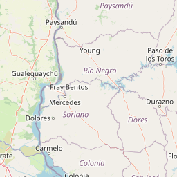
Map view of Chamangá Rock Art Protected Landscape

Use this park location map to pinpoint Chamangá Rock Art Protected Landscape in Uruguay, understand its exact geographic position, and read its mapped placement within the surrounding landscape more clearly.

Pigeon | © OpenStreetMap contributors

Location context for Chamangá Rock Art Protected Landscape

Flores Department

Visual exploration of granite outcrops and protected prairie habitats

Localidad Rupestre de Chamangá Landscape Photos and Scenery

Examine detailed photographs showcasing the open granite outcrops, rolling grasslands, and riparian woodlands of Localidad Rupestre de Chamangá. Visual records reveal the distinct rural terrain and exposed archaeological context that define this protected landscape.

A wide, outdoor landscape view showing a field with a cluster of grey, rounded granite rocks, scattered small trees, and a distant grove of dark trees under a clear blue sky.

Park atlas

Compare surrounding regional landscapes and connected conservation areas

Explore Protected Areas and Parks Near Localidad Rupestre de Chamangá

Continue geographic exploration by discovering other protected areas and regional reserves connected to Localidad Rupestre de Chamangá. Broaden regional comparisons across similar conservation zones and surrounding prairie terrain.
Natural monumentFlores
About 61 km away#1 closest

Northwest

Grutas del Palacio Natural Monument: Geological Landscape Map and Protected Area Context

Protected sandstone formations within the Flores region of central Uruguay

Grutas del Palacio represents a critical protected landscape in Flores, Uruguay, famous for its vaulted sandstone architecture and column-supported cavern structure. As an established natural monument, the site provides essential insights into Cretaceous sedimentary history and geoconservation. This record maps the natural features and territorial boundaries of this inland landmark, offering a structured look at its role in regional geography and geological heritage preservation.

Area
0.45 km²
Established
2013
Relief
Lowland
Climate
Subtropical
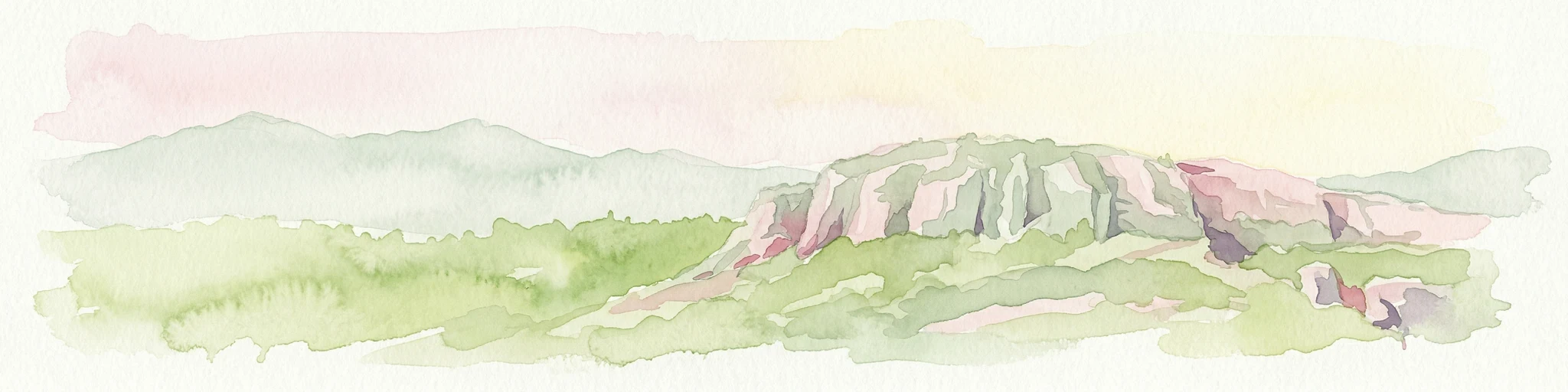
A watercolor painting of a wetland scene showing green, marshy areas and gentle, rolling hills in the background with soft brushwork.
Protected landscapeMontevideo
About 136 km away#2 closest

South

Humedales de Santa Lucía Protected Landscape: Geography and Mapped Wetland Boundaries in Uruguay

A dynamic tidal freshwater system located near the Montevideo riverfront

Humedales de Santa Lucía is a significant protected landscape spanning the departments of San José, Canelones, and Montevideo. This managed wetland ecosystem is defined by the interaction between freshwater river discharge and the brackish tidal influence of the Río de la Plata estuary, creating a unique riparian mosaic of channels, islands, and marshlands important to local waterbird populations.

Area
865.17 km²
Established
2015
Relief
Lowland
Access
Easy access
Watercolor painting showing a hill with green landscape and distant mountains
National parkUruguay
About 146 km away#3 closest

Southeast

Arequita National Park: Uruguay's National Park Protected Landscape and Geography

Mapped boundaries and regional natural terrain context for a key protected area.

Delve into Arequita National Park, a designated national park contributing to Uruguay's protected land inventory. This resource explores the park's unique geographic setting, its mapped boundaries, and its significance within the natural landscape of the Southern Cone. Gain structured insight into its role as a protected area and its contribution to the regional geography of South America.

Scope
Terrestrial
Water
No major water
Watercolor painting of a soft landscape with rolling hills in the background and grassy plains in the foreground on a white background.
National parkLavalleja Department
About 146 km away#4 closest

Southeast

Parque nacional Arequita: Protected Landscape and Volcanic Geography in Lavalleja

Mapped natural terrain and protected ecosystems of southeastern Uruguay.

Parque nacional Arequita preserves a unique volcanic landscape in the Lavalleja Department, centered on the ancient basalt hill of Cerro Arequita. The area protects diverse environments ranging from rocky cave systems and native forests to critical freshwater watersheds. This record offers a deep look into the geographical character, internal boundaries, and ecological importance of one of Uruguay's most prominent natural sites.

Area
5.6 km²
Established
2024
Relief
Upland
Climate
Temperate
A soft, light-toned watercolor illustration of a river landscape with low green islands and marshy vegetation under a pale, minimalist sky.
National parkRío Negro Department
About 152 km away#5 closest

Northwest

Parque nacional Esteros de Farrapos e Islas del Río Uruguay: Protected Wetland Geography

Exploring the fluvial island and riverine terrain of Río Negro

This protected area represents an essential riverine ecosystem along the western frontier of Uruguay. The landscape comprises a complex layering of flood-prone plains, riparian forest edges, and silty soil formations that characterize the regional geography of the Río Uruguay basin.

Area
215.65 km²
Established
2008
Relief
Lowland
Scope
Terrestrial
A horizontal watercolor illustration of a gentle landscape with rolling green hills, a winding river, and a light-colored mountainous horizon.
National parkColonia Department
About 153 km away#6 closest

Southwest

Parque Nacional Aarón de Anchorena: Protected Geography and Riverine Landscape

An expansive arboretum and presidential estate in Colonia

Parque Nacional Aarón de Anchorena is a protected territory in southwestern Uruguay, defined by its position on the Río de la Plata estuary. The area encompasses an extensive arboretum, ornamental gardens, and riparian habitats that house unique animal populations. The site serves as a vital geographic anchor for the region, combining historic architecture with the broad, reflective horizons of the river coast.

Area
13.69 km²
Established
1908
Relief
Lowland
Climate
Temperate
Wildlife reserveRío Negro Department
About 155 km away#7 closest

Northwest

Área de manejo de hábitats y/o especies Esteros y Algarrobales del Río Uruguay Protected Area Geography

Wildlife reserve in the Río Negro department with unique riparian corridors.

This wildlife reserve protects a unique transition zone where dry-forest Prosopis woodlands thrive alongside wetland esteros. Its mapped terrain reflects the intersection of two distinct ecoregions, creating a fragile landscape characterized by blanqueales soils, gallery forests, and river-fed floodplains within a larger protected conservation mosaic.

Area
15.5 km²
Relief
Lowland
Scope
Terrestrial
Water
Major water bodies
A watercolor painting showing stylized, rolling hills in shades of purple, green, yellow, and soft pink against a white background.
National parkCanelones Department
About 165 km away#8 closest

South

Isla de Flores National Park: Geographic Map and Protected Landscape Overview

Tidal island geography within the Río de la Plata estuary.

Located in the Canelones Department, Isla de Flores National Park represents a significant protected maritime area. Its landscape consists of a low-lying island reaching only two meters above sea level, featuring a protected maritime buffer that supports the integrity of this historic Río de la Plata site. Examine the mapped boundaries and the unique interplay between the estuary currents and this shifting coastal terrain.

Area
0.31 km²
Established
2018
Relief
Lowland
Climate
Temperate

Common questions about visiting, size, designation, and location context for Chamangá Rock Art Protected Landscape

Chamangá Rock Art Protected Landscape FAQs for park facts, access, geography, and protected area context

Find quick answers about Chamangá Rock Art Protected Landscape, including protected-area facts, park geography, trail and visitor context, and how the park fits into its surrounding country and regional landscape.
MoriAtlas Explorer

Continue Your Protected Areas Search Across the Global Atlas

Deepen your exploration by continuing the structured search for national parks and protected areas worldwide. Utilize the comprehensive filtering capabilities to compare different conservation landscapes and refine your understanding of global park geography. Discover more about the distribution and characteristics of protected natural areas.

Global natural geography