

Mori Atlas logo
Marine protected areaLoch Fyne

Tracing the mapped boundaries of Scotland's longest sea loch and its mountain-framed terrain

Loch Fyne Marine Protected Area and the Coastal Geography of Argyll and Bute

Loch Fyne stands as a defining feature of the Scottish western seaboard, stretching deep inland from the Firth of Clyde. This marine protected area reveals a complex landscape that transitions from the rugged peaks of the northern Arrochar Alps to the forested shorelines of the Cowal Peninsula. Our geographic data maps this expansive sea loch to illustrate its role as both a vital maritime corridor and a protected habitat for diverse marine life in the Argyll and Bute region.

sea lochcoastal inletCowal PeninsulaArgyll and ButeScottish Highlandsmarine protected area

Loch Fyne

Marine protected area

Park overview

Structured park overview, official facts, and landscape profile for Loch Fyne

Loch Fyne park facts, protected area profile, and essential visitor context

Review the core facts for Loch Fyne, including designation, size, terrain, visitor scale, habitats, and operating context in one park-focused overview.

About Loch Fyne

Loch Fyne is a long, narrow sea loch on the west coast of Scotland, cutting deep into the Cowal Peninsula in Argyll and Bute. Stretching roughly sixty five kilometres inland from the Sound of Bute, it is the longest sea loch in Scotland and forms a defining feature of the region's coastline. The loch's shores blend rugged mountain terrain in the north with gentler, forested landscapes further south, creating a varied and visually distinctive inlet of the Firth of Clyde. The loch is linked to the Sound of Jura by the Crinan Canal, providing a vital shortcut for vessels travelling between the Clyde and the Hebrides. Its waters support a wide range of marine life, including dolphins, seals, otters, and seasonal basking sharks, and in 2014 the entire loch north of Otter Ferry was designated a Nature Conservation Marine Protected Area. Loch Fyne is also renowned for its oyster fishery and its historic herring tradition, giving its name to the famous Loch Fyne kipper and the Loch Fyne Oysters brand.

Quick facts and research context for Loch Fyne

Loch Fyne is a saltwater sea loch on the western coast of Scotland, lying within the Argyll and Bute council area along the eastern edge of the Cowal Peninsula. It extends about sixty five kilometres inland from the Sound of Bute and is recognised as the longest sea loch in Scotland. The Crinan Canal links its upper reaches to the Sound of Jura, allowing small vessels to bypass the long route around the Kintyre Peninsula. Designated a Nature Conservation Marine Protected Area in 2014, the loch combines significant ecological value with a long-standing cultural identity tied to fishing, castles, and Highland scenery.

Protection and recognition

Marine conservation scope and designation history for Loch Fyne

Loch Fyne Protection Status and Official Designation Records

Documented protection records outline the marine conservation scope and establishment year for Loch Fyne since 2014. Structured designation data details official protection status and management frameworks without assuming external recognition sources.

Protection details

Protection scope
Marine
Designated year
2014
Transboundary protection
No
Park context

Deeper park guide and search-rich context for Loch Fyne

Loch Fyne history, landscape, wildlife, and travel context

Explore Loch Fyne through its history, landscape character, ecosystems, wildlife, conservation priorities, cultural context, and seasonal travel timing in a structured park guide built for atlas discovery and search intent.

Why Loch Fyne stands out

Loch Fyne is best known for being the longest sea loch in Scotland, a dramatic coastal inlet backed by the mountains of the Cowal Peninsula and the Arrochar Alps. It also enjoys strong recognition for its marine biodiversity, its long oyster and herring traditions, and its association with iconic Highland castles such as Inveraray Castle, Dunderave Castle, and Old Castle Lachlan. The combination of mountain scenery, maritime wildlife, and centuries of fishing heritage gives the loch a distinctive identity within Scotland's western seaboard.
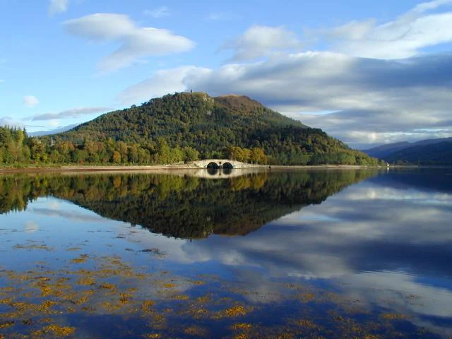
Inveraray Bridge
Inveraray Bridge on Loch Fyne, with Inveraray Castle spires visible in the background and Dun Corr Bhile hill behind the bridge.

Loch Fyne history and protected-area timeline

Loch Fyne's human history is closely tied to the surrounding glens and the strategic value of its waters. The loch and its tributary, Abhainn Fìne, were important enough to lend their name to the wider region, with the Gaelic name meaning 'loch of the vine' or 'wine', likely an honorific title rather than evidence of historical viticulture. Along the shoreline stand several castles that reflect the turbulent clan history of the western Highlands, including Inveraray Castle, Dunderave Castle, Kilmory Castle, Minard Castle, Castle MacEwen, and Old Castle Lachlan.

During the Second World War the loch took on a new strategic role when HMS Quebec, known as the No. 1 Combined Operations Training Centre, was established just south of Inveraray. Operating from 1940 to 1944, the centre trained around 250,000 personnel from the Royal Navy, the Royal Air Force, the Army, and Allied forces in landing craft techniques and beachhead operations. The Crinan Canal, built between 1794 and 1801 under John Rennie and later refined by Thomas Telford in 1816, also forms a significant chapter in the loch's history, opening a sheltered inland route between Loch Fyne and the Hebrides.

Loch Fyne landscape and geographic character

Loch Fyne's landscape is dominated by the contrast between its mountainous northern hinterland and the softer, more wooded terrain of its southern reaches. To the north the loch is flanked by the Arrochar Alps, Glen Shira, Glen Fyne, Glen Croe, and peaks such as Beinn Bhuidhe, with sweeping Highland scenery shaping the upper shoreline. Further south the land becomes gentler, transitioning into the wooded slopes and sheltered bays of the Cowal Peninsula and the Knapdale coast on the western shore.

The shoreline is punctuated by historic castles and settlements, while the waters themselves narrow and widen as the loch twists inland. The Fairy Hill near Inveraray marks a notable landmark on the approach to the upper loch, and the Crinan Canal cuts across the isthmus nearby, linking the sea loch to the Sound of Jura. Steep forested banks, small islands, and quiet coves combine with the mountain backdrop to create a landscape of classic west Highland character.
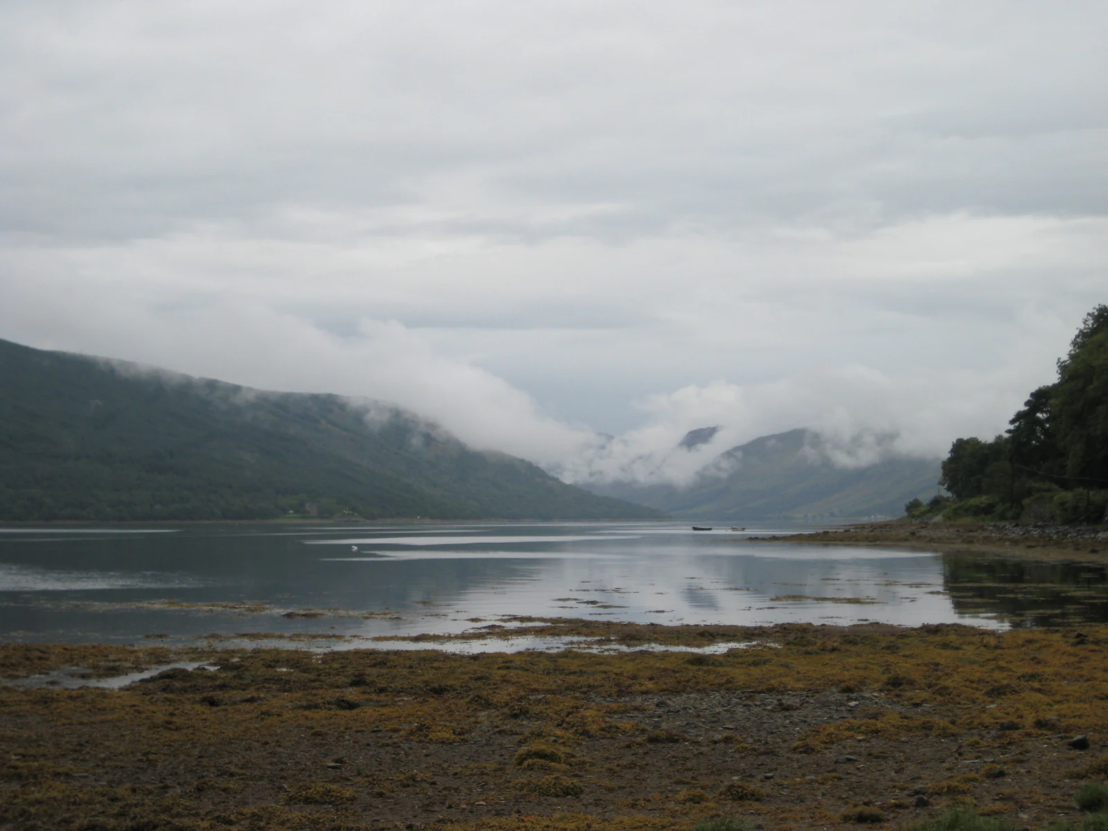
Loch Fyne view
A view of Loch Fyne in Argyll and Bute, Scotland

Loch Fyne ecosystems, habitats, and plant life

Loch Fyne supports a rich mix of marine and coastal ecosystems typical of Scotland's western sea lochs. Its sheltered waters provide habitat for a variety of marine mammals and seabirds, while the surrounding glens and forested banks host terrestrial wildlife along the shoreline. The loch's relatively narrow form and deep incursion into the Cowal Peninsula create a transitional zone between open Firth of Clyde waters and the more enclosed, fjord-like conditions further inland.

The surrounding landscape includes oak woodlands and Atlantic hazel habitat along parts of the shoreline, supporting a wide community of invertebrates, birds, and small mammals. Tidal stretches and estuarine influences near the head of the loch create additional habitat diversity, while freshwater inflows from glens such as Glen Shira and Glen Fyne bring nutrient-rich conditions that sustain a productive marine food web. The combination of marine, freshwater, and woodland environments gives Loch Fyne a layered ecological character.
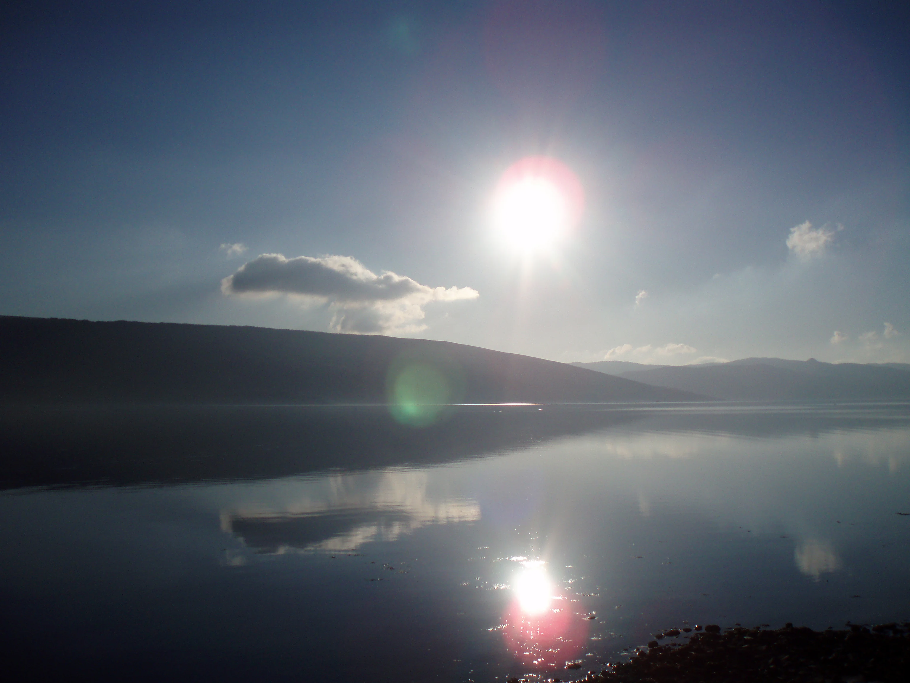
Loch Fyne from Inveraray
A view looking down Loch Fyne from the town of Inveraray.

Loch Fyne wildlife and species highlights

The waters of Loch Fyne are home to dolphins, seals, and otters, with basking sharks occasionally appearing in the loch during the warmer summer months. The presence of these marine mammals reflects the loch's role as a productive feeding area within the Firth of Clyde system. Seabirds and coastal birds make use of the loch's shores and islands, and rare visitors such as a Ross's gull have been recorded at the loch, highlighting its value for occasional vagrant and unusual species as well as resident wildlife.

Beneath the surface, the loch supports a varied fish fauna that has underpinned its long-standing fisheries heritage. Species such as herring, cod, saithe, and a range of smaller demersal fish inhabit the waters, sustaining both the traditional drift-net fishery and modern angling interest. The interaction between these populations and the surrounding marine mammals reinforces the loch's ecological significance and contributed to its designation as a Marine Protected Area in 2014.
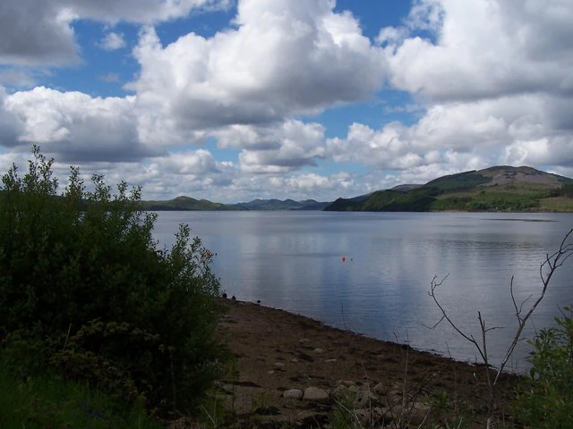
Shoreline and Loch Fyne
View of the shoreline and Loch Fyne from the Creggans Hotel

Loch Fyne conservation status and protection priorities

In 2014 Loch Fyne was designated a Nature Conservation Marine Protected Area, with the designation covering the entire loch north of a point near Otter Ferry. This status recognises the loch's importance for marine biodiversity, its role in supporting populations of seals, otters, and cetaceans, and the ecological value of its seafloor habitats. The protected area framework helps regulate activities that could affect the loch's marine environment while preserving its broader ecological functions.

Beyond formal designation, Loch Fyne's sheltered waters, varied depths, and transition between open sea and inland fjord conditions give it enduring conservation importance. The shoreline habitats, including reedbeds, saltmarsh fragments, and adjacent woodland, contribute additional ecological value to the broader protected landscape. Together, these features make the loch a significant component of Scotland's network of marine and coastal conservation areas in the Firth of Clyde region.

Loch Fyne cultural meaning and human context

Loch Fyne carries a strong cultural identity rooted in Gaelic language, Highland clan history, and maritime trade. The Gaelic name Loch Fìne, meaning 'loch of the vine', points to the ancient landscape of the Cowal Peninsula and the linguistic heritage of Argyll. Travellers' traditions are represented locally by the Tinkers' Heart, an old monument overlooking the loch that was traditionally associated with marriages and ceremonies among Scotland's travelling communities.

The loch's castles, including Inveraray Castle and Dunderave Castle, stand as enduring symbols of the region's aristocratic and clan past, while the Crinan Canal reflects the engineering ambition of the eighteenth and nineteenth centuries. Fishing culture, particularly the oyster and herring traditions, has shaped local identity and given rise to businesses such as Loch Fyne Oysters and the Loch Fyne Restaurants chain, linking everyday food culture to this distinctive corner of western Scotland.
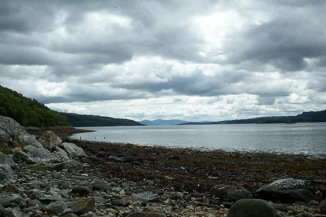
Foreshore of Loch Fyne near Castle Lachlan
The rocky foreshore along the coastline of Loch Fyne in the vicinity of Castle Lachlan.

Top sights and standout views in Loch Fyne

Loch Fyne is defined by its scale as Scotland's longest sea loch, its mountain-framed northern shores, and its sweeping coastal scenery along the Cowal Peninsula. The loch combines dramatic natural landscapes with a remarkable cluster of castles, gardens such as Crarae Garden overlooking the loch, and historic engineering works like the Crinan Canal. Its marine wildlife, oyster and herring heritage, and 2014 Marine Protected Area status reinforce its significance as both an ecological asset and a cultural landmark of western Scotland.

Best time to visit Loch Fyne

Late spring and summer are often the most rewarding times to experience Loch Fyne, when longer daylight hours bring out the mountain scenery along the northern shores and increase the chance of warm-weather wildlife sightings such as basking sharks. Summer also supports the widest range of diving, sightseeing, and ferry connections along the loch. Cooler months have their own character, with quieter waters, shifting light over the glens, and a traditional seasonal feel associated with the herring and oyster fisheries, though weather along the west coast can be highly changeable throughout the year.

Monthly climate preview

Long-term monthly temperature and precipitation averages for Loch Fyne in Argyll and Bute

Loch Fyne Climate Normals and Measured Annual Temperature Patterns

Representative coordinates record measured monthly temperature ranges alongside long-term precipitation rhythms across the protected area. Opening the complete monthly climate profile reveals detailed tabular breakdowns for every interval.
Annual mean8 °C
4 °C14 °C
Jan
Feb
Mar
Apr
May10°
Jun12°
Jul14°
Aug14°
Sep12°
Oct
Nov
Dec
Warmest month
July

13.8 °C

Coolest month
February

3.7 °C

Wettest month
January

5.3 mm/day

Driest month
May

2.9 mm/day

Park location guide

Geography guide, regional context, and park location map for Loch Fyne

Loch Fyne park geography, regions, and map view in United Kingdom

Understand where Loch Fyne sits in United Kingdom through a broader geographic reading of the surrounding landscape, nearby location context, and its mapped position within the national park landscape.

How Loch Fyne fits into United Kingdom

The United Kingdom is a parliamentary constitutional monarchy located in northwestern Europe, consisting of four constituent countries: England, Scotland, Wales, and Northern Ireland. As a major global power with over 69 million residents, it maintains significant international influence in politics, economics, and culture.

Wider geography shaping Loch Fyne in United Kingdom

The United Kingdom is an island nation located in northwestern Europe, surrounded by the Atlantic Ocean, North Sea, English Channel, Celtic Sea, and Irish Sea. It shares a land border with the Republic of Ireland to the west. The territory includes the island of Great Britain, the northeastern portion of Ireland, and most of the smaller British Isles islands.

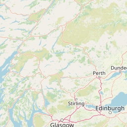
Map view of Loch Fyne

Use this park location map to pinpoint Loch Fyne in United Kingdom, understand its exact geographic position, and read its mapped placement within the surrounding landscape more clearly.

Pigeon | © OpenStreetMap contributors

Location context for Loch Fyne

Argyll and Bute

Explore protected area views, coastal terrain, and mountain scenery across Scotland's longest sea loch.

Loch Fyne Photos and Scenery: Visualizing Scottish Coastal Landscapes

Visual documentation reveals the rugged mountain terrain and forested shorelines that define the marine protected area. Photographic records illustrate coastal habitats and tidal waters, helping researchers evaluate regional geography.

Inveraray Bridge

Loch Fyne from Tighcladich

Loch Fyne view

Loch Fyne from Inveraray

Shoreline and Loch Fyne

Loch Fyne

Foreshore of Loch Fyne near Castle Lachlan

Park atlas

Compare nearby protected areas and regional Scottish marine habitats

Parks Near Loch Fyne, Exploring Surrounding Scottish Coastal Landscapes

Browse protected areas and rugged coastal terrain situated adjacent to Loch Fyne across the western seaboard. Comparative regional park browsing reveals broader patterns in Scottish highland topography and marine conservation zones.
Watercolor illustration showing mountains, green forests, a loch, and a river in a landscape
National parkScotland
About 13 km away#1 closest

Northeast

Loch Lomond and The Trossachs National Park: Mapped Landscapes and Terrain

Regional geography and protected Highland boundaries in Scotland

Loch Lomond and The Trossachs National Park covers a vast array of protected habitats, from coastal sea lochs to high-altitude Munros. This geographic profile outlines the park's position across the Highland Boundary Fault, highlighting its role as a core protected area for Caledonian forests and freshwater lake ecosystems within Scotland.

Area
1,865 km²
Established
2002
IUCN
V
Visitors
2.9M annual
Marine protected areaArgyll and Bute
About 23 km away#2 closest

Southwest

Loch Sween Marine Protected Area: Coastal Geography and Regional Atlas Map

A distinctive sea loch ecosystem in Argyll and Bute.

Investigate the coastal topography and protected marine boundaries of Loch Sween. This sea loch is defined by its irregular branching inlets and islands, creating a unique habitat mosaic of maerl beds and burrowed mud within the broader context of the western Scottish coastline.

Area
41 km²
Established
2014
IUCN
IV
Access
Access unknown
Marine protected areaArgyll and Bute
About 28 km away#3 closest

East

Loch Goil Marine Protected Area: Geography and Landscape Overview

Protected marine habitats in the Argyll and Bute region

Loch Goil offers a distinct look at an enclosed, sea loch landscape in western Scotland. Surrounded by the Arrochar Alps and steep conifer slopes, this marine protected area demonstrates the intersection of Highland wilderness and formal conservation zones. Use this atlas resource to understand its topographical form and regional context.

Established
2014
Relief
Mountain
Climate
Temperate
Access
Moderate access
Protected landscapeArgyll and Bute
About 31 km away#4 closest

Northwest

Scarba, Lunga and the Garvellachs National Scenic Area: Protected Island Geography

Coastal landscapes and tidal seascapes of Argyll and Bute

Gain insight into the distinct protected landscape of the Scarba, Lunga and the Garvellachs National Scenic Area. This area balances mountainous moorland with green meadows, while its submerged marine reefs and fierce tidal waters contribute to a complex ecological and geographic identity within the Firth of Lorn.

Area
65 km²
Established
1981
Relief
Upland
Climate
Temperate
National parkScotland
About 45 km away#5 closest

East

Loch Lomond and The Trossachs National Park: Geographic and Protected Area Overview

Tracing Highland and Lowland transition zones in Scotland

This protected area captures the contrast between the rugged mountainous terrain of the northern Trossachs and the gentler southern loch basins. By examining the Highland Boundary Fault, users can analyze how glaciers carved the landscape, creating the deep fjord-like trenches and islands that define the region's unique natural geography.

Area
71 km²
Established
2002
Relief
Mountain
Climate
Temperate
Marine protected areaScotland
About 46 km away#6 closest

North

Loch Sunart to the Sound of Jura Marine Protected Area: A Scottish Marine Geography Guide

Charting habitat management and Quaternary seabed geology in the western Highlands.

This protected area reaches across the waters of Loch Sunart, the Sound of Mull, the Firth of Lorne, and the Sound of Jura. By mapping this diverse bathymetry, the area safeguards essential marine habitats and the rare common skate population within a complex network of Highland sounds and coastal basins.

Area
741 km²
Established
2014
IUCN
IV
Climate
Temperate
Marine protected areaArgyll and Bute
About 52 km away#7 closest

North

Loch Creran Marine Protected Area: Atlas and Coastal Geography of Argyll and Bute

Mapped tidal basins, flame shell reefs, and Atlantic oakwood habitats

Loch Creran is a primary example of integrated marine and coastal conservation on the west coast of Scotland. Characterized by its long, narrow form and dramatic bathymetry, the loch creates a rich environment where rapid tidal currents meet sheltered forest shorelines. This record provides a detailed look at the geographic structure, protected seabed zones, and the transition from sea loch to the ancient woodlands at the head of the inlet.

Area
12 km²
Established
2014
IUCN
IV
Relief
Lowland
Marine protected areaScotland
About 58 km away#8 closest

South

Lamlash Marine Protected Area: Coastal Geography and Protected Waters in Scotland

Maritime terrain and conservation landscapes of the Firth of Clyde

Located along the eastern coast of the Isle of Arran, the Lamlash Marine Protected Area serves as a landmark for community-led conservation in Scotland. The site protects a vital marine ecosystem including maerl beds within a sheltered natural harbour, providing a distinct study of coastal boundaries and marine terrain facing Holy Isle across the Firth of Clyde.

Established
2008
Visitors
1.1K annual
Relief
Lowland
Climate
Temperate

Common questions about visiting, size, designation, and location context for Loch Fyne

Loch Fyne FAQs for park facts, access, geography, and protected area context

Find quick answers about Loch Fyne, including protected-area facts, park geography, trail and visitor context, and how the park fits into its surrounding country and regional landscape.
MoriAtlas Explorer

Continue Your Protected Areas Search Across the Global Atlas

Deepen your exploration by continuing the structured search for national parks and protected areas worldwide. Utilize the comprehensive filtering capabilities to compare different conservation landscapes and refine your understanding of global park geography. Discover more about the distribution and characteristics of protected natural areas.

Global natural geography