
Why Loch Lomond and The Trossachs National Park stands out
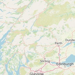
The park is best known for Loch Lomond and its setting across the Highland Boundary Fault, a single body of water that visibly contains two landscapes: a deep, narrow Highland basin in the north and a wider, gentler Lowland basin in the south. Beyond the loch itself, the park is recognised for the wooded glens, lochs, and Munros of the Trossachs. Ben Lomond, on the eastern shore of Loch Lomond, is the most southerly of Scotland's Munros, and the surrounding hills carry iconic species such as black grouse, golden eagles, pine martens, and red deer. The name "Loch Lomond" carries further weight through the beloved song "The Bonnie Banks o' Loch Lomond," which has long made the place a shorthand for Scotland itself.
Loch Lomond and The Trossachs National Park history and protected-area timeline
The history of what is now Loch Lomond and The Trossachs National Park stretches back thousands of years. People first arrived in the Loch Lomond area around 5,000 years ago during the Neolithic, leaving traces at sites including Balmaha, Luss, and Inchlonaig. Many of the loch's islands appear to be crannogs, artificial islands that served as dwellings and gathering places for over five millennia. By the early medieval period, the area was part of the province of Lennox, and Loch Lomond was prominent enough to be featured in Viking raids: Norse longships were hauled overland at Tarbet between Loch Long and Loch Lomond to attack the islands.
In the first century AD, the Romans built a double-row defensive fort at Drumququhassle, a so-called glen-blocker overlooking the loch, to control movement into the Highlands. Through the medieval and early modern periods, clans including Clan Buchanan held influence around the loch, with the crannog known as "The Kitchen" off Clairinsh used for clan meetings in line with practices seen at other Scottish highland-island centres. By the eighteenth century the loch was already an established travel destination; when James Boswell and Samuel Johnson visited in 1773 during their tour of the Western Highlands, the loch's fame was such that Boswell felt any further description was unnecessary, even though Johnson himself was unimpressed by the islands up close.
The modern protected landscape emerged in stages. Loch Lomond was designated a Ramsar wetland in 1976 and has long been recognised through national scenic area, special area of conservation, and national nature reserve designations. Wider conservation interest in the lochs and forests of the area, combined with growing recognition of the Trossachs as a national treasure, culminated in 2002 in the creation of Loch Lomond and The Trossachs National Park, Scotland's first national park. The park authority has since worked to integrate conservation, recreation, and rural land use across its territory.
Loch Lomond and The Trossachs National Park landscape and geographic character
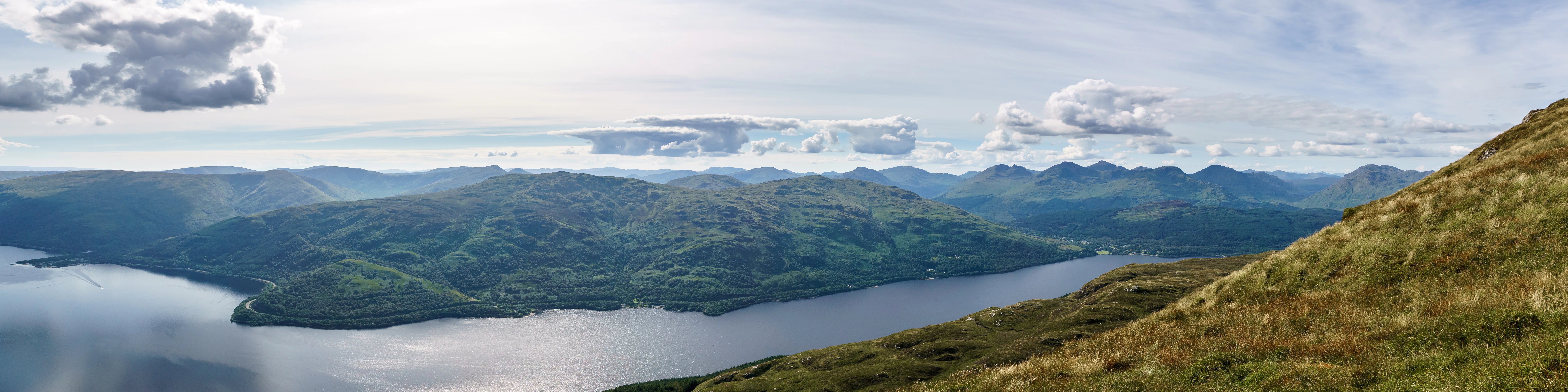
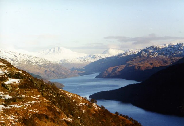
The landscape of Loch Lomond and The Trossachs National Park is shaped first by the Highland Boundary Fault, which slices diagonally through the park and through Loch Lomond itself. South of the fault, the terrain is shaped by younger sandstone and softer rocks: broader valleys, gentler slopes, agricultural land, and a shallow, wider loch basin rarely deeper than about 30 metres. North of the fault, ancient schists and quartzites form a harder, more rugged country, and glaciers during the Younger Dryas carved out a much deeper, narrower trench. The ice cut a deep channel through Highland bedrock, removing hundreds of metres of stone and producing the long, fjord-like northern basin that reaches around 190 metres deep and gives Loch Lomond its distinctive chain-of-lakes character in profile.
The mountain scenery of the park is concentrated in the north and east. Ben Lomond dominates the eastern shore of Loch Lomond at 974 metres and is the most southerly of Scotland's Munros. To the north and east rise the Trossachs hills, including Ben More and Stob Binnein, with their characteristic mix of smooth Highland ridges, corries, and forested flanks. To the west, the Argyll peaks press in close to the loch, and the A82 road threads between water and mountain. Conic Hill at the loch's narrows marks a visible transition, where the land lifts steeply from the shoreline and the underlying geology changes.
Water defines the park. Loch Lomond itself, with roughly sixty islands and 36 kilometres of length, is the central feature, but the park also includes the smaller Trossachs lochs, such as Loch Katrine, Loch Achray, and Loch Venachar, that combine with rivers and woodland to create the romantically textured landscape Sir Walter Scott celebrated. Glens such as Glen Falloch, Glen Douglas, and the upper Endrick valley add to the variety, while the southern fringes around Balloch and Drymen open up into parkland, farmland, and amenity landscapes linking the park to the Clyde valley.
Loch Lomond and The Trossachs National Park ecosystems, habitats, and plant life
Ecologically, Loch Lomond and The Trossachs National Park sits at the meeting of Highland and Lowland Scotland. The Highland schists and upland soils of the north support remnants of Caledonian pine forest, montane heath, blanket bog, and acid moorland, while the Lowland sandstones and improved pasture of the south carry a more mixed vegetation of oak woodland, birch, farmland, and riparian habitats. The lochs themselves add a freshwater dimension, with Loch Lomond acting as both an oligotrophic northern basin and a more mesotrophic southern basin, separated by the Highland Boundary Fault.
The most distinctive woodlands are the Atlantic oak woodlands along the sheltered loch shores. On Loch Lomond these are protected within the Loch Lomond Woods Special Area of Conservation, recognised for their exceptionally rich lichen, moss, and invertebrate communities; this habitat type, sometimes called Celtic rain forest, is globally rare and survives only in warm, wet oceanic climates like western Scotland's. Surrounding forest types include oak-birch woodland in the southern lowlands, commercial coniferous plantations managed for timber and deer habitat, and pockets of native pinewood higher up. Heathland, bog, and rough grassland above the treeline complete a vertical habitat gradient from loch-level oakwoods to alpine-like summit vegetation.
The freshwater systems support notable biodiversity. Loch Lomond is known to host more fish species than any other Scottish loch, and its waters carry unusual populations such as landlocked river lamprey that complete their life cycle entirely in fresh water. Reedbeds, marshes, and shoreline wetlands along the loch and its tributaries provide habitat for breeding, migrating, and wintering birds, while upland and forest habitats support forest birds, raptors, and ground-nesting species. The park's combination of woodland, open water, moorland, and mountain means ecological transitions are unusually compressed, and ecological interest is genuinely high across a relatively short distance.
Loch Lomond and The Trossachs National Park wildlife and species highlights
Loch Lomond and The Trossachs National Park supports an unusually rich mix of Highland and Lowland wildlife, and Loch Lomond itself acts as a hub for both aquatic life and seasonal bird movements. The loch holds more species of fish than any other loch in Scotland, including powan, lamprey, lampern, brook trout, perch, loach, common roach, and flounder. The river lamprey here is behaviourally unusual: unlike populations elsewhere, it remains in fresh water throughout its life, hatching in the Endrick Water before migrating into the loch as adults.
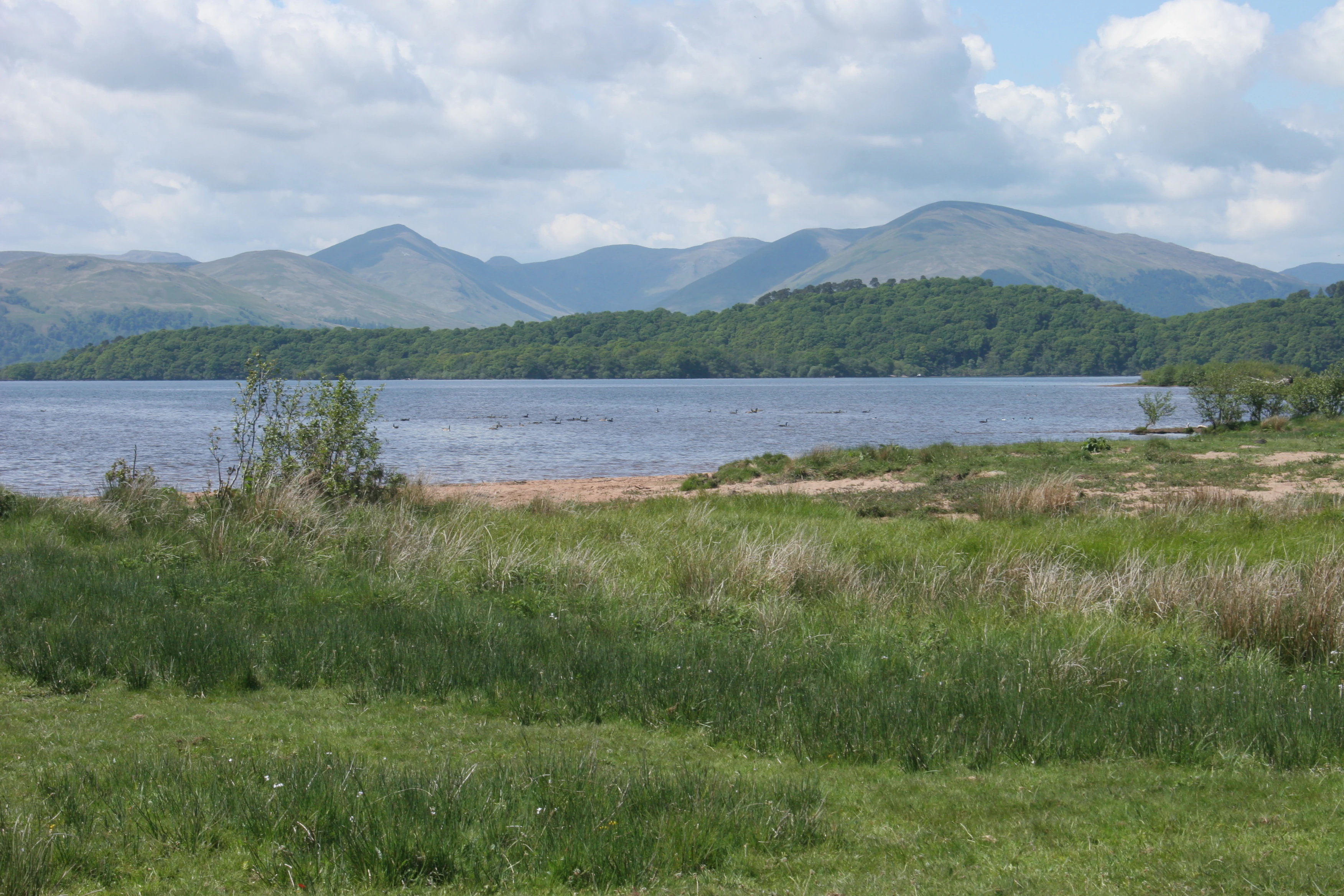
Birdlife is a major draw. The surrounding hills hold black grouse, ptarmigan, golden eagles, and a small but nationally important population of capercaillie linked to fragments of pinewood habitat. Loch shores and wetlands support breeding waders and water vole, while winter brings large numbers of geese to the area, including over 200 Greenland white-fronted geese, representing more than 1 percent of the global population, and up to 3,000 greylag geese. The loch and parts of its shore are designated as a Special Protection Area specifically because of these patterns of breeding capercaillie and wintering Greenland white-fronted geese.
Mammals include red deer and the smaller mountain hare in open Highland ground, pine martens in forested catchments, and otters along the loch shore and tributaries. A striking anecdote of the area is the colony of red-necked wallabies on the island of Inchconnachan, descended from animals originally introduced there in the twentieth century. In 2023, RSPB Scotland released a family of Eurasian beavers into the south-east of the loch, under licence from NatureScot, marking a step in efforts to restore natural processes like wetland creation and woodland regeneration. Conservation managers also work to control invasive non-native plants such as giant hogweed, Japanese knotweed, Himalayan balsam, and American skunk cabbage, which can dominate riverbanks and outcompete native flora. A botanical curiosity is the Scottish dock (Rumex aquaticus), which in Britain is found almost exclusively on the shores of Loch Lomond around Balmaha.
Loch Lomond and The Trossachs National Park conservation status and protection priorities
Loch Lomond and The Trossachs National Park is one of the most ecologically designated areas in Scotland. The loch itself is a Ramsar wetland and part of a national scenic area, and its shores and islands carry multiple overlapping conservation designations: a National Nature Reserve, Special Areas of Conservation, and Special Protection Areas. The Loch Lomond National Nature Reserve covers roughly 428 hectares, including five islands, while the Loch Lomond Woods Special Area of Conservation protects Atlantic oak woodland, otter populations, and other priority features. Parts of the shoreline and four islands are additionally protected as a Special Protection Area for breeding capercaillie and wintering Greenland white-fronted geese.
Beyond legal designations, the park is an important stronghold for species and habitats that have contracted severely elsewhere. Atlantic oak woodland, one of the rarest and most threatened habitats in Europe, survives here in meaningful blocks; Caledonian pine remnants and pinewood-associated wildlife such as capercaillie and pine marten persist in the northern forest patches; and rare botanical species such as the Loch Lomond dock survive in tiny populations. The integration of conservation with rural land use is a deliberate feature: peatland restoration, sustainable forestry, and agricultural collaboration all figure in the park's approach, alongside management of diffuse pollution from farmland and the long-running effort to control invasive non-native plant species along loch shores and riverbanks.
Climate, water quality, and biodiversity are also conservation priorities. Peatlands in the catchment are being restored for their carbon storage and water regulation value. Water quality across the loch is generally good, though localised pressures from agriculture, forestry, and tourism contribute nutrients to some areas, particularly in the southern basin and after heavy rainfall. The introduction of beavers is part of a broader effort to restore natural processes and improve wetland habitat. Together, the network of designations, the rarity of the habitats, and the active management of land, water, and invasive species make the park a conservation area of national significance within Scotland.
Loch Lomond and The Trossachs National Park cultural meaning and human context
The Loch Lomond and Trossachs area carries a deep cultural identity that long predates the national park. Loch Lomond itself is woven into Scottish imagination through poetry, music, and the famous song "The Bonnie Banks o' Loch Lomond," first published around 1841 and often associated with the Jacobite rising of 1745 or with the experiences of imprisoned Scottish soldiers. The song has been recorded by numerous artists and remains one of the most recognisable pieces of Scottish musical heritage. The loch is also frequently invoked as a poetic shorthand for Scotland as a whole, appearing in literature and musical theatre from Lerner and Loewe's Brigadoon to Bollywood films such as Kuch Kuch Hota Hai.
The Trossachs themselves are inseparable from Scottish literature and Romantic-era ideas of Highland scenery. Sir Walter Scott drew heavily on the area in poems and novels such as The Lady of the Lake and Rob Roy, and the region came to embody a particular vision of Highland beauty for Victorian and later visitors. Crannog-dotted islands and prehistoric settlement traces around the loch's shores, from Balmaha and Luss to Inchlonaig, speak to a continuous human presence back to the Neolithic era, while medieval clan territory, including the historical influence of Clan Buchanan centred around Clairinsh, anchors the more recent past.
Written travel accounts from the eighteenth and nineteenth centuries, from Boswell and Johnson's 1773 visit to H. V. Morton's later descriptions and the appearance of Luss in the television soap Take the High Road, show how deeply the area's landscapes have shaped Scottish identity. Today the park continues that tradition, serving both as a working landscape for local communities and as a place where visitors encounter an iconic and widely recognised Scottish setting.
Top sights and standout views in Loch Lomond and The Trossachs National Park
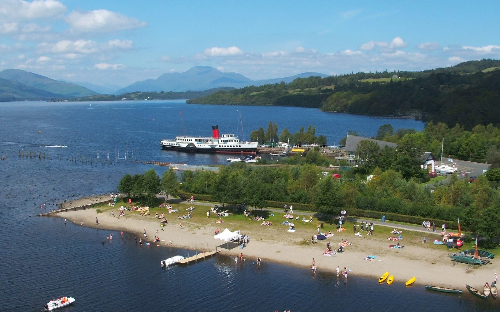
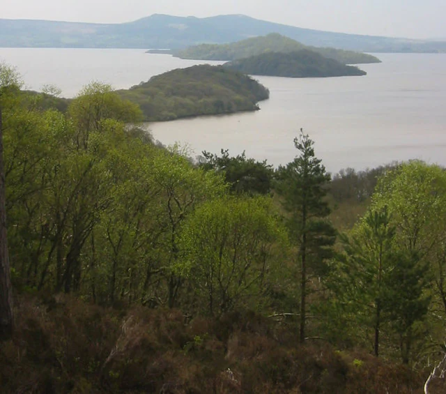
The park's principal highlight is Loch Lomond itself, the largest freshwater lake in Great Britain by surface area, with thirty or more islands including Inchmurrin, the largest freshwater island in the British Isles. Together with the loch's dramatic transition from deep Highland basin to broad Lowland shore, this gives the park one of its most distinctive scenes.
The Trossachs hills and lochs are equally central, offering Highland scenery, native woodlands, and Sir Walter Scott country in a compact area. Long-distance routes such as the West Highland Way and the West Loch Lomond Cycle Path showcase the park at walking and cycling pace, while conservation sites such as the Loch Lomond woods, Inchcailloch National Nature Reserve, and the loch's Ramsar-designated waters reflect its ecological importance. Song, literature, and centuries of visitor tradition add another layer, making the park not only a wild landscape but a cornerstone of Scottish cultural geography.
Best time to visit Loch Lomond and The Trossachs National Park
The park has a strongly seasonal character. Spring and early summer bring fresh greenery, active birdlife, and the cleanest water conditions on the loch, and lighter evenings make the Highland summits more accessible for walking. Summer is the most popular period for boating, watersports, and ferry cruises, when the loch and its islands are at their busiest and camping byelaws are in effect between March and October.
Autumn is often considered atmospheric, with lower light, woodland colour, and quieter conditions after the main summer rush. Winter brings shorter days, colder weather, and the arrival of wintering waterfowl, including significant flocks of Greenland white-fronted and greylag geese, while snow alters the higher summits and the Highland scenery takes on a more austere character. Whatever the season, weather in western Scotland can be changeable, so visitors typically plan for shifting conditions rather than a single fixed pattern.