Mori Atlas logo
Protected areaLønborg Hede

A study of dry heath plateau and low-lying mire systems in Region Midtjylland

Lønborg Hede Protected Area: Mapping the Heathland and Mire Mosaic of Central Jutland

(Natura 2000-område nr. 73 Lønborg Hede)

Lønborg Hede represents a vital protected landscape in western Denmark, defined by a distinct micro-topographic contrast between dry inland heath plateaus and waterlogged bog systems. Located in Region Midtjylland, this area encompasses a complex mosaic of twelve small lakes, acidic mires, and the Styg bæk stream. The site serves as a preserved remnant of traditional heathland, offering a clear geographic study of wet and dry habitat gradients within an otherwise agricultural landscape.

heathlandwet heathdry heathbogmireinland dunes

Lønborg Hede

Protected area

Park overview

Structured park overview, official facts, and landscape profile for Lønborg Hede

Lønborg Hede park facts, protected area profile, and essential visitor context

Review the core facts for Lønborg Hede, including designation, size, terrain, visitor scale, habitats, and operating context in one park-focused overview.

About Lønborg Hede

Lønborg Hede is one of Denmark's smaller but ecologically distinctive Natura 2000 habitat sites, located in the inland part of western Jutland not far from the Ringkøbing Fjord lagoon system. Although it lies only about five kilometers from that large coastal fjord, Lønborg Hede itself is an entirely inland site, set west of the Main Stationary Line that marks the limit of the last glaciation's maximum advance through Jutland. This geographic position places the heath within the older landscape of western Denmark, where sandy, nutrient-poor substrates have historically supported heath rather than forest.

The site's character is shaped by a clear contrast between wet and dry zones. The lower-lying parts consist of wet heath, mire, and bog communities crossed by the small stream Styg bæk and dotted with twelve small lakes of varying nutrient and vegetation types. Above this wet base sits a higher, drier inland heath that effectively forms a small plateau, with elevation differences of roughly 10 to 15 meters between the two zones. This combination produces a striking and unusually compact diversity of habitat types within the protected site.

The ecological importance of the area was recognized early. In 1970, a 247-hectare area south of the village of Vostrup Østerby was formally protected, with about 200 hectares falling within the present Natura 2000 boundary. The protection was aimed primarily at conserving breeding bird populations of open heathland and mire habitats. Today, much of the site, around 363 hectares in total of the larger Lønborg Hede area, is owned by the Danish Nature Agency, which continues to manage the heathland in line with national Natura 2000 planning adopted in 2011 and updated in later planning periods.

The surrounding land use frames the site clearly: traditional farmland lies to the north and south, while conifer plantations border it to the east and west. As a result, Lønborg Hede functions as an open-heath island within an otherwise heavily used landscape, reinforcing its value for species and habitats that depend on extensive, open, nutrient-poor conditions.

Quick facts and research context for Lønborg Hede

Lønborg Hede is a Danish Natura 2000 habitat area (site number 73) covering roughly 350 hectares in Ringkøbing-Skjern Municipality, Central Jutland. The terrain includes dry inland heath, wet heath, bogs, a stream called Styg bæk, and twelve small lakes of varying water types. Much of the area is owned or managed by the Danish Nature Agency (Naturstyrelsen), and a 247-hectare portion was formally protected in 1970 to safeguard breeding populations of heathland birds.

Protection and recognition

Documented terrestrial protection scope and recognized conservation frameworks

Lønborg Hede Protection Status and Official International Designations

Lønborg Hede maintains documented terrestrial protection status supported by formal Natura 2000 designation records. Official recognition frameworks provide verified context regarding the management scope and conservation boundaries of this protected area.

International recognition

Protection details

Protection scope
Terrestrial
Transboundary protection
No
Park context

Deeper park guide and search-rich context for Lønborg Hede

Lønborg Hede history, landscape, wildlife, and travel context

Explore Lønborg Hede through its history, landscape character, ecosystems, wildlife, conservation priorities, cultural context, and seasonal travel timing in a structured park guide built for atlas discovery and search intent.

Why Lønborg Hede stands out

Lønborg Hede is best known for its contrasting dry and wet heathland mosaic in an otherwise agricultural and plantation-dominated part of Jutland. The site's defining feature is a low-lying bell-heather (klokkelyng) heathland with bog, mire, small lakes, and a stream, against which a drier heath plateau rises 10 to 15 meters above the surroundings. This micro-topographic relief produces a compact but ecologically varied Natura 2000 site with both dry inland dune-heath vegetation and nutrient-poor aquatic habitats in close proximity.

Lønborg Hede history and protected-area timeline

Lønborg Hede's formal protection history begins in 1970, when 247 hectares south of Vostrup Østerby were placed under nature conservation reserve (fredning) status. Of this protected area, approximately 200 hectares overlap with what is now the Natura 2000 boundary. The original purpose of the reserve was to safeguard breeding populations of heathland and mire birds, including black grouse (urfugl), redshank (tinksmed), and curlew (stor regnspove), all species associated with open, low-intensity landscapes.

The site was later incorporated into the European Union's Natura 2000 network as habitat area H176, designated as Natura 2000 area number 73. The Natura 2000 plan for the site was adopted in 2011, after which the municipal councils and the Danish Nature Agency drew up binding action plans for its implementation. The plan has been extended and refined in subsequent planning periods, and the site is also covered by the water plan for the Ringkøbing Fjord river basin district, reflecting the importance of its small streams and lakes for broader hydrological management in the region.

Over time, the species composition of the site has shifted in ways that reflect wider changes in Danish nature. Black grouse disappeared from Denmark in the mid-1990s, and redshank no longer breeds in the area, although other characteristic heathland and mire species such as great grey shrike (stor tornskade), red-backed shrike (rødrygget tornskade), common crane (trane), wood lark (hedelærke), and European nightjar (natravn) continue to use the site.

Lønborg Hede landscape and geographic character

Lønborg Hede presents a compact but visually varied inland landscape defined by a clear wet-to-dry gradient. The low-lying base of the site is a mosaic of wet heath, bog, peat mires, small lakes, and the slow-moving Styg bæk stream, while a higher, drier inland heath rises above it like a low plateau. The elevation difference between the two zones reaches about 10 to 15 meters, giving the site a degree of internal relief that is unusual for the surrounding, generally flat western Jutland terrain.

The dry inland heath includes both inland dune-heath (indlandsklit) communities and classic dry heath on acidic, sandy soils, dominated by vegetation such as bell heather (klokkelyng). In contrast, the lower-lying wet heath and mire zones include wet heath, temporarily flooded grassland, hanging-bog communities, and acidic mire vegetation. This juxtaposition of dry upland heath and waterlogged lowland in a single small site gives Lønborg Hede its strongly compartmentalized character.

The site is bordered by traditional farmland to the north and south and by conifer plantations to the east and west, leaving the open heathland as a clear, sun-exposed core. The twelve small lakes scattered through the wetter part of the site add to the visual diversity, ranging from nutrient-rich lake-edge habitats to clear, brown-water, charophyte-dominated lakes.

Lønborg Hede ecosystems, habitats, and plant life

Ecologically, Lønborg Hede is defined by its juxtaposition of xeric heathland with wetland and aquatic habitats. The Natura 2000 designation lists a notable range of habitat types for such a compact area. On the dry side, the site supports inland dune-heath with crowberry (revling-indlandsklit) and inland dune-heath with broom (visse-indlandsklit), as well as classic dry heath and species-rich acidic grassland (surt overdrev).

The wetter zones include wet heath, temporarily flooded meadows, and hanging-bog communities, along with several lake and stream habitat types. Among the twelve small lakes, one falls within the lake-shore-with-small-herbs category, two are classified as charophyte lakes (kransnålalge-sø), and nine are classified as brown-water lakes (brunvandet sø), reflecting a range of nutrient conditions and vegetation cover. The stream Styg bæk belongs to the protected watercourse habitat type, and the broader wetland complex supports mires with sphagnum and other peat-forming species.

The variety of acidic, nutrient-poor substrates, combined with open exposure and stable hydrology in the lower-lying zones, creates conditions favorable for specialist heath, mire, and lake species that have become rare elsewhere in Denmark. The site's habitat list signals both a relict inland heath character and a functioning hydrological system connecting bogs, lakes, and stream through the area.

Lønborg Hede wildlife and species highlights

Lønborg Hede is primarily notable for its birdlife, both historically and in the present day. The original 1970 protection was explicitly aimed at three ground-nesting species: black grouse, redshank, and curlew. Black grouse has since disappeared from Denmark entirely, vanishing in the mid-1990s, and redshank no longer breeds at the site. Curlew and other large waders are part of the site's broader history of supporting open-ground breeding birds.

Today, the heath and mire mosaic continues to support a guild of heathland, scrub, and mire-associated bird species. Great grey shrike and red-backed shrike use the margins between open heath and plantations as hunting territory. Common crane visits or breeds in the wetter parts of the site. Wood lark breeds in the open heath with scattered vegetation, and European nightjar uses the drier, open interior. Together these species reflect the site's continuing value as an open-landscape bird habitat even as some of its original target species have declined.

The lake and stream habitats add an aquatic dimension. Brook lamprey is listed as an Annex II species for the site, indicating the presence of clean, structured streams suitable for this sensitive fish. The combination of brown-water lakes and charophyte lakes also supports distinctive invertebrate assemblages associated with clear, low-nutrient waters. The site's wildlife value thus extends from open-ground breeding birds to stream-associated species, though specific mammal and reptile details are not strongly supported by the available source material.

Lønborg Hede conservation status and protection priorities

The conservation significance of Lønborg Hede lies in its role as a rare inland refuge of open, nutrient-poor habitat in central-western Denmark. It combines high-priority dry heath types with multiple protected wetland and lake types within a relatively small surface area, something that is uncommon across the heavily cultivated Danish landscape. Several of these habitat types are marked as priority habitats in the Natura 2000 designation, giving them particular weight in conservation planning.

The site's formal protection history runs from a 1970 national reserve covering 247 hectares through to its integration into the EU Natura 2000 network as habitat area H176, and onward to Natura 2000 planning adopted in 2011. The Danish Nature Agency owns a substantial portion of the larger Lønborg Hede area, about 363 hectares, giving the state a strong role in management and enabling coherent, large-scale intervention such as grazing, prescribed burning, vegetation removal, or rewetting where needed.

Conservation management at Lønborg Hede is tied to broader catchment planning through the Ringkøbing Fjord water plan, since the lakes and stream within the site are part of a wider hydrological system. This means that conservation outcomes at the site are influenced not only by local management but also by regional water-quality and hydrology decisions, making coordinated action between the Nature Agency, the municipality, and water planners essential to maintaining the heath-mire-lake mosaic on which the site's species depend.

Lønborg Hede cultural meaning and human context

The cultural context of Lønborg Hede is shaped by its position at the edge of the traditional western Jutland heath landscape. The area sits within Ringkøbing-Skjern Municipality, historically one of Denmark's most extensive heathland regions. The contrast described in the source, between traditional farmland to the north and south and conifer plantations to the east and west, reflects a broader 20th-century shift in how former heathland was treated, with much of it either afforested with spruce or reclaimed for agriculture.

The name Lønborg Hede itself places the site firmly within that heathland heritage, with hede meaning heath in Danish. The surviving remnant of open heath, including the 1970 protection around Vostrup Østerby, can be read as an attempt to preserve a piece of the cultural-ecological landscape that shaped rural identity in the region. Although the source material does not detail specific folklore, archaeological, or indigenous heritage at the site, it situates the area within a long-standing Danish tradition of managing and protecting representative heathland fragments for both ecological and landscape-historical reasons.

Top sights and standout views in Lønborg Hede

The most distinctive aspects of Lønborg Hede are its compact heath-and-mire mosaic and the unusual micro-topography that puts dry heath 10 to 15 meters above wet heath, bog, and small lakes in a single protected area.

Other highlights include its twelve small lakes of three different habitat types, its protected stream Styg bæk, and its strong historical protection record, from a 1970 reserve through to ongoing Natura 2000 planning under the Danish Nature Agency.

Best time to visit Lønborg Hede

The source material does not provide direct visitor-oriented seasonal guidance, so any advice should stay general. Open, dry inland heaths in western Jutland tend to be visually most expressive in late spring and summer, when heather is in bloom and bird activity peaks, although ground conditions on the wet heath and lake margins can be soft after rain. Cooler seasons can offer easier walking on firmer ground but show less color and less visible wildlife activity. Visitors should generally expect an outdoor, weather-dependent experience typical of inland Danish heath reserves.

Monthly climate preview

Long-term representative point measurements tracking monthly averages across Region Midtjylland

Lønborg Hede Climate Normals: Measured Annual Temperature and Precipitation Patterns

Representative coordinates record mean monthly temperatures from negative values through roughly seventeen degrees Celsius alongside varying daily precipitation rates. Analyzing twelve-month climate normals reveals structural atmospheric rhythms across the protected landscape.
Annual mean9 °C
2 °C17 °C
Jan
Feb
Mar
Apr
May11°
Jun14°
Jul17°
Aug17°
Sep15°
Oct11°
Nov
Dec
Warmest month
August

17.2 °C

Coolest month
February

2.3 °C

Wettest month
October

3.3 mm/day

Driest month
April

1.5 mm/day

Park location guide

Geography guide, regional context, and park location map for Lønborg Hede

Lønborg Hede park geography, regions, and map view in Denmark

Understand where Lønborg Hede sits in Denmark through a broader geographic reading of the surrounding landscape, nearby location context, and its mapped position within the national park landscape.

How Lønborg Hede fits into Denmark

Denmark is a constitutional monarchy and Nordic country in Northern Europe. It is the southernmost of the Scandinavian countries, bordering Germany to the south, Norway to the north, and Sweden to the southwest. The country consists of the Jutland peninsula and an archipelago of islands, with Copenhagen as its capital and largest city. Denmark has a population of over 6 million and is characterized by flat, arable land, sandy coasts, and a temperate climate.

Wider geography shaping Lønborg Hede in Denmark

Denmark occupies the Jutland peninsula and roughly 406 islands in Northern Europe. It is situated between the North Sea to the west and the Baltic Sea to the east. The country borders Germany to the south and is connected to Sweden via the Øresund Bridge. Denmark is predominantly flat terrain with low elevation, the highest point being Møllehøj at 170.86 meters.

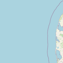
Map view of Lønborg Hede

Use this park location map to pinpoint Lønborg Hede in Denmark, understand its exact geographic position, and read its mapped placement within the surrounding landscape more clearly.

Pigeon | © OpenStreetMap contributors

Location context for Lønborg Hede

Region Midtjylland
Park atlas

Compare regional heathland reserves and connected protected habitats across western Denmark

Explore Parks Near Lønborg Hede and Related Protected Landscapes in Central Jutland

Visitors exploring Lønborg Hede can browse nearby protected areas to examine regional ecological patterns and lowland terrain features. Comparing adjacent conservation sites reveals broader geographic context across the surrounding Jutland landscape.
A pale watercolor landscape painting of a quiet fjord with soft green and pink marshy vegetation in the foreground and rolling hills in the background.
Protected areaRegion Midtjylland
3.5 km away#1 closest

West

Ringkøbing Fjord og Nymindestrømmen: Coastal Lagoon and Protected Wetland Geography

A vast Danish wetland complex in Region Midtjylland.

Ringkøbing Fjord og Nymindestrømmen defines the Danish west coast through its unique combination of brackish lagoons, salt meadows, and dune belts. This protected area integrates the Skjern Å river delta and the freshwater-lagoon chain of Nymindestrømmen, creating an internationally significant habitat for diverse waterbirds and migratory species across its multi-layered terrain.

Area
276.84 km²
Relief
Lowland
Climate
Temperate
Scope
Mixed
Nature reserveRegion Midtjylland
About 10 km away#2 closest

Northeast

Natura 2000-område nr. 68 Skjern Å: Protected Riverine Geography and Valley Landscapes

A central Jutland nature reserve featuring glacial valley systems

Explore the geographic boundary and habitat diversity of Natura 2000-område nr. 68 Skjern Å. This protected landscape preserves the vital connection between freshwater river channels, raised bogs, and open heathland, serving as a landmark for regional river management and biodiversity conservation in western Denmark.

Area
25.8 km²
Established
2011
Nature reserveCentral Denmark Region
12 km away#3 closest

East

Borris Hede Nature Reserve: Mapping the Protected Heathland of the Central Denmark Region

Glacial plains, wetland mosaics, and habitat conservation zones

Borris Hede encompasses a massive stretch of sandy outwash plain in central-western Denmark. This nature reserve serves as a vital habitat mosaic, ranging from dry and wet heath to bogs and riparian stream corridors. By preserving these open terrain characteristics, the site supports specialized birdlife and maintains one of the most distinctive geological and biological landscapes within the Danish geography.

Area
47.78 km²
Established
1903
Relief
Lowland
Climate
Temperate
National parkDenmark
25 km away#4 closest

South

Wadden Sea National Park: Denmark's Premier Tidal Wetland and Migratory Bird Sanctuary

Mapped boundaries and unique protected landscape exploration.

Wadden Sea National Park is a vast national park encompassing the Danish portion of the Wadden Sea, a globally significant tidal wetland. Recognized for its critical role in bird migration, hosting millions of birds annually, it features a distinctive landscape of tidal flats, salt marshes, coastal dunes, and barrier islands. This protected area offers a unique lens through which to explore dynamic coastal geography, intertidal ecosystems, and the conservation of a World Heritage Site.

Area
1,466 km²
Established
2010
IUCN
II
Relief
Lowland
A soft watercolor illustration showing a hazy coastal landscape with green dunes, rolling hills, and a calm water surface against a white background.
Protected landscapeDenmark
About 28 km away#5 closest

Southwest

Naturpark Vesterhavet: Geography and Protected Boundaries of the Danish West Coast

Coastal dune, heath, and wetland landscapes in West Jutland

Naturpark Vesterhavet serves as a critical coastal nature park along the North Sea, stretching between Blåvandshuk and Nymindegab. The park integrates a distinct series of parallel landforms, including active dunes, coniferous plantations, expansive heathlands, and the significant restored wetlands of Filsø. This protected landscape acts as a primary hub for coastal conservation, mapping the intersection of avian habitats and classic West Jutland terrain.

Area
225 km²
Established
2015
Relief
Lowland
Climate
Temperate
Protected areaRegion Midtjylland
35 km away#6 closest

North

Kimmelkær Landkanal: Mapped Protected Area and Regional Geography in Midtjylland

A rare aquatic habitat within the Ringkøbing Fjord water system.

Focusing on a narrow canal corridor, Kimmelkær Landkanal serves as a vital protected area for threatened aquatic species. Its geography is characterized by soft sandy sediments and a distinct parallel channel structure, connecting small watercourses to the larger wetland ecosystems of the Stadil Fjord catchment area.

Area
0.03 km²
Established
2011
Relief
Lowland
Scope
Terrestrial
Protected areaDenmark
About 36 km away#7 closest

Northwest

Natura 2000 area no. 66 Stadil Fjord og Vest Stadil Fjord Coastal Wetland Complex

Protected lagoon and dune landscape in western Jutland, Denmark.

Natura 2000 area no. 66 Stadil Fjord og Vest Stadil Fjord comprises a significant coastal lagoon system, encompassing shallow brackish waters, reed beds, and surrounding dune heaths. This protected area supports a high degree of botanical diversity and provides essential habitat for various bird species, serving as a primary example of Denmark's complex hydrological and coastal geography.

Area
69.03 km²
Relief
Lowland
Climate
Temperate
Access
Easy access
Nature reserveRegion Midtjylland
38 km away#8 closest

East

Mose ved Karstoft Å Protected Area: Landscape Geography and Wetland Mapping

Regional peatland habitat located in central Jutland, Denmark

Mose ved Karstoft Å represents a critical study in wetland restoration and habitat preservation. This small yet ecologically dense site features a complex terrain of Sphagnum mats, seasonal pools, and heathland, providing a vivid example of how post-industrial peat landscapes can foster specialist plant communities in the heart of Denmark.

Area
0.26 km²
Established
2011
Relief
Lowland
Climate
Temperate

Common questions about visiting, size, designation, and location context for Lønborg Hede

Lønborg Hede FAQs for park facts, access, geography, and protected area context

Find quick answers about Lønborg Hede, including protected-area facts, park geography, trail and visitor context, and how the park fits into its surrounding country and regional landscape.
MoriAtlas Explorer

Continue Your Protected Areas Search Across the Global Atlas

Deepen your exploration by continuing the structured search for national parks and protected areas worldwide. Utilize the comprehensive filtering capabilities to compare different conservation landscapes and refine your understanding of global park geography. Discover more about the distribution and characteristics of protected natural areas.

Global natural geography