
Mori Atlas logo
Park earthquake history

A mapped catalogue of historical seismic events occurring within the broader Rhine region.

Recorded Earthquake History and Seismic Activity Records for the Lorcher Werth Nature Reserve

Browse the comprehensive collection of historical earthquake records associated by epicentre proximity with the Lorcher Werth nature reserve in the Middle Rhine valley. This catalogue provides direct access to event dates, seismic magnitudes, and depth data for geological disturbances documented across the Hesse region. All records rely on established scientific data to show the historical frequency and distribution of seismic motion relative to this protected floodplain landscape.

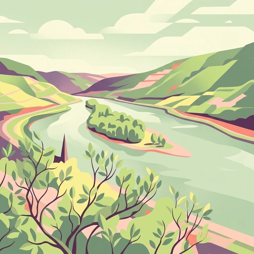
A stylized flat-art illustration showing a river winding through hills, with an island in the center and foliage in the immediate foreground.

A protected river island group in the Upper Middle Rhine valley.

Lorcher Werth

Lorcher Werth is a small, uninhabited group of river islands lying in the Middle Rhine between the towns of Lorch and Niederheimbach in the state of Hesse, Germany. The island group consists of the Großes Lorcher Werth and the Kleines Lorcher Werth, two low-lying flats connected by a guiding dam, stretching roughly two kilometers along the river between Rhine kilometer 538 and 540. It sits about ten kilometers downstream of the Binger Loch, a well-known narrow section of the Rhine. The islands are designated as a nature reserve (Naturschutzgebiet) and as an EU Habitats Directive (FFH) site, and they are closed to public access to protect their developing floodplain forest and shoreline habitats. After earlier plantings of hybrid poplars and black locust, the conservation goal is now to gradually remove these non-native trees and restore more natural softwood floodplain forest (Auwald) and natural riverbank conditions. Historically, the larger island also hosted a vineyard, a drinking-water pumping station, and at times a football pitch, and in the 1920s it was even earmarked for a monumental World War I memorial project that was never built. Today Lorcher Werth stands out as a quiet but ecologically important refuge within the heavily modified Upper Middle Rhine landscape.

Location
Germany
Park type
Nature reserve
Area
0.1 km²
Highest point
76 m
Explore Lorcher Werth Nature Reserve Geography

Navigate Lorcher Werth events by date, depth, and distance

Examine the earthquake record associated with Lorcher Werth

Lorcher Werth’s earthquake records are connected to the Middle Rhine island reserve by epicentre geography and calculated separation, not by automatic placement inside the site. Dates, magnitudes, depths, reported localities, distance values, and source links allow historical regional review while avoiding claims about island effects, causation, present seismic danger, or future activity.

Sort by
Magnitude
Location

This page describes catalogued earthquakes associated with the park by epicentre location and distance. It does not establish causation, assess current danger, or predict future earthquakes.

No earthquake records match the current filters

Park atlas

Move beyond the Upper Middle Rhine's protected river islands

Follow Lorcher Werth with new protected-area discoveries

Lorcher Werth places its earthquake record beside a small group of protected islands in Hesse's Upper Middle Rhine valley. Other atlas destinations follow for exploration alone, with no claim of common river-island character, conservation status, geology, seismic conditions, proximity, hazard, or source coverage.
A watercolor painting showing a soft, atmospheric landscape with a river flowing through green hills and gentle, misty mountains.
Nature reserveRhineland-Palatinate
Park boundaries overlap#1 closest

East

Inselrhein Nature Reserve, Rhineland-Palatinate: A Geographic and Protected-Area Atlas

River islands, floodplain forests, and Upper Rhine wetlands

Inselrhein features a chain of natural river islands and side channels forming a critical wetland habitat. The terrain transition from soft-wood to hardwood forest communities creates a layered landscape. Examine the protected boundaries and geographic significance of this river corridor between Mainz and Bingen, documented within the Rhineland-Palatinate atlas.

Relief
Lowland
Climate
Temperate
Access
Easy access
Scope
Terrestrial
A horizontal watercolor painting showing a serene valley landscape with distant rolling mountains, a central winding river or stream, and grassy banks in soft muted colors.
Nature reserveGermany
About 3.8 km away#2 closest

Southeast

Morgenbachtal Nature Reserve: A Geographic Atlas of the Middle Rhine Slate Cliffs

Exploration of the Binger Wald protected valley and its geological terrain.

Morgenbachtal presents a unique geographic profile characterized by two distinct ridge lines of crystalline slate cliffs. This protected area in Germany balances strict conservation with a complex landscape of narrow ravines, mixed forests, and historical landmarks like the Steckeschlääferklamm gorge and medieval castle ruins along the Rhine.

Watercolor painting of a river landscape with rolling green hills, distant slopes, and soft vegetation in shades of green and pink against a white background.
Nature reserveRheingau-Taunus-Kreis
9 km away#3 closest

Southeast

Rüdesheimer Aue Nature Reserve and Upper Rhine Protected Landscape

Riverine geography and protected floodplain forest

Rüdesheimer Aue represents a rare, uninhabited island refuge along the Upper Rhine. Its geography features shifting sediment bars, mudflats, and softwood floodplain forest cover, offering an essential staging ground for migratory waterbirds within the Rheingau-Taunus district of Hesse.

Area
0.057 km²
Relief
Lowland
Climate
Temperate
Access
Remote access
Nature reserveRhein-Hunsrück-Kreis
About 11 km away#4 closest

West

Struth Nature Reserve: Protected Wetland and Forest Geography in Rhein-Hunsruck-Kreis

Extensive wetland mosaic within the Hunsruck uplands

Struth is a sprawling nature reserve in Germany, known for its rare alder swamp woodlands and expansive wet meadows. Its geography reveals a transitional landscape between forested uplands and the Middle Rhine valley, offering a vital ecological corridor that includes protected habitat for threatened bat and beetle species across 871 hectares.

Area
8.71 km²
Established
1987
Relief
Upland
Scope
Terrestrial
A watercolor illustration of a calm body of water with a single tree in the center; distant rolling hills are visible in the background under a soft, pastel-colored sky.
Nature reserveLower Saxony
About 12 km away#5 closest

Southeast

Fulder Aue, Ilmen Aue Nature Reserve: Mapped Protected Landscapes and Floodplain Geography

Alluvial river islands and wetland ecosystems in the Rhine valley.

The Fulder Aue, Ilmen Aue nature reserve serves as an vital example of an active Rhine floodplain. This area preserves a mosaic of islands, connecting channels, and soft-wood forest habitats. Learn about the geographic and hydrological dynamics that shape this protected space near Bingen am Rhein, showcasing its importance within the Rhine lowland system.

Area
3.38 km²
Established
1995
Relief
Lowland
Scope
Terrestrial
A soft, painterly watercolor illustration of a rolling landscape with patches of forest, light green fields, and distant hazy hills.
Protected landscapeRheinland-Pfalz
14 km away#6 closest

Southwest

Soonwald Protected Landscape: Mapped Quartzite Ridges and Forested Massifs in Rhineland-Palatinate

Geographic analysis of the Hunsrück ridge system and protected natural terrain

The Soonwald is a significant quartzite-dominated ridge system within the German Hunsrück. This protected landscape encompasses 40 kilometers of uninterrupted crestlines, deep valley incisions, and ecological forest reserves. It offers a detailed study in mountain geography and ridge-dominated topography for those interested in the structural layout of the Rhineland-Palatinate natural environment.

Area
276.6 km²
Relief
Mountain
Climate
Temperate
Access
Easy access
A horizontal watercolor painting of a river landscape with lush green trees, grasses, and a winding waterway under a soft light.
Nature reserveHessen
16 km away#7 closest

East

Mariannenaue Nature Reserve: Protected River Island Geography and Landscape Atlas

Rhine river island and floodplain forest in Hessen, Germany.

Mariannenaue serves as a prominent example of a protected inland island in the Upper Rhine. Its geography encompasses a complex mix of veteran floodplain forest, still-water habitats, and centuries-old vineyard cultivation. This detail page provides insights into the park boundaries, the surrounding riverine terrain, and the ecological network that connects this site to the broader Rheingau landscape.

Area
1.96 km²
Established
1972
Relief
Lowland
Climate
Temperate
A horizontal watercolor illustration of a natural landscape featuring a small body of water or pond in the foreground, surrounded by grassy banks, low hills in the distance, and soft-colored vegetation.
Nature reserveRhineland-Palatinate
About 20 km away#8 closest

East

Sandgrube am Weilersberg Nature Reserve and Protected Landscape Map

Rhineland-Palatinate, Germany protected area

Sandgrube am Weilersberg is a protected nature reserve in Rhineland-Palatinate, Germany, known for its compact mosaic of calcareous sand slopes and wet meadows. Part of the Natura 2000 network, the site preserves rare steppe flora and wetland ecosystems that emerged following former sand extraction. The terrain supports significant entomological, botanical, and bryological diversity maintained through active grazing.

Area
0.095 km²
Established
1986
Relief
Lowland
Climate
Temperate
MoriAtlas Explorer

Explore the Protected River Geography of the Lorcher Werth Nature Reserve

Study the mapped boundaries and floodplain restoration efforts of Lorcher Werth in the Middle Rhine. This MoriAtlas destination provides detailed geographic context for one of Hesse's most significant river island ecosystems, illustrating the complex intersection of historic landscape use and modern nature conservation.