
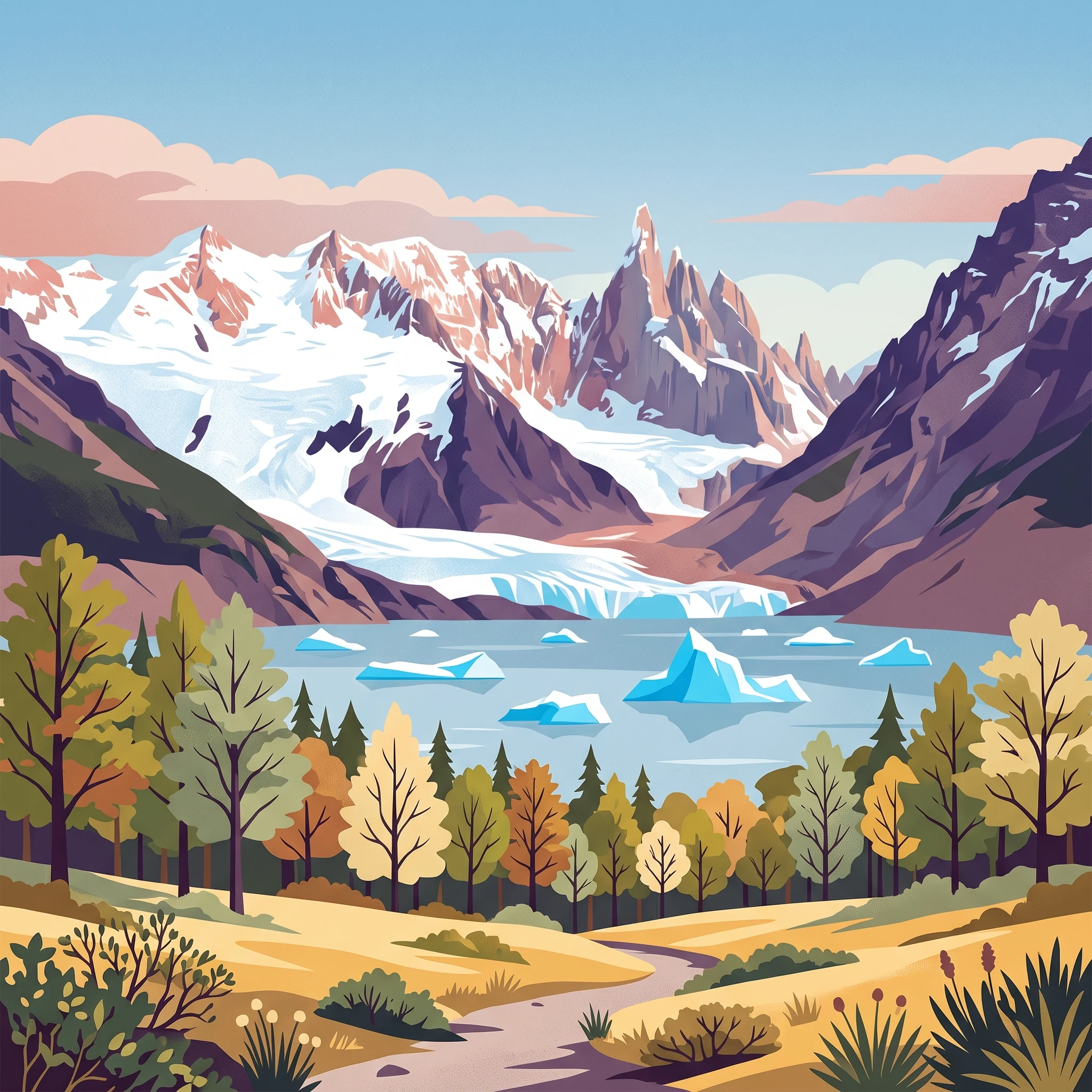
Trip Timing
When is the best time to visit Los Glaciares National Park for your trip
Deciding when to visit Los Glaciares National Park requires balancing the demand for daylight and warmer weather against the reality of Patagonia’s intense wind cycles and the seasonal influx of visitors. For most travelers, the best time to visit falls between November and March. This window offers the highest probability of manageable temperatures, with mean daily temperatures reaching their annual peak and daylight extending well past fifteen hours per day. These long summer days are essential for maximizing time on the extensive trail networks around Mount Fitz Roy and Cerro Torre, where terrain access and visibility are highly dependent on the suns position and the absence of cloud cover.
The Trade-offs of Peak Season
While the southern summer months provide the most favorable climate for trekking and glacier viewing, they coincide with the park’s highest density of international travelers. This period represents the most practical window for those aiming to experience the full range of activities, including boat excursions to the Upsala and Spegazzini glaciers and extended hiking expeditions. However, the increased traffic can impact the quiet solitude of the more remote trails. Visitors who prioritize a more secluded wilderness experience may find that early November or late March offers a compromise, as the visitor volume typically tapers off while the landscape remains accessible.
Managing Climatic Variables
Los Glaciares National Park is defined by its dramatic glacial landscape, and its weather patterns are dictated by the massive ice cap that moderates the surrounding environment. Regardless of the month, travelers must account for significant daily temperature fluctuations. Even during the warmest months, evening and early morning temperatures frequently drop toward the freezing point, necessitating a flexible approach to gear and daily scheduling. Wind is a constant factor in this region, often peaking in intensity during the height of summer. These gusty conditions can impact the perceived temperature and safety on exposed ridges or mountain passes, regardless of what the ambient air temperature might suggest.
Access and Regional Dynamics
Because the park encompasses both high-altitude ice fields and lower-lying subpolar forests, the experience of a visit is heavily influenced by elevation and proximity to the ice. The decision of when to travel should be viewed through the lens of your specific priorities. If your primary goal is to witness the active calving of the Perito Moreno Glacier, the reliability of the summer window is hard to replicate, as the increased melt and daylight provide more opportunities for observation. However, those strictly focused on mountaineering or specialized trekking should recognize that even in the height of the summer, the park environment remains a rugged, high-latitude wilderness where weather can transition quickly from clear skies to storm conditions. Understanding these interactions is the first step in planning a trip that aligns with your expectations.
Seasonal Planning
Best Months to Visit Los Glaciares National Park: A Quick Comparison
Peak Hiking and Glacial Viewing Windows
The period from November through March represents the most viable timeframe for visitors prioritizing extended outdoor activity. During these months, the park benefits from its longest daylight cycles, with December offering up to 16 hours of light. This extended window is essential for long-distance trekkers aiming to reach base camps for Mount Fitz Roy or traverse the trails near Cerro Torre. The trade-off for these favorable conditions is a significant increase in visitor numbers and consistent high wind speeds, which often exceed 7 meters per second. While temperatures are at their most manageable, the relentless nature of Patagonian winds can make exposed ridges feel significantly colder than thermometer readings suggest.
The Transition Months for Shoulder Season Exploration
For those looking to avoid the peak density of mid-summer while still maintaining reasonable access to trails, the transitional months of October and April serve as meaningful alternatives. October marks the beginning of the warming trend, with daylight hours rapidly increasing to over 13 hours. While average maximum temperatures hover near 8 degrees Celsius, the park remains quieter than in the height of the austral summer. April offers a similar sense of relative solitude as the season wanes. Travelers in these months must accept a higher degree of uncertainty regarding weather stability. Short-term climate shifts can occur rapidly, and the risk of early or late-season snow events on higher mountain passes is higher than in January or February.
Managing Cold-Weather Constraints
The winter months, ranging from May through September, present a fundamentally different set of conditions that favor specialized photography and low-impact, short-duration site visits rather than extensive wilderness trekking. During this time, daylight drops to as low as 8 hours, and average temperatures frequently stay well below freezing, particularly at higher elevations. While the park does not close, the environment becomes hostile for extended backcountry travel. Visitors who choose this window often do so to experience the glacial landscapes under winter light, accepting that many trail segments may be inaccessible and that weather-related delays are common. The primary compromise for this period is the limitation of movement; the park is less a destination for active exploration and more a environment for observation, requiring significant experience in cold-weather logistics and safety preparation.
Annual Climate Analysis
Monthly Temperature, Precipitation, and Daylight Normals in Los Glaciares
Understanding the climate of this Andean park requires looking beyond simple seasonal labels. Based on long-term climate normals for the 1991 to 2020 period at an elevation of approximately 925 meters, the park operates on a cycle defined by extreme shifts in daylight and wind intensity. While these figures provide a statistical baseline, they should not be mistaken for local weather forecasts. Because the terrain ranges from high-altitude ice fields to lower-elevation lakes, actual conditions at any specific trail or viewpoint can vary significantly from these recorded averages.
The Shift in Daylight and Thermal Extremes
The most dramatic driver of the visitor experience is the change in photoperiod. Daylight duration peaks in December at roughly 16 hours, providing a massive functional advantage for long-distance hikers and photographers. This is in sharp contrast to the winter months, specifically June, when daylight drops to under 8 hours. Temperature patterns follow a similar arc, though with a distinct lag. The warmest average maximums occur in February, reaching approximately 13.5 degrees Celsius, while the coldest average minimums settle near -14.5 degrees Celsius in July. Travelers should note that even during the warmest months, the average minimums remain near or below the freezing point, highlighting the necessity of layering regardless of the calendar date.
Wind Patterns and Moisture Dynamics
Wind is a persistent factor in this region, with velocity trends closely mirroring the peak daylight months. November, December, and January record the highest average wind speeds, often exceeding 7.4 meters per second. This environmental characteristic is a defining aspect of the Patagonian climate and has a substantial impact on the perceived temperature. Even on sunny days, high wind speeds can turn mild ambient air into a biting chill, particularly in exposed areas like the shores of Lake Argentino or open mountain passes.
Precipitation is relatively consistent throughout the year when viewed as a daily average, typically hovering between 2.7 and 3.6 millimeters per day. There is no distinct monsoon or rainy season in the way tropical regions experience them, but the persistent humidity levels, which climb above 90 percent during the winter months, contribute to the sense of cold. In the colder months, even if precipitation totals remain numerically low, the accumulation of ice and snow at higher altitudes is a regular occurrence, though this is a function of sustained low temperatures rather than massive spikes in rainfall.
Interpreting Climate Normals for Trip Planning
The relationship between these variables is critical for those setting expectations for a visit. The transition periods of October and April serve as buffers where daylight begins to expand or contract, and temperatures shift toward the winter or summer extremes. During these shoulder periods, travelers may find a balance between the high-wind, high-daylight summer months and the shorter, colder days of the off-season. Because the climate normals represent a station-specific sample, visitors should assume that higher elevations will be colder and more prone to rapid weather changes than these regional averages suggest. Always consult current meteorological updates and park authority reports for real-time visibility, wind, and trail status before heading into the backcountry.
Seasonal Cycles
Seasonal Patterns and Annual Weather Phases in Los Glaciares National Park
Defining the Annual Environmental Rhythm
While conventional travel planning often defaults to a four-season model, the high-latitude climate of Los Glaciares National Park is better understood through its distinct thermal and daylight-driven phases. The annual rhythm is governed by the oscillation between long, high-energy summer days and the short, dormant winter period. Because the park acts as a gateway to the Patagonian ice field, these phases are defined not just by calendar dates, but by the tangible impact of wind speeds, daylight availability, and the persistence of freezing night temperatures even during the warmest months.
The Extended Daylight Phase: November through March
This window represents the period of maximum potential for outdoor engagement. Daylight hours peak in December, reaching over 16 hours and providing extensive time for traversing trails and exploring glacial reaches. This phase is characterized by warmer mean temperatures, though visitors should note that daytime averages remain modest. The primary environmental trade-off during this period is the intensity of the wind. With average wind speeds reaching their annual peak, the feeling of warmth can be deceptive. While these months offer the most reliable trail access and clear visibility, the high energy of the atmosphere is a constant factor that influences trekking difficulty and boat tour stability.
The Transitional Windows: April and October
Transition periods function as bridges between the high-activity season and the quiet winter. April serves as a critical cooling phase. As daylight hours drop sharply from over 12 hours in March to around 10 hours in April, the mean temperature begins a consistent decline toward freezing. Visitors often choose these shoulder months to avoid the height of summer crowds, but they must accept the reality of shorter days and the increasing likelihood of cold fronts.
October acts as the spring counterpart. It signifies the start of the warming trend, yet it remains a month of significant volatility. Ice melt begins to shift, and the landscape prepares for the increase in visitor presence. These months are defined by a reduction in peak wind intensity compared to mid-summer, yet they lack the thermal stability found in the core months of December and January. Travelers in April or October should expect weather patterns that do not conform to summer norms and require a flexible approach to their itinerary.
The Winter Observation Phase: May through September
From May to September, the park enters a phase of limited solar input and significantly reduced mean temperatures. Daylight reaches its annual minimum of roughly 8 hours in June and July, accompanied by average minimum temperatures that drop well into the deep negative range. This is the quietest phase of the year. While the park does not close, the environment is fundamentally different. The focus shifts from extensive trekking to concentrated observation of the glaciers and the immediate surrounding landscapes. The relative calm in wind speeds during mid-winter, which drop to their annual lows, offers a stillness that contrasts sharply with the blustery conditions of the summer months, though this is offset by the harsh reality of the cold.
Seasonal Experiences
Experiencing the Landscapes and Activities of Los Glaciares Throughout the Year
Navigating Seasonal Trekking and Mountain Climbs
The park experience centers heavily on the ability to access high-altitude trails around the Mount Fitz Roy and Cerro Torre massifs. During the peak summer phase from November to March, the extended daylight reaching over 15 hours provides a wide window for independent hikers to tackle challenging routes. Because high-latitude weather patterns remain volatile regardless of the season, these long days offer a necessary buffer for trekkers to navigate unpredictable winds. Conversely, as daylight hours compress into the autumn and winter months, the window for safe, high-altitude navigation narrows significantly. Visitors planning technical climbs or remote treks must account for the reality that the same trail conditions vary drastically between the sun-drenched trails of December and the frozen, high-risk conditions found in the late-season transition.
Glacial Boat Tours and Ice Field Access
The experience of the Perito Moreno Glacier and the surrounding ice fields remains accessible for a longer portion of the year than remote wilderness trekking. Boat tours on Lake Argentino, which offer views of the Upsala and Spegazzini glaciers, rely on navigating iceberg-strewn waters. While the peak summer months offer the most reliable operational rhythm for these tours, the glaciers themselves present their characteristic visual appeal throughout the year. Visitors should note that the calving of the Perito Moreno is not tied to a specific month or climate pattern, but rather to the internal dynamics of the glacial system. While summer provides the warmest maximum temperatures for standing on viewing platforms, the off-season arrival of fewer crowds can make the experience of observing these massive ice formations feel more isolated, provided one is prepared for the significant drop in mean temperatures that occurs from May onward.
Seasonal Constraints for Southern Zone Activities
Areas such as Lago Roca offer a distinct, less-trafficked perspective on the park's steppe and forest ecosystems. Experiences like horseback riding in these southern regions are highly sensitive to seasonal daylight and temperature shifts. The period between November and April is the primary window for permitted sport fishing and guided excursions. Beyond this window, the combination of significantly reduced daylight and the onset of winter conditions effectively limits the accessibility of these secondary zones. Travelers seeking a balanced experience that includes both the iconic northern massifs and the quieter southern lakes should prioritize the shoulder months of November or March, when the infrastructure for guided services is fully operational but the peak summer crowds have begun to thin or have yet to fully arrive. This period strikes a balance between available daylight for movement and the practical requirements of guided wilderness access.
Visitor Priorities
Optimizing Your Los Glaciares Trip Based on Travel Preferences
Optimizing Your Itinerary for Extended Daylight and Trekking
If your primary goal is to maximize the time spent on the iconic hiking trails around Mount Fitz Roy or the glacial basins near El Chaltén, the peak summer months of December and January are the most supported periods. During these months, daylight stretches to over 15 or 16 hours, providing a massive safety buffer for long-distance trekkers who wish to complete challenging circuits without the pressure of an impending sunset. The trade-off for this extended visibility is exposure to the most intense winds of the year. Travelers should prepare for sudden gusts that can impact balance on exposed ridgelines, regardless of how clear the sky appears. If you prioritize daylight, you must be willing to accept that weather patterns in the high Andes are highly volatile, and even the longest days can turn into bitter, high-wind events that restrict higher-altitude movement.
Balancing Moderate Temperatures and Wind Exposure
Visitors who find themselves sensitive to extreme cold often gravitate toward the shoulder months of November and March. These periods offer a compromise: you lose some of the sheer volume of daylight found in peak summer, but you frequently trade it for a slight reduction in wind intensity compared to the mid-summer peak. In November, temperatures are beginning to climb toward their seasonal highs, often creating more comfortable conditions for early morning starts when sub-zero temperatures are common. March provides the inverse, as the park begins to cool, but the atmosphere often holds a comparative stability that can make glacial boat tours and lake-side walks feel less biting. The compromise here is the loss of the summer buffer; your window of safe daylight for mountain treks is narrower, meaning you must be more disciplined with your start times and pace to avoid navigating technical terrain in the dark.
Prioritizing Access to Remote Glacial Areas
For travelers focused on specific experiences like kayaking near the Perito Moreno Glacier or accessing the more remote sections of the southern zone near Lago Roca, the window between November and April is the most reliable. This period aligns with the regulatory window for activities that require seasonal permitting or guided participation. While the colder months from May to September offer a unique, stark beauty for those who enjoy absolute solitude, the reduction in daylight,dropping to below 8 hours,significantly limits the scope of what can be safely reached. If your priority is to see the diverse ecosystems, from the Magellanic subpolar forests to the open steppe, you are best served by sticking to the late spring and summer months when the physical infrastructure is fully operational and the daylight allows for the transit times required to reach these distant park sectors.
Visitor Access
Seasonal Access and Operational Considerations for Los Glaciares
Navigating Park Entry and Seasonal Infrastructure
Access to Los Glaciares is primarily dictated by seasonal shifts in road conditions and park management policies rather than complete year-round closures. While the main hubs remain open to visitors, the operational capacity of specific corridors changes based on the time of year. Travelers aiming to visit the Southern Sector, home to the Perito Moreno Glacier, should note that access hours are traditionally restricted during the winter months of May through August. During this period, the entrance window is typically narrower compared to the peak season of September through April. Because these operational schedules are subject to change based on local conditions or administrative updates, visitors must consult the official Administration of National Parks website before finalizing their travel itinerary.
Permit Requirements and Visitor Logistics
The logistical framework for entering the park depends on the specific zone you intend to explore. While the park maintains a general admission structure for foreign tourists, the application of fees and the necessity for specific permits can vary. In the Northern Zone near El Chaltén, most hiking trails are accessible directly from the town, yet you should verify if current regulations require registration for remote trekking circuits or specific backcountry zones. Similarly, travel to the Central Zone, often accessed via Parador La Leona, involves traversing significant stretches of gravel roads. Weather patterns during the shoulder months can influence the quality of these routes, making local intelligence regarding road status essential for those driving independently. Always check for updated transit advisories from the local park office to confirm whether particular segments are viable at your time of travel.
Verifying Operational Status and Facility Availability
Operational services, including visitor centers and organized excursions, are not static throughout the year. The Ceferino Fonzo Visitor Center and other local administrative offices serve as the primary conduits for up-to-date information. If you are planning a visit, avoid relying on guidebooks or older online articles for opening dates or facility status, as these can lag behind current mandates. Direct communication via established official email addresses or contact numbers is the most reliable way to confirm the availability of transport, shuttle services, and ranger-led programs for your planned arrival window. By treating official park bulletins as the final authority, you ensure your trip planning remains grounded in the most current administrative and environmental reality of the park.
Safety and Preparation
Seasonal Weather Hazards and Packing for Los Glaciares National Park
Preparing for a trip to this park requires acknowledging that Patagonia is defined by rapid, unpredictable weather shifts, regardless of the calendar month. While seasonal norms provide a framework, the most effective strategy is a commitment to layered clothing and constant vigilance regarding local conditions. Visitors should never rely on a single forecast or historical climate data to dictate their safety, as the transition between intense winds and calm intervals can occur within the same hour.
Managing Wind Exposure and Temperature Variability
Wind is a constant presence in the park, particularly throughout the peak season from November to March. These months see the highest mean wind speeds, often exceeding 7 meters per second, which can significantly decrease your body heat retention even on sunny afternoons. Effective preparation focuses on windproof shells that allow for ventilation during intense trekking. Because temperatures frequently drop toward freezing at night, even in the middle of summer, lightweight thermal base layers are essential. Dressing in layers allows you to adjust instantly when the sun disappears behind a mountain ridge or when wind gusts intensify, preventing the cycle of chilling that often leads to fatigue on the trail.
Preparing for Daylight Shifts and Terrain
The shift in daylight hours is a primary factor in planning daily safety. During December, you may experience over 16 hours of light, which grants flexibility, while May through July requires strict adherence to shorter windows, often less than 8 hours. Safety preparation in the shoulder seasons and winter involves carrying reliable headlamps and planning routes to ensure you are well clear of exposed mountain terrain before the light fails. The rugged terrain, ranging from glacial lakes to high granite spires, means that paths can become slick or exposed. Sturdy, broken-in footwear is necessary to manage the variable ground, as the park climate does not follow a predictable freeze-thaw cycle that would guarantee dry trails.
Prioritizing Official Alerts and Local Guidance
Regardless of your chosen travel window, safety relies on the most current administrative and weather information. Changes in access or route feasibility are communicated by park authorities through the official government portal. Before embarking on any trek, specifically in the remote zones or during the off-season months, always consult the park information centers in El Chaltén or El Calafate. These offices provide the most accurate assessment of current trail hazards, mandatory registrations, and weather alerts. Do not substitute personal assumptions for local expertise, especially regarding river crossings or high-altitude passes where conditions can differ drastically from the climate normals reported at lower elevations.
Trip Decisions
How to Choose the Best Time to Visit Los Glaciares National Park
Balancing Seasonal Priorities for Your Patagonia Trip
Choosing the right window for your visit comes down to how you prioritize the trade-off between the park's most accessible conditions and the reality of its high-latitude environment. The period from November through March remains the most robust choice for those seeking to maximize daylight for long-distance trekking and glacier viewing. During these months, the extended light hours provide a clear operational advantage for accessing remote trails or planning complex excursions. However, this peak season is defined by significantly higher wind speeds and the probability of encountering more visitors at central hubs like the Perito Moreno boardwalks.
If your priority is to balance manageable crowds with a reasonable level of daytime access, the shoulder windows in early November or late March offer a functional compromise. These transition periods see a slight reduction in visitor volume while maintaining sufficient daylight for standard activities. While temperature averages remain modest, the reduced wind intensity compared to the mid-summer peak can make outdoor conditions feel more temperate for some travelers. Understanding that these months act as a bridge between the peak summer energy and the quiet winter stillness is essential for setting realistic expectations regarding trail availability and park services.
Moving from Climate Normals to Real-Time Preparation
The climate data provided throughout this guide serves as a foundation for understanding the park's environmental constraints, such as the persistent wind and the sharp drop in temperature at higher elevations. It is critical to interpret these long-term normals as descriptors of the climate rather than specific forecasts for your dates of travel. The high variability in Patagonian weather means that a clear morning can quickly shift into a high-wind event regardless of the month. Use this framework to align your expectations with the expected environment, but always prioritize current, site-specific alerts for your actual dates. Before departing, confirm the latest operational status of park zones, transportation links, and any required permits or local registrations. This approach ensures your trip remains grounded in the current realities of the park authority and local conditions, rather than relying solely on historical patterns.