

Mori Atlas logo
National parkLos Glaciares National Park

Discover the mapped boundaries and spectacular protected terrain of this vast national park.

Los Glaciares National Park: Patagonian Ice Cap, Glacial Landscapes, and Andes Geography

Los Glaciares National Park in Argentina represents a premier destination for understanding glacial geography and protected landscapes. Covering 726,927 hectares, this national park is defined by its immense Patagonian ice cap feeding 47 glaciers that descend dramatically into glacial lakes. Its extraordinary ice fields and iconic granite peaks, such as Mount Fitz Roy, offer unparalleled opportunities for atlas exploration and appreciating the raw power of nature within a designated protected area.

glacial landscapesPatagonian AndesUNESCO World Heritage Sitemountain trekkingglacier viewingMagellanic forest

Los Glaciares National Park

National park

Park overview

Structured park overview, official facts, and landscape profile for Los Glaciares National Park

Los Glaciares National Park park facts, protected area profile, and essential visitor context
Review the core facts for Los Glaciares National Park, including designation, size, terrain, visitor scale, habitats, and operating context in one park-focused overview.

About Los Glaciares National Park

Los Glaciares National Park occupies the southernmost extension of the Argentine Andes, forming a vast protected wilderness that represents one of the most significant glacial landscapes outside the polar regions. The park's defining feature is the Patagonian ice cap, a massive frozen reservoir that covers much of the high terrain and feeds numerous glaciers that radiate outward toward lower elevations. Unlike glaciers in most other parts of the world, which typically form at altitudes above 2,500 meters, the sheer scale of the Patagonian ice cap allows these glaciers to originate at approximately 1,500 meters and descend nearly to the shores of the glacial lakes below. The park divides naturally into two distinct sections centered on its two great lakes. The northern portion encompasses Lake Viedma, the Viedma Glacier, and some of the most dramatic mountain terrain in the park, including the celebrated peaks of Mount Fitz Roy and Cerro Torre that rise abruptly from the surrounding terrain. The southern portion contains Lake Argentino, the largest lake entirely within Argentina, and hosts the most spectacular glaciers including Perito Moreno, Upsala, and Spegazzini, which calve directly into the lake's waters. Between these two regions lies a central zone without significant lake features. The park serves as a critical ecological corridor connecting the wet Pacific-influenced forests of the western Andes with the arid steppe landscapes of the Patagonian plateau, creating remarkable biodiversity within a relatively compact area.

Quick facts and research context for Los Glaciares National Park

Los Glaciares National Park spans 726,927 hectares in southern Argentina, making it the country's largest national park. The park is centered around two major glacial lakes: Lake Argentino, the largest in Argentina at 1,466 square kilometers, and Lake Viedma at 1,100 square kilometers. Both lakes drain through the Santa Cruz River to the Atlantic coast. The park is bordered by Torres del Paine National Park in Chile to the south. The park receives approximately 500 to 900 millimeters of annual precipitation, with the wetter conditions in the east supporting the Magellanic subpolar forest ecosystem that transitions to the arid Patagonian steppe on the eastern slopes. The park recorded 688,837 visitors in 2023.

Park context

Deeper park guide and search-rich context for Los Glaciares National Park

Los Glaciares National Park history, landscape, wildlife, and travel context
Explore Los Glaciares National Park through its history, landscape character, ecosystems, wildlife, conservation priorities, cultural context, and seasonal travel timing in a structured park guide built for atlas discovery and search intent.

Why Los Glaciares National Park stands out

Los Glaciares is best known for its spectacular glacial landscapes centered on the world-famous Perito Moreno Glacier, one of the few advancing glaciers in an era of global glacial retreat. The park also protects the iconic granite peaks of Mount Fitz Roy and Cerro Torre, which rank among the most sought-after mountaineering destinations in the world. The combination of massive glaciers descending from the Patagonian ice cap, dramatic mountain spires, and the ecological transition between forest and steppe creates a landscape of exceptional visual and ecological significance.

Los Glaciares National Park history and protected-area timeline

Los Glaciares National Park was established on May 11, 1937, making it one of the oldest protected areas in Argentina. The park's creation reflected a growing recognition of the need to preserve the extraordinary natural landscapes of southern Patagonia, which had long attracted explorers, scientists, and adventurous travelers from around the world. The establishment of the park preceded the more widespread appreciation of glacial dynamics and climate change, though today the park serves as an important natural laboratory for understanding glacier behavior and ecosystem response to environmental pressures. The park was designated as a UNESCO World Heritage Site in 1981, becoming one of the first natural sites in Argentina to receive this international recognition. This designation acknowledged both the outstanding universal value of the glacial landscape and the importance of protecting representative examples of Patagonian ecosystems. The park's administration is handled by Argentina's National Parks Administration, with the headquarters located in the nearby town of El Calafate, which serves as the primary gateway for visitors exploring the region.

Los Glaciares National Park landscape and geographic character

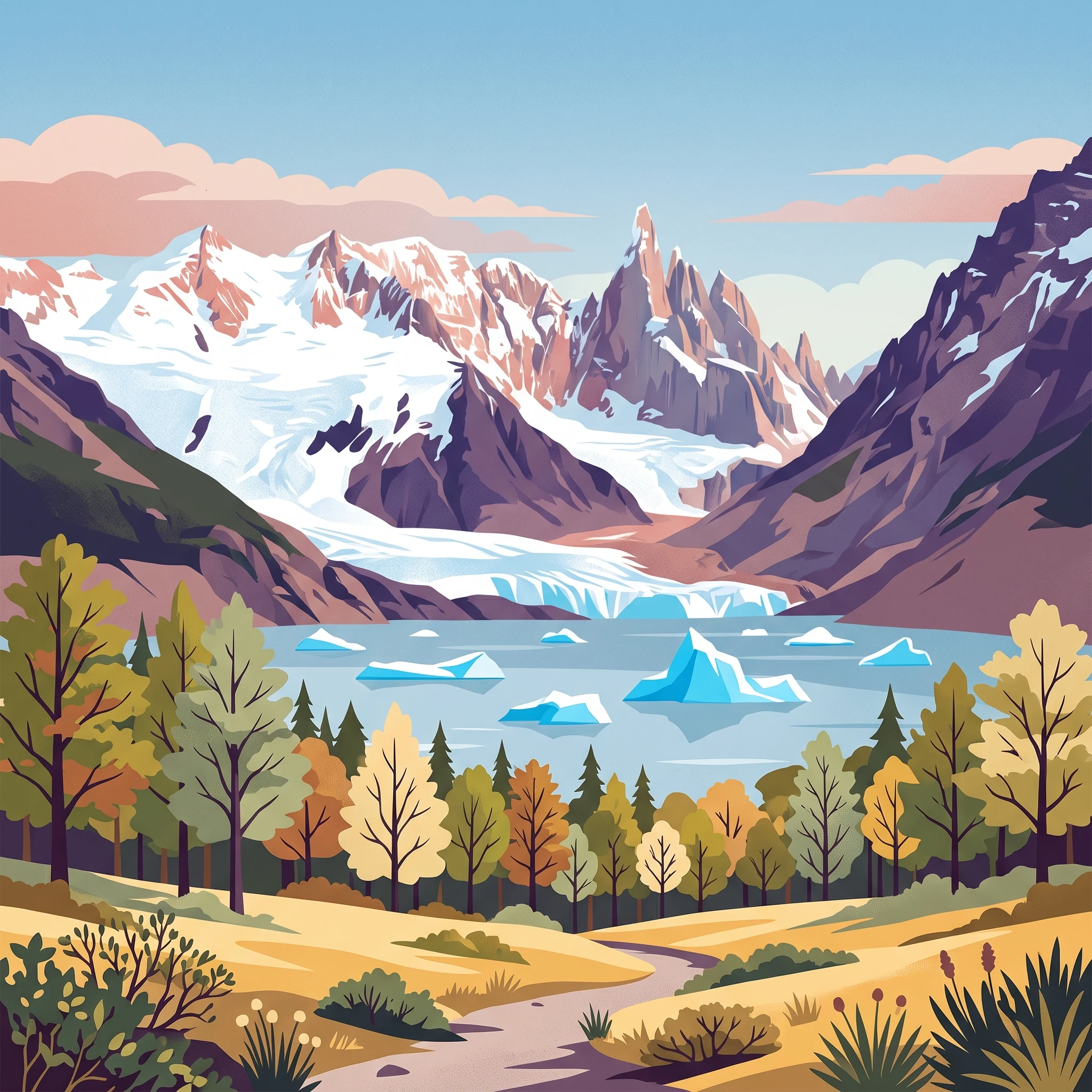
The landscape of Los Glaciares is defined by the dramatic interplay between massive glacial ice, deep glacial lakes, and the rugged granite peaks of the southern Andes. The Patagonian ice cap dominates the western portion of the park, creating a stark white landscape that contrasts sharply with the dark rock of the surrounding mountains. From this ice cap, numerous glaciers flow outward, carving valleys and depositing moraines as they descend. The two great lakes, Argentino and Viedma, represent the_terminal basins of this glacial system, their milky blue waters colored by the fine glacial flour suspended in their depths. The mountain landscape reaches its dramatic apex in the northern section, where the distinctive silhouette of Mount Fitz Roy rises to 3,406 meters, its steep granite walls often shrouded in cloud. Nearby Cerro Torre reaches 3,128 meters, and these two peaks together form one of the most iconic mountain scenes in South America. Between the glacial lakes and the steppe lands to the east, the terrain transitions through rolling hills and forest-covered slopes, creating a varied landscape that offers dramatically different scenery within short distances.

Los Glaciares National Park ecosystems, habitats, and plant life

The ecological character of Los Glaciares reflects the park's position at the crossroads of multiple climatic and vegetation zones. The western portion of the park, influenced by moisture-laden Pacific winds, supports Magellanic subpolar forests dominated by lenga beech and Magellanic beech, creating a landscape of dense, dark forest that covers the lower slopes and valley floors. This forest habitat grades eastward into the Patagonian steppe, a semi-arid grassland environment characterized by tough, wind-resistant vegetation adapted to the harsh conditions. This abrupt transition from forest to steppe occurs over remarkably short distances, creating an ecological mosaic of exceptional interest. The forest environment provides habitat for the huemul deer, a species listed as endangered and considered a symbol of the Patagonian wilderness. The rivers and streams support populations of torrent duck, while the more open steppe areas are home to guanaco, Darwin's rhea, and the South American gray fox. The bird population includes condors and various eagle species, often seen riding the thermal currents along the mountain walls. The glacial lakes themselves support aquatic ecosystems adapted to the cold, nutrient-poor conditions.

Los Glaciares National Park wildlife and species highlights

The wildlife of Los Glaciares reflects the park's diverse habitats ranging from glacial forelands to forest and steppe environments. The Magellanic forests provide shelter for the huemul, a distinctive deer species that has adapted to the dense vegetation and represents one of the most emblematic animals of southern Patagonia. The forest also supports the torrent duck, a specialized waterfowl that inhabits the fast-flowing mountain streams. In the more open Patagonian steppe, guanaco herds range across the grasslands, maintaining populations that have persisted despite historical pressure from livestock grazing. The South American gray fox, though now endangered due to competition with invasive species and habitat loss from cattle ranching, still inhabits the park's boundaries. Birdlife is particularly diverse, with over 100 species recorded including the Andean condor, which soars on the thermal updrafts generated by the mountains, and various eagle species. The dramatic peaks provide nesting habitat for these large raptors, while the lakes and wetlands support waterfowl and shorebird populations.

Los Glaciares National Park conservation status and protection priorities

Los Glaciares National Park faces several significant conservation challenges despite its protected status. The park's growing popularity as a tourist destination has increased pressure on sensitive areas, particularly around the most visited glaciers and along popular trekking routes. Overgrazing by cattle and the presence of feral livestock have impacted natural vegetation communities, particularly in areas where the forest-steppe transition occurs. Introduced species including European hares and certain trout populations have created ecological imbalances, competing with native species for resources and habitat. Forest fires have affected portions of the park, degrading forested areas and altering ecosystem dynamics. The Park management works to address these challenges while balancing the need to provide visitor access to the park's remarkable natural features. The UNESCO World Heritage designation brings international attention and support for conservation efforts, while the park's status as Argentina's largest national park provides substantial, though not always sufficient, resources for management and protection.

Los Glaciares National Park cultural meaning and human context

The human presence in the Los Glaciares region predates the establishment of the park, though the area remained sparsely populated due to its challenging climate and terrain. The indigenous Tehuelche people historically inhabited the broader Patagonian region, though their presence in the high Andean valleys was limited compared to the more accessible steppe areas. The establishment of the park created a new relationship between the protected landscape and surrounding communities, with El Calafate developing as the primary service center for visitors and the village of El Chaltén established within the park boundaries to support trekking and mountaineering activities. The area has attracted scientific interest since the early explorations of the region, with the glaciers and glacial lakes providing valuable research opportunities in fields ranging from glaciology to ecology.

Top sights and standout views in Los Glaciares National Park

Los Glaciares offers visitors access to some of the most spectacular glacial scenery in the world. The Perito Moreno Glacier, reachable by a network of viewing platforms, provides one of the most accessible and dramatic glacier experiences anywhere, with regular calving events creating dramatic ice chunks crashing into the waters of Lake Argentino. The trekking routes around Mount Fitz Roy and Cerro Torre rank among the world's great wilderness hikes, passing through forest, past glacial lakes, and beneath some of the most iconic peaks in the Andes. Boat tours on Lake Argentino provide access to the Upsala and Spegazzini glaciers, navigating through fields of brilliant blue icebergs. The ecological diversity of the park, transitioning from forest to steppe within a short distance, offers remarkable opportunities to experience multiple ecosystems in a single visit.

Best time to visit Los Glaciares National Park

The park can be visited year-round, though the austral summer months from November through March offer the most comfortable conditions for outdoor activities, with temperatures ranging from cool to mild and the longest daylight hours. Summer brings the greenest forest scenery and the most active glacier calving at Perito Moreno, though this is also the busiest season for visitors. Winter months offer a dramatically different experience, with snow-covered landscapes and fewer visitors creating a more solitary wilderness experience, though some facilities and routes may have limited access. The shoulder seasons of spring and autumn provide fewer crowds and often excellent conditions for trekking, though weather can be more unpredictable. The park's climate remains cool throughout the year, with temperatures in the higher elevations remaining cold even during summer.
Park location guide

Geography guide, regional context, and park location map for Los Glaciares National Park

Los Glaciares National Park park geography, regions, and map view in Argentina
Understand where Los Glaciares National Park sits in Argentina through a broader geographic reading of the surrounding landscape, nearby location context, and its mapped position within the national park landscape.

How Los Glaciares National Park fits into Argentina

Argentina is a federal republic located in the southern cone of South America, bordering Chile, Bolivia, Paraguay, Brazil, Uruguay, and the Atlantic Ocean. With an area of 2,780,085 km², it is the second-largest country in South America and the eighth-largest globally. The capital and largest city is Buenos Aires, and the official language is Spanish. The country claims sovereignty over the Falkland Islands, South Georgia and the South Sandwich Islands, and a portion of Antarctica.

Wider geography shaping Los Glaciares National Park in Argentina

Argentina occupies the southern portion of South America, sharing the Southern Cone region with Chile to the west. The country borders Bolivia and Paraguay to the north, Brazil to the northeast, Uruguay and the South Atlantic Ocean to the east, and the Drake Passage to the south. The Andes mountain range runs along the western border, while the Pampas plains dominate the central region. Argentina also claims territories in Antarctica.

Map view of Los Glaciares National Park

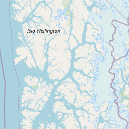
Use this park location map to pinpoint Los Glaciares National Park in Argentina, understand its exact geographic position, and read its mapped placement within the surrounding landscape more clearly.

Pigeon | © OpenStreetMap contributors
Park atlas

Map the Surrounding Patagonian Andes, Compare Protected Area Geography, and Trace Regional Conservation Landscapes

Explore Nearby National Parks and Related Protected Areas Near Los Glaciares National Park
After exploring Los Glaciares National Park, browse other national parks and protected areas in the Patagonian Andes, identifying diverse glacial formations, mountain peaks, and steppe ecosystems. Compare their unique geographic features and conservation zones to understand the broader regional context of these significant protected landscapes.
National parkAysén del General Carlos Ibáñez del Campo Region

Bernardo O'Higgins National Park: Southern Patagonian Ice Field & Glacial Terrain

Chile's largest protected area: a map of vast ice caps and fjords.

Bernardo O'Higgins National Park is a colossal protected landscape in Chile, safeguarding much of the Southern Patagonian Ice Field and its colossal glacial features like the Pío XI Glacier. Explore the dramatic terrain of towering granite peaks and intricate fjord systems that define this remote national park. This page provides essential context for understanding its geography, mapped boundaries, and significance as a vast wilderness preservation.

Area
35,259 km²
Established
1969
IUCN
II
Visitors
36K annual
National parkMagallanes Region

Torres del Paine National Park: National Park Protected Area Geography

Explore mapped protected landscapes and regional context.

Torres del Paine National Park represents a distinct protected landscape within Chile's Magallanes Region, offering valuable insights for geographic discovery and atlas exploration. This national park's mapped boundaries and unique terrain contribute to a comprehensive understanding of its protected status and environmental context. MoriAtlas provides structured data to explore the park's geography, landscape features, and its role as a vital protected natural area for detailed study.

Area
1,814.14 km²
Established
1959
IUCN
II
Visitors
304.9K annual
National parkMagallanes and Chilean Antártica Region

Kawésqar National Park: A National Park with Distinct Protected Landscape Identity

Explore the mapped geography and protected area boundaries.

Kawésqar National Park is a key national park entity situated within the Magallanes and Chilean Antártica Region, contributing to the protected landscape of southern Chile. This atlas-focused profile details the park's geographic scope and its significance as a designated protected area. It serves as an entry point for understanding the mapped terrain and regional park context, crucial for structured geographic discovery.

Area
28,425.3 km²
Established
1969
IUCN
IV
Visitors
1.7K annual
National park

Perito Moreno National Park: Argentina's Expansive Patagonian Protected Landscape

Explore its mapped terrain and significant protected area geography.

Perito Moreno National Park stands as a cornerstone of Argentinian conservation, safeguarding over 126,000 hectares of striking Patagonian mountain wilderness. This national park protects a rare ecological transition zone, blending wet Andean forests with dry steppe environments across its dramatic amphitheater-like terrain and dual-watershed hydrography. Its mapped boundaries encompass significant natural geography, offering a clear atlas view of protected Patagonian landscapes.

Area
1,268.3 km²
Established
1937
IUCN
II
Relief
Mountain
National park

Monte León National Park: Patagonia's First Continental Marine Protected Area and Coastal Atlas

Explore its unique sandstone formations and rich marine geography.

Monte León National Park stands as a significant federal protected area along Argentina's Patagonian coast. Known for its dramatic sandstone cliffs, including the iconic Monte Cabeza de León, and extensive Magellanic penguin colonies, this park offers a unique glimpse into coastal ecosystems. Its designation as Argentina's first continental marine park highlights its importance for biodiversity and landscape conservation along the southern Argentine Sea shoreline, providing rich context for atlas exploration.

Area
621.68 km²
Established
2004
IUCN
II
Relief
Upland
National parkAysén Region

Patagonia National Park, Chile: Exploring Protected Landscape and Regional Geography

Mapped boundaries and natural terrain in Aysén Region.

Patagonia National Park, situated within the Aysén Region of Chile, serves as a significant protected area offering rich opportunities for atlas-based geographic exploration. This national park's specific landscape identity and mapped boundaries provide a clear focal point for understanding regional conservation and natural terrain. Discover the geographic context of this protected land and its place within the broader landscape of southern Chile through structured data and map exploration.

Area
3,045.28 km²
Established
2018
IUCN
II
Relief
Mountain
National parkChile

Pali-Aike National Park: Chilean Protected Area and Landscape Atlas

Explore the geographic context and park boundaries in Chile.

Examine Pali-Aike National Park as a distinct protected landscape within Chile. This entry offers a detailed atlas perspective, focusing on its mapped boundaries, regional geographic setting, and the specific character of its natural terrain. Understand its significance as a national park and a point of interest for geographic discovery.

Area
50.3 km²
Established
1970
IUCN
II
Visitors
2.5K annual
National park

Patagonia National Park: A National Park Protecting the Argentine Patagonian Steppe Landscape

Explore the mapped boundaries of this semi-arid grassland ecosystem.

Patagonia National Park is a protected national park in Argentina established to preserve the representative Patagonian steppe ecosystem. Covering 528.11 square kilometers, it offers a deep dive into the unique semi-arid grassland environment, known for its rolling plains and wind-shaped terrain. This park provides crucial context for understanding the broader geography of southern Argentina and the conservation of its distinctive natural landscapes.

Area
528.11 km²
Established
2015
IUCN
II
Climate
Arid

Common questions about visiting, size, designation, and location context for Los Glaciares National Park

Los Glaciares National Park FAQs for park facts, access, geography, and protected area context
Find quick answers about Los Glaciares National Park, including protected-area facts, park geography, trail and visitor context, and how the park fits into its surrounding country and regional landscape.
MoriAtlas Explorer

Continue Your Protected Areas Search Across the Global Atlas

Deepen your exploration by continuing the structured search for national parks and protected areas worldwide. Utilize the comprehensive filtering capabilities to compare different conservation landscapes and refine your understanding of global park geography. Discover more about the distribution and characteristics of protected natural areas.

Global natural geography
