
Why Lost Creek Wilderness stands out
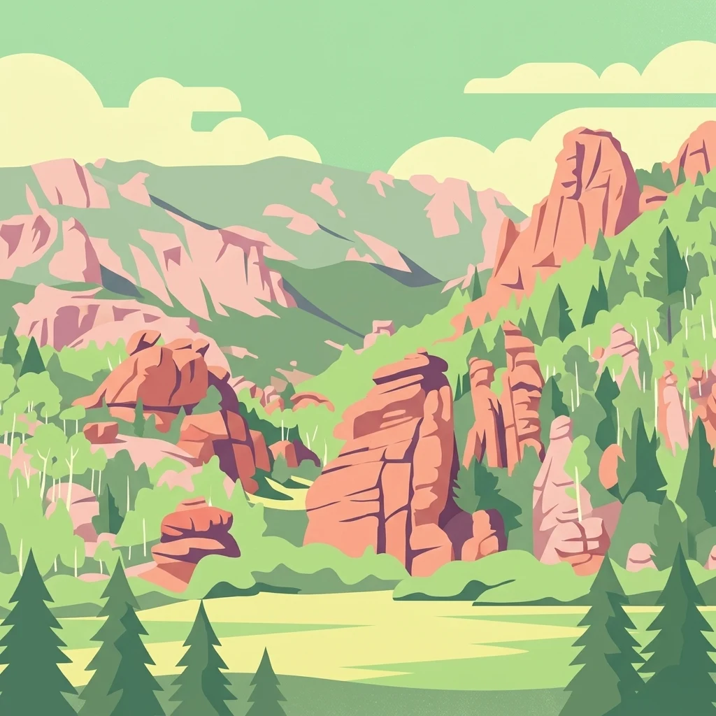
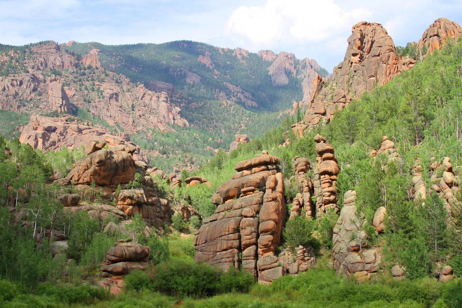
Lost Creek Wilderness is best known for its unusual concentration of weathered granite landforms: rounded domes, isolated knobs, natural arches, spires, and pinnacles clustered in narrow gorges and along ridges. These features distinguish it from many other Colorado wilderness areas, where forested slopes and alpine tundra tend to dominate the visual character. Equally distinctive is the hydrology that gives the area its name, since Lost Creek resurfaces repeatedly along its course rather than flowing as a continuous surface stream. Together, the rock formations and the vanishing-and-reappearing creek create the sense of a carved, almost geological garden that defines the wilderness's identity and draws visitors seeking scenery that feels separate from typical Front Range hikes.
Lost Creek Wilderness history and protected-area timeline
The modern history of Lost Creek Wilderness begins in 1963, when the Lost Creek Scenic Area was established under the so-called "U-Regulations" of 1939, an early federal framework for protecting undeveloped public lands that became the direct precursor of the Wilderness Act of 1964. In 1966 the scenic area was further honored with designation as a National Natural Landmark, recognizing the geological significance of its granite formations and unusual surface hydrology.
In January 1980, the area was elevated to full Wilderness Area status, formalizing its long-term protection under the U.S. Wilderness system. The wilderness is administered by the U.S. Forest Service as part of the surrounding Pike National Forest, and its trail network has been integrated with the broader Colorado Trail, which passes through the area on its way toward Kenosha Pass.
Long before any of these designations, the open meadows now known as Lost Park served as one of the final refuges of the American bison in the United States, a historical layer that still echoes in place names such as Bison Peak on the wilderness's high ridge.
Lost Creek Wilderness landscape and geographic character
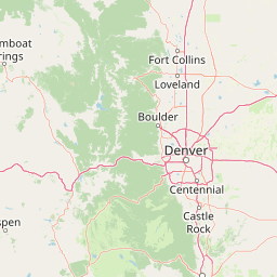
The landscape of Lost Creek Wilderness is dominated by two parallel subranges of the Rocky Mountain foothills: the Kenosha Mountains to the north and the Tarryall Mountains to the south. These mountains form a corridor of low-alpine terrain rather than sharp alpine peaks, with rolling, forested ridges interrupted by outcrops of bare granite and long views into surrounding basins.
The defining surface features are the granite landforms themselves. Weathering has sculpted the bedrock into rounded domes, isolated knobs, natural arches, balanced rocks, and walls of spires and pinnacles. In the Lost Creek Scenic Area, these formations crowd into narrow gorges and perch along ridges, creating small, intimate geological landscapes between broader forested valleys.
The hydrography is equally unusual. Lost Creek is a perennial stream that repeatedly vanishes underground and reappears downstream before finally joining Goose Creek and, eventually, the South Platte River at Cheesman Reservoir just east of the wilderness boundary. The entire creek system functions as a contributing watershed within the broader Platte River Basin, and its disappearing-and-returning behavior is one of the area's signature natural phenomena.
Lost Creek Wilderness ecosystems, habitats, and plant life
Ecologically, Lost Creek Wilderness lies in a transitional zone of the Colorado Front Range where montane forest gives way to drier foothills and rocky outcrops. The vegetation pattern is shaped strongly by elevation, aspect, and the presence of bare granite. Where soil is thin or absent, open slabs of rock host sparse, drought-tolerant plant communities; where soils accumulate, ponderosa pine, lodgepole pine, Douglas-fir, Engelmann spruce, and stands of aspen clothe the slopes and valleys.
The wilderness's mix of exposed rock, sheltered canyons, and forested benches creates a patchwork of microhabitats that supports a variety of wildlife adapted to both Front Range forests and rocky foothills environments. Seasonal streams and willow-lined riparian corridors, particularly along Lost Creek and its tributaries, add another ecological layer that contrasts with the drier uplands.
Lost Creek Wilderness wildlife and species highlights
Wildlife in Lost Creek Wilderness reflects the broader profile of Colorado's Front Range forests and foothills. Mule deer are common throughout the area, moving between forested benches and open meadows, while elk use the higher forested slopes and aspen groves, especially in transitional seasons. Black bears occupy the woodland portions of the wilderness, and mountain lions range across more remote parts of the terrain.
Smaller mammals such as marmots, pikas, foxes, coyotes, and porcupines are typically encountered along the trail system, and the rocky habitats around the granite formations provide shelter for many of these species. The variety of elevations and the dense cover of both conifer and aspen forest make the wilderness productive habitat for these mammals, while the open rock gardens and meadows offer rich feeding grounds during summer.
The area's history as one of the last strongholds of the American bison is preserved in place names such as Bison Peak, even though bison no longer roam these mountains. Contemporary wildlife viewing in Lost Creek tends to focus on the ungulate and predator communities of the Front Range rather than on wide-ranging plains herds.
Lost Creek Wilderness conservation status and protection priorities
Lost Creek Wilderness carries an unusually layered conservation history. Its inner core, the Lost Creek Scenic Area, was created in 1963 under the original 1939 "U-Regulations," making it one of the earliest federal efforts to formally protect a wild landscape purely for its natural and recreational character. Its subsequent designation as a National Natural Landmark in 1966 underlined the geological and hydrological distinctiveness of its granite formations and disappearing creek.
The broader 119,790-acre wilderness, established in 1980, extends that protective framework to the surrounding Kenosha and Tarryall Mountains. Management by the U.S. Forest Service under the Wilderness Act framework emphasizes preservation of the area's unmodified character: trails are maintained at low intensity, motor vehicles are excluded, and modern infrastructure is kept to a minimum so that the ecological and geological qualities of the landscape remain intact.
Because the wilderness lies close to Denver and at a relatively accessible elevation, its conservation role extends beyond protecting scenery to safeguarding a sizeable block of intact Front Range habitat and the headwaters of a creek system that ultimately feeds the South Platte. In this sense, Lost Creek serves both as a refuge for native flora and fauna and as a working example of how early American wilderness policy evolved into the modern National Wilderness Preservation System.
Lost Creek Wilderness cultural meaning and human context
The cultural identity of Lost Creek Wilderness is closely tied to early American conservation history. The Lost Creek Scenic Area was the first protected scenic zone of its kind in the United States, designated more than a decade before the Wilderness Act itself, and it stands as an important milestone in the development of modern wilderness policy. The fact that it predates the Wilderness Act gives the area a special place in the story of how Americans chose to permanently protect wild landscapes.
The open meadows of Lost Park also carry a deeper historical resonance. They were one of the final refuges of the American bison in the United States during the decline of the great plains herds, a legacy that remains visible in place names such as Bison Peak along the wilderness's high spine. More recently, the dramatic scenery of Lost Creek has entered popular culture through its use as a setting in early episodes of the television series "Supernatural."
Top sights and standout views in Lost Creek Wilderness
Lost Creek Wilderness is notable for the density and variety of its granite formations: rounded domes, knobs, arches, and spires that turn a typical foothills hike into a tour of geological sculpture. The Lost Creek Scenic Area concentrates many of these formations into a compact, named landscape with both Wilderness and National Natural Landmark recognition.
The disappearing-and-returning behavior of Lost Creek itself is another highlight, offering visitors a tangible demonstration of the area's unusual hydrology as the creek moves toward the South Platte watershed. Combined with the wilderness's 130 miles of trails, its segment of the Colorado Trail, and its proximity to Denver, this mix of scenery, history, and accessibility is what gives Lost Creek its distinctive identity within the Colorado wilderness system.
Best time to visit Lost Creek Wilderness
Lost Creek Wilderness is a year-round destination, and each season brings a different character to the landscape. Late spring and summer are the most popular periods for hiking and backpacking, when wildflowers bloom in the meadows and aspen groves are fully leafed, and long daylight hours make it possible to explore the full trail network, including the Colorado Trail segment toward Kenosha Pass.
Fall is especially striking when the aspens turn gold across the foothills and the crowds thin after Labor Day, while winter transforms the wilderness into a quieter setting for cross-country skiing, snowshoeing, and winter camping on its low-elevation trails. Because the area lies relatively close to Denver and at foothill elevations, it can be visited in winter without the extreme conditions of Colorado's higher alpine wildernesses.